
Scan the QR code and open PeakVisor on your phone
The Bonanza Range is a collection of peaks that’s located in the Regional District of Mount Waddington on the north end of Vancouver Island in British Columbia, Canada. The range has 4 named peaks, the highest and most prominent of which is Bonanza Peak at 1,766 m (5,794 ft) in elevation and with 1,443 m (4,734 ft) of prominence.
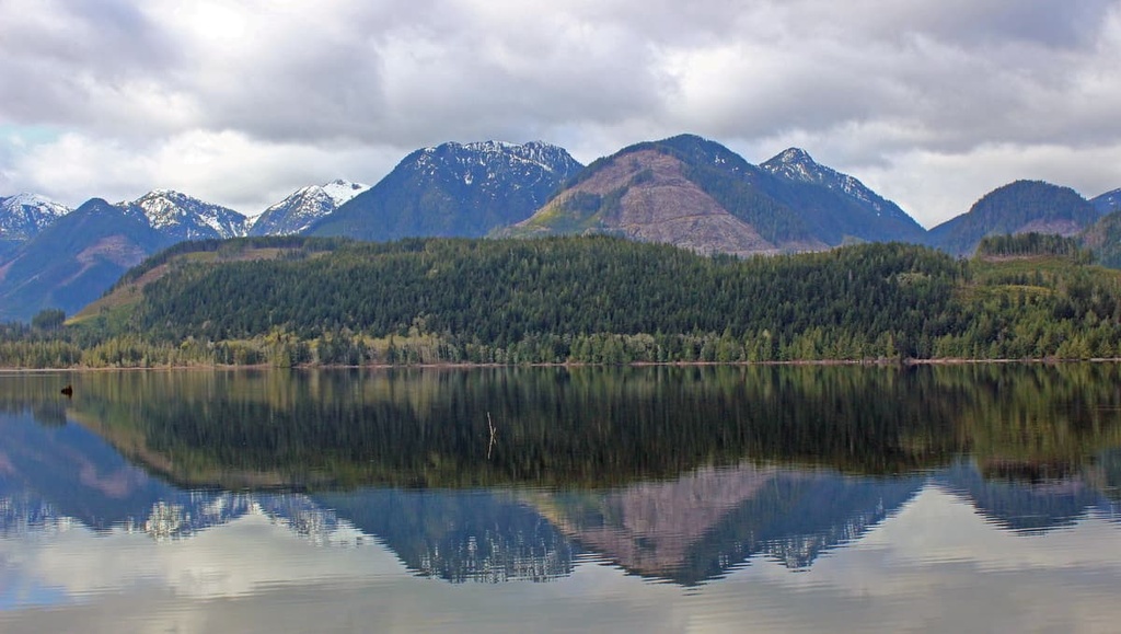
Located on the north end of Vancouver Island in British Columbia, Canada, the Bonanza Range occupies the land between the Nimpkish and Tsitika rivers.
There are only four named mountains in the range, the highest and most prominent of which is Bonanza Peak. Bonanza Peak is 1,766 m (5,794 ft) tall and is almost considered an ultra-prominent mountain thanks to its 1,443 m (4,734 ft) of prominence.
The range is mainly accessible via forest service roads, including the Kokish Main and the Claude Elliott Main FSRs. Claude Elliot Provincial Park is situated on the southern slopes of Mount Ashwood, the southernmost mountain in the Bonanza Range. Other nearby parks and land reserves include:
The Bonanza Range is part of the Vancouver Island Ranges, which are a subrange of the Insular Mountains. The Insular Mountains are the westernmost ranges of the Canadian Cordillera, which consists of the Rocky Mountains in the east followed by the Columbia Mountains, Interior Mountains, Coast Mountains, and finally the western Insular Mountains.
The Insular Mountains form parts of the mainland mountains in southwestern British Columbia, southern Alaska, as well as Vancouver Island and the archipelago of Haida Gwaii. Formed from an ancient terrane called Wrangellia, the Insular Mountains feature many different geologic formations.
Wrangellia was historically composed of layers of volcanic, plutonic, and sedimentary rocks. The Bonanza Range is named for the Jurassic age Bonanza Arc, which features the Westcoast Crystalline Complex as its deepest layer, followed by the Island Intrusion Suite. These layers are topped off with the volcanic rocks of the Bonanza Group.

During the Cretaceous, Wrangellia collided with the continent of North America, which caused the major uplift of the Rocky Mountains as well as additional uplift of the Columbia and Coast Mountains. Furthermore, during this collision, the Wrangellia terrane was compressed, folded, and broken apart. These geologic events all helped to create the Vancouver Island Ranges.
The additional collisions of the outboard Pacific Rim and Crescent Terranes caused the final uplift of the Vancouver Island Ranges, including the Bonanza Range. While the major topographical features in the range were completed after the collision of the Crescent Terrane, the glaciers and ice sheets of the Pleistocene carved out the shape of the peaks that we continue to see to this day.
During the Pleistocene, ice sheets formed from the mountain peaks at the center of the island, where Strathcona Provincial Park now resides. There were also local glaciers nestled among the tall peaks in each range. Additionally, there were several occurrences of the ice sheet extending from the mainland, all of which helped to cover Vancouver Island in over 1 kilometer (0.6 mi) of ice.
The glaciers and ices sheets eroded the peaks and valleys as they formed and advanced across the terrain. During their retreat, the glaciers deposited massive amounts of debris and sediment across the landscape. Many of the valleys that are located adjacent to the Bonanza Range have layers of glacial sediment and till that date back to this period of glacial retreat.
As it is located toward the end of the Vancouver Island Ranges, the Bonanza Range contains only minimal representation of the region’s distinct alpine ecosystems. Most peaks in the range feature habitats from the Mountain Hemlock ecosystem while the slopes are primarily representative of the Western Hemlock ecosystems.
Mountain hemlock and amabilis fir are the dominant trees found on the upper slopes and peaks of the Bonanza Range, alongside yellow cedar. At the highest elevations of the zone, the trees thin out into a parkland-like mosaic of distinct grassy meadows and stands of trees.
The lower slopes and valleys of the Bonanza Range are covered in the forests typical of the Western Hemlock ecosystems, which represent the northern temperate rainforests. Western hemlock and amabilis fir are the dominant trees on the lower slopes; however, towering Douglas firs, Sitka spruces, and western red cedars are also major features of any of the old growth forests.
The range is inhabited by many animal species, such as the Columbian black-tailed deer, Vancouver Island gray wolf, and the Vancouver Island marmot. Black bears, eagles, and many other small mammal and bird species are also present in the range.

Archeological evidence suggests that Vancouver Island has been home to humans for at least 13,000 years. It is possible that the western coastal areas of Canada were used as an ancient migration route during the Pleistocene; however, changing sea levels make it difficult to find evidence of older habitation in the region.
Vancouver Island is divided into three regions that have been traditionally occupied by the Coast Salish, Nuu-chah-nulth, and the Kwakiutl. The Bonanza Range is along the border of the territory of the Coast Salish and Kwakiutl.
The Coast Salish have traditionally lived on the southeastern part of the island while the Kwakiutl have lived throughout the northeast part of the island. The Nuu-chah-nulth have traditionally lived throughout the west coast of Vancouver Island.
That said, due to the region’s remoteness, the Bonanza Range hasn’t seen much development in recent years. Although there are a few forestry roads in the range, there aren’t many other amenities.
The only major park in the range, the Claude Elliot Provincial Park, is fairly small (328 ha/811 acres), and it was established in 1995 on the traditional lands of the Tlowitsis and the Mumtagila First Nations. The park was named after Claud Elliot, who was born in what is now Ontario to a United Empire Loyalist family.
Elliot eventually moved to British Columbia in the 1890s and he started visiting Vancouver Island in the early 1900s. Eventually, Elliot became active in the local timber industry and he also served as an alderman for the City of Vancouver.
The Bonanza Range is relatively untrodden despite its proximity to several major communities and cities. While the Bonanza Range isn’t located along the Spine Trail, which travels across Vancouver Island; there are still routes in the range that lead to its four prominent peaks.
One of the most popular unmaintained trails in the range is the route that summits both Ashwood Mountain and Bonanza Peak. There is an additional trail that summits Whiltilla Mountain. However, note that any hiking through the Bonanza Range generally requires good backcountry navigational skills as the trails are only used infrequently.
As it is located at the north end of Vancouver Island, the Bonanza Range is accessible via Highway 19. The following are some of the major towns and cities located near the range that offer services and accommodations for travelers to enjoy.
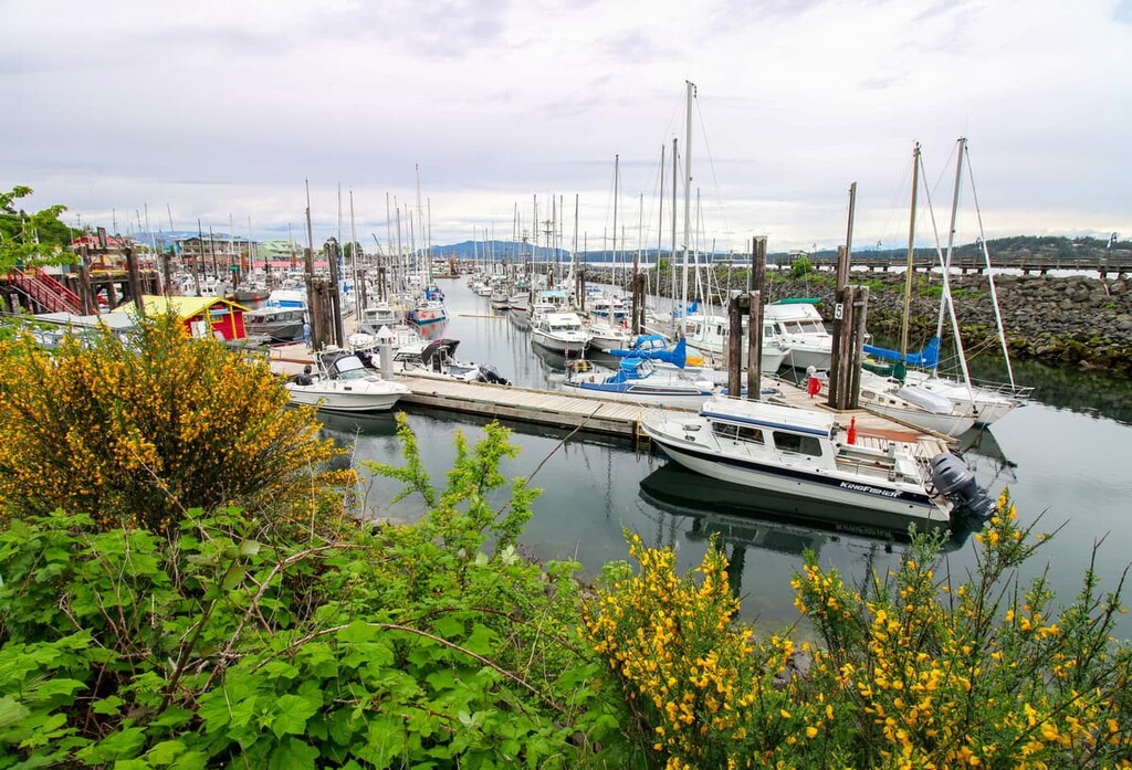
Campbell River is the gateway to the north end of Vancouver Island and the islands of the Discovery Channel. It is the largest community on the north end of Vancouver Island, and it is situated about 130 km (80 mi) from the edge of the Bonanza Range along Highway 19.
The community of Campbell River is home to an incredible stretch of beaches, where you can sit on beautiful volcanic outcrops, cobble rocks, or soft sand. From these beaches, there are stunning views into the Georgia Strait toward the Pacific Ranges on the mainland as well as toward Quadra Island, Cortes Island, and many of the other islands that make up the Discovery Islands.
If you’re in Campbell River, there are many incredible hiking and wilderness areas located nearby that you can check out. Some of the local favorites are Elk Falls Provincial Park and Strathcona Provincial Park. The incredible Ha’thayim Marine Provincial Park is also only a couple ferry rides away and we recommend taking at least a couple days to visit Cortes and Quadra Islands if you’re in the area.
Port McNeill is home to the regional offices of the Regional District of Mount Waddington. The town is located about 67 km (40 mi) to the northwest of the Bonanza Range along Highway 19.
As the gateway to the scenic islands of Broughton Archipelago, Port McNeill has regular ferry service to Alert Bay on Cormorant Island, and Sointula on Malcolm Island. The town is also home to the Port McNeill Airport, which is the regional airport for the north end of Vancouver Island.
The seaways and wilderness areas of north Vancouver Island are beautiful and are full of opportunities for adventure. Some of the many amazing places to visit in and around the community of Port McNeill are the scenic islands of the Broughton Archipelago, where there are several marine provincial parks. Here, you can also check out Nimpkish Lake Provincial Park and the beautiful Cape Scott Provincial Park.


