
Scan the QR code and open PeakVisor on your phone
The Sophia Range include 2 named peaks. The highest is Mount Rosa at 754 m. Other notable peaks include Newton Hill.
The Sophia Range covers the peninsula on the northwest corner of Nootka Island in British Columbia, Canada. Nootka Island is located on the west coast of Vancouver Island and is adjacent to the Nootka Sound, where James Cook was the first non-Indigenous person to make landfall in the region 1778. There are 2 peaks in the range, the highest and most prominent of which is Mount Rosa (754 m/2,474 ft).
Located off the west coast of Vancouver Island in British Columbia, Canada, the Sophia Range covers a peninsula on the northwest corner of Nootka Island. The Sophia Range was named by Captain George H. Richards after Sophia Elizabeth, the fourth daughter of Captain Edward E. Langford, for whom a city on the island is named after.
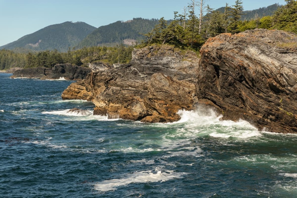
The Sophia Range is situated on the remote and rugged west coast of the province and is only accessible by float plane, helicopter, or boat. The range rises from the Pacific Ocean and creates a peninsula on Nootka Island. The tallest of the hills and peaks in the range is Mount Rosa, which stands 754 m (2,474 ft) above sea level.
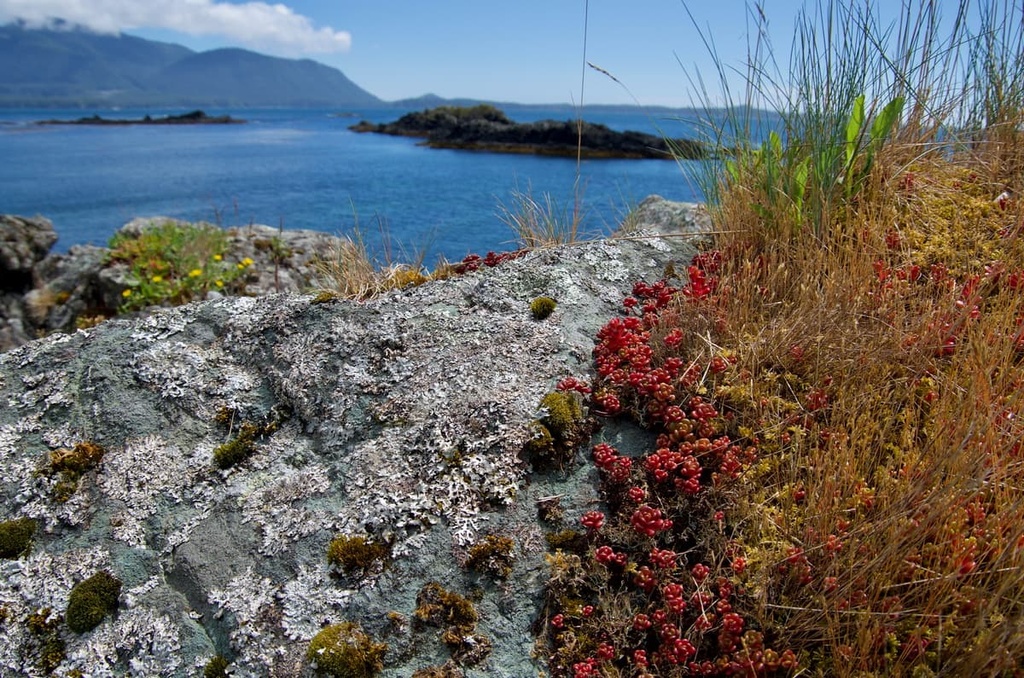
Nuchatlitz Provincial Park is located at the end of the peninsula, and it includes the coastal area and islands to the northwest of the Sophia Range. While there are no other protected areas or parks in the Sophia Range, the following parks are located on and around Nootka Island:

Located along the west coast of Canada, the Canadian Coast Mountains dominate the coastal skyline of the province, even though they are actually located to the east of the Insular Mountains. The Sophia Range is part of the Vancouver Island Ranges, which itself is a subrange of the Insular Mountains. The Insular Mountains are also located to the west of the Pacific Ranges in the Canadian Coast Mountains.
In general, the Coast Mountains include the mountains that are part of mainland British Columbia while the Insular Mountains form the major islands and their mountain ranges that are located off the west coast of British Columbia. The major subranges of the Insular Mountains include the Vancouver Island Ranges and Haida Gwaii, which was previously known as the Queen Charlotte Islands.
The Insular Mountains formed when the Insular plate, which was a broken-off section of the Farallon tectonic plate, subducted beneath the North American plate during the mid-Cretaceous. As the Insular plate slid under the continent, a string of volcanic islands collided with and accreted to the continental margin, forming the basis of the Insular Mountains.
The Sophia Range and the Vancouver Island Ranges are part of an exotic terrane called Wrangellia. Wrangellia is primarily made of turbidites and pillow lavas that started forming into islands about 230 million years ago. Unlike the Coast Mountains, the Vancouver Island Ranges have very few granitic intrusions; however, the region is still significantly seismically active.
While the initial collision of the Insular Island with the coastal margin of Canada created the initial uplift of the Vancouver Island Ranges, additional collisions further uplifted the ranges. About 55 million years ago, the Pacific Rim Terrane collided with Vancouver Island, followed by the Crescent Terrane 13 million years later.

The collision of these additional terranes compressed the coastal margin, which, in turn, uplifted the Vancouver Island Ranges. Furthermore, the collision created islands in the Georgia Strait, such as the Gulf Islands and Discovery Islands, off the east coast of Vancouver Island.
The Vancouver Island Ranges and Haida Gwaii are just the highest elevation representations of the Insular Mountains. During the last glacial maximum, around 18,000 years ago, the sea level was several hundred meters lower, and the Insular Mountains were fully exposed.
During the Pleistocene, the Sophia Range was covered by an ice sheet that stretched from the continent across Vancouver Island to the Pacific Ocean. The glacial ice eroded the valley walls and bottoms so that as the sea level rose, the ocean filled the long valleys, creating the rugged fjords along the west coast.
The west coast is dominated by temperate rainforests where old growth forests may be hundreds of years old. The temperate rainforests along the Pacific Coast are representative of the Coastal Western Hemlock ecosystem.
The forests of the Coastal Western Hemlock ecosystem are dominated by western hemlock, Pacific silver fir, western red cedar, and big leaf maple. Sitka spruce have also adapted to withstand the salty air and salt spray from the ocean, and they typically dominate the shoreline in the region. The coastal spruce trees in the area are often windswept to the point that they look like giant, sculpted bonsai trees.
Significant tracts of the old-growth forest in the region have been logged since the nineteenth century. Many of the forests along the west coast of Vancouver Island were the first to be logged because the trees were easily taken down to the ocean for transport to mills.

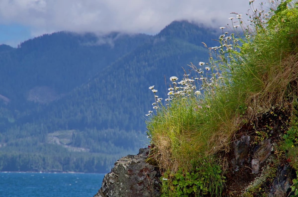
The Sophia Range is quite low-lying and does not have any alpine areas. There are an abundance of animals that inhabit the range, including black bears, golden eagles, bald eagles, gray wolves, and Columbia black-tailed deer.
The oceans surrounding the range are inhabited by gray whales, orcas, dolphins, porpoises, sea lions, and sea otters.
During the eighteenth and nineteenth centuries, sea otters were hunted to near extinction. In fact, it was only through conservation efforts in the mid twentieth century when conservationists relocated sea otter colonies from Alaska, that there are any sea otters at all along the west coast of Vancouver Island.
Prior to the arrival of Europeans on the west coast of Vancouver Island, the Sophia Range and the northern parts of the island were the traditional territory of the Nuu-chah-nulth First Nations. The name “Nootka” for which the island and the sound were named, comes from a derivation of the name of the Nuu-chah-nulth.
The first recorded landfall on Vancouver Island by a European was made by Captain Cook as he sailed the Pacific Northwest in search of the fabled Northwest Passage. Captain Cook arrived in the Nootka Sound in 1778. The area has an extensive history that includes disputes between the Spanish and British for control of the region as well as disputes between Europeans and the Nuu-chah-nulth.
Located on the south end of Nootka Island, the community of Yuquot has been inhabited for the past 4,300 years. The current community surrounds a lighthouse; however, it was also the location of the only Spanish settlement in Canada, as well as the location of caves with Indigenous and Spanish burial sites.

Located on the northwest coast of Nootka Island, the Sophia Range contains and surrounds some remote wilderness destinations. The following are some of the major attractions and hiking areas in and around the Sophia Range:
Nuchatlitz Provincial Park is located on the tip of the same peninsula on Nootka Island as the Sophia Range. The park encompasses the shore and islands that were previously part of the range when the regional sea level was much lower. The maze of islets and reefs in the park create a fascinating intertidal zone that’s worth checking out.
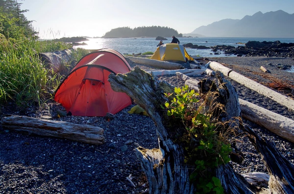
Additionally, there are unofficial trails across the park that lead from the shore to the headlands. Many visitors also enjoy sea kayaking and sea canoeing along the coast and around many of the small islands. Backcountry camping is permitted on Nootka Island as well as the small islands in the park.
There are some small, developed areas for camping in the park, such as those on Rosa Island. Other undeveloped camping areas are scattered throughout the region. While camping in the park, visitors can enjoy fishing for Chinook, coho, and pink salmon, as well as rockfish.
Situated adjacent to the Sophia Range along the west coast of Nootka Island is the 36 km (21.6 mi) long Nootka Trail. While traveling the beachside trail you’ll likely see wolf tracks along the beautiful beaches. This remote trail should only be tackled by experienced backpackers who are prepared for potentially rough weather.
The trail traverses the coast between Louie Bay on the north side of the island and Yuquot on the south side of Nootka Island. While it boasts similar terrain to the West Coast Trail, the trail has much less maintenance work done on it each year and is considered more rugged. Some of the highlights of the trail are the Calvin Creek Waterfalls, swimming in the Pacific Ocean, beachcombing, and the ancient First Nations middens.
The trail typically takes 5 days to complete and is accessible via float plane or water taxi. Nootka Trail is best hiked between May and September, and there is a trail fee payable to the local First Nations to allow access across their lands and to the facilities at Friendly Cove.
There are many logging roads and trails that traverse the Sophia Range. Most of the peaks are reasonably accessible; however, there are no official trails leading to the summits. The remote area permits backcountry camping, but caution should be taken to avoid any active logging areas during your hikes.
Nootka Island is the largest of the islands that are located off the west coast of Vancouver Island. There are several access points to the island via water taxi and float plane. The following are some of the major communities that allow access to Nootka and Vancouver Island:
Located in the geographic center of Vancouver Island, the village developed as a typical community that was reliant upon logging and a pulp and paper mill. However, with changing world markets, the mill closed, forcing many inhabitants to relocate. Those that remained enjoy living among the picturesque mountains, lakes, rivers, ocean, and forests.

The community has developed a tourism industry that promotes sport fishing and other wilderness pursuits. Gold River is the closest village to the historic Yuquot, or Friendly Cove, where Captain James Cook made landfall. The village serves as a base for hiking the Nootka Island Trail and the Elk Lake Trail, as well as for expeditions upon Golden Hinde, the island's tallest mountain, and other climbing areas.
Located some 120 km (72 mi) to the east of Nootka Island and the Sophia Range, Campbell River is the gateway to many of the adventures on the east and west coast of Vancouver Island.
Connected to the east of Vancouver Island via Highway 19, and the west via Highway 28, Campbell River is the jumping point for wilderness adventures on the north end of Vancouver Island.
Campbell River has many great places to stay, fantastic places to eat, and some incredible beaches for relaxation. Visitors can hike the historic Ripple Rock trail or travel to the nearby Horne Lake and Upana Caves. Mountain bike and hiking trails are also located only minutes from the main street and they lead along the beach, rivers, or through the beautiful forests of the town.

Some of the places near Campbell River that are worth visiting include Elk Falls Provincial Park. where there are several vantage points to see the stunning Elk Falls, including a suspension bridge that spans the canyon. Other hiking and biking areas near Campbell River include Strathcona Provincial Park, Quadra and Cortes Islands, Schoen Lake Provincial Park, and Miracle Beach Provincial Park.
Situated on the east coast of Vancouver Island, Nanaimo is one of the major ports for visitors arriving to the Island. The city is famous for its namesake dessert, the Nanaimo Bar, which is a layered treat of chocolate, custard, and a cookie base. Local restaurants have created their own unique variations of the bar, all of which can be discovered by following the Nanaimo Bar Trail.

Located along the Interior Passage between mainland British Columbia and Vancouver Island, Nanaimo is blessed with typically warm and dry weather. The region was one of the first areas to be developed on the island, after the development of the Comox Valley, which is located to the north.
There are many small protected areas in and around Nanaimo that are good for picnics and short walks in nature. Some of the best hiking areas in the region include Mount Benson Regional Park, Westwood Lake Park, Jack Point and Biggs Park, Hemer Provincial Park, and Nanaimo River Regional Park.


The highest peak in the Sophia Range is Mount Rosa, at 754 m.
The Sophia Range have 2 named peaks.


