
Scan the QR code and open PeakVisor on your phone
The Somerset Range include 2 named peaks. The highest is Somerset Range at 820 m. Other notable peaks include Hobiton Ridge.
The Somerset Range is a collection of peaks that’s located on the west coast of Vancouver Island in the province of British Columbia, Canada. The range stretches from Barkley Sound to Nitinat Lake and has dozens of unnamed peaks. The tallest of the 2 named peaks in the range is Hobiton Ridge, which stands 799 m (2,621 ft) above sea level and has 568 m (1,909 ft) of prominence.
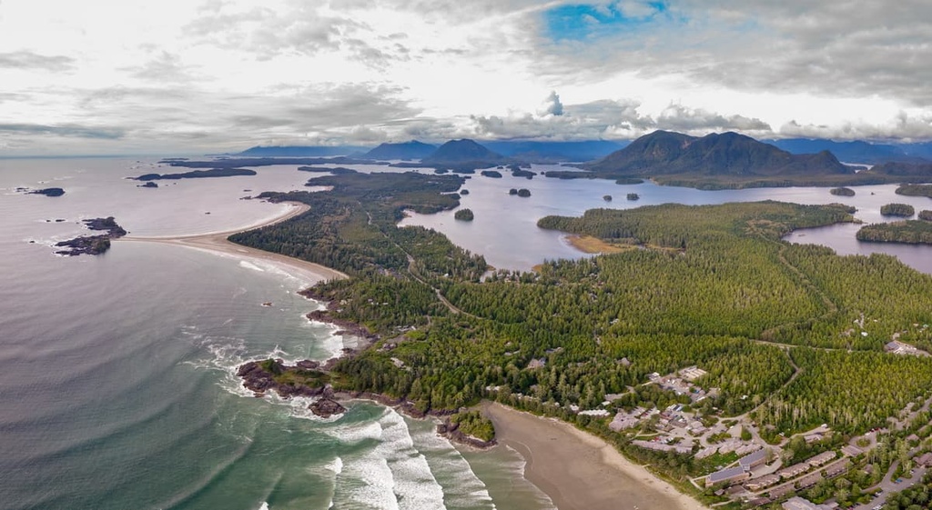
Located on the west coast of Vancouver Island, in British Columbia, Canada, the Somerset Range is a low-lying collection of peaks that consist of dozens of small mountains and hills. The tallest of the named peaks in the range is Hobiton Ridge, which is 799 m (2,621 ft) tall.
The range extends from Barkley Sound in the north to Nitinat Lake in the south. The West Coast Trail Unit of Pacific Rim National Park Reserve covers the western edge of the range along the coastline. Hitchie Creek Provincial Park, Nitinat River Provincial Park, and Klanawa River Ecological Reserve are also located in the Somerset Range while Carmanah Walbran Provincial Park is situated adjacent to the range.
The primary method of access to the range is via the major forestry roads on the west coast of the island. In particular, you can access the range on the Bamfield Main and the Carmanah Main roads. Further access to the range is via the water taxi, which runs daily along Nitinat Lake from Ditidaht to Nitinat Narrows.

The Somerset Range and its accompanying coastline are part of the Wrangellia Terrane, which is an ancient island arc and landmass that started forming 300 million years ago from undersea lava flows. The major feature of the Wrangellia Terrane is the 6 km (3.6 mi) thick layer of basaltic lava that erupted from a seafloor rift about 230 million years ago.
Wrangellia collided with North America during the Cretaceous and was part of the cause of the Laramide orogeny, which was the formation event for the Rocky Mountains. The accretion of the exotic terrane compressed the continental margin. As a result, some of the Insular Mountains that exist today started forming during this time.

The rocks in the nearby Pacific Rim National Park Reserve are part of the Pacific Rim Terrane, which accreted to the edge of Vancouver Island about 55 million years ago. However, the Pacific Rim Terrane completely subducted beneath the Somerset Range and the accompanying coastline.
Furthermore, it was the collision, accretion, and subduction of the Pacific Rim Terrane that compressed Vancouver Island, resulting in the further uplift of the Vancouver Island Ranges. As a subrange of the Vancouver Island Ranges, the Somerset Range is part of the Insular Mountains, which is the westernmost range of mountains in Canada.
During the Pleistocene, as the ice sheets were forming on the continents, the sea level around the world dropped significantly. The drop in sea level allowed for most of the Insular Mountains to be exposed above the ocean. As the ice melted around 15,000 years ago, the oceans reclaimed many of the mountains, leaving only their peaks above sea level, as islands.
The west coast of British Columbia is known for its massive trees, which are part of the temperate rainforest. The west of Vancouver Island and the Somerset Range are also covered with these temperate rainforests.

A beautiful sight along the west coast of Vancouver Island is the coastal fringe of Sitka spruce. The trees have adapted to survive amidst the salty air; however, fierce winds ravage the coast and sculpt many of the coastal trees to appear as bonsai.
Unfortunately, significant tracts of the Somerset Range have been logged in the past centuries, removing most of the ancient, old growth forests. The old growth forests were full of giant western hemlock, red cedar, big leaf maple, and Douglas fir. The massive size of the ancient trees proved too tempting and valuable to early settlers of the region, who cut most of the old growth trees out of the range.
The range currently primarily contains old second growth and subsequent forests, in addition to small pockets of the old growth forests. The pioneer, seral, and climax forests all support the wildlife in different ways. In the past century, locals have convinced politicians and industry in the importance of preserving some of the natural wilderness and have created several parks and an ecological reserve in the range.
While visiting the protected areas of the range, or otherwise traveling the many logging roads and trails, you are likely to see black-tailed deer, bald eagles, and many more birds. If you are lucky, you may spot one of the many black bears, gray wolves, or a Vancouver Island marmot. The trek along the West Coast Trail has opportunities to see whales, sea lions, otters, and many more animals that inhabit the ocean.

Vancouver Island has been inhabited for about the past 14,000 years by various cultures. The Somerset Range is in the traditional territory of the Huu-ay-aht First Nation, who are a Nuu-chah-nulth (Nuučaan̓ułʔatḥ) people.
The Nuu-chah-nulth were previously referred to as the Nootka, and their territory is primarily situated along the northwest coast of Vancouver Island. They were the first Indigenous people to meet Captain James Cook as he made his first recorded landfall on the island at Yuquot (Friendly Cove).

Additionally, the Somerset Ranges are part of the Ditidaht First Nations territory, who are culturally and politically affiliated with the Nuu-chah-nulth.
The hunting of whales is essential to Nuu-chah-nulth culture and spirituality, and this is reflected in their art, songs, stories, and their names. It is known that the Nuu-chah-nulth have been hunting whales for their blubber and meat for the past 4,000 years. Gray and humpback whales are the most common prey; however, some First Nations citizens would try to show their bravery by hunting an orca.
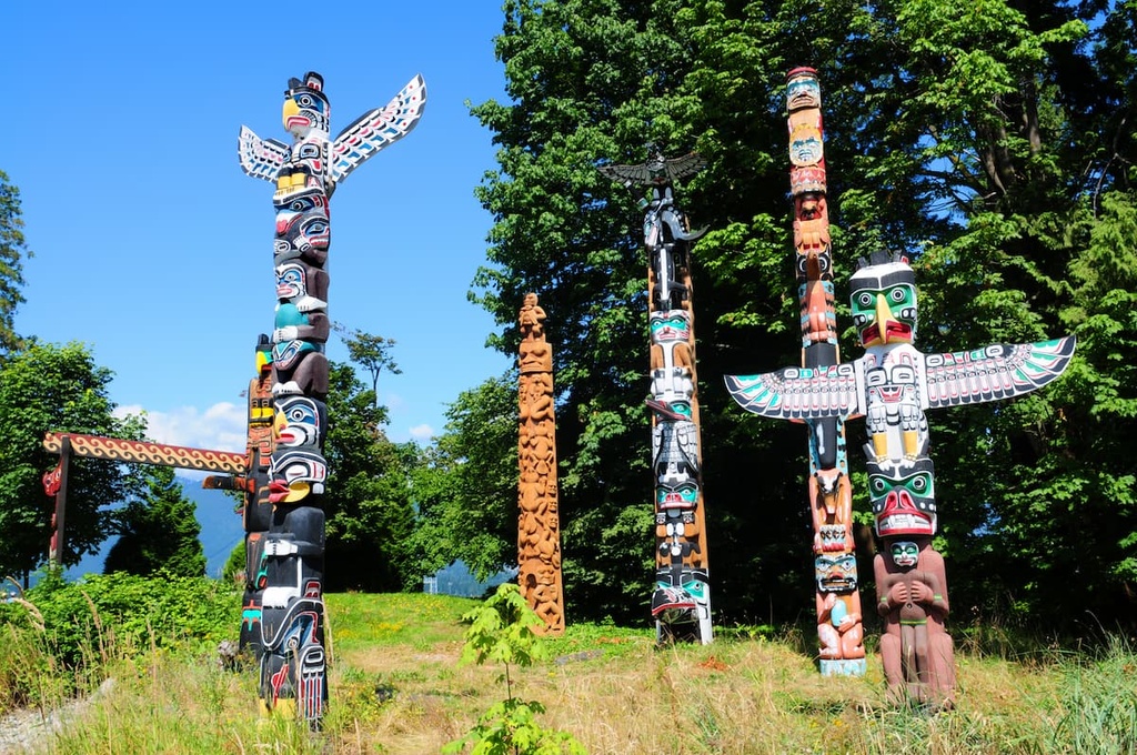
The abundance of natural resources in the region allowed for complex social hierarchies to form among the Indigenous communities of Vancouver Island. Furthermore, these abundant resources allowed members of these First Nations to dedicate time to creating art and to practice cultural and spiritual ceremonies.
First Nations artists in the region traditionally carve full trees into totem poles to adorn the community and its houses, while other woodworkers construct canoes. Cedar trees maintained particular importance to many First Nations in the area because in addition to being carved into totem poles and canoes, the bark was crafted into baskets, clothing, and other ceremonial regalia.
When Europeans arrived in the late eighteenth century, they brought industry, settlers, and disease. First Nations in the region would trade with the ships as they sailed the coast hunting otters and other fur-bearing sea animals. The demand for otter fur was so high, that the local populations of sea otters were all but wiped out along the coast of Vancouver Island.
It was only through a conservation effort in the late twentieth century when sea otter colonies were transplanted from Alaska, that there are any sea otters at all along the island coast. Furthermore, in addition to extirpating the sea otters, smallpox and other diseases ravaged the local First Nations, killing upwards of 90 percent of the Indigenous people of Vancouver Island.
As the settlements on Vancouver Island grew, so did the shipping traffic along the west coast of the island. The waters were so treacherous that the west coast of Vancouver Island was dubbed “the graveyard of the Pacific.” There are dozens of wrecks along the shore that are still visible to this day.
In 1906, when the 125 lives were lost when the SS Valencia went down, the public outcry spurred the government to create the Dominion Life Saving Trail. However, over time, and with advancements in technology, the Dominion Lifesaving Trail was required less frequently, and it was eventually abandoned.
In the 1970s, the Dominion Lifesaving Trail was revitalized as the West Coast Trail, which is a major attraction of the newly created Pacific Rim National Park Reserve. The trail covers the coastline at the base of the Somerset Range.
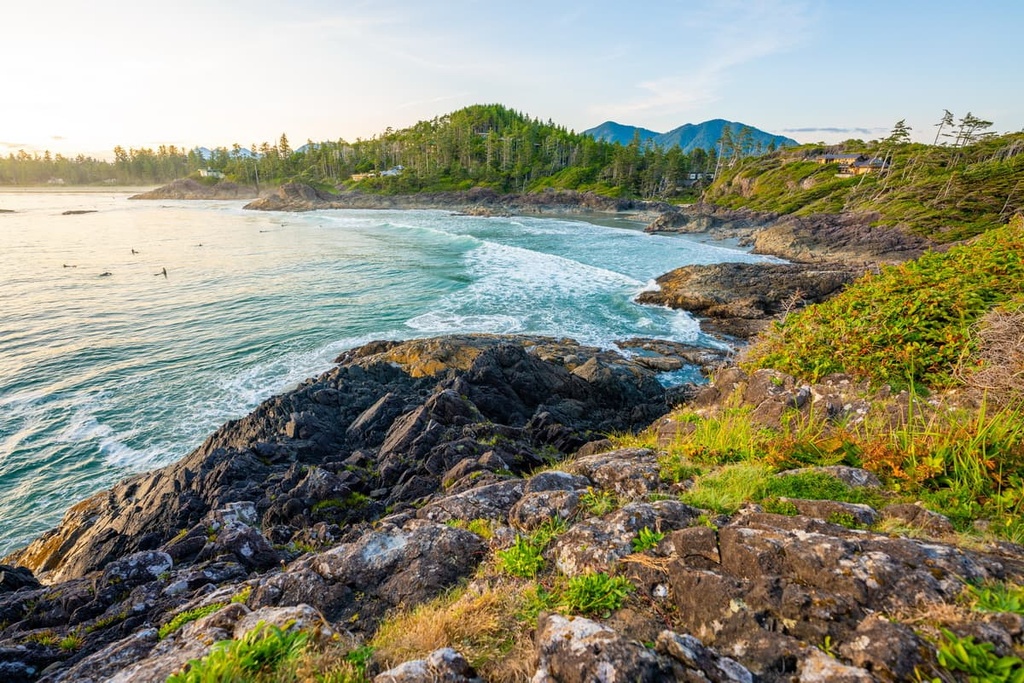
The Somerset Range encompasses beautiful mountain wilderness as well as a stunning coastline. The following are some of the major trails and attractions in and around the Somerset Range:
The coastal area of the Somerset Range is protected as part of the Pacific Rim National Park Reserve – West Coast Trail Unit. The 75 km (45 mi) long trail was established along the old Dominion Lifesaving Trail that was created to help shipwrecked sailors and passengers at the turn of the twentieth century.
The trail is now considered one of Canada’s best hikes and is known worldwide. The trail follows the beaches, crossing rivers and creeks. Hikers are required to climb ladders, traverse boardwalks, and even cross some rivers in a cable car. While the trail is difficult and hikers should be prepared for adverse conditions, it is certainly worthwhile to gain the necessary skills to hike this trail.
The Sarita River is an important river in the Huu-ay-aht territory, and it’s located along the north side of the Somerset Range. Named for the Spanish explorer who mapped the area, the river has provided salmon and transportation to the First Nations in the region for generations.
The trail to the falls is tricky and it requires traversing fallen and uneven logs, and roots. The trail is steep beyond the first waterfall; however, there are ropes to help. Hiking past the second waterfall requires ascending the falls or going the long way through the woods. While this hike is out of the way, it offers a unique chance to immerse yourself in the history, ecology, and general beauty of the island.
Amidst the hills and peaks of the Somerset Range is Flora Lake, a relatively unused gem of a lake and campground. For those that know, Flora Lake is a lovely destination for fishing, boating, and nature walks along the web of trails in the area.
The Somerset Range is located on the remote west coast of Vancouver Island. The following are some of the nearby communities and major cities:
Bamfield is situated along the Barkley Sound on the north side of the Somerset Range on Vancouver Island. The town is considered the northern terminus for the famous West Coast Trail and the small community is home to the renown Bamfield Marine Sciences Centre, which offers educational tours and university credit courses.

In addition to being the terminus for the West Coast Trail, thanks to its many ferry and water taxi services, Bamfield is the starting point for adventures in the Broken Group Islands of the Pacific Rim National Park Reserve.
While ecotourism and marine sciences are an important feature of Bamfield, the community also boasts of its amazing fresh seafood. Bamfield is an incredible launching point for adventures along the west coast, for learning about marine biology, or just for relaxing on a sunny beach.
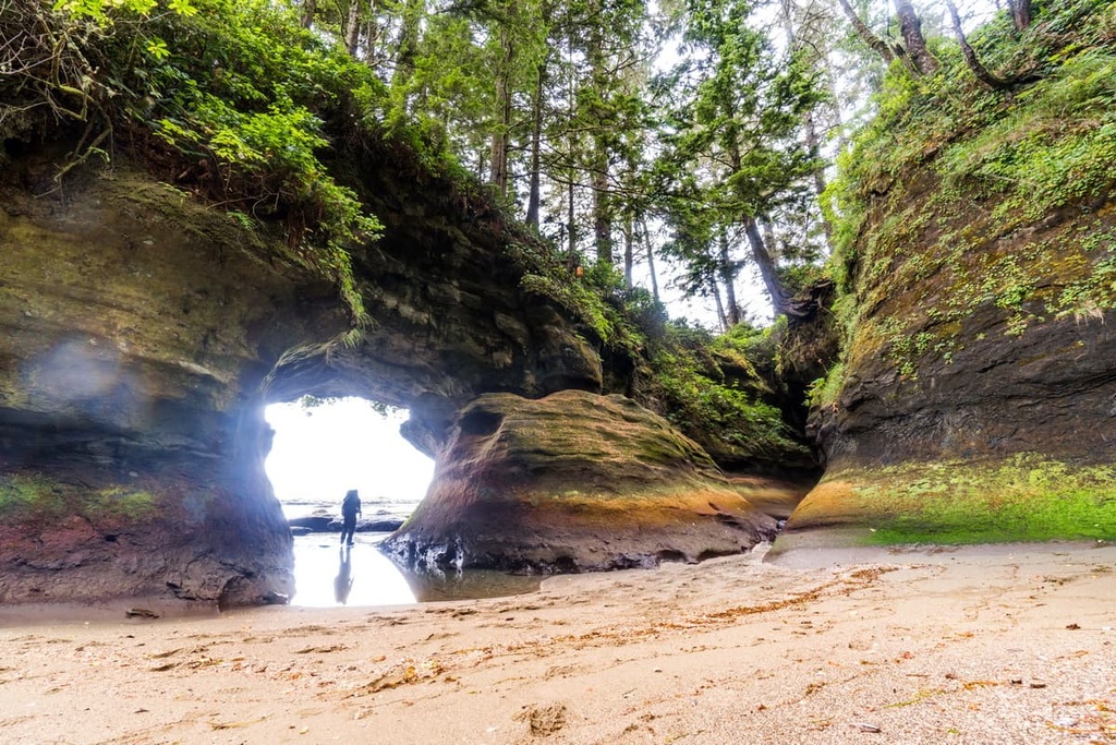
Located on the southern shore of Port San Juan, the Port Renfrew is situated to the south of the Somerset Range, and it serves as a terminus for hikers traveling along the West Coast Trail. Within a short distance of the community are some of the island’s most spectacular beaches as well as access to some of the last old growth forest on the island.

Botanical Beach, with its incredible tidal pools and interesting rock formations, and Sombrio Beach, with its sandy beaches, great surf, and hidden waterfall, are two great beaches to check out during your visit. From Port Renfrew, there are also marine and wilderness excursions that you can head out on that feature fishing, hunting, whale watching, and hiking.
Also accessible from Port Renfrew are several hikes on the south side of Carmanah Walbran Provincial Park, which encompasses and protects some of the last old growth forest on the south end of the island. From the logging roads you can access the Harriet Nahanee Memorial Trail, Anderson Lake Trail, the Castle Grove and Castle Giant Trail, and the ancient forest of the Walbran Valley.


The highest peak in the Somerset Range is Somerset Range, at 820 m.
The Somerset Range have 2 named peaks.


