

Share

Scan the QR code and open PeakVisor on your phone
Scan the QR code and open PeakVisor on your phone
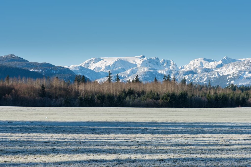
The Comox Valley Regional District is an administrative region located on Vancouver Island, off the west coast of British Columbia, Canada. Comox Valley is centrally located on the east coast of the island, and there are 41 named peaks in the district. Mount Albert Edward is the tallest and most prominent peak in the regional district with 2,093 m (6,867 ft) of elevation and 1,205 m (3,953 ft) of prominence.
Located on the east coast of Vancouver Island, British Columbia, the Comox Valley Regional District borders the Georgia Strait and includes Hornby and Denman Island. Highway 19 roughly follows the coast through the district and the major communities of the Comox Valley are Courtenay, Cumberland, and Comox.
The Comox Valley is surrounded by Strathcona Regional District which is located to the north, the Regional District of Nanaimo to the south and the Alberni-Clayoquot Regional District to the west. Campbell River is located to the north of Comox Valley and the cities of Nanaimo and Port Alberni are located to the south.
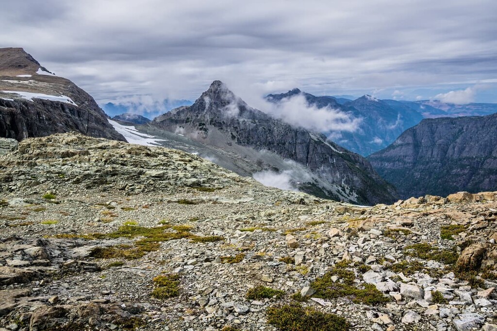
The Strait of Georgia is the waterway that separates Comox Valley from mainland British Columbia, which is in the east, while Buttle Lake is the rough western boundary of the district. The mountains of Vancouver Island are part of the Vancouver Island Ranges and the Beaufort Range is a subrange that includes the bulk of the peaks in the southern end of the Regional District of Comox Valley.
The following are some of the parks and protected areas within the regional district:
Most of the rocks of the Regional District of Comox Valley and Vancouver Island are part of a landmass called Wrangellia that started forming as undersea lava deposits 380 million years ago. Subsequent deposition of layers of marine sediment and further eruptions of lava formed the limestone and basalt outcroppings found on the island.
The Farallon and Insular tectonic plates that underlaid what is now the Pacific Ocean collided with the ancient North American plate about 160 million years ago when the Insular and then Farallon Plate subducted beneath the continent. During the subduction, the volcanic islands on the Insular Plate were accreted (bonded) to North America.
About 100 million years ago, Wrangellia accreted to North America and formed the majority of what is now Vancouver Island. There is a sediment layer on the west coast near Comox Valley and Nanaimo that formed as eroded sediment was washed from the mainland and out over the continental shelf. As the seafloor was uplifted during the Sevier orogeny, the layer became the exposed east coast of Vancouver Island.
During the Fraser Glaciation of the Pleistocene between 29,000 and 15,000 years ago, glaciers covered Vancouver Island and the Georgia Strait effectively connecting the island to mainland British Columbia. The weight of the glaciers caused the island to sink between 150 and 300 m. As the glaciers melted, around 10,000 years ago the rate of rebounding exceeded the rise in the sea level from the melting glaciers, exposing land that is currently covered by the ocean.
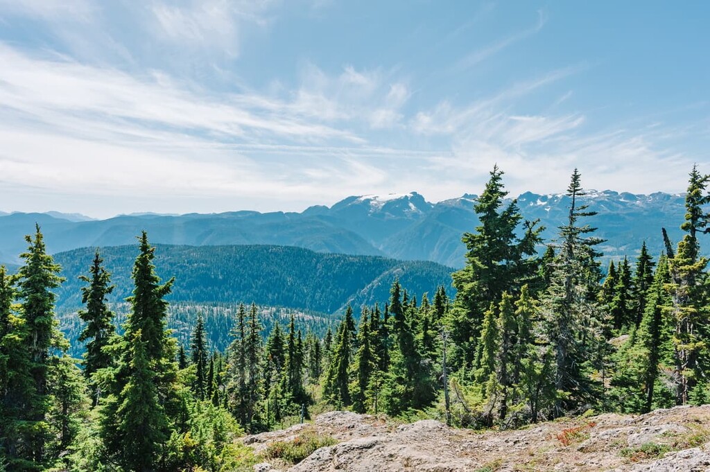
The ecology of the Comox Valley Regional District is characterized by four different ecological zones. The Coastal Alpine zone covers the inland mountain peaks with the Mountain Hemlock ecology dominating the high mountain slopes. The lower slopes and valleys are covered with the Coastal Western Hemlock ecozone while Denman Island and Hornby Island have the Coastal Douglas Fir ecologies.
The Coastal Douglas Fir Ecology is unique to Denman and Hornby Islands in the Comox Valley Regional District. The islands have the unique Saanich ecosystem that includes seaside parkland, dry forest, rocky outcrops, wetlands, and many rare plants and trees including Garry oak and arbutus. The meadows have the beautiful blue camas, shooting star, easter lily, chocolate lily, and satin flower.
The Coastal Alpine ecology is dominated by bare peaks and meadows of heather while the upper slopes are part of the Mountain Hemlock zone. Forests of fir, mountain hemlock, and yellow cedar grow denser as they move down the slopes, until they meet with the Coastal Western Hemlock ecology.
The landscape of the Coastal Western Hemlock ecology is dominated by forests of massive western hemlocks and red cedars. Douglas fir and bigleaf maple grow in the warmer areas of British Columbia, and Comox Valley has an abundance of such beautiful trees.
Unfortunately, however, in the Comox Valley Regional District most of the old growth forests have been logged with only a few exceptions; therefore, there are almost no trees older than 250 years in the district.
In fact, the logging industry prefers to cut trees that are 40-80 years old, so even the second growth forests are being cut down, except in protected areas. There are many species, especially birds, that prefer old growth forests, so there is less diversity in a region where those forests have been logged.
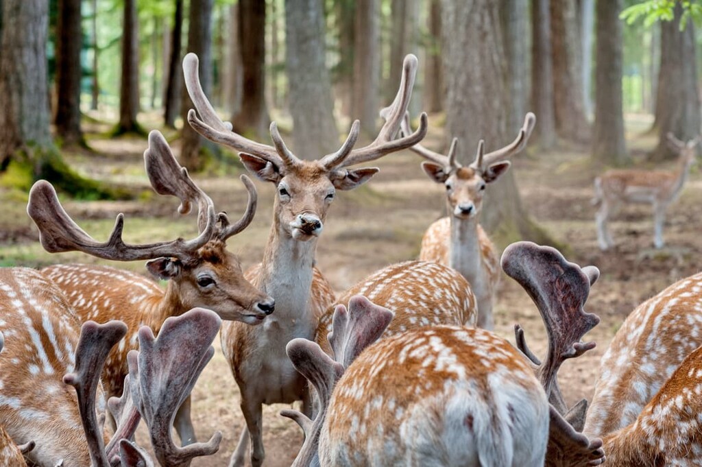
The animals that inhabit Comox Valley and Vancouver Island are not the same variety that inhabit mainland British Columbia. While there are black bears and cougars, there are only a few grizzlies on Vancouver Island.
The petite and adorable Columbian black-tailed deer is the most common ungulate in the district and the grey wolf is the most elusive animal on the island. Furthermore, here, bald eagles are masters of the skies and are a magnificent sight whether they are soaring overhead or perched in a tree.
Archaeological discoveries have been made under water in the islands near Vancouver Island that likely pertain to this period where the sea level was lower after the Pleistocene. The land of the Comox Valley and surrounding waters are the traditional territory of the Homalco, Tla’amin, We Wai Kai, We Wai Kum, and the K’ómoks First Nations with archaeological evidence suggesting that humans have lived in this region for at least 4,000 years.
The Indigenous communities of the region traditionally fished, hunted, and gathered their food in the Comox Valley. The region’s trees, especially the red cedar, were also traditionally used to provide shelter, tools, clothing, and building materials for houses and canoes.
Weirs were created by driving stakes into the mudflats along the coast to hold fishing nets. As the tide went out, fish caught in the nets could be easily harvested. There are suspected to be more than 200,000 stakes in the flats, with the oldest dated to the year 750 and the youngest being from 1830.
It is possible that the first European to see the Comox Valley was Sir Francis Drake of England during his global circumnavigation voyage in 1579. In 1791, Spanish sailor Dionisio Alcalá Galiano traveled the Georgia Strait and may have landed at Comox. The following year, Captain George Vancouver sailed to the area and charted the shoreline of Comox.
In 1837, the Hudson’s Bay Company built a trading post in the Comox Valley and named it Komoux. By 1862, with the recognition of the fertile agricultural land of the valley, Governor of Vancouver Island, James Douglas offered land in the valley for $1 per acre and free transportation to the area in an attempt to divert settlers from the Victoria region and encourage settlement of the Comox Valley.
As the population of settlers slowly grew, the British Royal Navy desired a permanent presence in the area and built a naval base on the Goose Spit. The base was later used as an army camp to train soldiers for World War I, after which it was returned to the navy.
The towns of Cumberland and Courtenay grew from economic prosperity brought by agriculture, mining, and forestry, while the town of Comox became a destination for wealthy tourists. Comox was advertised as a destination for fishing, tennis courts, golf, boating, swimming, hunting, skiing, and fine dining.
The onset of the Second World War led to the creation of an airbase at Comox, in addition to the naval base, to send patrols into the Pacific. After the war, the base was practically abandoned: however, Cold War tensions led to the base’s reopening.
Since that time, the fishing and logging industries have declined and the region’s economy is primarily driven by agriculture, tourism, and airbase support services. Canadian Forces Base Comox is among the largest employers in the valley. Tourism has also picked up in the Comox Valley as it once had in the 1920s.
There are many opportunities for recreation, such as boating, wildlife tours, hiking, and skiing at Mount Washington Alpine Resort or on the Forbidden Plateau. The Comox Valley Regional District is becoming especially popular with retirees, many of whom move to the temperate valley to enjoy their golden years.

There are some incredible sights to see and activities to do in the Comox Valley. In particular, there are plenty of wildlife viewing tours that feature grizzly bears, whales, sea lions, and seals. Visitors can also set sail on a fishing charter in the Georgia Strait.
Alternatively, visitors to the Comox Valley can ride the more than 250 mountain bike trails in the region, including those at the Mount Washington Alpine Resort. Plus, the resort offers skiing, biking, and much more. The following are some of the destinations and hiking areas of the region.
The resort at Mount Washington is built for year-round enjoyment. The winter months are great for skiing with 1,700 acres and 505 m (1,654 ft) of vertical descent. There are 55 km (33 mi) of cross-country ski trails and 25 km (15 mi) of snowshoe trails. The resort is home to a rising generation of Olympic-level athletes.

In the summer, the resort features lift-accessed mountain biking, a zip line, tours, and scenic chair lift rides. Additionally, there is a bungee trampoline, disc golf, miniature golf, and giant chess and checkers.
The resort is open year-round to guests and it offers shopping and dining options, too. The Mount Washington Alpine Resort has incredible views and is a fantastic wilderness playground. Some of the hiking trails at the resort include Memory Lane, Top of the World, Wet Summit Ridge, and Giv’r Trail, the latter of which is the trail to take if you want to grind it up to the summit.
Seal Bay Nature Park contains 642 hectares (1,585 acres) of beautiful coastal forest and beach. As the name implies, seals frequent the bay, as do great blue herons. The forests are second growth, with the most recent logging occurring in the 1920s, and you can still find the plank notches in these ancient stumps.
The forest is filled with massive Douglas fir, red cedar, and bigleaf maple and the understory is a carpet of ferns that stretch out under the canopy of the tall trees. There are many wide trails through the forest and to the beach, all of which have many benches along the way for resting and peaceful contemplation. The park is incredibly beautiful and peaceful and you may find yourself invigorated after a short walk through the forest to the beach.

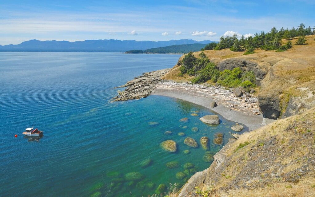
Mount Geoffrey Escarpment Provincial Park is located on Hornby Island, off the east coast of Vancouver Island. The park provides opportunities for hiking, mountain biking, canoeing, fishing, swimming, and horseback riding.
Visitors can arrive at Hornby Island by ferry or they can canoe or kayak over from Vancouver Island. There are many hiking trails, some of which lead to the top of the escarpments for incredible views of Vancouver and the Denman Islands.
The Comox Valley Regional District has mild winters, warm summers, abundant sea life, and fertile soil, all of which attracted Indigenous people to the region for thousands of years and settlers of European descent in the 1800s. The following are some of the towns and cities in and near the Comox Valley
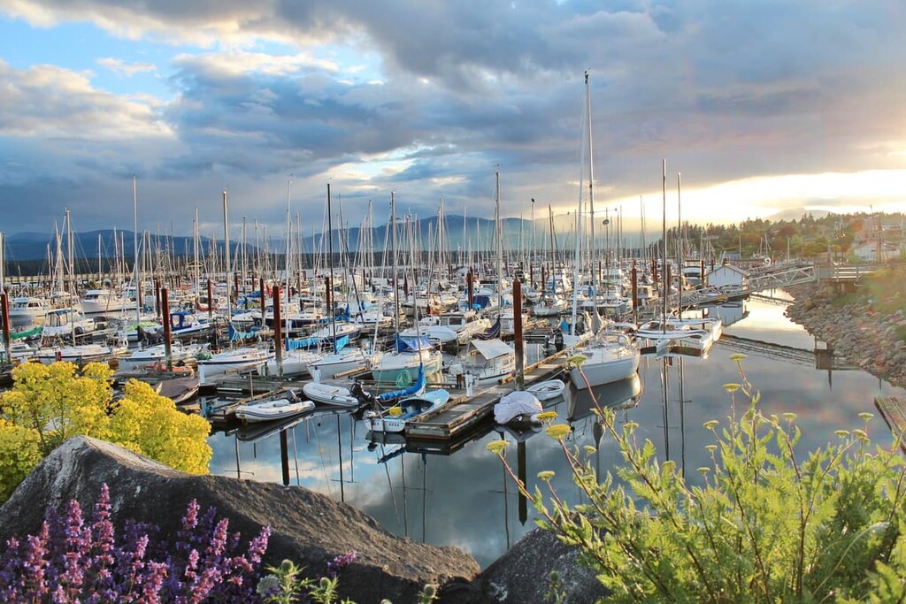
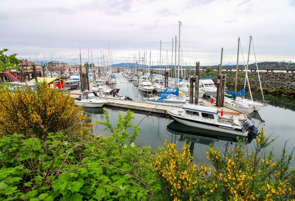
The cities of Courtenay, Comox, and Cumberland are the central municipalities of the Comox Valley and they form the primary commercial and residential area of the valley. Settlers officially arrived in Comox in 1862 and paid $1 per acre for the land that they wanted.
Courtenay and Cumberland were developed through industries such as fishing, mining, and forestry; however, Comox grew slowly and was a vacation town that offered golf, dining, fishing, hunting, tennis, and more to the affluent visitors. With the beautiful beaches along the coast as well as clear lakes, rivers full of salmon, and an incredible wilderness just outside of town, tourism has grown significantly.
Some of the attractions and trails worth checking out are the Seal Bay Nature Park, the Rosewell Creek Trail, Trent Falls, and Helliwell Provincial Park Loop. The cities also have annual festivals in the summer months that celebrate their nautical history with music, arts, and an amateur boat building competition.
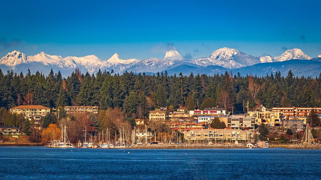
Located some 55 km (33 mi) north of Comox, the city of Campbell River is connected to the rest of the valley via Highway 19, which is the major highway on this part of Vancouver Island. Campbell River has many great places to stay, fantastic places to eat, and some incredible beaches for relaxation.
There are also some amazing hiking trails near Campbell River. Some of the places worth visiting are Elk Falls Provincial Park, where a wide trail leads though incredible forests filled with massive red cedars, Douglas fir, and bigleaf maple. There are several vantage points to see the stunning Elk Falls, including a suspension bridge that spans the canyon.
Other trails worth hiking are the Campbell River Lookout Trail, Mount Menzies, and the Quinsam River Hatchery Trail. The weather is beautiful, the food is great, the wilderness is beautiful and majestic, all of which make Campbell River a worthwhile destination while exploring Vancouver Island.
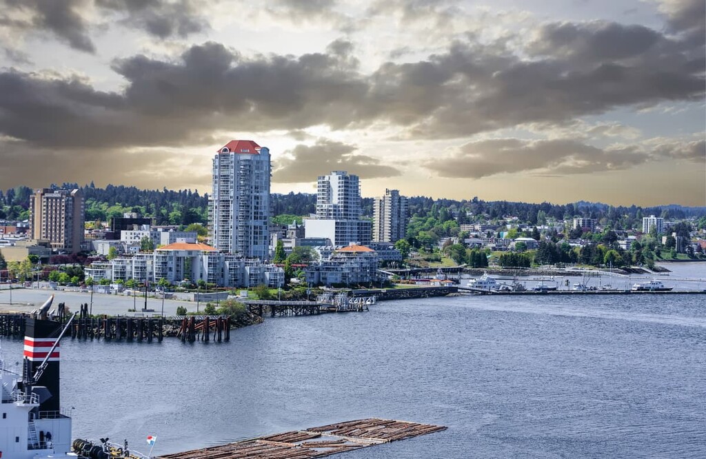
The city of Nanaimo is located 114 km (68 mi) to the south of Comox, and it is one of the primary ports for ferries bringing passengers from mainland British Columbia. Nanaimo and Comox both have airports with regional flights from Victoria, Vancouver, and Calgary. Nanaimo, British Columbia is the home of the Nanaimo bar, a delicious treat that features yellow custard sandwiched between chocolate ganache and a coconut-graham crust.
After touring Nanaimo on the Nanaimo Bar Trail, you might check out the Gordie’s Trail up Mount Benson, the Mount Benson Loop, Westwood Lake Trail, and the Cable Bay Nature Trail. All of these hikes are fantastic trails that will immerse you in the majestic wilderness while you burn off the calories from the Nanaimo bars you enjoyed earlier in the day.

Explore Comox Valley Regional District with the PeakVisor 3D Map and identify its summits.


