Share

Scan the QR code and open PeakVisor on your phone
Scan the QR code and open PeakVisor on your phone
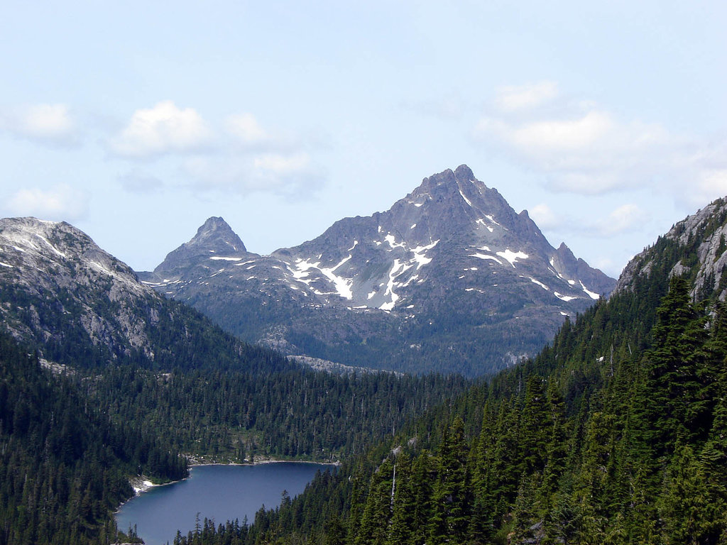
The Prince of Wales Range is a collection of peaks located on the eastern coast of Vancouver Island in British Columbia, Canada. This small range of mountains has 10 named peaks, the tallest of which is Hkusam Mountain (1,645 m/5,397 ft). Hkusam Mountain is also an ultra-prominent mountain as it has 1,512 m (4,961 ft) of prominence.
Located on the eastern side of Vancouver Island in British Columbia, Canada, the Prince of Wales Range is a subrange of the Vancouver Island Ranges. Hkusam Mountain is the tallest of the ten mountains in the Prince of Wales Range. As an ultra-prominent mountain, Hkusam Mountain has over 1,500 m of prominence even though it is only 1,645 m (5,397 ft) tall.
The range is accessible via Highway 19, the Island Highway that runs along the east coast of Vancouver Island. There are many forestry roads that penetrate the range, and there are campgrounds and recreation sites located along the shores of the lakes on the south end of the range.
The Sitka Spruce Recreation Site is situated on the western shore of McCreight Lake and is one of the many recreation sites and parks in the region. Some of the other parks located around the Prince of Wales Range that are worth checking out include:
The Prince of Wales Range geology is consistent with the general geology of the Vancouver Island Ranges. The range is primarily composed of sedimentary and volcanic layers of rock that formed part of the ancient Wrangellia terrane hundreds of millions of years ago.
Composed of layers of volcanic and marine sedimentary rock that accumulated in the Pacific Ocean, Wrangellia started forming over 300 million years ago. Wrangellia collided with the coastal margin of North America about 150 million years ago. This collision was part of the mountain-building event that formed the Columbia, Coast, and Rocky Mountains.
During this collision, the layers of Wrangellia were compressed against North America’s continental margin as Wrangellia’s tectonic plate subducted beneath North America. The compression of the terrane created immense heat that allowed the layers of rock to fold. In addition to the folds, the compression buckled and up-thrust the layers of the terrane, forming the Insular Mountains.
The Insular Mountains contain the Vancouver Island Ranges, Haida Gwaii, part of the Alaska panhandle, and the islands of the Inside Passage. During the Pleistocene, an ice sheet and various smaller glaciers covered the continental mountains and spread over the sea to Vancouver Island. The ice sheet and glaciers eroded the softer rocks of the mountains on the island, expanding valleys and creating the topography of the range as we see it today.
Furthermore, evidence of the glaciers is seen in the glacial deposits that are scattered across Vancouver Island and much of the rest of Canada in the form of moraines, eskers, and kames. A lot of glacial debris was deposited into the sea and seafloor between Vancouver Island and the west coast of British Columbia. By some measurements, this section of the seafloor is estimated to have a layer of glacial till that’s over 100 m (330 ft) thick.
The ecology of the Prince of Wales Range represents the full extent of Vancouver Island’s mountain ecosystems. In fact, the range includes sections of the Coastal Mountain-Heather Alpine, the Mountain Hemlock, and the Coastal Western Hemlock ecologies.
The rocky peaks in the range are covered with communities of mountain heather. Meanwhile, old-growth forests are found along the slopes and in the valleys. Forests of mountain hemlock, Pacific silver fir, and yellow cedar occupy the upper elevations of the range. The valleys, coastline, and the areas along the creeks are filled with Douglas fir, western red cedar, big leaf maple, and alder.
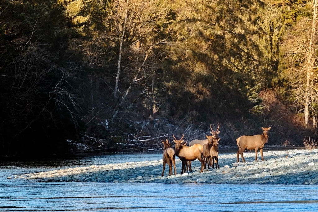
The typical island wildlife species inhabit the Prince of Wales Range, including black bears, Columbian black-tailed deer, Roosevelt elk, cougars, and wolves. Roosevelt elk are a relatively rare species on Vancouver Island as snow depth is a limiting factor for ungulate habitation.
The lower elevations of the Prince of Wales Range are inhabited by Columbian black-tailed deer as this is where they can find a suitable winter range. The deer are a major food source for the Vancouver Island wolves who bring a balance to the deer population.
Vancouver Island is part of the coastal regions that were among the first parts of North America to be released from the frozen grip of the Pleistocene ice sheet. Archeological evidence suggests that Vancouver Island has been inhabited for at least the past 13,000 years.
The Prince of Wales Range is in the traditional territory of the K’ómoks and We Wai Kai First Nations. The First Nations who inhabit the island are likely the descendants of the first people who migrated to the region at the end of the last glacial maximum.
The origin stories of the First Nations of the island typically tie their descent from the initial inhabitants to their respective territories. The K’ómoks and We Wai Kai First Nations have harvested and managed the natural resources of their respective territories for countless generations.
The region has traditionally had a diversity of resources that helped create a rich and sophisticated culture among the First Nations of the region. First Nations in the area historically traded resources with neighboring groups though they also waged war for control of both territory and resources.
The First Nations of the island had frequent and bloody battles; however, the diseases brought by European and American trading ships devastated the populations of many First Nations communities. The epidemics of smallpox and measles likely killed over 75 percent of the Indigenous people who lived on Vancouver Island before the turn of the twentieth century.
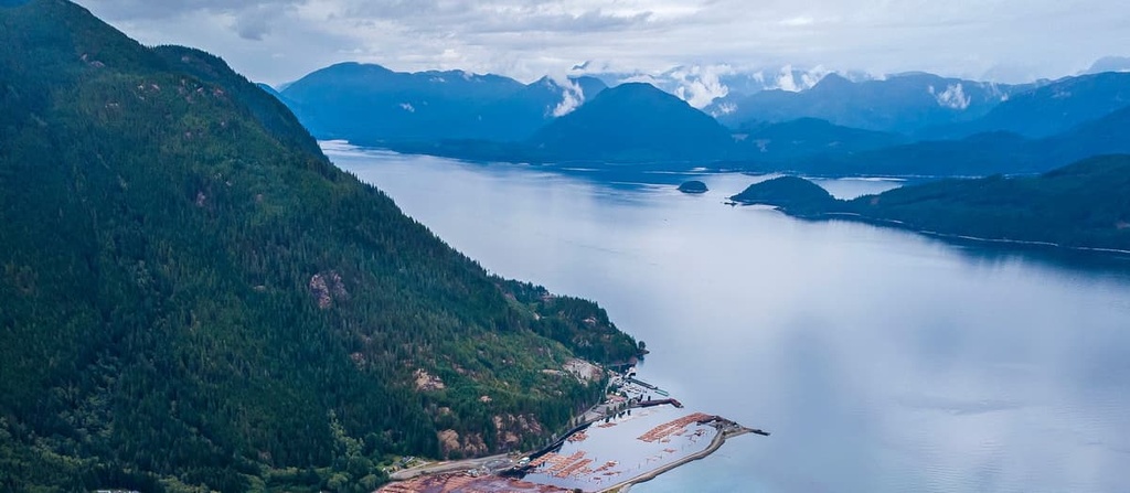
The Prince of Wales Range is located to the north of Campbell River, which is the major city on the north end of Vancouver Island. The range is currently uninhabited and heavy forestry activity has occurred across the range for many years. Much of the old-growth forests have been cut down and many of the forests in the range are now considered second and third growth.
The Prince of Wales Range is filled with trails and logging roads that supply access to most areas of the region. The following are some of the popular hikes in the Prince of Wales Range to check out during your next trip to the region.
The Kusam Klimb Trail is a 22 km (13 mi) loop around Hkusam Mountain with over 1.5 km (1 mi) of elevation gain. The loop takes you to the summits of Springer Peak and Stowe Peak as you make your way to a spur that leads to the summit of the ultra-prominent Hkusam Mountain. The long trail is considered difficult as it may take 9 or more hours to complete.
The trail is well marked, and many stretches of the trail follow logging roads and wide OHV trails. But the views of the ocean and surrounding mountains from the summit of Hkusam Mountain are worth the long, steep trek.
This mild 5 km (3 mi) round trip hike on the H’Kusam Bay Access Trail leads through the forest to the picturesque H’kusam Bay.
A large village was once located along the bay when Europeans first sailed along the coast of the island in 1792. The village was located on the border between the K’ómoks and We Wai Kai territory and is believed to have changed possession many times during the preceding centuries.
The end of the nineteenth century brought European settlers to the bay who built their own town and buildings. This includes a post office, general store, hotel, and a saloon. The community then started to serve as a stop for steamships that were making their way along the coast.
By 1911, the inhabitants and businesses of the town moved to the nearby faster-growing community of Sayward. The ruins of the village remain standing to this day for those who are willing to make the trek.
If you make your way to the ghost town there is also a popular geocaching course that takes you through the ruins. Furthermore, a series of trails run from the community to the summit of Hkusam Mountain.
The 5 km (3 mi) out and back scramble along Mount Kitchener is considered moderately challenging. For some, navigating the logging roads to the trailhead is the most difficult part of the excursion.
However, the summit offers fantastic views of the surrounding mountains and ocean so it’s a great reward for anyone willing to make the climb to the top of Mount Kitchener. The views and experience alone are worth the effort involved in this minor scramble.
The north end of Vancouver Island is the least densely populated and most rugged area of the island. The following are some of the communities located near the Prince of Wales Range where you can stop to rest or get more supplies for your adventures.
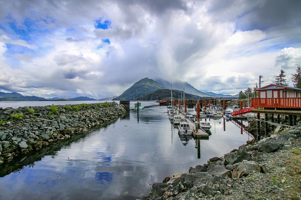
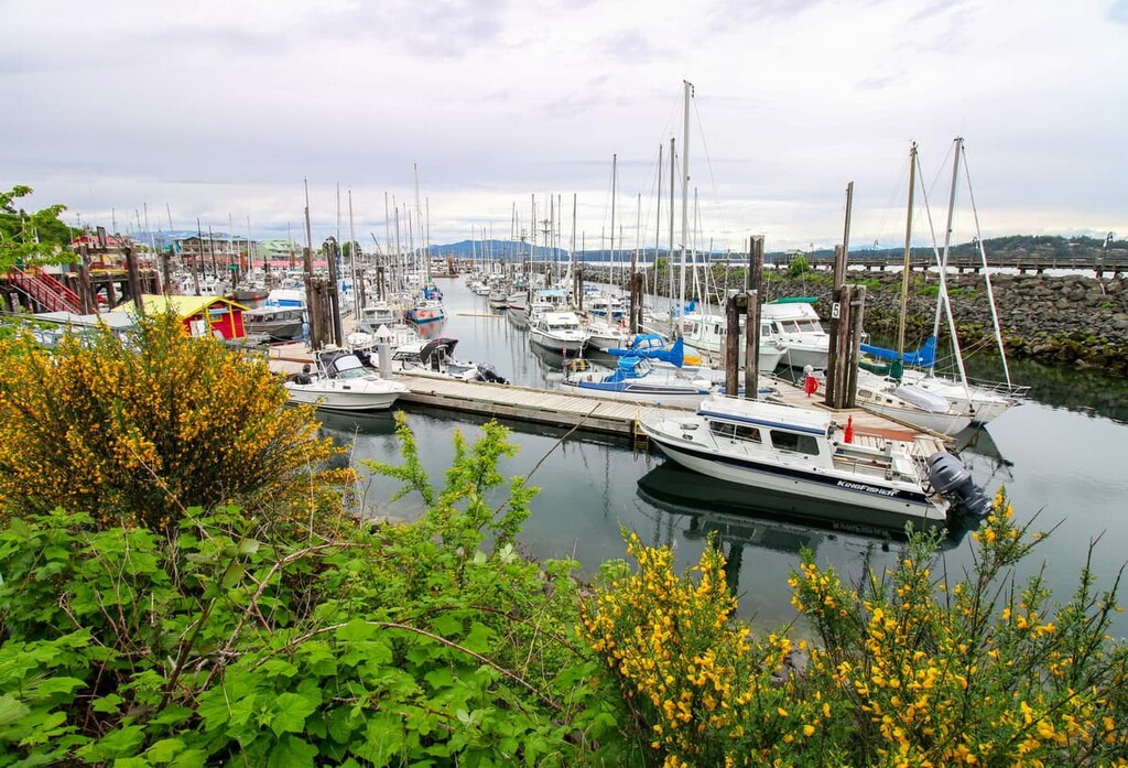
The village of Sayward is situated at the mouth of the Salmon River on the north end of the Prince of Wales Range. The small village has basic lodging amenities and other services so it can make a great basecamp for exploring mountains along the east coast of Vancouver Island.
Schoen Lake Provincial Park, Lower Tsitika River Provincial Park, and Woss Lake Provincial Park are some of the many hiking and wilderness areas located near Sayward. Just south of Sayward, visitors can also explore the ghost town of H’Kusam or find one of the trails to the top of Hkusam Mountain.
Campbell River is the largest city on the north end of Vancouver Island. It is located about 40 km (24 mi) to the south of the Prince of Wales Range. The town of Campbell River is called the Salmon Capital of the World, and it serves as the gateway to the northern part of the island.
Furthermore, Campbell River has ferry service to Quadra and Cortes Islands of the Discovery Islands. The Discovery Islands are an incredible series of islands that are both beautiful and well worth visiting.
The city of Campbell River has all the services and lodging that most adventurers could desire, and it has many local attractions that are worth visiting, too. For example, the local museum showcases the history of the community and region. If you’re interested in a more nature-based activity, you can also stroll along the stunning beaches that are located along the edge of the city.
While there are many nature pathways to follow around and through the city of Campbell River, there are also many parks and wilderness areas nearby that are worth visiting. The beautiful falls and suspension bridge of Elk Falls Provincial Park are only a short drive away, as are the trails in Strathcona Provincial Park and Seal Bay Regional Nature Park.
Port McNeill is the regional capital of the Regional District of Mount Waddington. The city is located about 140 km (84 mi) to the north of the Prince of Wales Range, and the primary industries in Port McNeil are logging and tourism.
The community is the gateway to the scenic islands of Broughton Archipelago as it offers regular ferry service to both Alert Bay on Cormorant Island and Sointula on Malcolm Island. The town is also home to the Port McNeill Airport, which is the regional airport for the north end of Vancouver Island.
The seaways and wilderness areas of northern Vancouver Island are beautiful and full of opportunities for adventure. Some of the most amazing places to visit around Port McNeil include Nimpkish Lake Provincial Park, Marble River Provincial Park, and the beautiful Cape Scott Provincial Park.


Explore Prince of Wales Range (Canada) with the PeakVisor 3D Map and identify its summits.