Scan the QR code and open PeakVisor on your phone
Rock Lake–Solomon Creek Wildland Provincial Park is an outdoor recreation area located in central Alberta, Canada that is a major staging area for excursions into Willmore Wilderness Park. The wildland park has an extensive network of trails that take you along creeks, into valleys, and over mountains. The park has 2 named mountains, the highest and most prominent of which is Mount Kephala (2,429 m/7,969 ft).
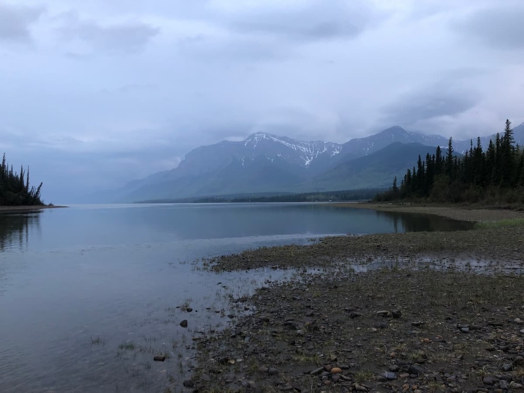
The western border of Alberta, Canada is dominated by the rugged peaks of the Rocky Mountains. Located along the eastern slopes of the Rockies central Alberta, Rock Lake–Solomon Creek Wildland Provincial Park acts as an ecological transition zone and a staging area for adventures into Willmore Wilderness Park.
Rock Lake–Solomon Creek Wildland Provincial Park encompasses 347 sq. km (134 sq. mi) of streams, forested valleys, grassy slopes, rugged mountains, and two named peaks. Mount Kephala is the tallest of the two mountains in the park, standing at 2,429 m (7,969 ft) in elevation.
The park is accessible via road; however, the final portion of the road is gravel and unmaintained. The access to the park is located about 70 km (42 mi) to the north of Hinton, where the 32 km (19 mi) gravel road leaves Highway 40 and leads to the south end of the park along Solomon Creek.
The northern part of the park is situated in the Hoff Range and the southern part of the park is located in the Broule Range, both of which are subranges of the Canadian Rockies. Adjacent subranges include the Bosche Range, Berland Range, and the Persimmon Range, which are all part of the Northern Front Ranges.
Rock Lake–Solomon Creek Wildland Provincial Park is one of several parks located along the eastern slopes of the northern Rockies. Other nearby parks in the northern front ranges include Willmore Wilderness Park, Kakwa Wildland Provincial Park, and William A. Switzer Provincial Park.
Furthermore, most of the Canadian Rockies are situated within protected parks and recreation areas. Other parks located near Rock Lake–Solomon Creek Wildland Provincial Park include:
The Canadian Rockies started forming about 75 million years ago, when oceanic tectonic plates collided with the western edge of North America. As the oceanic plates collided with the continental margin, the oceanic plates subducted beneath North America, compressing the western edge of the continent.
This formation event, which helped build the Rockies, is called the Laramide orogeny. It lasted until about 45 million years ago. During this time, mountains began forming in the southwest, along the Alberta–British Columbia border, and they gradually extended to the north and east.
The collision compressed, deformed, folded, and broke the underlying layer of Paleozoic limestone and dolomite. The breaking of these layers of marine sediment created fault lines. As the continental crust was pushed eastward, the Paleozoic layers were squeezed and thrust upward and eastward onto the younger layers of Cretaceous sandstones and shales.
The compression and uplift of the Paleozoic and Cretaceous layers of rocks are what created the Rockies. The eastern ranges of the Rockies are often referred to as the Front Ranges and were among the final ranges to form during the Laramide orogeny.
As the mountains were lifted, they were immediately worked at by the forces of erosion. The displaced sea was a major force that eroded much of the softer layers of sandstone and shale that were once found between layers of durable limestone.
Wind and rain also continued to erode the new mountains; however, it was the Pleistocene glaciers and ice sheet that were primarily responsible for the current topography of the Rocky Mountains.
As the Earth started cooling, the seasonal snowfall didn’t melt each year, and it accumulated year after year. Eventually, as the snowpack accumulated, it compressed the previous snow layers into ice until the immense weight of the accumulated snow and ice forced the glaciers to flow down the mountains.
The alpine glaciers carved cirques into mountain sides, creating many horned peaks across the Rockies as well as many of the alpine valleys. These alpine glaciers coalesced into an ice sheet that overrode and covered most of the Canadian Cordillera, which includes the Vancouver Island Ranges in the west, the Coast Mountains, the Interior Plateaus, the Columbia Mountains, and the Rockies in the east.
The glaciers and ice sheet carved their way through the mountains, expanding valleys, and carving away mountain summits. The ice removed and transported massive amounts of debris across the area, which we now find as glacial veneer, moraines, kames, eskers, and drumlins.
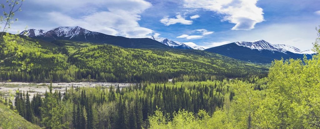
Located in the Front Ranges of the Rocky Mountains and adjacent to Jasper National Park, Rock Lake–Solomon Creek Wildland Provincial Park is home to a diverse range of habitats and ecosystems.
The elevation of the northern end of the park, along Solomon Creek, is around 1,000 m (3,300 ft) and it steadily rises towards the nearly 2,400 m (7,826 ft) summit of Mount Broule, which is located in the southern part of the park.
This nearly 1,300 m (4,500 ft) difference in elevation is one of the reasons why the park contains representations of all the Rocky Mountains Natural areas as well as the Upper Foothills Natural Region.
The Rocky Mountain Natural Region has the three subregions, which are the alpine, subalpine, and montane. This region has the highest annual precipitation rates in Alberta as well as long cold winters and short cool summers.
Due to the varied topography in the area, there are many different habitats in the region. Indeed, the lower elevations of the montane subregion contain the largest variety of wildlife and vegetation in the area Meanwhile, the Rock Lake area is a major wildlife corridor where the Wildhay River and Rock Creek cut across the Front Ranges of the Rockies to create a low valley.
The low valley allows animals to easily move in and out of Jasper National Park and the Willmore Wilderness. Furthermore, the open and grassy slopes that are cleared of snow by the western winds are a critical winter range for elk, deer, and bighorn sheep.
The alpine is rocky with minimal vegetation, which usually consists of lichen, sedge, and heath. Any trees that start growing in the alpine are stunted and twisted because of the fierce winds that blow across the mountain tops. Some birds, such as the white-tailed ptarmigan will nest among the alpine rocks while mountain goats and bighorn sheep also use the alpine to avoid predators.
The hoary marmot, Columbian ground squirrel, and the pika make nests among the alpine rocks in the park. They inhabit the border between the alpine and subalpine to feed off the vegetation of the subalpine slopes. Grizzly bears, black bears, cougars, moose, and wolves also inhabit the park.
There are many birds that inhabit or migrate through the Rocky Mountain Natural Region, including MacGillivray’s warblers, white-crowned sparrows, lazuli buntings, gray-crowned rosy finches, American pipits, and the warbling vireos.
Conifers, such as Engelmann spruce, subalpine fir, white spruce, larch, and lodgepole pine, all fill the subalpine forests. Particularly moist areas in the park also commonly grow dwarf birch and willow shrublands.
The eastern edges of the park are home to some of the most diverse Upper Foothills ecosystem complexes in Alberta. The foothills have a range of habitats, which include dense forests of lodgepole pine and white spruce, mixed and aspen forests, communities of tall shrubs, grassy slopes, and wet meadows.
By about 12,500 years ago, the Cordilleran ice sheet, which once covered the mountains in the park, and the Laurentide ice sheet, which covered Canada to the east of the Rocky Mountains, began to divide.
This division created an ice-free corridor that connected what is now Alaska with Yukon and the southern half of North America at a time when North America was also connected to Asia by Beringia.
It is speculated that the ice-free corridor had opened on several occasions during the Pleistocene, when populations of wildlife and people possibly migrated southward. Eventually, however, the corridor closed during periods of increased glaciation.
The “corridor” has long been considered one of possible entry points for the early humans that inhabited North America. Evidence of human habitation along the corridor dates back as early as about 11,000 years ago. Many archeological sites have been discovered along the eastern slopes, including campsites, stone quarries, workshops, and cultural sites.
While experts are still unsure if the ice-free corridor was used for southward migration, groups of ancient people certainly migrated north through the corridor as it opened for the final time, about 11,000 years ago. Rock Lake–Solomon Creek Wildland Provincial Park is actually located along the corridor that allowed ancient people to spread out across the region.
Several First Nations, including the Tsuut’ina and Stoney, as well as the Métis Nation of Alberta consider the area of Rock Lake–Solomon Creek Wildland Provincial Park to be part of their traditional territory.
In the last century, forestry has occurred within the park as has some mining. However, aside from tourism, the park is primarily just recovering from decades of industry and commercialization.
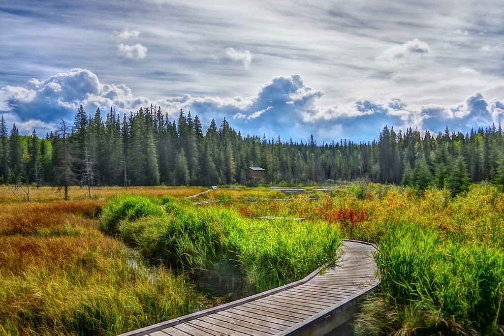
There is an extensive network of trails that can be found throughout Rock Lake–Solomon Creek Wildland Provincial Park. Some of the trails are constructed recreation trails while others are abandoned resource roads. Others still are old pack trails, fur trade routes, and historic trails that have been used by Indigenous people for countless generations.
Do note, however, that most of the stream crossings on trails in the park have no bridges, so you must be comfortable with technical river crossings before venturing into the park. However, if you have the requisite skills, it is worth the time and effort to explore the backcountry wilderness area around Rock Lake and Solomon Creek.
The following are some of the main hiking routes and destinations that you can find in Rock Lake–Solomon Creek Wildland Provincial Park:
Solomon Creek Wildland Provincial Park is located on the eastern slopes of the Rocky Mountains in central Alberta. The following are some of the nearby cities and towns that can offer lodging and other services to set you up for a visit to Solomon Creek Wildland Provincial Park:
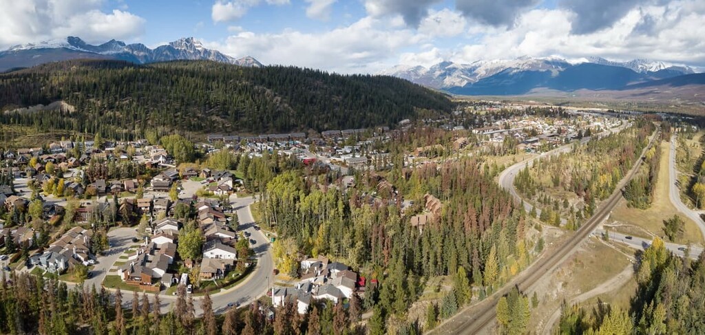
The town of Hinton was founded in 1911 when the Grand Trunk Railway built a station house at the current Hinton townsite. Hinton is located about 160 km (100 mi) to the southeast of Kakwa Wildland Provincial Park.
It is home to the Wild Mountain Music Fest and is a popular staging area for expeditions into the Willmore Wilderness Park, which is located to the north of the town. Hinton is also the gateway to the incredible wilderness of central Alberta and the Rocky Mountains, including Rock Lake Provincial Park, Jasper National Park, and Mount Robson Provincial Park.
Situated to the north of Rock Lake–Solomon Creek Wildland Provincial Park along Highway 40, Grande Cache was first incorporated in 1966 to help establish the coal mining industry in the region. The boom and bust of coal prices over the decades led to a steady population decline and the town was reclassified as a hamlet in 2018.
However, despite the lagging economy and industry, some residents took initiative to reinvigorate the town by creating the Canadian Death Race. The race hosts participants from across the world who want to test themselves against the harsh northern wilderness and mountains.
In 2000, Paul Bailey and Dale Tuck created the Canadian Death Race which is a 125 km (75 mi) ultra-marathon event that summits three mountains, includes one major river crossing, and has over 5,000 m (17,000 ft) of elevation change. The participants have 24 hours to finish the race, and the fastest competitors generally finish in less than 14 hours.
Aside from the Canadian Death Race, other great areas for trail running and hiking in the region include the nearby Willmore Wilderness Park, Kakwa Wildland Provincial Park, and Rock Lake–Solomon Creek Wildland. Mount Robson Provincial Park and Jasper National Park are both located only a couple hundred kilometers away from the town, too.
Established in 1813 as a trading post named Jasper House, the town of Jasper was incorporated in 1907 as the commercial center for the newly created Jasper National Park. The town of Jasper is located about 60 km (36 mi) to the south of Rock Lake–Solomon Creek Wildland Provincial Park in the heart of Jasper National Park.
The scenery of the park is spectacular as it features lush forests at the base of rugged limestone peaks. Glaciers creep through the alpine of Jasper and the wildlife is abundant. Visitors to the park regularly sight grizzly bears, moose, elk, black bears, and countless species of birds.
Since it is considered to have some of the most stunning landscapes and beautiful scenery in Canada, Jasper National Park is a great place for a hike. Some of the most popular trails in Jasper include the hike to Sunwapta Peak, the Sulphur Skyline Trail, and the Maligne Canyon Hike. Other attractions include the Miette Hot Springs and the boat ride across Maligne Lake.