
Scan the QR code and open PeakVisor on your phone
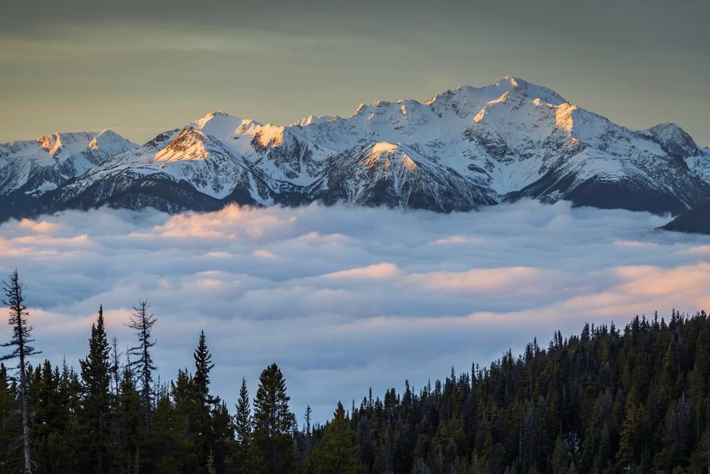
The White Goat Wilderness Area is 445 square kilometers (172 square miles) of the most protected wilderness in Alberta, Canada. Located in central Alberta, bordering Banff and Jasper National Parks, the wilderness area has 13 named mountains, the tallest of which is Mount Stewart with 3,312 m (10,866 ft) of elevation.
The White Goat Wilderness Area is a swath of rugged terrain located in the east-central part of the Canadian province of Alberta near the province’s border with British Columbia.
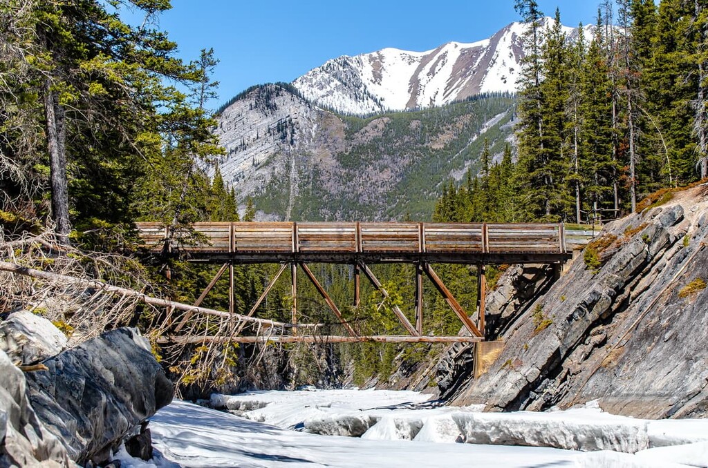
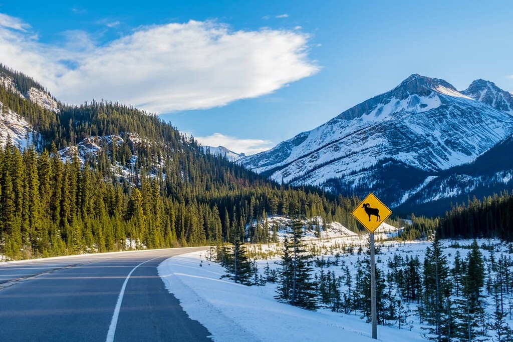
There are no roads into White Goat Wilderness Area, which is located near the junction of Alberta Highway 93 (Icefields Parkway) and Highway 11, about 150 km (90 mi) north of Banff, Alberta. Routes through the national parks and public land use zones are the only way to enter the area. Most of the trails into White Goat Wilderness area originated as pack trails and are not maintained.
Entering White Goat Wilderness Area usually requires hiking 4 to 5 hours just to reach the border. The junction of Highway 11 and the Cline River is the trailhead to access the area from the east. Norman Creek off Highway 93 is the access to White Goat Wilderness Areas from the southwest. Access from the north is from the Nigel Creek trailhead near Sunwapta Pass on Highway 93.
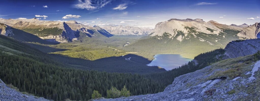
The wilderness area is framed by the Brazeau River on the north, the Cline River is located along the south, and a row of peaks which separate the McDonald Creek watershed and the Coral Creek watershed are the eastern border.
Job/Cline Public Land Use Zone is located to the east and south of the White Goat Wilderness Area. Banff National Park is located to the west, while Jasper National Park is located to the north.
The White Goat Wilderness Area is home to the peaks of the Rocky Mountains, which started rising out of the sea about 100 million years ago as North America collided with tectonic plates under the Pacific Ocean. The oceanic plates were sliding under the west coast at a steep angle, compressing and deforming the slabs of limestone and shale. The limestone slabs started cracking, creating faults, which were thrust up and stacked onto the layers of rock to the east.
The faulting and stacking continued for about 40 million years, compressing several hundred kilometers of the continent into the 180 km (108 mi) wide Canadian Rockies. As the mountains were rising, erosive forces were immediately acting on them. The sea the mountains were rising from moved massive amounts of rocks and sediment as it was displaced, and glaciers scoured the mountains for over two million years.
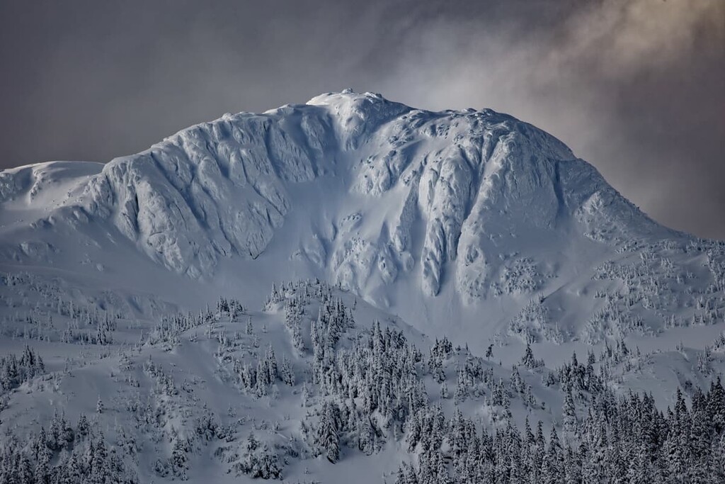
During the Pleistocene, glaciers and ice sheets formed across the high and mid-latitudes, lowering the sea level by as much as 120 m (394 ft). The glaciers that covered Canada were up to 3 kilometers (1.9 mi) thick in some places and as they grew and moved through the mountains, they formed the landscape that we see today.
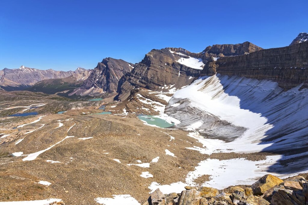
The glaciers scoured the softer rock in the region, leaving behind large valleys. Meanwhile, the erosion-resistant limestone was left as the mountain peaks. While the limestone was more resistant to glacial erosion, it wasn’t immune, and the glaciers removed whole mountain sides to create cirques. The debris and till from the glacial erosion were deposited across the landscape as moraines, eskers, and kames. Depressions were created and tarns formed among the peaks as well as kettle lakes.
Major peaks in the White Goat Wilderness Area include Mount Stewart, Cirrus Mountain, Cornice Peak, Mount Willis, Mount McDonald, and Lonely Peak.
The ecology and habitats of White Goat Wilderness area are mostly alpine. However, some subalpine ecosystems occur along the creek valleys at the lowest elevations of the wilderness area. The landscape is extensively bare rock and shale because above 2,100 m (6,888 ft) the conditions are too severe for trees to survive.
The hardy plants that inhabit the alpine meadows are glacier lilies, buttercups, anemones, paint brush, cinquefoil, sedge, and heath. While the alpine appears desolate and barren, there are some incredible animals which have adapted to prosper among the mountain peaks.
Bighorn sheep and mountain goats have incredible agility, which allows them to avoid and escape predators by inhabiting treacherous cliffs and rocky outcroppings. The golden-mantled ground squirrels, pika, and hoary marmot make their nests under the rocks which makes it difficult for bears to reach their nests to prey upon them. Finally, the white-tailed ptarmigan uses camouflage to hide its nests and itself among the rocks.
The slopes and valleys of the White Goat Wilderness include forests of Engelmann spruce, whitebark pine, and lodgepole pine. Juniper, bearberry, cinquefoil, buffaloberry, showy aster, as well as mountain avens make up the understory and open meadows of the subalpine zone.
The lower elevations contain the popular Rocky Mountain animals, such as grizzly and black bears, moose, elk, cougars, gray wolves, and wolverines. The area is an extensive wintering area for bighorn sheep and mountain goats as well, the White Goat Wilderness Area also contains part of the range of the Brazeau caribou herd.
It is suspected that as the ice melted from the region that is now the White Goat Wilderness about 10,000 years ago, humans began to establish themselves in the area. The area is the traditional territory of the Ktunanxa, Stoney, Tsuu T’ina, and the Peigan and Blood of the Blackfoot Confederacy.
Archaeological surveys suggest that the first post-glacial inhabitants were the Upper Kootenay of the Ktunaxa Nation. The Ktunaxa historically inhabited from the Columbia River to the eastern slopes of the Rocky Mountains.
The history of the Ktunaxa is fascinating and their longevity in the region shows resiliency and how well the community has adapted to different challenges and environmental conditions. The ancestors of the contemporary Ktunaxa likely arrived in what is now the White Goat Wilderness Area via Howse Pass to hunt bison overwintering in the large valleys of what is now the Siffleur Wilderness.
The Blackfeet moved west from their ancestral grounds in the upper Great Lakes region from the advancing European settlements and colonization. The nations of the Blackfoot Confederacy were long regarded as fierce warriors and once they were introduced to horses they quickly expanded their territory. The Blackfoot Confederacy displaced many other groups, including the Ktunaxa, who were forced west over the Continental Divide.
During the seventeenth century, the Stoney-Assiniboine separated from the Dakota/Lakota Nation and moved west along with the Cree, following the fur trade. By the end of the eighteenth century, the Stoney were well established on the eastern slopes and ranges of the Rocky Mountains as well as the prairies.
In 1961, the White Goat Wilderness Area was designated as a protected place. Over the next two decades, policies were introduced to strengthen the protection of a wilderness area. Wilderness areas, under the Provincial Parks Act, are the most protected of all the areas in the province of Alberta. There is zero tolerance for any form of resource consumption or development and hiking is the only permitted transportation option within the area.
White Goat Wilderness Area is further protected by its inaccessibility, in such that access to the area is a 4 to 5-hour hike from the nearest roads. In the 1990s, it was proposed that White Goat Wilderness area become a wilderness park; however, the full conservation status of White Goat Wilderness Area was preserved.
White Goat Wilderness Area, as well as the other two places under the Wilderness Areas Act, which are the Siffleur Wilderness Area and Ghost River Wilderness Area, are among the last true wildernesses in Alberta. The areas are preserved for visitors to experience pure and natural landscape and to support the conservation of the region’s rich biodiversity.
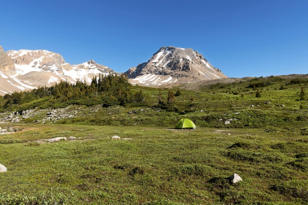
The White Goat Wilderness is rugged and remote. The landscape is wild and the scenery is majestic. While exploring this area requires using unmaintained trails, there are some incredible places to visit. Here are some of the best places to check out in the wilderness:
The trail to Mount Willis is a 43 km (26 mi) return trip from the trailhead on Highway 93 to the summit of Mount Willis and back again. There is 2,154 m (7,065 ft) of elevation gain along the trail. As such, the total distance and elevation gain as well as the unmaintained and remote nature of this trail make it a difficult hike that should only be attempted by experienced backcountry travelers.
Despite the difficulty of the hike, it provides stunning views and an opportunity to enjoy the solitude and peace of the wilderness. The trail leads through Banff and Jasper National Park before reaching the border of White Goat Wilderness area. This is a great option for a straightforward multi-day backpacking trip.
The White Goat is truly wilderness with no maintained trails. Furthermore, trails that were previously established by frequent horse use are starting to grow over. There are many routes to take to explore this vast wild country, the following is only one suggestion.
Starting from the Icefields Parkway, head east across Banff National Park to Nigel Pass. From Nigel Pass descend north to the Brazeau River and follow it east towards Afternoon Peak. There is a way up the western slopes of Afternoon Peak that will lead you a fork of McDonald Creek and into the Valley of Lakes.
From the lakes, you’ll pass the many alpine tarns which are fed by a glacier. There is a steep talus and scree field descent down a steep ridge to Cline Pass. While difficult, the views are spectacular and make the effort worth it.
The final part of this traverse leads through the upper meadows of Cataract Creek with its scattering of erratics from a glacier long melted. The route ascends to Cataract Pass and through the valley back to Nigel Pass, where the final leg of the journey takes you back through Banff National Park and to the Icefields Parkway.
This traverse was done by Don Wales of the Alberta Wilderness Association, and it is one of many routes by which to explore White Goat Wilderness Area. Sufficient preparation and experience are key to a fun and safe adventure in the backcountry.
The White Goat Wilderness Area is the epitome of wilderness in Alberta and in Canada. The only access to the area is by hiking 4 to 5 hours through Jasper National Park, Banff National Park, or Job/Cline Public Land Use Zone.
The wilderness area is remote and rugged. The following are some places to stay before or after your trip into White Goat Wilderness Area.
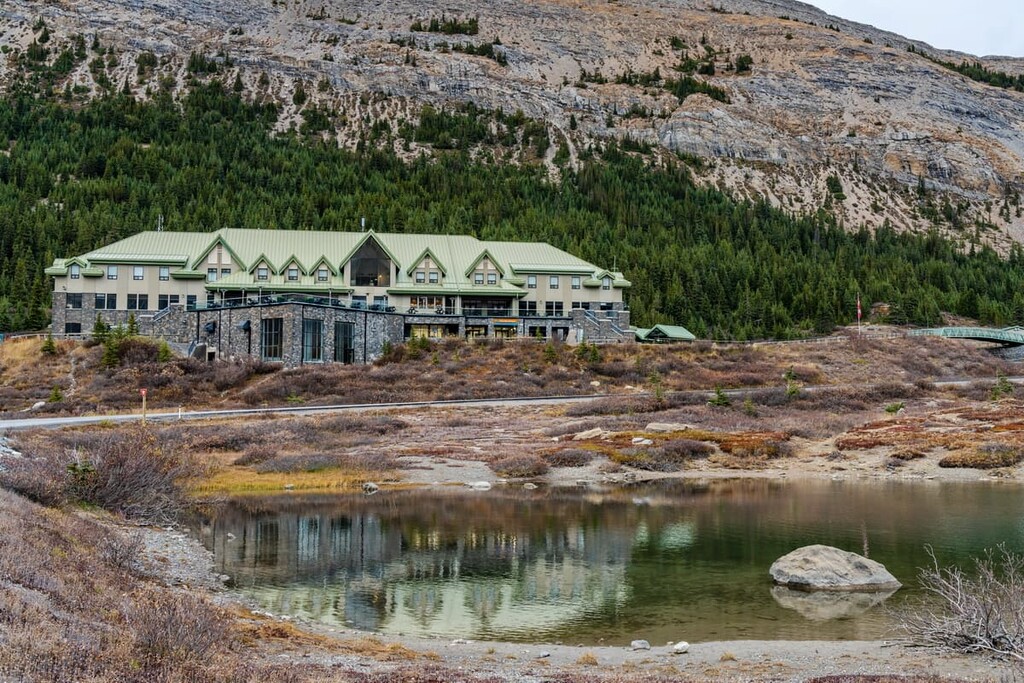
Located across the Icefields Parkway from White Goat Wilderness Area, the Glacier View Lodge is the first and only glacier view hotel in Canada. The cozy and comfortable luxury rooms offer a glacier or mountain view.
The evening may be filled with in-house entertainment or solitude gazing up at the countless stars in the dark, night sky. Fine restaurants and private access to the glacier in the morning, as well as private access to the glacier skywalk in the evening, are perks to enjoy while at the lodge.
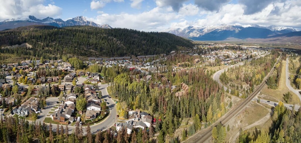
Jasper, Alberta is located about 80 km (48 mi) to the north of the White Goat Wilderness Area. Established as a Hudson’s Bay Company outpost in 1813, Jasper is the only sizable town in this area of the Rocky Mountains.
The region initially became popular because it was along the first route that Europeans had established as a viable trading route through the Rocky Mountains. Jasper National Park was established in 1907 and the townsite was moved to its current location in 1913.
There are countless hikes and attractions around Jasper and some of the popular destinations include the beautiful Maligne Lake, the Columbia Icefield, the stunning Athabasca Falls. Jasper National Park is a beautiful wilderness area similar to Banff National Park; however, it feels more wild than the more commercialized park to the south.
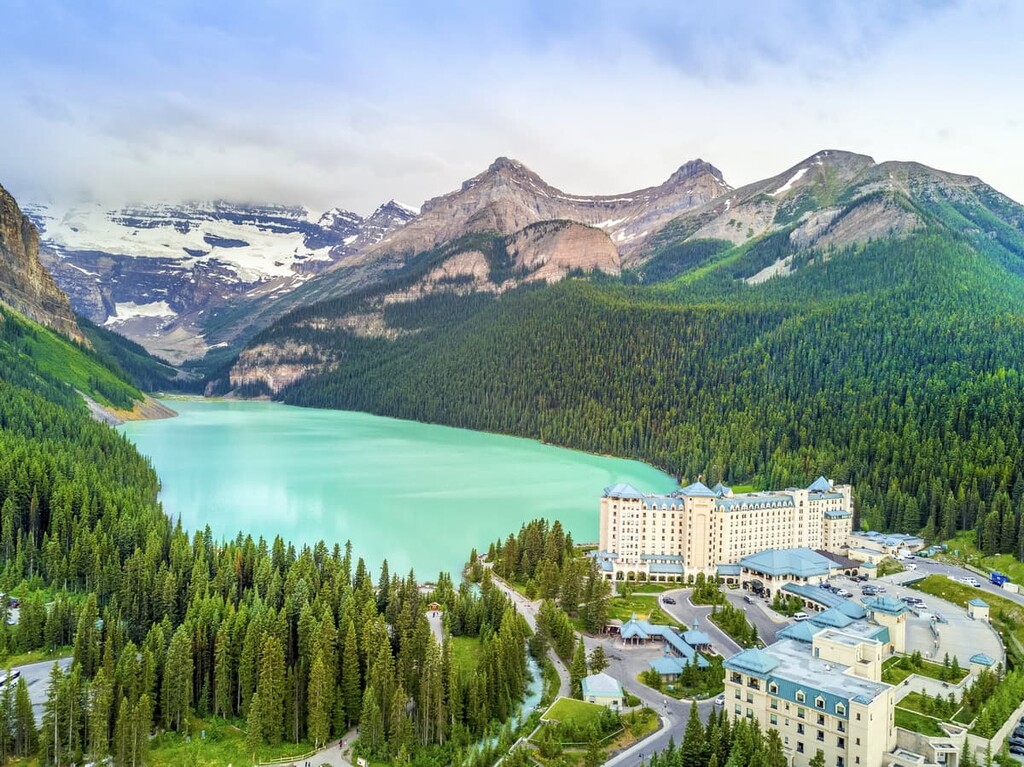
Lake Louise is situated about 80 km (48 mi) south of White Goat Wilderness Area and about 100 km (60 mi) north of the Banff townsite in Banff National Park.
The stretch of Highway 93 that runs through the region is called the Icefields Parkway and is considered one of the world’s most scenic drives. The Icefields Parkway was completed In 1940 to connect the town of Jasper and Jasper National Park to Lake Louise and Banff National Park.
On the shores of Lake Louise is the majestic Chateau Lake Louise which looks across the lake at the Victoria Glacier. There are numerous world class hikes from the Chateau, including the hike to the teahouse at the Plain of the Six Glaciers.
Winter activities are extremely popular at Lake Louise. This includes skiing at the nearby Lake Louise Ski Hill, hiking and skating on Lake Louise, and the annual Ice Festival, which features an ice castle on the lake as well as an ice carving competition that brings competitors from across the world.
Banff is about 150 km (90 mi) south of White Goat Wilderness area and is home of the famous Cave and Basin Hot Springs. There are some incredible hikes near Banff, such as Johnston Canyon, Tunnel Mountain, Sunshine Meadows, and the Ink Pots.
The town offers plenty of lodging and a unique mountain lifestyle experience within Banff National Park. Banff has amazing mountain views from the streets, like the iconic East End of Rundle (EEOR), and sites like the world class Fairmont Banff Springs Hotel. Hiking, cycling, shopping, dining, skiing, and canoeing are all activities to enjoy while in Banff.


