Scan the QR code and open PeakVisor on your phone
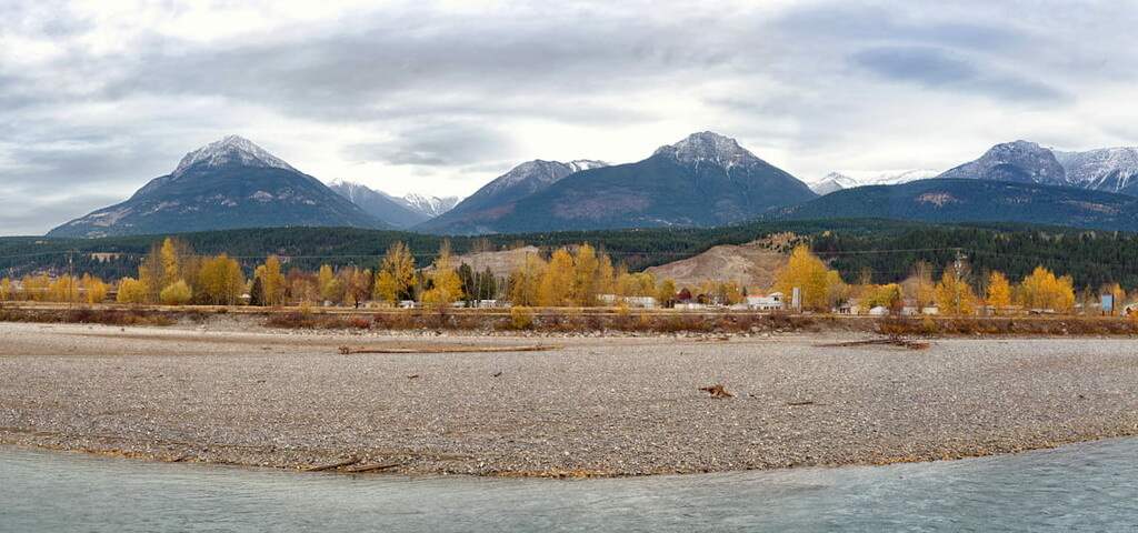
Bugaboo Provincial Park is in the northeast tip of the Purcell Mountains in southeast British Columbia, Canada. The access to this spectacularly remote park is a 50 km (31 mi) gravel road that you’ll find off of Highway 95, about 75 km (47 mi) south of Golden. Visitors risk their vehicles on the road to try their hand at climbing the 24 peaks and spires, of which the tallest and most prominent is Howser Spire (3,412 m/11,194 ft).
Bugaboo Provincial Park is located in the southeastern part of the province of British Columbia in Canada, near the province's border with Alberta. It is situated within both the Regional District of Central Kootenay and the Columbia-Shuswap Regional District in a range of mountains that’s locally referred to as “the Bugaboos.”
The park is 50 km (31 mi) to the west of Brisco, an unincorporated community along HIghway 95 in the Regional District of East Kootenay of southeast British Columbia. Brisco is 75 km (45 mi) south of Golden and 30 km (18 mi) north of Radium Hot Springs.
Bugaboo Provincial Park itself is just 136 square kilometers (52 sq. miles) of land, making it one of the smaller parks in the region. However, it is located in one of the most mountainous regions in Canada and it is surrounded by other nearby parks and conservation areas.
For example, Bugaboo Provincial Park is located to the west of Banff National Park, Kootenay National Park, Mount Assiniboine Provincial Park, Peter Lougheed Provincial Park, Elbow-Sheep Wildland Provincial Park, and Elk Lakes Provincial Park.
It is also situated to the north of Purcell Wilderness Conservancy Provincial Park, and Goat Range Provincial Park. The park is also located east of Monashee Provincial Park and to the south of Mount Revelstoke National Park, Yoho National Park, and Glacier National Park (Canada).
However, we should note that, due to the remoteness of Bugaboo Provincial Park, it takes much longer to get from place to place in this part of British Columbia. So, don’t be fooled by the distances on the map as it often takes quite a while to reach the Bugaboos from any of the surrounding national and provincial parks.
While mountaineering in the USA seems synonymous with the massive granite walls, like those of Yosemite or the Wind River Range, most popular climbs in western Canada are on limestone peaks.
The exceptions are the granite spires in Bugaboo Provincial Park, the granite walls on Baffin Island, and in Nahanni National Park Reserve in Northwest Territories. Of the three locations, even with 50 km (31 mi) of gravel road, Bugaboo Provincial Park is by far the easiest to reach.
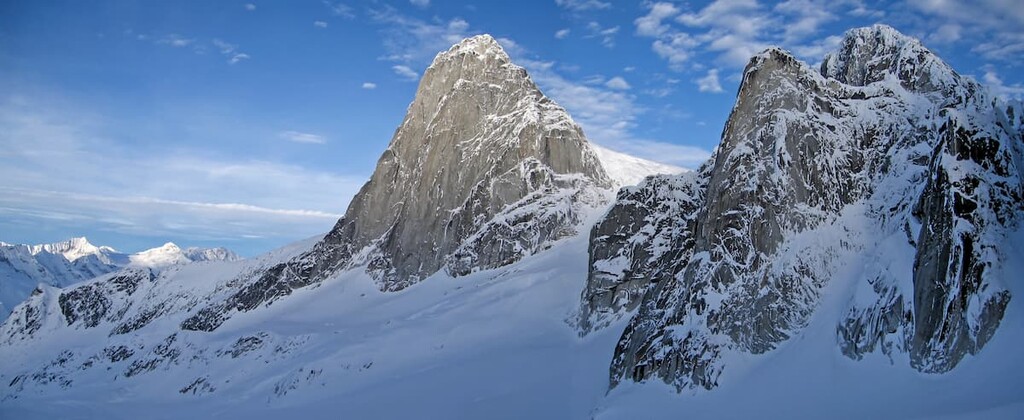
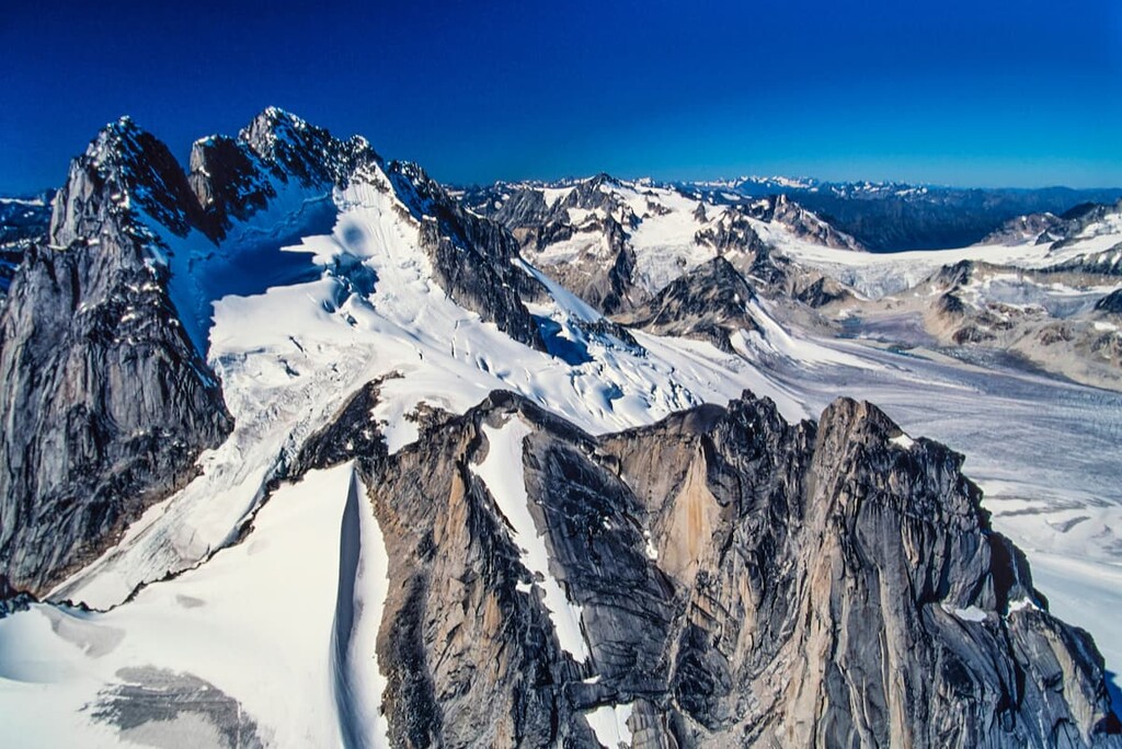
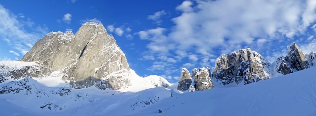
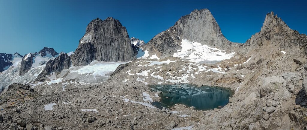
The main feature of Bugaboo Provincial Park are the granite spires that rise out of the glaciers. These formations were created from viscous magma that was being pushed upward, but never made it above the surface; the term for these formations is a batholith.
Between 160 and 50 million years ago, a tectonic plate from the Pacific Ocean was sliding under the North American plate creating the mountains as conductive forces heated the rock and compressive forces deformed the layers of rock.
The 110 million years through which the Columbia Mountains formed is called the Sevier orogeny, which also created the mountains down the western interior of North America. In the USA, volcanic eruptions occurred, as well as igneous intrusions, where the magma moves towards the surface but doesn’t erupt and since these intrusions stay covered, the magma cools slowly to create the dense granite.
While these intrusions were common throughout the USA, there are only two locations in Canada that formed batholiths during the Sevier orogeny—Nahanni National Park Reserve in Northwest Territories, and the peaks in Bugaboo Provincial Park.

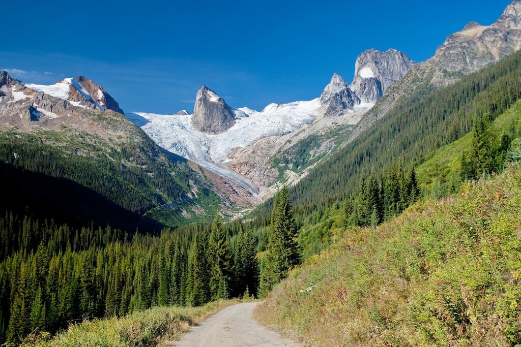
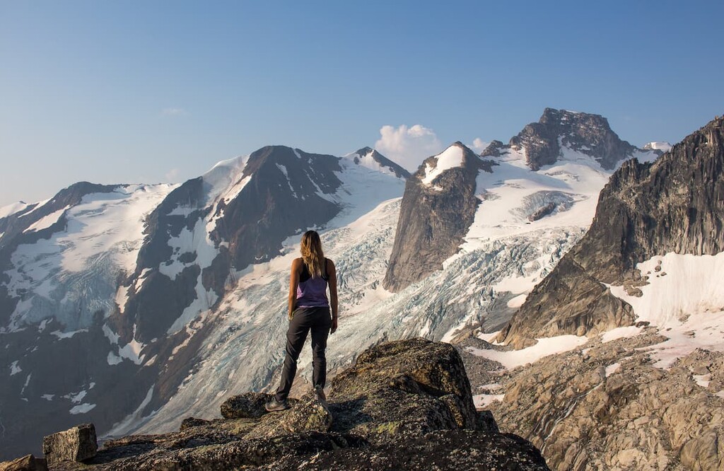
The fact that the spires in Bugaboo Provincial Park were once covered with and surrounded by other rocks are a testament to the immense erosive power of the glaciers. Bugaboo Provincial Park has four glaciers: the Malloy Glacier, Vowell Glacier, Crescent Glacier, and Bugaboo Glacier, along with other glaciers and an icefield bordering the park.
The glaciers are large and persistent in the area because the “Columbia Wet Belt” creates heavy snowfall in the park. Since the formation of the Purcell Mountains, glaciers have carved away the softer rock to leave behind the resistant granite spires.
Major peaks in the Bugaboos include Howser Spire, Bugaboo Spire, Pigeon Spire, Howser Peak, Snowpatch Spire, and Marmolata Mountain.
The most extensive ecological zone in the park is that of the alpine zone. Within this zone, the low temperatures, bare rocks, and glaciers prevent little more than alpine heath and sedge, mosses, and lichen from inhabiting the area.
The subalpine areas of the park are dominated by forests of Engelmann spruce and alpine fir. The transition area between the alpine and subalpine has open parkland meadows full of alpine grasses, heaths, and wildflowers. These meadows are a fragile ecosystem and great care must be taken to avoid damaging the area through negligence and over use.
In the lower elevations of the subalpine region, alder, willow, lodgepole pine, whitebark pine, grouseberry, raspberry, and sedge can be found. The areas around the creeks provide even more diversity with aspen, willow, and water birch clustering to damp sites. The diverse vegetation and habitats allow for many species to thrive in the area.
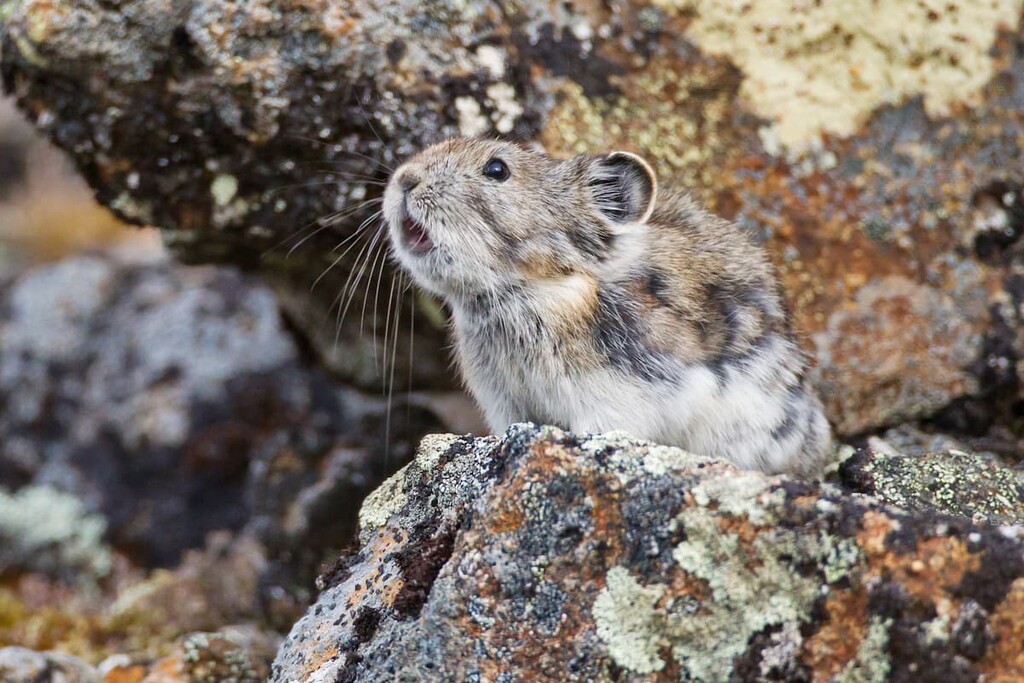
Some of the small mammals that live in Bugaboo Provincial Park are pika, porcupine, ground squirrels, woodrats, and voles. For birdwatching, you may see white-tailed ptarmigan, Clark's nutcracker, hermit and varied thrush, red crossbar, spruce and blue grouse, and the dark-eyed junco, as well as the Townsend's, Wilson's and yellow rumped warbler.
Bugaboo Provincial Park has prime habitat for mountain goats and grizzly bears which inhabit the park year-round. However, deer, elk, and moose leave the park to lower elevations during the winter because it is too cold and has too much snow for them.
The areas around Bugaboo Provincial Park have been inhabited for over 10,000 years, with the earliest archeological evidence found within the Goatfell Complex, which is south of the park.
The park is part of the traditional territory of the Ktunaxa, Shuswap, and Sinixt Nations. While there have been no archeological discoveries within the alpine regions of Bugaboo Provincial Park to suggest ancient cultures visited the area with any frequency, the unique formations and peaks may have been important parts of the culture of the region’s earliest inhabitants.
However, the First Nations who inhabited this general region were pushed off their homelands upon the arrival of settlers of European descent.It was the Palliser expedition in the late 1850s that surveyed and charted the region for the first time and referred to the spires as “nunataks.” That being said, the word “nunatak” comes from the Inuit word “nunataq,” which refers to rocky summits that stick out from ice sheets, ice fields, and glaciers.
Miners came to the region during 1895 and 1896 during a gold rush; however, there was extraordinarily little gold in the area and they mostly found pyrite and galena. It is likely the term Bugaboo came from miners as it was local miner slang for a “dead-end” or a waste of time, which describes the Bugaboo area in terms of gold deposits (though not scenic beauty).
Rumors of granite spires in the Purcell Mountains reached Thomas Longstaff, who in 1910, with A.O. Wheeler and Conrad Kain as his guide, set out to survey the spires. Kain would become a legendary mountaineer with 69 first ascents in Canada, including Bugaboo Spire, which he considered his most challenging alpine climb.
After Kain returned to the Bugaboos in 1916 and made first ascents of several of the peaks. Interestingly, the mountaineers of the time focused on peaks that were more accessible, and Bugaboos were left alone.
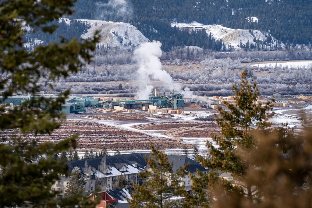
It wasn’t until the 1950s and 1960s that newly constructed logging roads made the area more accessible and reinvigorated the peaks with a new generation of climbers. With the increased recreation in the area, the British Columbia government saw that it was necessary to help preserve the natural landscapes and ecology by creating a park around the spires.
Bugaboo Glacier Provincial Park and Bugaboo Alpine Recreation Area were created in 1969 and would be combined as Bugaboo Provincial Park in 1995. The park status helps control public and commercial access to the area to preserve the fragile alpine landscape.
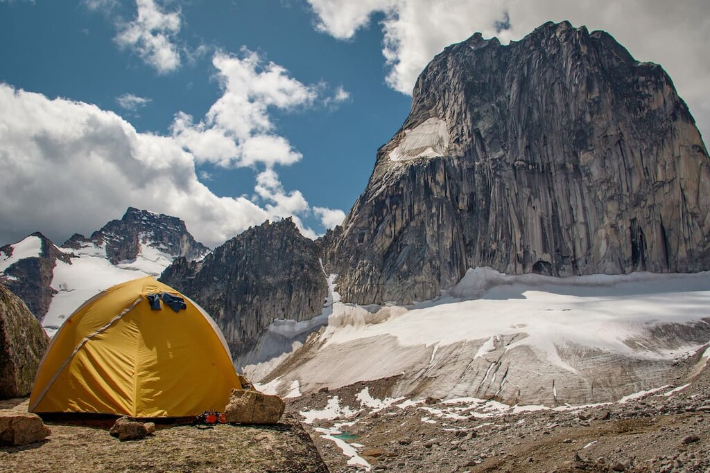
There was additional need to mitigate the damage that alpine climbing camps were creating, so the Alpine Club of Canada built the Conrad Kain Hut below the spires to house up to 40 climbers at a time. The Malloy Igloo was built by the province on the other side of the park and can hold six people.
Bugaboo Provincial Park permits personal use as well as commercial guiding and outfitting services. Companies offer heli-skiing in the winter as well as heli-hiking and guided climbing and touring in the summer. Hiking, climbing, skiing, and snowshoeing are permitted activities in the park. The park does not allow open fires, domesticated pets, or mountain biking, in an effort to preserve the fragile ecosystem.
Bugaboo Provincial Park is a hotspot for mountaineers in Canada. With its magnificent spires, glaciers, and deep valleys, the park is unfortunately not family friendly and all trails are difficult and some require glacier training and specific safety equipment. However, the following are the major attractions and climbs in the region:
The granite spires of the Bugaboos stick out through the glacier below, extending hundreds of meters into the sky, taking your breath away and inviting you to climb. These spires are the reason people came to the area in the first place, and they will continue to be the main attraction in Bugaboo Provincial Park for years to come.
The Conrad Kain Hut offers accommodations for visitors to the area through the Alpine Club of Canada. The spires are a mountaineering mecca, and as such, they can get busy during peak season during the summer. There are guides and outfitters that work out of the area that can equip and lead guests on the mountaineering routes; however, most visitors are accomplished climbers in their own right.
The difficult part of visiting and traveling through Bugaboo Provincial Park is that to reach most of the destinations, glacier travel is required, which should only be undertaken with proper training and equipment. While beautiful, the spires in Bugaboo Provincial Park should only be climbed and approached by those with appropriate training and equipment.
The trail to the Conrad Kain Hut is 5 km (3 mi), one way, with about 700 m (2,300 ft) of elevation gain. The trail begins in the parking lot and follows a moraine of the Bugaboo Glacier. The trail is very steep with exposure to steep drop-offs as it climbs through granite bluffs. This is not your average day hike, and caution should be taken along this route.
Cobalt Lake is a stunning glacial lake surrounded by granite spires and glaciers, in the middle of Bugaboo Provincial Park. The 8 km (4.5 mi) trail begins along the park access road and starts with an uphill grind along switchbacks up an old skid road.
The trail then follows through a larch forest and leads onto an open ridge with good views of Cobalt Lake and the Bugaboo Spires. From the ridge, there is no official trail to the lake and it requires some route finding; however, the trail does have some cairns to help guide you the rest of the way.
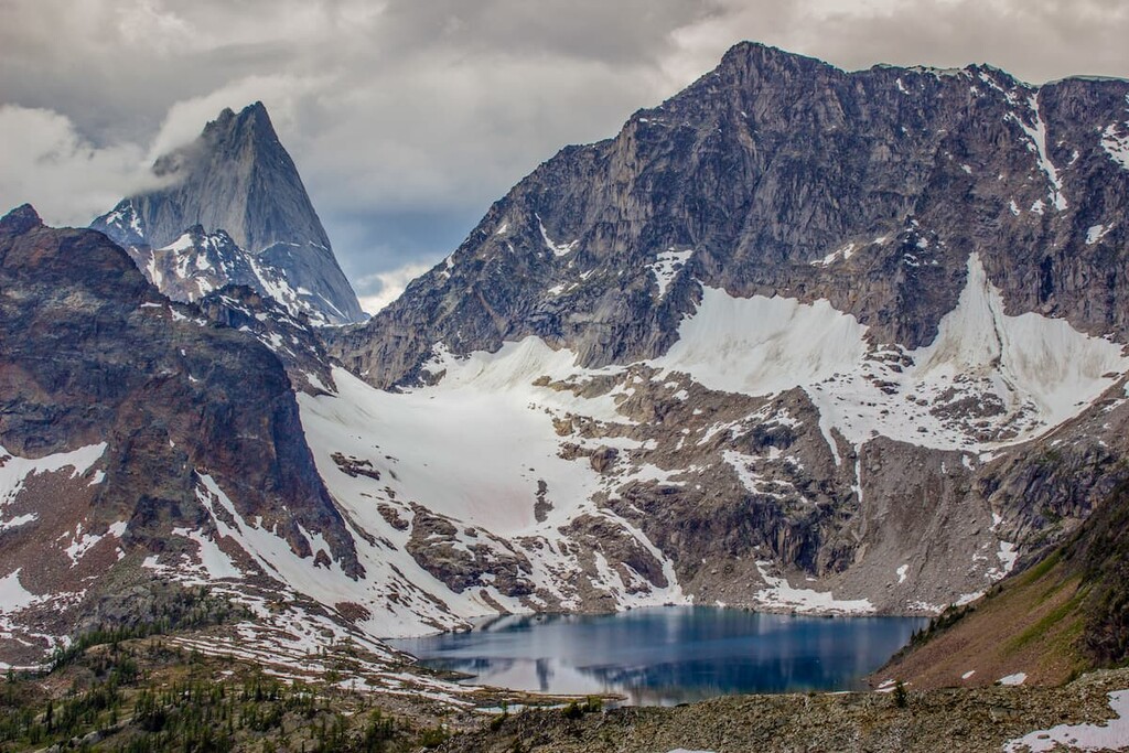
The lake is often frozen late into summer with snow patches on the shore. The lake is a brilliant cobalt blue, and the hike takes you through beautiful forests and meadows of wildflowers. This is a difficult and strenuous hike through bear country, so caution should be taken.
There are two ways to reach Malloy Igloo, which is located near Osprey Peak in Bugaboo Provincial Park. The most common way is for mountaineers to traverse the 13 km (7.8 mi) route from the Conrad Kain Hut. However, this traverse crosses several glaciers and only roped parties with adequate experience should attempt this route.
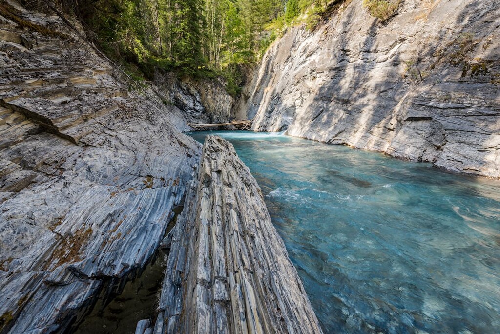
Access to Malloy Igloo is also possible via Malloy Creek. This route has two formidable stream crossings and will lead you up a steep gully to the top of the moraine. The final headwall is easier in early summer while there is still lots of snow and may require roped climbing later in the season.
In a nutshell, Bugaboo Provincial Park and its trails and activities are meant for mountaineers and climbers. Visitors should ensure they have sufficient training and experience before tackling the trails and routes in this park.
Bugaboo Provincial Park is remote and the nearest large town is over 100 km (60 mi) away. The park has two backcountry campgrounds and two wilderness huts for visitors of the park. Here are some places that provide accommodation in the region:
The Conrad Kain Hut was named after the legendary mountaineer of the early twentieth century. He guided a survey team to the area in 1910 and returned in 1916 to make first ascents on several of the nearby spires. as part of his 69 first ascents of Canadian mountains.
In 1972, the Alpine Club of Canada built a three-level quonset-style hut amid the spires to house up to 40 visitors. The hut helps protect the fragile alpine ecosystems around the spires that were being damaged by climbing camps. The hut can be booked through the Alpine Club of Canada. This is a wilderness hut and guests need to bring all their own supplies and food.
Located to the southwest of Bugaboo Provincial Park along Highway 95, Radium Hot Springs makes a great base camp for exploration into the park and other surrounding wilderness areas. With comfortable lodging and the enjoyable hot springs, Radium Hot Springs is a year round resort town.
There are trails, lakes and creeks nearby for summer hiking and relaxing and ample cross-country, backcountry, and downhill skiing offered in the winter. The town has everything you need to enjoy your mountain adventures and to start the adventure you just need to walk out the door.
Golden is at the junction of Highway 1 and Highway 95, in British Columbia. The town is built at the confluence of the Kicking Horse River with the Columbia River, and is a hotspot for outdoor recreation. Bugaboo Provincial Park is a couple hours drive from south from Golden, while Yoho National Park, Kootenay National Park, and Glacier National Park surround Golden.
Golden is known for excellent mountain biking, in addition to hiking, kayaking, and rafting the whitewater of the Kicking Horse River is quite exciting. There is a bear sanctuary where you can visit Boo the grizzly bear, as well as a wolf sanctuary that has created a home for wolves that are not able to live in the wild.
While mountain bikes flock to the slopes during summer, the slopes are open to skiers in the winter at the Kicking Horse Resort. Golden is a lovely mountain town and is at the epicenter of outdoor adventure. As a personal note, the local hospital is easy to find and the staff are very kind.