
Scan the QR code and open PeakVisor on your phone
The Baffin Island include 301 named peaks. The highest is Mount Odin at 2,147 m. Other notable peaks include Tête Blanche, Tinfoil Ridge and Qilaut Mountain.
Located in the Canadian territory of Nunavut, Baffin Island is the largest island in Canada and the fifth largest island in the world. Much like its neighbor, Greenland, Baffin Island is infamous for its arctic landscape, expansive tundra, ice caps, glaciers, polar bears, and incredible fiords. The Hudson Strait separates Baffin Island from Mainland Quebec and the Fury and Hecla Strait separates the island from the Melville Peninsula, the largest peninsula in the Canadian Arctic.
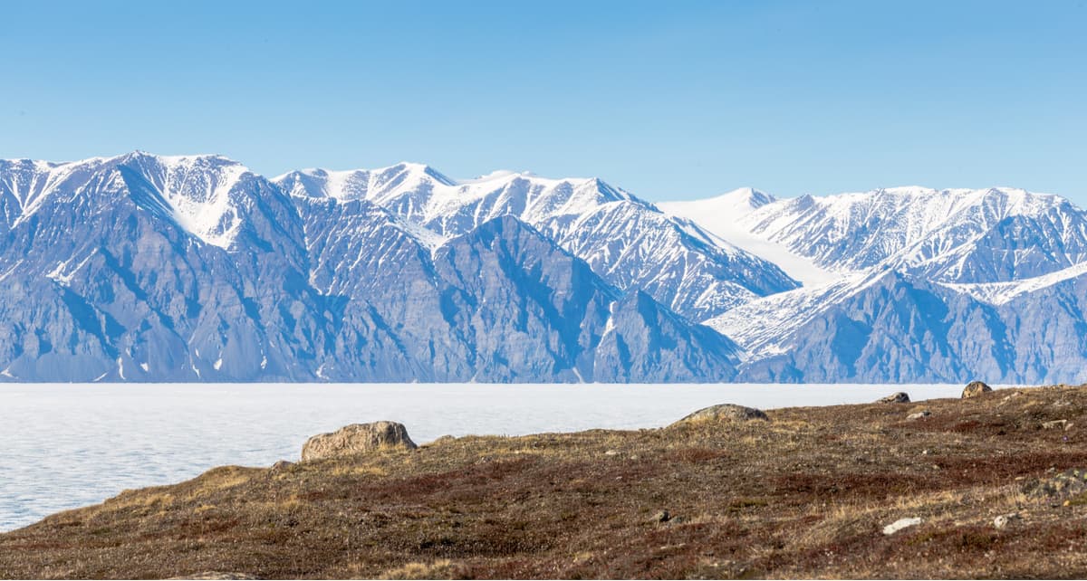
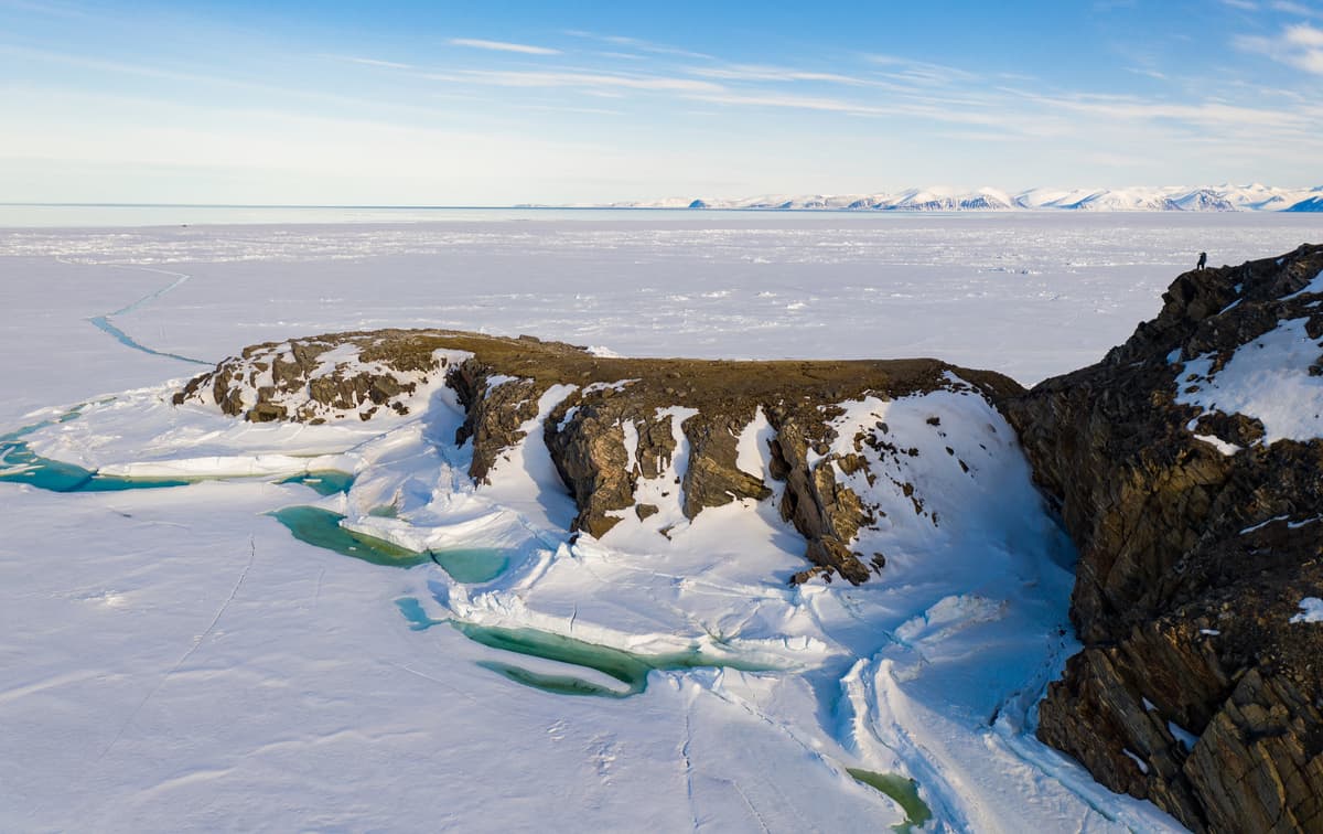
Baffin Island is part of the Canadian Shield and contains 238 ancient granitic peaks, some of which are 3.5 billion years old. The Baffin Mountains run along the northeastern coast of the island, extending to Bylot Island. These ice-capped summits reach over 7,000 feet above sea level and are some of the tallest mountains in eastern North America. Because this set of summits lie north of the Arctic tree line, the Baffin Mountains contain no trees. The western side of the island consists mostly of rolling tundra, lowland hills, lakes and rivers.
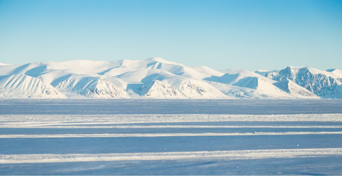
The Barnes Ice Cap, which contains Canada’s oldest ice, lies in the middle of the island. Though the 20,000-year-old ice cap has retreated significantly due to global warming, it still covers nearly 2,300 square miles of the Baffin Mountains. Both the Penny and Barnes Ice Caps are the last remnants of the colossal Laurentide Ice Sheet that covered all of Eastern Canada and portions of the Great Lakes and New England during the last ice age.
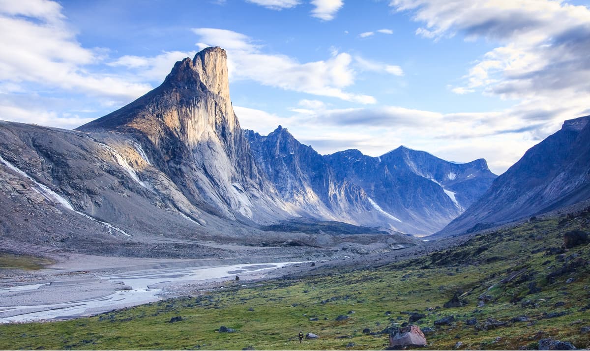
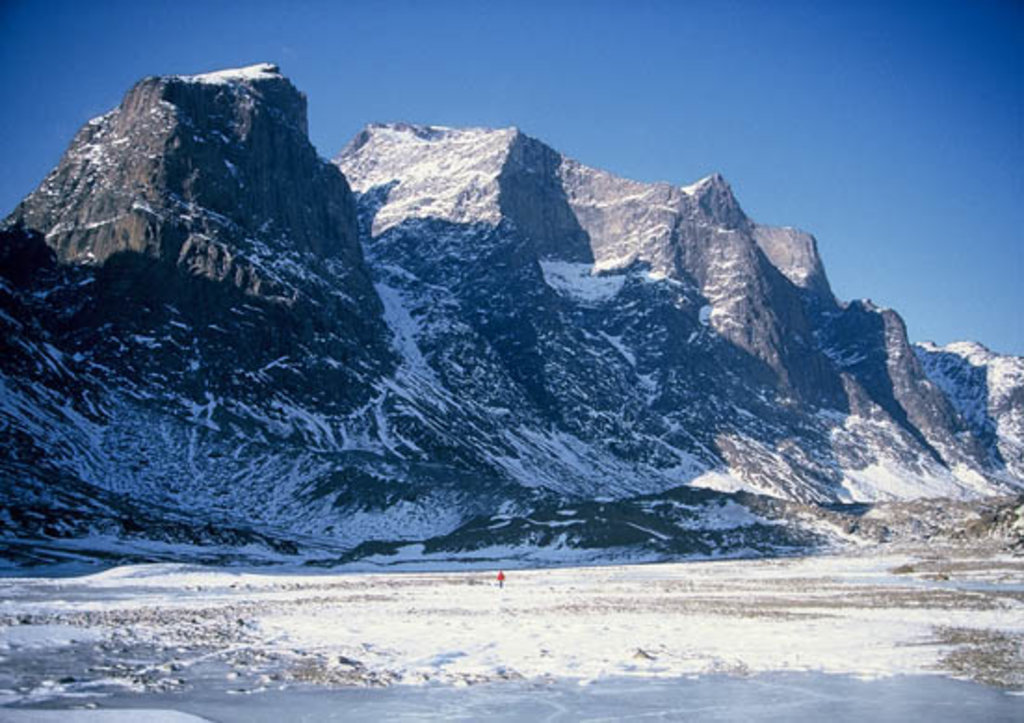
The highest peak in the Baffin Mountains is Mount Odin, a 7,044-foot summit that lies in Auyuittuq National Park along Akshayuk Pass. The most iconic summit in the range, however, is Mount Asgard, a set of flat-topped rock towers on the Cumberland Peninsula. Mount Asgard’s North Peak was first climbed in 1953 and its South Peak was ascended in 1971. Since then, at least 13 routes with varying degrees of difficulty have been placed on these towering twin peaks.
Sitting at 6,617-feet, Qiajivik Mountain is another notable peak on the island and is the highest point in the northern Baffin Mountains. Other noteworthy summits include Angilaaq Mountain, Bastille Peak, Ukpik Peak, and Mount Thule.
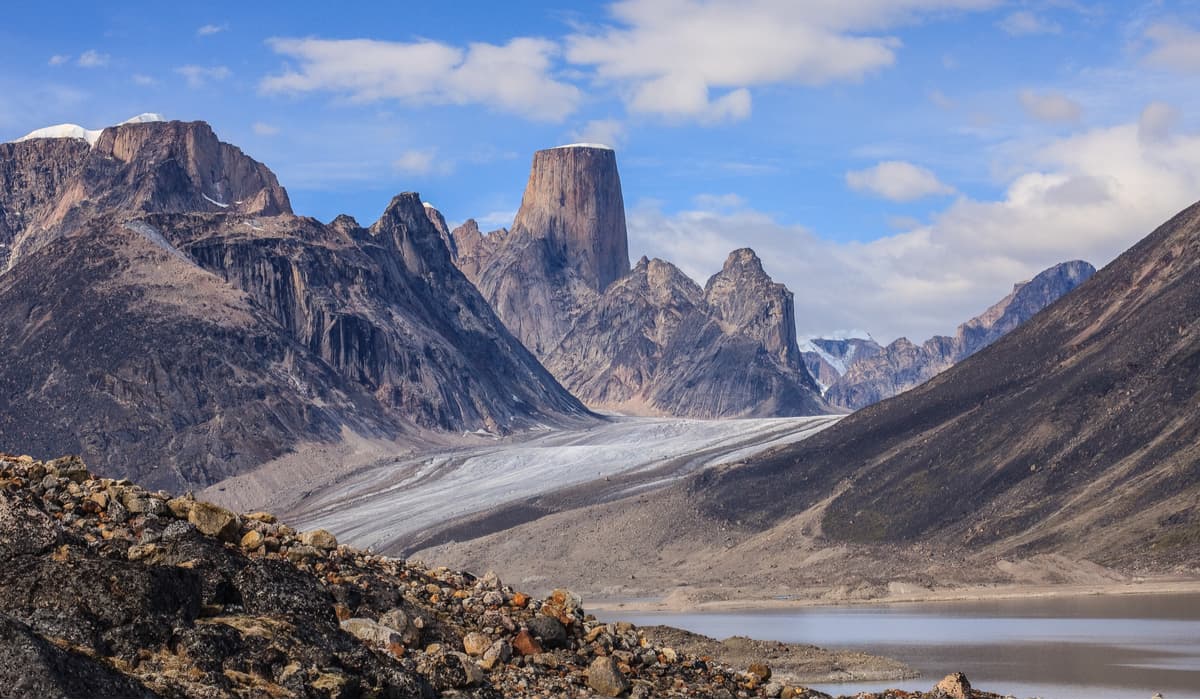
Known as “The land that never melts,” Auyuittuq National Park covers 8,290 sq. miles of Baffin Island’s Cumberland Peninsula. The park, which was established in 1972, is covered in craggy granite peaks, glistening glaciers, and expansive tundra valleys. Auyuittuq is known as a refuge for adventurous mountaineers and backcountry skiers, offering a once-in-a-lifetime, large-scale Arctic experience unlike any other park in the world.
Hiking and exploring Baffin Island should only be attempted by experienced hikers and climbers. Both the weather and terrain can be unforgiving on the island, so it’s important to exercise caution and be well-prepared before attempting one of Baffin Island’s incredible footpaths.
The Cumberland Peninsula is arguably the best-known stretch of wilderness on Baffin Island, particularly for outdoor recreation. The Cumberland Peninsula houses some of the island’s most impressive peaks, valleys, and mountain passes, including the island’s highest point, Mount Odin. The Cumberland Peninsula also contains Auyuittuq National Park and two of the most iconic landmarks in this region Mount Asgard and Mount Thor. The most popular route in the park is Akshayuk Pass, a stunning 62-mile trek through Arctic scenery and towering Baffin Mountain summits.
Bylot Island, which sits at the northern tip of Baffin Island, houses the Byam Martin Mountains, a subrange of the Baffin Mountains and several impressive peaks, including Angilaaq Mountain, Malik Mountain, Mount St. Hans, and Mount Thule. Like Baffin Island’s Auyuittuq National Park, Bylot Island’s Sirmilik National Park is a 5-million-acre remote wilderness defined by massive ice caps, glaciers, snow-capped summits, and impressive fiords.
The park, which was established in 1999, contains three separate land and marine components – Oliver Sound, a long and narrow fjord flanked by cliffs and glaciers, the Borden Peninsula and Baillarge Bay, characterized by expansive river valleys and plateaus, and Bylot Island, a region known for its coastal lowlands, incredible icefields, and rugged, mountainous terrain. The park’s population of Arctic seabirds make it an excellent destination for avid birdwatchers, but visitors can also opt to traverse icefields, hike to hoodoos, scale mountains, or partake in a multi-day paddle along one of the park’s iconic waterways.
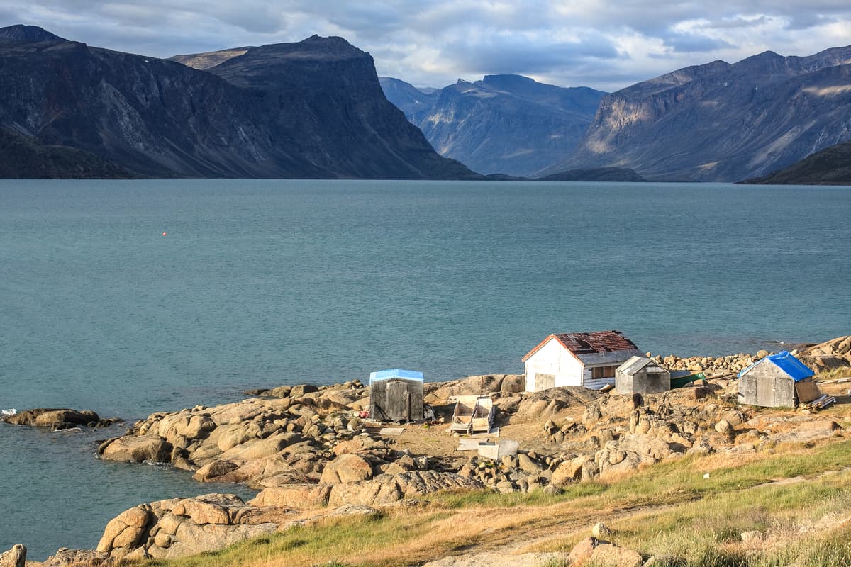
Iqaluit, which sits at the northern end of Frobisher Bay near the mouth of the Sylvia Grinnell River, is not only the capital of Nunavut, but it’s the largest community. With a population just over 7,000 people, Iqaluit is a small but dynamic city centered around traditional Inuit culture. Iqaluit is also largely considered the entry point to Baffin Island and most visitors will check in to Iqaluit prior to exploring the surrounding parklands. Dog sledding, cross-country skiing, snowmobiling, canoeing, tobogganing, fishing, and hiking are popular activities in Iqaluit. Free camping can be found along the Sylvia Grinnell River, as well as a handful of hotels and restaurants.
Pangnirtung, known as ‘Pang,’ is the gateway to the southern entrance of Auyuittuq National Park and where most visitors will go to pick up permits, pay fees, and talk with park wardens prior to entering the park. Pang is an Inuit hamlet with less than 2,000 residents, many of which are skilled Inuit artists. The town’s proximity to Auyuittuq National Park, Pisuktinu Tunngavik Territorial Park, and Kekerten Territorial Park make it particularly popular amongst hikers, climbers, and skiers. Pang visitors can stay at a campground in Pisuktinu Tunngavik Territorial Park or at one of the few hotels in town.


The highest peak in the Baffin Island is Mount Odin, at 2,147 m.
The Baffin Island have 301 named peaks.


