
Scan the QR code and open PeakVisor on your phone
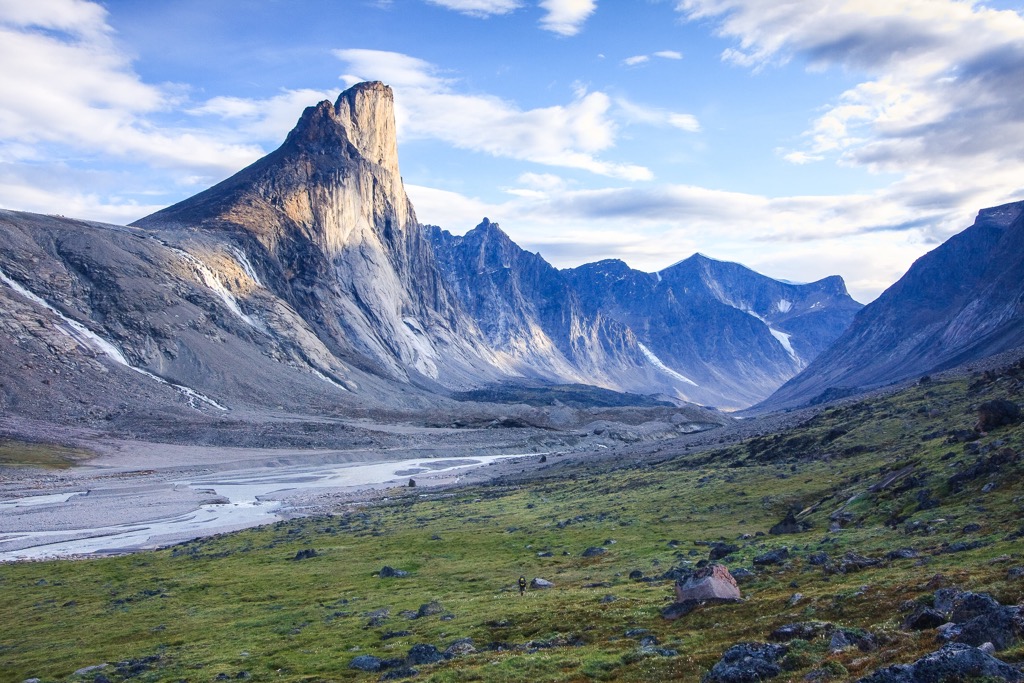
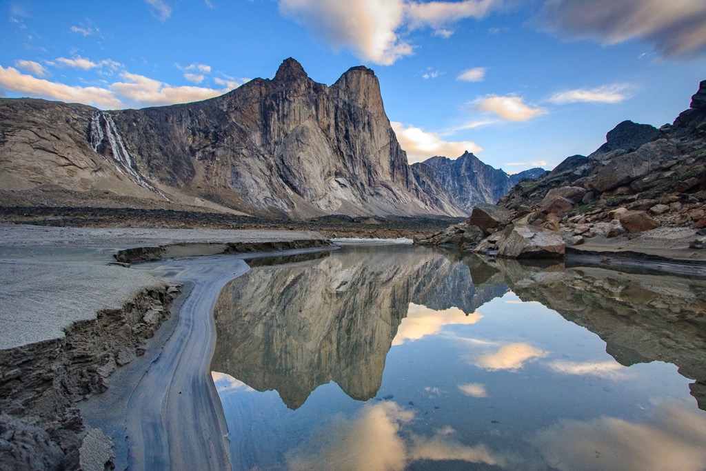
Located on Baffin Island in Canada’s northern territory of Nunavut, Auyuittuq National Park is one of Nunavut’s most accessible and popular national parks. Over 32 rocky peaks grace the skyline of Auyuittuq National Park, with Mount Odin (2,147 m /7,044 ft) being the tallest and the most prominent. Many of the other peaks are named after Norse Gods and legends, such as Mount Asgard, Mount Thor, and Mount Loki.
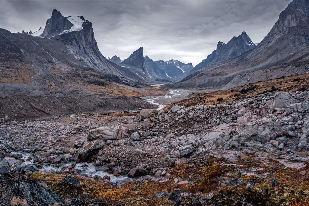
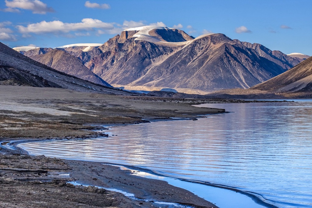
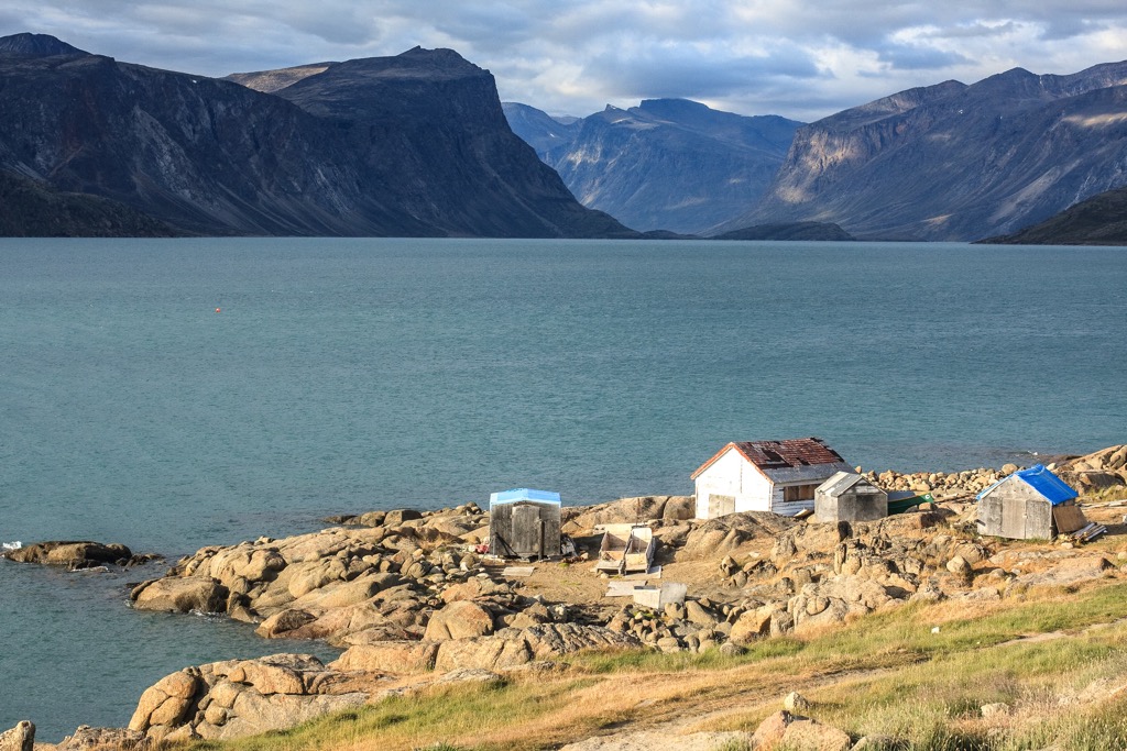
Auyuittuq National Park is located on southeastern Baffin Island, above the Arctic Circle, in the territory of Nunavut, Canada. Dominated by the Penny Ice Cap, the park is filled with craggy limestone peaks, imposing granite cliffs, and massive glaciers that create the dramatic meltwater creeks and thundering rivers.
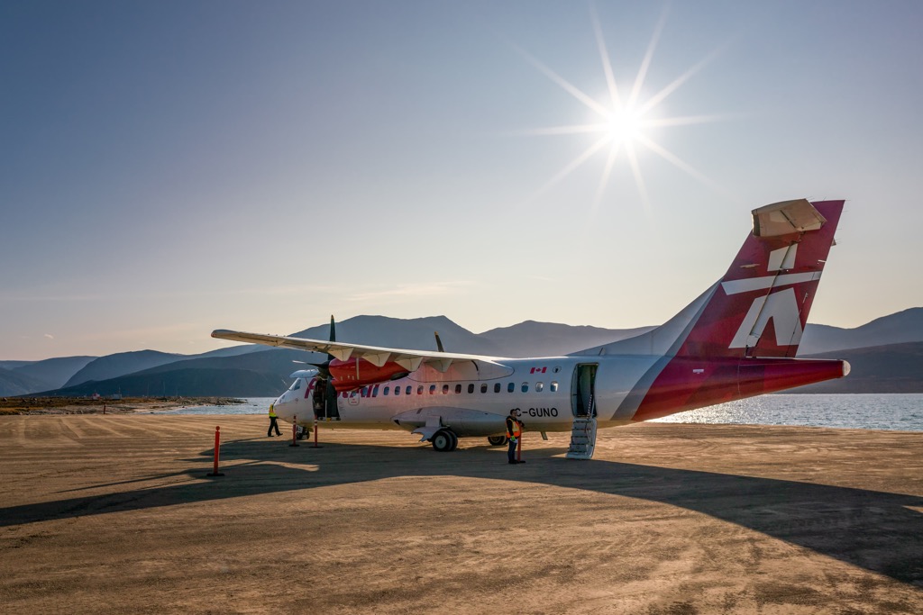
Most travel to the park arrives by plane from Iqaluit to the nearby communities of Pangnirtung and Qikiqtarjuaq which are located on either side of the park. Pangnirtung and Qikiqtarjuaq are often used as pick-up and drop-off sites for visitors.
Depending upon the season, visitors can arrange transport to the park or travel overland from the communities to the park border; however, it adds considerable distance through potentially dangerous polar bear territory. Outfitters and tour guides work from each of these communities and can facilitate transport to and from the park as well as arrange guided tours.
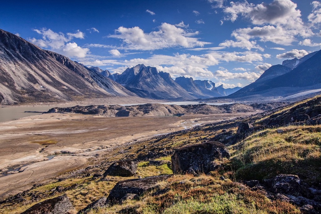
The most common path through the park is following the nearly 100 km (60 mi) Akshayuk Pass along the southern end of the park. The pass follows a narrow valley through the otherwise imposing northern landscape. Most of the park’s 32 named peaks overlook the Akshayuk Pass and many of them are named after Norse legends, such as Mount Loki, Mount Thor, Mount Asgard, and many others.
Of the 32 named peaks, Mount Odin (2,147 m /7,044 ft) is the tallest and most prominent peak in the park. Mountaineers come from across the world to try their craft upon the dominating peaks of Auyuittuq National Park.
While Auyuittuq National Park is the most accessible national park in Nunavut, there are several other parks in the territory and region that are worth mentioning. The following are other parks that are in Nunavut or near Auyuittuq National Park:
Auyuittuq National Park is on the southeastern side of Baffin Island, which is geologically the eastern edge of the Canadian Shield. At the location of Baffin Island, the Canadian Shield has tilted upwards from lowlands and plateaus in the west, to culminate in the eastern, mountainous spine of the island.
The Canadian Shield refers to the exposed continental crust that otherwise underlies most of North America. The crust that underlies North America is also known as the North American Craton and it extends from Greenland to northern Mexico. The rocks of the craton are at least 1 billion years old and are typically buried deep below the continent, except for the Canadian Shield.
The Canadian Shield reaches from the northwest corner of Alberta, through northern Saskatchewan, parts of Northwest Territories, Nunavut, and nearly all of Manitoba, Quebec, Ontario, and Labrador. The North American Craton and Canadian Shield started forming over 3 billion years ago through plate tectonics.
Ancient crustal plates formed during the Archean as massive blocks, or geological provinces. These blocks collided and the ensuing volcanic activity would weld many of the blocks together. The collisions would result in deformations of the crust and geologists refer to the deformation process as an orogeny.
Along the borders of the various blocks that make up the Canadian Shield, mountains were created and eroded over the past billion years. About a billion years ago the Grenville Orogeny, which is thought to be one of the most significant orogenies to affect North America, created a mountain range across the continent that extended through Quebec and Ontario, and stretched down the east coast as far as Texas.
Over the past 800 million years tens of kilometers of rock have been eroded from the ancient Grenville Mountains. During the most recent 2.5 million years the Pleistocene ice sheets covered most of North America, including Baffin Island. The glacial ice was incredibly erosive and created the current topography of the park, including the u-shaped valleys, steep fjords, and craggy peaks.
It is likely that some of the ice that overran Canada originated on Baffin Island and that the most recent glacial maximum included glaciers that formed on Baffin Island about 18,000 years ago. The ice only melted from the island about 1,500 years ago, and the Penny Ice Cap, in the middle of Auyuittuq National Park, is likely a remnant of the greater ice sheets that once covered eastern Canada. Indeed, the translation of the Inuktitut word, Auyuittuq, means, “the land that never melts.”
Underlying the Canadian Shield are seven distinct geological provinces that have separate and unique characteristics. The Grenville Mountains were the result of the accretion, or attachment, of the Grenville Province to the southeastern edge of the Canadian Shield.
The other six geological provinces of the Shield are the Bear, Slave, Churchill, Superior, Southern, and Nain provinces. All seven geological provinces of the shield have unique geological composition and most of them have unique mineral deposits. For example, Baffin Island and Auyuittuq National Park are within the Churchill Province which typically contain deposits of uranium, lead, and zinc.
Other geological provinces contain deposits of copper, gold, iron, silver, nickel, and diamonds. The volcanic activity that originally fused the various provinces together are responsible for the mineralization that occurred along the borders of the geological provinces.
It should also be said that the Canadian Shield contains some of the oldest known rocks on Earth. About 1000 km (600 mi) southwest of Auyuittuq National Park, researchers discovered rock that is an estimated 4.28 billion years old. What this means is that the rock, discovered upon the shores of Hudson Bay, was created only about 300 million years after the formation of the Earth.
Most of Auyuittuq National Park is located above the Arctic Circle and is part of the Northern Arctic Ecozone. The latitude of the park allows for nearly endless daylight during the summer and nearly endless darkness during the winter. While the park may seem desolate, there is a surprising abundance of hardy flora and fauna to be found.
Some of the wildflowers of the park that carpet the meadows in spring and summer are mountain avens, campion, Papaver, and saxifrage. Dwarf birch, Arctic willow, and heather are the shrubs that are common across the lower elevations of the park. Most of the plants grow in communities that create a beneficial microclimate to survive in the harsh arctic environment.
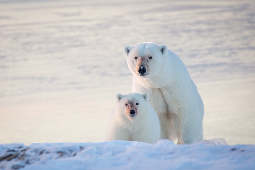
The coastal regions of the park are likely the most densely inhabited, with populations of narwhals and beluga whales swimming along the coast. Polar bears typically found along the coastal areas and extreme caution should be taken while traveling in their territory.
Other mammals that live in the park are red foxes, snowy owls, ermines, wolves, Arctic fox, Arctic hares, American brown lemming, northern collared lemming, and barren-ground caribou. The birds that may be spotted across the park are peregrine falcons, rough-legged hawks, gyrfalcons, snow geese, and Canada geese.
Originally established as Baffin Island National Park in 1972, the name was changed to Auyuittuq National Park in 1976 to better reflect the history and people of the region. The Inuit have long been the inhabitants of Baffin Island and the surrounding arctic areas.
The recent history of the park and surrounding communities includes the local Inuit settling in the community of Pangnirtung in the 1950s and 1960s and the community of Broughton Island (now Qikiqtarjuaq) was established in 1955 as a DEW (Distant Early Warning) station line during the cold war.
Early settlement of Baffin Island includes the Pre-Dorset Culture that began to establish itself upon the island about 4,000 years ago. The Pre-Dorset Culture is a catch-all for all Paleo-Eskimo people that inhabited the arctic before the Dorset culture, between 3,200 and 850 BCE.
The Pre-Dorset Culture was followed by the Dorset Culture, which lasted from 500 BCE to about 1500 CE. The Dorset culture migrated eastward along the arctic coast and may have ended up in northern Quebec before they were believed to have gone extinct.
Inuit legends refer to the Tuniit, who inhabited the north before them. The Tuniit were seen as giants, who were taller and stronger than the Inuit; however, the Tuniit seemed to avoid interaction with the migrating Inuit (Thule Culture). It is likely that the Tuniit refer to the members of the Dorset culture, who migrated across the north, before the arrival of the Thule.
The Thule are the prehistoric ancestors of the modern Inuit who inhabit Canada’s north. The Thule tradition lasted from about 200 BCE to 1600 CE and included their likely migration over the Bering Land Bridge, their exploration and settlement of the Canadian Arctic, and their exploration and settlement of Greenland.
It is likely that Baffin Island was visited by Norse seafarers during the 11th century, and it is possibly referred to as Helluland in the Viking sagas. The Norse were one of the sources of metal that the Thule had to work with, and they used for carving knives, projectile points, and other tools.
Whaling was important to the Thule cultures, and they were very skilled in hunting the giant creatures from their kayaks. The Thule would hunt the whales in groups, with one hunter harpooning the beast, while the rest attached floats. They would work together to land and butcher the whale, sharing the bounty with the community. The Thule also hunted seals, caribou, and other small mammals for subsistence.
Martin Frobisher was the first recorded Englishman to encounter the ancestors of the Inuit on Baffin Island in 1576. In 1616, William Baffin charted the east coast of the island; however, despite the charts, the fjords and channels baffled voyagers of the following centuries as they searched for the Northwest Passage.
The Inuit of Baffin Island were relatively insulated from European contact until the whaling industry developed on the island in the 1820s. After this time, the Inuit started settling permanently in communities, disposing of their traditionally nomadic lifestyle. However, many of the Inuit that now live near Auyuittuq National Park follow traditional hunting and subsistence lifestyle.
Auyuittuq National Park is the most accessible of the national parks in Nunavut; however, there are still only about 400 annual visitors to the park. Some come to hike Akshayuk Pass, while others come to pit their mountaineering skills against Norse legends and other peaks.
The following are details of the major trails and activities of Auyuittuq National Park:
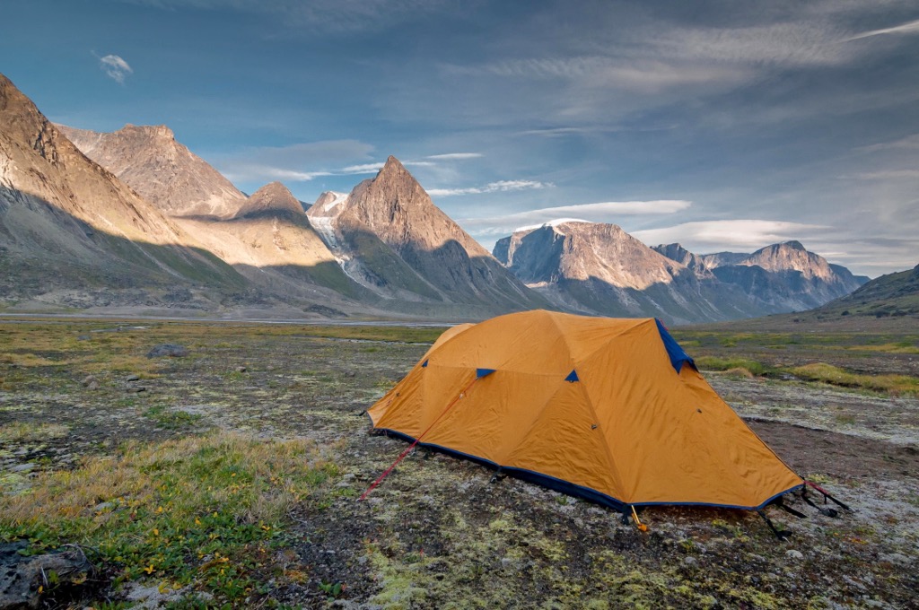
Most visitors hike the 97 km (58 mi) Akshayuk Pass during July and August; however, there are opportunities in the spring and fall to travel the pass on snowshoes or skis. The route typically takes 8-12 days and there are many incredible destinations along the way.
The Akshayuk Pass is a natural corridor between the mountains at the south end of Auyuittuq National Park. There is no trail; however, the route is fairly straightforward, following the glacial valley and significant landmarks.
The route leads over glacial moraines, includes river and creek crossing, and you pass in the shadows of stunning mountains, such as Overlord, Odin, Thor, and Asgard peaks. The weather can quickly change and fierce winds are known to rip through the pass.
The Akshayuk Pass is like the main highway through the park and the trail that many ski tours branch from or from where mountaineers make their main approach to the park's stunning peaks.
The boat trip and hike to Ulu Peak are one of the typical day trips that can be accommodated at Auyuittuq National Park. A boat will take visitors up the fjord from Pangnirtung to the base of Ulu Peak at which time, visitors can follow the guide to Ulu Peak.
Guided hikes to Ulu Peak are an incredible opportunity to hear the stories that your Inuit guides share about the region and its rich history. This hike is suitable for most visitors that are of average fitness and can walk on uneven surfaces.
Akshayuk Pass is the typical route that skiers take to enter the park. While it is popular to ski the entire pass, as though you were hiking, many visitors set up a base camp to explore other areas of the park.
Summit Lake is a popular location for a ski base camp, from which the 6,000 square kilometers (2,317 square miles) of the Penny Ice Cap is opened up for exploration. Skiing in remote northern parks is certainly not for the faint of heart or inexperienced skiers.
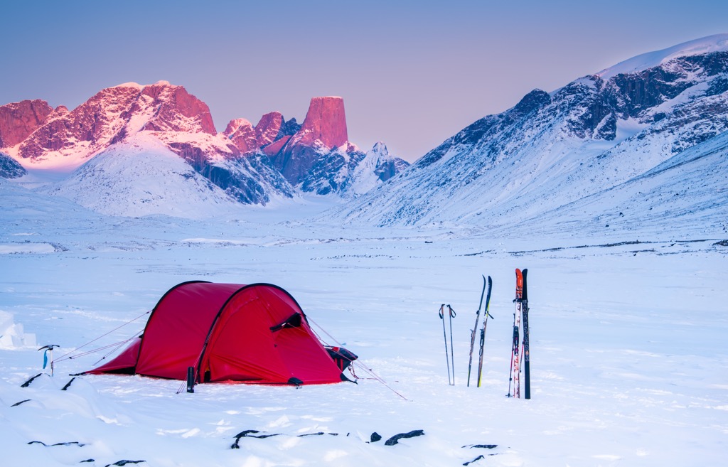
For visitors that have experience and training in glacier travel and crevasse rescue, skiing upon the ice cap enables exploration of many more mountains and glaciers.
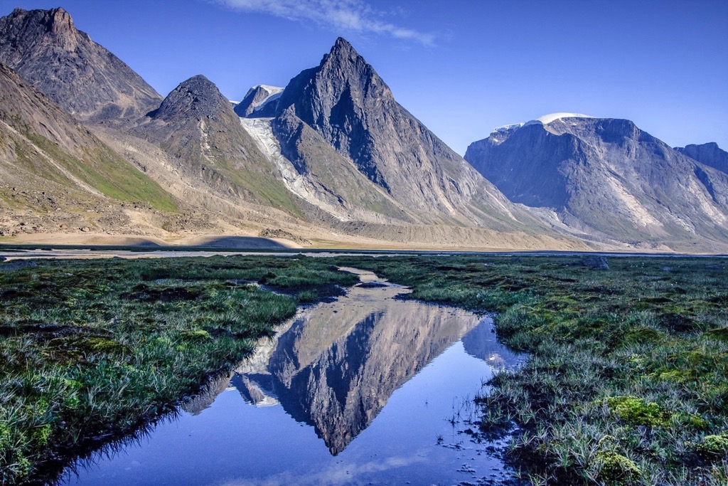
The twin, plateaued summits of Mount Asgard and the rugged peak of Mount Thor are two of the popular mountains to climb in Auyuittuq National Park. The peaks of the Arctic should be faced only by experienced mountaineers and not by beginners.
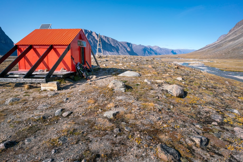
Isolation from potential rescue is part of what makes the peaks of Auyuittuq National Park dangerous. Climbers seeking challenges in the park should contact park staff to discuss expedition plans and to arrange for permits for their base camp and cache sites.
Guided snowmobile tours take visitors from Pangnirtung to Auyuittuq National Park and above the Arctic Circle. This day trip is about an hour of riding to the destination, with occasional stops to rest and stretch.
After about an hour, the guides stop below Crater Lake and you can walk up to admire the view and to cross the Arctic Circle on foot. You’ll be surrounded by stunning scenery and you may be able to spot Mount Thor if the skies are clear enough.
A Parks Canada interpretive guide will accompany the tour and will share stories about the area and the park. This is one of several guided day trips that allow visitors to access the arctic park with relative safety.
While visiting Auyuittuq National Park you will likely have the opportunity to visit the nearby communities. The following are the communities that you’ll likely visit, either before or after your arctic adventure:
Previously known as Frobisher Bay, Iqaluit was renamed in 1987 to restore its Iniktitut name. Located at the end of Frobisher Bay, on Baffin Island, Iqaluit is the largest community, the territorial capital, and only city in Nunavut. The capital city of Nunavut is about 350 km (210 mi) southwest of Auyuittuq National Park.
The settlement that would eventually become Iqaluit began in 1942 when the American military built Frobisher Bay Air Base, a refueling station for short-range aircraft that were being sent to the war effort in Europe.
Several factors encouraged growth of the community over the following decade. The new airstrip encouraged Hudson’s Bay Company to move their operations to an adjacent valley. The construction of the Cold War’s Distant Early Warning Line (DEW Line) brought many non-Inuit personnel to work on the base. At this time, hundreds of Inuit came to the burgeoning community for jobs and access to medical care.
By the 1960s, the Canadian government had established permanent services in the community which included doctors, schools, and social services. In response to the new services and the government's encouragement to settle permanently in communities, the Inuit population of the town quickly grew.
While the founding of Iqaluit only happened in 1942, the area has been used by the ancestors of the Inuit and even older cultures for hundreds of years. Located only about a kilometer from Iqaluit is Sylvia Grinnell Territorial Park which features archeological sites of the ancient Thule and Dorset peoples.
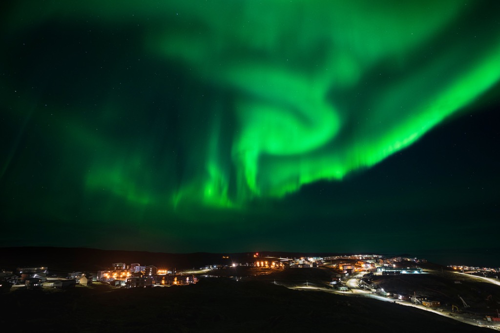
Sylvia Grinnell Territorial Park is also a great place to fish, picnic near the waterfalls, or watch for the passing arctic wildlife or appreciate the local flora. Hiking in the park is one of the many different activities to enjoy while in the arctic. Other activities include viewing the northern lights, traveling north of the Arctic Circle, dog sledding, or a visit to the Sinaaq, or flow edge, to view the dramatic wildlife.
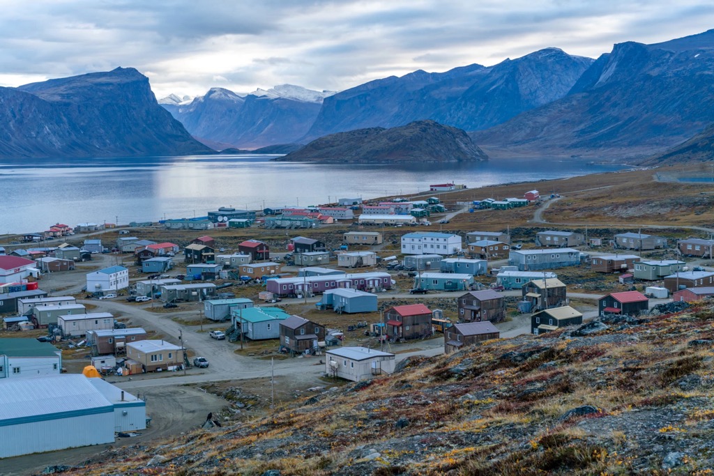
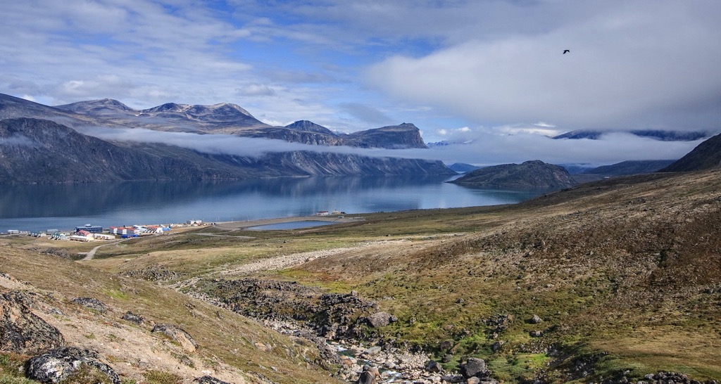
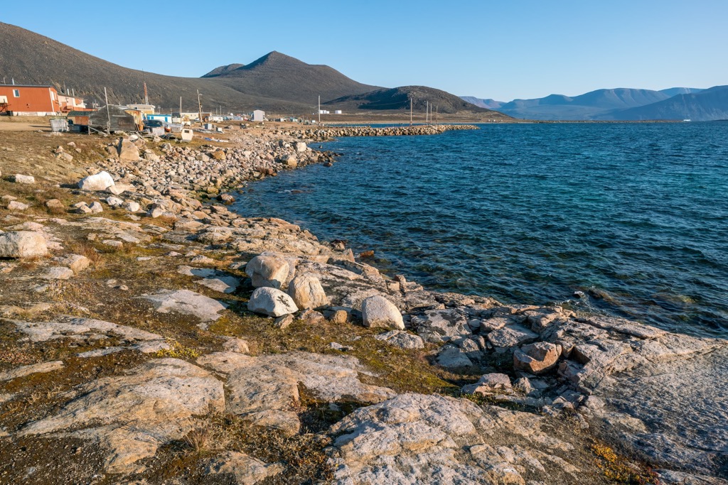
Pangnirtung is the closest community and gateway to the arctic adventures in Auyuittuq National Park. Located about 30 km (18 mi) south of the park, the only access to the community is by plane. While many visitors will come to the community to hike or ski Akshayuk Pass in the park, there are other opportunities as well.
If you’re not up to spending over a week traveling through Auyuittuq National Park, there are many guided tours from the community that offer a genuine arctic experience. Tours can take you north for an opportunity to cross the Arctic Circle or to the edge of the park where you can take a day-hike upon Ulu Peak.
The locals of Pangnirtung are known around the world for their high quality, traditional arts of sculpture, as well as printmaking and weaving. The Angmarlik Visitor Centre is a good place to find information on local activities around town and more about the history of the area and the people that inhabit the arctic.
A relatively new community, Qikiqtarjuaq was founded as Broughton Island in the 1950s as a DEW Line base. The community is about 80 km (48 mi) from the edge of Auyuittuq National Park, and it is a popular ingress / egress point into the national park.
The remote hamlet offers visitors the opportunity to immerse themselves in the local culture and to enjoy the beautiful arctic. Tour guides take visitors on expeditions to view polar bears or you may be more satisfied watching for narwhals, orca whales, walruses, and seals from the edge of the Hamlet.
Charter boats shuttle visitors to and from the nearby Auyuittuq National Park to start or end their journey through Akshayuk Pass. Other local adventures include dog sledding or hiring a guide to show you some amazing sites and their perspective of the Arctic.


