
Scan the QR code and open PeakVisor on your phone
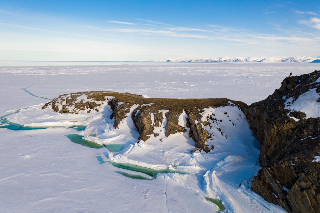
Meaning the “place of glaciers”, Sirmilik National Park is located on the north end of Baffin Island and the adjacent Bylot Island in Nunavut, Canada. The 22,252 square kilometer (8,592 square mile) park encompasses rugged peaks, arctic shoreline, and arctic lowlands that are home to many birds and other incredible arctic wildlife.
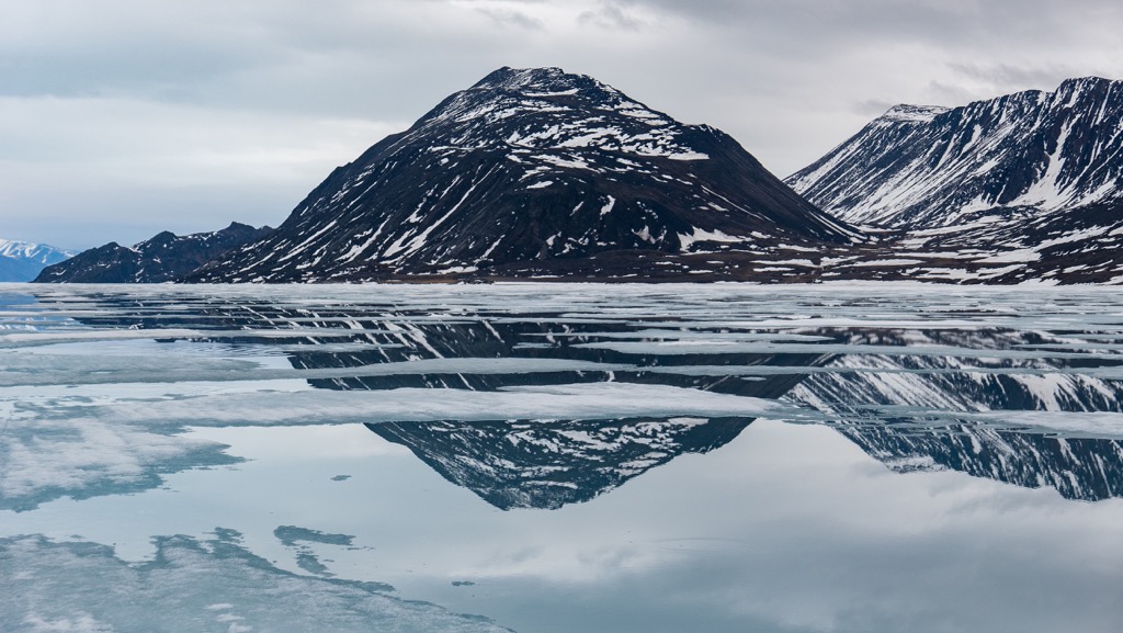
The rugged arctic landscape of Sirmilik National Park is overlooked by 19 named peaks, of which Angilaaq Mountain is the tallest and most prominent. Situated upon Bylot Island, Angilaaq Mountain rises 1,940 m (6,365 ft) from the sea and is considered an ultra-prominent mountain.
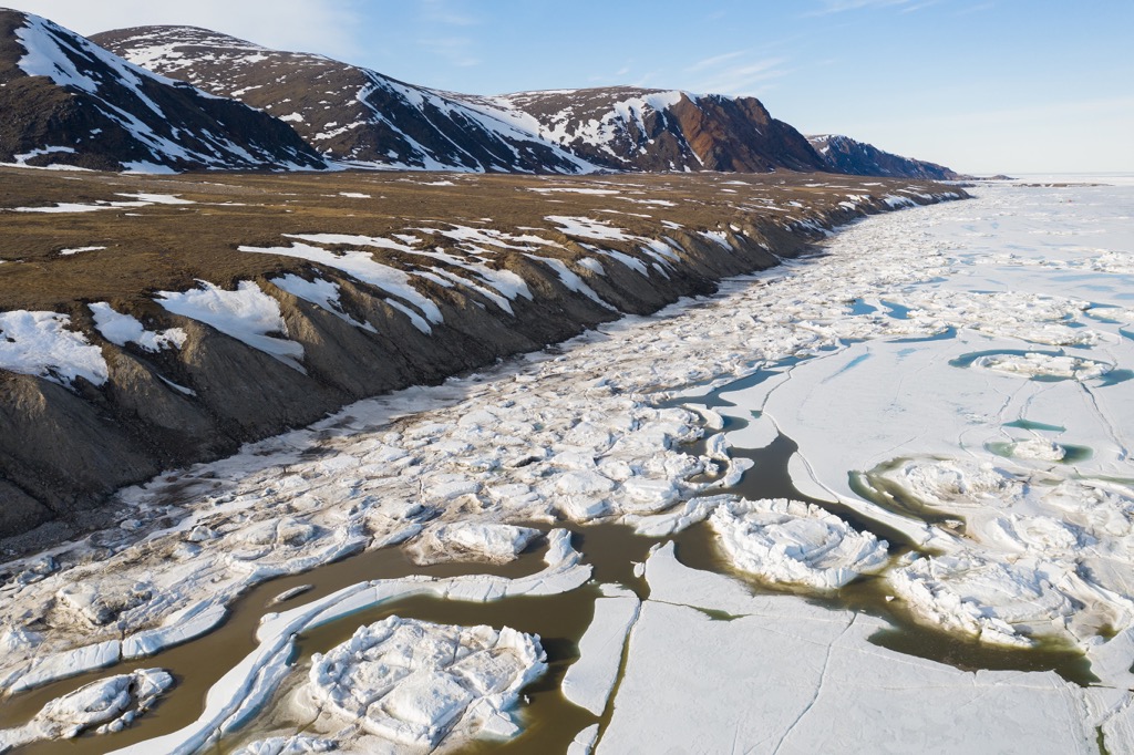
Sirmilik National Park sits above the Arctic Circle in the Canadian territory of Nunavut. The park is located up the east side of the Borden Peninsula of northern Baffin Island and the adjacent Bylot Island. The vast arctic park is a landscape of glaciers, ancient valleys, red-rock hoodoo spires, and diverse wildlife living upon the land, in the air, or among the iceberg dotted waters.
Glaciers flow down from among the park’s 19 named peaks, where ice has likely covered the landscape for tens of thousands of years. Angilaaq Mountain is at the center of the Byam Martin Mountains on Bylot Island, and stands as the tallest point in the park, 1,940 m (6,365 ft) above sea level.
Nunavut is home to several national parks that encompass and preserve the delicate arctic landscape. The following are other parks and protected areas in Nunavut and near Sirmilik National Park:
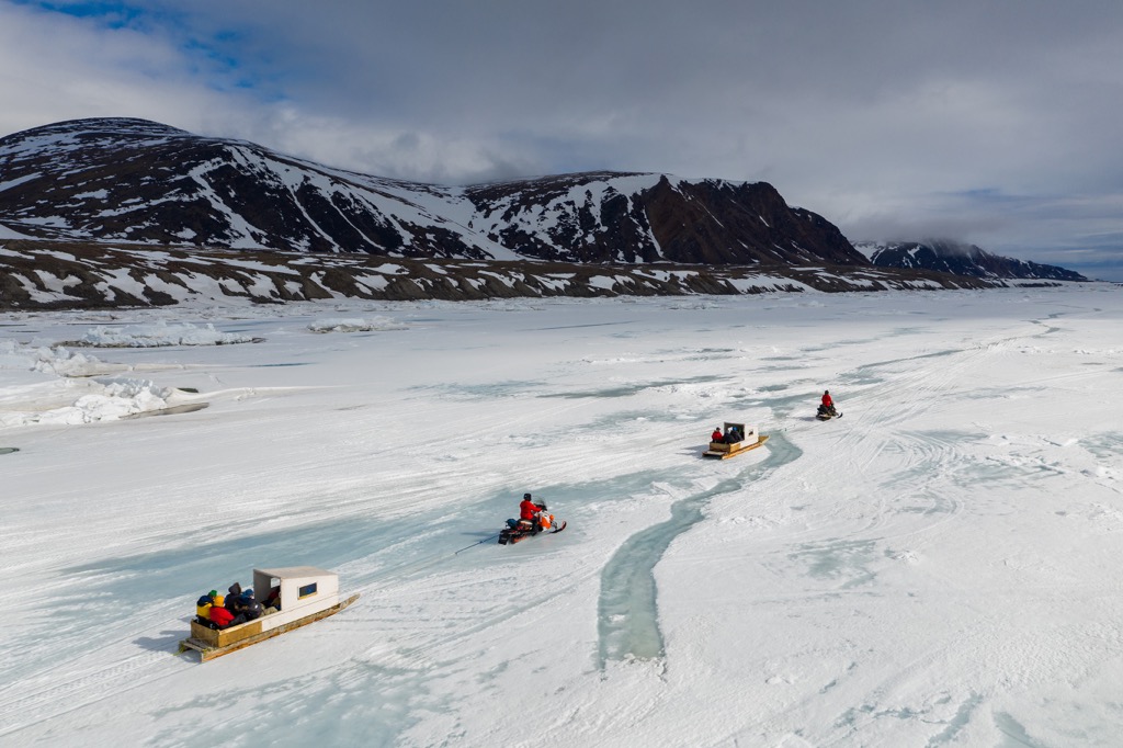
Visitors to the park will typically arrive first at the Iqaluit airport on Baffin Island and continue north via commercial or chartered flights to Pond Inlet and Arctic Bay. Pond Inlet and Arctic Bay are the gateways to the park, where a boat or snowmobile can be hired to take visitors into the park.
The mountains of Sirmilik National Park are part of the Byam Martin Mountain which are an extension of the Baffin Mountains. The Baffin Mountains run along the east side of Baffin Island and are part of the Arctic Cordillera.
The Baffin Mountains are the eastern extension of the Canadian Shield, and the rock composition of the area is primarily composed of igneous crystalline, metasedimentary, and metamorphic rock, such as gneiss. The major geological feature underlying the park is the Rae Craton
A craton is an ancient and relatively stable section of the Earth’s lithosphere that has survived cycles of rifting and merging of continents. The Rae Craton is part of the Canadian Shield, which is an amalgamation of the Slave, Rae, Hearne, and Superior Cratons.
The rocks of the cratons were formed during the Archean (2.5 to 4 billion years ago), making them some of the oldest rocks on earth. The rocks have been extensively worked upon by geological forces over billions of years, giving them a complex metamorphic history.
The geological history of the Rae Craton includes metamorphosed Paleoproterozoic aged volcanic and sedimentary rock overlaying the Archean age metamorphosed plutonic rocks. The Archean age rocks were the first to start forming on the Earth, as the surface finally cooled enough for the molten lava to solidify into the first continents.
Sirmilik National Park has a marine polar climate which heavily influences the flora and fauna of the park and surrounding marine areas. Some of the most spectacular wildlife can be viewed during the annual migrations of over 40 bird species that arrive on Bylot Island.
Thick-billed murres, fulmars, and black-legged kittiwakes annually arrive on the shores of Bylot Island where they have a nesting area. The rugged seaside cliffs may be inhabited by over 300,000 murres or over 80,000 kittiwakes in any given season. Furthermore, the wetlands are a sanctuary for the world’s largest population of greater snow geese, when over 50,000 birds arrive during the late summer.
Many visitors enjoy bird watching from power boats, kayaks, and even cruise ships. However, while upon the sea, there are many more animals to look out for. If you’re lucky you may spot beluga whales, narwhals, ringed seals, orca whales, or walruses during your visit to the park.
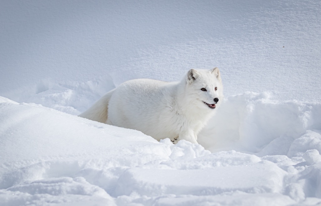
Polar bears hunt upon the ice and the land and great caution should be taken to avoid encounters with them. Arctic foxes, Arctic hares, Arctic wolves, and caribou also inhabit the national park and Baffin Island.
While the terrain may appear stark and desolate, there are over 360 distinct plants that have been documented within the park. Many of the plants that you’ll see are hardy grasses such as white cottongrass, Fisher’s tundragrass, polar grass, and semaphore grass.
The open meadows are typically filled with Arctic heather, Arctic poppy, mountain avens, and mountain sorrel among the grasses. Some of the shrubs that grow in the park are the northern bilberry and Arctic willow.
People began arriving on the Arctic coast and the Arctic islands when the continental ice sheet finally receded from the Arctic around 4,000 years ago. The Inuit are the current indigenous population that inhabits Nunavut and the region surrounding Sirmilik National Park; however, at least two other distinct cultures traversed the northern tundra before the arrival of the Inuit.
By 2,000 BCE people of the Pre-Dorset Culture arrived on the northern shores of Baffin Island. Due to difficulties with northern archeology, the Pre-Dorset Culture is a catch all name for any and all groups of people that inhabited the Canadian north before the arrival of the Dorset Culture.
The first evidence of the Dorset Culture was found in 1925 near the community of Kinngait, on Cape Dorset which is on the southwest corner of Baffin Island. It was determined from their unique technology and artistic styles that the Dorset Culture likely arrived in the north about 500 BCE and migrated across the Arctic until they became extinct around 1500 CE.
Starting about 200 BCE, the Thule Culture arrived from Asia via Beringia, the land bridge that once connected Asia and North America. Similar to the previous cultures, the Thule migrated east along the Arctic coast. Thule lore tells of encounters with a race of giants; however, the giants consistently retreated and didn’t interact with the Thule.
The Thule refer to the giants as Tuniit, and the Tunnit were likely members of the Dorset Culture who inhabited the north before the Thule. The Thule are the ancestors of the modern Inuit who now inhabit the north.
The ancient Thule followed a traditional seasonal round that had them traveling to prime hunting, fishing, and gathering spots during the warmer months, living in tents made of animal hide. During the winter, the Thule lived in semi-subterranean winter houses.
Hunting, fishing, and gathering are still a main component of the Inuit economy even though many Inuit inhabit the small, established communities. From the 1950s the government of Canada made a particular effort to encourage the Inuit to move to the settlements that were being created. In the settlements, the Inuit had greater access to medical care, schooling, and other social services.
There are no settlements in the park and the mountainous Bylot Island is a formidable landscape to try and tame. However, by 1939, the first recorded expedition to the Byam Martin Mountain was completed in 1939 by Pat Baird.
Baird managed to summit an unnamed peak during his expedition and it wasn’t for another 15 years that another peak was climbed when in 1954 Ben Ferris first ascended Mount Thule. It wasn’t until the late 1970s that mountaineers truly desired to make first ascents on the peaks of the Byam Martin Mountain.
Canadian expeditions to Bylot Island started in 1977, when Rob Kelly climbed 20 peaks, making 19 first ascents. Jack DeBruyn’s 1981 expedition climbed 15 peaks, making 14 first ascents. Finally, Mike Schmidt’s expedition traversed the island, climbing 28 peaks, and making 16 first ascents.
The rugged mountains on Bylot Island bring mountaineers from across the globe to test their mettle on the Arctic peaks; however, there is a lot more to enjoy and do in a visit to Sirmilik National Park. The following are some of the popular activities in the park:
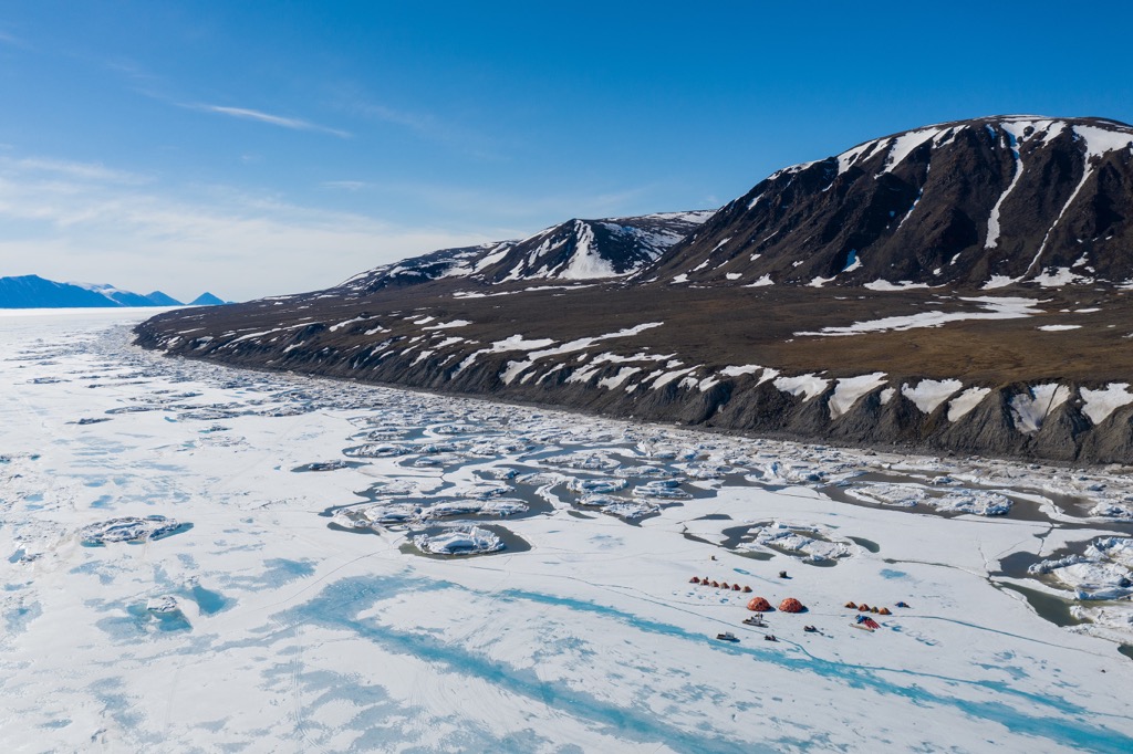
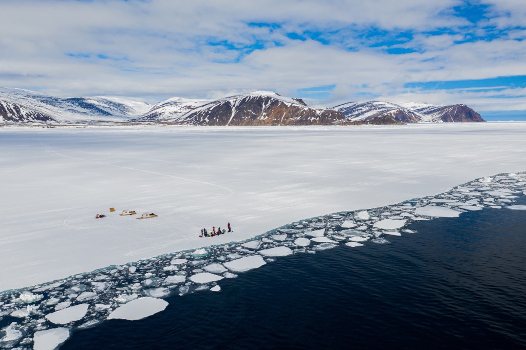
Some of the popular places to hike are to see the glaciers and hoodoos on Bylot Island or along the Mala River Valley on the Borden Peninsula. There are 16 glaciers on Bylot Island to choose from, in addition to many more on Baffin Island.
There are no facilities in Sirmilik National Park, nor are there any designated trails. The vast Arctic wilderness is open to daring visitors, who appreciate solitude, wide open spaces, and can be self-sufficient in case of emergencies.
Access to the park is typically via Pond Inlet and Arctic Bay, where visitors can hire a snowmobile, dog team, or a boat to get them to the park.
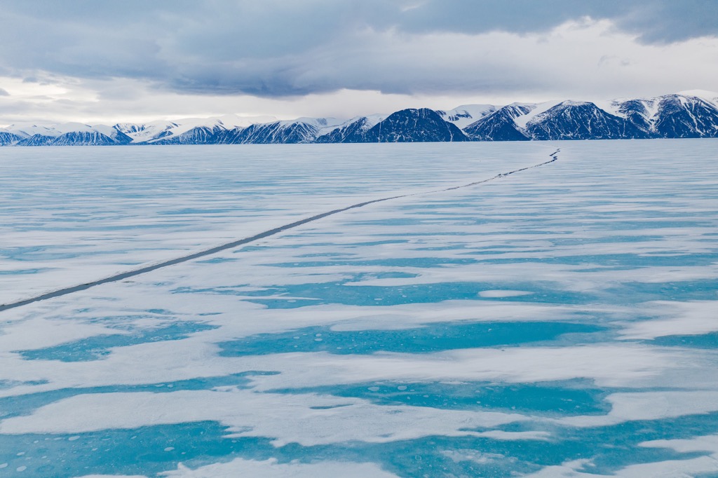
The ski-touring season lasts from about mid-April to early June. During this time the sea ice is still typically frozen and visitors can ski between Baffin Island and Bylot Island, where further ski-touring can occur upon the glaciers and through the mountains. As with all Arctic adventures, there is a high level of danger that visitors must be able to manage on their own.
Whether through a bird watching tour to Bylot Island or a Floe Edge tour, there are ample opportunities to view wildlife at Sirmilik National Park. During the summer, hundreds of thousands of birds visit the coast and wetlands of Sirmilik National Park, making their nests or as a stop on their migratory journey.
Wildlife viewing at a Floe Edge should only be done with a credible guide, who will be familiar with ice travel. With a guide, you’ll be able to have an incredible experience watching for whales, seals, polar bears, and birds as they come to the breaking ice to breathe and hunt. You may be able to spot narwhals, beluga whales, and polar bears hunting for seals on your excursion.
Located at the north end of Baffin Island in the Canadian territory of Nunavut, Sirmilik National Park is an incredible arctic wilderness for those willing to make the journey. The following are the towns and cities closest to the national park, where you may find respite, information, and guides for your arctic adventure.
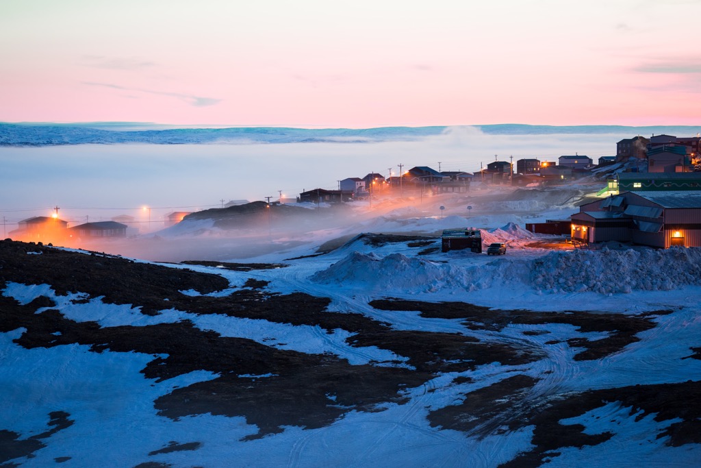
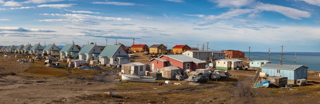
Pond Inlet is adjacent to Sirmilik National Park and contains the head office for the park. Visitors typically arrive in Pond Inlet by commercial and charter planes from Iqaluit, and continue to the park via skis, snowmobile, dog sled, or boat.
Before Hudson’s Bay Company opened a trading post in 1921, Inuit lived in a nearby camp, and have always referred to the community as Mittimatalik. The Pond Inlet area has been occupied over the past 4,000 years, starting with people of the Per-Dorset Culture.
The community is now the largest community on the north end of Baffin Island, with about 1,500 residents. Situated in the Arctic Cordillera, Pond Inlet is called the “Jewel of the North”.
Some of the local and area attractions include visiting Sirmilik National Park, or the Tamaarvik Territorial Park, or the Qilaukat Thule site. Wildlife viewing along the floe edge is an exciting excursion and the Nattinnak Visitors Centre showcases the works of local artists.
Having been occupied by several cultures over the past 5,000 years, Arctic Bay received its English name in 1872, by Willie Adams, the captain of a whaling vessel. Located on the north end of Baffin Island, Arctic Bay is nearly adjacent to Sirmilik National Park, and guided tours and chartered travel to the park are available from the community.
The Inuktitut name for the hamlet is Ikpiarjuk, which translates as “the pocket”. The name refers to the high hills around the nearly landlocked bay.
Arctic Bay has several claims to fame, including being home to the Midnight Sun Marathon, which is one of the northernmost contests held in the world. Additionally, The hamlet is the northernmost public community in Canada that wasn’t created from forced relocation.
Some of the attractions to look forward to around Arctic Bay include wildlife viewing along the floe edge, visiting archeological sites, interacting with locals to learn their culture, igloo building courses, and many more. While Arctic Bay is a very remote community, there is a rich history and lively culture in the community.
Iqaluit is about 900 km (540 mi) south of Sirmilik National Park; however, most visitors to the arctic parks on Baffin Island need to pass through the city. As the only city in Nunavut, Iqaluit is also the capital of the territory.
Regular flights come and go from the mainland, connecting the remote community and supplying a steady stream of tourists. Commercial and charter flights connect Iqaluit to most of the other communities on Baffin Island and Nunavut.
Iqaluit was established in 1942, with the construction of an American military base; however, the area has been occupied for thousands of years by the hardy indigenous people of the arctic. About a kilometer from the city is Sylvia Grinnell Territorial Park, where there are significant archeological sites featuring artifacts from the Dorset and Thule cultures.
Furthermore, in addition to wildlife tours, dog sledding, and snowmobiling which can take place around the city, the territorial park offers a great place for picnicking, hiking, or fishing. Visitors can rest in the arctic meadows and discover the stunning waterfalls in this arctic terrain.


