
Scan the QR code and open PeakVisor on your phone
King County is a county located in western Washington in the United States. The county has a population of 2.2 million people, making it the most populous county in the entire state. Within King County lies the city of Seattle, which is the most populous city in the state. The county was originally formed back in 1852 as part of the larger Oregon Territory, which later became the Washington Territory in 1853. In 1986 the county voted to officially rename the county after Dr. Martin Luther King Jr. Today both the county flag and logo honor Dr. Martin Luther King Jr.
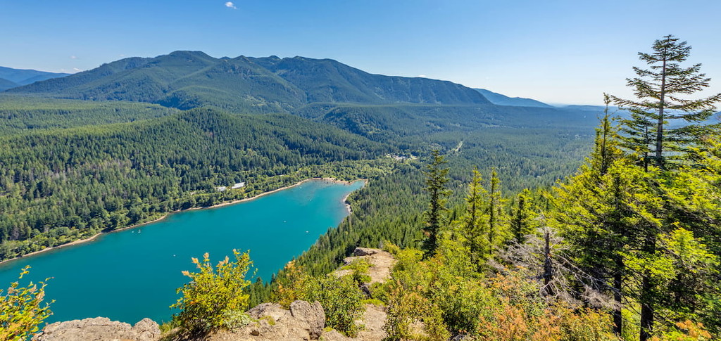
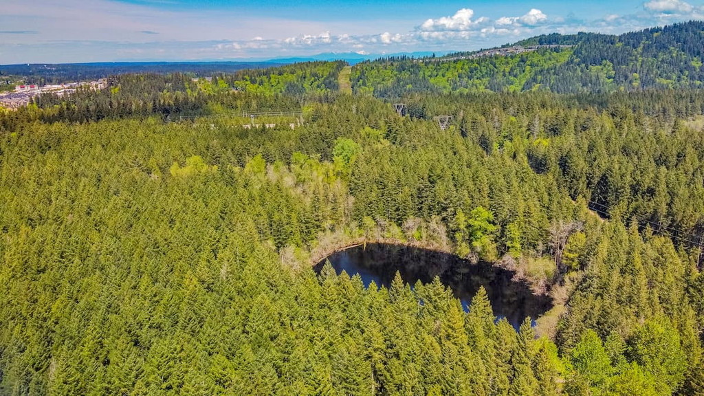
There are 218 named mountains in King County. Mount Hinman is the highest point at 7,454 feet. The most prominent mountain is Mount Index with 3,018 feet of prominence. King County covers 2,307 square miles of land across western Washington in the Puget Sound region. Much of the geographic features of the region were carved out by ice age glaciers. These glaciers shaped what is now the Puget Sound, Lake Washington, Lake Sammamish, as well as the low elevation land surrounding these waterways. The county spreads from the waters of the Puget Sound eastward into the Cascade Mountain Range. While large cities dominate the land near the water, the population thins as the land approaches the mountains.
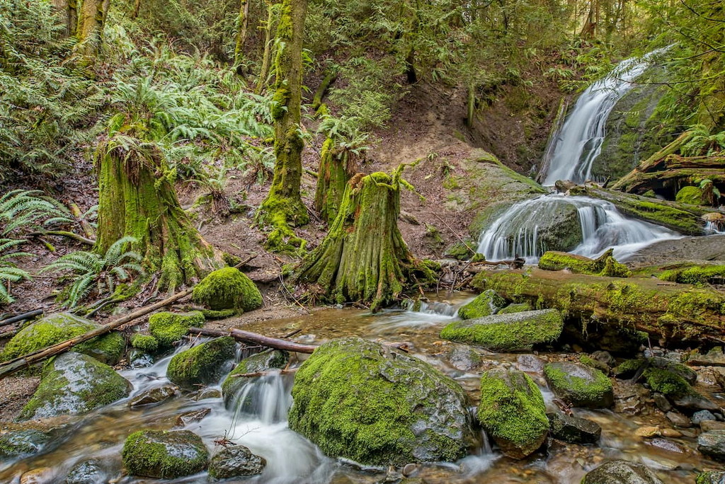
King County is known for being a rainy region, averaging 46 inches of rainfall per year. The rainy season is typically from October to March with moderate summers. The immense amount of rainfall leaves behind lush forests which the state is known for. King County is home to a wide variety of plants and animals. The waters of the region are full of salmon, otter, orca whale, and seahawks which the land is home to deer, coyote, bear, fox, mountain lion, eagles, and numerous species of owls while Douglas firs and cedars dominate the rainforests.
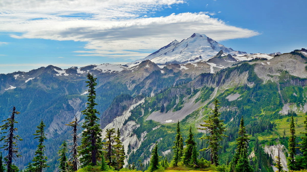
Mount Baker-Snoqualmie National Forest: The western region of the Mount Baker-Snoqualmie National Forest lines the eastern region of King County. The forest covers 1.72 million acres of land across the western region of the state. The sheer size of the forest, along with its close proximity to the Seattle-metro and Vancouver-metro areas make it the most visited National Forest in the country. Both Mount Baker and Glacier Peak lie within this forest. Major hikes in the forest near King County include Mount Si, Twin Falls Trail, Snow Lake Trail, and Rattlesnake Ridge.
Cougar Mountain Regional Wildland Park: The Cougar Mountain Regional Wildland Park is located on the eastern outskirts of Seattle near the cities of Bellevue and Issaquah. The park was established back in 1983 to protect Cougar Mountain and the surrounding land. Today there are nearly 40 miles of hiking trails throughout the park. Popular hikes in the park include Margaret’s Way Trail, Whittaker Wilderness Peak Trail, and the Coal Creek Falls loop.
Tiger Mountain State Forest: Tiger Mountain State Forest is a ridge located in the western foothills of the Washington Cascades, just 20 minutes east of Seattle. The forest spans 13,734-acres forming a triangle between Interstate 90 (1I-90) on the north, Issaquah-Hobart Road on the southwest, and State Route 18 (SR 18) on the southeast. In 2009, 11,200 acres were purchased to its south, which included Rattlesnake Mountain, and became known as Raging River State Forest. Popular hikes within the forest include Cable Line Trail, Poo Poo Trail, and Tiger Mountain Trail.
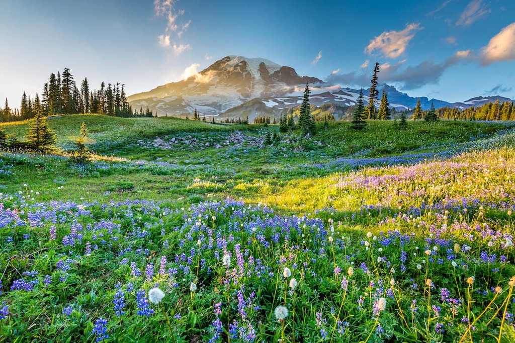
Mount Rainier National Park: Southeast of King County lies Mount Rainier National Park. Though it does not lie within the county, it is one of the most popular hiking areas in the entire state. Established back in 1899, this National Park encompasses 236,381 acres surrounding, and including, Mount Rainier. The mountain stands at 14,411 feet, making it the highest point in all of the Cascade Range. There are 25 glaciers on the mountain and hiking trails throughout. The park is defined by its old-growth forest, alpine meadows, glacier fed lakes, and some of the most stunning views in the entire state. Major hikes include the Wonderland Trail, 93 miles that circle the mountain, Skyline Trail, Tomie Peak, Mount Fremont, and Mowich Lake. Major visitor centers are located at Sunrise, Paradise, and Longmire.
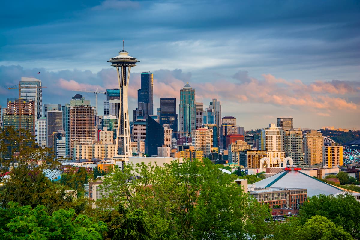
The most iconic and populated city in the state of Washington is Seattle, in the heart of King County. While Seattle is known for being a rainy city, don’t let that deter you. Surrounded by lush forest, the Puget Sound, and views of Mount Rainier, Seattle has something to offer all of its visitors. Take a trip to Pike Place Market, stop by the original Starbucks location, visit the Space Needle, or swing by one of the city’s 174 breweries. Staying in Central Seattle, just east of I-5, will ensure that you’ll have quick access to the state’s major highways and nearby parks.
Issaquah has a population of over 30,000, and sits at the base of the Cascade Mountains, east of Seattle. Located at the northwestern end of the Tiger Mountain State Forest, just off I-90, this quaint mountain town is perfect for a pre hike coffee or post hike feast. Staying in town will ensure that you are just a few minute drive to many of the major trailheads.


mid-state-milers
washington-difficult-10
smoots-100
mountaineers-everett
mid-state-milers
smoots-100
mountaineers-snoqualmie-all
mountaineers-snoqualmie-first-10


