
Scan the QR code and open PeakVisor on your phone
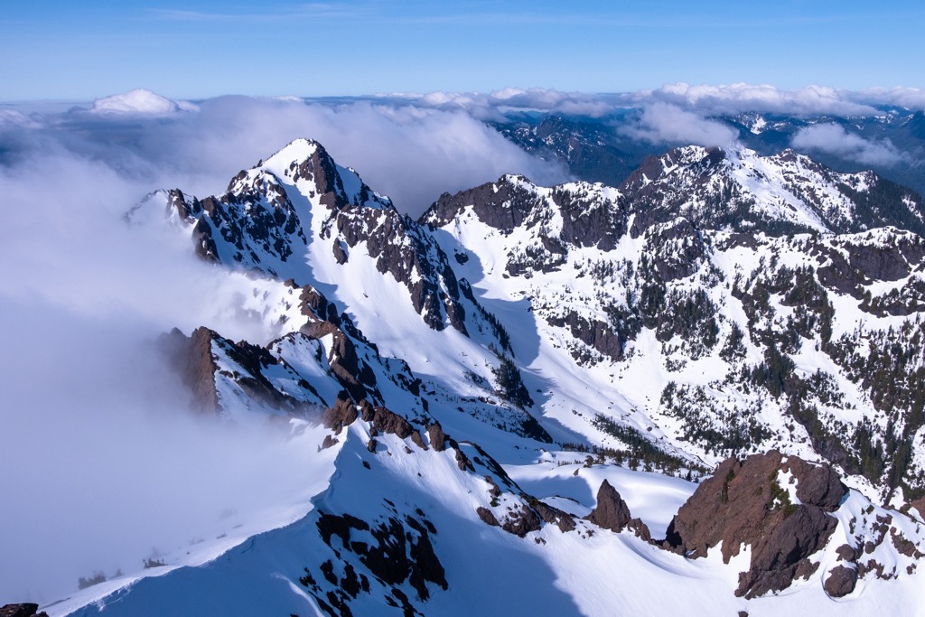
Mount Skokomish Wilderness has 12 named peaks. The highest is Mount Skokomish at 1,961 m. Other notable peaks include Mount Washington, Mount Pershing and Mount Cruiser.
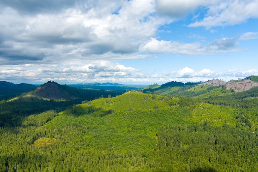
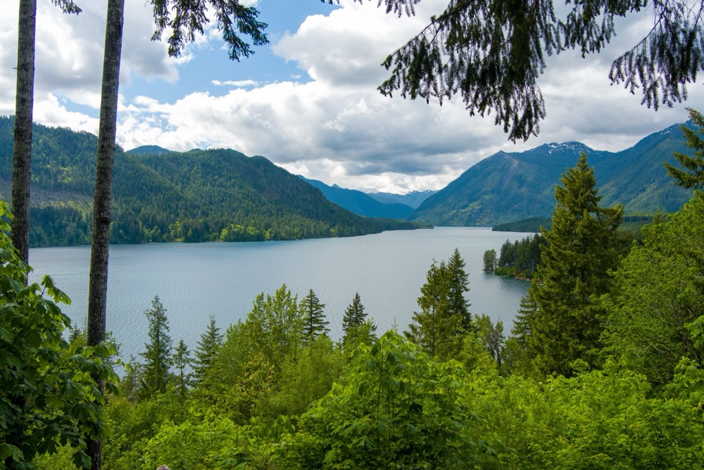
Mount Skokomish Wilderness is on the Olympic Peninsula in Washington, USA. Located in the southeastern part of Olympic National Forest, the wilderness spans over 13,000 acres (5,260 ha) and includes 12 peaks of the Olympic Mountains. At 6,434 ft (1,961 m), Mount Skokomish is the tallest peak and Mount Washington (6,273 ft/1,912 m) has the greatest prominence at 2,641 ft (805 m).
Located on the Olympic Peninsula in Washington state, the Mount Skokomish Wilderness covers 13,105 acres (5,303 ha) in the southeast of Olympic National Forest. The wilderness was established in 1984 and encompasses a portion of the Olympic Mountains.
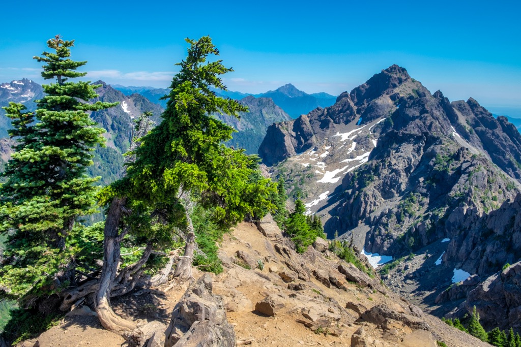
Two ridges run through the wilderness, oriented roughly northeast to southwest. Mount Skokomish (6,343 ft/1,961 m), Mount Lincoln (5,850 ft/1,783 m), and Mount Cruiser (6,047 ft/1,843 m) are part of the northern ridge. The ridge between Mount Lincoln and Mount Cruiser is known as Sawtooth Ridge and a well-known rock climbing spot.
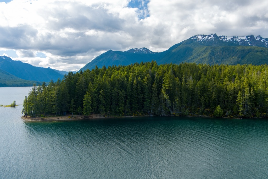
Mount Pershing (6,152 ft/1,875 m), Mount Washington (6,273 ft/1,912 m), Mount Rose (4,291 ft), Mount Ellinor, and Jefferson Peak (5,719 ft/1,743 m) rise from the southern peak. The only river in the wilderness, the Hamma Hamma River, flows through the basin between the two ridges.
It is a rugged and challenging landscape with steep slopes and elevations ranging from 800 ft (245 m) near Lake Cushman to over 6,400 ft (1,951 m) on the summit of Mount Skokomish. The area has bare ridgelines and steep, rocky outcrops.
The wilderness shares a border with Daniel J. Evans Wilderness to the north and lies to the south of Olympic National Park.
The Olympic Mountains formed between 18 and 57 million years ago through a process of underwater volcanoes, sedimentation, and tectonic plate convergence. Millions of years ago, underwater volcanoes erupted, leaving behind basalt on the ocean floor. As time passed, sediment accumulated over the basalt on the ocean floor.
Around 34 million years ago, the North American plate and Juan de Fuca plate collided. The intense pressure between the two caused the ocean floor to uplift, bend, and fold, thus creating the Olympic Mountains. The collision is still occurring as the Juan de Fuca plate continues to slide beneath the North American plate.
Glaciers also played a role in shaping the region. They formed during the Pleistocene Epoch, around 2.5 million years ago. The most recent event lasted from 16,900 years ago to 14,000 years ago and is known as the Cordillera Ice Sheet. As glaciers advanced and retreated, they left behind U-shaped valleys and carved out Puget Sound.
Within the forests of the steep-sided slopes, stands of old growth remain featuring Douglas fir, western hemlock, and western red cedar. As elevation increases, these species give way to subalpine firs and western white pine. The highest elevations are mainly exposed rock interspersed with sparse alpine vegetation.
Along the ridge of Mount Rose, as well as at higher elevations across the wilderness, one can find bear grass, sitka valerian, false hellebore, avalanche lilies, and tiger lilies. Growing in the understory at lower elevations are rhododendrons, Indian paintbrush, salal, Oregon grape, foam flower, and wild ginger.
Elk, black-tailed deer, black bears, and mountain lions make their homes in the old growth forests and along the rocky outcroppings. Marmots and mountain goats are common at higher elevations. The mountain goats in the region are sometimes dangerous so caution is recommended around them.
Human history in the area around the Olympic Peninsula dates back nearly 14,000 years. At this time, hunter-gatherers followed big game through the region. In 1977, a farmer near Olympic National Park came across the ancient remains of a mastodon with a projectile point between the ribs. The projectile point has been dated back to 13,800 years ago.
Around 3,000 years ago, increasing populations drove people to shift towards rivers and lakes. This was the start of the region’s rich cultural maritime cultures as early peoples began to fish, hunt marine mammals, and gather shellfish. They also utilized the forest widely for food, weaving materials, and medicine. Longhouses were made of red cedar and canoes were carved out for hunting in the ocean.
Change came quickly to the region following the arrival of Europeans in the late 1700s. Disease wiped out nearly 30% of the Northwest’s native population and settlers quickly began to compete for natural resources – harvesting salmon, hunting elk, and cutting down large portions of the forests.
In 1855, the Treaty of Neah Bay created the Makah Reservation and the Point No Point Treaty created the Skokomish Reservation. Around this time, the O’Neil and Seattle Press expeditions surveyed and traversed the Olympic Peninsula.
Today there are eight tribes associated with the lands around Olympic National Park – the Hoh, Jamestown S’Klallam, Elwha Klallam, Makah, Port Gamble S’Klallam, Quileute, Quinault, and Skokomish. They continue to practice their long standing traditions such as First Salmon ceremonies, basket weaving, and whaling.
Olympic National Forest was established in 1897, Olympic National Park in 1938, and the Mount Skokomish Wilderness in 1984.
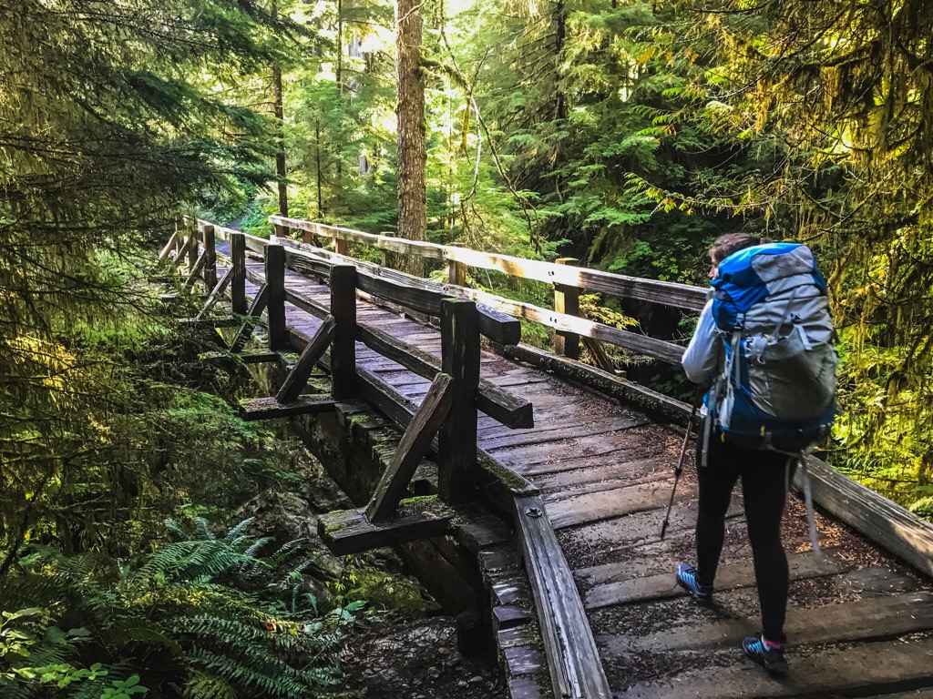
The Mount Skokomish Wilderness is great for backpacking, hiking, camping, and fishing. It has more than 13 mi (21 km) of trails and four trails. However, not all trails are maintained and all the trails are considered strenuous.
Fires are not allowed above 3,500 ft (1,065 m) in the wilderness. Hiking poles, shoes with good traction, and rain gear are highly recommended. Hikers should also be aware that mountain goats on the Olympic Peninsula can be dangerous.
The Mildred Lakes Trail was made by hikers and fishermen and is not maintained. Up until Huckleberry Creek, the trail is fairly well established. However, past this point the trail becomes steep and harder to follow. The trail climbs steeply, descends, and then climbs steeply again before dropping to the lakes. It is around 9 mi (14 km) roundtrip with about 2,300 ft (700 m) elevation gain.
The Mount Rose Trail is maintained by a volunteer group. It measures 6.4 mi (10.3 km) out and back and gains about 3,500 ft (1,065 m) in elevation. The trail passes through old growth forest, offering glimpses of Lake Cushman, Prospect Ridge, Dow Mountain, and Lightning Peak on the way up. There is a ridge loop trail at the top with views of Bear Gulch Valley, Mt. Ellinor, Mt. Washington, and Mt. Pershing.
The first 3 mi (5 km) of the Putvin Trail run through the Mount Skokomish Wilderness before entering Olympic National Park. The trail is very steep and difficult. Several campsites are located along the trail. The trail extends to Lake of the Angels and from there, several trails head off in multiple directions.
The Mount Ellinor Trail is 3.1 mi (5 km). It crosses through open forest up to timberline, and above 4,500 ft (1,372 m) it turns into wildflower meadows. There are two trailheads to access this trail. The lower one begins at 2,600 ft (792 m) and the upper one at 3,500 ft (1,065 m). The trail from the lower trailhead begins with a gentle incline but becomes steeper after the first mile (1.6 km).
About 2.5 mi (4 km) from the lower trailhead is a junction where the winter climbing route shoots off to the right and the summer trail route heads to the left. This junction is a good turnaround point for inexperienced hikers. From the summer route, the trail follows along a series of switchbacks to the southridge of Mount Ellinor and then continues on the ridge to the summit. You’ll get nice views of Hood Canal, Lake Cushman, and the Cascades from this route.
There are campsites in the nearby Olympic National Forest and Olympic National Park and several small towns such as Shelton and, a bit further, Olympia, for groceries, fuel, and lodging.
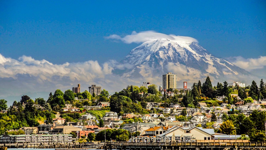
Tacoma is 95 mi (155 km), or about a two hour drive, from the wilderness and has a population of 215,000 people. One of its best known attractions is the Museum of Glass. Other spots to check out in and around Tacoma include the LeMay Car Museum, Point Defiance Park with its old growth forest, High Rock Lookout, and the Mount Tahoma trail system with its great views of Mount Rainier.
The city offers a wide mix of cuisines, local seafood and produce, and waterfront dining. There’s no trouble finding a spot to stay whether it's a hotel, rental property, campground, or a marina for those looking to dock their boats overnight.
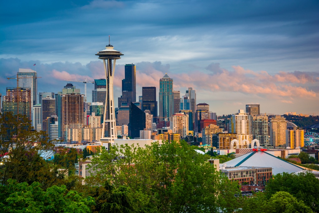
Seattle is located across Puget Sound from the Mount Skokomish Wilderness, about a 2.5 hour drive away and is home to 740,000 people. The city is bursting with things to do and among the top sites to visit are the 605 ft (184 m) Space Needle, built for the 1962 World Fair and the Chihuly Garden and Glass Museum, celebrating the locally-born, world-famous glassblower Dale Chihuly.
Stop by Pike Place Market for the iconic gum wall, as well as dozens of artisans, food stalls, and music. Get outside nearby by taking a ferry ride on Puget Sound, or plan a day trip to Mount Rainier or the San Juan Islands.
The city offers a wide selection of cafes, breweries, wineries, and the restaurants are known for their fresh seafood and local produce. There’s no shortage of accomodation, ranging from hostels to B&Bs to resorts and lodges.


olympic-mountains-rain-shadow-court
smoots-100
olympic-mountain-project
mountaineers-olympia
olympic-mountains-rain-shadow-court
olympic-mountain-project
mountaineers-seattle-clubhouse
mountaineers-olympia-scramble
olympic-mountains-rain-shadow-court
smoots-100
olympic-mountain-project
mountaineers-olympia
The highest peak in Mount Skokomish Wilderness is Mount Skokomish, at 1,961 m.
Notable peaks in Mount Skokomish Wilderness include Mount Skokomish, Mount Washington, Mount Pershing, Mount Cruiser and Mount Henderson.


