Scan the QR code and open PeakVisor on your phone
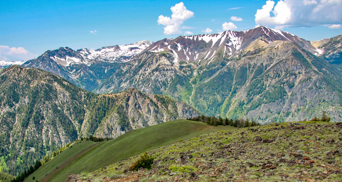
The Eagle Cap Wilderness lies within the Wallowa Mountains of northeastern Oregon. The wilderness sits within the Wallowa-Whitman National Forest and stretches 361,446 acres making it Oregon’s largest wilderness area. There are 51 named mountains in Eagle Cap Wilderness. The highest and the most prominent mountain is Sacajawea Peak at 9,820 feet. Another prominent peak is Eagle Cap that was once thought to be the tallest point in the wilderness though it stands at 9,572 feet. In total there are over 30 summits in the wilderness that reach over 8,000 feet. The wilderness gets its name, Eagle Cap, from a mountain located in the Wallowa Mountains that were once named Eagle Mountains.
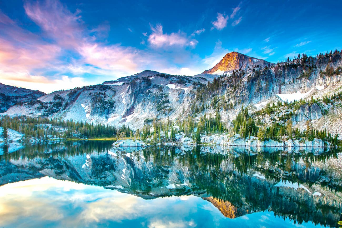
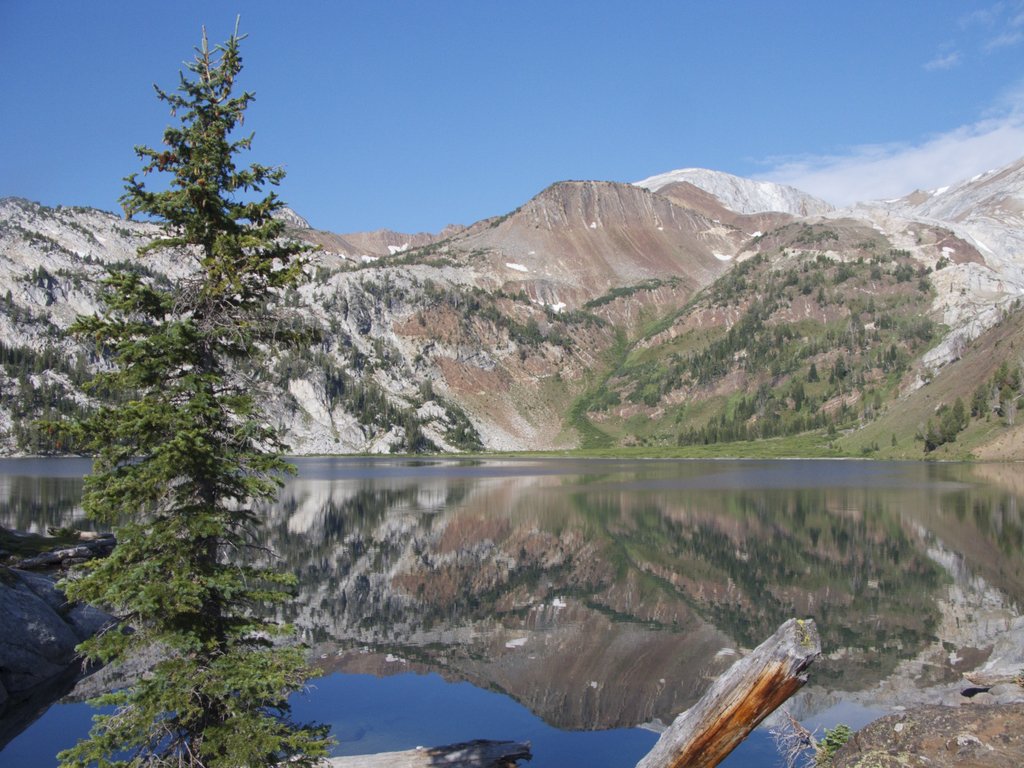
Eagle Cap Wilderness is characterized by the high alpine lakes, meadows, U-shaped glaciated valleys, and ridges. The elevation ranges from 3,000 feet up to 9,820 feet at the top of Sacajawea Peak. Legore Lake is one of the 60 alpine lakes in the wilderness, and at an elevation of 8,950 feet, it is the highest lake above sea level in the entire state. There are a total of 12 named lakes that sit at an elevation above 8,000 feet. Within the wilderness lives black bears, cougars, Rocky Mountain bighorn sheep, as well as mountain goats. In recent years a herd of elk have returned, and it is estimated there are at least 40. There are four designated Wild and Scenic Rivers that originate within the wilderness. This includes Lostine, Eagle Creek, Imnaha, and Minam Rivers.
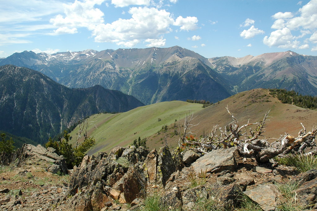
Since the Eagle Cap Wilderness is the largest wilderness area in the state of Oregon, there is ample opportunity for outdoor activities. This includes hiking, backpacking, trail running, fishing, camping, and hunting. During the winter some trails are used for cross country skiing and snowshoeing. There are 47 named trails in the wilderness which totals to approximately 534-miles of trails. The region is often referred to as “Oregon’s Best Kept Secret”.
Due to the remote location of the wilderness, many of the hikes are long and rated as difficult. This popular route totals 16.9 miles with 4,146 feet of total elevation gain. From Mirror Lake the trail climbs up through the trees and high meadows offering small campsites along the way. This hike is great for backpacking and taking a day trip to the top of Eagle Cap. The trail to the top climbs quickly and some scrambling is required. As one of the tallest peaks in the entire wilderness, the views from Eagle Cap show the expansive forest, ridges, and alpine lakes below.
As the tallest peak in the wilderness, getting to the top of Sacajawea Peak is no easy hike. The out and back trail totals 13.4 miles with 5,436 feet of elevation gain. The route climbs through the forest before reaching an open meadow a few miles in. From there the trail ascends along the ridgeline to the top of Sacajawea Peak. Some scrambling is involved as there is not a designated route to the summit. Hikers are advised to carry maps to ensure they can return back to the trail after summiting the peak. Campgrounds lie within the meadow at the base of the peak or the hike can be done over the course of a single day.
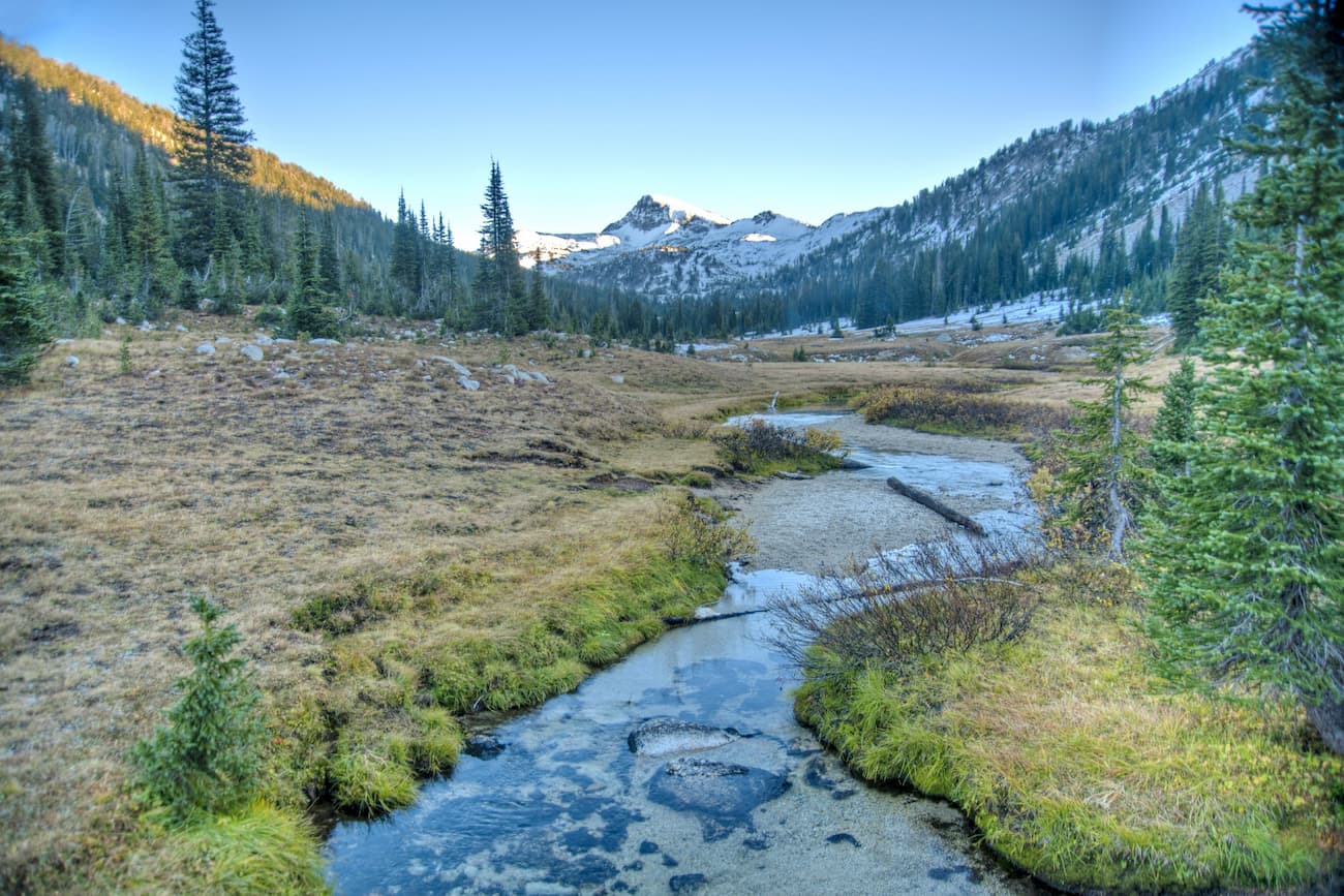
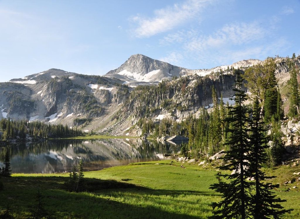
With over 30 named alpine lakes it can be overwhelming to choose which one to hike to. A popular and well-maintained trail takes you to Maxwell Lake sitting at 7,729 feet. The out and back trail totals 8-miles with 2,450 feet of elevation gain. The trail starts by crossing the Lostine River before climbing through the forest for three miles. The last mile of the trail becomes steeper before you reach the lake. The lake itself is known for the two small islands and abundant fish population. Maxwell Lake is also one of the few lakes in the Eagle Cap Wilderness that has its own designated trail.
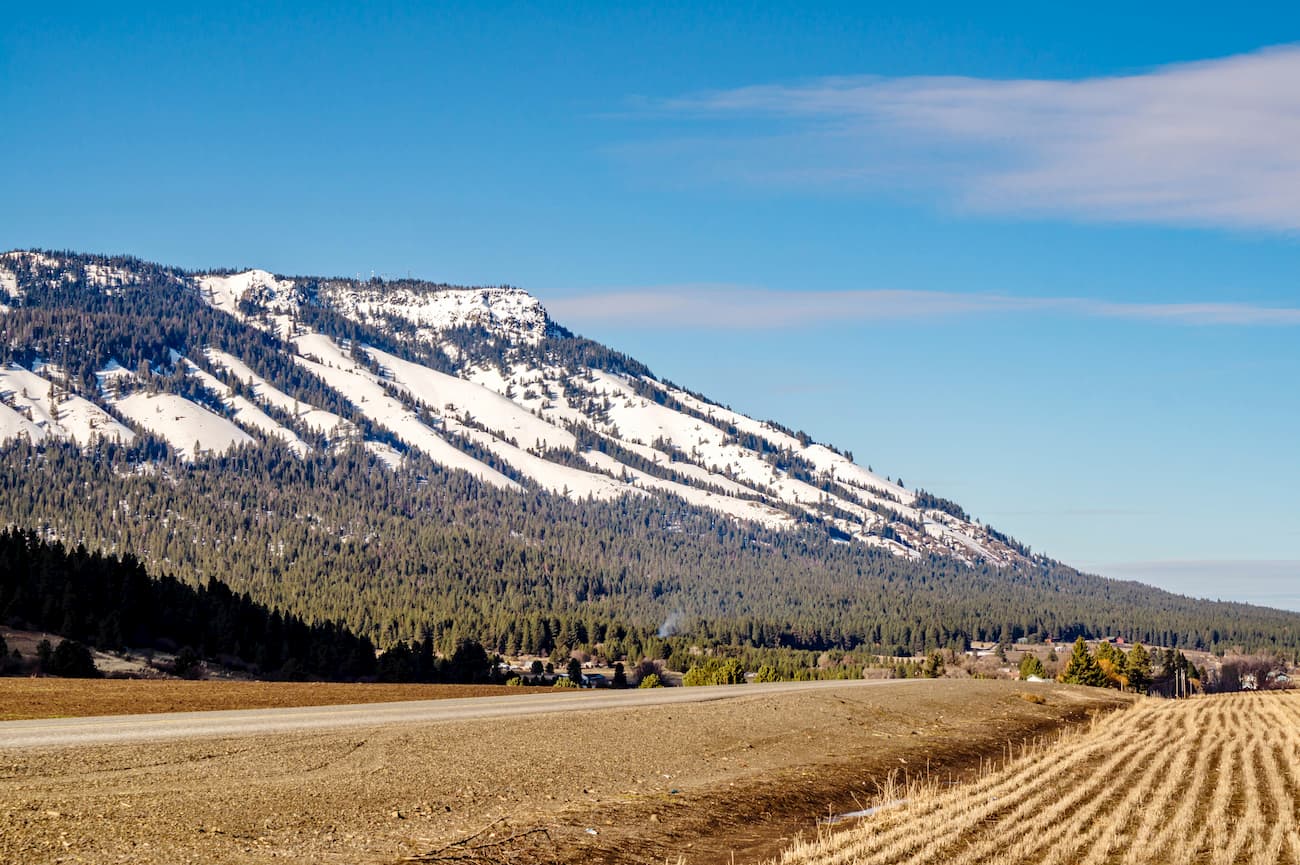
While there are not any major cities in much of eastern Oregon, La Grande sits at the foothills at the Wallowa Mountains. The city is located in the Grande Ronde Valley and has a population just under 15,000. It sits east of the Blue Mountains and west of the Wallowa Mountains. Mount Emily sits north of the town, towering over its streets. The small town is a great place to stop on your way to the Eagle Cap Wilderness, grab a bite to eat or check out the many local shops.
The Tri-Cities, includes three closely linked cities; Kennewick, Pasco, and Richland. The cities are situated where the Yakima, Snake, and Columbia rivers meet. Situated about two hours northwest of the Eagle Cap Wilderness, the area has been historically based on farming and the Hanford Nuclear Reservation. Farming has been popular due to the irrigation from the three conjoining rivers. The area is home to seven river-front parks that are popular among locals and tourists alike.