
Scan the QR code and open PeakVisor on your phone
Morley Nelson Snake River Birds of Prey National Conservation Area has 22 named peaks. The highest is Big Foot Butte at 1,078 m. Other notable peaks include Christmas Mountain, Cinder Cone Butte and Sinker Butte.
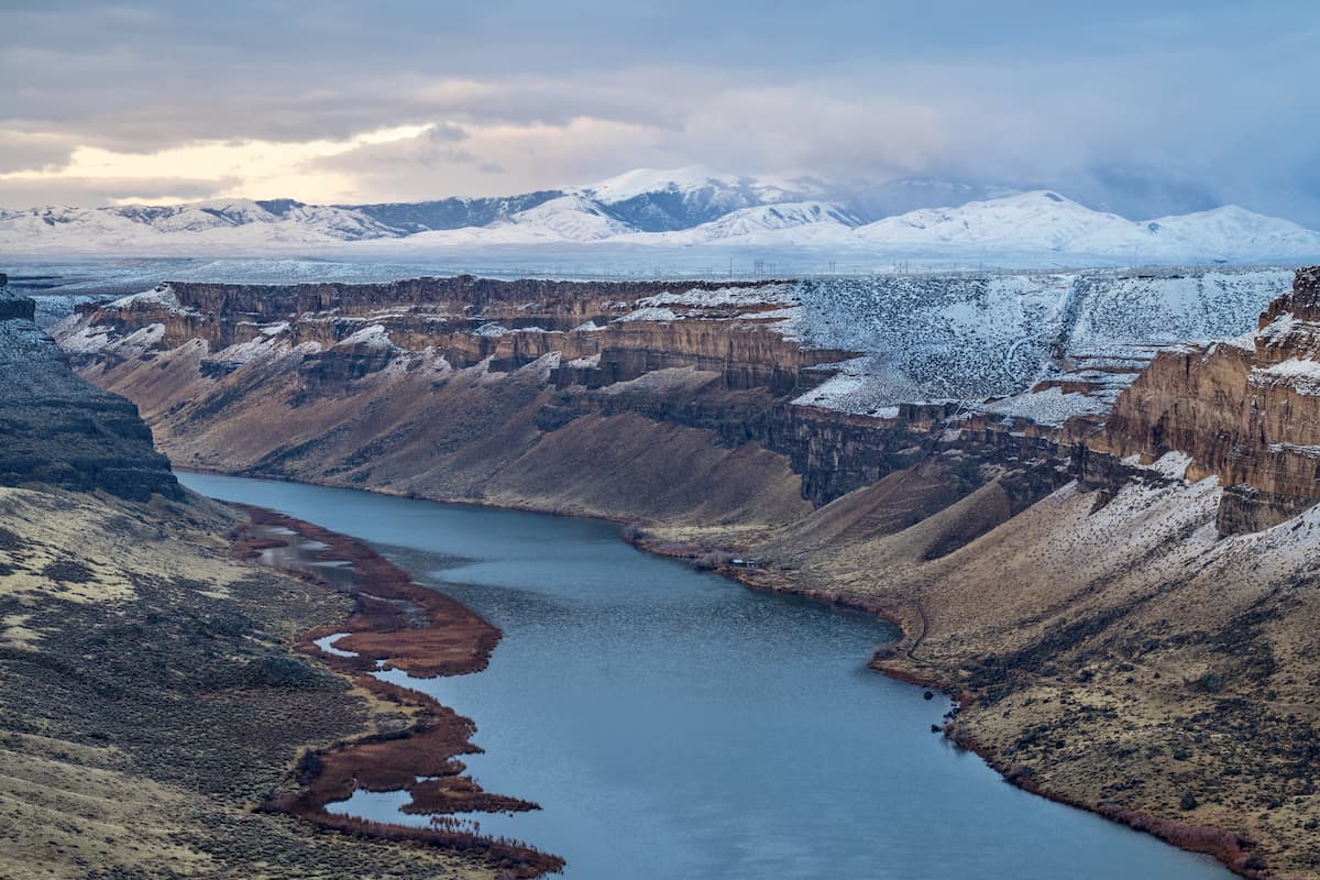
The Morley Nelson Snake River Birds of Prey National Conservation Area is located in southern Idaho in the United States. The conservation area was established due to the region having one of the highest populations of raptors; also known as birds of prey. The Conservation Area covers a region spanning 484,873 acres. There are 20 named mountains in Morley Nelson Snake River Birds of Prey National Conservation Area. BigFoot Butte is the highest point. The most prominent mountain is Guffey Butte.
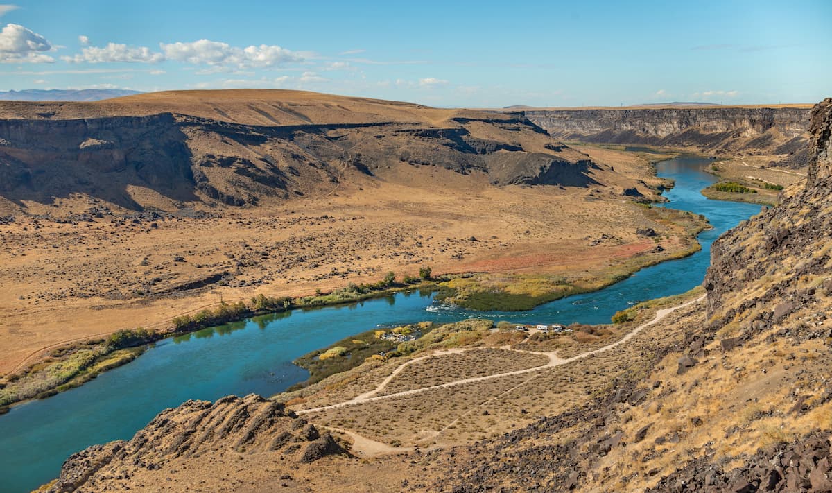
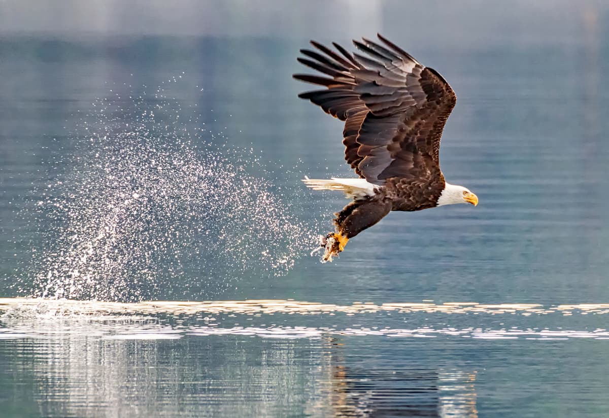
This Conservation Area was named after Morley Nelson who was an expert on birds of prey. His work heavily influenced the establishment of this area back in 1993. The region was shaped by the Bonneville Flood which occurred about 14,000 years ago. Today visitors can see the remnants of this massive flood through large boulders and the deep canyons that now house the Snake River. After the flood, the soil and geological features left behind were rich with nutrients for small prey. This led to the influx of raptors with over 700 pairs across 15 species. Another nine species utilize this region for seasonal hunting during migration. North America’s only indigenous falcon is the prairie falcon which flourishes in this region. Many of the birds of prey call this place home due to the dense population of squirrels, jackrabbits, and badgers.
The region has a rich history with some of the oldest Native American artifacts in the entire state of Idaho being found here. Within the Morley Nelson Snake River Birds of Prey National Conservation Area are three sites of the Oregon National Historic Trail from the gold mining rush back in the mid 1800’s. Nowadays, the protected area is home to some of the most magnificent views of the snake river and of course, an abundance of raptors seen throughout the year.
Halverson Lake Trail: This hike is one of the most popular in the region. The 3.8-mile loop has 167 feet of elevation gain while taking hikers through a variety of landscapes. The trail follows along the Snake River before making a loop to Halverson Lake. Pass through massive boulders and wild grass while the canyon walls rise on either side. The lake itself is unique for its curving two miles of sandbar along the Snake River. Above the sand dunes lie the two small lakes with most of the water being supplied from the upland plateaus.
River Canyon Trail: This 10.6-mile hike has 420 feet of elevation gain and follows along the Snake River. The trail winds through the boulder fields with buttes towering above along the way. A rock shelter signifies the land having been used during the gold rush over 150 years ago. Watch fish jumping out of the river as the raptors swoop overhead.
Dedication Point and Swan River Lookout: A short 0.5-mile trail brings hikers to Dedication Point towering above the Snake River below. Take in the exception and unobstructed views, or continue on to Swan River Overlook to see even more views of the canyon and river below for a total of 3 miles.
Boise, Idaho lies just 45 minutes north of the Morley Nelson Snake River Birds of Prey National Conservation Area. The city is the capital of the state of Idaho and the most populous city in the state. Situated on the Boise River, the city is 41 miles east of the Oregon border and 110 miles north of the Nevada border. The Boise metropolitan area contains the state’s three most populous cities; Boise, Nampa, and Meridian with a total population of 710,000. The city is known as “The City of Trees” and the downtown area is full of shops and local dining options. The town is home to numerous recreational opportunities which include hiking and biking. Boise is also home to the Boise River Greenbelt which is an extensive urban trail system along the Boise River.

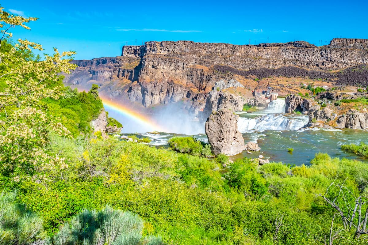
Just two hours southeast lies the city of Twin Falls, Idaho. Located in southern Idaho, Twin Falls has a population of approximately 50,000 people making it the largest city in a 100-mile radius. The city is on the southern rim of the Snake River Canyon. It is also where, in 1974, Evel Knievel attempted to jump across the canyon. Sitting on the Snake River, there are three prominent waterfalls near the city. Most notable is Shoshone Falls which stands at 213 feet. The canyonlands and river are full of hiking, mountain biking, and ATV trails.


The highest peak in Morley Nelson Snake River Birds of Prey National Conservation Area is Big Foot Butte, at 1,078 m.
Notable peaks in Morley Nelson Snake River Birds of Prey National Conservation Area include Big Foot Butte, Christmas Mountain, Cinder Cone Butte, Sinker Butte and Wind Butte.


