Scan the QR code and open PeakVisor on your phone
With over 2 million acres (800,000 ha) of land covering 10 mountain ranges and 115 named peaks, the Sawtooth National Forest is an epic hiking destination located in the south-central part of the US state of Idaho. The tallest and most prominent peak in the national forest is Hyndman Peak (12,008 ft/3,660 m).
The Sawtooth National Forest covers a massive area in the mountainous heart of south-central Idaho. It’s part of the largest contiguous tract of national forest land in the lower 48 US states, a 30 million-acre (12 million ha) area of federally protected land that covers over 60 percent of Idaho.
The Sawtooth National Forest sits between the Boise and Salmon-Challis national forests, with several smaller non-contiguous sections along the Utah/Idaho border about 100 miles south of the main forest area. About 4 percent of the Sawtooth National Forest is located in northern Utah.
The national forest covers a total area of 2,110,408 acres (854,052 ha) and includes the Sawtooth National Recreation Area, Sawtooth Wilderness, and two other wilderness areas, all of which are managed by the US Forest Service.
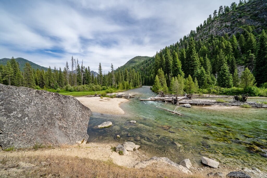
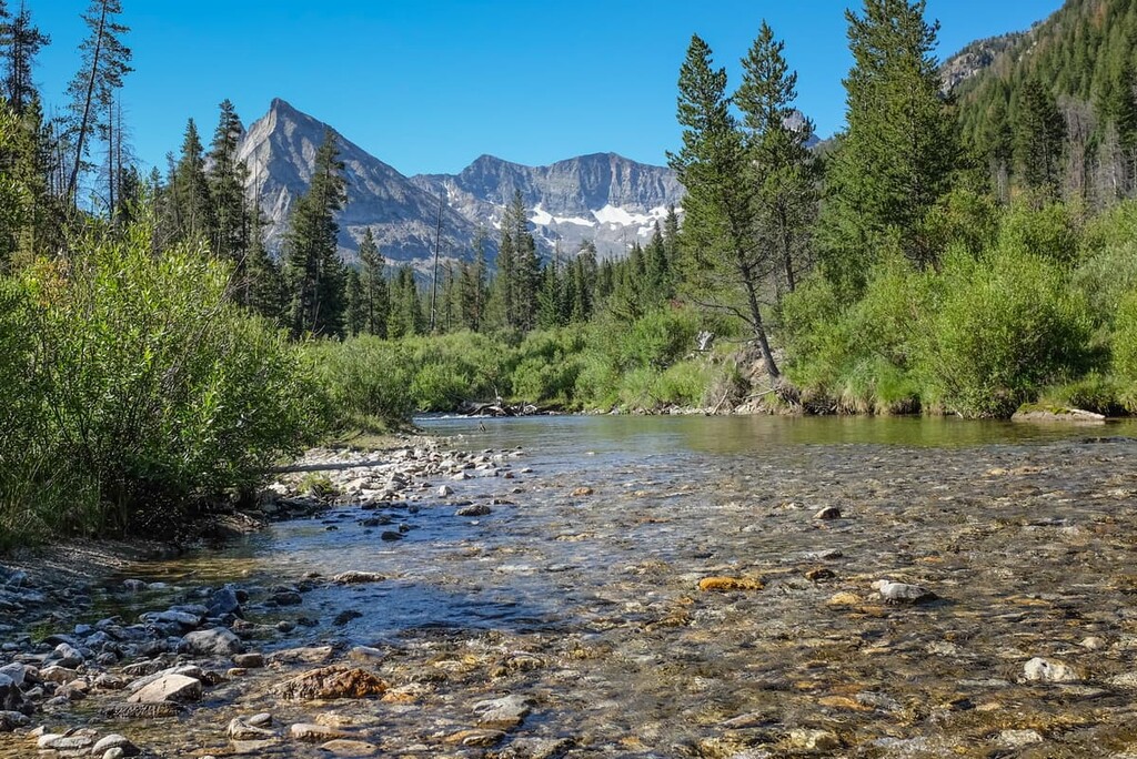
There are over 1,000 lakes, 3,500 miles (5,600 km) of rivers and streams, and 10 mountain ranges in the area. These include the Albion, Black Pine, Boulder, Pioneer, Raft River, Smoky, Soldier, Sublett, White Cloud ranges, and, of course, the Sawtooth Mountains.
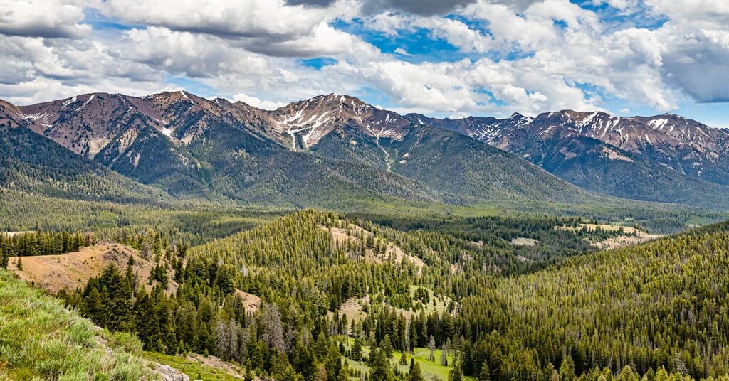
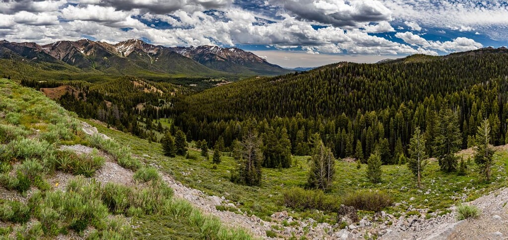
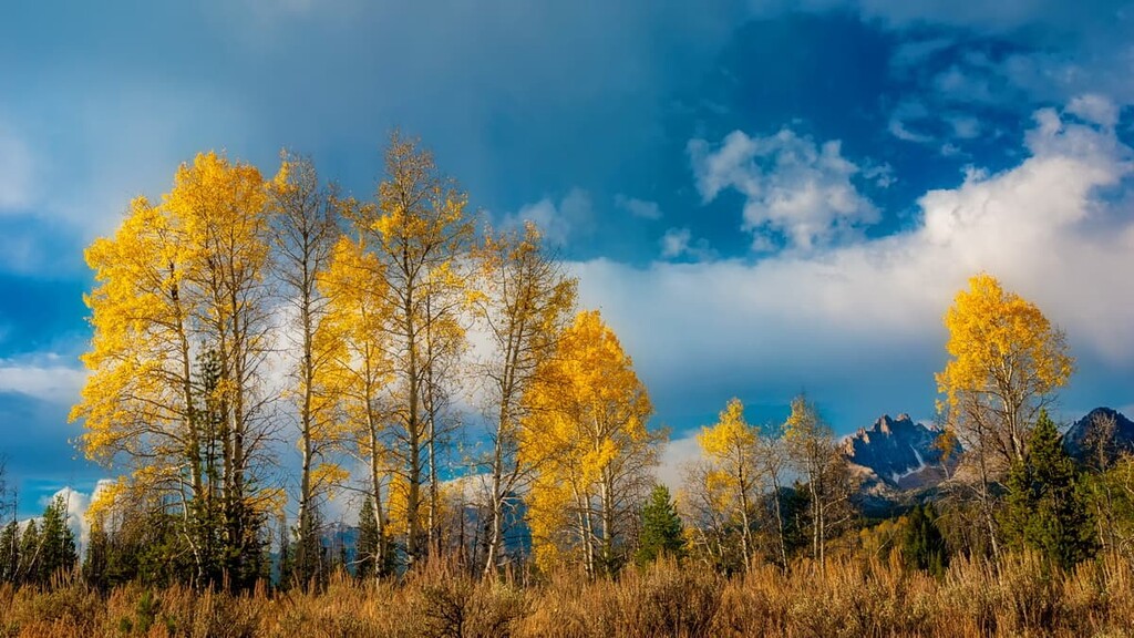
The national forest is mostly mountainous terrain, with areas of spruce-fir forests, alpine tundra, and sagebrush steppe. In the springtime, hundreds of wildflowers bloom on the mountain slopes, some of which are unique species only found in the area.
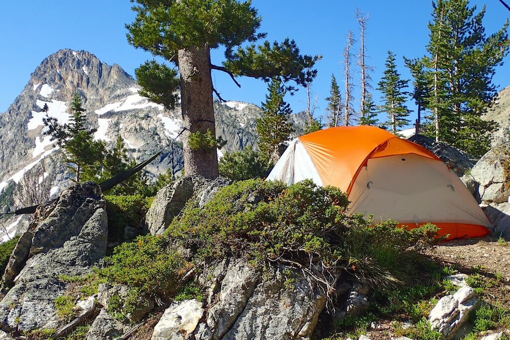
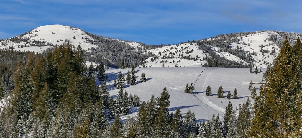
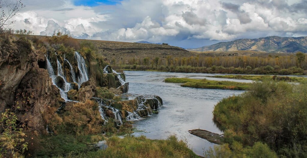
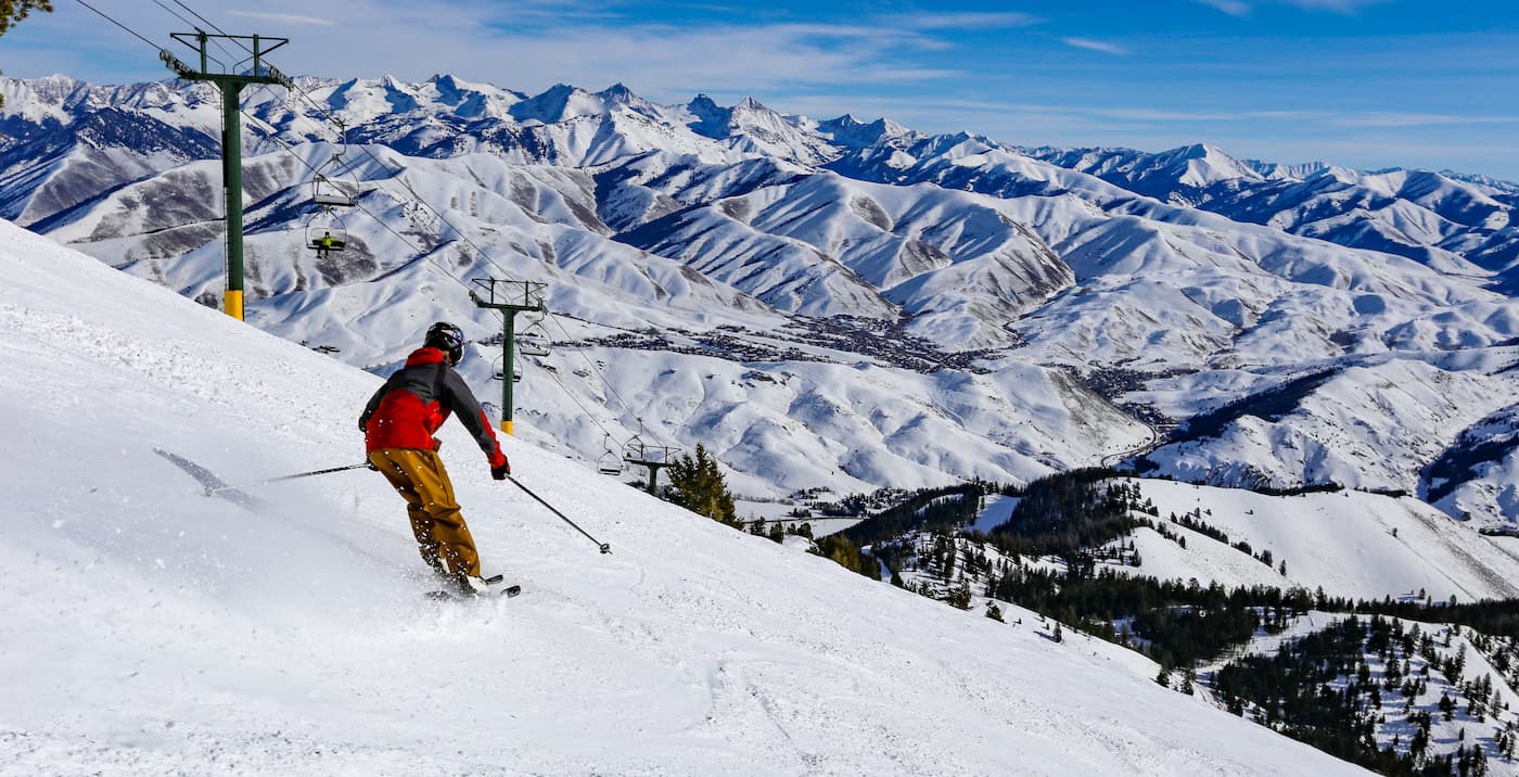
The Sawtooth National Forest is a major year-round destination for hikers, campers, skiers, and outdoor enthusiasts of all stripes. There are four ski areas, 81 campgrounds, and over 1,000 miles (1,600 km) of off-road trails for hiking, mountain biking, and all-terrain vehicles in the national forest. Whitewater rafting, fishing, and hunting are also popular activities.
Situated in the heart of the mountain west, the Sawtooth National Forest is surrounded by other hiking opportunities. The Frank Church River of No Return Wilderness, the Selway-Bitterroot Wilderness, and the broader Salmon-Challis National Forest are all located nearby.
The Sawtooth National Forest and its varying mountain ranges have different geological origins. The Minidoka District, the area of the national forest close to the Utah border, is part of the Basin and Range Province that covers much of the US southwest. Most of the mountain features in the region, however, are part of the Idaho batholith and the broader Rocky Mountains.
The Idaho batholith is a 200-mile-long (320 km) segment of intrusive igneous rock that formed between 110 and 45 million years ago. This massive lobe of cooled magma formed plutons of granite and granodiorite which were pushed to the surface over millions of years, producing the towering granite spires we see in the Sawtooths today.
The northern Sawtooths are underlain by the Sawtooth Batholith, a younger section of orthoclase granite that’s known for its sparkling pink feldspar. Thompson Peak, the highest point in the Sawtooth Range, is formed by metamorphic rock that may be over 1 billion years old.
The Soldier Mountains and the White Cloud Mountains are underlain by various other formations of the Idaho Batholith. Portions of the Smoky and Boulder ranges are made up of Challis Volcanics, lava rock from volcanic eruptions that covered much of central Idaho about 50 million years ago.
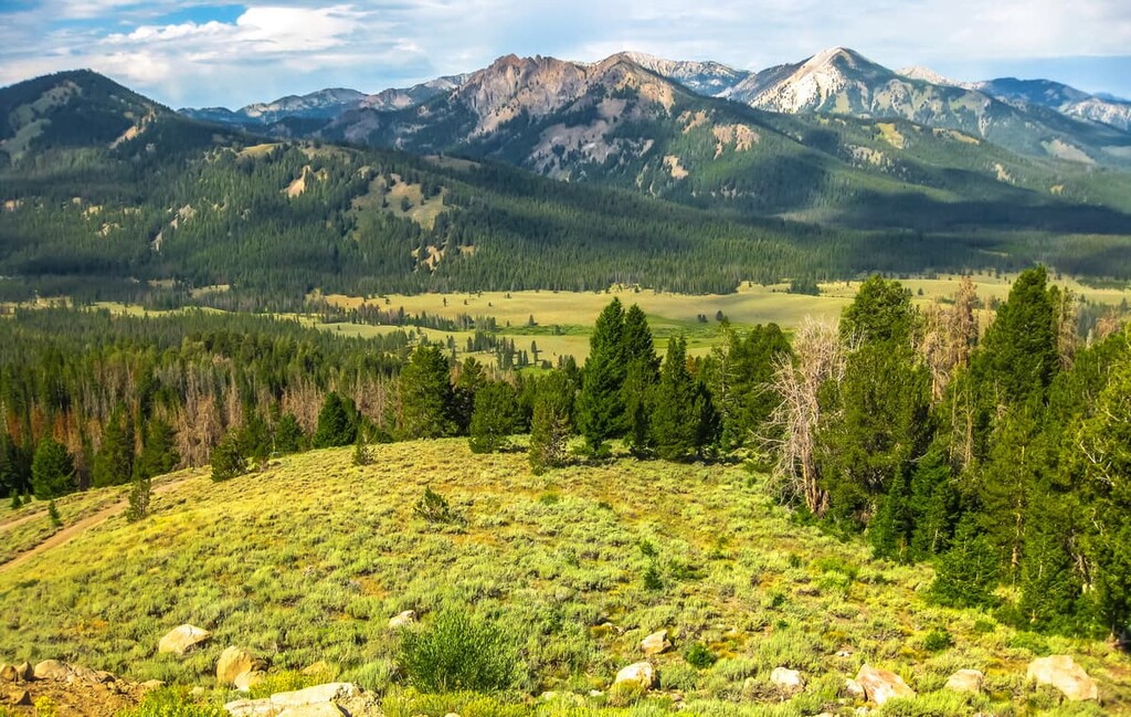
In general, the Rocky Mountain portions of Sawtooth National Forest feature jagged, dramatic mountains, while the ranges to the south in the Minidoka district are smoother and more rolling. Many of these dramatic features were carved by alpine glaciers.
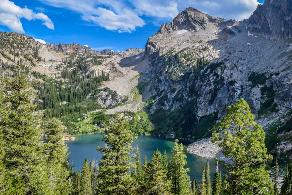
The Sawtooth, Boulder, and White Cloud ranges in particular show extensive evidence of glaciation, including glacially carved lakes, hanging valleys, cirques, and arêtes. While none of these glaciers remain, there are over 200 perennial snow fields in the Sawtooths today.
One of the most unique geological features in the area is the Sawtooth Fault, a 40 mile (65 km) fault that runs along the base of the Sawtooth Range. Scientists believe the fault, which was first identified in 2010, could be capable of producing earthquakes of up magnitude 7.5. The most recent earthquake in the area was a magnitude (mww) 6.5 quake in March of 2020.
The Sawtooth National Forest is covered in a diverse landscape of wetlands, scrub brush, grasslands, mountain forests, and high alpine plant communities. About 50 percent of the area is forested.
High elevation forests in the area support Engelmann spruce, limber pine, subalpine fir, and significant communities of endangered whitebark pine, including the largest individual whitebark pine tree in North America. Some of the pines here are up to 1,000 years old.
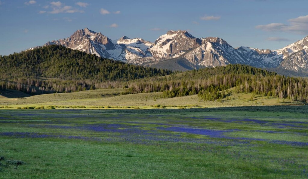
Above the treeline, there are many low-lying plants like grasses, sedges, mosses, and lichens. The Sawtooths are also known for their gorgeous wildflower displays. Alpine laurel, mountain heather, cushion phlox, penstemon, and various other wildflowers cover the hillsides in late spring. Some of these plants, like Christ’s Indian paintbrush and Davis’ spring parsley, are only found in and around Sawtooth National Forest.
In terms of animal life, the national forest is home to many of the most famous animals in the mountain west, including mountain goats, bighorn sheep, elk, mule deer, black bears, mountain lions, and wolves.
There are 30 species of reptiles and amphibians, 80 species of mammals, and over 200 types of birds in Sawtooth National Forest. Some of these are threatened species like Canada lynx, wolverines, gray wolves, sockeye salmon, and the greater sage-grouse. Wolves were reintroduced to the area in the 1990s.
People have lived in the area of what’s now the Sawtooth National Forest for thousands of years. The oldest evidence of human habitation in the area comes from spear points found to be 12,000 years old. There are over 1,500 national heritage sites in the national forest.
Prior to European contact, the most prominent groups in the area were the Shoshone- Bannock Tribes, and Northern Paiute. They spoke different dialects of the central Numic branch of the Uto-Aztecan language family and traditionally lived primarily in semi-nomadic groups, hunting, fishing, and traveling across their lands.
Europeans and European-descended Americans began arriving in what’s today known as the Sawtooth National Forest in the early 1800s. By the 1850s, immigrants were passing through the region on the Oregon and California trails. Most of the early settlers were occupied with fur trapping or cattle ranching.
Beginning in the 1860s, gold, silver, lead, and zinc were found in the area, leading to a mining boom that peaked in the 1880s. For most of the 1900s, cattle and sheep herding were major occupations in the area.
The original herders in the Sawtooth National Forest were Basque immigrants, who brought their sheepherding traditions to the US mountain west beginning in the mid-1800s. There’s still a large Basque community in Boise, Idaho, although many of the herders guarding sheep in the Sawtooths today are migrant workers from Peru and other Latin American countries.
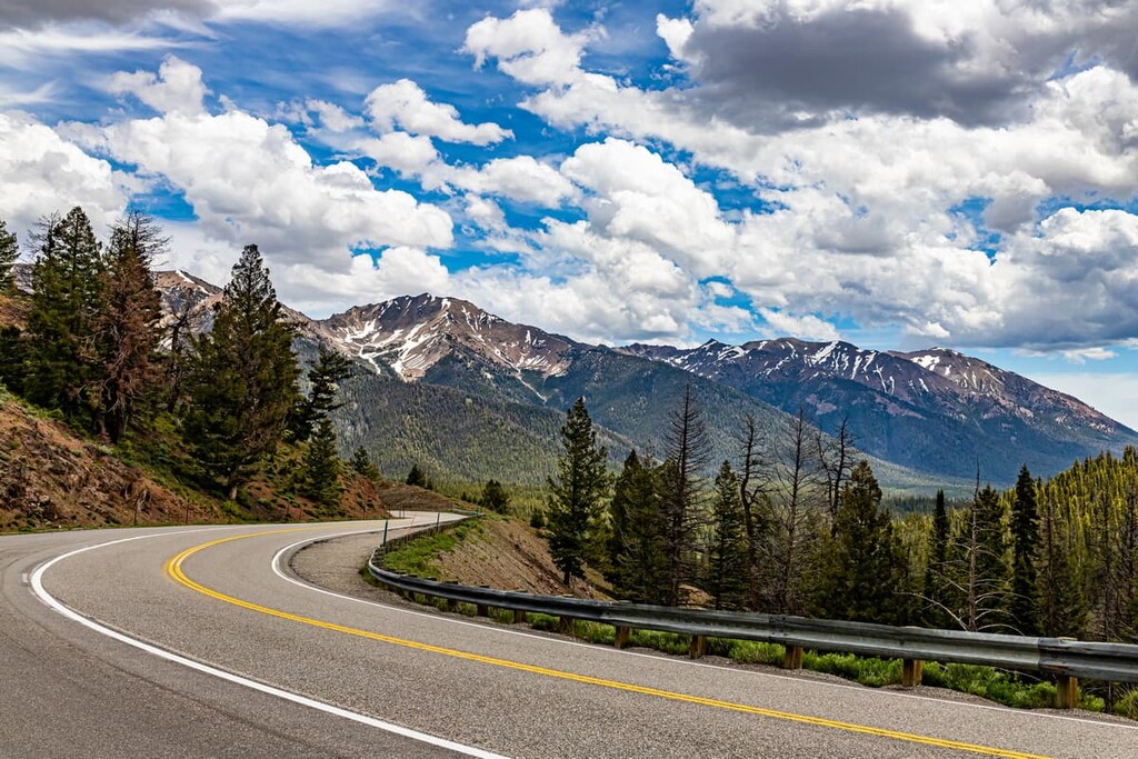
The Sawtooth National Forest was first preserved by a presidential proclamation issued by President Teddy Roosevelt in 1905. In the 1920s, State Highway 75 was built, linking the towns of Shoshone and Challis and allowing access to the Sawtooth Wilderness Area. The Union Pacific Railroad also brought more people to the area, particularly to the town of Ketchum.
When Sun Valley and Bald Mountain ski resorts were developed in the 1930s, the Sawtooth National Forest saw an influx of new visitors interested in winter sports and recreation, including Ernest Hemingway. The author lived in Ketchum for the last few years of his life and is buried in the Ketchum cemetery.
The premier hiking destination in the Sawtooth National Forest is the Sawtooth National Recreation Area (Sawtooth NRA), but with 2 million-plus acres, there are practically limitless hiking opportunities in the broader Sawtooth National Forest.
Each region has its own unique draws. The Sawtooth NRA offers beautiful alpine lakes and long-distance hikes, Ketchum is home to the tallest peaks in the area and unparalleled resort and backcountry skiing. The Fairfield and Minidoka districts have big mountain hikes, extensive jeep trails, and hot springs like the northern districts, but with far fewer crowds.
The Sawtooth NRA features over 700 miles (1,125 km) of trails, 40 peaks over 10,000 ft (3,048 m), and more than 300 high-elevation alpine lakes. The scenery in the area, from the sparkling lakes to the towering granite peaks, is spectacular.
Within the borders of the recreation area, there are three designated wilderness areas: the Sawtooth Wilderness, Cecil D. Andrus-White Clouds Wilderness, and the Hemingway-Boulders Wilderness.
This loop trail takes you through some of the most classic Sawtooth scenery without the crowds you’ll find at some of the easier-to-access destinations. You’ll see crystal clear alpine lakes, waterfalls, and soaring cathedral peaks on this hike.
Distance and elevation will vary depending on which, if any, side trips you decide to take along the way. There are side trails to the top of Observation Peak and short detours to Everly and Plummer Lakes.
Most hikers start at the Grandjean Campground, where you’ll need to pick up a self-issued wilderness permit.
There are lots of fantastic options for challenging day hikes in the Sawtooth NRA, but this is one of the most popular. The trail climbs steadily from the Iron Creek Trailhead to Sawtooth Lake, which offers a beautiful location for camping and fishing (you’ll need a permit to fish in the lake, though).
From Sawtooth Lake, you can continue up Alpine Peak for even more beautiful views of the lake and surrounding area.
The Fairfield Ranger District, located south of the Sawtooth Wilderness in the southwestern corner of the main national forest, is home to numerous hot springs, 12 campgrounds, and 400 miles (645 km) of trails and backcountry roads.
There are four peaks in the district over 10,000 ft (3,048 m): Baker Peak, Big Peak, Two Point Mountain, and Smoky Dome.
This trail is open to hikers, horseback riders, and mountain bikers. The trailhead is located at Canyon Transfer Camp half a mile (0.8 km) north of Big Smoky Guard Station.
There’s plenty of backcountry camping options along this trail, as well as a natural hot spring (Skillern Hot Springs at 2.5 miles (4 km) up the trail) and side trail access to Big Peak. Be prepared for challenging creek crossing in the spring and summer.
If you want to visit a hot spring with minimal hiking, Worswick Hot Springs off Forest Service Road 227 is a good choice. It’s a short walk to the hot springs, although you can continue upstream about a quarter-mile (0.4 km) for hotter pools.
The Ketchum Ranger District features endless backcountry skiing, off-road driving, and hiking opportunities in the tallest mountains in the Sawtooth National Forest.
This area is centered around the resort town of Ketchum and the Sun Valley ski area, so it’s a major tourist destination.
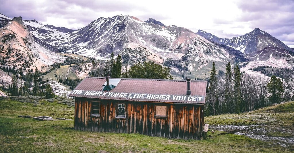
This is one of the most popular trails in the Ketchum area and all of the Sawtooth National Forest. It climbs steeply via 23 switchbacks to a historic cabin built in 1938. Views from the top are spectacular, especially when the wildflowers are in bloom in late spring.
This is a tough trek, but it takes you to the top of the highest peak in the Sawtooth National Forest for stunning views of the Boulder and Pioneer mountains.
While Hyndman is the tallest peak in the area, it’s the shortest and least challenging of Idaho’s 9 peaks over 12,000 ft (3,658 m), so it gets extra attention from hikers. There’s a peak-bagging challenge for anyone who wants to climb Idaho’s 12ers.
The Minidoka Ranger District lies south of the main part of the national forest area. It’s separated into five non-contiguous areas: the Cassia, Albion, Sublett, Raft River, and Black Pine divisions. The highest peak in the area is Cache Peak in the Albion district at 10,339 ft (3,151 m).
The highest peak in the Minidoka District can be accessed via Forest Service Road 562. This is a long drive on rough forest roads to reach the trailhead, but once you’re there, it’s a relatively short hike to the peak, with less elevation gain than other hikes in the national forest.
South of Twin Falls off Rock Creek Road, the Rim View Trail travels through high desert and pine forest for beautiful views over Rock Creek Canyon.
This trail has very little elevation gain, so it’s a great choice if you’re looking for a more moderate hike. There are two stream crossings, but they’re usually easy to cross after the spring melt waters have receded.
Looking for a place to stay near the Sawtooth National Forest? Here are some of the best cities and towns to check out:
The resort towns of Ketchum and Sun Valley are located right in the heart of the Sawtooth National Forest, so they’re a great base for exploring the area. They’re also a major draw unto themselves, with high-end amenities like hotels, golf courses, fine dining, and one of the premier ski resorts in Idaho.
Ketchum and Sun Valley also have excellent backcountry skiing, hiking, and extensive mountain biking paths leading out from town. Whether you’re looking to hit the spa or the trail, there’s something for everyone in these amazing mountain towns.
Boise is Idaho’s capital and largest city, with nearly 230,00 residents. It also has Idaho’s largest airport and the only international airport in the state, so there’s a good chance you’ll be passing through Boise on your way to the Sawtooth National Forest.
While the city is about 3 hours away from the national forest, it’s a good place to stock up for any hiking trips, and it’s a worthy destination in its own right. Downtown Boise has shops, restaurants, and the Greenbelt, which is an extensive network of urban trails along the Boise River.

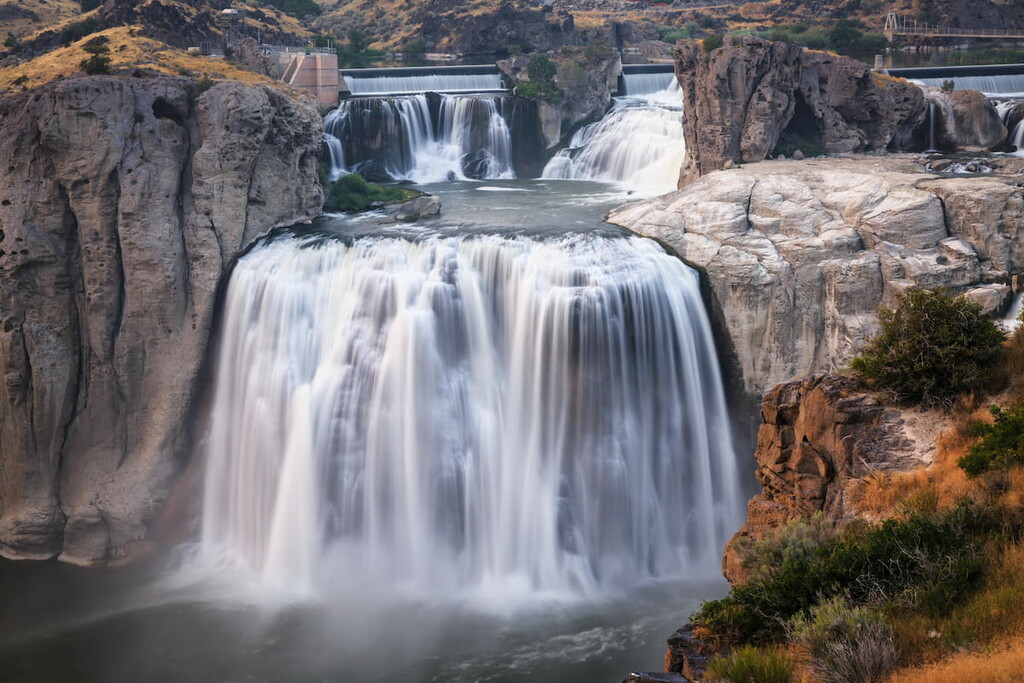
Twin Falls is the closest major town to the southern Minidoka district of the Sawtooth National Forest. Home to about 45,000 people, the town features a thriving, recently revitalized downtown and lots of attractions for visitors.
In addition to the shops, restaurants, and breweries downtown, Twin Falls is located near the Snake River Canyon, a major draw in the area. There are zip lines, rock climbing, scenic trails along the cliffs, and Shoshone Falls, a 200 ft (60 m) waterfall.