
Scan the QR code and open PeakVisor on your phone
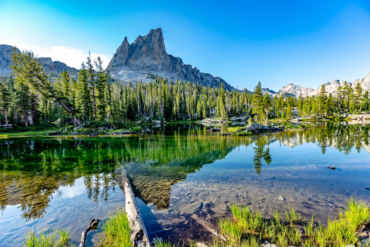
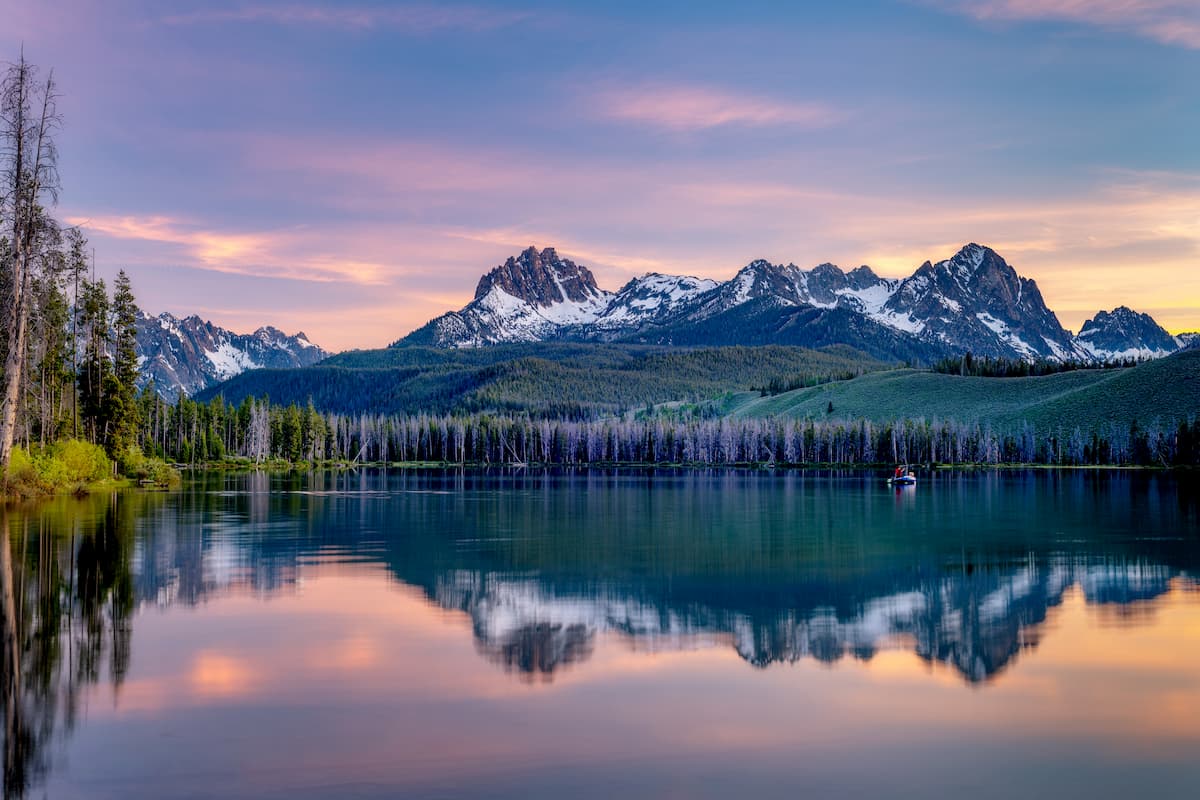
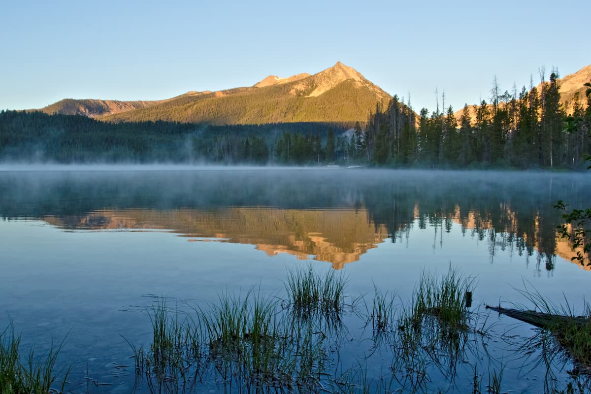
Decidedly beautiful, the rugged Sawtooth Wilderness is a federally-protected area with stunning mountain views that’s located in the central part of the US state of Idaho. The wilderness contains 67 named mountains, the highest and most prominent of which is Thompson Peak (10,748ft/3,276m).
The Sawtooth Wilderness Area is a magnificent and highly mountainous area of publicly-owned land within the central part of Idaho. It is included within parts of 4 different Idaho counties: Boise, Blaine, Elmore, and Custer.
As part of the United States’ National Wilderness Preservation System, the Sawtooth Wilderness is managed by the Sawtooth National Forest and it is also partly included within the Sawtooth National Recreation Area.
In total, the Sawtooth Wilderness encompasses some 217,088 acres (87,852 ha) of land. This makes it the fourth largest federally-managed wilderness in the state of Idaho, after the Frank Church-River of No Return Wilderness, the Selway-Bitterroot Wilderness (partly located in Montana), and the Owyhee River Wilderness.
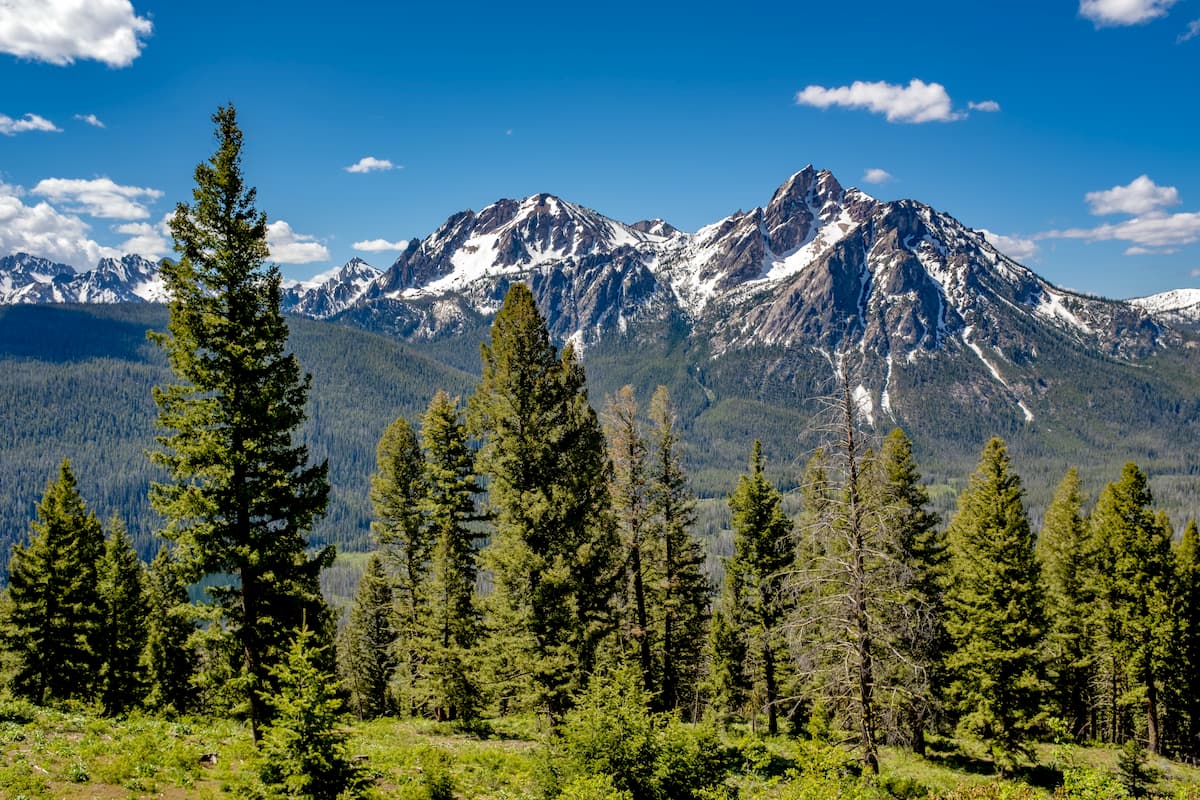
As the name suggests, the Sawtooth Wilderness is situated around the stunning Sawtooth Range of the Idaho-Bitterroot Rocky Mountains. The Sawtooth Range is a collection of 72 of the most jagged peaks in Idaho and it forms a natural border between the Boise National Forest to the west and the Sawtooth National Forest to the east.
Due to the wilderness’ location within the heart of some of the most mountainous terrain in Idaho, the wilderness is surrounded by other major areas of public land.
In particular, it is located to the west of the Hemingway-Boulders Wilderness Area, the Jim McClure-Jerry Peak Wilderness Area, and the White Clouds Wilderness Area and to the east of the Boise National Forest.
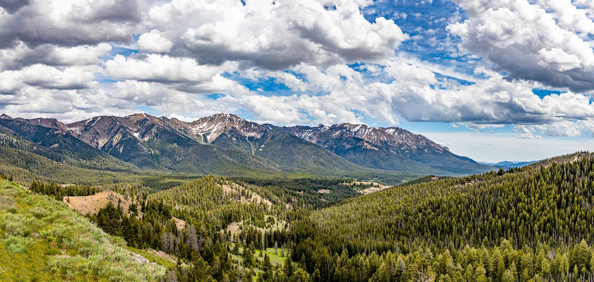
Moreover, the Sawtooth Wilderness is situated to the north of the rest of the Sawtooth National Forest and to the south of the Salmon-Challis National Forest and the Frank Church-River of No Return Wilderness.
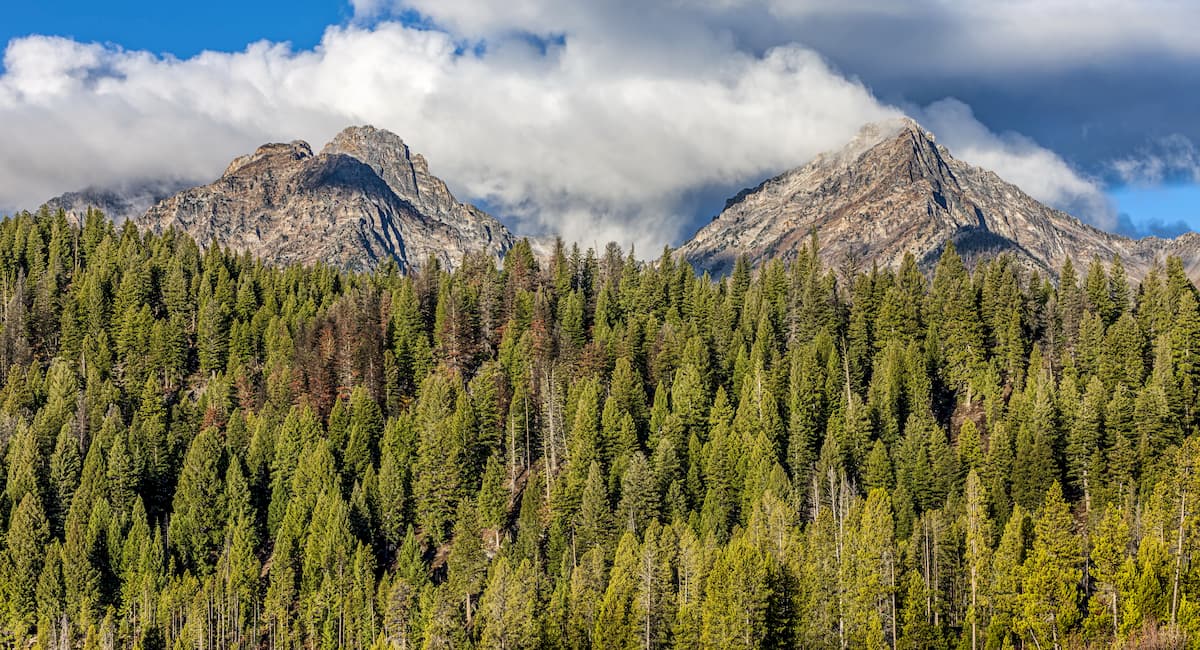
Geologically, the peaks within the Sawtooth Wilderness are part of the Sawtooth Range subrange of the greater Idaho-Bitterroot Rocky Mountains.
The range itself is underlaid by a massive pluton of granites and granodiorites called the Idaho Batholith, which covers much of central Idaho and the neighboring mountain systems. This batholith started to form during the Palogene some 145 to 43 million years ago as magma was pushed up toward the Earth’s surface as a result of a series of complex tectonic processes.
In particular, the Sawtooth Range is underlaid by a section of the Idaho Batholith known as the Sawtooth Batholith, which is slightly younger than its neighbors. This batholith is believed to have formed during the Eocene, about 55 to 33 million years ago.
One of the key differentiations between the rocks within the Sawtooth Range and those of other nearby chains, however, is that the Sawtooths are home to large quantities of orthoclase granites, which appear pink due to the high concentration of feldspar in the rock. This pink color exists in direct contrast to the whitish hues of granodiorite, which is more commonly found in neighboring ranges.
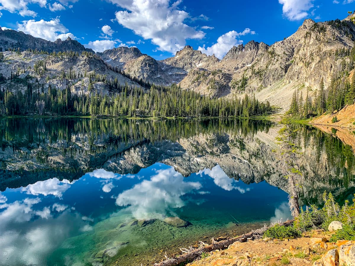
Moreover, the Sawtooth Range and, by extension, the Sawtooth Wilderness, owes much of its current shape and form to the glaciers that once blanket the region. During the Pleistocene, the range was heavily glaciated and these glaciers helped to carve out the many cirques and U-shaped valleys that we see in the mountains today.
It’s also worth mentioning that the Sawtooth Wilderness is a potentially seismically active location.
In fact, in 2010, a group of scientists at Idaho State University extensively mapped a massive fault line (called the Sawtooth Fault) that runs through the base of the Sawtooth Range for about 40 miles (64.4km). Although more research is needed, the scientists believe that the region is prone to some fairly sizable earthquakes, including those that could hit as high as a 7.5 on the moment magnitude scale.
Major peaks in the wilderness include Thompson Peak, Decker Peak, Mount Cramer, Snowyside Peak, Elk Peak, Mount Regan, and Horstmann Peak.
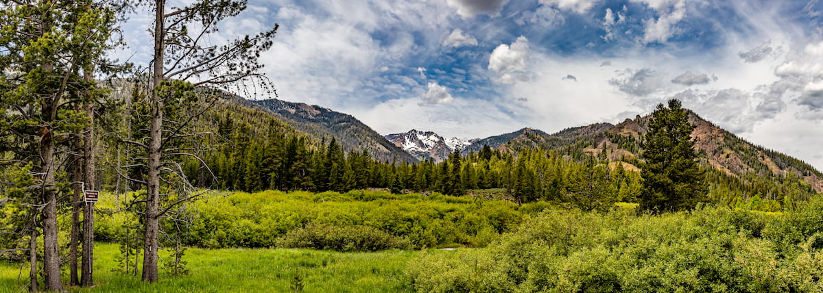
Despite the ruggedness of the terrain, the Sawtooth Wilderness is home to a fantastic diversity of flora and fauna.
Like the rest of the Idaho Batholith ecoregion, the Sawtooth Wilderness is heavily forested. In particular, forest communities within the wilderness are dominated by stands of lodgepole pine, Engelmann spruce, limber pine, subalpine fir, Douglas fir, whitebark pine, and quaking aspen.
At the highest elevations, the wilderness also contains large sections of alpine tundra, which boasts stunning wildflowers during the summer months. These alpine regions are also home to around 400 lakes, which provide important habitat for the region’s aquatic life.
Wildlife is also particularly abundant in the Sawtooth Wilderness. Major species found in the region include black bears, mountain goats, elk, moose, mule deer, lynx, wolverines, and grey wolves.
The region is also home to an abundance of fish species, which inhabit its many lakes, rivers, and smaller waterways. Some of the many fish found in the Sawtooth Wilderness include rainbow trout, bull trout, lake trout, westslope cutthroat trout, sockeye salmon, chinook salmon, and brook trout, though the latter is not native to the region.
The land in and around the Sawtooth wilderness has long been home to humans. Many people consider the region to be part of their traditional territory and ancestral homelands, including the Shoshone-Bannock Tribes and the Eastern Shoshone Tribe.
Some of the earliest people of European descent to visit the region were probably fur trappers that came in the early 1800s. However, when compared to some of the other mountain ranges to the north, the region wasn’t as heavily visited by the fur trappers as there was a relative lack of beavers in the area.
That being said, it’s believed that Alexander Ross, a prominent Canadian fur trader, traveled through the Sawtooth Valley to the northeast of the current wilderness boundary in the 1820s. Ross was in search of pelts, of course, and he led a large group of trappers from the Hudson’s Bay company through the valley, even crossing Galena Summit during their travels.
Formal settlement of the region by immigrants from the United States began in earnest toward the latter half of the 19th century, particularly after the discovery of precious metals and minerals in the area. In particular, mining in the area led to the establishment of the town of Ketchum (then named Leadville) in the 1880s, which served as an important smelting center for the mining industry.
Although mining in the area eventually declined by the end of the 19th century, the Sawtooth Range, Boulder Mountains, and Pioneer Mountains soon became important grazing areas for local shepherds during the summer months. In fact, the town of Ketchum, which is just outside the wilderness’ current boundaries, was one of the largest sheep raising centers in the country during its heyday in the early part of the 20th century.
During the 1920s, a road (now Idaho State Highway 75), was also established in the region, connecting the towns of Shoshone and Challis, while also providing access to the current Sawtooth National Recreation Area and the Sawtooth Wilderness. This road actually mostly follows the route that Alexander Ross took during his travels in the early 1800s.
The establishment of the Union Pacific Railroad around this time (which connected Ketchum to the main line near the town of Shoshone) also became a driving force behind development in the region. Indeed, the Union Pacific Railroad became a major player in the development of the area, marketing the town of Ketchum and nearby Sun Valley as ideal tourist destinations, drawing big names, like Ernest Hemingway, to the region.
Moreover, the early part of the 20th century also saw some of the earliest concerted efforts to conserve the natural landscape in central Idaho. The Sawtooth Forest Reserve was first established in 1905 by President Theodore Roosevelt. A few years later, this reserve was expanded and officially designated as a national forest, alongside the Salmon-Challis and Boise national forests.
Interestingly, in 1936, legislation was introduced in the US Senate to create a national park in the Sawtooth Range. The bill was ultimately rejected, but just one year later, the US Forest Service created the Sawtooth Primitive Area in the range, instead.
In 1971, the Sawtooth National Recreation Area was officially established by Public Law 92-400 and this same law also renamed the Sawtooth Primitive ARea as the Sawtooth Wilderness.
These days, the Sawtooth Wilderness remains a premier destination for outdoor recreation in central Idaho. The rugged peaks and alpine lakes that dot the region make it an excellent place to visit if you’re looking for solitude and beauty in the mountains.
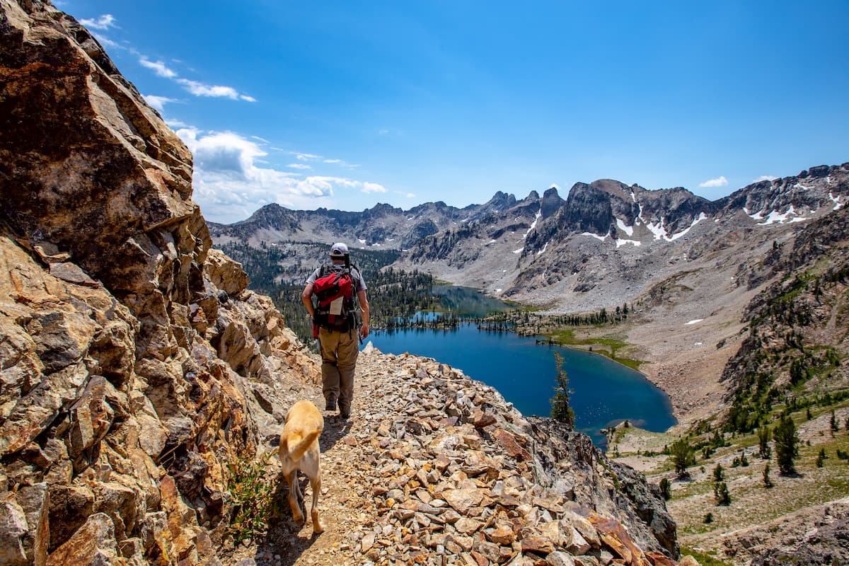
The Sawtooth Wilderness boasts 17 different trailheads that lead to hundreds of miles of trails, as well as countless opportunities for off-trail adventure. That being said, many of the more remote areas of the wilderness are particularly rugged, so competence with navigation and outdoor skills are a must for all visitors.
With that in mind, here are some of the best places to check out in the Sawtooth Wilderness:
The Alpine Way Trail is a very popular 17.2 mile (27.7km) thru-hike that traverses the Sawtooth Wilderness. Although one can hike the trail from the Stanley Lake Parking area all the way to the parking lot on Highway 75 near Stanley, the Alpine Way Trail is most commonly used to access scenic areas, such as those at Alpine Lake and Goat Lake.
Throughout this hike, visitors get a chance to venture deep into the Sawtooth Wilderness. The hike also provides a number of great opportunities for anyone looking for some spectacular views as it climbs a ridge with excellent panoramic vistas of the surrounding region.
The Sawtooth Wilderness Loop (also called the Grand Sawtooth Loop) is a 60 to 70 mile (96.6 to 112.7km) backpacking trail that takes hikers through the backcountry of the Sawtooth Wilderness, with plenty of options for side adventures.
Most hikers start the loop at the Grandjean Campground, climbing steadily until reaching a number of alpine lakes. The rest of the trail is well-marked and fairly straightforward, giving hikers a chance to see some of the most beautiful lakes in the wilderness.
If you’re looking for more of a challenge, you can also take a slight detour up to the summit of Observation Peak along the way or you can go check out Plummer and Everly Lakes if you’re in search of some new fishing opportunities.
One of the most popular trails in the Sawtooth Wilderness, the Alice-Toxaway Loop is a 19 mile (30.6km) long backpacking adventure that gives you a chance to check out some truly alpine terrain.
Many backpackers choose to begin this adventure at the Tin-Cup Trailhead near Pettit Lake. hikers can choose to follow the trail either clockwise or counterclockwise and get the same great experience either way. However, river crossings on the trail can be dangerous, so extra care is warranted, particularly in the early summer and spring.
For most of the Alice-Toxaway Loop, you’ll have plenty of camping options, thanks to the many lakes in the region. Alice Lake, Farley Lakes, Toxaway Lake, and Twin Lake all make for great camping spots. The trail also provides good vistas of the nearby White Clouds Wilderness when you reach the top of a pass near the northern slopes of Snowyside Peak.
The tallest peak in the Sawtooth Wilderness and in the Sawtooth Range, Thompson Peak is a popular choice among peak baggers in the area. However, there is no trail that leads directly to the top of the peak; rather, Thompson Peak is accessible by either a scramble or a technical rock climb.
Most climbers ascend Thompson Peak via one of four routes. Three of these routes - the Southwest Couloir, the West Crack, and the Northeast Face - all require technical rock climbing skills.
Meanwhile, the South Couloir, which is a class 3 scramble, is accessible from Redfish Lake via the Alpine Way Trail. This scramble does take some solid route finding abilities, however, and is best for experienced hikers.
On the lookout for a place to stay during your trip to the Sawtooth Wilderness? Here are some great cities to visit during your adventures:
Boise is the capital and largest city in the state of Idaho, with about 228,000 residents. The city is located about 3 hours away from the Sawtooth Wilderness and it is a major commercial and cultural center for the state.
Within Boise, you can find plenty of great restaurants, hotels, and parks, as well as the largest airport in Idaho. Boise is also relatively easy to get to by road, since it’s located right on I-84.

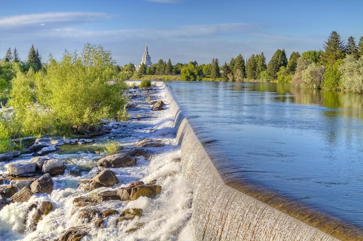
The largest city in Idaho outside of the Boise Area, Idaho Falls is home to about 60,000 residents who live just to the southeast of the Sawtooth Wilderness. Idaho Falls is a major hub for the eastern part of the state, providing essential transportation, medical, and commercial services for the region.
Additionally, Idaho Fall is the site of the second largest airport in the state, so it’s a great transportation link for anyone visiting the Sawtooth Wilderness.
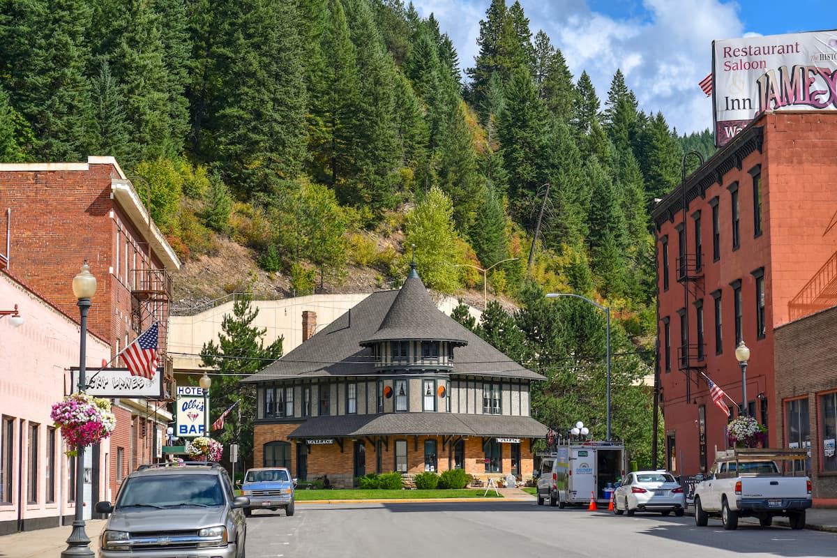
One of the largest cities near the Sawtooth Wilderness, the twin municipalities of Sun Valley and Ketchum are an excellent place to stay if you’re visiting the region.
Home to a total of about 4,000 residents, Sun Valley and Ketchum are perhaps best known for their outdoor recreation opportunities, especially during the winter months. Sun Valley is a world-class ski resort, so don’t forget to build in some for hitting the slopes if you’re visiting during the winter.

The city of Ontario, Oregon is located along the Idaho-Oregon border just to the west of the Sawtooth Wilderness. It is home to about 11,000 residents and it is situated along I-84, making it easily accessible by road. Since Ontario is about halfway between Salt Lake City, Utah and Portland, Oregon, it’s a nice place to stop if you’re traveling around the area by car.
However, Ontario is perhaps best known for its potato production (hundreds of millions of pounds are grown there annually). The city is also the birthplace of the tater tot, so it’s a must-visit if spuds are one of your favorite foods.


