Scan the QR code and open PeakVisor on your phone
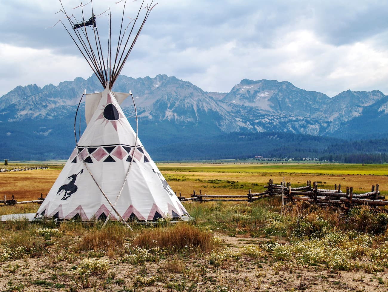
Custer County is located in central Idaho in the United States of America. The county covers 4,937 square miles across the state and is sparsely populated. Despite the large amount of land, only 4,400 people call Custer County home. Similar to many counties of the state, Custer was established back in the 1880s after the gold rush brought people to the region. Today the main industries include ranching, mining, and tourism.
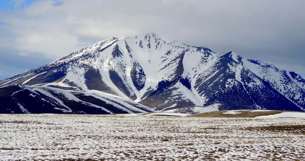
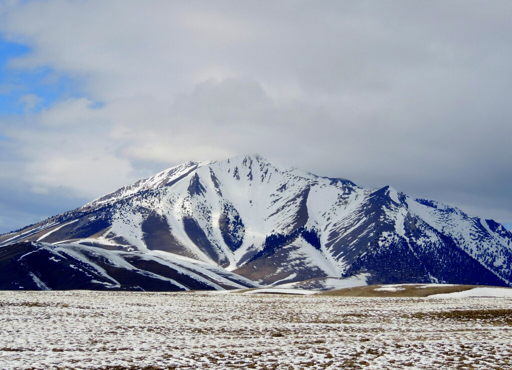
Custer County is the third largest county in the state of Idaho and home to some of the most rugged landscapes in the entire state. There are 181 named mountains in Custer County. The highest and the most prominent mountain is Borah Peak at 12,654 feet. Many of the tallest mountains within the county lie within the Lost River Range, Idaho’s tallest range. Not only is Borah Peak the tallest in the county, but it is also the tallest natural peak in the entire state.
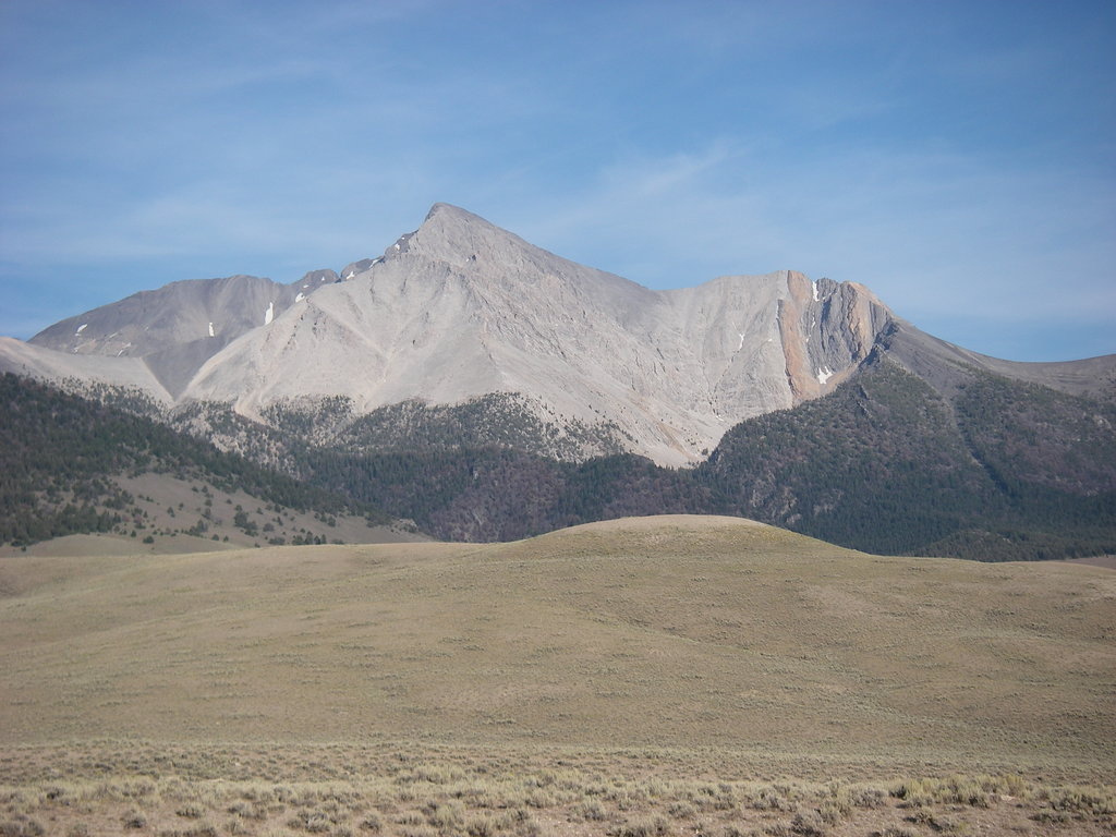
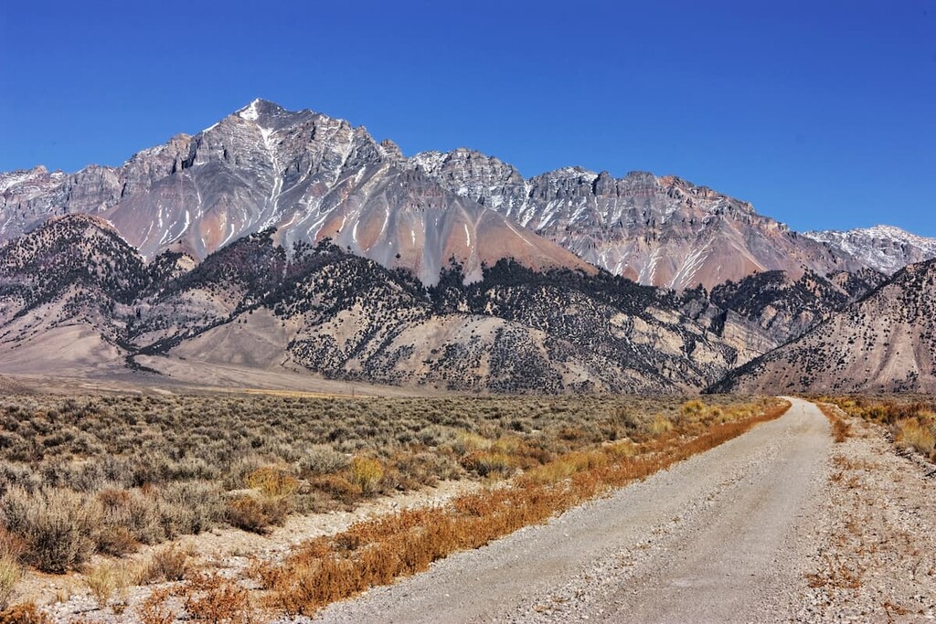
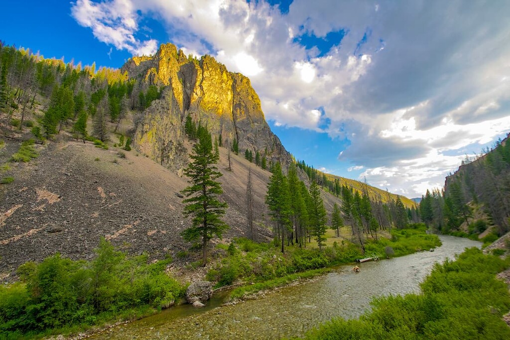
The Lost River Range runs along the eastern edge of the county while the iconic Sawtooth Range runs along the western border. While the Lost River Range has many peaks above 12,000 and 11,000 feet, the tallest mountain within the Sawtooth Range, within Custer County, is Thompson Peak at 10,748 feet. To the east of the county lies the White Cloud Mountains, with the tallest peak being Castle Peak. While rugged mountain ranges run throughout the region, Custer County is also home to the Salmon River and the Big Lost River, both which flow through it. Amidst the rugged peaks lie arid high desert, flat lush valleys, and rolling hills along the base of the many mountain ranges.
The seemingly small population of Custer is surrounded by mountain peaks and protection outdoor spaces. Within Custer County lie parts of the Challis National Forest, Sawtooth National Forest, and the Sawtooth National Recreation Area which also includes the Hemingway-Boulders Wilderness, and the Sawtooth Wilderness.
Frank Church River of No Return Wilderness: Much of the Frank Church River of No Return Wilderness lies within Custer County. The protected area spans 2.37 million acres and is the largest contiguous wilderness in the Lower 48 of the United States. The Challis National Forest is combined with the Salmon National Forest and together the two make up 39.59% of the wilderness. The wilderness represents the geography of Custer County with rugged crag mountains and steep canyons along the Salmon River. The sheer size of the wilderness provides seemingly endless backcountry hiking routes and an immense amount of wildlife. Within the wilderness are large populations of mountain lions, grey wolves, lynx, red fox, bighorn sheep, black bears, elk, moose, deer, and mountain goats. The remote nature of much of the land has allowed for the elusive wolverine population to thrive.
Sawtooth National Recreation Area: The Sawtooth National Recreation Area spans 730,864 acres across Idaho. The expansive Recreation Area, along with the Sawtooth Wilderness and the Hemingway-Boulders Wilderness, are known for some of the most beautiful landscapes in all of the state. The tallest peak in the area is Silver Peak at 11,112 feet. While the region is home to the rugged peaks of central Idaho, the glaciers that once covered the land have left behind a multitude of alpine lakes and meadows. The narrow ridgelines of the Sawtooth Mountains dominate the upper landscape with the delicate fields of summer wildflowers below. Popular hikes in the region include Redfish Lake, Sawtooth Lake, Alpine Peak, and Lookout Mountain.

Challis is the largest city in the county with a population of approximately 1,000 people. The small city sits in the northern region of the county, nestled along the Salmon River. To the southwest lies the Salmon-Challis National Forest, for which the city was named after. Though small, the city offers a few local restaurants and inns.
The city of Boise is the capital of the state of Idaho and the most populous city in the state. Situated on the Boise River, the city is 41 miles east of the Oregon border and 110 miles north of the Nevada border. The Boise metropolitan area contains the state’s three most populous cities; Boise, Nampa, and Meridian with a total population of 710,000. The city is known as “The City of Trees” and the downtown area is full of shops and local dining options. The town is home to numerous recreational opportunities which include hiking and biking. Boise is also home to the Boise River Greenbelt which is an extensive urban trail system along the Boise River.