Scan the QR code and open PeakVisor on your phone
The Jim Mclure-Jerry Peak Wilderness is a remote wilderness area in the US State of Idaho, featuring sweeping landscapes and high mountain peaks. There are 6 named mountains in the wilderness, the tallest and the most prominent of which is Sheep Mountain at 10,909 ft (3,325 m) in elevation.
The Jim McClure-Jerry Peak Wilderness covers 116,898 acres (47,307 ha) of land in the Salmon-Challis National Forest, within Custer County, Idaho. The wilderness area is located in the Boulder Mountains (unrelated to the Boulder Mountains of Montana), adjacent to the Hemingway-Boulders Wilderness and Cecil D. Andrus White Clouds Wilderness.
As the least visited of these three wilderness areas, the Jim Mcclure-Jerry Peak Wilderness is known for its solitude. The area offers hiking, fishing, hunting, camping, and horseback riding opportunities. The US Forest Service manages about 80 percent of the area, while the other 20 percent is administered by the Bureau of Land Management.
The Jim McClure-Jerry Peak Wilderness features dry scrub brush vegetation and high-mountain landscapes. Five of the six peaks in the wilderness area reach over 10,000 ft (3,048 m) in elevation, with Herd Peak coming up only a little bit short at 9,869 ft (298 m).
There are several designated trails in the wilderness area, and lots of opportunities for off-trail, cross-country adventure. The landscape in the wilderness area is mostly broad rolling slopes with minimal tree cover, making for wide-open views all around.
The Jim McClure-Jerry Peak Wilderness is a relatively new wilderness area, having been officially created in 2015. It’s part of the broader 30-million-acre (12 million ha) complex of public lands that cover 60 percent of Idaho. Other hiking opportunities nearby include the Frank Church River of No Return Wilderness, the Sawtooth National Recreation Area, and the Lost River Range.
The Jim McClure-Jerry Peak Wilderness is part of the Boulder Mountains, themselves part of the larger Idaho-Bitterroot Rocky Mountains that run through central and eastern Idaho from the Canadian border to the Snake River Plain.
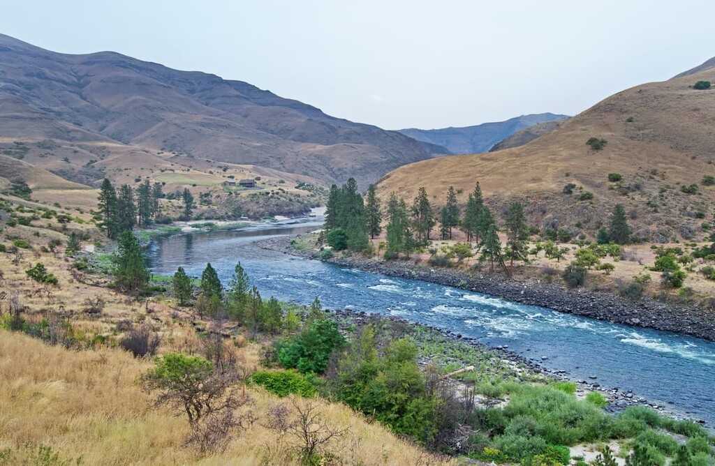
The Boulder Mountains stretch from Galena Peak on Route 75 northwest about 50 miles (80 km) to Lone Pine Peak, just south of the town of Challis. The Jim McClure-Jerry Peak Wilderness covers the north-central area of the range.
Unlike many of Idaho’s dozens of mountain ranges, the Boulder Mountains aren’t underlain by the Idaho Batholith. Instead of this massive segment of intrusive igneous rock that makes up the nearby Sawtooth and White Cloud Mountains, the Boulder Mountains are underlain with Paleozoic sedimentary rocks of the Devonian Milligen and Pennsylvanian Wood River formations, in addition to Eocene granite and granodiorite rock.
On top of these rock formations lies a thin layer of Challis volcanics, including dacite, andesite, rhyolite, and basalt from large eruptions that took place about 50 million years ago. These volcanic deposits form steep mountain slopes and occasionally rock spire hoodoos throughout the area.
The topography of the wilderness area is mostly rounded basalt summits and deep canyons. High points in the area include Sheep Mountain, Bowery Peak, Meridian Peak, and Hunter Creek Summit.
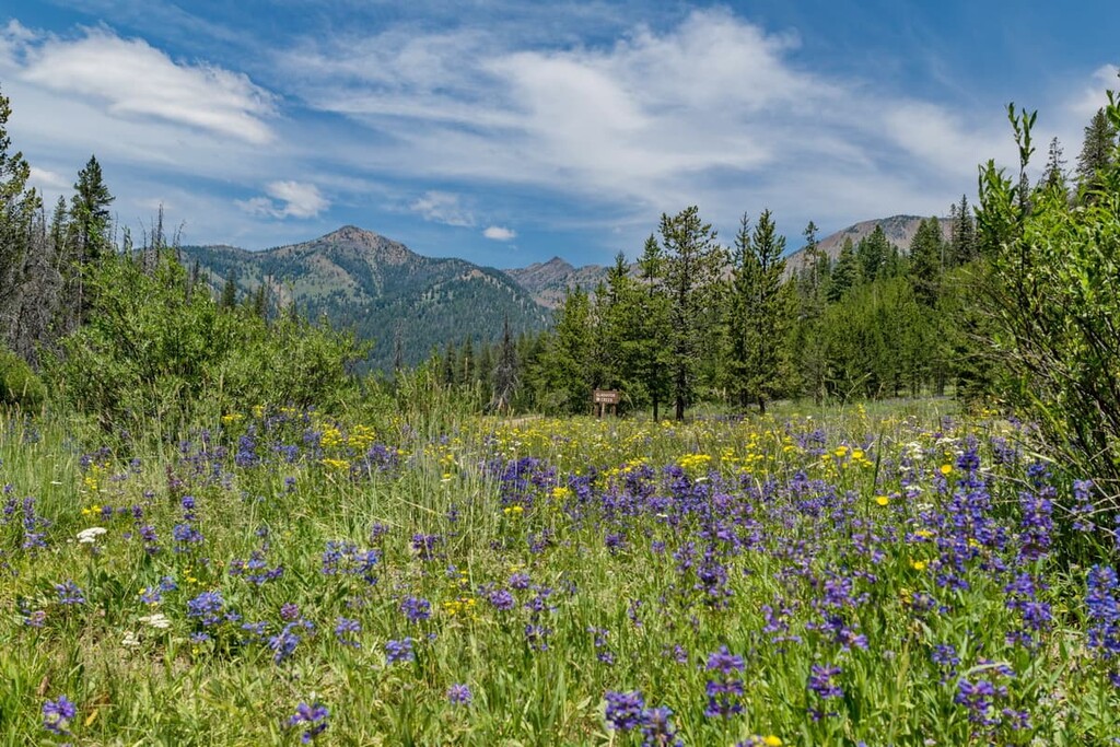
The Jim McClure-Jerry Peak Wilderness is a dry, open shrub environment of sagebrush steppe. This steppe is interspersed with stands of Douglas fir trees and other conifers, mostly on mid-elevation, north-facing slopes.
Above 9,000 ft (2,740 m), the mountaintops are covered in low-lying grasses and shrubs. At low elevations along rivers, there are riparian areas home to willow and aspen stands. The Upper Herd Creek watershed is considered one of the most intact native plant communities in the state of Idaho.
There are a number of large animals in the wilderness area, including elk, moose, mule deer, bighorn sheep, mountain goats, bears, wolves, pronghorn, and wolverines. Greater-sage grouse, a threatened species, also live in the area.
The East Fork of the Salmon River, which runs along the western edge of the Jim McClure-Jerry Peak Wilderness, is home to one of the longest, highest-elevation salmon migration routes in the world. In addition to Chinook Salmon, rivers and streams in the area also support steelhead, cutthroat, and rainbow trout.
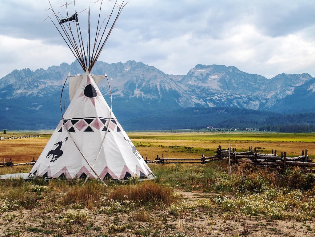
Many ancient archaeological sites have been found throughout the Salmon-Challis National Forest, showing that the area has been inhabited for thousands of years. The most prominent tribal nations in the area prior to European contact were the Shoshone.
The Shoshone lived a semi-nomadic lifestyle, moving seasonally and hunting various large and small game, most notably bighorn sheep and salmon. During the late 1800s, they were removed from their traditional lands and forced to relocate to reservations.
Today, many Shoshone live on the Duck Valley Shoshone-Paiute Reservation and the Fort Hall Shoshone-Bannock Reservation in Idaho. Each reservation is home to several thousand people, over a thousand of whom speak the Shoshoni language.
The area of the Boulder Mountains was infrequently visited by Euro-Americans until late in the nineteenth century. Fur trappers made expeditions into the area, but until gold was discovered here in 1860, there was little incentive for emigrants to head into the uncharted areas of Idaho to the north of the Oregon Trail.
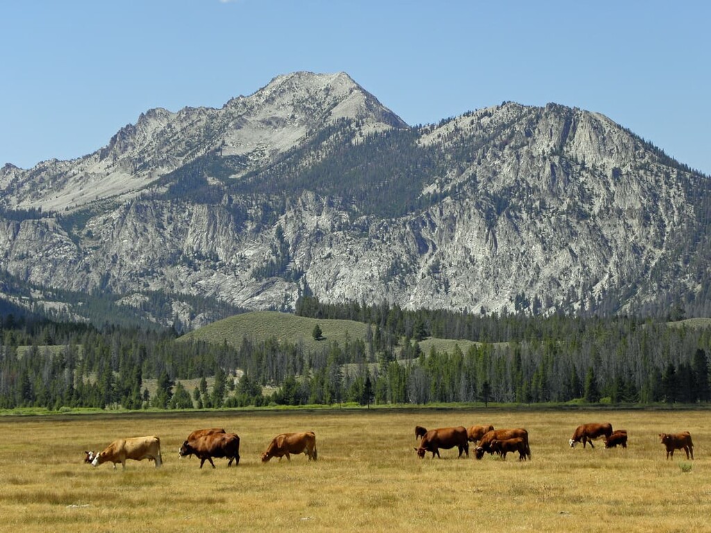
The discovery of gold set off a mining boom and a number of other minerals were mined in the area, including galena, an ore of lead, which gives its name to Galena Peak in the Boulder Mountains. After mining, ranching became a main occupation in the area.
The Jim McClure-Jerry Peak Wilderness was preserved by act of congress in 2015. Along with the Hemingway Boulders and White Clouds Wilderness areas, it’s one of the newest wilderness areas in the country. Its namesakes are Senator James A. McClure, who represented Idaho from 1973 to 1991, and Jerry Peak, which is one of the most prominent mountains in the region.
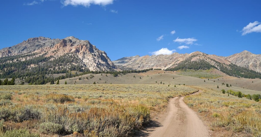
While there are only a few designated trails in the Jim McClure-Jerry Peak Wilderness, most of the area is wide open scrub brush and grassland, so it’s relatively easy to navigate and travel off-trail here.
The Toolbox/Herd Creek Trail is one of the longest trails in the Jim McClure-Jerry Peak Wilderness and one of only two official access points to the area from the south.
The trail runs along the east side of Herd Creek from Bull Gulch all the way over Herd Peak to the North Fork of the Big Lost River, just outside the southern boundary of the wilderness area. If you’re hiking from the south, Herd Peak makes a good day hike with great views.
The Toolbox to Herd Peak hike starts at the southern trailhead at Toolbox Creek. If you’re summiting Herd Peak, this is a 7 mile (11.7 km) round trip with 2,280 ft (694 m) of elevation gain, although you can continue along the full length of the trail for a longer hike.
The overall trail is rated as easy to moderate and features colorful red rock formations. Hikers have a chance to see deer, elk, and coyotes. The area at the southern end of the trail, by Toolbox Creek, features beautiful stands of Douglas fir and aspens.
The Lower Cedar Trail is a great choice if you want to experience the Jim McClure-Jerry Peak Wilderness without having to spend hours hiking into the wilderness area. The trail is short and ends at a unique mountain spring.
The trail begins just outside the town of Mackay. From Main Street, turn left onto Lower Cedar Creek Road and follow it to the end, where there will be a parking area for the trail.
From there, the trail leads past a former dam site where you can view the remaining old wooden flumes. The trail ends at the Hole in the Rock Waterfall, a spring that emerges directly from a rock face.
The Hunter Creek Trail, along with the Toolbox/Herd Creek Trail, is one of only two official access points along the southern border of the wilderness area.
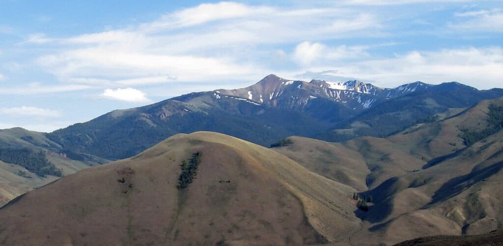
This trail begins near the North Fork of the Big Lost River, just off of North Fork Road at the end of Forest Road 40477. The trail climbs steeply through heavy timber up Hunter Creek Canyon. After climbing the switchbacks to the top of the ridgeline that makes the boundary of the wilderness area, you’ll arrive at Hunter Creek Summit.
From the summit, there are beautiful views south to Ryan Peak and Kent Peak, the first and third highest peaks in the Boulder Mountains.
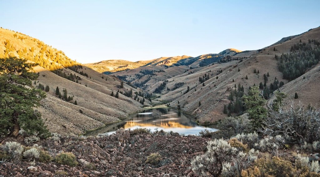
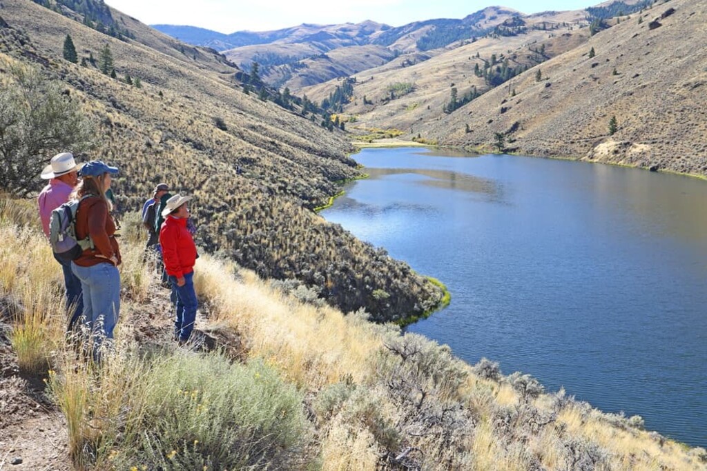
While this isn’t necessarily a hike, Herd Lake is one of the most accessible and beautiful areas in the Jim McClure-Jerry Peak Wilderness.
To reach the area, take Herd Lake Road off of the East Fork Road in the northern end of the wilderness area. The road leads to the Herd Lake Campground. From there, there’s a short foot trail over the border into the non-motorized zone of the wilderness area.
You can continue to follow the road even higher into the mountains, for a beautiful view over the lake. This is an open, scrub brush area, so there are lots of views here. For the best views, climb nearby Jerry Peak.
Looking for a place to stay during your trip to the Jim McClure-Jerry Peak Wilderness? Here are some of the best nearby towns and cities to check out:
To the south of the Jim McClure-Jerry Peak Wilderness and on the other side of the Boulder Mountains lies the resort town of Ketchum, one of the premier mountain destinations in southern Idaho. Ketchum and the adjacent town of Sun Valley are home to about 4,000 people, although the area sees thousands of visitors each year thanks to the Sun Valley ski area.
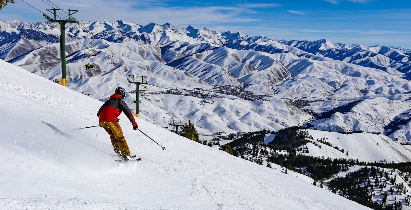
Ketchum and Sun Valley have plenty of hotel and dining options, and the surrounding region offers nearly endless hiking opportunities. The area sits between the Smoky, Pioneer, and Boulder Mountains, and it is surrounded by the Sawtooth National Forest.
The tiny town of Challis may not look like much on a map, but it’s surrounded by incredible hiking, camping, and off-road driving opportunities. In addition to being just a few miles north of the Jim McClure-Jerry Peak Wilderness, Challis borders the Frank Church River of No Return Wilderness, the largest wilderness area in the contiguous United States.
If hiking and camping aren’t enough for you, Challis also has natural hot springs, a ghost town, and a historic state park right near town. If you’re in need of supplies before a big trip into the Salmon-Challis National Forest, Challis has a grocery store and a couple of shops that sell basic outdoor gear.
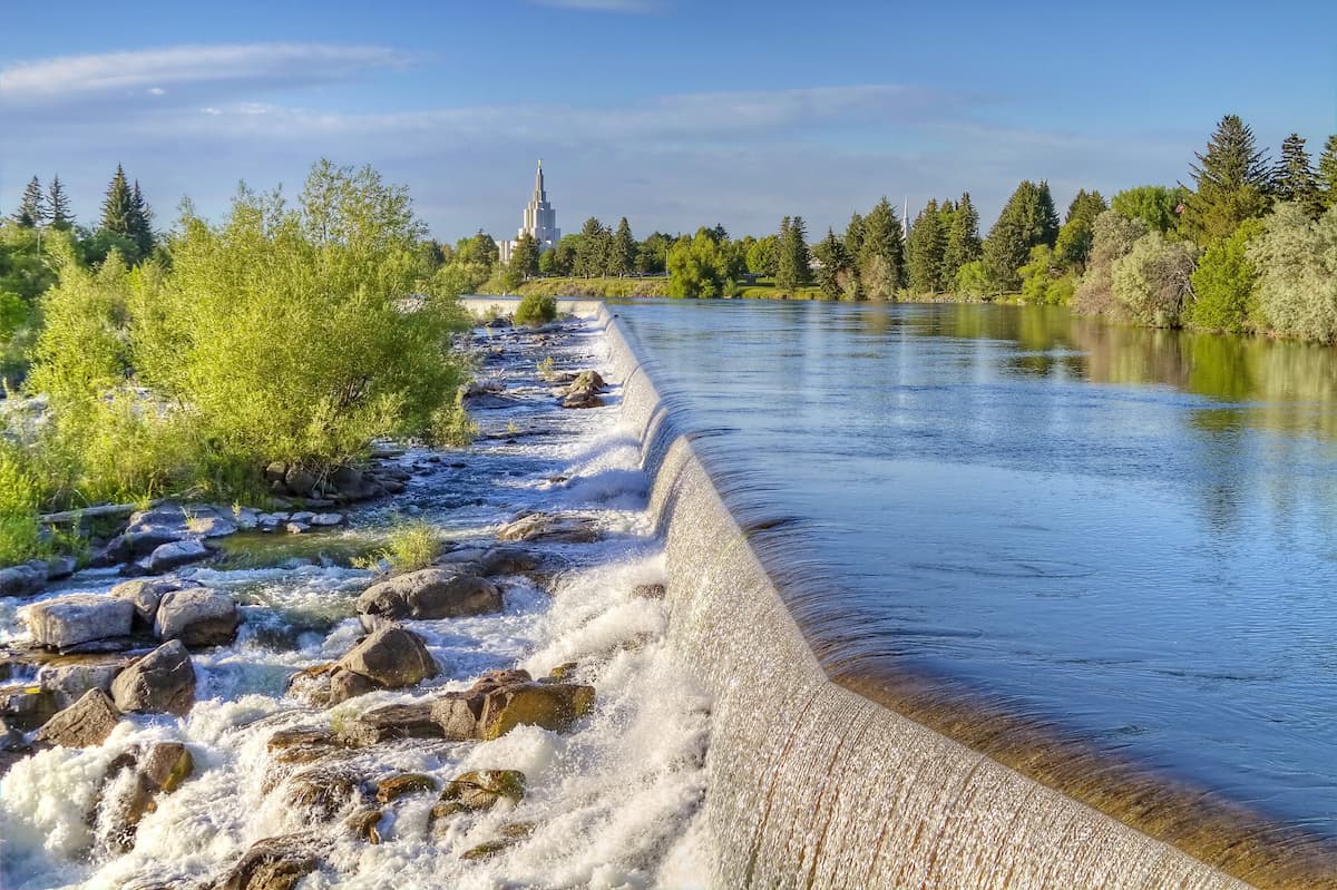
Located about 100 miles (160 km) southeast of the Jim McClure-Jerry Peak Wilderness, Idaho Falls is the largest town near the wilderness area. The town is located conveniently between Ketchum and the Teton Mountains, so it’s a good place to stop if you’re hitting both destinations.
Idaho Falls is located on the Snake River and home to about 60,000 people. Despite its relatively large size, Idaho Falls offers visitors plenty of chances to get outside, with a zoo, thriving downtown area, and a 5-mile (8.4 km) greenway trail system along the river.