
Scan the QR code and open PeakVisor on your phone
The Teton Range include 134 named peaks. The highest is Grand Teton at 4,199 m. Other notable peaks include Glencoe Spire, The Enclosure and Okies Thorn.
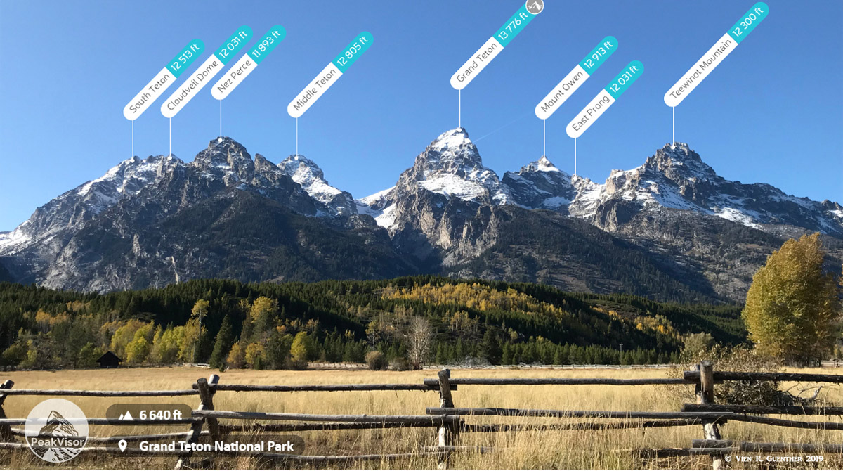
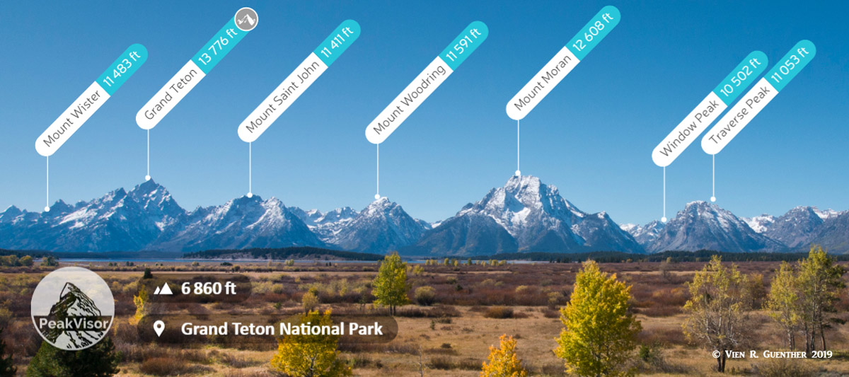
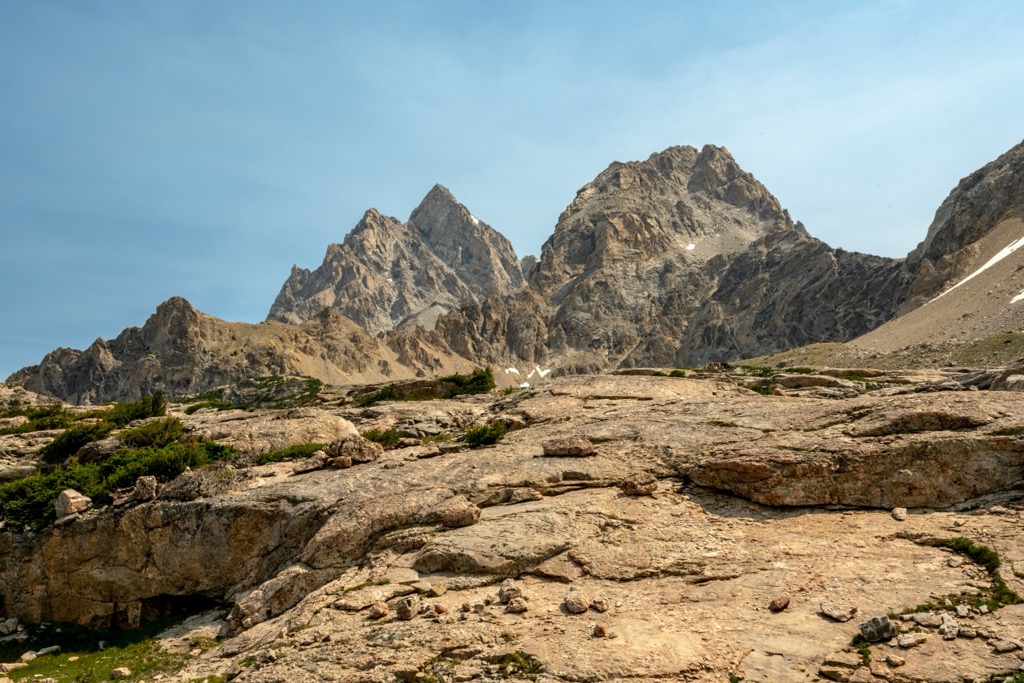
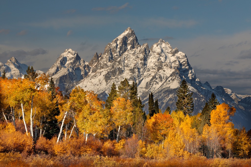
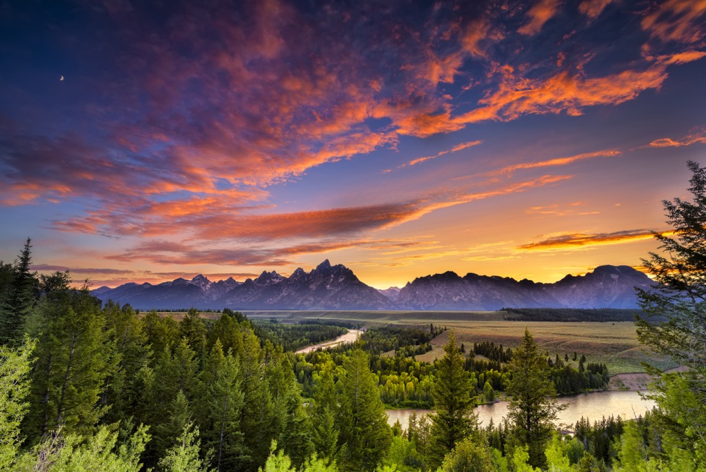
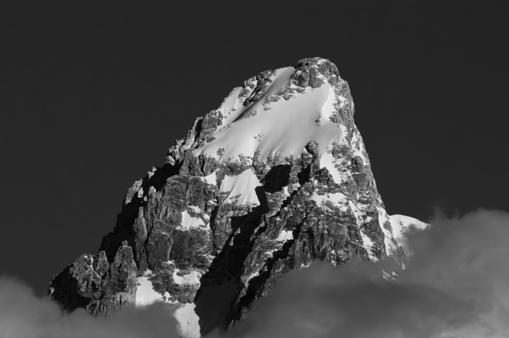
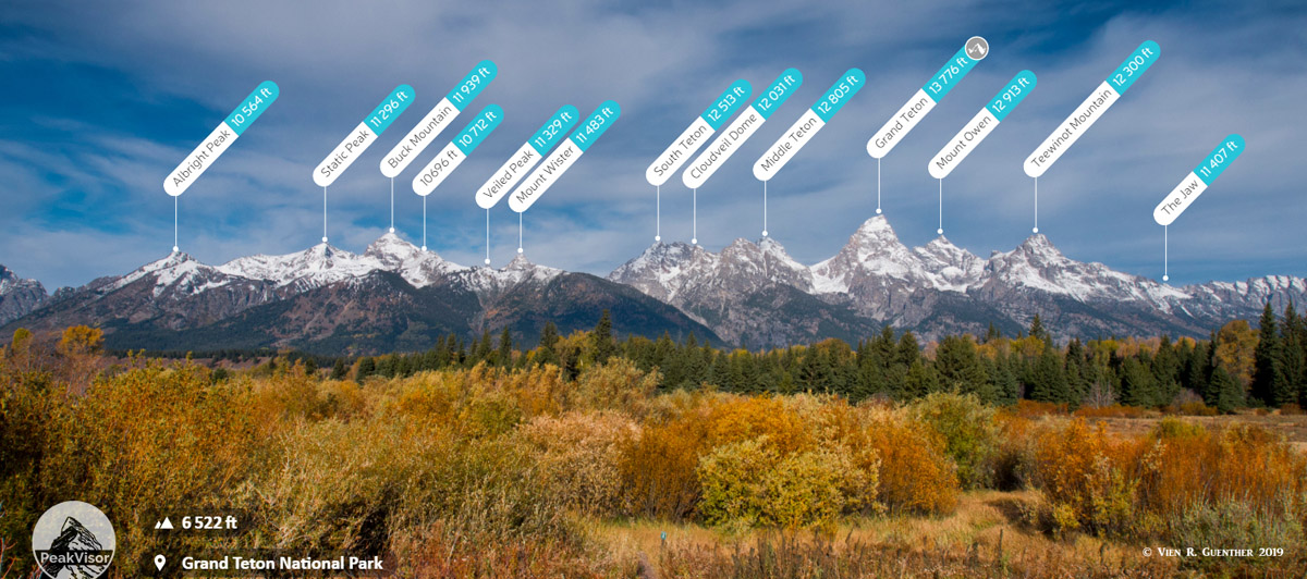
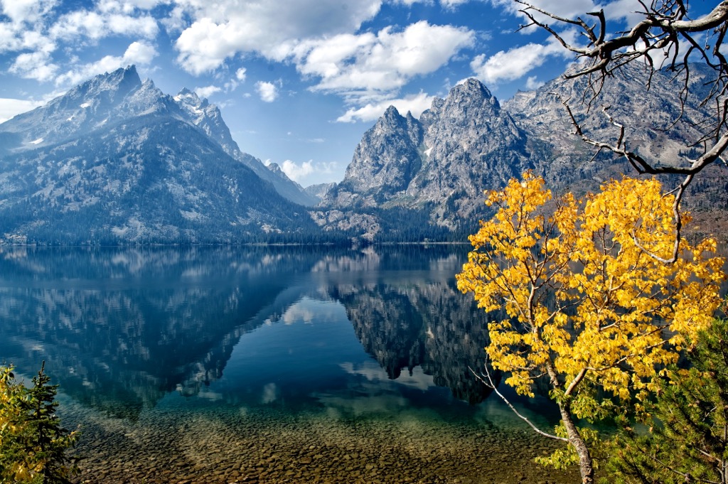
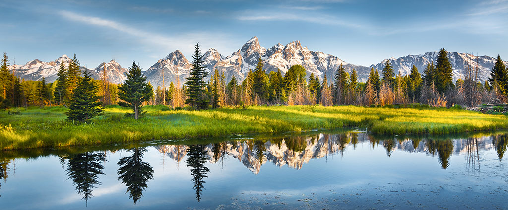
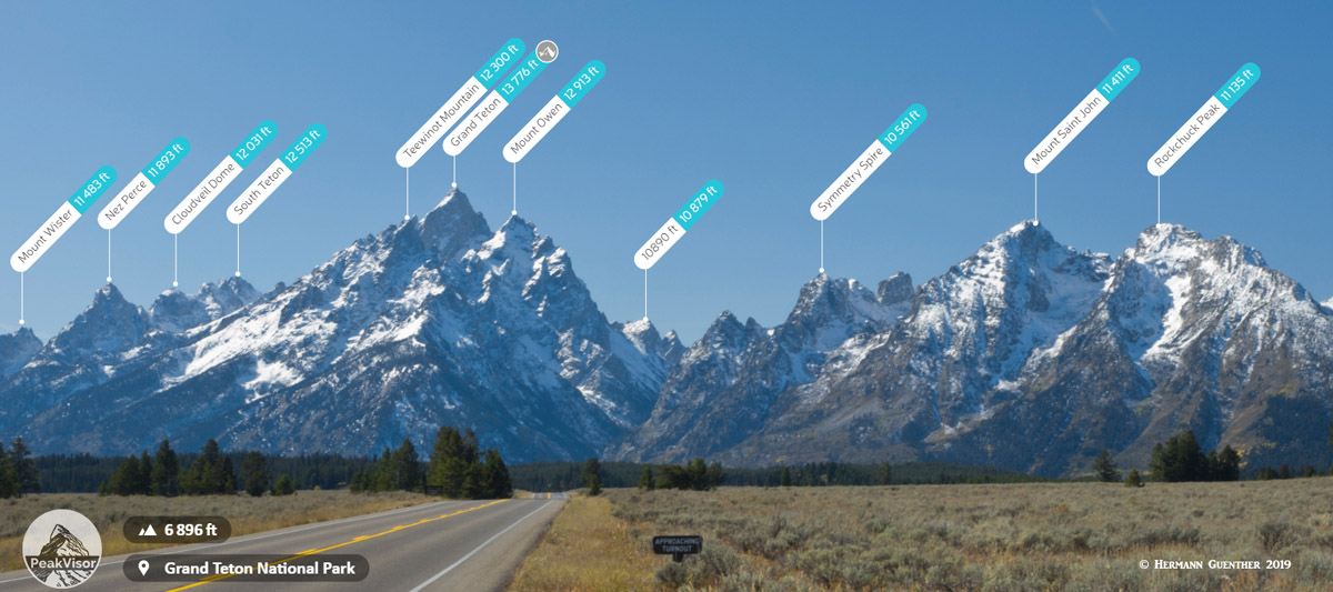
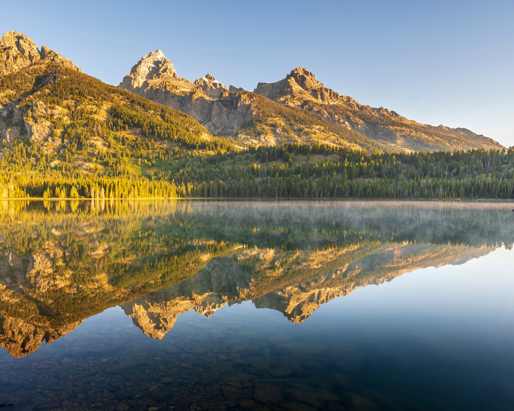
The Teton Range, a subrange of the Western Rocky Mountains, extends for approximately 40 miles across northwest Wyoming. There are 134 named mountains in the Teton Range, but the principal summits consist of several classic alpine peaks referred to as the Cathedral Group. Jagged, pyramidal peaks characterize the Cathedral Group, which contains eight of the range’s ten highest summits, most of which are over 12,000 feet (3,657 m) above sea level. The most recognizable mountains in the Cathedral Group include Grand Teton (13,775 feet / 4,198 m), the tallest peak in the Teton Range, as well as Mount Owen, Teewinot Mountain, Middle Teton, and South Teton.
Although some foothills extend into southeastern Idaho, most of the range extends southward from the southern border of Yellowstone National Park to Teton Pass, west of Jackson, Wyoming. Two impressive valleys flank the range: Jackson Hole to the east and Teton Valley to the west.
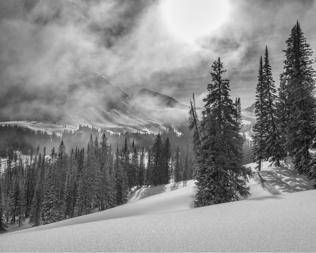
The Teton Range is one of the most distinct ranges in the United States due to its dramatic elevation profile along its eastern side. The western side is also striking but has more distance between the valley and the peaks.
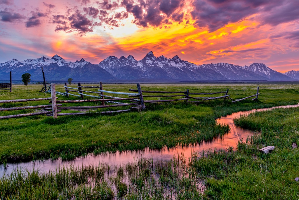
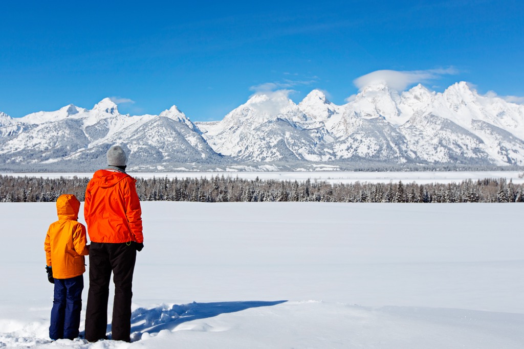
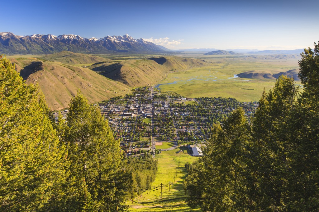
The Tetons tower over the valley of Jackson Hole, Wyoming, rising abruptly 5,000 to 7,000 feet above the surrounding landscape. This side of the range lacks significant foothills or lower peaks, so its iconic pyramidal-shaped summits are easily visible.
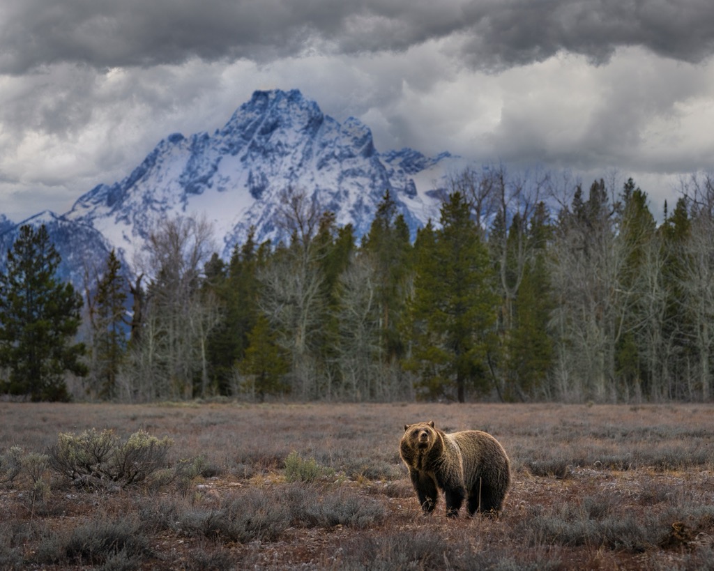
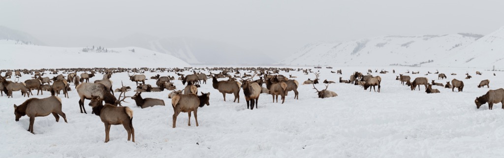
The Jackson Hole Valley is a hotspot for wildlife, with a complex ecosystem of large mammals taking shape. Winter elk populations number in the tens of thousands, while wolves and grizzly bears prowl the thick forests that flank the range’s high peaks.
Much of this beauty is protected by the Grand Teton National Park, which envelopes most of the east side of the range. The National Elk Refuge likewise dominates the Jackson Hole Valley.
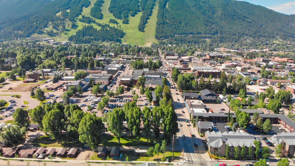
The park is one of the world’s premier tourist destinations, with the town of Jackson, WY, hosting nearly two million visitors annually. In fact, the town records about fifty thousand tourists every day during the summer. Although swarming with tourists during the summer and winter, the permanent population of the Jackson Hole Valley is no more than 11,000, while Teton Valley is home to just 11,500 residents. Incredibly, these numbers pale compared to Yellowstone National Park, just up the road from the Tetons. Yellowstone, the nation’s oldest national park, sees upward of 3.3 million visitors annually.
Nevertheless, the park effectively protects the Teton ecosystem; there is essentially no new development within its boundaries and intrusive sports are prohibited. Naturally, the park is also a veritable candy shop of adventure for climbers, hikers, and skiers.
One of the region’s most prized climbing achievements, the Grand Traverse, links the finest summits in the Teton Range: Teewinot, Mount Owen, Grand Teton, Middle Teton, South Teton, Cloudveil Dome, and Nez Perce.
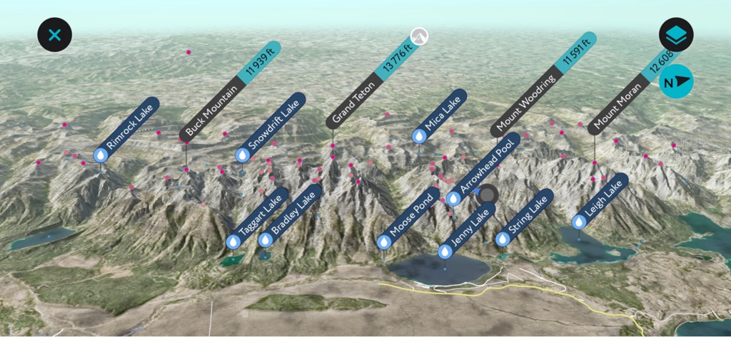
Other noteworthy peaks in the range include Mount Moran, which dominates the northern section of the Teton Range, Static Peak, Buck Mountain, and Mount Wister.

The Visitors Center is a state-of-the-art facility that will point you in the right direction on any topic. Here’s the main one in Jackson:
Jackson Hole & Greater Yellowstone Visitor Center
532 North Cache Street (next to the Elk Refuge), Jackson, Wyoming, 83001, USA
Daily from 9 am to 5 pm
The Tetons are the youngest range on the North American continent. This adolescent mountain range was born out of incredible seismic activity, uplifting a mere 7-9 million years ago.
Despite the range’s relative youth, the Tetons harbor some of North America’s most ancient rocks; a considerable portion of the Teton Range is gneiss, a metamorphic rock dating back around 2.7 billion years. Granite is also present in large quantities, to the delight of mountaineers, who consider it a high-quality rock for climbing.
These formations originated from the burial of oceanic sediments and volcanic fragments at depths of up to 18 miles (32 km) due to the convergence of two tectonic plates. The deposits are relics from Earth’s early days, long before complex life forms developed.
In fact, these sediments contain the compressed matter of some of the planet’s earliest life. Cyanobacteria flourished in Earth's oceans during this period, producing oxygen from carbon dioxide, water, and sunlight. The process, called photosynthesis, ultimately oxygenated Earth’s atmosphere, paving the way for more complex life to evolve.
Intense heat and pressure eventually metamorphosed this sediment into the gneiss and granite we see on the peaks today. However, it was only very recently that tectonic forces uplifted these layers above the surface of the earth’s crust.
Since about nine million years ago, the Teton Range has undergone a gradual uplift process. The uplift occurs one earthquake at a time along the Teton fault, a 40-mile, north-to-south fissure in the Earth's crust.
Tension along the fault accumulates until it reaches a critical point, leading to an earthquake that elevates the mountainous section (western part) while simultaneously lowering the Jackson Hole Valley floor. Each quake produces about 10 feet (3 meters) of additional difference between the peaks and the valley floor.
The Teton fault remains active and has the potential to generate a magnitude 7.0-7.5 earthquake. The fault’s current slope indicates approximately twelve earthquakes since the retreat of glacial ice from the valley 20,000 years ago. Geoscientists estimate the three most recent earthquakes occurred about 5,900, 8,000, and 10,000 years ago.
Compressional deformation of the Earth’s crust, like in the Tetons, is the planet’s most common mountain-building process. These forces mirror the current collision between India and Asia, giving rise to the Eurasian continent's Himalayas and the entire Alpide Belt.
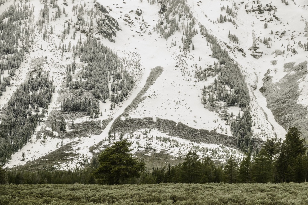
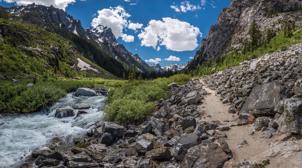
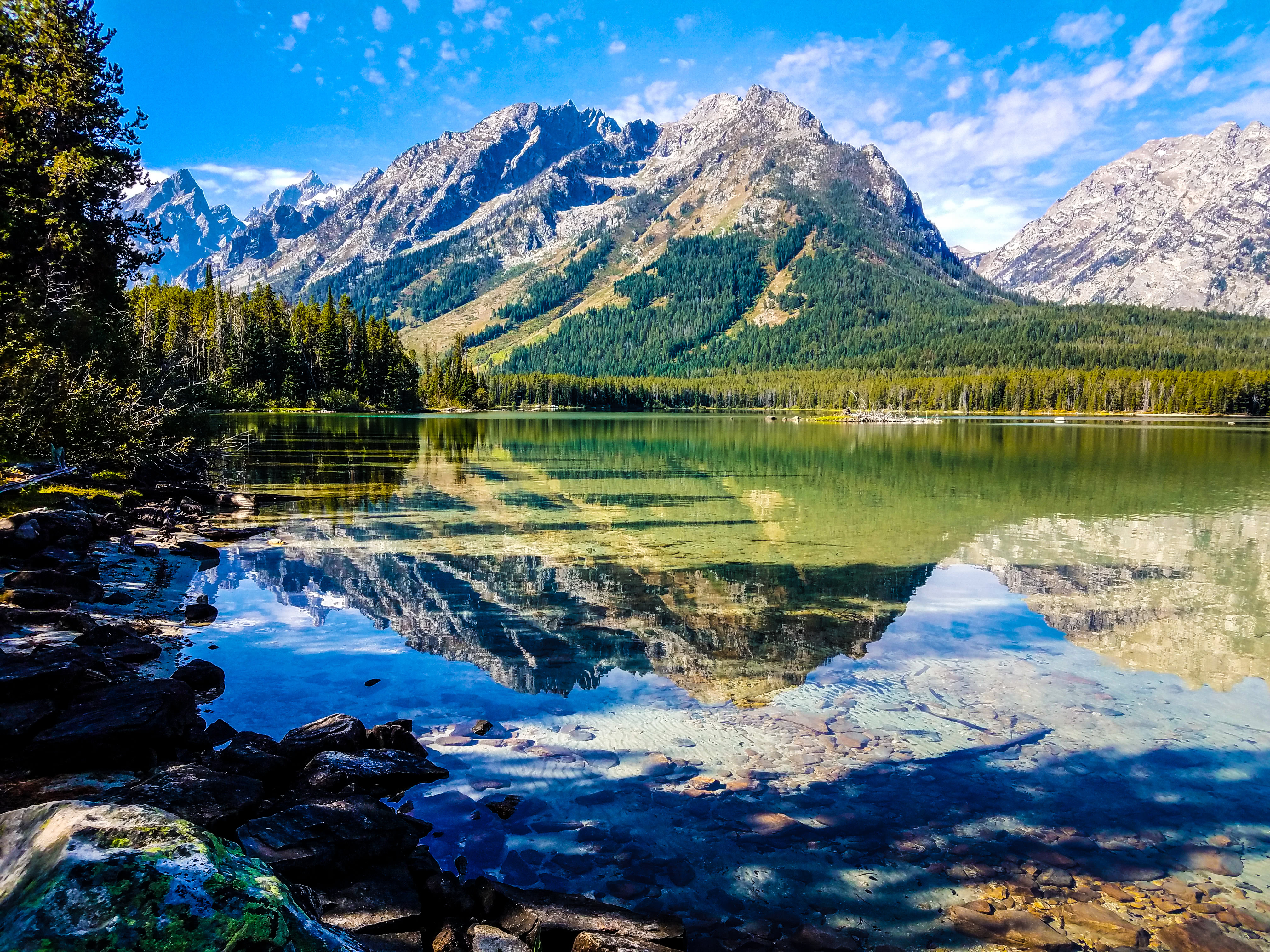
Glaciers have sculpted the Teton landscape over several advances, widening V-shaped river canyons into U-shaped glacial canyons. Two canyons, Cascade Canyon and Avalanche Canyon, separate the Cathedral Group from other high peaks in the range. Several terminal moraines are also visible throughout the Tetons from past glacial advances.
Several small, alpine glaciers still occupy the highest bowls of the Cathedral group, including the Teton, Middle Teton, Schoolroom, Petersen, Falling Ice, Skillet, and East, Middle, and West Triple glaciers. The Teepe Glacier was officially designated a ‘remnant glacier’ in 2022, as it had lost too much ice to flow downhill under its weight.
All glaciers in the Tetons are shrinking, although the larger ones, like the Teton and Middle Teton, may stick around for several more decades.
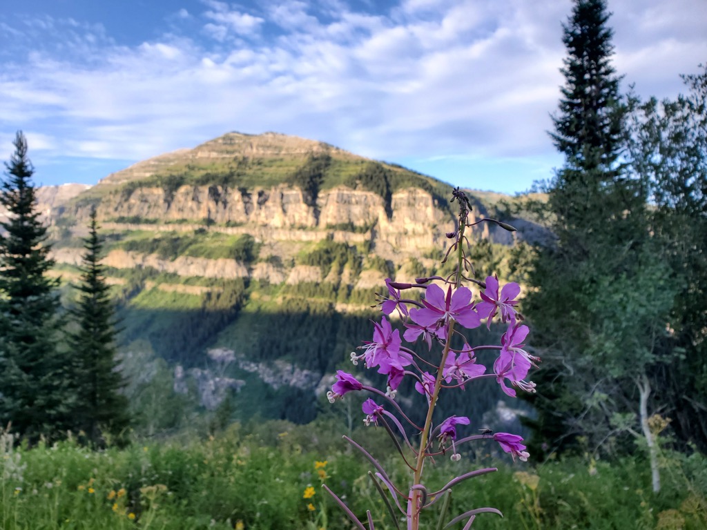
The Teton Range is astoundingly biodiverse, primarily due to elevation changes and the ecoregions accompanying these different zones. Four primary ecoregions exist: alpine, forest, sagebrush, and wetland (rivers, lakes, ponds, swamps).
The Alpine environment's elevation, winds, harsh winters, and short summers necessitate adaptation. Vegetation takes the form of compact mats, while the animal presence is limited. Nevertheless, the alpine zone is home to yellow-bellied marmots, pikas, and bighorn sheep.
Forests in the Tetons span from the treeline to the valley floor, offering shelter and sustenance for numerous species of mammals. While lodgepole pines are the dominant species, various other types of pines, firs, aspens, and spruces also thrive.
Visitors are often surprised at just how lush the lower elevations of the Tetons are. Copious amounts of rain, snow, and runoff provide ample year-round moisture. Thick undergrowth carpets the forest floor, and mosses drape from the pine branches. Elk, mule deer, martens, weasels, black and grizzly bears, and snowshoe hares are just a few of these forests’ residents.
Sagebrush expanses dominate the semi-arid, rocky terrain of the valley floor. Alongside sagebrush are hundreds of grass and wildflower species. Pronghorns, coyotes, bison, badgers, elk, and Uinta ground squirrels are a few of the residents of this ecoregion. The lack of ground cover here makes it much easier to spot animals here than in any other part of the Tetons.
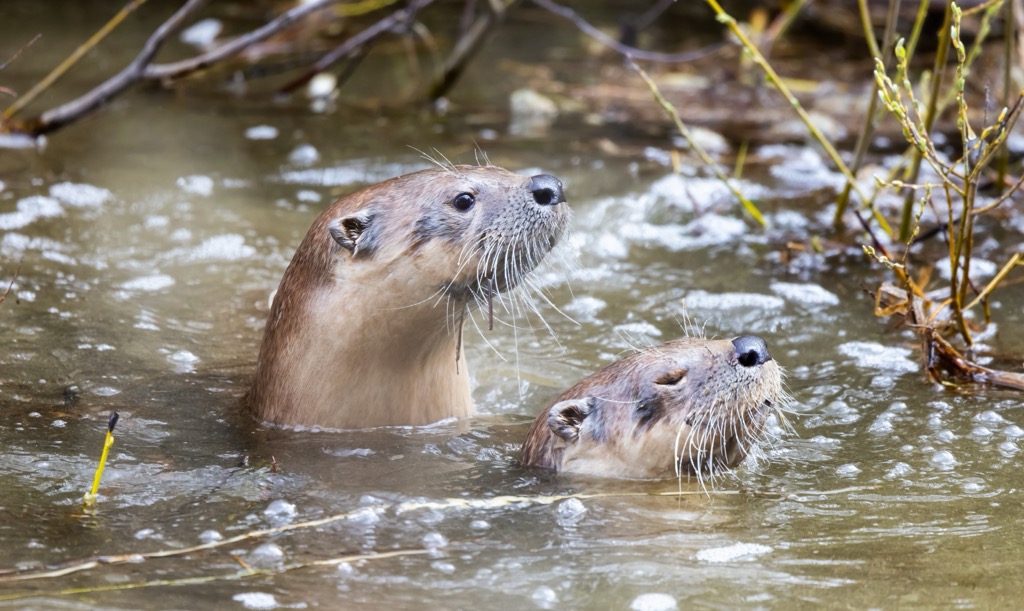
Rivers, lakes, ponds, and marshes create aquatic environments that meet the requirements of many wildlife species. These are some of the most productive ecosystems in the Teton region; diverse and plentiful vegetation provides nourishment and shelter to charismatic mammal species. Moose, river otters, beavers, muskrats, coyotes, and mule deer are a few of the larger species in this region.
Naturally, the Tetons are home to diverse avifauna. The calliope hummingbird, North America's tiniest bird, weighs less than a tenth of an ounce. This delicate creature frequents blooming scarlet gilia and willow shrubs and may be mistaken for an insect.
Conversely, the trumpeter swan, North America's largest waterfowl, frequents the range’s lakes and ponds. These majestic swans often live in mated pairs that remain devoted for life. Bald eagles are also increasingly present, especially around larger bodies of water like Jenny Lake.
Humans have inhabited the area around the Teton Range for at least the last 11,000 years. The first people to live in the region were Paleo-Indian peoples. These nomadic tribes settled in the mountains during the warmer months in search of food and supplies. The Tetons offered abundant hunting and foraging, as well as water resources and respite from the heat of the surrounding sagebrush desert.
The Jackson Hole Valley then was even colder than the current climate. Survival through winter would have proven impossible, but the mountains were bountiful during the summer. Game animals followed the same ritual, so these early nomads likely tracked migratory routes year-round.
When the first Europeans arrived, they encountered the Eastern Shoshone peoples, who had subsisted in the region for countless generations. The Shoshone, who spent much of their time in the mountains, were known as Tukudika or “Sheep-eaters,” as the main staple of their diet was the region’s endemic bighorn sheep.
After the arrival of Lewis and Clark during their 1807-1808 trans-continental journey, fur trappers set up shop in the Tetons. A number of companies tried and failed to set up mining operations around Jackson Hole, ultimately realizing the region’s true economic calling was ranching and agriculture.
Although the eastern Shoshone people developed an intimate spiritual connection to the Teton Range, after years of conflict and broken treaties, they were eventually forced into relocation on the Wind River Indian Reservation, 100 miles southeast of Jackson Hole, in 1868.
Like the rest of the Rocky Mountains, the Teton Range was a significant obstacle to westward white settlement in the expanding United States. However, the establishment of roads from Jackson Hole over Teton and Togwotee Passes and the explosive rise of the automobile made it easier for people to pass through the area. This led to a dramatic increase in tourism, especially among dude ranches and outdoor recreationists.
After the 1872 designation of Yellowstone National Park, America’s premier NP, many conservationists wanted to increase the park’s boundaries to include the stunning Teton Range. However, residents preferred the creation of a separate Teton National Park. On February 26, 1929, President Calvin Coolidge signed an executive order to formally create the 96,000 acre (39,000 ha) Grand Teton National Park on the heels of congressional approval.
After the first recorded ascent of the Grand Teton by William Owen, Franklin Spencer Spalding, and company in 1898, many new routes were put up on the mountain, spurring a long and storied history of climbing in the range.
The Tetons are also a popular winter recreation destination, particularly for skiing, snowboarding, and mountaineering. In fact, in 1971, Bill Briggs, admirably named the "father of extreme skiing," made the first-ever ski descent of Grand Teton and introduced the sport of ski mountaineering in North America.
Today, the range contains/is surrounded by approximately 310,000 acres of protected peaks and wilderness. The national park is one of the most visited in the country, while the town of Jackson Hole has become a getaway for the rich and famous.
While a few ranches still operate, primarily as pet projects for oil executives, subsistence ranchers have been extirpated from the region just as the Shoshone were two centuries prior.
The Teton Range is a paradise for hikers. Much of the range is accessible by foot, with only the highest peaks in the Cathedral Group requiring technical climbing. Be sure to check out the PeakVisor App for comprehnsive route and tracking information for every trail in Grand Teton NP and beyond.
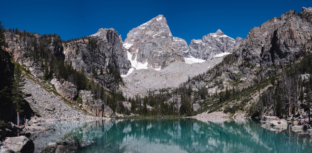
The Cascade Canyon Trail is a 10-mile round-trip trek highlighting the craggy peaks and cliffs of the Teton Range. Hikers reach Cascade Canyon via the well-maintained Jenny Lake Trail (approx. 2 mi / 3.5 km) or the Jenny Lake Ferry, which takes travelers across the lake to the trailhead.
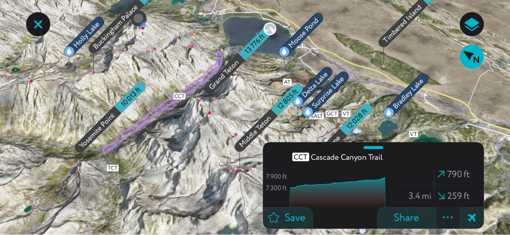
The trail offers stunning views of the Cathedral Group towering above the surrounding canyon. Some hikers will also stop at Inspiration Point to view Jenny Lake and the nearby Gros Ventre Mountains. The trail ends at Lake Solitude, a glacier-fed lake tucked within a beautiful alpine meadow.
Hiking to the top of Table Mountain is the perfect way to experience the Teton Range and the upper reaches of Cascade Canyon. The trail to Table Mountain rises more than 4,000 feet (1,200 m) in just 4.6 miles (7.4 km). However, the views from Table Mountain are arguably some of the best in the region and include icons like the Cathedral Group, Cascade Canyon, the Schoolroom Glacier, and Battleship Mountain.
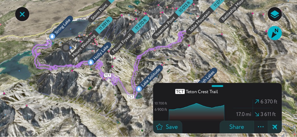
The Teton Crest Trail is the crown jewel of through-hikes in Grand Teton National Park. Hikers are guaranteed to experience some of the most incredible alpine lakes, high-altitude passes, and mountain peaks in the range. The trail extends for nearly 40 miles, requires a backcountry permit, and takes approximately 3 to 5 days to complete. Hikers can also break off to summit Hunt Mountain, Static Peak, or Upper Cascade Canyon.
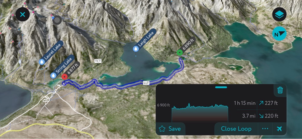
The hike around Leigh Lake is a popular trail for visitors looking for a day trip filled with iconic Teton views. Hikers can travel for 3.2 miles (5 km) round-trip to the first viewpoint for panoramic views of Mount Saint John, Rockchuck Peak, Mount Woodring, and Mount Moran, or continue to the northern end of the lake to extend the hike to 7.6 miles (12.2 km) round-trip.
Topping off at approximately 10,800 feet, the hike to Static Peak Divide is the highest mountain pass along any Grand Teton National Park trail. Despite its elevation, the hike requires no climbing or scrambling, which makes it an excellent option for day hikers looking for a high-altitude trek. Static Peak earned its name from being repeatedly struck by lightning, so be cautious to avoid hitting this trail too late in the day.
The vertical orientation of the Teton Range efficiently captures moisture from a predominantly west-to-east weather flow. The narrow character of the range means the skiable terrain stretches from the range's crest to the valley floor, hence the massive vertical drop. However, the Tetons are the only range in the Rocky Mountains that receive truly coastal amounts of moisture.
The secret is a geographically low-lying moisture channel comprising a break in the coast range between Mount Shasta (14,176 ft / 4,321 m ) and the rest of the Cascades, followed by the Snake River Valley in Idaho. Storms funnel their way up this valley and collide with the Tetons. With its vertical orientation and massive prominence, the range causes moist air to rise and condense into precipitation that falls as snow.
Big storms regularly buffet this region. The Tetons are known for high winds, low visibility, and frostbite-inducing temperatures. When the storms finally break, the weather can be stunning. Low humidity, abundant sunshine, and perfectly crisp temperatures can make for memorable skiing.
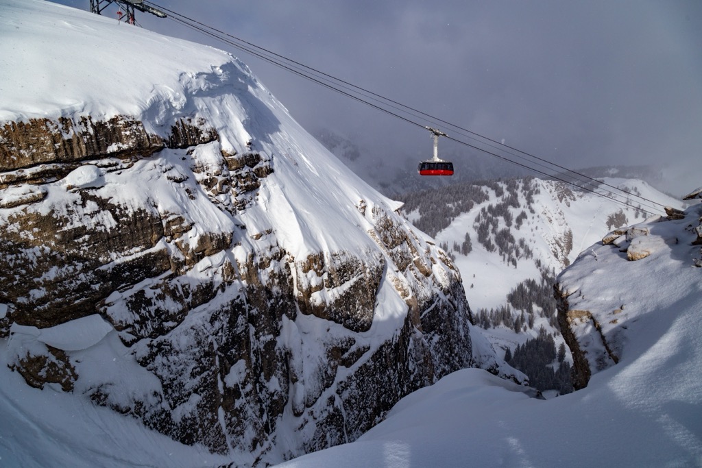
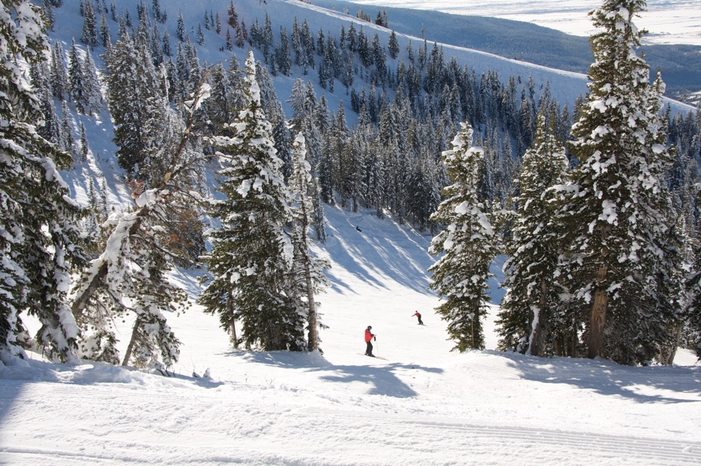
Jackson Hole Mountain Resort (JHMR) is the biggest ski resort in Wyoming, with over 130 slopes of 72 mi (116 km), best suited for intermediate to expert skiing. Thirteen ski lifts serve the largest vertical drop in the US of 4,139 ft (1,261 m).
However, its main feature is not the size, the lift infrastructure, or inbounds skiable acreage but the sheer amount of steep, off-piste skiing accessible from the lifts in the legendary Teton Range. At a reported 450 in (11.43 m) a year, the mountain receives copious amounts of snowfall and features a long season lasting from late November to early April.
The JHMR Access Gates offer some of the most incredible lift-access backcountry skiing in the US. The saga of these access gates is one of the great tales in skiing. For decades, the backcountry surrounding the resort was closed to skiers. However, an exclusive and rogue group of skiers called the “Jackson Hole Air Force” was sneakily “poaching” the terrain because the conditions were so good.
Eventually, the contest between JHMR Ski Patrol and the Air Force came to a head, and some renowned local skiers were banned from the resort. A few years later, the resort, in conjunction with the forest service, finally opened the Gates. The film “Swift, Silent, Deep” documents this mythology and is worth watching if you’re interested in JHMR (or skiing in general).
Nowadays, the Gates are more like an extension of the ski resort. You will be seeing other tracks and the folks who made them. Nevertheless, it’s still perilous (maybe even more so), especially in Granite Canyon. “If You Don’t Know, Don’t Go” is the slogan you will become accustomed to hearing at the top of every Tram ride. JHMR offers an in-house guide service for clients who wish to explore this terrain safely. If you’re a knowledgeable backcountry skier, I recommend going with a partner who knows the routes, at a minimum. Check out the “Jackson Hole Ski Atlas” for the visual beta.
Check out PeakVisor’s Jackson Hole Mountain Resort page, which I also wrote, for an in-depth and comprehensive guide to the resort and area.
Grand Targhee Ski Resort is the second-biggest of 13 ski resorts in the great cowboy state of Wyoming. It’s perched at an altitude between 9,862 ft (3,005 m) and 7,851 ft (2,392 m) with 2,270 ft (691 m) of vertical drop. The resort’s main features are limitless bowl skiing, big snowstorms, and uncrowded slopes.
The unobstructed views of the Tetons from the top of the lifts are stunning. Targhee boasts 93 runs over 21.7 mi (35 km) or 2,602 skiable acres (10.5 sq km), although much of the skiing is off-piste, and there are limitless variations through the bowls and trees. Most terrain is intermediate, making Grand Targhee an excellent resort for families. The ski season, which averages more than 500 inches (12.5 m) of snow annually, lasts from mid-November to mid-April.
Generally speaking, Targhee is under the same weather system as JHMR. They average a bit more snow because they are located on the west side of the Tetons, facing the main flow of weather. The windward exposure also means that Targhee is subject to heavy cloud cover; locals have endearingly nicknamed it Grand Foggy.
Northwest Flow is The thing to watch for at Grand Targhee. It’s a weather pattern that will set up, on average, a few times every season. This wind direction is more favorable for heavy snow at Targhee. They have been known to wake up to 30 in / 75 cm of powder when JHMR has much less. Northwest Flow is conducive to stellar dendrite snowflakes, so the snow is more likely to be blower powder.
Check out PeakVisor’s Grand Targhee page, which I also wrote, for an in-depth and comprehensive guide to the resort and area.
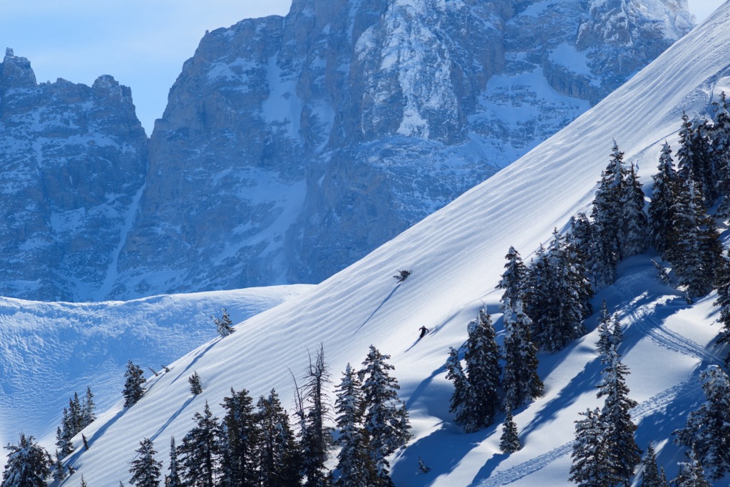
The best backcountry skiing around Jackson is within the boundaries of Grand Teton National Park. The park and the skiing experience are just extraordinary. The famous big routes, like the Grand, are in the park. However, for first-timers, I recommend starting with a beautiful route called “25 Short,” named after the summit, which is 9,975 ft (3,040 m) — 25 ft (7.2 m) short of 10,000 ft (3,048 m).
The routes back here are far more committing than the resort gate access. Even 25 Short, which is by far the easiest route, is a 3,300 ft (1,005 m) climb with a descent through significant avalanche terrain. There is an abundance of mountain guide services operating within the region. The most famous is Exum. Hire a guide if you don’t know the ropes.
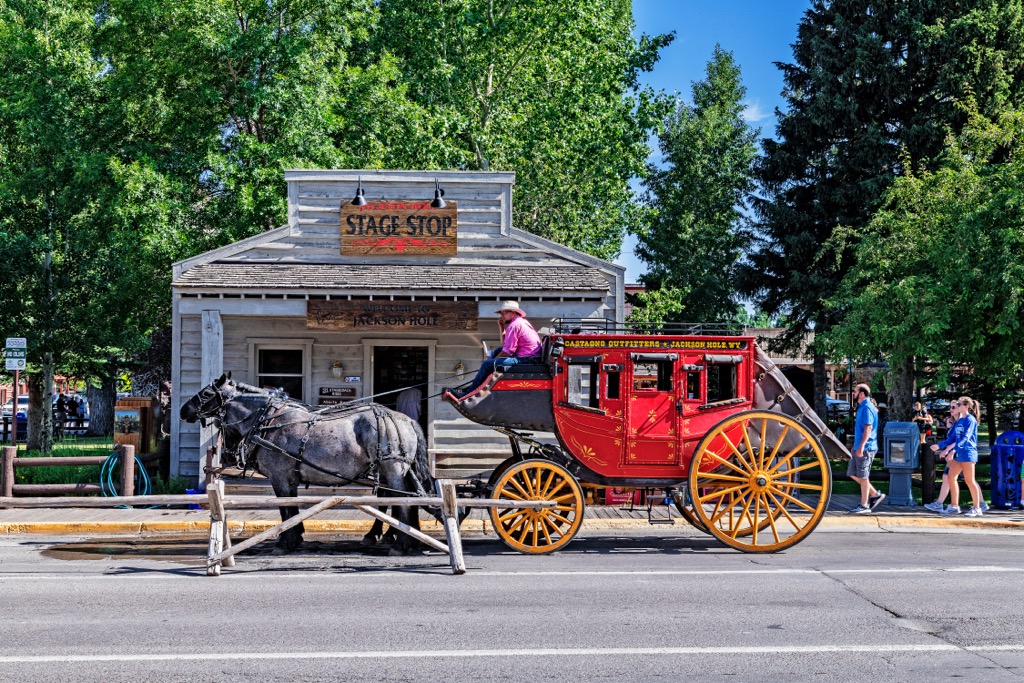
High altitude, proximity to nearby National Parks, and the steep mountain slopes make Jackson Hole ideal for outdoor recreation and lodging. Jackson was once at the center of America’s old-west mythology. Nowadays, it’s one of the most legendary mountain towns in the world. There’s a little bit of everything here: the old west, the new chic, and, yes, there is still some of that ski bum lifestyle left.
If you like the mountains, you’ll never run out of things to do here. With JHMR, Grand Targhee Resort, Snow King Resort, and endless backcountry skiing, Jackson can’t be beaten. Winter here also offers meticulously groomed cross-country skiing, snowshoeing, dog sledding, snowmobiling, and ice skating on natural lakes.
Likewise, whitewater experiences, climbing, wildlife encounters, hiking, backpacking, and camping define the summer in Jackson. There are even backcountry natural hot springs. This place didn’t become America's most expensive zip code for nothing.
Jackson is just 15 miles from the Idaho border, 12 miles from Grand Teton National Park, 12 miles from Teton Village, and 60 miles from Yellowstone National Park.


13er
ultra
wyoming-13ers
teton-13ers
greater-yellowstone-finest
fred-beckey-great-peaks
wyoming-ultras
13er
ultra
wyoming-13ers
teton-13ers
greater-yellowstone-finest
fred-beckey-great-peaks
wyoming-ultras
The highest peak in the Teton Range is Grand Teton, at 4,199 m.
The Teton Range have 134 named peaks.


