
Scan the QR code and open PeakVisor on your phone
The Sawtooth Range include 103 named peaks. The highest is Thompson Peak at 3,276 m. Other notable peaks include Mount Cramer, Mickey's Spire and Decker Peak.
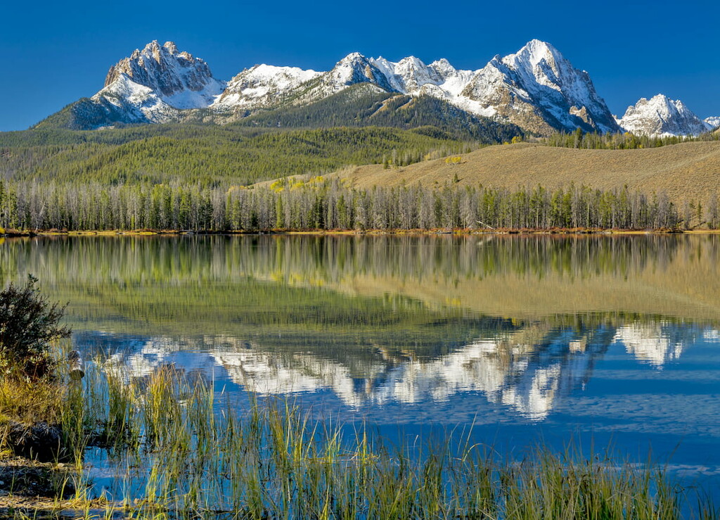
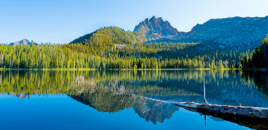
The Sawtooth Range is a mountain range located in central Idaho in the United States of America. The range totals 43 miles in length and up to 25 miles wide, totaling 678 square miles across the state. Most of the range lies within the Sawtooth Wilderness while some parts extend into the Sawtooth National Recreation Area and the Sawtooth National Forest. The name “sawtooth” refers to the rugged and rather jagged peaks that define this mountain rain. To the east of the range lies the expansive Sawtooth Valley.
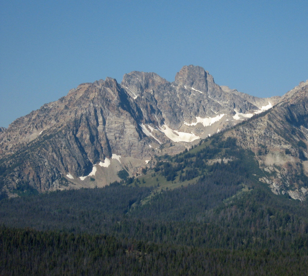
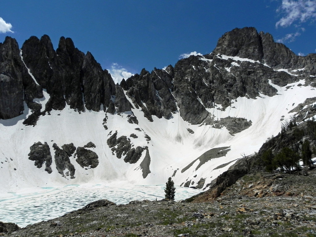
There are 72 named mountains in Sawtooth Range. The highest and the most prominent mountain is Thompson Peak at 10,748 feet. There are nearly 60 peaks throughout the range that reach elevations of over 10,000 feet. On top of these peaks, the range also boasts 77 peaks that are between 9,000 and 10,000 feet.
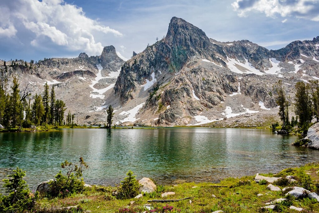
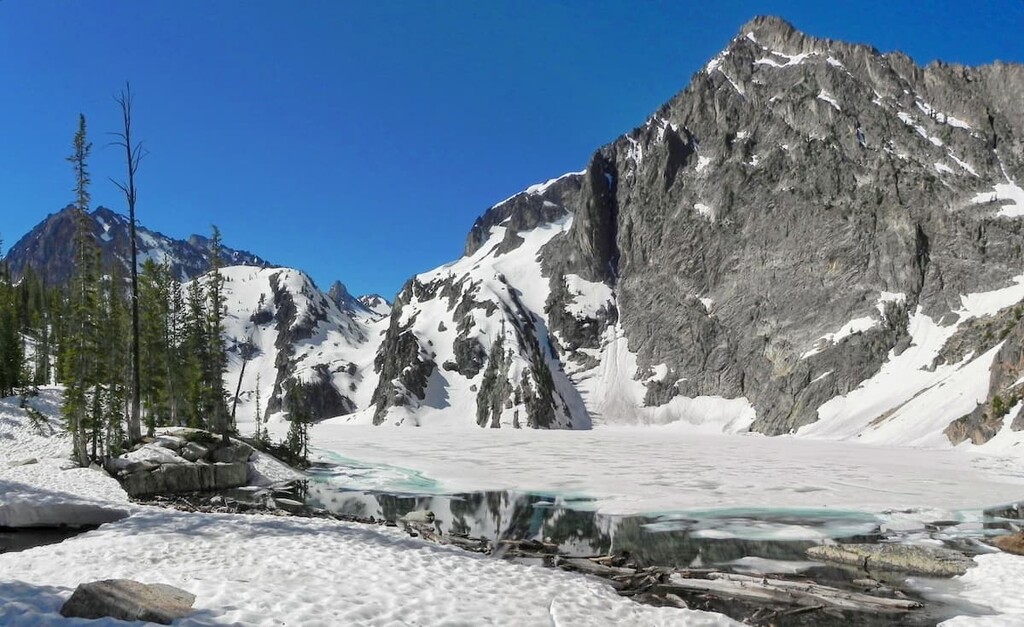
No snow glaciers exist within the range today, though the region is home to rock glaciers and snow fields during the winter months. At the base of the range lies the Sawtooth Fault that totals 40 miles in length. It is estimated that the most recent major earthquake occurred on the fault about 4,000 years ago.
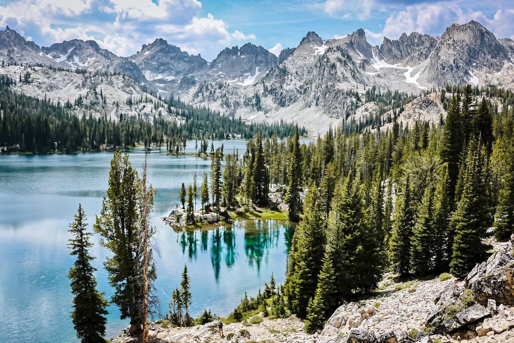
Besides the jagged peaks, the Sawtooth Range is also home to over 400 lakes, remnants of the alpine glaciers that once existed. Lakes in the eastern region of the range tend to drain via the Salmon River. The western half of the range drains throughout the South Fork Payette Rivers. Other rivers within the range include the Middle Fork Salmon River and the Boise River.
Throughout the Sawtooth Range are numerous hiking trails. Within the Sawtooth National Recreation Area lie over 700 miles of trails. During the winter months, the range also boasts miles of trails designated for cross country skiing, snow shoeing, and snowmobiling. The western side of the range has more established campgrounds though back country hiking is allowed anywhere within the wilderness.
Sawtooth Lake: The most popular hike in the Sawtooth Range is the trail to Sawtooth Lake. The trail lies within the Sawtooth National Forest and totals 10 miles round trip with 1,873 feet of elevation gain. The trail climbs steadily throughout before reaching the beautiful lake. Steep hills surrounding the alpine lake, offering solitude in the rugged range. The trail is accessible throughout the year, though winter gear is recommended during the colder months.
Tin Cup Hiker: Tin Cup Hiker is an 18-mile loop with 3,169 feet of elevation gain. The trail starts and ends at Pettit Lake before going deep within the Sawtooth Range. Hikers travel through valleys, over mountain passes and past seemingly endless backcountry lakes. Major lakes along the way include Toxaway Lake, Twin Lakes, Alice Lake, and Pettit Lake. While some fast packers complete this hike in a day, many people often cover the distance over the course of a few days.
Goat Lake and Goat Falls: The trail to Goat Lake and Goat Lake Falls is 8.2 miles with 1,800 feet of elevation gain. The trail climbs steadily through the Sawtooth National Forests until the last half mile of the hike. From there the trail becomes quite steep before reaching the lake. The lake itself is surrounded by rugged mountain faces.
Bench Lakes Trail: The trail up to Bench Lake is 7.8 miles out and back with 1,200 feet of elevation gain. The well-maintained trail climbs steadily, all while overlooking the large Redfish Lake below. Once at the top, the trail heads westward and ends at the small and quaint Bench Lakes.
The city of Boise is the capital of the state of Idaho and the most populous city in the state. Situated on the Boise River, the city is 41 miles east of the Oregon border and 110 miles north of the Nevada border. The Boise metropolitan area contains the state’s three most populous cities; Boise, Nampa, and Meridian with a total population of 710,000. The city is known as “The City of Trees” and the downtown area is full of shops and local dining options. The town is home to numerous recreational opportunities which include hiking and biking. Boise is also home to the Boise River Greenbelt which is an extensive urban trail system along the Boise River.


The highest peak in the Sawtooth Range is Thompson Peak, at 3,276 m.
The Sawtooth Range have 103 named peaks.


