
Scan the QR code and open PeakVisor on your phone
The Boulder Mountains include 21 named peaks. The highest is Ryan Peak at 3,566 m. Other notable peaks include Glassford Peak, Kent Peak and Galena Peak.
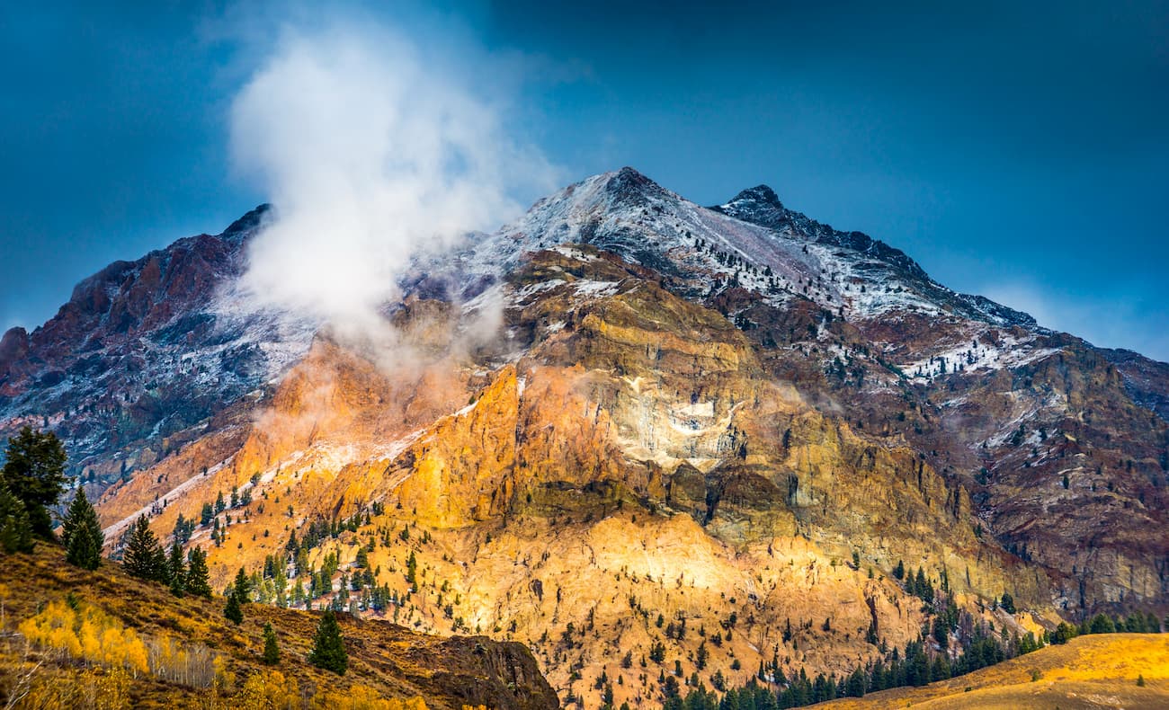
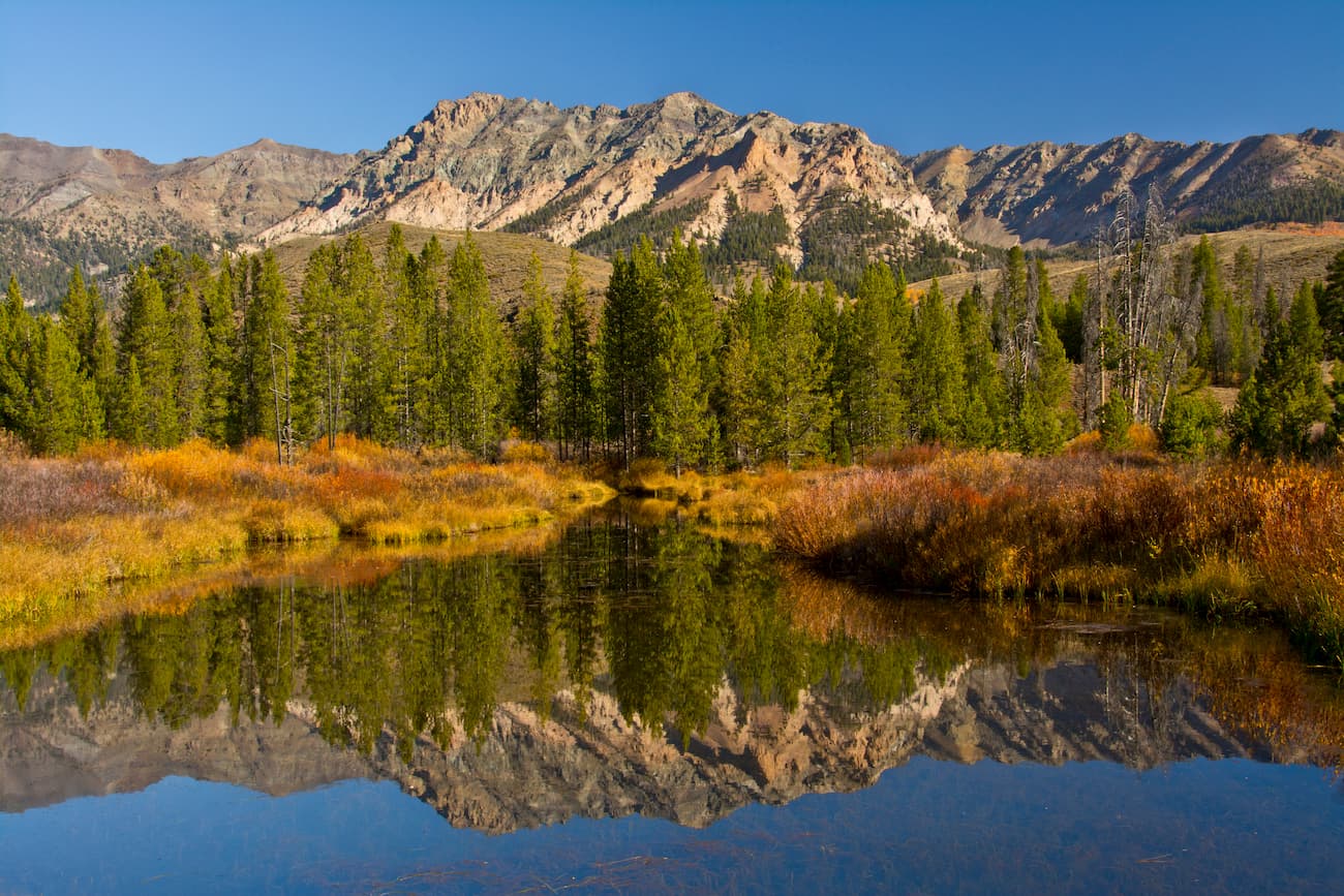
Rugged and beautiful, the Boulder Mountains are a small range of peaks located in the central part of the US state of Idaho. Popular among hikers in the summer months, the Boulder Mountains contain 18 named summits, the highest and most prominent of which is Ryan Peak (11,703ft/3,567m).
Situated in the heart of Idaho, the Boulder Mountains are mostly contained within Custer County. They are located within a highly mountainous part of the state, all of which is part of the greater Idaho-Bitterroot Rocky Mountains.
However, the Boulder Mountains of Idaho are not to be confused with the nearby Boulder Mountains of Montana, which are part of the Central Montana Rocky Mountains within the Beaverhead-Deerlodge National Forest near the Elkhorn Mountains, the Lewis Range, and the Tobacco Root Mountains.
The Boulder Mountains are located to the southwest of the Lost River Range, Lemhi Range, and the Beaverhead Mountains, which form a series of 3 parallel ridges that separate the range from Idaho's border with Montana.
Moreover, the range is situated to the south of the White Cloud Mountains and the Bitterroot Range and to the north of the Pioneer Mountains. Located to the west of the Boulder Mountains is the Smoky Mountains, the Boise Mountains, and the Sawtooth Range, which are part of the Sawtooth National Forest, the Sawtooth National Recreation Area, and the Boise National Forest. Finally, the White Knob Mountains form the range's eastern border near the town of Mackay.
The Boulder Mountains, like the rest of the Idaho-Bitterroot Rocky Mountains, are mostly located on public land. In particular, they are almost located within the boundaries of the Salmon-Challis National Forest, including within the Jim McClure-Jerry Peak Wilderness Area and the Hemingway-Boulders Wilderness Area. Moreover, parts of the range, including the highest mountain, Ryan Peak, are located within the Sawtooth National Recreation Area.
From a geological perspective, the Boulder Mountains are part of the Rocky Mountains, in particular, the Idaho-Bitterroot Rocky Mountains, which cover a large part of Idaho, from the Snake River Plain in the south to the state's border with Canada in the north.
However, unlike many of the ranges to the west, such as the Boise Mountains and the Sawtooth Range, the Boulder Mountains are not underlain by the Idaho Batholith. Moreover, unlike the Lost River Range and the Lemhi Range to the northeast, the Boulder Mountains are not generally considered to be part of the Basin and Range Province, which is why they do not display the characteristic valley/ridge formation typical of the Great Basin Ranges.
Compared to their neighbors, the Boulder Mountains are perhaps most similar to the Pioneer Mountains, which also contain a thrust belt of predominantly Paleozoic rock. Much of the area is also home to darkly colored sedimentary rocks that are part of the Idaho Black Shale Mineral Belt.
The range also contains some evidence of the igneous and metamorphic rocks of the Challis Volcanic Group within the range. This geologic group covers some 9,650 square miles (25,000 sq. km) of land in central Idaho and is believed to be a result of the subduction of the Farallon Plate under the North American Plate.
In years past, the range was the site of some large mining operations, particularly for galena, which is lead in its natural mineral form.
Major peaks within the range include Ryan Peak, Kent Peak, Glassford Peak, Sheep Mountain, Anderson Peak, Jerry Peak, and Herd Peak.
Similar to many other nearby ranges, the Boulder Mountains are part of what's known as the Middle Rockies Ecoregion. This ecoregion is drastically different from the low-lying Snake River Plain to the east and has some slight nuances that differentiate it from the Idaho Batholith Ecoregion that surrounds it to the west and southwest.
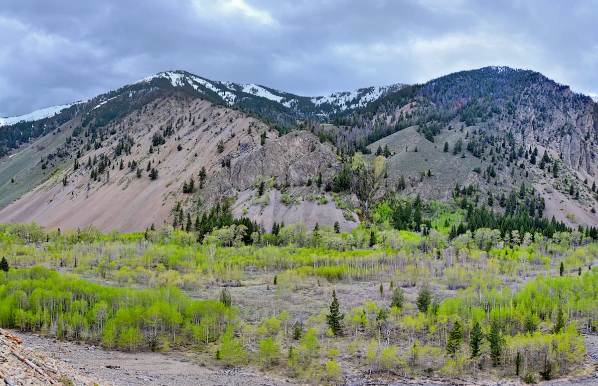
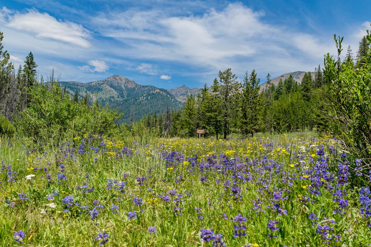
Within this Middle Rockies ecoregion, much of the lower elevations are home to shrubs and grasses and open range grazing is common in valleys, particularly on BLM land. At mid-elevations on the other hand, slopes are dominated by forests of subalpine fir, Engelman spruce, and Douglas fir.
Meanwhile, the highest slopes of the Boulder Mountains, like many of the other nearby ranges, are hope to alpine terrain with typical Rocky Mountain alpine vegetation and scree slopes near the tallest summits.
As far as wildlife goes, the range is home to typical Rocky Mountain wildlife, including black bears, grey wolves, mountain lions, bighorn sheep, mule deer, and moose, as well as a fairly large population of mountain goats.
Central Idaho, including the region in and around the Boulder Mountains, has long been home to humans. Many peoples consider the region to be part of their ancestral homelands, including the Shoshone-Bannock, the Lemhi, the Nimiipuu, and the Eastern Shoshone.
The first non-Indigenous peoples to visit the area were likely fur trappers from the Hudson's Bay Company, who may have arrived in the 1820s. However, they didn't stay in the region due to the relative lack of beavers, whose pelt was of prime economic importance at the time.
Unlike the Lemhi Range to the northeast, which saw the creation of a Mormon missionary settlement known as Fort Lemhi in the 1850s, the region around the Boulder Mountains didn't seem much European-American permanent settlement until after the 1860s.
During the 1860s, a group of prospectors led by Captain John Stanley searched the area for gold, but left empty handed.
In the 1880s, however, after the discovery of lead in the area, a small group of miners established the town of Ketchum to the southwest of the range. The town saw a brief boom during the height of its mining operations in the 1880s and 1890s. After this subsided, the town transitioned to an agricultural economy and many shepherds started to drive their flocks into the Boulder Mountains and the surrounding ranges.
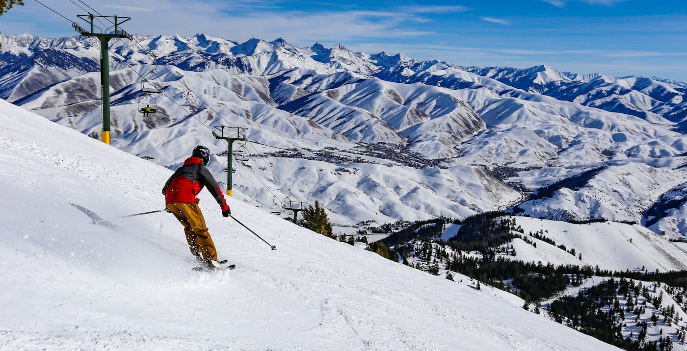
Meanwhile, the town of Sun Valley, which is just to the northeast of the range, quickly became a winter resort destination after the Union Pacific Railroad established a rail line to the town. After Sun Valley was connected to the main rail line, passengers could travel from as far as Los Angeles to the town while only changing trains once along the way.
Interestingly, the author Ernest Hemingway used to spend quite a bit of time in the region. In fact, it's believed that he finished his book For Whom the Bell Tolls while staying in Sun Valley. Hemingway later moved to Ketchum and spent much of his later life in the region before committing suicide in his Ketchum home in 1961.
These days, Ketchum, Sun Valley, and the rest of the Boulder Mountains remain popular destinations for outdoor recreation. Mountain pursuits, particularly skiing, are quite popular during the winter months and hiking in the Boulder Mountains is a common activity during the summer.
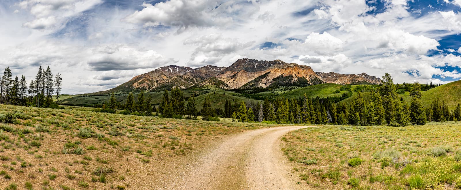
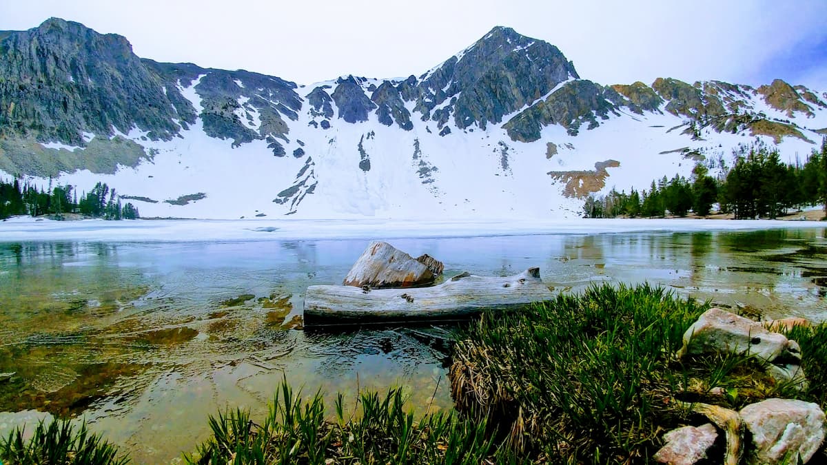
The Boulder Mountains are a frequently visited hiking destination during the summer months. Here are some of the most popular places to check out:
The path to North Fork Lake is about 3 miles (4.8km) long if you depart from forest road 128. However, the trail is intermittent and is not clearly marked, so backcountry navigation skills are a must. That being said, the lake itself is situated near Ryan Peak and offers some stunning panoramic views of the heart of the Boulder Mountains.
It's a bit of a mouthful to say, but the West Fork Trail is a popular option in the boulder Mountains. This 7 mile (11.3km) hike starts off from a trailhead off of forest service road 146, which is connected to Highway 75.
The trail is mostly shaded and offers a nice walk through a stunning forest with great views of 2 waterfalls and an open canyon at the end. If you continue climbing beyond the falls, you can also enjoy views of an alpine meadow and a third waterfall. The more intrepid amongst us can also continue on toward Window Lake or you can attempt some peak ascents if you're up for a bit of scrambling.
Despite being rugged and remote, the Boulder Mountains are located within driving distance of some of Idaho's largest cities and resort destinations. Here are some good places to check out during your visit to the region.
The city of Ketchum is located just a short drive to the southeast of the Boulder Mountains. It is home to approximately 2,600 residents and is down the road from the nearby resort city of Sun Valley, which has an additional 1,400 residents.
Both Ketchum and Sun Valley are popular destinations for outdoor recreationalists, thanks to their proximity to the region's world-class ski resort. Moreover, both towns are a short distance away from the Sawtooth National Recreation Area and the Boulder Mountains, which both offer great hiking opportunities.
Additionally, there is a small airport, the Friedman Memorial Airport, that's located about 30 minutes away from the Sun Valley Resort. The airport offers regular service to Salt Lake City and Seattle, as well as seasonal service to other major cities in the western US.
Although it's located on the opposite side of the state, Boise is just under 3 hours away from the Boulder Mountains by road. Boise is the capital and largest city in the state, with some 228,000 residents, and it is a major cultural and commercial center for the region.
The city has the largest airport in the state of Idaho, as well as gerat road connections on I-84, which offers links to both Portland, Oregon and Salt Lake City, Utah.


The highest peak in the Boulder Mountains is Ryan Peak, at 3,566 m.
The Boulder Mountains have 21 named peaks.


