Scan the QR code and open PeakVisor on your phone
The White Clouds Wilderness Area spans 90,775 acres across the state of Idaho in the United States. This protected region lies within the Boulder-White Clouds within the Sawtooth Mountains. To the west lies the Boise National Forest, with the Challis National Forest spanning to the north. A large majority of the wilderness is managed through the Sawtooth National Forest that it lies within. The region was established back in 2015 with the passing of the Sawtooth National Recreation Area and Jerry Peak Wilderness Additions Act.
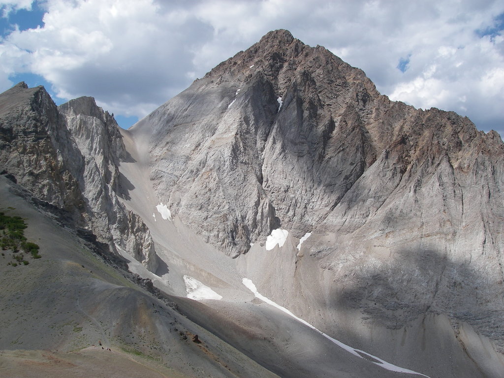
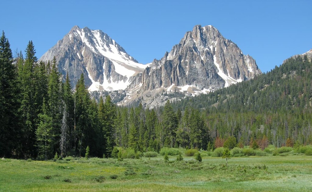
There are 9 named mountains in White Clouds Wilderness Area. The highest and the most prominent mountain is Castle Peak at 11,824 feet. The iconic peak has 4,032 feet of prominence above the other mountains within the region. Castle Peak gained name recognition after it was to become the starting point for a molybdenum mine. The local communities fought against it and won, which led to the establishment of the Sawtooth National Recreation Area.
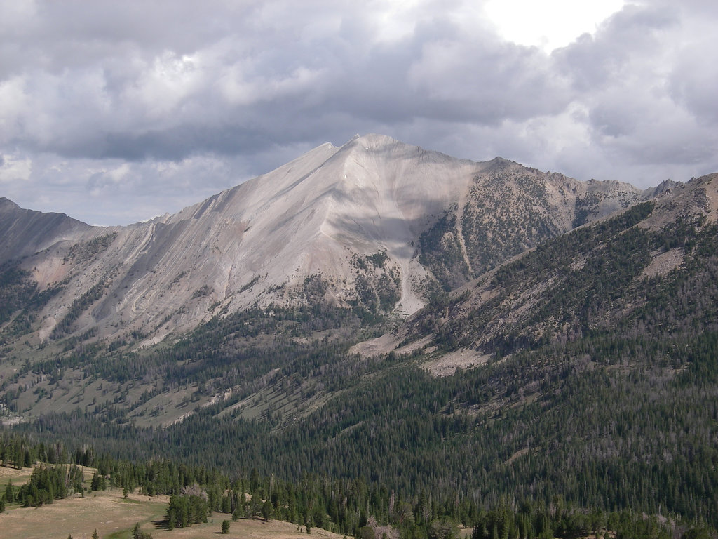
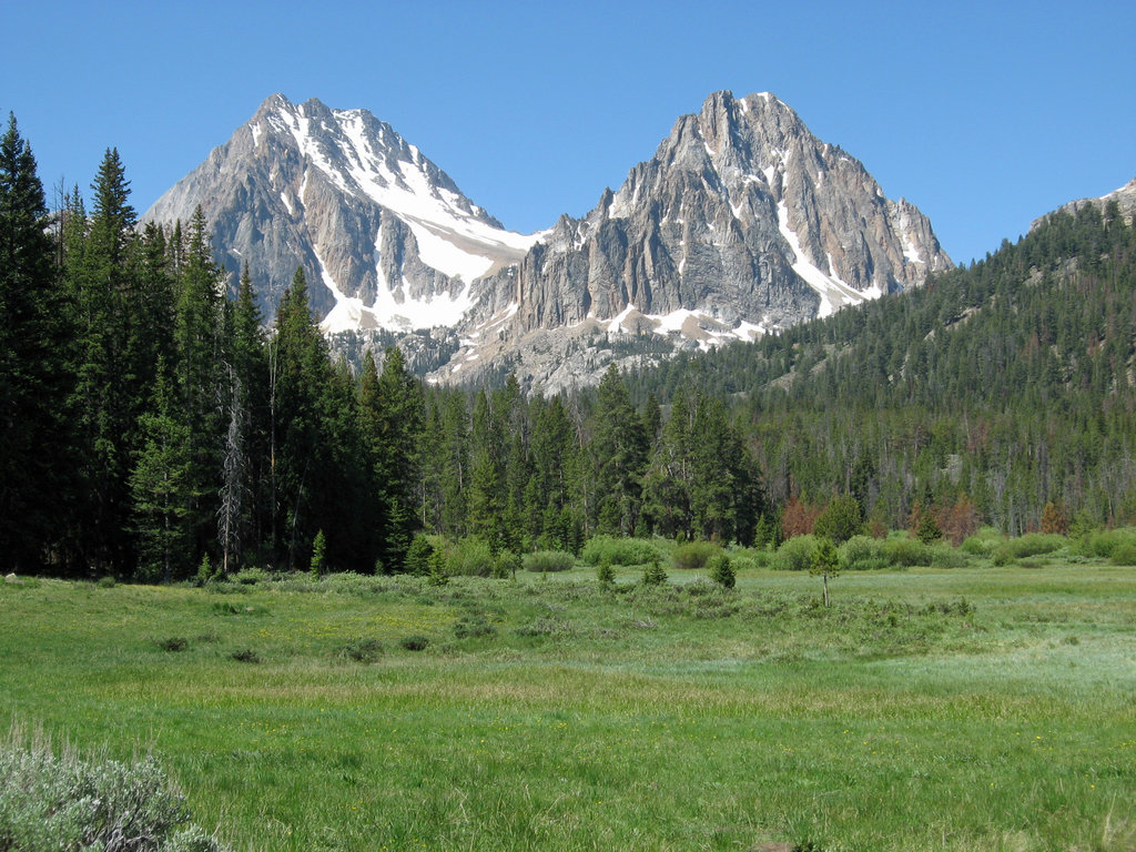
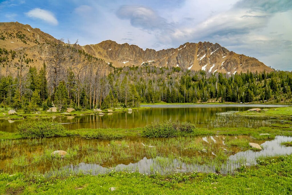
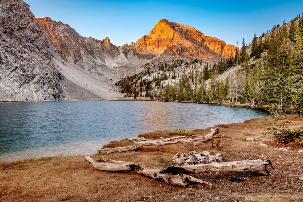
Much of the range is characterized by its alpine terrain, full of crystal-clear lakes and a variety of wildlife. The White Clouds Wilderness was named by early European settlers who saw the snow capped peaks of the range. Amongst the towering peaks lies a forest made of mostly white bark pine, along with some of the oldest trees in the entire world. The mountains within this wilderness are composed mostly of limestone and granite. This combination of rock allows for the peaks to appear to change colors depending on how the light of the sun is hitting it.
While the wilderness is full of alpine lakes and rugged peaks, it is also home to the highest elevation wildflower fields in all of Idaho. The pristine lakes of the wilderness feed into the Salmon River that runs throughout the state. These streams and rivers are abundant with spawning salmon and boast the highest elevation for salmon in the continental United States. Besides salmon, the wilderness is also home to mountain lions, bighorn sheep, mountain goats, black bear, gray wolves, elk, moose, and the ever elusive wolverines.
This wilderness is popular for hiking, camping, skiing, and horseback riding. Throughout the White Clouds Wilderness are 57 miles of designated trails. Because of the remote location of much of the protected area, off-trail navigation is also allowed.
White Cloud Peaks Loop: This popular loop trail takes hikers through much of the wilderness. The trail totals 28 miles with 7,148 feet of elevation gain. The route passes through nearly everything that the wilderness has to offer, alpine lakes, wildflower meadows, rugged mountain peaks, mountain passes, and expansive views of the forest below. The trail is often completed over the course of three days and is rated as difficult as there are multiple sections with loose rock and steep climbs.
Fourth of July Lake: The 5.5-mile trail to Fourth of July lake is one of the most popular hikes in the wilderness. The route has 860 feet of elevation gain and gradually climbs through the pine forest up to the lake. The lake itself is surrounded by wildflower meadows with the rugged Cloud Mountains towering above. While the short hike is often done in one day, there are campgrounds at the lake.
Washington Lake: Washington Lake is a moderate hike that showcases the beauty of the White Clouds Wilderness. The trail starts on the same trail that leads to Fourth of July Lake. Hikers can continue onward to reach the much larger Washington Lake. The forest surrounds much of the lake with steep shale cliff faces along the northern shore.
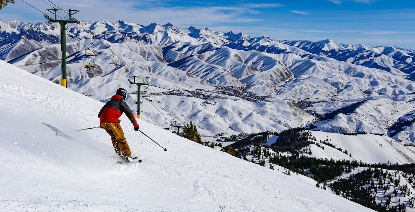
The small town of Ketchum is an hour south of the White Clouds Wilderness Area. The population is estimated to be just under 3,000 people. The city was established during the mining boom in the 1890s and later became the largest sheep-shipping center in the western United States. The Trail Creek and Warm Springs Creek join with the Big Wood River within Ketchum city limits. Hiking trails surround the small mountain town. During the winter months Bald Mountain turns into a ski resort with over 60 runs.
Boise, Idaho lies two and a half hours southwest of the White Clouds Wilderness Area. The city is the capital of the state of Idaho and the most populous city in the state. Situated on the Boise River, the city is 41 miles east of the Oregon border and 110 miles north of the Nevada border. The Boise metropolitan area contains the state’s three most populous cities; Boise, Nampa, and Meridian with a total population of 710,000. The city is known as “The City of Trees” and the downtown area is full of shops and local dining options. The town is home to numerous recreational opportunities which include hiking and biking. Boise is also home to the Boise River Greenbelt which is an extensive urban trail system along the Boise River.