
Scan the QR code and open PeakVisor on your phone
Craters of the Moon National Monument has 23 named peaks. The highest is Big Cinder Butte at 1,986 m. Other notable peaks include Sunset Cone, Silent Cone and Grassy Cone.
Located on a desolate stretch of the Snake River Plain in the US state of Idaho, Craters of the Moon National Monument features dormant volcanoes, lava fields, and some of the deepest open rift cracks in the world. There are 23 named mountains in the area, the highest and most prominent of which is Big Cinder Butte (6,516 ft/1,986 m).

Craters of the Moon National Monument and Preserve covers a total area of over 1,000 square miles (2,893 sq km) of the southern part of the US state of Idaho, just to the south of the Pioneer Mountains. The preserve extends across Blaine, Butte, Lincoln, Minidoka, and Power counties to the south of US Route 20 between the towns of Arco and Carey.
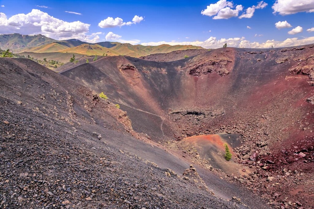
Craters of the Moon is home to some of the most significant volcanic landforms of their kind. The preserve lies along the Great Rift of Idaho, which has some of the best examples of open rift cracks in the world, including the deepest rift crack anywhere on Earth at 800 ft (244 m) deep.
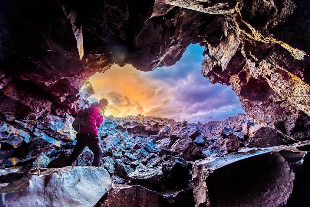
The Great Rift of Idaho has given rise to three major lava fields, creating one of the best-preserved flood basalt areas in the continental US. Other volcanic features in the monument include cinder cones, spatter cones, lava tubes, and tree molds. Craters of the Moon is considered dormant, but scientists expect future eruptions in the area.
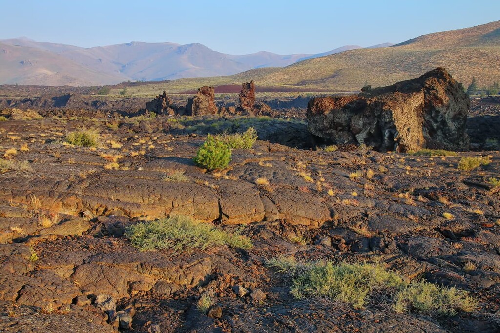
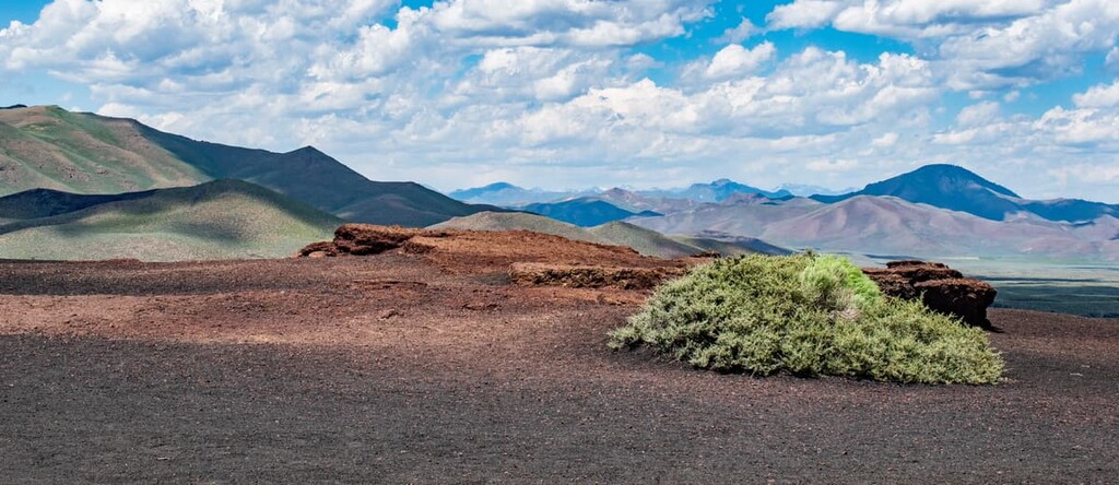
Outside of the 400 square miles (1,036 sq km) of sagebrush steppe found in the preserve, the landscape feels inhospitable and a bit otherworldly. There’s very little visible plant life in the lava fields. The average elevation across the preserve is about 5,900 ft (1,800 m), with cinder cone hills rising between 200 ft (60 m) and 600 ft (182 m) above the plain.
Craters of the Moon National Monument and Preserve is managed jointly by the National Park Service and the Bureau of Land Management. The “national monument” section in the north of the preserve has the only developed facilities in the park, including a visitor center, campground, bathrooms, and hiking trails.
Visitors can take in views from the 7-mile (11 km) loop road around the National Monument and hike to the top of some of the cinder cones. Several of the scenic trails at Craters of the Moon are fully accessible for people who use wheelchairs or have limited mobility.
Situated in the southern part of mountainous Idaho, Craters of the Moon is surrounded by other hiking opportunities in the state and beyond. The Pioneer Mountains, the Lost River Range, and the Portneuf Range are all located nearby, while the Tetons and Yellowstone Rockies lie further afield along Idaho’s eastern border with Wyoming.
The area of Craters of the Moon National Monument and Preserve has played host to volcanic activity for millions of years. Between 8 and 10 million years ago, the hotspot that underlies Yellowstone National Park today was underneath Craters of the Moon, causing massive eruptions of rhyolite magma.
As the North American continental plate drifted southwest, the stationary hotspot under Earth’s crust appeared to move northeast along the Snake River Plain to its present location under Yellowstone. The hotspot caused over 100 eruptions over millennia and formed massive craters called calderas that are between 10 and 40 miles (16–65 km) wide.
The lava flows visible in Craters of the Moon today formed during eight different periods of eruptions that occurred between 15,000 and 2,000 years ago. This makes them some of the youngest lava flows in North America. (Note that there are younger lava flows in the US in Hawaiʻi, but the archipelago is usually considered to be outside North America).
Lava in the region erupted from a series of deep parallel cracks in Earth’s crust called the Great Rift, which runs about 60 miles (100 km) southeast through the preserve.
The largest lava field, the Craters of the Moon lava field, covers over 600 square miles (1,550 sq km) and features nearly every type of basaltic lava, including great examples of ʻaʻā and pāhoehoe flows. The area is made up of 60 overlapping lava fields and 25 cones. The smaller Wapi and Kings Bowl fields to the south both formed around 2,000 years ago.
The crust around the Craters of the Moon is still experiencing basin and range type faulting, which has produced extensive stretching. The last major earthquake in the area was a magnitude 7.3 earthquake in 1983 that caused nearby Borah Peak to rise by 1 ft (30 cm) and the Lost River Valley to drop about 8 ft (2.4 m).
Scientists expect future eruptions from the Craters of the Moon. For the past 15,000 years, the Great Rift has erupted about every 2,000 years, and it’s been more than 2,000 years since the last eruption. It’s estimated that just over one cubic mile (4.2 cubic km) of lava will come to the surface during the next eruption event.
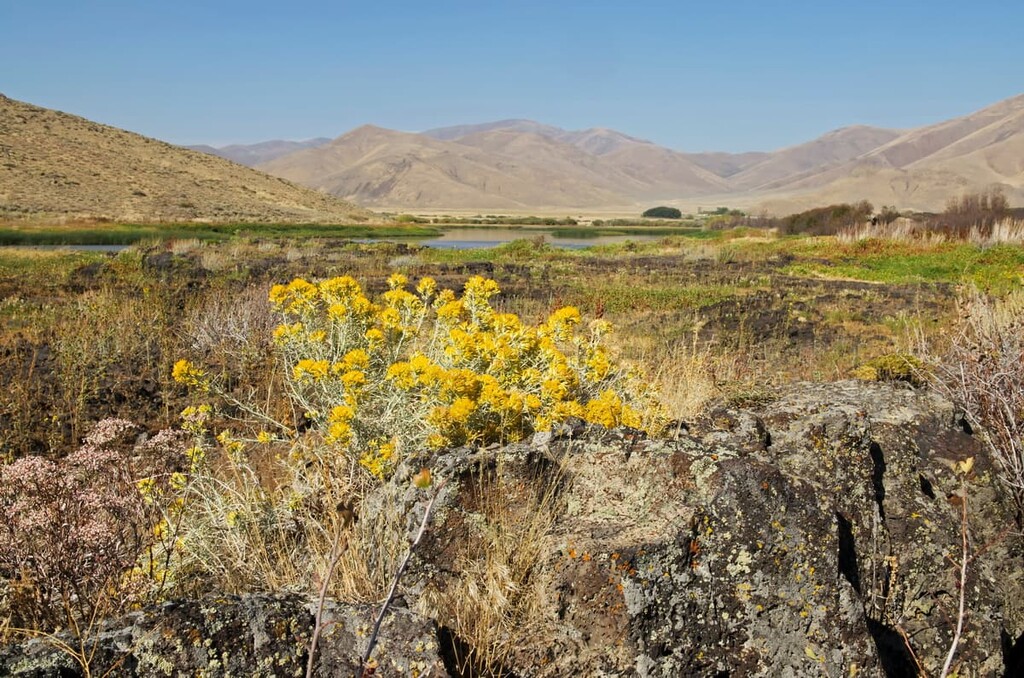
The lava fields of the Craters of the Moon provide a unique environment for hardy, well-adapted plant communities. The area receives near-constant winds only about 15–20 inches (38–51 cm) of rain per year, but there are over 750 different types of plants in the preserve.
Many of these plant communities in the monument are clustered in small areas called kipukas where older lava flows provide an island of hospitable conditions within newer lava flows.
As soil slowly accumulates in the lava fields, the first plants to colonize these areas are wildflowers, which are in full bloom on the cinder cones in springtime. In areas with more soil build up, antelope bitterbrush, limber pine trees, and juniper trees are common.
Before European-American settlement and colonization, the Craters of the Moon were home to large animals like bighorn sheep, grizzly bears, and bison. However, these animals have mostly been extirpated from the region. The largest mammals in the preserve today are mule deer.
Many of the animals at the Craters of the Moon have adapted to avoid the extreme desert heat during the day and are only active at night, or during the cooler hours of dusk and dawn. Some species here, including the Great Basin pocket mouse, yellow pine chipmunk, pika, marmot, and lava tube beetle are found nowhere else on Earth.
People first arrived in the area of Craters of the Moon between 12,000 and 14,000 years ago. The two most prominent groups in the area have historically been the Shoshone and Bannock tribes, interrelated groups that traditionally shared a semi-nomadic lifestyle but spoke slightly different Numic languages.
There’s extensive archeological evidence that both groups visited the area that is now Craters of the Moon and spent time there, especially in the northern area of the lava fields. The park museum holds over 5,000 worked stone artifacts found nearby, including bifaces, projectile points, and 85 potsherds.
The ancestors of the present-day tribal nation, the Shoshone-Bannock Tribes, likely witnessed the last volcanic eruption at Craters of the Moon. A Shoshone legend describes a giant snake coiling around a mountain and squeezing until it exploded and lava flowed through the area.
In the 1840s and 1850s, tens of thousands of European-American settlers began to arrive in the area via wagon trains, passing through on the Oregon Trail to more fertile farmlands to the north and west. In 1864 alone, 40,000 people passed through the area, encroaching on Shoshone-Bannock lands and straining the game resources they depended on.
Even more settlers were brought to Craters of the Moon by Goodale’s Cutoff, a 230-mile (370 km) spur off the original Oregon Trail that led emigrants around the edges of the lava fields. The cutoff, which took 2 to 3 weeks, was used by 70 percent of the wagon traffic on the Oregon Trail by 1863.
The Shoshone and Bannock peoples in the area sought to defend their land, and in 1858 the US Army was called into the territory, initiating full-scale conflict between the Indigenous peoples who have lived in the region since time immemorial and the newly arrived settlers.
After the Bear River Massacre of 1863, where the US army killed more than 400 Shoshone men, women, and children, the Tribe was forced to sign a peace treaty and moved to what’s today the Fort Hall Reservation to the southeast of Craters of the Moon. More than 5,000 members of the Shoshone and Bannock tribes live on the reservation today.
Craters of the Moon was deemed completely inhospitable by most European-American visitors until the 1920s, when an Idahoan named Robert Limbert made several expeditions in the area. He took hundreds of photos of the volcanic features and published essays in newspapers around the country, recommending that the area be made a national park. He even sent a scrapbook of his expedition to President Calvin Coolidge.
Within two months of the articles appearing, Coolidge issued a proclamation to establish Craters of the Moon as a national monument, on May 2, 1924. The area of the monument and preserve was greatly expanded by a proclamation from President Bill Clinton in 2000.
In 2017, Craters of the Moon was among more than two dozen national monuments that were placed under review for potential downsizing or elimination by then-Secretary of the Interior Ryan Zinke under President Donald Trump.
Unlike a number of other notable monuments, such as the Grand Staircase-Escalante National Monument in Utah, Craters of the Moon was not downsized as a result of this review. Furthermore, in March of 2017, the Idaho Senate even voted to petition Congress to re-designate the monument as a national park. If successful, this would make Craters of the Moon the first national park that’s wholly contained in the state of Idaho.
Hiking in Craters of the Moon gives you a chance to see some of the most significant volcanic features in North America, all in one place.
There are lots of great day hikes in Craters of the Moon, but don’t underestimate even the short trails. There’s no water and no shade on most hikes, so come prepared for the sun and bring plenty of water.
Inferno Cone
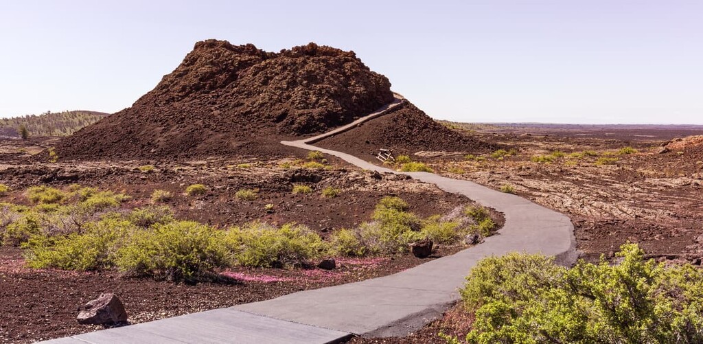
This is a short, steep trail that offers 360-degree views from the top of one of the signature cinder cones in Craters of the Moon. On a clear day, you’ll be able to see all the way to the Tetons 100 miles (160 km) away, in addition to the Pioneer Mountains, the Great Rift, and Snake River Plain.
North Crater Trail
This one-way trail takes hikers through North Crater and along the Rim of Big Crater to the Spatter Cones, traversing some of the most interesting volcanic features and lava flows in the area.
You can start the trail at the Splatter Cones and walk north towards the main entrance to the park, or hike north to south and walk back on the road or arrange to be picked up at the trailhead. The southern end of the trail is close to Inferno Cone, so you can extend your hike here if you want.
Broken Top Loop
This beautiful loop trail offers stunning views and takes hikers past nearly every type of major volcanic feature in the park. With a free permit, you can also access Buffalo Cave and the Wilderness Trail from Broken Top Loop.
Tree Molds Trail
To reach this trail, drive south along the park road and follow signs off the loop road for the Lava Cascades. At the end of the road, you’ll find the Tree Molds Trailhead. This trail leads through the Craters of the Moon Wilderness, past shrubs and limber pine trees to the edge of the Blue Dragon lava flow.
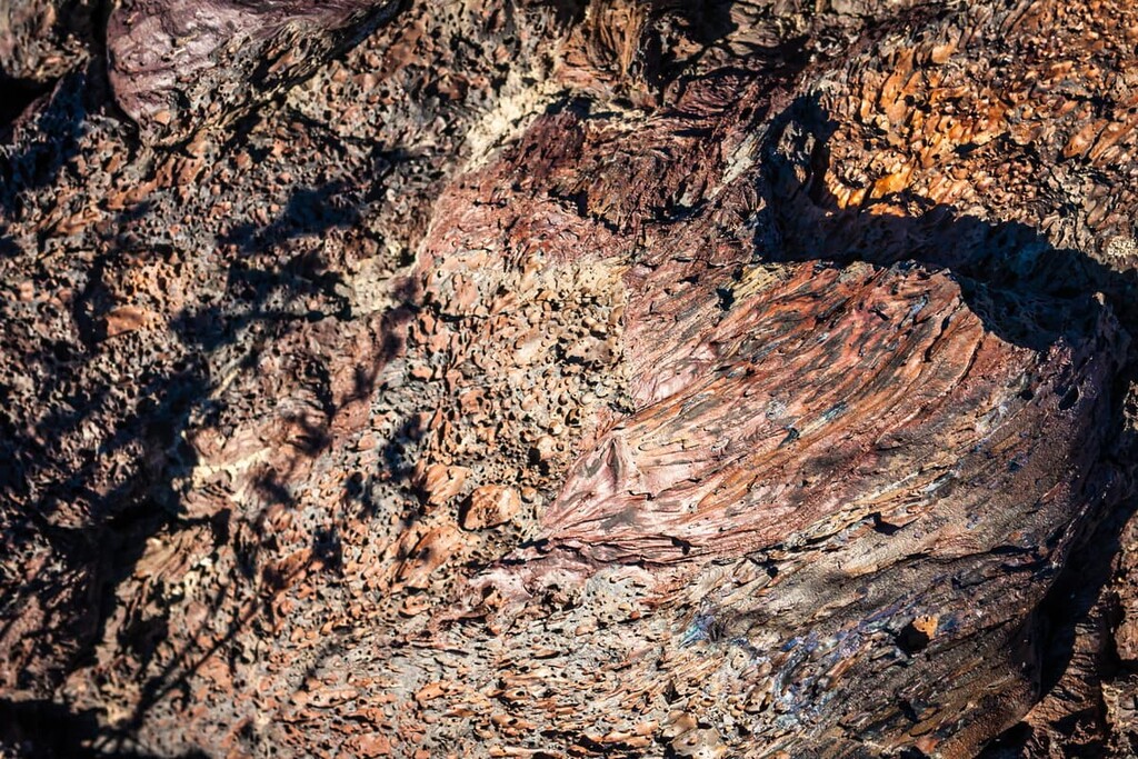
The distinctive blue lava in this area ignited trees when it was fresh, leaving impressions in the lava and creating vertical molds where trees stood.
With a backcountry camping permit and plenty of water, you can explore Craters of the Moon Wilderness. You won’t need a permit to do this as a day hike, but you will need a free permit from the visitor center if you’re planning an overnight.
There are no reliable sources of water here, so bring at least a gallon of water per person per day.
The Wilderness Trail
This quiet backcountry trail takes hikers away from the most visited areas of the park and into Craters of the Moon Wilderness. This trail passes craters, caves, and Big Cinder Butte, the tallest point in the preserve.
The Wilderness Trail starts from the Broken Top Trailhead (Tree Molds/Broken Top parking area) and immediately forks to the right, although you can follow the Broken Top loop trail for a scenic detour that rejoins with the Wilderness Trail.
Echo Crater, towards the southern terminus of the trail, offers protection from wind and sun and makes a great camping spot. The Wilderness Trail is passable all the way to the Sentinel, where it becomes difficult to follow. From here, you can continue off-trail, but the jagged lava rocks and scrub brush make it challenging.
“Nearby” is a loose term in rural southern Idaho, but Idaho Falls, Twin Falls, and Ketchum are the three largest towns within 100 miles (160 km) of Craters of the Moon. They both have plenty of hotels, restaurants, and places to buy gear and supplies for a longer hiking trip.
Twin Falls is located about 90 miles (145 km) southwest of Craters of the Moon, just off of I-84 in southern Idaho. The town has a population of about 45,000 people and a thriving recently revitalized downtown with shops, restaurants, and breweries.
Twin Falls provides visitors access to the Snake River Canyon, which is the main attraction in the area. There are scenic trails, zip lines, rock climbing, and a 200 ft (60 m) waterfall called
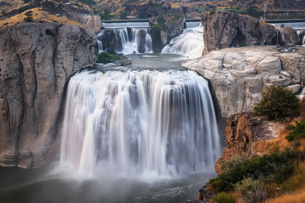
Shoshone Falls on the Snake River.
Idaho Falls, located about 85 miles (135 km) east of Craters of the Moon, is another midsize Idaho town with a beautiful natural setting and great attractions for visitors.
Idaho Falls is situated on the Snake River and home to around 60,000 people. One of the most popular spots in town is the Snake River Greenway, a five mile system of trails and parks along the river, which features a waterfall. The town has plenty of shops and restaurants, as a zoo with animals like lions, penguins and sloths. There’s also a petting zoo for kids.

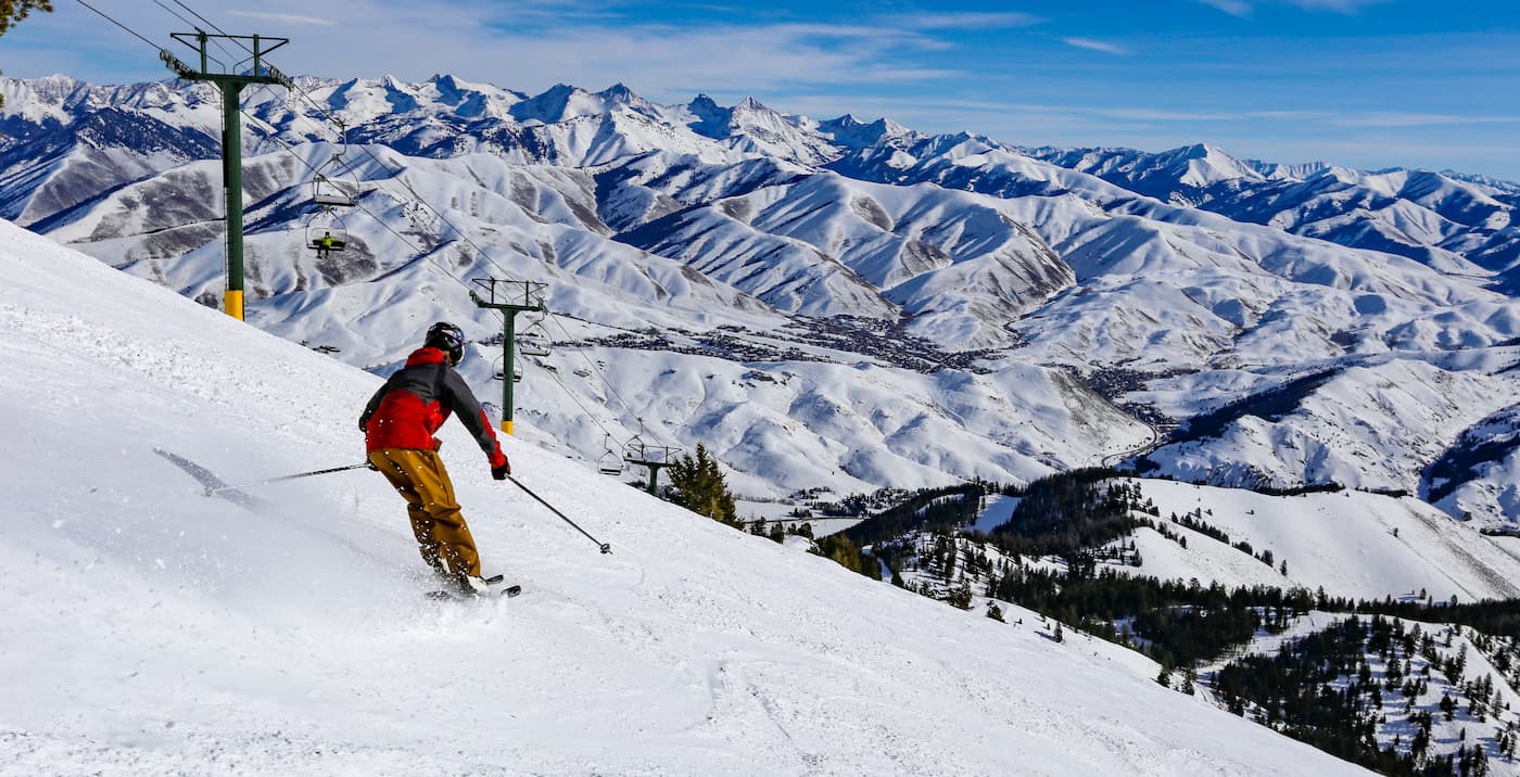
One of the most popular ski towns in Idaho, Ketchum is a community of about 2,700 people located an hour’s drive to the northwest of Craters of the Moon. When combined with nearby Sun Valley, Ketchum is a world-famous ski resort area.
Ketchum provides access to superb year-round outdoor recreation opportunities in addition to Craters of the Moon. There are thousands of miles of hiking trails in the region, including those within Sawtooth National Forest, the Sawtooth Wilderness Area, the Sawtooth National Recreation Area, and the Hemingway-Boulders Wilderness Area.


The highest peak in Craters of the Moon National Monument is Big Cinder Butte, at 1,986 m.
Notable peaks in Craters of the Moon National Monument include Big Cinder Butte, Sunset Cone, Silent Cone, Grassy Cone and Snow Cone.


