Scan the QR code and open PeakVisor on your phone
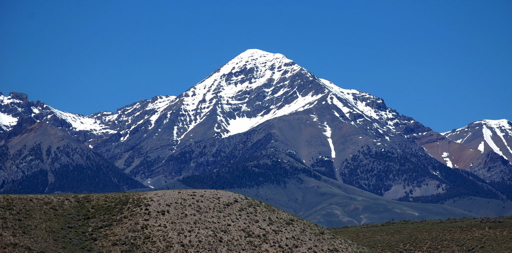
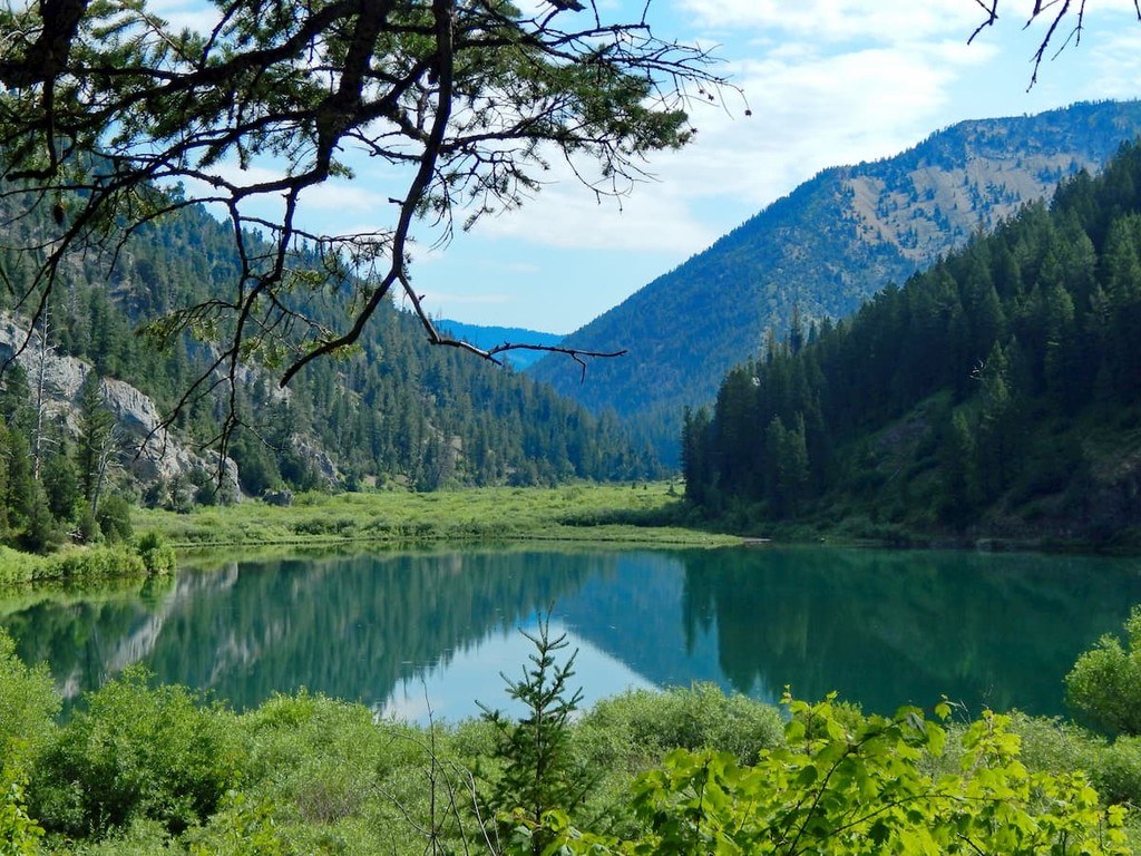
The Caribou-Targhee National Forest is a protected region located in the states of Idaho, Wyoming, and Utah. The forest covers 2.63 million acres of land and is bordered by Yellowstone National Park, Grand Teton National Park, and the Bridger-Teton National Forest. Combined these parks and forests make up the Greater Yellowstone Ecosystem, spanning 20 million acres across the United States. There are 175 named mountains in Caribou-Targhee National Forest. The highest and the most prominent mountain is Diamond Peak at 12,198 feet.
The Caribou and the Targhee National Forests were originally established back in 1891. Today the two forests operate as one, covering over 10 counties across the three states. Of the two sections, Caribou National Forest is smaller, totaling 987,221 acres. The Caribou Forest has sections located in all three states, and sits at the southern edge of the Caribou-Targhee National Forest. The Targhee National Forest is much larger, covering 1.6 million acres across Idaho and northwestern Wyoming. The main office for the two forests is located in Idaho Falls, Idaho.
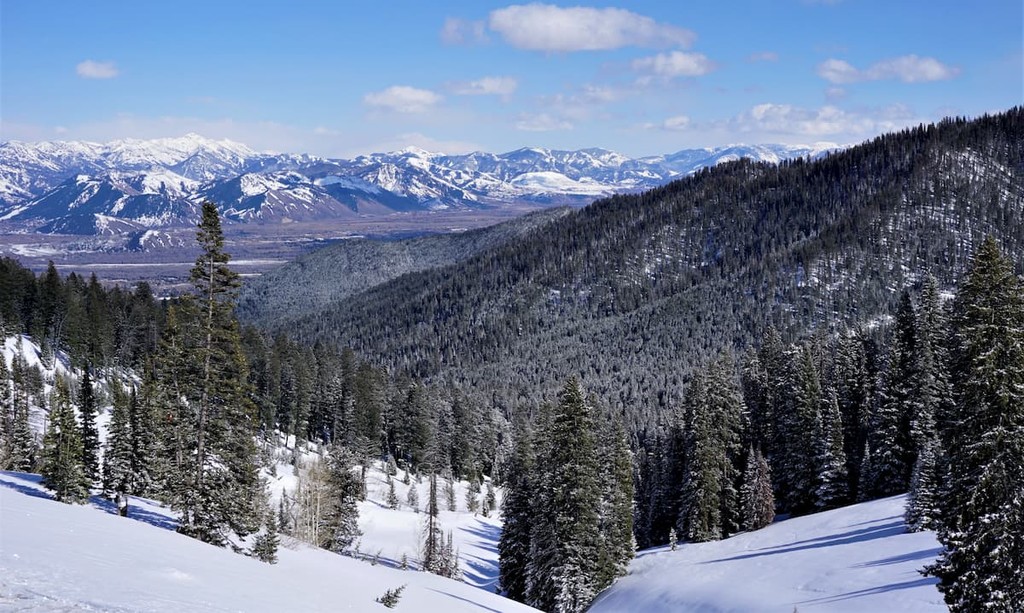
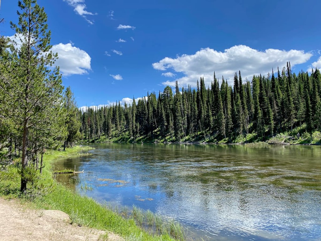
The western sections of the forest are characterized by sagebrush and tall grasses, often not receiving much annual rainfall. The eastern sections of the forest are characterized by pine, spruce, and fir trees that dominate the landscape. The Caribou-Targhee National Forest is home to the iconic grizzly bears of the region, black bear, cougar, bison, elk, wolf, and various other animals. The rivers and streams are abundant with cutthroat trout and brook trout and it is often thought to be one of the best places to fish for cutthroat trout in the entire world.
Outdoor adventure opportunities are accessible across the entire forest with over 1,600 miles of trails. Campgrounds are scattered throughout along with backcountry camping. Within the forest lie two wilderness areas; Jedediah Smith Wilderness, at 123,451 acres, and the Winegar Hold Wilderness, at just 10,715 acres.
Darby Canyon: The most popular trail in the forest is the Darby Canyon Wind Cave Trail. The route totals 6.3 miles out and back with 1,810 feet of elevation gain. The trail wind steadily through the forest before entering a clearing and climbing upstream. After a steep climb, the trail ends at a waterfall with the cave being accessible after more climbing.
Upper Palisades Lake: The Upper Palisades Lake trail is 15 miles out and back in just under 1,700 feet of elevation gain. While the trail is longer than most, it is rated as moderate due to the flatness through much of the route. Bridge crossing lie across the rushing creek and backcountry camping is available at lakes. There is also a Lower Palisades Lake trail that is time miles long.
Alaska Basin Trail: Though not in Alaska, this 15-mile loop trail boasts 3,100 feet of elevation gain. After nine miles, the trail reaches the expansive Alaska Basin, flanked by lush forests and rolling plains on each side. While the hike is often completed over the course of two days, the route is popular amongst trail runners during the summer months.
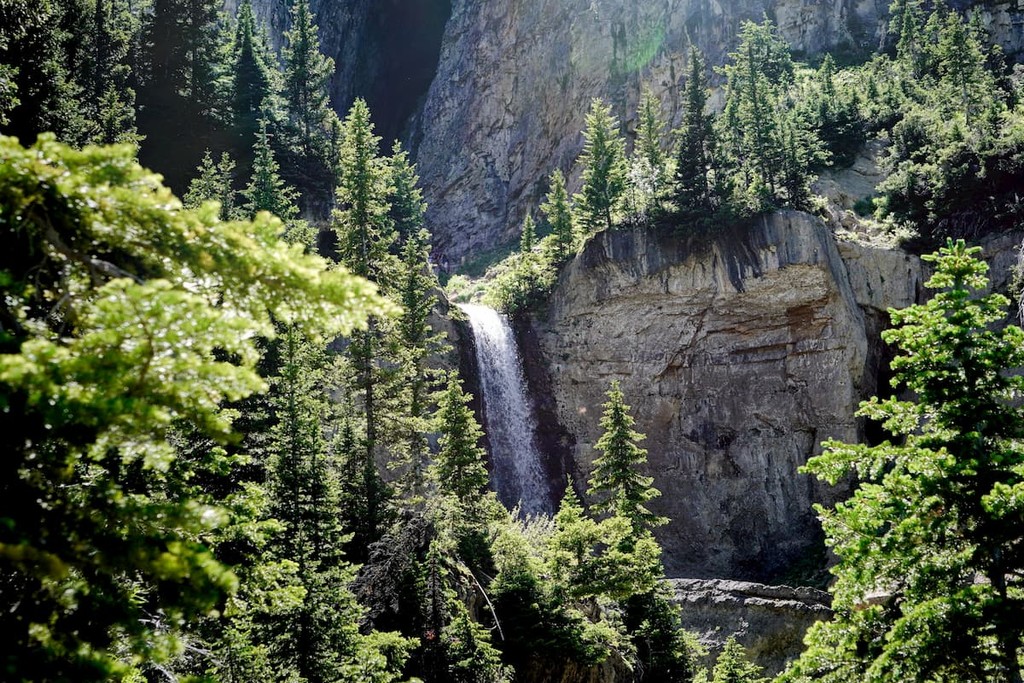
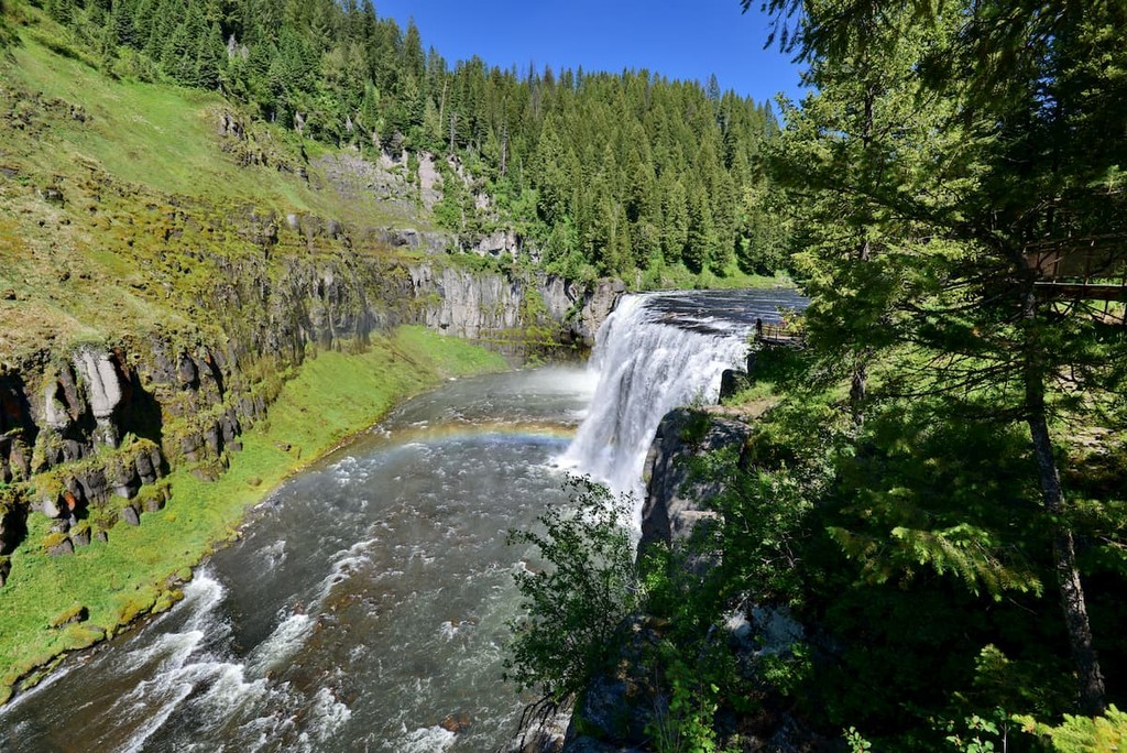
Mesa Falls: Mesa Falls is one of the most iconic landmarks in all of the forest. The short trail totals just 2.2 miles with 219 feet of elevation gain. The trail is accessible throughout much of the year and the winter months offer breathtaking views of the frozen falls with the water rushing below it.
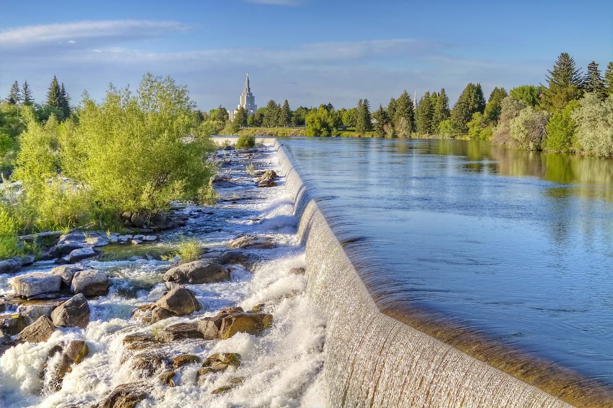
The Caribou-Targhee National Forest lies to the north, east, and south of Idaho Falls. The city of Idaho Falls is the largest city in Idaho, outside of the Boise metropolitan area with a population of 63,000. The city is also known for its river walk trail which offers paved and dirt routes along the Snake River. The historic downtown is home to museums, gardens as well as local shops and eateries.
Salt Lake City is the most populous city in the state of Utah and is south of the Caribou-Targhee National Forest. The city’s population is 200,000 while the metropolitan area is estimated to be about 1.2 million. The city is known for being an outdoor adventure paradise. Surrounding the city are seemingly endless places to go hiking, biking, running, and skiing. The city was home to the 2002 Winter Olympics and is closely located to numerous ski resorts. There are 5 national parks near the city, allowing for countless opportunities for hiking. Popular restaurants include Red Iguana, White Horse, The Copper Onion, and Nomad Eatery.