Scan the QR code and open PeakVisor on your phone
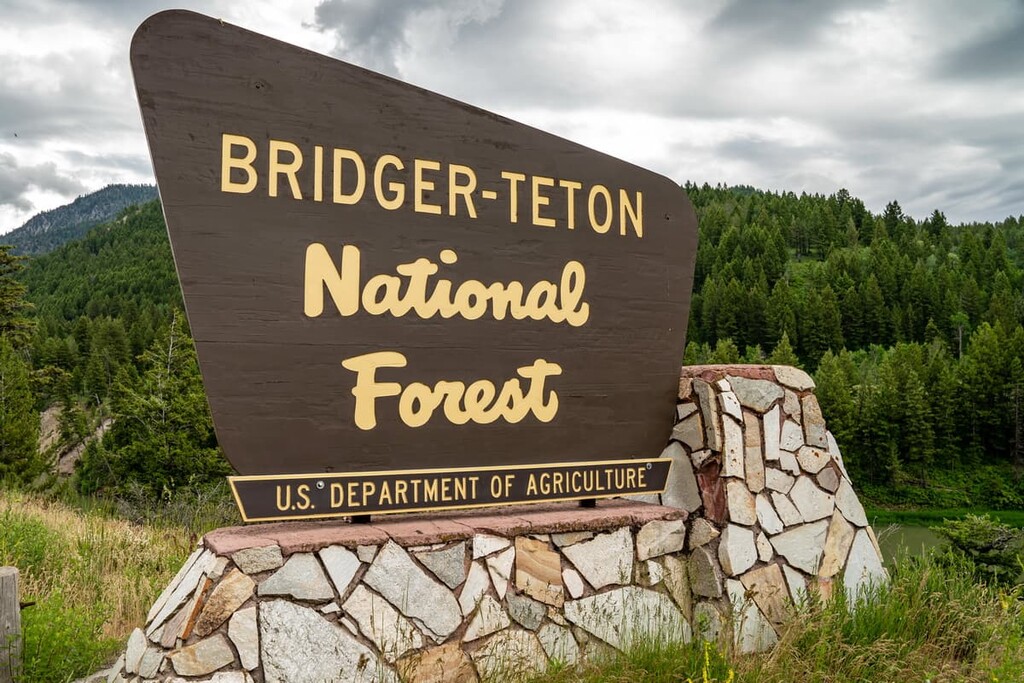
Covering over 2,000 miles (3,200 km) of backcountry trails and several million acres of pristine wild land in the US state of Wyoming, the Bridger-Teton National Forest is the third-largest national forest in the continental US. There are 141 named mountains in the preserve, the highest and most prominent of which is Gannett Peak at 13,819 ft (4,212 m).
The Bridger-Teton National Forest covers a vast 3.4 million acre (1.4 million ha) area in the western part of the US state of Wyoming, including three wilderness areas totaling over 1 million acres (400,000 ha).
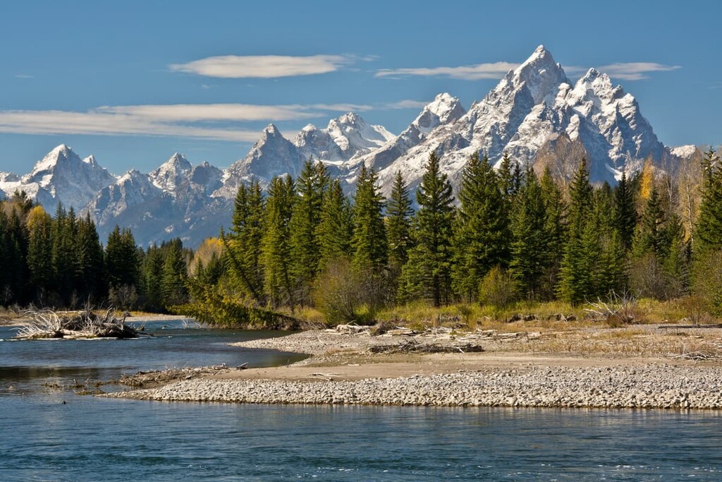
The forest stretches from Yellowstone and Grand Teton national parks in the north all the way south through the western half of the Wind River Range on the southwest side of the Continental Divide. Along the way, it also covers parts of the Absaroka, Wyoming, and Gros Ventre mountain ranges.
Bridger-Teton National Forest is the third-largest national forest in the US outside of Alaska. It is a massive, expansive area home to varying ecosystems and an extensive network of recreational spaces. There are 37 developed campgrounds and 34 designated trailheads in the national forest.
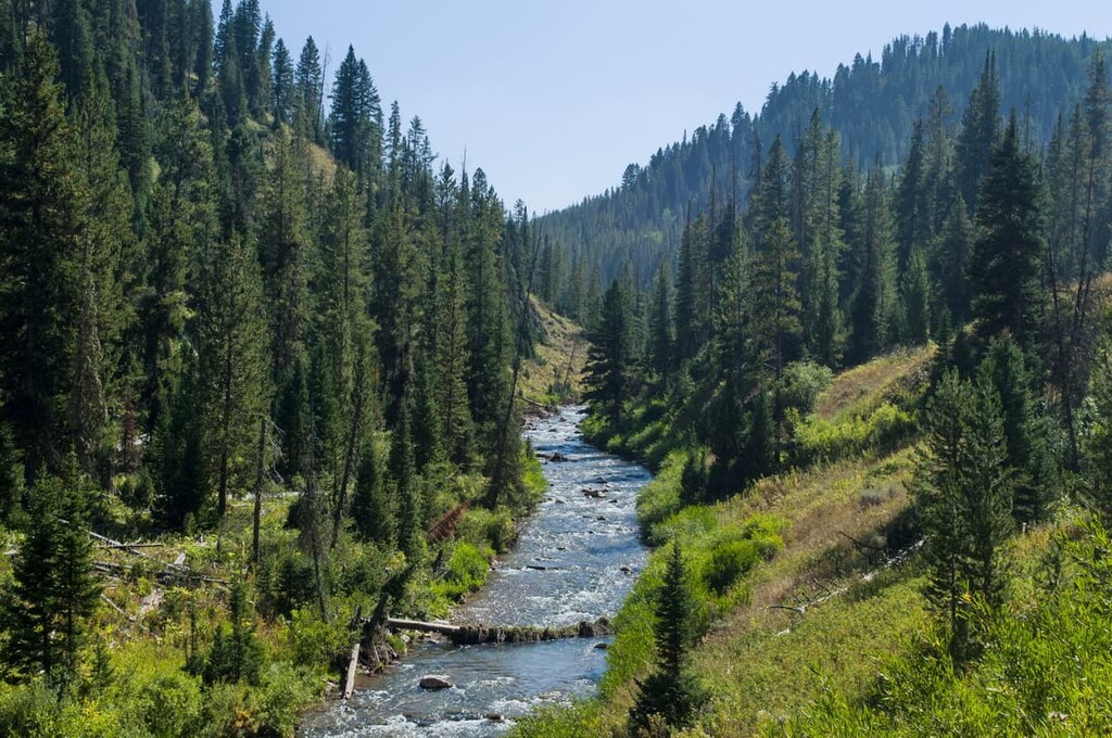
Hiking, mountain biking, horseback riding, and off-road driving are all popular activities in the Bridger-Teton National Forest during the summer. The rivers and streams in the wilderness area, including the Snake, Green, and Gros Ventre rivers, offer endless opportunities for fishing, boating, and whitewater rafting.
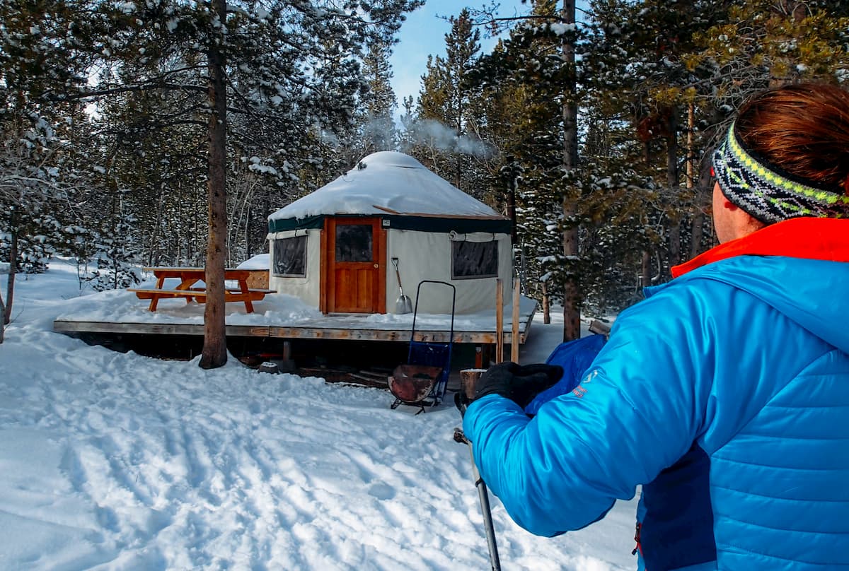
In the fall, hunting is a major tourist draw to the area. During the winter months, three permitted ski resorts offer downhill skiing, and there are endless opportunities for backcountry skiing and snowmobiling.
There are over 1,000 miles (1,600 km) of roads throughout the Bridger-Teton National Forest, offering scenic drives and easy access to many areas of the forest. However, the Bridger, Teton, and Gros Ventre wilderness areas that are located inside the national forest all feature large roadless areas.
One of the main draws to the Bridger-Teton National Forest is the 2,200 miles (3,500 km) of hiking trails that traverse the forest. Many of these trails also link the area to the adjacent national parks and forests, including Yellowstone National Park, Grand Teton National Park, the Shoshone National Forest, and the Caribou-Targhee National Forest.
The Bridger-Teton National Forest is part of the Greater Yellowstone Rockies, themselves a part of the broader 3,000 mile (4,830 km) Rocky Mountain range that runs from British Columbia in Canada all the way south to New Mexico in the US.
The whole national forest is underlain by the Wyoming Craton, the geologic province that covers the area from southern Saskatchewan and Alberta in Canada through northern Utah. The Wyoming Craton was joined to Laurentia about 2 billion years ago, forming the initial core of the North American continent.
Although they’re interrelated, the subranges of the Rockies all have their own unique geological histories. The Bridger-Teton National Forest encompasses parts of a half-dozen mountain ranges, most of which can be traced back to the Laramide orogeny.
The northern section of the national forest nearly meets the southern edges of the Yellowstone Caldera, the zone of intense volcanic activity that forms the geysers and other geologic features in the national park. In this area, volcanic rocks from previous eruptions of the caldera are common.
To the south, the national forest covers part of the Teton, Snake River, and Wyoming ranges, which are part of the Overthrust Belt. These areas are highly geologically complex, and they feature thick sedimentary rock that has undergone intensive folding and thrust faulting, leaving oil and gas deposits in difficult-to-reach pockets throughout the ranges.
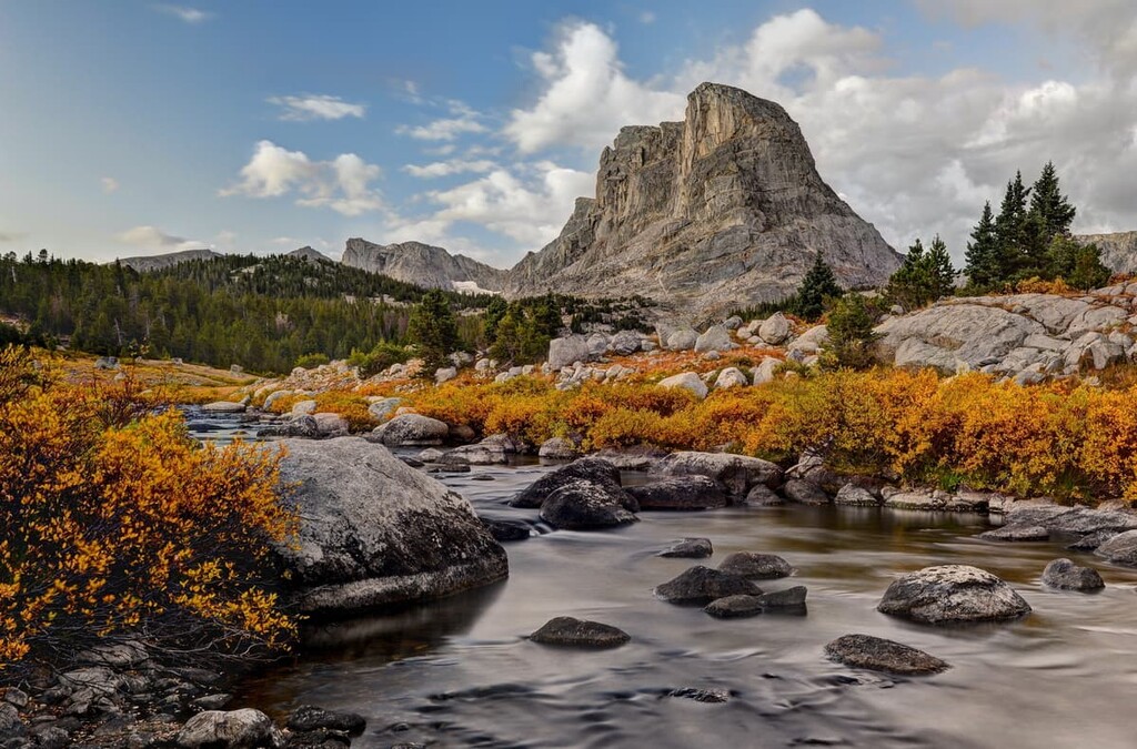
In the northeastern area of the national forest, the Gros Ventre Range contains deposits of limestone and shale up to 15,000 ft (4,600 m) thick. The Wind River Range at the southeastern edge of the forest is underlain by a granite batholith, which has been stripped of overlying sediments in many places and shaped by glaciation.
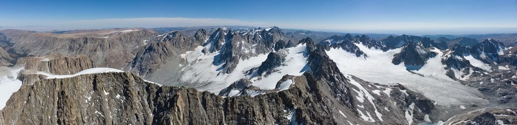
The highest point in the national forest is Gannett Peak, the highest peak in all of Wyoming at 13,819 ft (4,212 m). Other high points in the area include Fremont Peak, Doublet Peak, and Mount Helen. All of these mountains, along with about 40 others over 13,000 ft (3,962 m), are located in the Wind River Range.
The Bridger-Teton National Forest is part of one of the most unique and significant ecosystems in all of North America. Covering about 20 million acres (89,900 ha), the Greater Yellowstone Ecoregion is arguably the largest intact ecosystem in the lower 48 US states. The Bridger-Teton National Forest makes up nearly 20 percent of this area.
Many of the large mammals that ranged across the American West before the arrival of European-descended settlers still live in their natural habitats here. Grizzly bears, wolves, bighorn sheep, bison, and cougars are all found in the national forest, along with more common species like elk, moose, and mule deer.
In the rivers and streams throughout Bridger-Teton National Forest, anglers can find 25 species of fish, including four different types of cutthroat trout. There are over 350 species of birds in the wilderness area, including bald eagles and Clark’s nutcrackers.
Forests in the area are made up primarily of coniferous trees including Engelmann spruce, lodgepole pine, Douglas fir, subalpine fir, and whitebark pine. The most common deciduous trees are aspens.
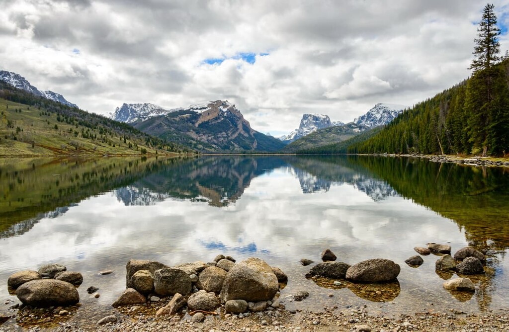
At low elevations in the river valleys, there are grassy meadows, sagebrush, and willow trees. On the mountain peaks above treeline, alpine meadows are filled with grasses and wildflowers are common. This expansive, largely intact ecosystem is one of the best places in the US for wildlife viewing
People have lived in the area of what’s now called the Bridger-Teton National Forest for at least 10,000 years. Although less than 2 percent of it has been surveyed for historic purposes, over 800 archeological sites have been documented in the national forest.
There were a number of tribal nations that moved through or inhabited the area of the Bridger-Teton National Forest, but the two communities most closely associated with the area are the Mountain Shoshone (Tukudika) and the Crow (Apsáalooke).
The Crow are a tribal nation from the northern plains who were pushed west into the Rocky Mountains by conflict with other Indigenous communities, along with European-American settlement in the east. By the early 1800s, their traditional lands covered what’s now the northern end of the national forest, in the Yellowstone Valley near the Wyoming border and north into Montana.
Despite allying with the US in conflicts with other Plains tribal nations, many members of the Crow Nation were relocated to the present-day Crow Reservation outside of Billings in Montana. Today, there are about 11,000 enrolled members of the tribe, and about 85 percent of them speak Crow as their first language.
The other major Indigenous community in the area is the Tukudika (Sheepeater) Tribe of the Mountain Shoshone, who traditionally lived in the high mountain areas of what’s now the national forest. The Tukudika built over two dozen villages in the Wind River Range alone, some of which sit at over 10,000 ft (3,048 m) in elevation. This makes them some of the highest elevation Indigenous settlements found so far in North America.
Some of these villages were used seasonally by the tribe until the early 1900s when they were forcibly removed to reservations. Today, some descendants of the Tukudika are enrolled members of the Shoshone-Bannock Tribes, who are now based on the Fort Hall Reservation in southeastern Idaho.
Other descendants are enrolled members of the Eastern Shoshone Tribe. Many tribal members live on the Wind River Reservation, which lies just north of the Pinedale Ranger District of the Bridger-Teton National Forest.
The first European-Americans in the area of the national forest were members of the Lewis and Clark Expedition in 1805. John Colter, a man who broke away from the expedition on its return journey, is thought to have traveled through the Jackson Hole area in 1807. For the next 30 years, fur trappers frequented the area.
Settlement of Europeans and European-Americans in the area was limited due to the challenging mountain terrain, but mining and logging were beginning to take their toll on the landscape by the late 1800s. At the same time, conservationist sentiment was increasing across the country.
In 1891, the original Yellowstone Park Timber Land Reserve was created by President Benjamin Harrison, and in the next 15 years, millions of acres were set aside in the area for forest preservation. Most of the land that became the Bridger-Teton National Forest was designated as such by President Theodore Roosevelt in 1902.
With over 2,000 miles of trails, there’s something for everyone. Here are a few of the main hiking areas in the Bridger-Teton National Forest.
Located in the area around Yellowstone and Grand Teton National Parks near the city of Jackson, this is one of the most visited areas of the Bridger-Teton National Forest.
Snow King Summit Trail
If you’re staying in Jackson, hiking the Snow King Ski Resort is one of the quickest ways to get a good workout and some amazing views of the Tetons. Located right on the edge of town, this is a short but very steep hike that climbs over 1,500 ft (460 m) in under two miles.
Blue Miner Lake Trail
This beautiful trail travels through the northern area of the Gros Ventre Wilderness. It leads up through varied terrain to a beautiful alpine lake in a bowl on the ridge below Sheep Mountain. The trail is less heavily trafficked than others in the hyper-popular Jackson area, so it’s a good choice if you’re trying to get away from the crowds.
Pacific Creek Trail
If you’re truly looking to get off the beaten track, this lightly trafficked trail through Teton Wilderness will get you there. The Pacific Creek Trail crosses the wilderness area from its southwestern edge all the way to the border with Yellowstone National Park in the north.
One of the highlights of the trail is the Parting of the Waters at Two Ocean Pass, a spot where a creek divides into two forks. One flows eventually into the Gulf of Mexico, while the other empties into the Pacific.
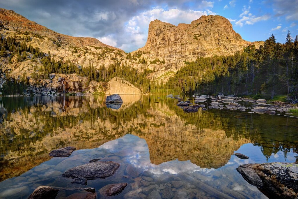
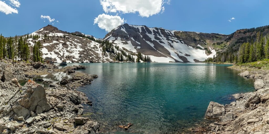
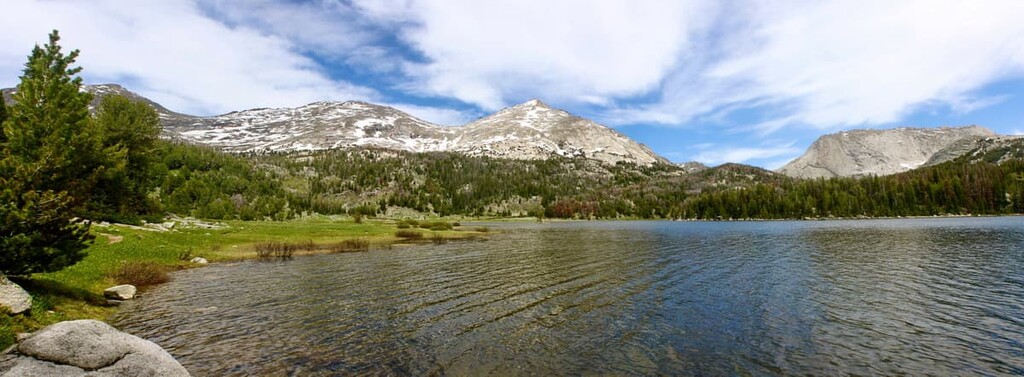
If you’re looking to experience this area at its most wild and untouched, head for the Wind River Range and the Bridger Wilderness. The range is home to the forest’s tallest peaks and hundreds of miles of backpacking trails.
Big Sandy Lake via Big Sandy Trail
Two of the most defining features of the Wind River Range are craggy granite peaks and crystal clear alpine lakes. On this hike, you’ll see both, without having to backpack deep into the range. If you do want to extend your trip, the trail connects to dozens of other routes through the southern Bridger Wilderness.
Cirque of the Towers Loop
This is one of the most popular and photographed hikes in the Wind River Range (There’s even a stop on the trail called Photographer’s Point). While there are plenty of beautiful views on this loop, the highlight is the Cirque of the Towers, a glacial bowl featuring jagged spires of granite, such as Pingora and Lizard Head Peak.
This area of the national forest extends south for about 100 miles (160 km) from the Tetons, covering the Snake River and Wyoming ranges along the Idaho/Wyoming border.
Periodic Springs
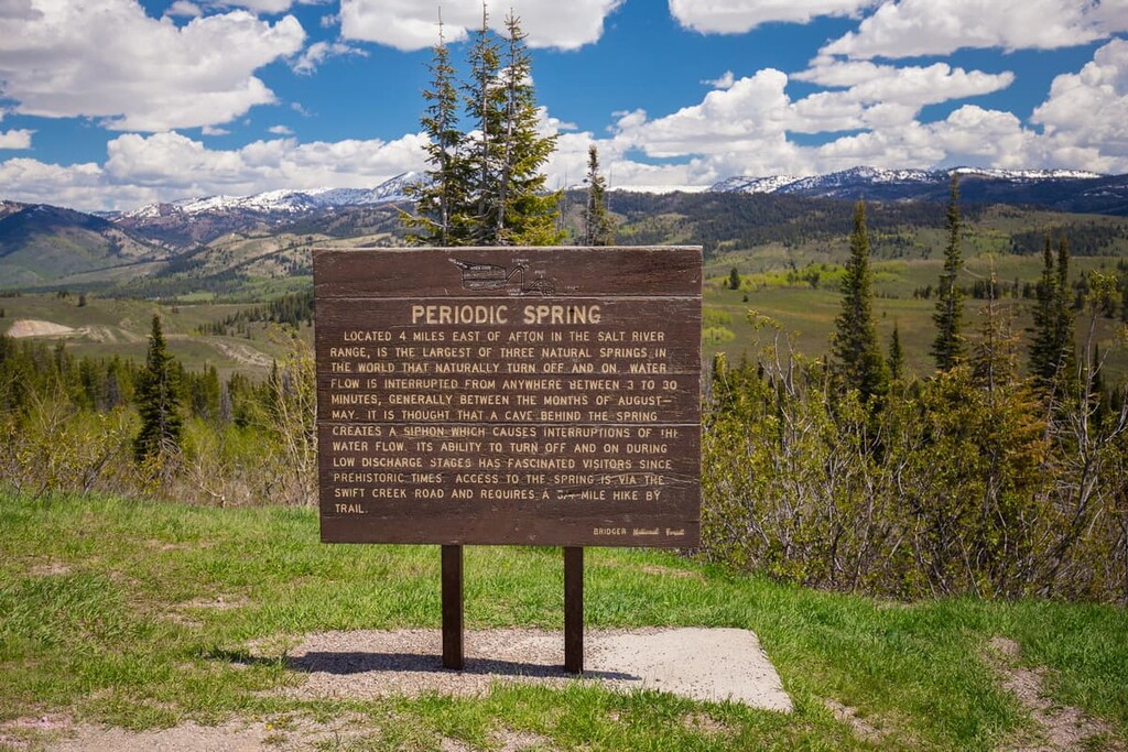
The Periodic Spring, located just east of Afton, Wyoming, is one of the most interesting geological features in the area. It’s the only cold water geyser in North America and the largest of three features of its kind in the world.
Wyoming Peak
Wyoming Peak is the tallest mountain in the Wyoming Range. It offers stunning 360-degree views of the nearly untouched landscape around it. This mountain is challenging to hike but can be climbed as a day hike, especially if your car can make it up the first few miles of Forest Service road that make up this trail.
Looking for a place to stay near the Bridger-Teton National Forest? Here are some of the best nearby cities and towns to check out:
The town of Jackson is completely surrounded by the Bridger-Teton National Forest. It is located between the Gros Ventre and Teton Wilderness areas and the National Elk Refuge. It’s the closest major town to the national forest and it is home to the busiest airport in Wyoming.
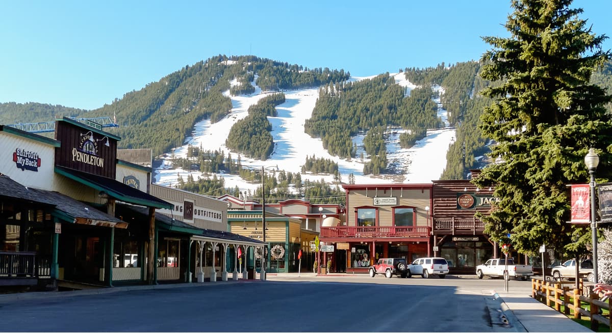
While Jackson is close to several wilderness areas and national parks, the town is a destination in its own right. There are two ski resorts (one of which is the world-class Jackson Hole Mountain Resort) and plenty of high-end resort amenities nearby.
With about 7,500 residents, Lander is one of the largest towns near the Wind River Range in the southeastern area of the national forest. The city lies east of the Bridger Wilderness, near the Wind River Reservation on the Middle Fork of the Popo Agie River.
Lander is a major tourist center in the area, with several guest ranches and plenty of shops to outfit a hiking or hunting trip. Lander is also the site of the headquarters of the National Outdoor Leadership School (NOLS), one of the premier outdoor education organizations in the world.