
Scan the QR code and open PeakVisor on your phone
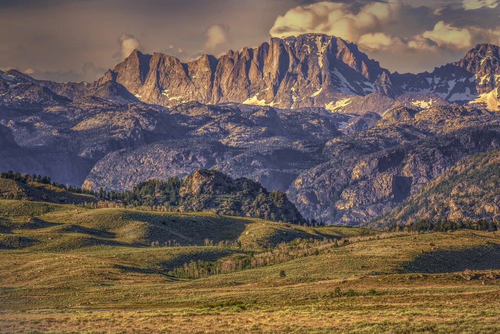
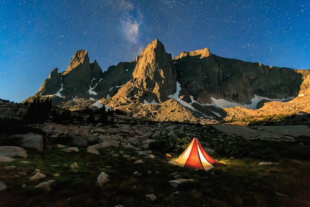
The Bridger Wilderness is home to glaciers, year-round snowfall, and towering 13,000 ft (3,962 m) peaks, making it one of the most extreme mountain environments in the US state of Wyoming. There are 121 named mountains in the Bridger Wilderness, the highest and most prominent of which is the state high point, Gannett Peak at 13,819 ft (4,212 m).
The Bridger Wilderness lies within the Wind River Range (often called the Winds) in western Wyoming. The area extends for about 80 miles (120 km) along the western side of the Continental Divide and covers approximately 430,000 acres (174,000 ha) within the Bridger-Teton National Forest.
This is a rugged, remote section of the Rocky Mountains with elevations up to 13,000 ft (3,962 m). In the high alpine areas, it can freeze any night of the year, even during the summer months.
Snow can linger on the trails through June and July in some areas, and it never melts at all in other places. The Bridger Wilderness is home to 7 of the 10 largest glaciers in the lower 48 US states, including Gannett Glacier, the single largest glacier in the US Rocky Mountains.
At 13,819 ft (4,212 m) in elevation, Gannett Peak is the tallest mountain in the wilderness area. It just sneaks its way past Grand Teton by 43 ft (13 m) to come in as the tallest mountain in Wyoming. While the Teton Range highpoint is far more famous, Gannett Peak is notable for being the fifth highest state highpoint and fifteenth most prominent mountain in the contiguous US.
Gannett Peak lies on the border between the Bridger and Fitzpatrick wilderness areas. In an interesting bit of trivia, the mountain is the highest point in two counties (Fremont and Sublette counties), two national forests (Bridger-Teton and Shoshone), two wilderness areas (Bridger and Fitzpatrick), and three river drainage basins (the Yellowstone, Bighorn, and Green).
Gannett Peak is also considered one of the most difficult state high points to summit, grouped with Denali in Alaska, Mount Rainier in Washington, and Granite Peak in Montana. The mountain is very remote, requiring at least a 40 to 50 mile (65 to 80 km) round trip and serious mountaineering skills to summit.
You don’t need to be a mountain climber to enjoy the Bridger Wilderness, however. There are 600 miles (1,000 km) of trails in the preserve, offering nearly limitless hiking and backpacking opportunities.
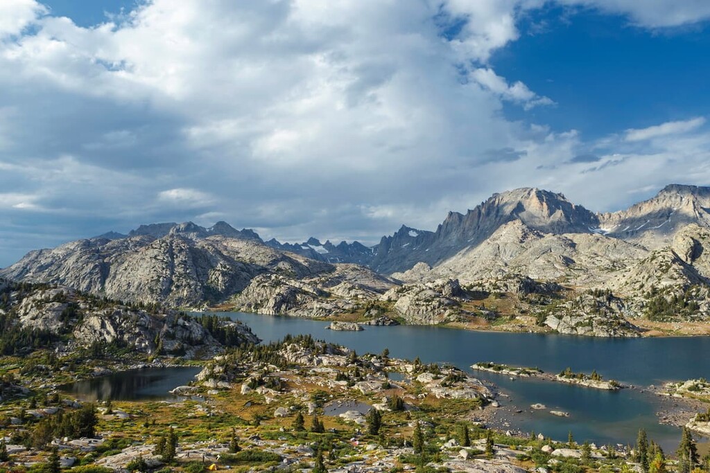
As an official wilderness area, motorized and mechanized vehicles, including bikes, aren’t allowed in the Bridger Wilderness, so the trails are quiet (if crowded at times) and optimal for hiking. Many of these paths lead up to some of the Bridger Wilderness’s 2,300 high alpine lakes, where you can admire the towering peaks above.
The Bridger Wilderness is part of a massive complex of protected wild land that extends across most of the Wind River Range. It’s directly adjacent to the Fitzpatrick and Popo Agie Wilderness areas on the eastern side of the continental divide. Beyond the Wind River Range, the Gros Ventre, Teton, and Wakashie wilderness areas are all located nearby.
The Bridger Wilderness lies entirely within the Wind River Range. The Winds are part of the Greater Yellowstone Rockies, a subset of the Rocky Mountains that runs 3,000 miles (4,800 km) from British Columbia in Canada all the way to New Mexico in the US.
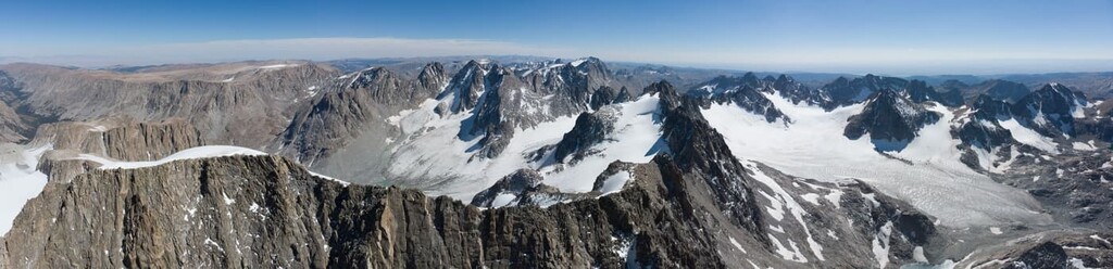
The mountains of the Wind River Range are primarily formed from ancient granitic batholith, an intrusive igneous rock that formed under the Earth’s surface over a billion years ago. The batholith began to rise over millions of years, most notably during the Laramide orogeny.
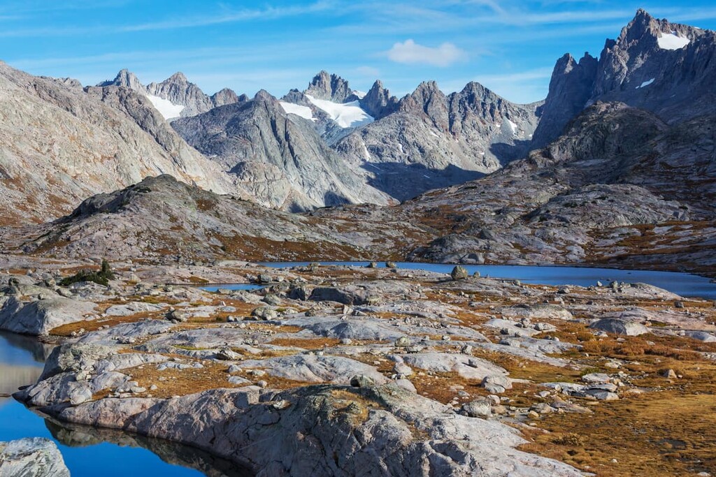
As it rose, the softer rock around the batholith eroded away, leaving just the exposed granite we see today in the range’s distinctive craggy peaks. In the last half-million years, glaciers advanced and retreated over the Winds numerous times, carving out lakes, valleys, kettles, and cirques throughout the range.
There are still glaciers today in the Wind River Range, including 27 in the Bridger-Teton National Forest. Gannett Glacier, which extends down the northern side of Gannett Peak into the Fitzpatrick Wilderness, is the largest alpine glacier in the US Rockies.
The highest point in the area is Gannett Peak, followed by Fremont Peak, Doublet Peak, and Mount Helen. There are more than 40 peaks in the range over 13,000 ft (3,962 m).
The Bridger Wilderness is a high alpine environment, featuring mostly coniferous forests on lower mountain slopes and open meadows above the treeline at 10,300 ft (3,100 m). The highest peaks in the area are covered by snow and ice or sheer rock.
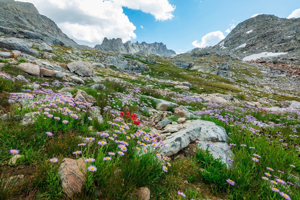
At lower elevations, the forests are made up of stands of aspen and lodgepole pine trees, while spruce and fir trees dominate in the higher elevations. Above the treeline, the high alpine meadows feature unique, delicate plant communities that are highly sensitive to human impact. Be sure to stay on the trails in these areas.
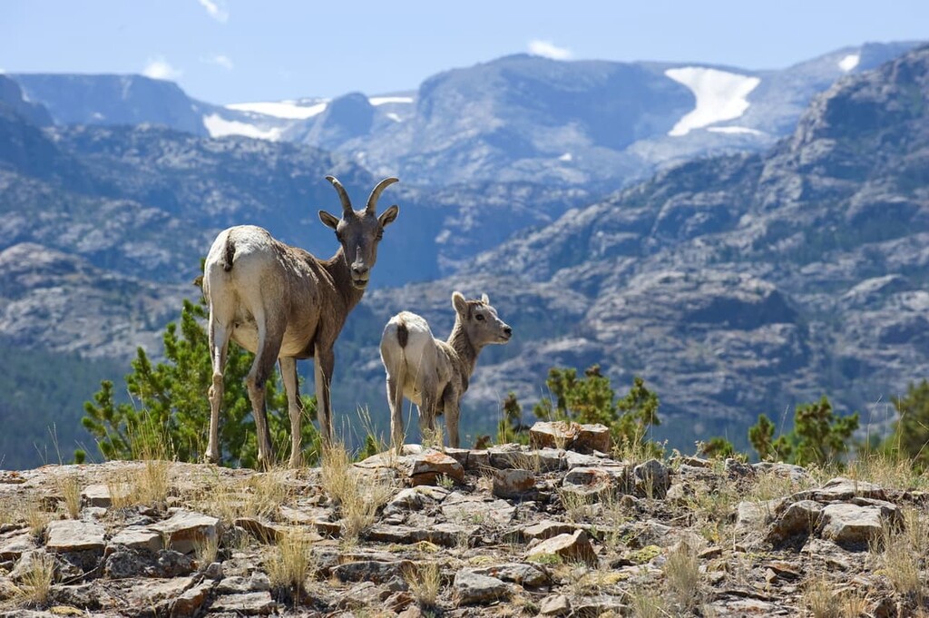
Because the Bridger Wilderness is so wild and remote, many of the large animal species that have been driven out of their original habitats around the Rocky Mountain West can still be found here. There are wolverines, bighorn sheep, mountain lions, and grizzly bears in the area, in addition to more common species like moose, elk, and mule deer.
Hunting is allowed in the Bridger Wilderness and campers are required to store food in proper bear-safe storage, which means bear hangs or bear canisters if you’re headed above treeline.
There are also reports of wolf sightings in the Bridger Wilderness. Wolves were reintroduced to nearby Yellowstone National Park in 1995, so it’s possible that there are wolves in the area, but these sightings are as of yet unconfirmed.
Notable birds in the Bridger Wilderness include bald eagles, peregrine falcons, ospreys, and Clark’s nutcracker. Mountain whitefish, grayling, and several species of trout can be found in the river and streams in the area.
People have lived in the area that’s now called the Wind River Range for at least 9,000 years. The most prominent group in the area was the Tukudika (Sheepeater) Tribe of the Mountain Shoshone, who built some of the most unique settlements in North America.
In contrast to other Indigenous communities who usually favored less demanding low elevation land for their settlements, the Tukudika lived at least part of the year in high mountain areas, sometimes above 10,000 ft (3,048 m) in elevation. Nearly two dozen villages have been found in the Wind River Range, including one 26-acre (10.5 ha) site that held over 60 lodges.
The Indigenous inhabitants of the Bridger Wilderness returned to some of these sites seasonally until the early 1900s, when they were forcibly removed to reservations in Wyoming and Idaho.
Today, some of the descendants of these people are enrolled members of the Eastern Shoshone Tribe, which is now based on the Wind River Reservation adjacent to the Bridger-Teton National Forest. Others are members of the Shoshone-Bannock Tribes, many of whom live on the Fort Hall Reservation in southeastern Idaho.
European-Americans first began to arrive in the area in the years around the Lewis and Clark Expedition of 1805. Although Lewis and Clark themselves didn’t see the area, a man from the expedition, John Colter, is thought to have traveled through in 1807.
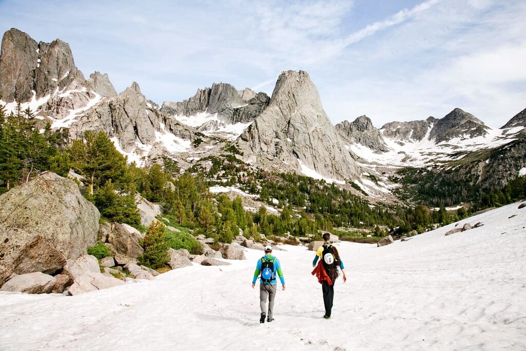
As a high alpine range with challenging conditions, there was limited settlement in the area of the Bridger Wilderness. Most of the European-Americans who came to the mountains were surveyors, and later mountain climbers. Climbing is still a major draw to the area today, especially around Titcomb Basin and the Cirque of the Towers.

The Bridger Wilderness was first preserved as part of Bridger-Teton National Forest in 1931 and redesignated as an official wilderness area in 1964. The wilderness area is named after Jim Bridger, a famous mountain man who traveled throughout the American West in the mid-1800s as a fur trapper, scout, and guide,
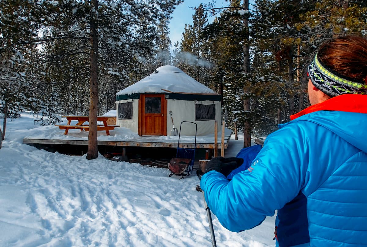
The Bridger Wilderness offers over 600 miles (1,000 km) of hiking trails, so there’s something for everyone. While some of the trails in the wilderness area are very popular, visitors should be aware that the area is remote, with limited cell service and no infrastructure beyond hiking trails.
Hikers are also advised to be aware of the high elevations in the Bridger Wilderness. Altitude sickness can ruin your trip and even be life-threatening in extreme cases. Acclimatize properly and always bring first aid supplies and good maps with you into the wilderness area.
Additionally, keep in mind that, while there are many, many trails in the Bridger Wilderness, not all are well traveled or well maintained. Anyone venturing into the Wind River Range should have a map, compass, GPS, and the navigation abilities to be able to travel off trail—even if your route is supposedly on-trail.
The Bridger Wilderness is known as a backpacking destination, but there are some great day hikes to be found in the area.
Big Sandy Lake via Big Sandy Trail
The hike to Big Sandy Lake is one of the classics in the Bridger Wilderness. It’s a moderate hike that offers incredible views of high alpine lakes and the surrounding mountains. When you reach Big Sandy Lake, you can continue east on short side trips to Clear Lake or Black Joe Lake.
The trail starts from the end of Big Sandy Opening Road, towards the southern end of the wilderness area.
Sacred Rim
This trail begins near the Elkhart Visitor’s Center and climbs to incredible views over Long Lake and into the heart of the Bridger Wilderness. While this is a short trail, don’t underestimate it. The climb is steep and demanding in places.
The best way to truly experience what the wilderness area has to offer is to head out on an overnight hike. Here are some of the best options for a longer trip.
Cirque of the Towers Loop
29.8 miles (48 km) round trip
4,146 ft (1,264 m) elevation gain
Along with Big Sandy Lake and Titcomb Basin, Cirque of the Towers is one of the best hikes in the Bridger Wilderness. It follows the Big Sandy Trail past major highlights like Photographer’s Point and Big Sandy Lake.
The highlight of the trail is the beautiful Cirque of Towers, a glacial bowl featuring jagged spires of granite, such as Pingora and Lizard Head Peak. You return to the trailhead near Big Sandy Lodge via the Continental Divide and Fremont trails.

Wind River High Route
This is a challenging, unofficial route traversing the length of the Wind River Range, right near the crest of the Continental Divide. Distances vary from 80 to over 100 miles (130 to 160 km) depending on the exact route taken.
While there are other trails that run long distances through the range (the Fremont and Highline Trails parallel sections of High Route), the High Route maintains an average elevation of about 10,000 ft (3,048 m), crossing mountain passes, glaciers, and dozens of alpine lakes.
A large portion of this route is off-trail, so you’ll need to be comfortable navigating with a map and compass for long distances. The High Route is challenging, but it’s a great way to see the entirety of the Bridger Wilderness in all its glory.
The Bridger Wilderness is home to some of the very best alpine rock climbing, mountaineering, and scrambling peak ascents in the entire Wind River Range. The bulk of these summit attempts require modest rock climbing skills, or, at the very least, a high level of comfort with scrambling over talus fields and climbing up steep snow.
There are dozens of superb and notable peak ascents in the wilderness, though some of the best include Gannett Peak, Pingora, and Wind River Peak. There are also a number of iconic peaks in the wilderness, such as Mount Hooker and Mount Bonneville that are worth climbing high passes to get a view of, even if summit attempts aren’t very common.
In the Wind River Range and in the Bridger Wilderness, in particular, crossing passes on the Continental Divide is also sometimes a worthy climbing challenge.
Blaurock Pass between Mount Febbas and Sunbeam Peak near Gannett Peak is one of the highest passes in the Wind River Range with an elevation of over 12,000 feet (3,600 m). Meanwhile, Angel Pass on the shoulder of Angel Peak is one of the most iconic passes in the northern part of the Winds.
Regardless of what climbing adventure you choose to set out on in the Wind River Range, remember that route finding can often be a challenge. Many peaks in the range feature large boulder fields, many of which have deceptively loose rock. River crossings can also be particularly challenging in the wilderness in the early part of the summer season, so take caution when traveling in the region.
If you’re looking for a place to stay near the Bridger Wilderness, here are a few good options:
Pinedale is a small town of about 2,000 people located just south of the Bridger Wilderness, near Fremont Lake. Pinedale serves as one of the main gateways to the Wind River Range and has plenty of shops to supply a hunting or backpacking trip. The town has a ski area and hosts rodeos in the warmer months.
The city of Lander is located to the east of the Bridger Wilderness, just outside of Sinks Canyon State Park and the Wind River Reservation along the Middle Fork of the Popo Agie River. It is home to approximately 7,500 residents, making it one of the largest communities near the Wind River Range.
Lander is the international headquarters for the National Outdoor Leadership School (NOLS), which is one of the world’s premier outdoor education organisations. The city is also home to a number of great outdoor gear stores, coffee shops, and other attractions that make it well worth a visit.
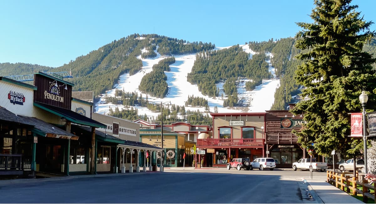
Located about 85 miles (140 km) northwest of Pinedale, Jackson is the closest major town to the Bridger Wilderness area. Jackson is home to the busiest airport in Wyoming and the only airport in the county within a national park.
Jackson is a destination tourist town, known for its high-end amenities and world-class ski resort, Jackson Hole. In addition to the Bridger Wilderness, Jackson is a great jumping-off point for Grand Teton and Yellowstone national parks.
About 250 miles (400 km) or four driving hours southwest of Pinedale is Salt Lake City, the largest major city to the Bridger Wilderness. If you’re looking for the cheapest flight, or you’re planning to explore a broader area of Wyoming, Salt Lake City can be a good starting point for your trip.
The city is home to several universities, lots of parks and museums, and nearly 200,000 people, so it’s easy to find lodging at any price or supplies for a longer hiking trip.


13er
ultra
glacier
wyoming-13ers
greater-yellowstone-finest
fred-beckey-great-peaks
wyoming-ultras
13er
glacier
wyoming-13ers
greater-yellowstone-finest
fred-beckey-great-peaks
13er
glacier
wyoming-13ers
greater-yellowstone-finest
13er
ultra
glacier
wyoming-13ers
greater-yellowstone-finest
fred-beckey-great-peaks
wyoming-ultras
13er
glacier
wyoming-13ers
greater-yellowstone-finest
fred-beckey-great-peaks


