Scan the QR code and open PeakVisor on your phone
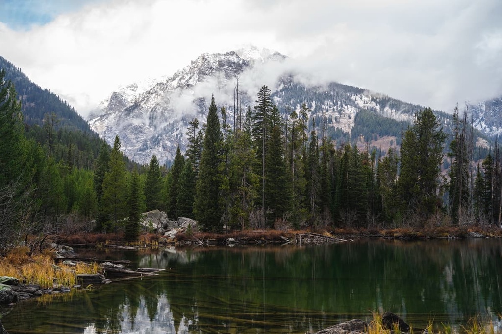
The Teton Wilderness Area is located in the northwestern part of the US state of Wyoming. The rugged landscape of the wilderness is home to the famous Two Ocean Pass, which serves as the dividing line between the Pacific Creek and Atlantic Creek, both of which eventually flow into their namesake oceans. The Teton Wilderness Area contains 41 named mountains, the highest and most prominent of which is Younts Peak (12,149 ft/3,703 m).
Located in northwestern Wyoming, the Teton Wilderness Area is one of three wilderness areas within Bridger-Teton National Forest. It was created in 1964 and covers 585,238 acres (236,837 ha) of remote and rugged wilderness, making it the second-largest wilderness area in the state after the Washakie Wilderness.
As the Teton Wilderness is situated within the Greater Yellowstone Ecosystem, Yellowstone National Park borders the wilderness area to the north while Grand Teton National Park marks the wilderness area’s western boundary. Both the Gros Ventre Wilderness and Mount Leidy Highlands are situated to the south of the Teton Wilderness Area.
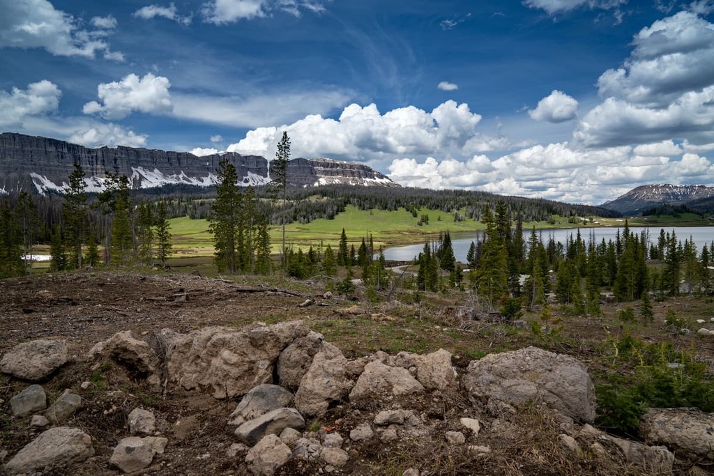
The Absaroka Range dominates much of the wilderness. Furthermore, the tallest peaks are located on the eastern side of the wilderness. The area contains 450 mi (724 km) of trails and the headwaters of multiple Wild and Scenic Rivers, including the Snake River, North and South Buffalo Fork Rivers, Soda Fork River, and Pacific Creek.
The Continental Divide, which is also referred to as the Great Divide, runs through the wilderness in a north-to-south fashion.
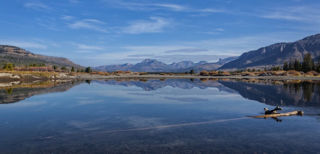
Additionally, the wilderness area is home to Two Oceans Pass, which features the Parting of the Waters. The Parting of the Waters is where the headwaters of the Atlantic Creek and the Pacific Creek split as they head toward their namesake oceans.
From the Parting of the Waters, the Pacific Creek flows westward via the Snake and Columbia Rivers to the Pacific Ocean. Meanwhile, the Atlantic Creek flows to the east of the divide to the Atlantic Ocean through the Yellowstone, Missouri, and Mississippi Rivers.
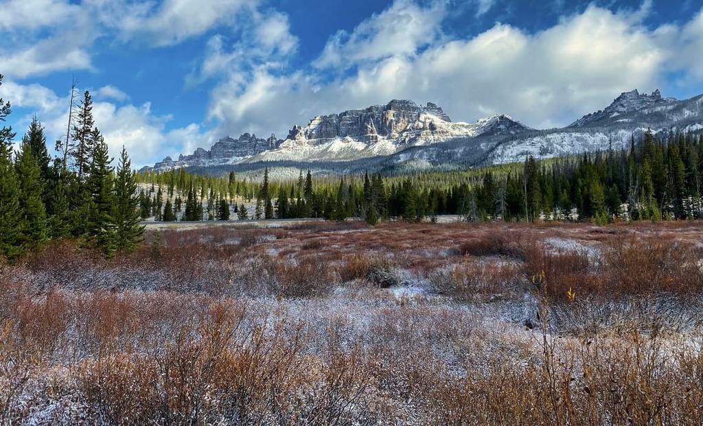
Other notable features in the wilderness include a vast area of scorched terrain that’s left over from forest fires that traveled throughout the Yellowstone region in 1988. A year prior to these fires, a tornado cleared a 2-mile (3.2 km) wide and 20-mile (32 km) long section of forest in the wilderness. This was the highest-elevation tornado ever recorded at the time, though it has since lost that title to more recent storms in California.
The Teton Wilderness Area lies within the Bridger-Teton National Forest and is dominated by the Absaroka Range. This rugged range spans the wilderness and crosses the Wyoming border into the state of Montana.
The Absaroka Range is a subrange of the Rocky Mountains. It is approximately 75 miles (120 km) in width and 150 miles (240 km) in length. The range, along with the surrounding region, is part of the Absaroka Volcanic Province.
The Absaroka volcanoes were active during the Eocene epoch, around 56 to 43 million years ago. This volcanic activity was the result of the tectonic uplift that formed the Rockies. It preceded the arrival and subsequent volcanic activity of the Yellowstone Hotspot, which formed roughly 2 million years ago.
Although Yellowstone volcanics get more attention for being both younger and more active, the volume of material generated by the Absaroka volcanoes is many times greater than the volume found on the Yellowstone Plateau.
Many of the peaks in the Teton Wilderness Area are part of the Wiggins Formation, which is the youngest unit of the Absaroka Volcanic Supergroup. These mountains were formed by volcanic activity, overlaid by sedimentary rocks, and, over time, carved out by erosion and glaciation.
As temperatures rose across the region at the end of the Pleistocene epoch, glacial retreat carved out the landscape in what is now the Teton Wilderness, leaving behind sweeping valleys, alpine tundras, and glacial cirques.
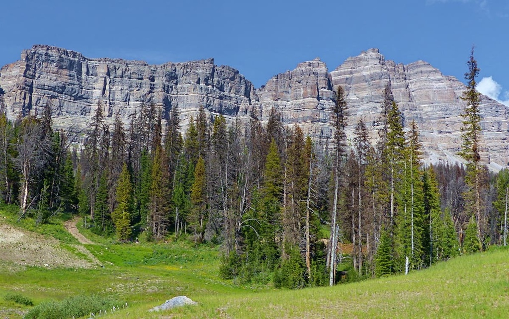
Today, the region features volcanic breccia, which slowly transitions into gneiss and granite bedrock as you move toward the northern edges of the wilderness. The mountains within the Teton Wilderness also contain fossils from millions of years ago. Petrified trees have even been discovered in the wilderness, as most of them were preserved in mudflows.
Some of the major peaks found within the wilderness include Younts Peak, Breccia Cliffs, South Two Ocean Plateau, Terrace Mountain, and Bobcat Ridge.
The Teton Wilderness Area is part of the Greater Yellowstone Ecosystem, which encompasses roughly 20 million acres (8.1 million ha) of terrain across the states of Wyoming, Idaho, and Montana.
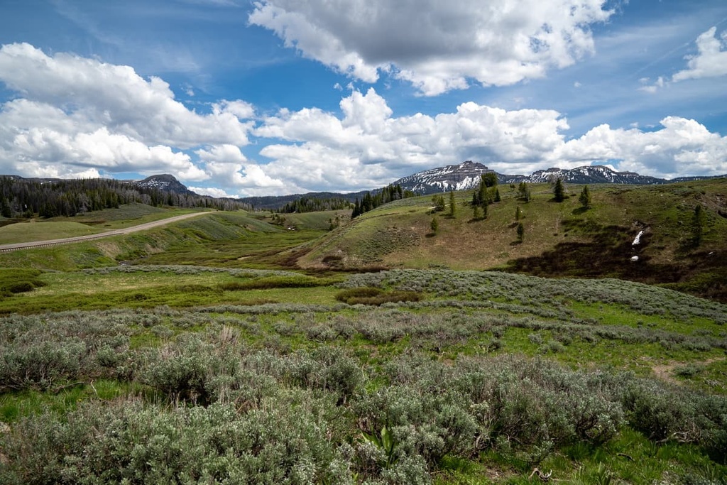
Peaks in the wilderness that are located to the west of the divide range from 7,000 ft (2,134 m) to 9,675 ft (2,949 m) in elevation, while those situated to the east of the divide are typically around 8,000 ft (2,438 m) to 12,149 ft (3,703 m) tall. The varying elevations in the wilderness area allow a variety of flora and fauna to thrive in the region.
As the area is split by the Continental Divide, habitats in the wilderness include mountain meadows, timbered slopes, high alpine plateaus, and willow and sedge meadows.
Some of the dominant tree species in the wilderness area’s forests are lodgepole pine and whitebark pine. There are a handful of different spruce and fir tree species that are found throughout the wilderness area, too.
Alpine meadows, which are found at the highest elevations in the wilderness, support low-growing grasses and wildflowers. Willow trees are commonly found near the various creeks, streams, and rivers in the region, and sagebrush often grows in clearings in the lowest-elevation parts of the wilderness.
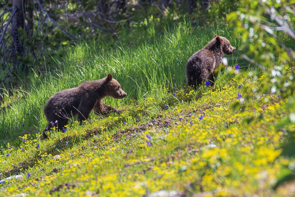
The Greater Yellowstone Ecosystem also provides vital habitat to numerous animals, including some of the United States’ most iconic mammal species. Grizzlies, black bears, wolves, bison, moose, and elk all thrive in the area. Other common mammals found in the region include wolverines, bobcats, coyotes, marmots, pikas, mink, martens, porcupines, river otters, and beavers.
Over 300 species of birds live in Teton Wilderness year-round, including bald eagles, golden eagles, hawks, osprey, owls, and grouse. There are also a number of bird species that only live in the region during the summer, such as trumpeter swans, sandhill cranes, ducks, geese, falcons, and songbirds. Various species of trout inhabit the rivers of the Teton Wilderness Area, too.
Humans have lived in these mountains for the past 10,000 years. Less than 2 percent of Bridger-Teton National Forest has been inventoried by archeologists, but within the surveyed sections, archaeologists have documented more than 800 cultural sites.
During the Paleo-Indian period, about 11,500 to 8,000 years ago, nomadic hunters roamed through the region as they hunted megafauna. Researchers in the wilderness have only uncovered a small number of projectile points from this period. This suggests that the area was either sparsely populated at the time or that more research is needed to find other archeological evidence.
Later, during the Archaic period 8,000 to 1,500 years ago, a shifting climate caused human populations to adapt their survival methods in the region. People began to hunt smaller game and focus more on gathering plants. This trend toward plant gathering encouraged people to make seasonal rounds to the mountains and other areas. Researchers have uncovered a sizable number of sites and projectile points from this era, which suggests that the regional population grew during this time.
From 1,500 to 400 years ago, during the late prehistoric period, humans lived and moved through the Absaroka Range as they hunted bighorn sheep and mule deer. Pottery and bows and arrows came into use during this time.
The proto-historic period took place from about 1650 CE until contact with Europeans around 1805. During this time, Indigenous tribes in the area that is now the wilderness first began to utilize European goods, even though they had yet to come into contact with Europeans. Many tribes in the region traded for European goods with other tribes located further to the east who had already made contact with settlers.
Furthermore, the region is the ancestral homelands of numerous Indigenous peoples, including the Eastern Shoshone and Apsáalooke (Crow).
The Eastern Shoshone traditionally lived throughout what is now northwestern Wyoming, Utah, Idaho, and Montana. They were historically hunter-gatherers who adopted the use of horses during the mid-1600s, earlier than many of the other surrounding tribes.
This increased their mobility and allowed the Eastern Shoshone to spread through the Rockies into Canada. With this expansion, they encountered members of the Blackfeet Nation who had obtained guns from fur trappers in the Pacific Northwest.
The Apsáalooke (Crow) traditionally lived in the Midwest before migrating to what is now Wyoming and Montana. The tribe eventually settled in the Yellowstone River Valley and split into four bands known as the River Crow, Mountain Crow, Beaver Dries its Fur, and Kicked in the Bellies.
Both the Apsáalooke (Crow) and Eastern Shoshone hunted bison in the region. They often fought with each other over the Wind River Basin, which is known for its superb hunting opportunities.
The first recorded contact between the Apsáalooke (Crow) and Eastern Shoshone and European settlers likely occurred in 1805 during the Lewis and Clark Expedition.
Fur trappers were some of the first Europeans to frequent what is now the Teton Wilderness Area. During the early to mid-1800s, rivers and streams in the region became a hotspot for fur trappers who flocked to the area in search of beaver pelts.
Both the Apsáalooke (Crow) and Eastern Shoshone were heavily involved in the Rocky Mountain fur and bison trade throughout the early 1800s. As settler communities continued to grow in the region, the settlers and the US government repeatedly attacked, displaced, and killed Indigenous people who lived in the area, disregarding their claims to the land in the process.
In 1868, the Shoshone Leader Washakie signed the Fort Bridger Treaty, which established the Wind River Indian Reservation. The reservation is located just to the east of the Teton Wilderness Area. Additionally, the Crow Tribe of Montana is a federally recognized tribe that maintains a reservation near Billings, Montana, just to the northeast of the wilderness area. Nowadays, the Crow Tribe has around 14,000 enrolled tribal members.
With the arrival and construction of the Transcontinental Railroad, which took place from the late 1800s to the mid-1900s, the forests in the area were harvested for timber to make railroad ties. Trees were cut, slid down the mountain, and then floated along the rivers. Some old cabins still remain in the region from this era.
In early 1891, the Yellowstone Park Timber Land Reserve was set aside to the east and south of Yellowstone National Park. Some of this land overlapped with what is currently the Bridger-Teton National Forest.
Eventually, the region was re-designated as a forest reserve and its total area expanded. The Teton Wilderness Area was later established as part of the Wilderness Act of 1964. In 1973, the Bridger National Forest and Teton National Forest were combined into one national forest.
With 450 mi (724 km) of trails, the Teton Wilderness Area is the perfect place for adventure, but adequate preparation is a must for anyone looking to travel to the area.
Wildlife is abundant in the region and parts of the wilderness area are quite remote. Hikers on these trails should be comfortable in bear country. They should also be knowledgeable about proper food storage tactics and bear safety strategies before traveling to the area.
Despite its remoteness, the Teton Wilderness is a relatively popular place for hiking and other backcountry adventures. In fact, the Continental Divide Trail travels along the northeastern edge of the wilderness and is regularly used for hiking.
With that in mind, here are some of the best hikes in the Teton Wilderness to check out during your next trip to the region.
The Sheffield Trailhead leads to a 6 mi (10 m) one-way trail that cuts across the northwestern section of the Teton Wilderness Area. This trail begins at Grand Teton National Park and ends at the junction with Trail 6030 Rodent Creek. Along the way, one can stop by the Huckleberry Lookout and enjoy spectacular views of the Tetons.
One can also use the trail to access Huckleberry Mountain. As you head toward Huckleberry Mountain, the trail passes through dense forests, alpine meadows, and barren ridgelines. From the summit of Huckleberry Mountain, hikers are rewarded with views of the Teton Wilderness, Grand Teton National Park, and Yellowstone National Park.
This out-and-back route follows the banks of Sheffield Creek. It is 10 mi (16 km) long and it has 2,765 ft (843 m) of elevation gain. The trailhead is located about 40 minutes from Moran, Wyoming, and is situated near the south entrance of Yellowstone National Park.
The scenic Parting of the Waters is only accessible by hiking or horseback riding through the Teton Wilderness on the Two Ocean Pass Loop. The route leading to Two Ocean Pass climbs steeply through the forested landscape and occasionally passes through alpine meadows. Keep in mind that the remote nature of this hike means there are many grizzly bears in the region.
This out-and-back hike to Two Ocean Pass is roughly 31 mi (50 km) long round-trip and it has around 2,000 ft (610 m) of elevation gain. However, hikers on this trail have the option to turn around once reaching the pass instead of completing the entire loop.
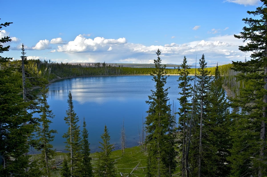
The entire loop continues into the southern portion of Yellowstone National Park, and it takes you along the shores of Yellowstone Lake. If you complete the whole loop, the route is 92.3 miles (149 km) long and it has 7,545 ft (2,300 m) of elevation gain. The trail begins off Two Ocean Road to the north of Moran.
The Pacific Creek Trailhead is a great starting location for hikers and backpackers. This is the main access point for the southwestern portion of the wilderness area, and it can be used to connect to multiple backcountry routes, including the trails that lead to Moss Lake, Whetstone Creek, Mink Creek, Box Creek, and Buffalo Fork. From this trailhead, one can also stop at Enos Lake or visit the Parting of the Waters Natural Landmark near the Two Ocean Plateau.
The Pacific Creek Road Outer Loop Trail is approximately 4 mi (6.4 km) in length and it intersects with a number of other shorter trails if you want to extend your adventure. It provides hikers with views of the creek, forested landscape, and meadows. The route can be extended to take you along the Pacific Creek Trail, which travels northeastward into the wilderness.
This trailhead is located a 20-minute drive from Moran, Wyoming. To reach the trailhead from Highway 89/287, drive 7 mi (11 km) along Forest Service Road 30090.
The Thorofare River Trail is a challenging 21 mi (34 km) trail that runs along the northeast corner of the wilderness area.
This trail begins at Bridger Lake Area and ends at the head of the Thorofare River. Those looking to extend their hike on this route can access remote side trails along the way that lead to Hidden Creek, Pass Creek, Butte Creek, Open Creek, and North Fork.
There are two maintained campgrounds located near the Teton Wilderness Area: Pacific Creek Campground and Sheffield Campground.
The Pacific Creek Campground is located along Pacific Creek Road, about 9.5 mi (15 km) from the Moran entrance to Teton National Park. Note that there is no water provided at this campground. Meanwhile, the Sheffield Campground is situated on Forest Service Road 30504 off of US Route 89/191/287.
Looking for a place to stay near Teton Wilderness Area? Here are some of the best cities and villages to check out in the region.
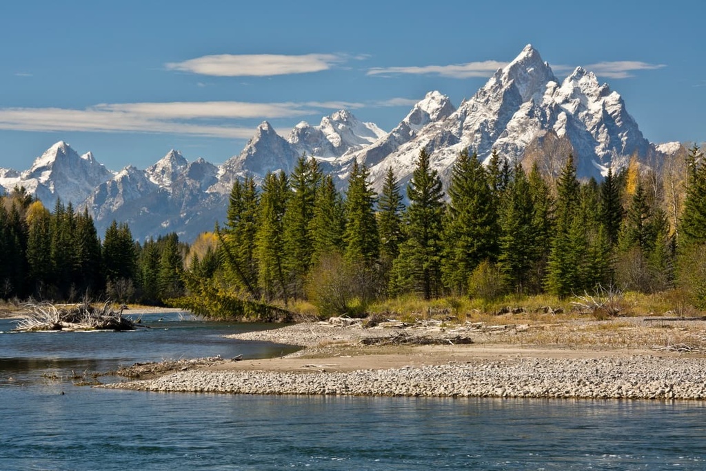
With fewer than 350 inhabitants, Moran is a small town that sees numerous visitors each year who come to experience the best of the Greater Yellowstone Ecosystem. Moran is located along the edge of Buffalo Valley and Togwotee Pass and is situated approximately 30 mi (48 km) to the north of Jackson. The east entrance of Grand Teton National Park is located in Moran.
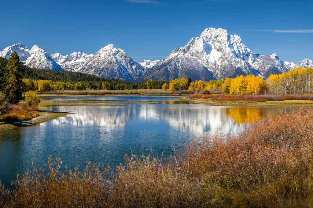
Near the town of Moran, you can find Oxbow Bend, a highly-photographed section of the Snake River where the Grand Tetons tower majestically in the background. Moran is also located 10 mi (16 km) from Jackson Lake and the Colter Bay Village where visitors can kayak, canoe, or visit the Indigenous art exhibit at the Colter Bay Visitor Center.
There are several spots for camping located near Moran and Colter Bay Village and several lodges in the Buffalo Valley. But overall, accommodation and dining options are limited in Moran, so most people use the town as a stepping stone for accessing the surrounding wilderness.
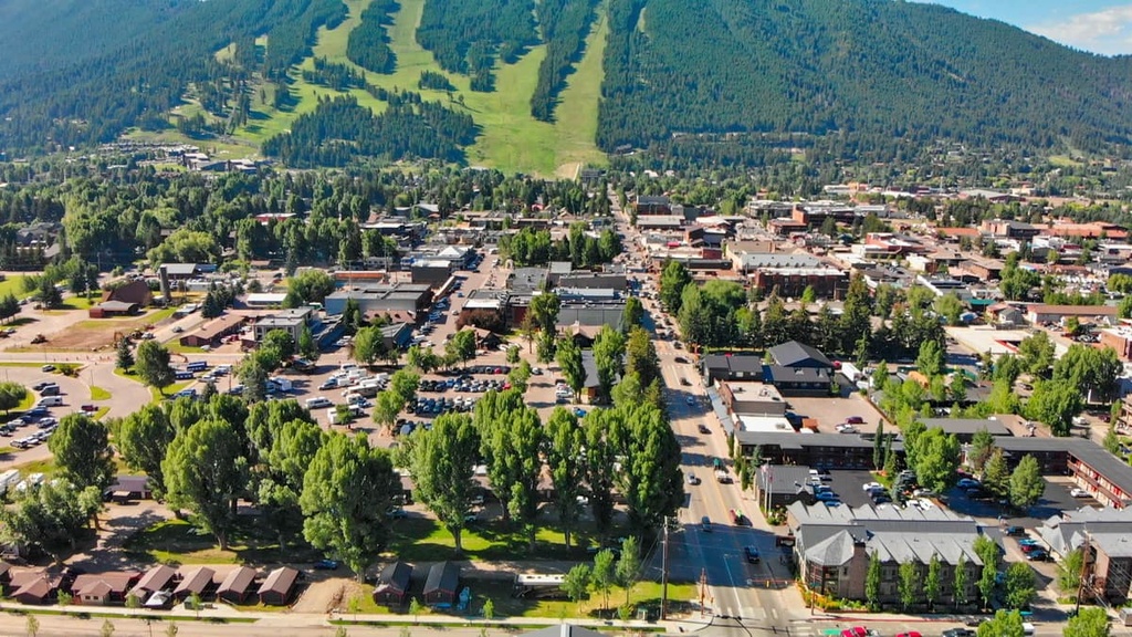
The closest big city to the Teton Wilderness is Jackson, which is situated in Teton County within the Jackson Hole Valley.
Jackson is home to around 10,000 residents, but it attracts thousands of tourists each year due to its plethora of outdoor recreation opportunities. As it is home to the Jackson Hole Mountain Resort and situated near both Grand Teton National Park and Yellowstone National Park, Jackson is a cultural and tourist hub for western Wyoming.

The city of Jackson is home to the National Elk Refuge and is known for its stunning landscapes. The Jackson Hole Valley is surrounded by natural hot springs that offer a relaxing end to a day spent out in the mountains.
Besides abundant opportunities to hike, bike, rock climb, camp, raft, horseback ride, and otherwise enjoy the outdoors, the town of Jackson also hosts a lively arts and culture scene. One can find numerous art galleries and theater performances in town on any given day. While in Jackson, you can also visit the National Museum of Wildlife Art and its outdoor sculpture garden.
With a diverse array of dining options to choose from, those looking to eat with an impact in Jackson can check out the local food guide to support restaurants that source their food locally. Or you can stop by the Hole Food Rescue to eat at a restaurant that works to reduce food waste and provide food to socio-economically disadvantaged members of the community.
All types of lodging are available in Jackson from RV parks and campgrounds to charming inns, B&Bs, rustic lodges, and luxury resorts. However, accommodation is in high demand in Jackson, so anyone planning a visit should make reservations ahead of time to ensure availability.
Located an hour’s drive to the southeast of Moran, Dubois is a small town with a population of around 900 people.
The town is located in the beautiful Wind River Valley, so you can enjoy everything from hiking and biking to horsepacking, kayaking, and fishing in the area around Dubois. Plus, Dubois offers great access to the Teton Wilderness, Shoshone National Forest, and Dubois Badlands Wilderness Study Area.
While passing through the quaint downtown area of Dubois, which was designed in an old western style and features stunning mountain vistas in every direction, be sure to visit the Gale Badlands Gallery, Dubois Museum & Wind River Historical Center, and National Bighorn Sheep Interpretive Center to learn more about the town’s art, history, and ecology.
Despite the fact that it is a relatively small town, Dubois has a decent selection of eateries, such as delis, cafes, and steakhouses. There are also restaurants in Dubois that serve up excellent Mexican cuisine.
For a different experience during your next trip to Dubois, be sure to check out one of the guest ranches in the Wind River Valley, where you can enjoy lodge dining at its finest. If a guest ranch isn’t quite your style, there are also campgrounds, hotels, and cabin rentals available in Dubois.