Scan the QR code and open PeakVisor on your phone
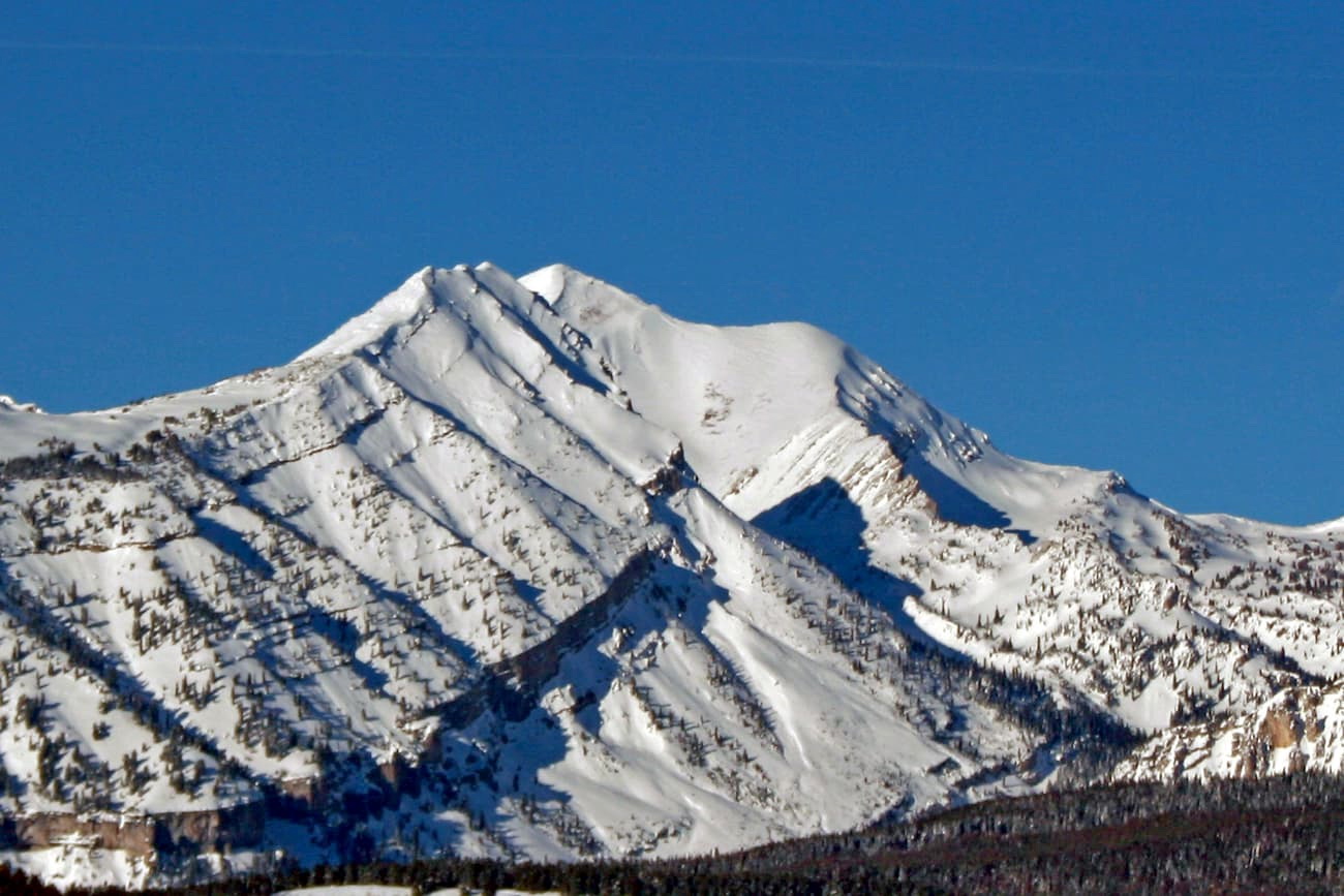
The Gros Ventre Wilderness is a protected area that’s located in the northwestern part of the US state of Wyoming. The wilderness is marked by rugged terrain and is part of the Greater Yellowstone Ecosystem. The tallest and most prominent peak in the range is Doubletop Peak at 11,683 feet (3,564 m) tall with 2,933 feet (894 m) of prominence.
The Gros Ventre Wilderness is situated in northwestern Wyoming within the Bridger-Teton National Forest. This wilderness is part of the Greater Yellowstone Ecosystem and spans 317,874 acres (128,639 ha) across Teton and Sublette counties.
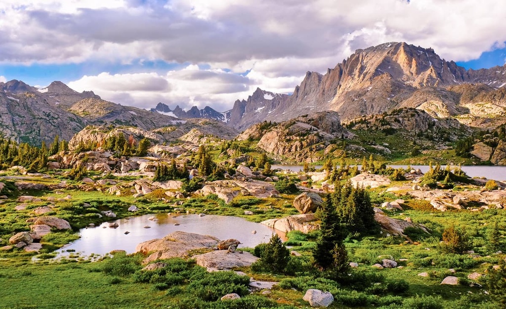
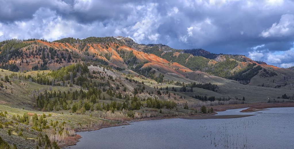
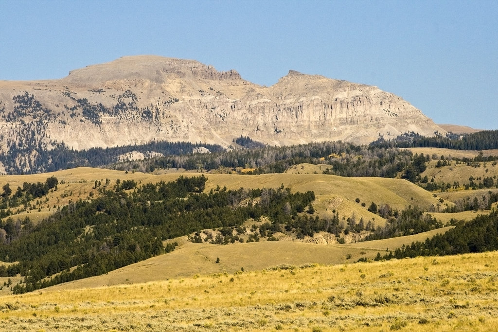
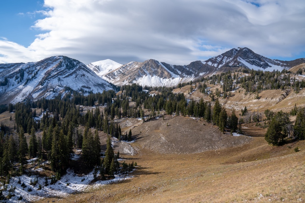
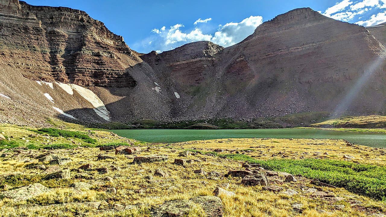
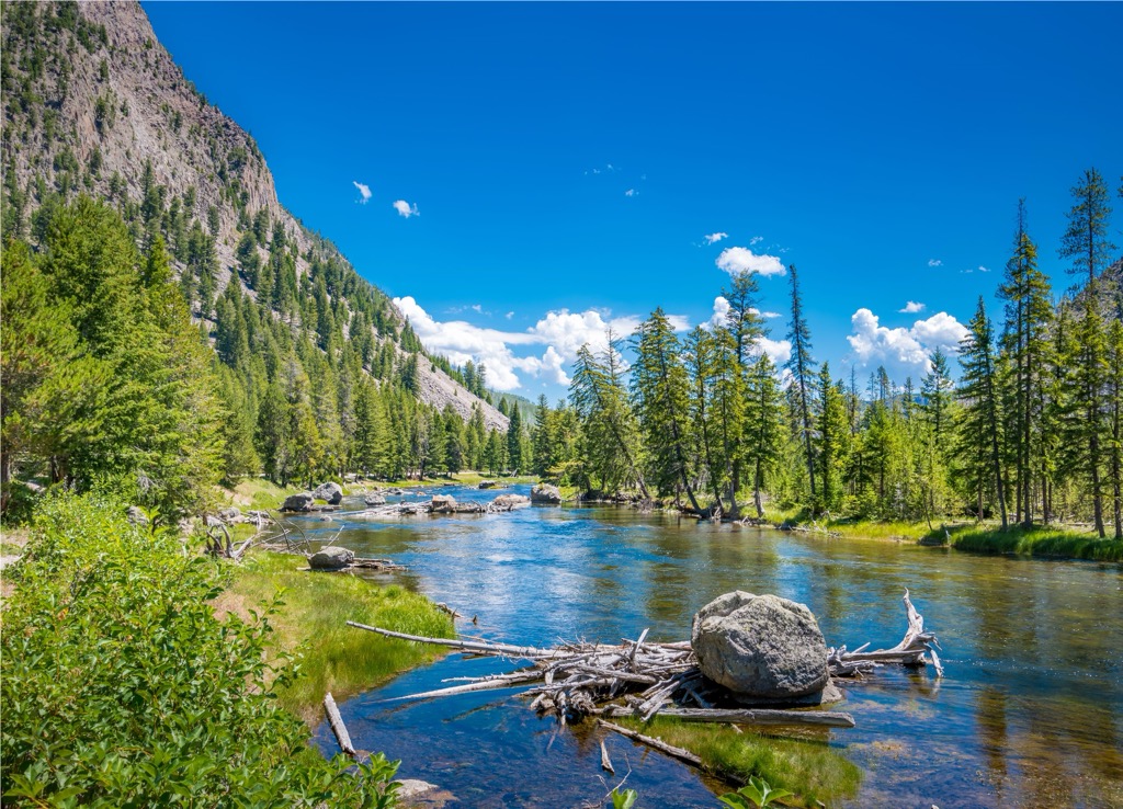
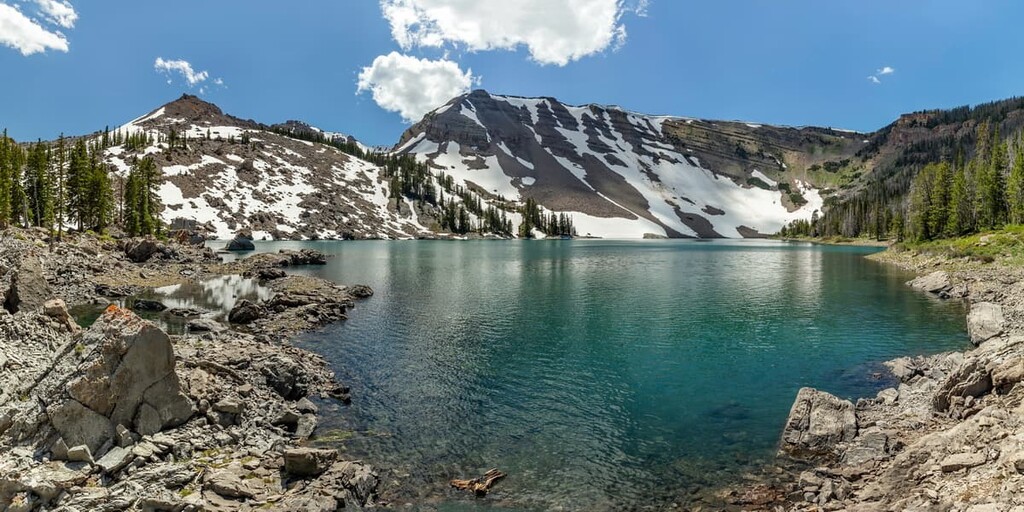
A majority of the Gros Ventre Range lies within the wilderness. Terrain ranges from sweeping meadows to rugged and jagged limestone peaks. Glacier cirques and sweeping basins can be found near the peaks in the region, showcasing the geological history of the terrain.
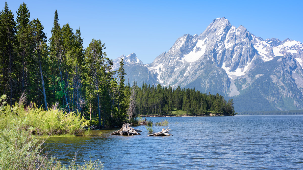
Alpine meadows are met with sweeping basins, forested hillsides, and stunning ridgelines. From many of the highest peaks in the wilderness, visitors have sweeping views of the Teton Range to the west.
The wilderness is bound by the Gros Ventre River in the north, the National Elk Refuge and Snake River to the west, Hoback River to the south, and the Green River to the East. The headwaters for the Gros Ventre River and Granite Creek are both located in the wilderness.
Mountainous terrain lies west and east of the wilderness while the land to the northwest and south is relatively flat. The National Elk Refuge lies to the northwest along with Jackson Lake which is situated in Grand Teton National Park.
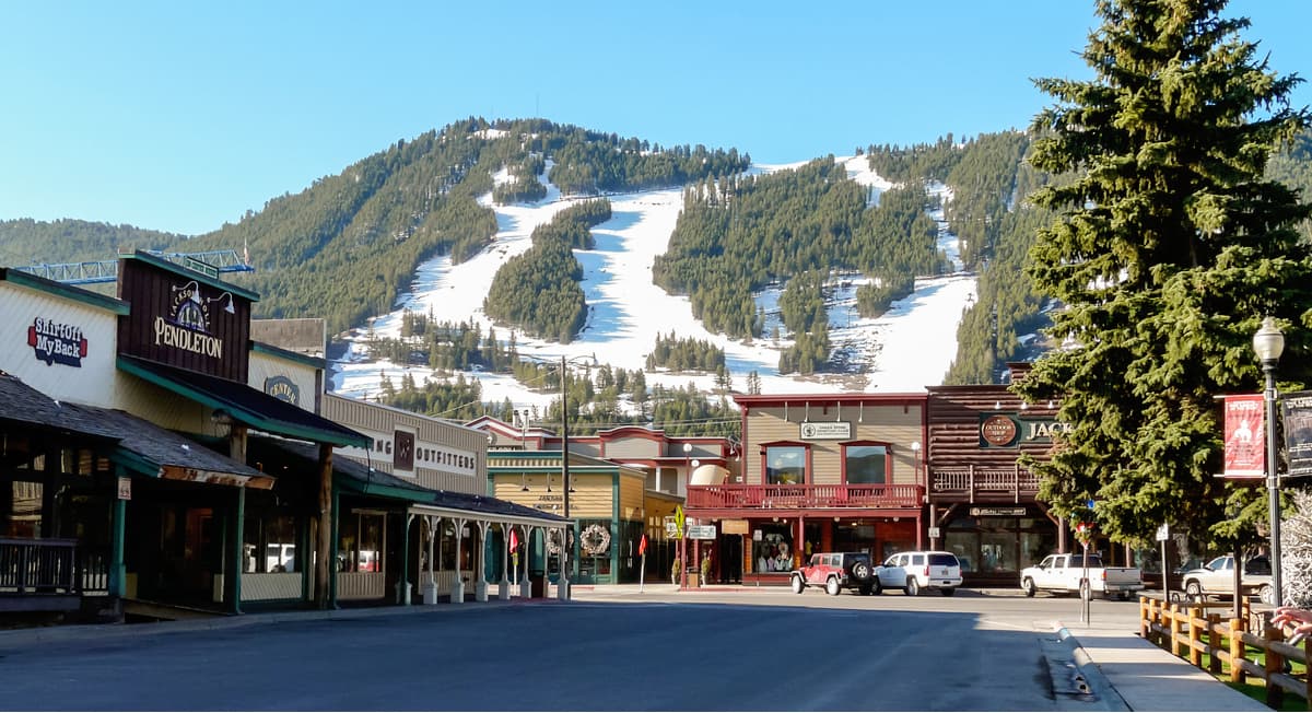
Dramatic changes in elevation can be found throughout the wilderness with the foothills rising steeply up to the peaks and ridgelines of the Gros Ventre Range. The Snow King Ski Resort lies at the northern edge of the wilderness.
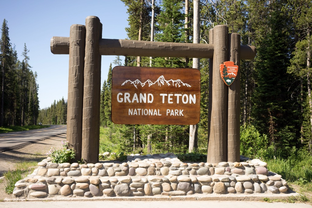
The Gros Ventre Wilderness is surrounded by other wilderness areas and national parks. The wilderness lies within Bridger-Teton National Forest while Grand Teton National Park is located directly north. West of the wilderness lies Jedediah Smith Wilderness and the Palisades Wilderness Study Area. Teton Wilderness Area is situated to the northeast while further north lies Yellowstone National Park.
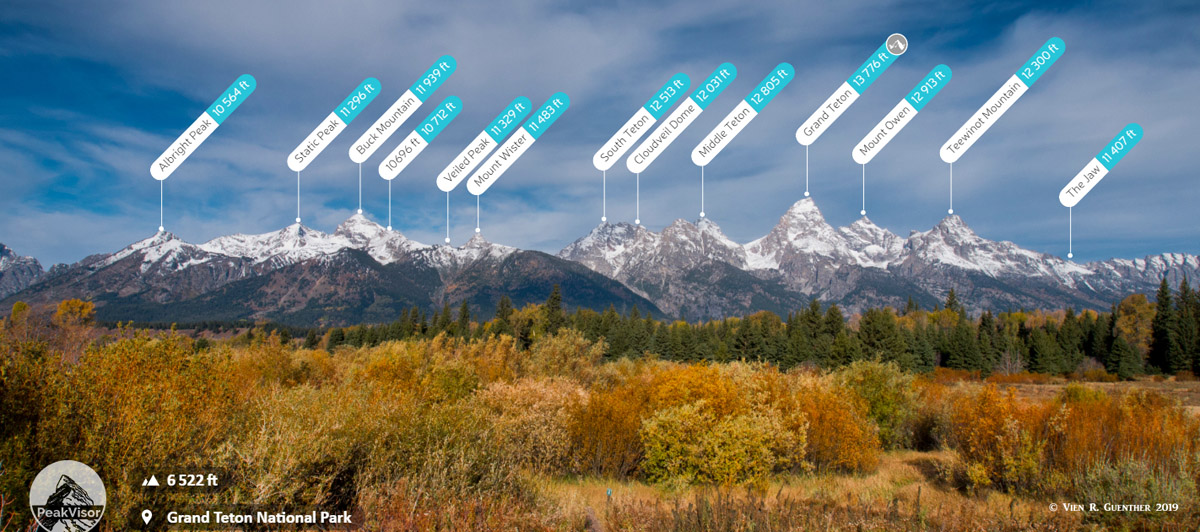
The Gros Ventre Wilderness lies within the Bridger-Teton National Forest. Peaks within the wilderness are part of the Gros Ventre Range while the Teton Range lies to the west. Both of these mountain ranges mark a subrange of the Rocky Mountains.
These peaks share a close geological history with the rest of the Central Rocky Mountains. The range was first uplifted around 50 million years ago. This major uplift throughout the Rocky Mountains occurred during the Laramide orogeny.
Following this orogeny, the region was marked by a high plateau. Over the course of fifty million years, the Gros Ventre Range was heavily eroded. This erosion stripped away the outer layers of rock, leaving behind the distinct craggy peaks and revealing younger layers of rock.
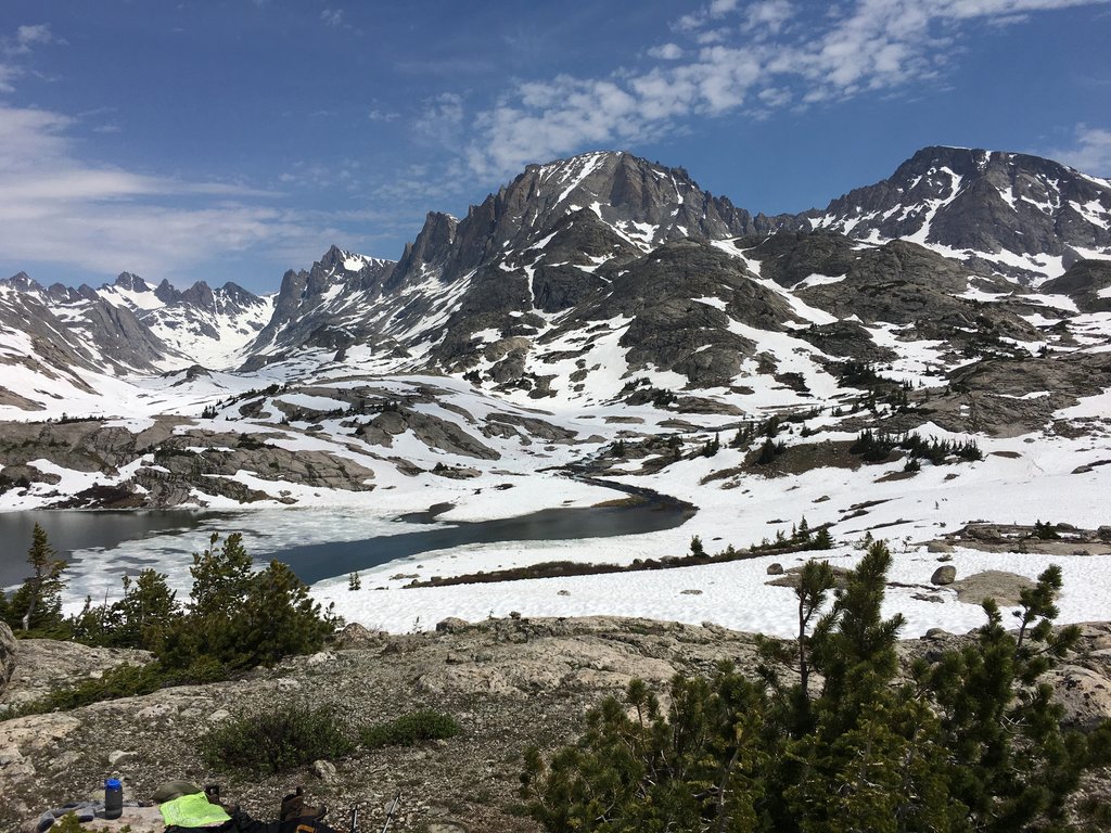
Widespread glaciation occurred during the Pleistocene Epoch to the Holocene Epoch, roughly 1.8 million to 70,000 years ago. As these glaciers retreated, they left behind distinct landforms such as U-shaped valleys and glacial cirques.
Evidence of numerous landslides can be found amidst the range. The dramatic changes in elevation was caused by the continual folds and fault lines that uplifted the range.
Major peaks found within the wilderness include Doubletop Peak, Black Peak, Pinnacle Peak, and Cream Puff Peak.
The Gros Ventre Wilderness is part of the Greater Yellowstone Ecosystem, which encompasses over 22 million acres (8.9 million ha) of terrain, spanning across the states of Wyoming, Idaho, and Montana. Surrounded by a vast network of protected terrain, the wilderness shares similar flora and fauna to that found in Grand Teton National Park.
The plant life in the range has been affected by fires in recent years. The lower elevations are marked by sagebrush fields along with wet sedge and various grasses. Forested hills are populated by Doughlas fir, aspen, and lodgepole pine.
At the higher elevations in the wilderness, hikers are likely to spot stands of whitebark pine and spruce-fir forests. The tallest peaks in the region are classified as an alpine tundra landscape. Here the terrain features some low growing grasses and wildflowers along with lichen.
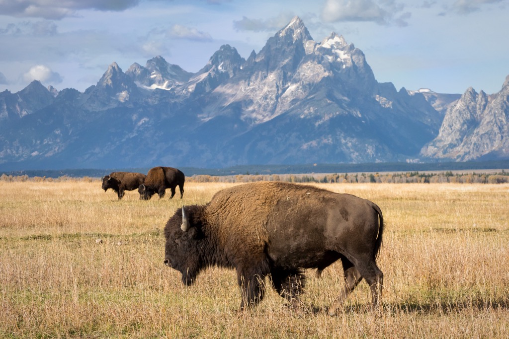
Larger mammals found in the wilderness include elk, deer, bison, black bear, grizzly bear, mountain lions and bison. Populations of wolves and pronghorn are also common along with porcupines, marmots, badgers, martens, beavers, and river otters.
Birds of prey found in the wilderness include bald eagles, golden eagles, falcons, ospreys, hawks, and great horned owls. Other birds such as the black-billed magpie and Steller's jay are also common.
The land within and surrounding the Gros Ventre Wilderness has been inhabited for nearly 10,000 years. This region of land marks part of the ancestral homelands of numerous Tribes, including the Newe Sogobia (Eastern Shoshone) and Apsáalooke (Crow).
The traditional homelands of the Newe Sogobia (Eastern Shoshone) extended throughout present-day Wyoming, Utah, Idaho, and Montana. Traditionally hunters and gatherers, the Newe Sogobia (Eastern Shoshone) utilized the natural abundance that this region offered. This Tribe is also known for their early use of horses, allowing them to extend their territory.
The Apsáalooke (Crow) are another prominent tribe with ancestral ties to the region, primarily inhabiting land to the east of the wilderness. Traditionally from the midwest, the Apsáalooke (Crow) Tribe migrated westward eventually settling in Wyoming and Montana. Many of the tribal members who came to the region settled in the Yellowstone River Valley.
Both of these prominent tribes would hunt bison in the region which once flourished throughout the Greater Yellowstone Ecosystem. The nearby Wind River Basin was a common spot for battles to take place as the Tribes fought for these fertile lands.
The first recorded contact between these Indigenous Tribes and people of European descent occurred during the Lewis and Clark Expedition of 1805. Contact between the Tribes and European fur trappers is thought to have happened earlier though those encounters were not documented.
Following the Lewis and Clark expedition, populations of settlers steadily began to rise throughout the Yellowstone region. A plethora of fur trappers, loggers, miners, and ranchers quickly populated this mountainous region.
By the mid-1800s, relationships between the settlers and Indigenous peoples became hostile. Groups of settlers, often backed by the US government, repeatedly attacked, harassed, killed, and displaced the Indigenous peoples of the region in order to expand their land control
Eventually, the US government led the forced removal of these Tribes. In 1868, the Shoshone Chief Washakie was forced to sign the Fort Bridger Treaty, which put the Newe Sogobia (Eastern Shoshone) onto the Wind River Indian Reservation. The federally recognized Crow Tribe of Montana has a reservation located near Billings, Montana, with currently around 14,000 enrolled members.
Yellowstone National Park, which lies north of the wilderness, was established in 1872, marking the first national park in the country. Teton Forest Reserve was established in 1891, later becoming Grand Teton National Park.
Various forest reserves were established in Wyoming and Montana in 1902 under President Theodore Roosevelt. Combined, these forest reserves covered roughly 5 million acres (2 million ha) of terrain. These forests would later become Bridger, Teton, Custer, Caribou, and Targhee national forests. In 1973 the Bridger and Teton National Forests were administratively combined.
The Gros Ventre Wilderness was established in 1984 as part of the Wyoming Wilderness Act (Public Law 98-55). This act also created the Jedediah Smith, Cloud Peak, Popo Agie, Winegar Hole, Huston Park, Encampment River, and Platte River wilderness areas.
The name Gros Ventre is French for “big belly” or “big stomach”. The Snow King Ski Resort lies just north of the wilderness in Jackson, Wyoming and was established in 1936.
The Gros Ventre Wilderness is home to numerous hiking trails. Here are some of the most popular routes to check out on your next visit to the wilderness.
This hiking route travels through the sagebrush foothills of the wilderness before reaching the Red Hills and forested hillsides in the region. The route has a few climbs and descents throughout before reaching the pristine Grizzly Lake.
Hikers can also take a short detour to reach Blue Miner Lake. This out and back route is 9 miles (14.5 km) in length and is used for both hiking and backpacking.
This trail takes hikers up to the summit of Cream Puff Peak. The route climbs steadily throughout, eventually reaching the alpine terrain. From the summit, hikers have sweeping views of the surrounding wilderness, Gros Ventre Range and the Teton Range to the west. This out and back trail is 12 miles (19.3 km) round trip and features over 3,300 feet (1,006 m) of climbing.
This hiking route begins near the southern edge of the wilderness before traveling north into the mountain range. The trail climbs steadily throughout, from the forested landscape and through alpine meadows, before reaching Turquoise Lake.
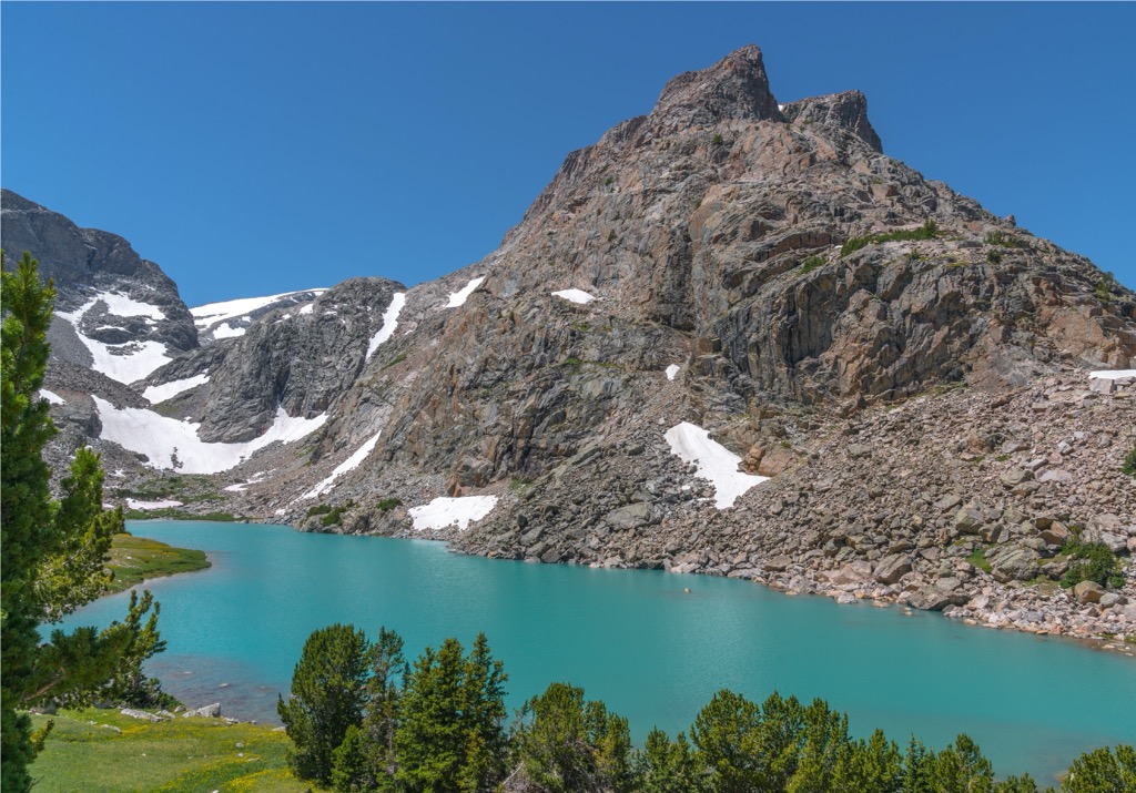
Cache Peak towers above along with numerous other ridgelines and unnamed peaks. The out and back trail is often used for backpacking. This route is 22.7 miles (36.5 km) long and features 3,356 feet (1,023 m) of total elevation gain.
Looking for a place to stay near the Gros Ventre Wilderness? Here are some of the best cities and villages to check out in the region.
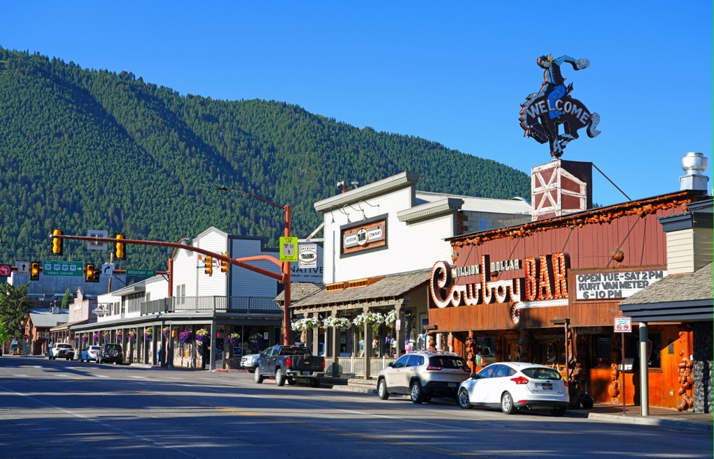
The city of Jackson lies at the northern edge of the wilderness, marking a major community in the region. Situated in Jackson Hole Valley in Teton County, Jackson is known for being a tourist destination due to its close proximity to both Grand Teton National Park and Yellowstone National Park.
The city has a population of around 10,000 residents but is home to thousands of tourists throughout the year. Within the city also lies Jackson Hole Mountain Resort, Snow King Mountain Resort, and Grand Targhee Resort, offering ample opportunities for year round outdoor recreation.
Between the wilderness and the city lies the National Elk Refuge, while the Teton Range rises steeply in the west. Within the valley lie numerous natural hot springs, offering visitors a great way to relax after a long day of adventuring.
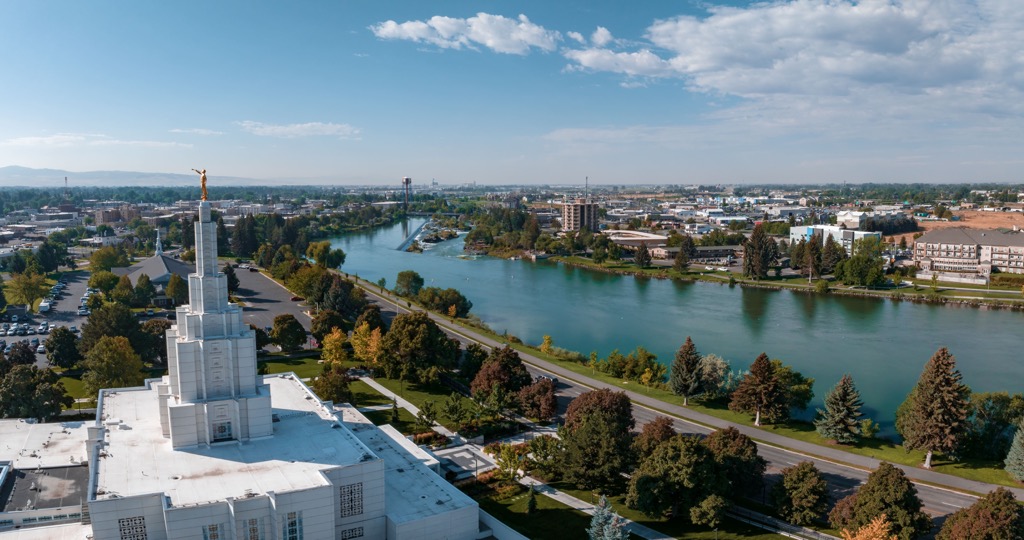
Idaho Falls lies west of the wilderness, in the western foothills of the Teton Range. Home to around 65,000 residents, Idaho Falls marks the most populous city in the state of Idaho outside of the Boise metropolitan area. The city acts as a cultural and economic hub for eastern Idaho and western Wyoming.
Situated along the banks of the Snake River, Idaho Falls is home to numerous pedestrian trails. In the downtown streets visitors will find the Museum of Idaho and the Art Museum of Eastern Idaho. Local shops, restaurants, and breweries can be found throughout the city.