Scan the QR code and open PeakVisor on your phone
The Jedediah Smith Wilderness is a protected area that’s located in the northwestern part of the US state of Wyoming. The rugged wilderness area features karst topography and is part of the Greater Yellowstone Ecosystem. The tallest peak in the Jedediah Smith Wilderness is the Teton Crest Highpoint (11,604 ft /3,537 m) while the most prominent mountain in the wilderness is Rendezvous Peak, which has 1,857 ft (566 m) of prominence.
The Jedediah Smith Wilderness is situated in northwestern Wyoming within the Bridger-Teton National Forest. The land in the wilderness area is part of the Greater Yellowstone Ecosystem. In total, the wilderness area encompasses 123,451 acres (49,959 ha) of terrain.
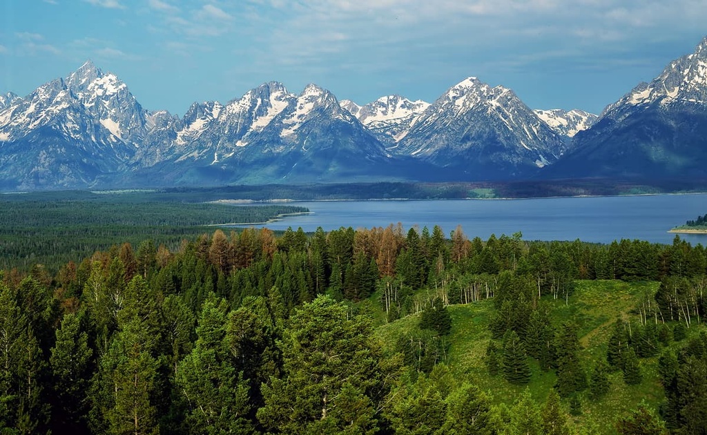
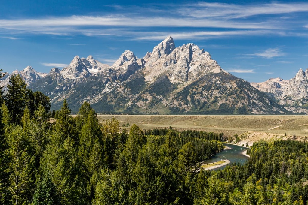
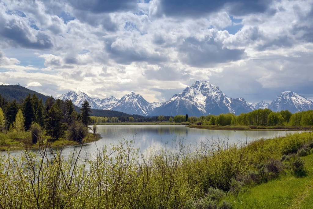
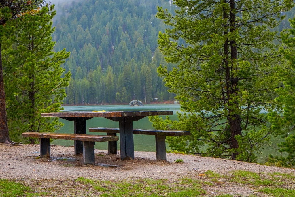
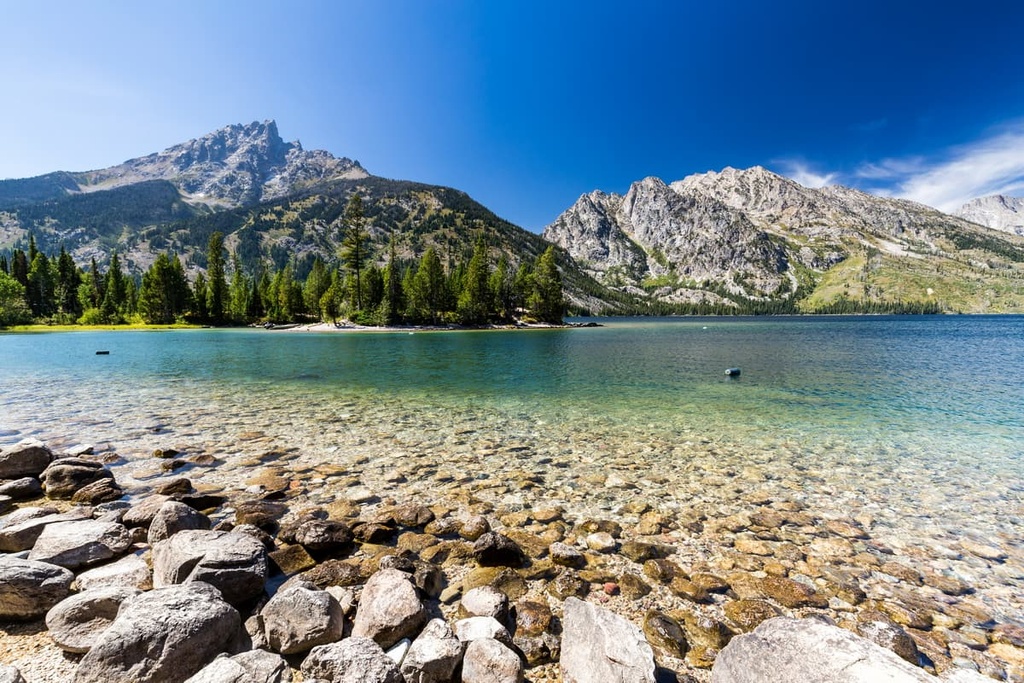
The wilderness lies along the western edge of the Teton Range. As a result, the popular Grand Teton National Park is located directly to the east of the wilderness area. Forested slopes, jagged peaks, alpine meadows, and vast basins are found throughout much of the region in the wilderness.
The northern boundary of the wilderness is defined by Grassy Lake Road while Teton Pass Highway marks the southern boundary of the area. Alongside the nearby national park, the wilderness protects much of the main ridgeline of the Tetons.
Furthermore, the Tetons themselves are known for their craggy peaks and dramatic changes in elevation. The forested hillsides in the foothills surrounding the range rise steeply up to the rocky snow-capped peaks that make the Tetons so famous. That said, these very steep slopes are less common along the western edge of the range.
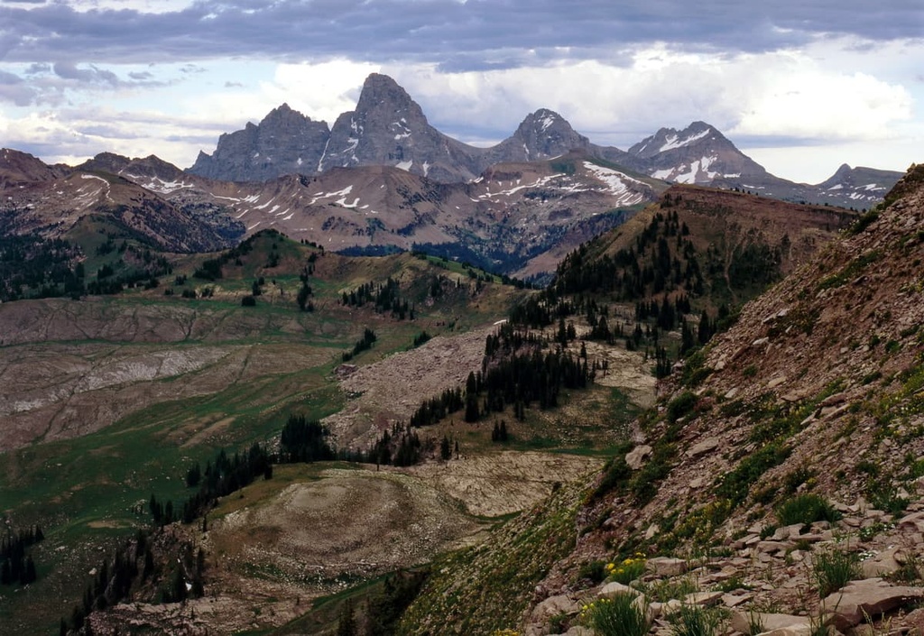
Remnants of the region’s once-vast glaciers are scattered throughout some of the tallest peaks in the wilderness area. Meanwhile, the western stretches of the wilderness are home to forested hillsides, creeks, and streams. Alpine meadows and glacial cirques can be found at higher elevations in the wilderness.
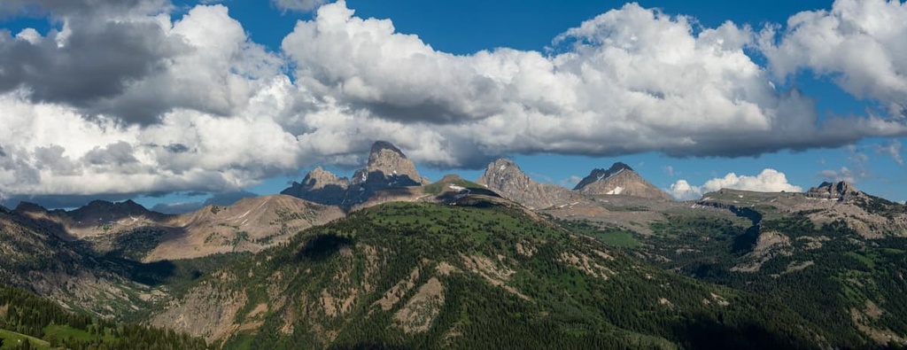
Major waterways found in the wilderness area include South Leigh Creek, North Leigh Creek, North Fork Cascade Creek, North Bitch Creek, and Conant Creek. The topography of the wilderness area is dominated by the Teton Range, which runs in a north to south direction.
The Jedediah Smith Wilderness is surrounded by other wilderness areas and national parks. The wilderness lies within Bridger-Teton National Forest while Grand Teton National Park is located directly to the east. Further to the east lie both the Teton Wilderness Area and Gros Ventre Wilderness. Furthermore, Yellowstone National Park is situated to the northeast of the Jedediah Smith Wilderness.
The Jedediah Smith Wilderness lies within the Bridger-Teton National Forest and is dominated by the peaks of the Teton Range. The Teton Range is one of the youngest mountain ranges in the Rocky Mountains.
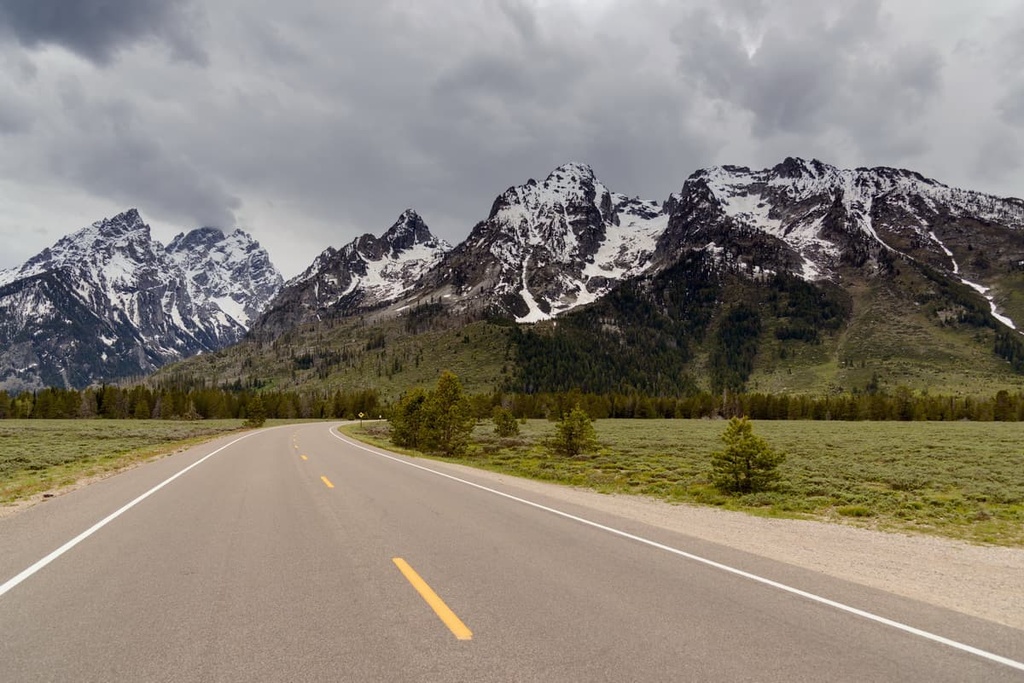
The rugged peaks in the Tetons began forming between 6 to 9 million years ago. The range is 40 miles (64 km) long and around 7 to 9 miles (11 to 14 km) wide. The eastern side of the range rises abruptly from Jackson Hole Valley, providing the peaks with an incredible amount of relief over the terrain below. However, the western side of the range rises up more slowly from the Teton Valley, so it features a number of foothills.
Geologically, the origin of the Tetons can be traced back to the Teton fault. This fault formed as the Earth’s crust was stretched in the region around the range. As the Earth’s crust began to stretch and fold, the Teton fault thrust the landscape upward. Over time, the eastern block of the fault fell, forming the Jackson Hole Valley and giving the region the dramatic changes in elevation that we see to this day.
While the range itself is relatively young, the oldest rocks found in the Tetons date back to around 2.5 billion years ago. These rocks were once found along the floor of an ancient ocean where they were deposited as sediment and slowly transformed into rock. Millions of years of pressure and heat transformed these sedimentary rocks into gneiss.
During the Cambrian, sedimentary rock was deposited by the sea on top of these metamorphic rocks. As the range was thrust upwards, millions of years of erosion exposed the intrusive igneous rocks and metamorphic rocks of the region. Earthquakes along the Teton Fault further shaped the range by forcing the western side of the range upward and the eastern side of the range downward.
That said, the Jedediah Smith Wilderness isn’t known for its metamorphic rocks. Rather, the wilderness was originally designated because of its limestone karst topography, which, while common in places like the Dinaric Alps in southern Europe, is unique for the region. As a result of this karst topography, the wilderness area is home to many caves.
Major peaks found within the wilderness include Teton Crest Highpoint, Rendezvous Peak, Table Mountain, Taylor Mountain, Mount Bannon, and The Wall.
The Jedediah Smith Wilderness is part of the Greater Yellowstone Ecosystem, which encompasses over 22 million acres (8.9 million ha) of terrain across the states of Wyoming, Idaho, and Montana. Due to their geographic proximity, species of flora and fauna found in the wilderness are very similar to those found in Grand Teton National Park.
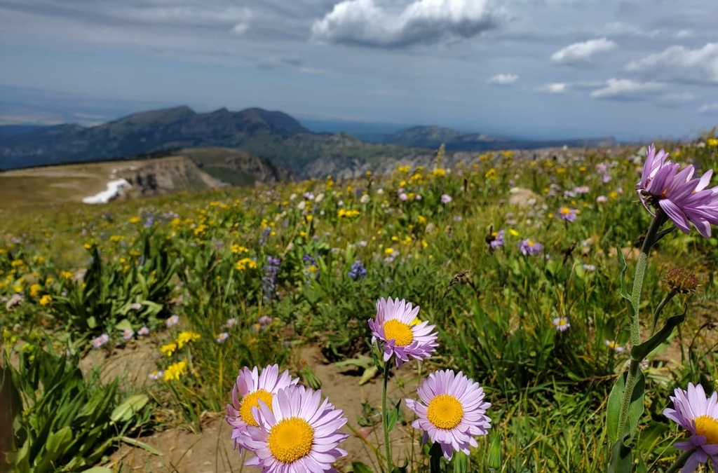
The highest elevations in the wilderness are home to an alpine tundra landscape, which features low-growing grasses and wildflowers. As elevations decrease in the wilderness, the ecosystem transforms into a Rocky Mountain subalpine zone where both fir and spruce trees dominate the landscape. The western foothills of the Teton Range feature deciduous trees and sagebrush fields.
While lichen, grasses, moss, and wildflowers flourish amidst the tallest peaks in the wilderness, the region’s subalpine zone is primarily home to Engelmann spruce, subalpine fir, whitebark pine, and limber pine. Lodgepole pine is more common in the western foothills of the wilderness.
With respect to wildlife, the gray wolf has returned to the region after being extirpated during the early 1900s. After the wolves were reintroduced to nearby Yellowstone National Park, some of them migrated back to the Teton Range. They have since been spotted in both the wilderness and the nearby Grand Teton National Park.
Other large mammals found in the region include black bears, grizzly bears, coyotes, cougars, lynx, bison, moose, pronghorns, elk, and deer. Smaller animals that live in the wilderness include river otters, martens, badgers, marmots, muskrats, beavers, porcupines, and pikas.
Common birds of prey in the wilderness area include ospreys, American kestrels, red-tailed hawks, bald eagles, golden eagles, and great horned owls. Smaller birds such as black-billed magpies are common near campgrounds in the region while Steller’s jay can be spotted in the wilderness area’s backcountry.
The land in and surrounding the Jedediah Smith Wilderness has been inhabited by Indigenous peoples for thousands of years. This region is part of the ancestral homelands of many Tribes, including the Eastern Shoshone and Apsáalooke (Crow).
The Eastern Shoshone traditionally lived throughout present-day Utah, Idaho, and Montana. They were traditionally hunters and gatherers who traveled throughout the surrounding mountain ranges and sweeping valleys to find big game to hunt and plants to gather. The Eastern Shoshone are also known for their early use of horses, which allowed them to extend their territory to reach places as far away as the modern-day Canadian province of Alberta.
The other prominent tribe with cultural and historic ties to the region is the Apsáalooke (Crow). The Apsáalooke (Crow) traditionally lived in the Midwest but eventually began migrating westward and settled in both Wyoming and Montana. Many of those who traveled westward settled in the Yellowstone River Valley. The tribe was also split into four major bands known as the River Crow, Mountain Crow, Beaver Dries its Fur, and Kicked in the Bellies.
Both of these tribes hunted the bison that once flourished in the Greater Yellowstone Ecosystem. The Wind River Basin was a common spot for battles, too, as the Tribes in the region fought over the basin’s fertile lands.
The Lewis and Clark Expedition of 1805 was one of the earliest recorded points of contact between the Indigenous tribes who lived in the region and people of European descent. It is believed that the Tribes had previously made contact with Europeans due to the expansion of the fur trade in the area, but these earlier interactions were not documented.
Settler communities in the Yellowstone region began to steadily grow in size following the Lewis and Clark Expedition. An influx of fur trappers and settlers soon flooded the region, and they were followed by ranchers, miners, and loggers.
As the Rocky Mountain Fur Trade began to grow, many Tribal members started to take part in the industry. This somewhat harmonious partnership grew during the early 1800s but quickly became hostile. The settlers, with support from the US government, repeatedly attacked, displaced, and killed the Indigenous peoples in the region in order to claim control over an increasingly large area of land.
Eventually, these hostilities led to the forced removal of the Tribes from the region. Most of the Indigenous people who lived in the region were forced to move to newly established reservations. For example, the Wind River Indian Reservation was established in 1868, when the Shoshone leader Washakie signed the Fort Bridger Treaty. The reservation is located to the east of the Jedediah Smith Wilderness Area.
Meanwhile, the federally recognized Crow Tribe of Montana has a reservation located near Billings, Montana, to the north of the wilderness. There are around 14,000 enrolled members of the Crow Tribe.
While the nearby Yellowstone National Park made history in 1872 by becoming the first national park in the US, the land in and around the Jedediah Smith Wilderness wasn’t protected until decades later.
In 1891, President Benjamin Harisson created the Yellowstone Park Timber Land Reserve, which was located to the east and south of the national park and was designed to limit logging and overgrazing in the region.
A few years later, in 1897, President Grover Cleaveland established the Teton Forest Reserve. This land is now primarily part of Grand Teton National Park, but some of it is located in the modern-day Bridger-Teton National Forest.
The forest reserves in Wyoming and Montana were greatly expanded under President Theodore Roosevelt, who protected some 5 million acres (2 million ha) of terrain in 1902.
In 1907, all forest reserves were renamed national forests, and in 1908, the Yellowstone National Forest was separated into five separate national forests. This includes the current Bridger, Teton, Custer, Caribou, and Targhee national forests. The Bridger and Teton national forests were then administratively combined in 1973.
Finally, the Jedediah Smith Wilderness Area was established in 1984 as part of the Wyoming Wilderness Act (Public Law 98-55), which also created the Cloud Peak, Popo Agie, Gros Ventre, Winegar Hole, Huston Park, Encampment River, and Platte River wilderness areas.
The Jedediah Smith Wilderness is named after the American colonizer, trapper, hunter, and author, Jedediah Smith.
The Jedediah Smith Wilderness is home to around 175 miles (282 km) of hiking trails. Here are some of the most popular routes to check out on your next visit to the wilderness.
The Table Mountain Trail is the most popular hiking route in the wilderness area. This trail takes you from the Teton Canyon Campground to the summit of one of the most prominent peaks in the wilderness, Table Mountain.
From the campground, this route travels along the western face of the peak before reaching the summit. Hikers on this trail pass through alpine meadows and a forested landscape before reaching the rocky ridgelines and peaks that define the Teton Range.
The out-and-back version of this hike is 8.2 miles (13 km) long and it has 4,094 feet (1,248 m) of elevation gain. Meanwhile, the loop version of this trail is 10.7 miles (17.2 km) long and it has 4,146 feet (1,264 m) of elevation gain.
The Coal Creek Meadows Trail is a more moderate hiking route in the wilderness. This route begins along Highway-22 and climbs steadily through a large canyon. Hikers will then pass through sprawling meadows while forested hillsides rise steeply on either side.
This out-and-back trail is 4.7 miles (7.6 km) in length and it has 1,673 feet (510 m) of elevation gain. The Coal Creek Meadows Trail is also a common starting point for those looking to reach the summit of Taylor Mountain.
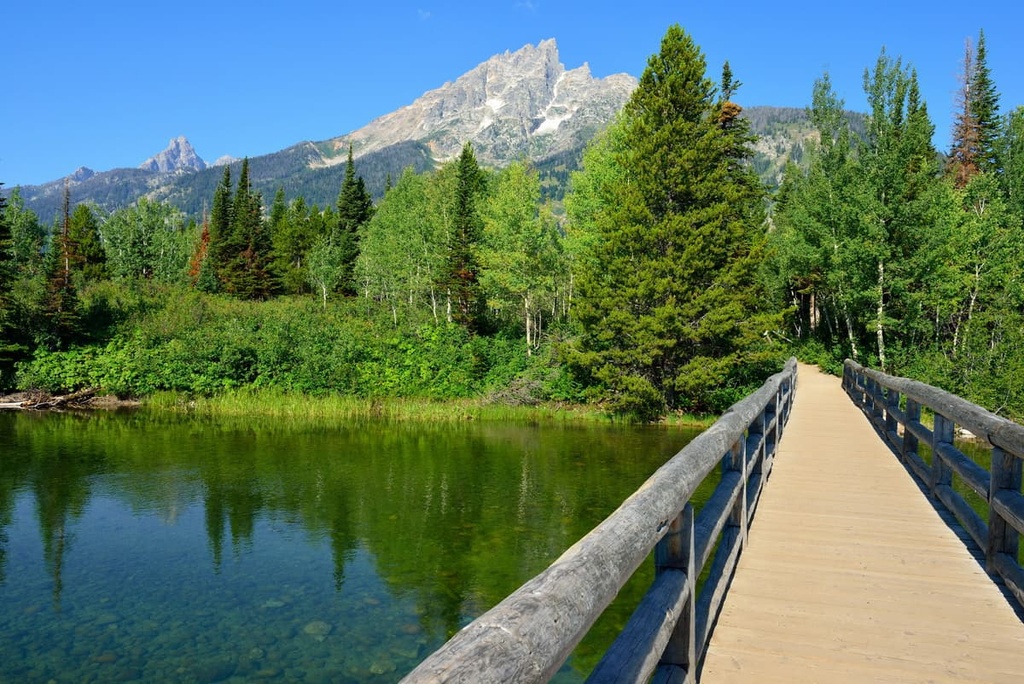
The Teton Canyon to Jenny Lake Trail is a point-to-point hike that begins at Teton Canyon Campground. This route climbs steadily from the trailhead while following along the South Fork Teton Creek. Hikers on this trail get a chance to see flowing streams, small lakes, alpine basins, and dense forests, all while the rugged Teton Range towers overhead.
After climbing out of the canyon, the trail traverses a ridge and descends to Jenny Lake, which is located just to the south of Jackson Lake. This route is 21.3 miles (34.3 km) long and it has 4,317 feet (1,316 m) of elevation gain.
Looking for a place to stay near the Jedediah Smith Wilderness Area? Here are some of the best cities and villages to check out in the region.
The city of Jackson lies just to the south of the wilderness and is one of the major communities in the region. As it is located within the Jackson Hole Valley in Teton County, the city of Jackson is a popular tourist destination for those looking to hike in Grand Teton National Park and Yellowstone National Park.
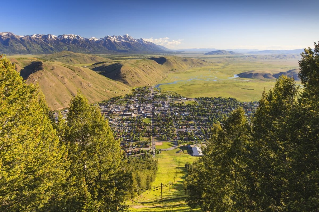
Jackson is home to just 10,000 permanent residents, yet every year, thousands of tourists come to visit the stunning beauty that surrounds this quaint community. The city is also home to the Jackson Hole Mountain Resort, Snow King Mountain Resort, and Grand Targhee Resort, so there are plenty of outdoor recreation opportunities to enjoy in Jackson throughout the year.
Just outside the city of Jackson, you can also find the National Elk Refuge, which features the dramatic backdrop of the Teton Range. Natural hot springs are common in the valley surrounding the town, too, providing visitors with a way to relax after hiking, biking, camping, or skiing in the Tetons.
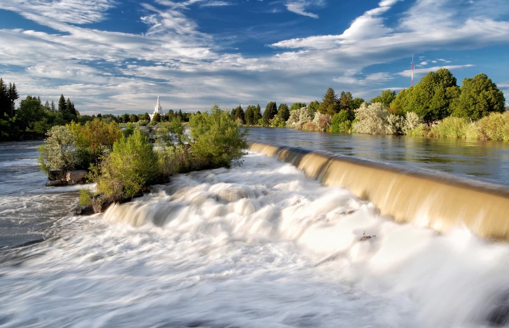
Located just to the west of the Jedediah Smith Wilderness is the city of Idaho Falls. Since it is home to around 65,000 residents, Idaho Falls is the most populous city in the state outside of the Boise metro region. This relatively large size has allowed Idaho Falls to become the cultural and economic hub of eastern Idaho and western Wyoming.
Idaho Falls is situated along the banks of the Snake River, where you can find many walking paths if you want to enjoy a casual stroll during your trip to the city. Both the Museum of Idaho and the Art Museum of Eastern Idaho are located in the city, too. Plus, local restaurants and breweries line the streets of Idaho Falls, so there’s something for everyone to love during a trip to this bustling city.