
Scan the QR code and open PeakVisor on your phone
The Cloud Peak Wilderness is located in the north-central portion of the US state of Wyoming. Situated along the spine of the Bighorn Mountains, the wilderness features rugged mountain peaks and glacial lakes. There are 37 named mountains in the wilderness, the tallest and most prominent of which is Cloud Peak at 13,189 ft (4,020 m) in elevation.
The Cloud Peak Wilderness is a rugged mountainous landscape situated within Bighorn National Forest in north-central Wyoming. The wilderness is located along the main ridgeline of the Bighorn Mountains, which run in a northwest to southeast direction.
This rugged landscape covers 189,039 acres (765 sq. km) of terrain across northern Wyoming. It is 27 miles (43 km) in length and it encompasses the tallest peaks in the Bighorn Mountains. Cloud Peak, for which the wilderness is named, is the tallest peak in both the Bighorn Mountains and the wilderness area.
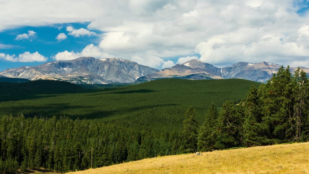
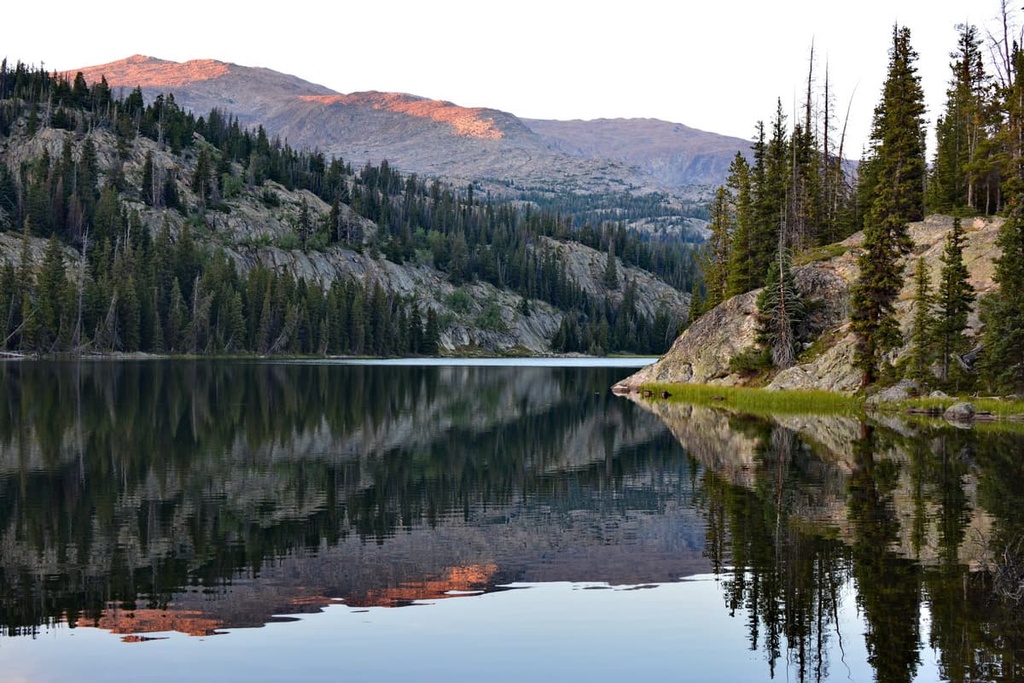
The jagged peaks and sheer rock faces of the Cloud Peak Wilderness stand in stark contrast to the region’s dense forests, alpine meadows, glacial cirques, and alpine lakes. The high elevations found throughout the wilderness also mean that the region’s landscape is typically covered in snow for much of the year.
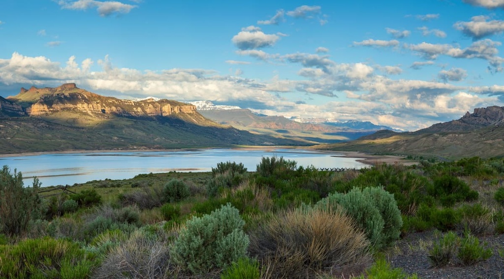
Cloud Peak towers above the landscape below, acting as a focal point for both the wilderness and the surrounding national forest. The last remaining glacier in the range can be spotted along the eastern side of Cloud Peak. The meltwater from this glacier and the region’s annual snowpack feed the hundreds of small lakes that are scattered throughout the landscape.
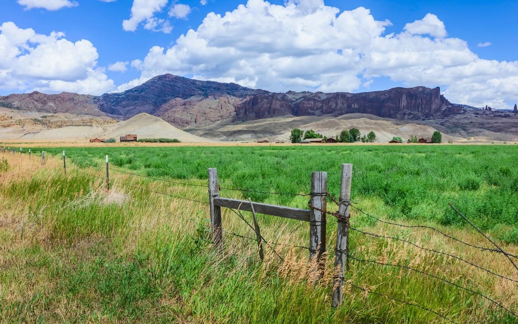
The peaks within the Cloud Peak Wilderness are separated from other major ranges in the state such as the Absaroka Range and the Teton Range. The Bighorn Basin lies directly to the west of the wilderness while the Great Plains extend to the east.
The Cloud Peak Wilderness is surrounded by other wilderness areas and national parks. The wilderness lies entirely within Bighorn National Forest, while Shoshone National Forest, Bridger-Teton National Forest, Grand Teton National Park, and Yellowstone National Park are all situated to the west.
The peaks within the Cloud Peak Wilderness are part of the Bighorn Mountains. Though this range is isolated compared to other ranges in the region, the Bighorn Mountains are still part of the larger Rocky Mountains.
A majority of the Bighorn Mountains are located within Wyoming, but a smaller portion of the range extends northward into Montana. The rugged mountains of the range began forming during the Laramide orogeny around 70 million years ago. The bedrock for this remote region primarily consists of sedimentary rock. This rock dates back to the Cambrian and Lower Cretaceous period and it contains a sizable number of fossils.
Though these peaks share a geological history with the rest of the Rocky Mountains, the Bighorn Mountains are also unique from other subranges of the Rockies. For example, the Bighorns are home to some rocks that date back 3.25 billion years, making them some of the oldest rocks in the world.
During the Holocene, extensive glaciation covered much of what is now the Cloud Peak Wilderness. As temperatures rose, glacial retreat further carved out the rugged landscape, leaving behind U-shaped valleys, glacial cirques, and glacial lakes. Today, the only remaining glacier in the wilderness can be found along the eastern side of Cloud Peak.

Karst topography is common in the region, which is one of the reasons why you can find a network of caves in the area around the Bighorn Mountains. These caves can be seen at the Natural Trap Cave, which lies along the western edge of the range.
Interestingly, miners have yet to find large deposits of precious metals in the Bighorn Mountains. Because of this, the region has been relatively untouched by human activity.
Major peaks located within the wilderness include Cloud Peak, Mather Peak, Spear Peak, Bomber Mountain, Bighorn Peak, and Black Tooth Mountain.
Though the Bighorn Basin separates the wilderness from the rest of the Rocky Mountains, the flora and fauna of the region are similar to what you can find elsewhere in western Wyoming.
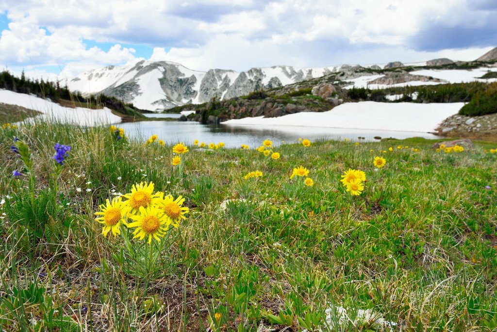
In the low to mid-elevations, the wilderness is marked by densely forested hillsides that are often dominated by aspen, spruce, fir, and lodgepole pine. At higher elevations, the wilderness consists of wetlands, alpine meadows, wildflowers, and scree fields. The tallest peaks in the wilderness are free of plant coverage with the exception of some low-growing grasses.
The remote nature of the wilderness, combined with its close proximity to the Greater Yellowstone Ecosystem, allows for a wide variety of flora to thrive. Larger mammals in the region include black bears, moose, elk, mule deer, pronghorn, and cougars. Grizzly bears also inhabited the region as recently as the beginning of the twentieth century, but they no longer do.
The lower elevations of the wilderness area provide the ideal habitat for coyotes while the region’s scree fields allow marmots to thrive. Many of the lakes in the wilderness are naturally stocked with species of trout and other small fish. Common bird species in the wilderness area include sage grouse, northern flicker, and golden eagles.
Indigenous people have inhabited the land in and surrounding the Cloud Peak Wilderness for thousands of years. The region's plethora of waterways, coupled with the ideal hunting grounds of the Bighorn Basin, have made it a highly desirable area for human settlement since time immemorial.
In particular, this region is part of the ancestral homelands of the Apsáalooke (Crow) Tribe and Cheyenne Nation. Some bands of the Shoshone Tribe are also thought to have inhabited the region in centuries past.
According to cultural and archeological evidence, the Apsáalooke (Crow) Tribe settled in the region around 300 to 400 years ago. The migratory patterns of big game, coupled with the fertile nature of the land, made the region an ideal place for people to establish settlements.
Before settling in the region, the Apsáalooke people traditionally lived in the midwest. After arriving in the area around what is now the Cloud Peak Wilderness, the tribe split up into four major bands: River Crow, Mountain Crow, Beaver Dries its Fur, and Kicked in the Bellies.
During the 1800s, other tribes, such as the Cheyenne, Arapaho, and Lakota, began inhabiting the region. The Arapaho primarily lived on the land directly to the east of the Rocky Mountains, which includes the Bighorn Mountains.
The first recorded contact between European settlers and the Indigenous peoples of the region likely took place during the Lewis and Clark expedition of 1805, though it’s possible that fur trappers had traveled through the area before the expedition took place.
In the decades that followed, the population of settlers in the region slowly began to rise as the fur trapping industry started to grow. As the Rocky Mountain Fur Trade continued to grow, the settlers, backed by the US government, continually attacked, displaced, and killed members of local tribal nations. Many of the Indigenous people who remained in the region were forced onto reservations.
Today, the Crow Tribe of Montana is a federally recognized tribe whose reservation lies to the north of the wilderness near Billings, Montana. The Crow Tribe has around 14,000 enrolled tribal members, a majority of whom live on the reservation.
Bighorn National Forest was established in 1897, though it didn’t get its current name until 1908. The Cloud Peak Wilderness was formally designated in 1984 in order to preserve and protect the highest elevation sections of the Bighorn Mountains.
The Cloud Peak Wilderness is home to over 100 miles (161 km) of hiking trails. Here are some of the top hiking areas to visit during your next trip to the wilderness area.
This route takes hikers up to the tallest peak in the wilderness and the Bighorn Mountains, Cloud Peak. This out-and-back trail is often used as a backpacking route as it totals 22.5 miles (36.2 km) in length and has 5,328 feet (1,624 m) of elevation gain. The trail winds its way through the forested hillsides of the wilderness while continually gaining elevation.
Many backpackers on this trail set up a camp at Mistymoon Lake before hiking the final section of the route to the summit. This final climb requires some scrambling over rocks so hikers should use extreme caution. The summit offers unobstructed views of the wilderness, the Bighorn Basin to the west, and the Great Plains to the east.
The Mirror Lake Trail is a scenic out-and-back route that showcases the remote beauty of the region. The trail begins at West Tensleep Lake before steadily climbing through the forest up to Mirror Lake.
This out-and-back route also features meadows, steep rock faces, and sweeping views of the surrounding ridgelines. This trail is 5.8 miles (9.3 km) long round-trip and it has 1,095 feet (334 m) of elevation gain. Hikers on this route can turn around at Mirror Lake or continue for another 2 miles (3.2 km) to reach Lost Twin Lakes.
Situated along the western edge of the wilderness, Sherd Lake Trail gently climbs through the forested landscape while passing numerous small lakes. The network of lakes and ponds that you’ll pass by on the Sherd Lake Trail are all connected by a multitude of creeks and streams.
This out-and-back trail is 3.5 miles (5.6 km) in length and it has 574 ft (175 m) of elevation gain. The Sherd Lake Trail route can be completed throughout much of the year, and it is occasionally used for snowshoeing during the winter months.

Looking for a place to stay near the Cloud Peak Wilderness? Here are some of the best cities and villages to check out in the region.
The city of Gillette is located to the east of the Cloud Peak Wilderness and to the west of the Black Hills National Forest. Gillette is commonly referred to as the “Energy Capital of the Nation,” as it is one of the state’s major coal exporters.
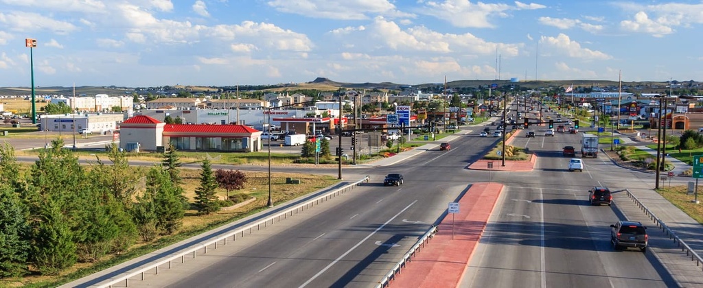
Gillette is home to around 34,000 residents, making it the third-most populous city in the state. Local restaurants and shops line the downtown streets of the city. Each year, the city hosts the Donkey Creek Festival, which includes the Avenues of Arts concert.
Devils Tower National Monument (Bear Lodge Butte/Matȟó Thípila/Daxpitcheeaasáao) lies just an hour's drive to the northeast of Gillette, and it offers visitors and locals alike the opportunity for outdoor recreation.
The tower itself is sacred to many Tribes, including the Lakota, Kiowa, and Cheyenne. Local Tribal leaders ask visitors to respect the voluntary climbing ban that’s put in place on the tower each June due to the many ceremonies that are conducted around it during that time of year.
The city of Cody lies to the west of the wilderness along the eastern edge of Shoshone National Forest. The Shoshone River runs through the city of Cody, which is home to around 10,000 residents. Cody is also home to the Buffalo Bill Center of the West, which features five smaller museums.
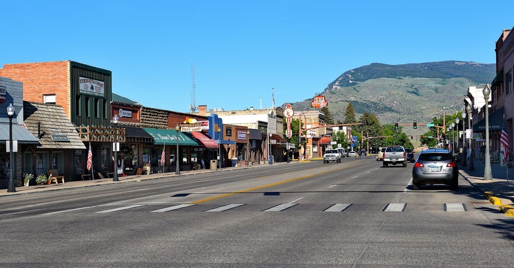
Cody serves as a gateway to both Bighorn National Forest and Yellowstone National Park. Each year, the city hosts the Cody Stampede Rodeo, which is one of the reasons why it’s locally known as the “Rodeo Capital of the World.” The downtown area of Cody also offers many great restaurants and art galleries, as well as the historic Irma Hotel.


13er
ultra
wyoming-13ers
wyoming-ultras
13er
ultra
wyoming-13ers
wyoming-ultras


