Scan the QR code and open PeakVisor on your phone
Home to some of the most rugged and remote terrain in the Absaroka Range, the Washakie Wilderness Area is a federally-protected region in the northwestern part of the US state of Wyoming. The wilderness contains 60 named mountains, the highest of which is Mount Crosby (12,441ft/3,792m), and the most prominent of which is Fortress Mountain (12,080ft/2,682m).
The Washakie Wilderness is situated in the northwestern region of the state of Wyoming in Shoshone National Forest. It covers an area of 704,274 acres (285,009 ha) within Wyoming’s Park, Hot Springs, and Fremont counties.
Due to its location within the northwestern part of Wyoming, the Washakie Wilderness is surrounded by other areas of federally-managed land. In particular, the wilderness is nestled to the south of the northern part of the Absaroka Range in the North Absaroka Wilderness and the Absaroka-Beartooth Wilderness.
Meanwhile, the Washakie Wilderness is located to the east of Yellowstone National Park, Grand Teton National Park, Bridger-Teton National Forest, the Teton Wilderness, and the Jedediah Smith Wilderness, all of which are home to the Gallatin Range, the Teton Range, and the Gros Ventre Range.
To the south of the wilderness lies the Wind River Range and the Gros Ventre Range, which are included as part of the Gros Ventre Wilderness, the Fitzpatrick Wilderness, the Bridger Wilderness, and the Popo Agie Wilderness. These wildernesses are part of either Shoshone National Forest or the Bridger-Teton National Forest.
Finally, the Washakie Wilderness is situated to the west of the lower-lying plains of the Bighorn Basin and the Wind River Reservation, which separates the wilderness from the Bighorn Mountains of the Bighorn National Forest and the Cloud Peak Wilderness Area.
Geologically, the mountains within the Washakie Wilderness are part of the Absaroka Range, which is a long chain of peaks that extends for about 150 miles (240km) from southern Montana to north-central Wyoming. The Absarokas are part of the Greater Yellowstone Rockies and they are crossed by the Continental Divide.
Interestingly, the Absaroka Range is the remains of an ancient volcanic field that was active during the Middle Eocene, about 53 to 43 million years ago. As a result, the rocks within the range and within the wilderness are mostly part of the Absaroka Volcanic Supergroup.
The Absaroka Volcanic Supergroup is a collection of different rocks, most of which are igneous or volcaniclastic. Volcaniclastic rocks are actually sedimentary rocks that are composed of sediments derived from igneous materials.
For many years, geologists studying the region believed that the Absarokas were just a subsection of the larger Yellowstone Plateau Volcanic Field (YPVF). But, it turns out that the rocks in the Absaroka Range and the rocks within the YPVF differ in age by about 50 million years.

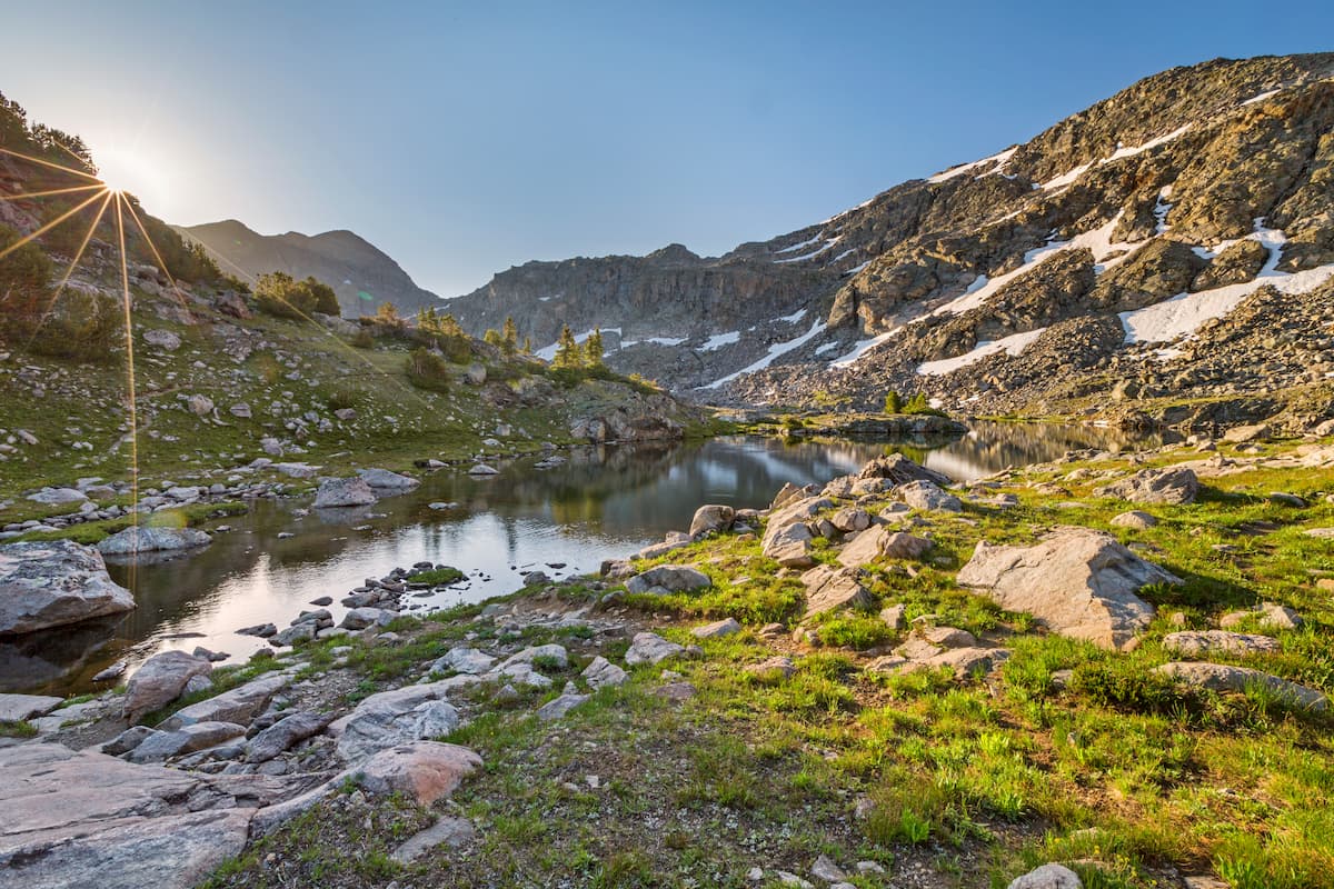
From a topographical perspective, the land in the Washakie Wilderness is particularly rugged. It is home to some very deep and narrow valleys as well as broad mountains and flat-topped plateaus with some highly fragile rocks that tend to break apart and erode quite easily.
Major peaks within the wilderness include Mount Crosby, Fortress Mountain, Eagle Peak, Carter Mountain, Wall Mountain, and Dome Mountain.
The ecology of the Washakie Wilderness is similar to that of the rest of the Shoshone National Forest and of the Absaroka Range.
In the wilderness, one can find an abundance of flora and fauna. At lower elevations, the land is dominated by sagebrush and grasslands, which is typical of the region.
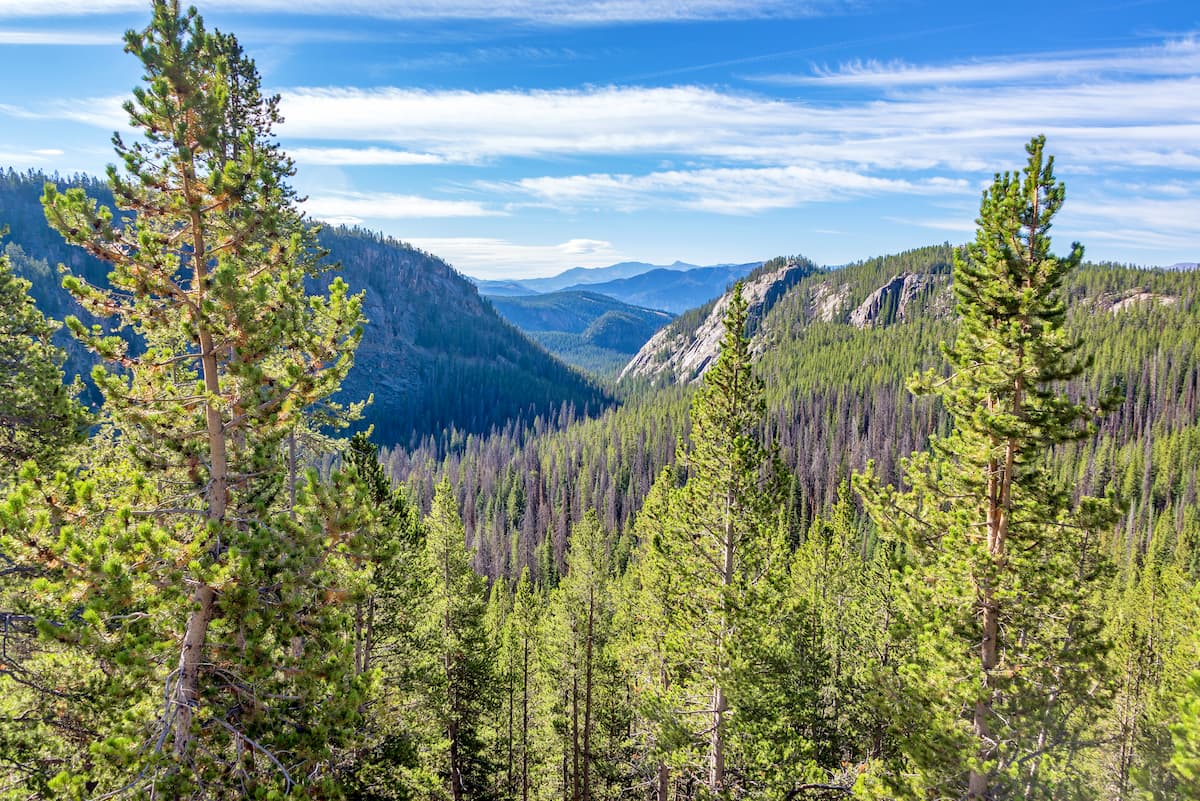
Higher up, at mid-elevations up to about 9,000 feet (2,700m), the wilderness is mostly covered in forests. These forests are predominately lodgepole pines, Rocky Mountain juniper, and quaking aspen.
Above 9,000 feet (2,700m), these lodgepole pine woodlands give way to stunning forests of limber pine, whitebark pine, Engelmann spruce, and subalpine fir.
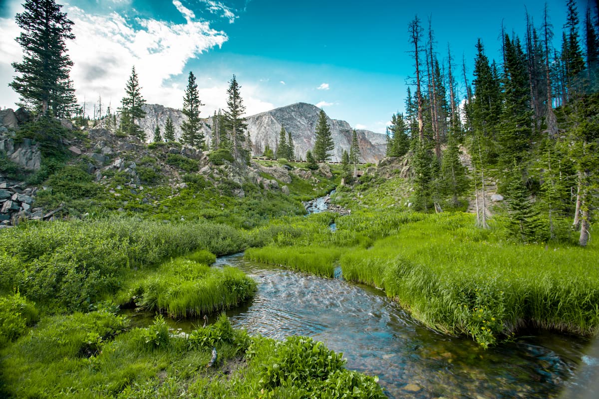
Finally, at the highest elevations in the wilderness, the land supports alpine ecosystems, including sprawling alpine meadows and krummholz vegetation before reaching a point where only scree, talus, glaciers, and snow exist.
As far as wildlife goes, the Washakie Wilderness is the perfect habitat for a great collection of flora. Some of the largest mammals that roam the wilderness include mountain lions, wolves, bobcats, beavers, and foxes, as well as moose, elk, bighorn sheep, and mule deer.
The wilderness is home to both black bears and grizzly bears, so special precautions, such as the use of bear canisters and the carrying of bear spray, are a must for any visitor.
Although it’s now known as a wilderness area, the land that is now part of the Washakie Wilderness was inhabited by humans for thousands of years before being designated in 1964.
Indeed, the wilderness occupies land that is part of the ancestral homelands and traditional territories of many Indigenous peoples, including the Crow Tribe (Apsaalooké), the Eastern Shoshone Tribe, and the Northern Cheyenne Tribe, among others. The Eastern Shoshone Tribe and the Northern Arapaho Tribe both have members who live on the Wind River Indian Reservation, just to the east of the Washakie Wilderness.
Moreover, the Washakie Wilderness was actually named after Chief Washakie, the renowned leader of the Shoshone in the mid-19th century. Chief Washakie signed a number of treaties, including the Fort Laramie Treaty of 1851, the Fort Bridger Treaty of 1863, and the Fort Bridger Treaty of 1868.

During the early 1800s, one of the earliest known Americans of European descent to visit the region in and around what’s known as the Washakie Wilderness was John Colter.
Colter was one of the members of the Lewis and Clark Expedition, however he left the expedition on the homeward journey in order to travel around the Greater Yellowstone Area. He was one of the first European-Americans to travel through the Absaroka Range, even going as far as to cross Togwotee Pass on the Continental Divide.
In 1891, not long after then-future President Theodore Roosevelt visited the region in the 1880s, much of the Absaroka Range and the Wind River Range became part of the Yellowstone Timberland Reserve. This reserve eventually became the Shoshone National Forest (which includes the modern-day Washakie Wilderness) in 1905 after the creation of the US Forest Service.
The Washakie Wilderness (originally the South Absaroka Wilderness and Stratified Primitive Area) was formally designated alongside its northern neighbor, the North Absaroka Wilderness, in 1964 with the passage of the Wilderness Act. As a result, the wilderness is open only to those traveling on foot or on horseback, so it’s an excellent place to visit if you’re looking for some solitude in the mountains.

In comparison to the Popo Agie Wilderness, the Bridger Wilderness, and the Fitzpatrick Wilderness to the south, the Washakie Wilderness is fairly infrequently traveled. However, there is plenty of adventure to be had for anyone willing to venture into more remote terrain in the Absaroka Range.
The trails in the Washakie Wilderness are rough and poorly-marked so anyone considering visiting the region should be very competent with their backcountry navigation skills as well as their river crossing abilities.
Some potential trail options include:

Many of the major trails in the Washakie Wilderness follow drainages within the wilderness’ very steep valleys, so care is necessary, particularly around river crossings. However, from many of these trails, a bit of off-trail scrambling can lead you to the summit of some of the tallest peaks in the region.
Here are some of the best places to stay before or after your trip to the Washakie Wilderness:
The city of Cody, Wyoming is located to the northeast of the Washakie Wilderness. It is home to about 9,500 residents and it is a major outdoor recreation destination in the northern part of the state. Cody has a small airport known as Yellowstone Regional, which is a good place to fly into if you’re coming from other major cities in the area.
Dubois is located to the southeast of the Washakie Wilderness along US Highway 26. The town is home to just under 1,000 residents, but it is the location of the Dubois Museum and the National Bighorn Sheep Interpretive Center, both of which are certainly worth a visit. Plus, Dubois is situated just at the base of the Wind River Range, so it boasts some truly spectacular scenery for visitors to enjoy.
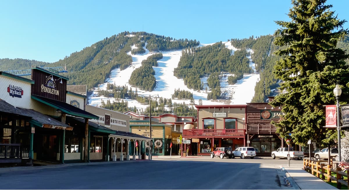
Home to about 10,000 residents, the city of Jackson is situated to the west of the Washakie Wilderness, near Wyoming’s border with Idaho. The city is a world-famous destination for outdoor recreation due to its proximity to both Yellowstone National Park and Grand Teton National Park.
Additionally, Jackson is home to the largest airport in Wyoming by passenger traffic, making it an excellent starting point for your adventures.