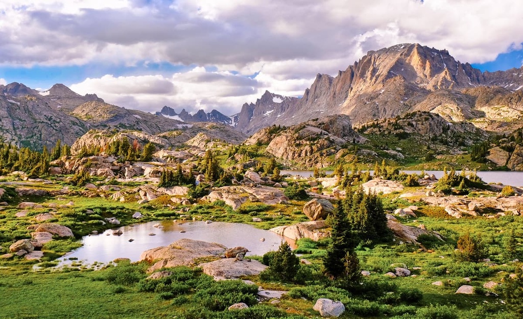
Fremont Peak is the third highest peak in the state of Wyoming, surpassed only by Gannett Peak and Grand Teton, and straddles the boundary between Fremont and Sublette counties in the Wind River Range. It is named for American explorer John C. Frémont who climbed the peak with Charles Preuss and Johnny Janisse from August 13 to August 15, 1842. Kit Carson had been with the climbing party on its first attempt at the peak, but had gone back for supplies the day Fremont and his men reached the summit. Carson is thought by some to have been the first to climb neighboring Jackson Peak. At that time, Fremont Peak was mistakenly thought to be the highest mountain in the Rocky Mountains, although there are actually over 100 higher peaks in the Rocky Mountain range.
By elevation Fremont Peak is
# 3 out of 1962 in the Greater Yellowstone Rockies # 2 out of 264 in the Wind River Range # 3 out of 2428 in Wyoming # 2 out of 319 in Fremont County # 2 out of 243 in Sublette County # 2 out of 48 in Fitzpatrick Wilderness Area # 2 out of 120 in Bridger Wilderness Area
By prominence Fremont Peak is
# 16 out of 264 in the Wind River Range # 22 out of 319 in Fremont County # 15 out of 243 in Sublette County # 5 out of 48 in Fitzpatrick Wilderness Area # 8 out of 120 in Bridger Wilderness Area
We use GPS information embedded into the photo when it is available.
3D mountains overlay
Adjust mountain panorama to perfectly match your photos because recorded by camera photo position might be imprecise.
Move tool
Rotate tool
Zoom
More customization
Choose which peak labels should make into the final photo and what photo title should be.
Next
Photo Location
Satellitte
Flat map
Relief map
Latitude
Longitude
Altitude
OR
Latitude
°'''
Longitude
°'''
Apply
Register Peak
Peak Name
Latitude
Longitude
Altitude
Register
Teleport
PeakVisor
This 3D model of Sagarmatha National Park in Nepal was made using the PeakVisor app topographic data. The mobile app features higher precision models worldwide, more topographic details, and works offline. Download PeakVisor maps today.
Download OBJ model
PeakVisor
The download should start shortly. If you find it useful please consider supporting the PeakVisor app.
PeakVisor for iOS and Android
Be a superhero of outdoor navigation with state-of-the-art 3D maps and mountain identification in the palm of your hand!