
Scan the QR code and open PeakVisor on your phone
Gospel-Hump Wilderness has 38 named peaks. The highest is Buffalo Hump at 2,714 m. Other notable peaks include North Pole, Oregon Butte and Pyramid Peak.
The Gospel-Hump Wilderness is a protected area located in western Idaho. The wilderness spans 205,796 acres across the state and lies within the Nez Perce National Forest. The Gospel-Hump Wilderness is also part of the Frank Church-River of No Return Wilderness Area. To the north of the wilderness lies the Selway-Bitterroot Wilderness Area. Combined these wilderness areas, along with surrounding protected land, are part of the 3.3-million-acre wilderness-roadless area complex. Back in 1978, the Gospel-Hump Wilderness was established with the passing of the Endangered American Wilderness Act. There are 33 named mountains in Gospel-Hump Wilderness.
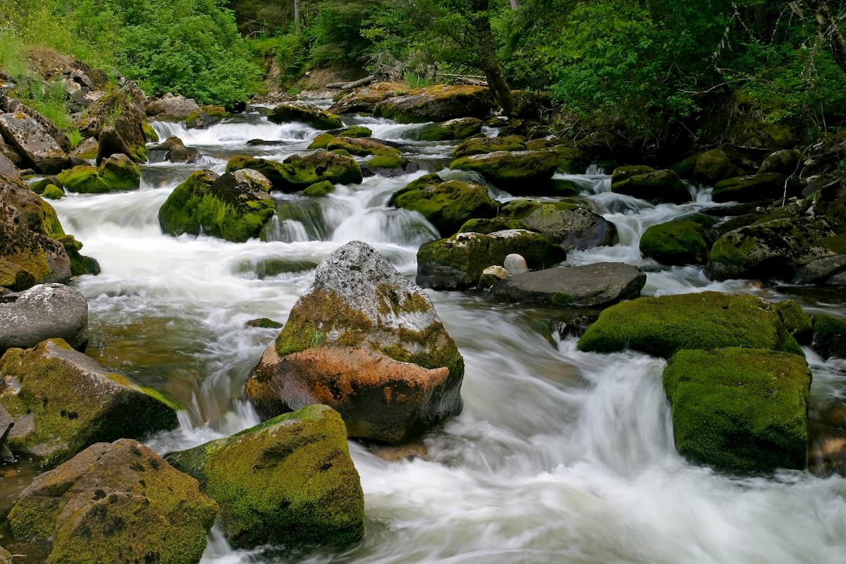
The highest and the most prominent mountain is Buffalo Hump at 8,904 feet. Elevations range in the wilderness from 1,970 feet on the Wind River, up to the summit of Buffalo Hump. The south border of the wilderness is marked by the Salmon River. Within the wilderness there are numerous alpine lakes and creeks that feed into the surrounding rivers. The northern and southern regions of the wilderness are distinctly different. The southern region of the wilderness is characterized by dry rolling hills, plateaus, and sparse forests. However, the northern region of the wilderness is characterized by being densely forested with far more precipitation.
Wildlife is abundant in the wilderness with most of the visitors in the fall months being for hunting and fishing. In the lakes and streams live an abundance of salmon, trout, whitefish, and bass. Larger mammals in the wilderness include elk, deer, mountain lions, mountain goats, black bear, gray wolves and the occasional bighorn sheep.
Many of the trails in the Gospel-Hump Wilderness are left unmaintained so hikers should pack accordingly.
Grangeville-Salmon Road: This mountain road is the perfect gateway into the Gospel-Hump Wilderness. The road can be found south of the city of Grangeville. About halfway to the city of Salmon is Forest Road 444. This road offers numerous trails and places to car camp along the way before hitting a dead at Square Mountain Lookout. Drive up to the lookout or explore one of the lesser known trails along the road. Among the trails are routes leading to the wildernesses many alpine lakes, including Lower Gospel Lake, Gospel Lake, and Slate Lake
Square Mountain Lookout: Twelve miles up Forest Road 444 lies Square Mountain Lookout. Short hikes can be taken from here to explore the panoramic views of the peak. Travel three miles by foot to Twin Lakes or complete a point to point trail across the wilderness totaling 15 miles and ending at Wildhorse Lake trail.
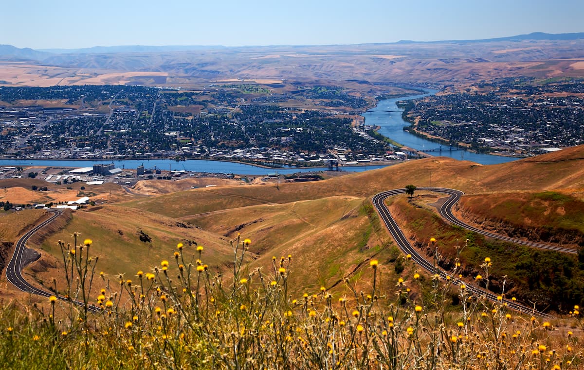
The city of Lewiston, Idaho sits in the northern foothills of the Craig Mountains, just over an hour northwest of the Gospel-Hump Wilderness. The city has a population of 32,000 people and sits at the confluence of the Snake and Clearwater Rivers. Because of dams along the Snake and Columbia Rivers, the city of Lewiston can be reached by some ocean boats, making it the most inland possible port of the west coast. The small city is home to the Hells Canyon National Recreation Area which offers hiking trails.
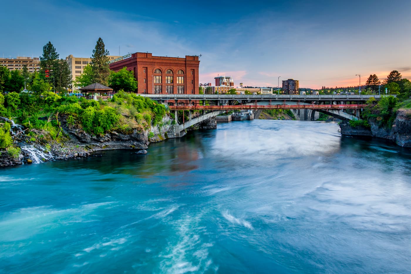
Though located in Washington state, Spokane is just three hours from the Gospel-Hump Wilderness. Located just southeast of the Okanogan Highlands, Spokane is the most populous city in eastern Washington. The Spokane river runs through the city while it sits 92 miles south of the Canada-U.S. border. With a population of 222,000, Spokane is the second largest city within the state of Washington. While most of the state’s population lives on the western side of the Cascade Mountain Range, Spokane is a hidden gem for any outdoor enthusiast. There are four ski resorts within two hours of downtown, while rock climbing, hiking, running, rafting, canoeing, and fishing are all accessible within minutes.
Three and a half hours south of the Gospel-Hump Wilderness lies the city of Boise, Idaho. The city is the capital of the state of Idaho and the most populous city in the state. Situated on the Boise River, the city is 41 miles east of the Oregon border and 110 miles north of the Nevada border. The Boise metropolitan area contains the state’s three most populous cities; Boise, Nampa, and Meridian with a total population of 710,000. The city is known as “The City of Trees” and the downtown area is full of shops and local dining options. The town is home to numerous recreational opportunities which include hiking and biking. Boise is also home to the Boise River Greenbelt which is an extensive urban trail system along the Boise River.


The highest peak in Gospel-Hump Wilderness is Buffalo Hump, at 2,714 m.
Notable peaks in Gospel-Hump Wilderness include Buffalo Hump, North Pole, Oregon Butte, Pyramid Peak and Concord Hill.


