
Scan the QR code and open PeakVisor on your phone
The Owyhee Mountains include 204 named peaks. The highest is Hayden Peak at 2,566 m. Other notable peaks include Cinnabar Mountain, Turntable Mountain and Quicksilver Mountain.
Known for its rugged terrain and steep canyons, the Owyhee Mountains are a collection of peaks in the southwestern part of the US state of Idaho and in the southeastern part of Oregon. The range contains 154 named mountains, the highest and most prominent of which is Hayden Peak (8,419ft/2,566m).
Situated in the southwestern-most corner of Idaho and the southeastern part of Oregon, the Owyhee Mountains are a remote chain of peaks that’s less frequently visited than many of the ranges in central Idaho. The Owyhee Mountains are mostly located within Owyhee and Malheur counties to the south of Boise and to the west of Twin Falls.
The range is just southwest of the Morley Nelson Snake River Birds of Prey National Conservation Area and the rest of the Snake River Plain. Additionally, the plain separates the Owyhee Mountains from the ranges further to the northeast, such as the Boise Mountains and the Sawtooth Range within Boise National Forest and Sawtooth National Forest.
To the northwest of the Owyhees is the Strawberry Mountains, which are part of the Malheur National Forest and the Strawberry Mountain Wilderness. Meanwhile, the Steens Mountain Wilderness and a dozen or so smaller wilderness study areas are located to the west of the range.
Just across the border in Idaho, the Owyhee Mountains are bordered by the Jarbidge Mountains, the Jarbidge Wilderness Area, and the Owyhee Desert.
Within the Owyhee Mountains, there are a number of smaller areas of public land, including the North Fork Owyhee Wilderness, the Owyhee River Wilderness, the Owyhee River Canyon Wilderness Study Area, and the Pole Creek Wilderness.
Geologically, the Owyhee Mountains are part of the Great Basin Ranges, which cover an extensive part of the western United States, including all of Nevada, parts of eastern California, southeastern Oregon, western Utah, southwestern Idaho, and northern Arizona. In fact, the Owyhee Mountains are located in the northernmost extent of the Great Basin Ranges.
Interestingly, the Owyhee Mountains are situated near an intersection between four major geologic regions, namely the Great Basin Ranges to the south, the Columbia Plateau to the west, the Western Rocky Mountains to the east, and the Idaho-Bitterroot Rocky Mountains to the north.
The Owyhee Mountains have an interesting geologic history. They formed alongside the rest of the Basin and Range Province. However, the Owyhees are located in an area that has experienced extensive volcanism, especially in the Mahogany Mountain and Three Fingers Rock areas.
Mahogany Mountain is actually the remains of an ancient caldera, which is believed to have last erupted about 15.5 million years ago, an eruption which created many of the rock formations in nearby Leslie Gulch.
War Eagle Mountain is also particularly well known for its stunning rock outcroppings. The mountain was also the site of one of the earliest silver lode discoveries in the region, which started a boom town in nearby Silver City (now a ghost town).
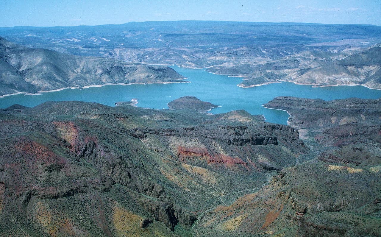
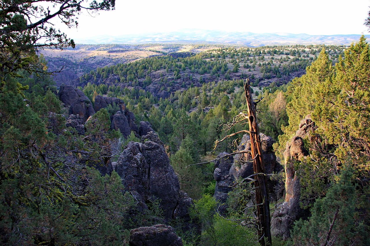
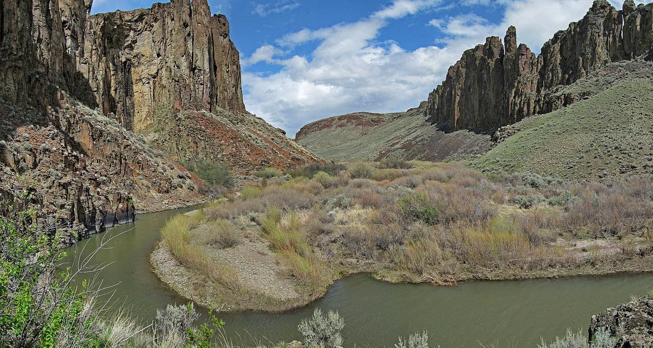
Additionally, the region is known for its extensive basalt plateaus and for the erosive properties of the range’s namesake Owyhee River. The Owyhee River is a National Wild and Scenic River that flows through the range from its headwaters in northern Nevada until its confluence with the Snake River to the west of Boise. It is one of the largest sub basins of the Columbia River.
Over the course of millenia, the Owyhee has carved out the region’s basalt plateaus, creating canyons that have vertical drops of over 1,000ft (300m). Some of the canyons in the range contain excellent rapids for white water rafting and other recreational activities.
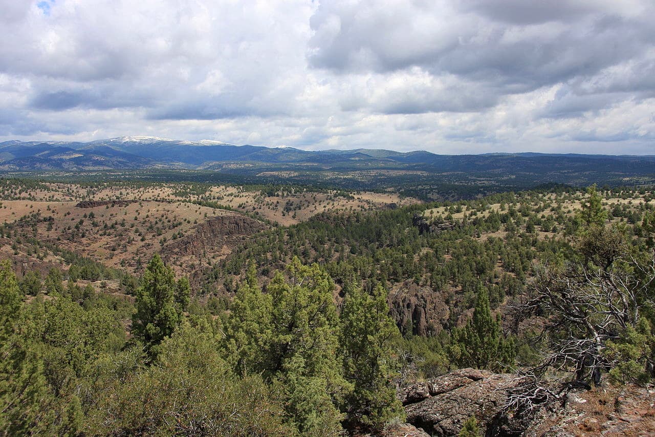
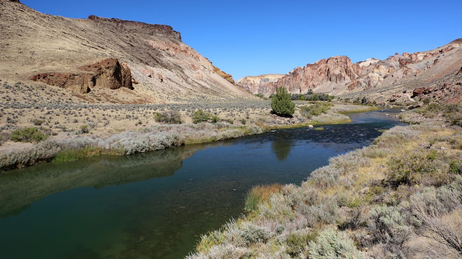
The Owyhee Mountains and the rest of the Owyhee River drainage are known for their hot, arid conditions. At lower elevations, the region is dominated by steppe-like shrubbery and juniper.
Additionally, in the southernmost part of the range, the mountains transition into the Owyhee Desert, which is part of the greater Basin and Range Ecoregion. Here, the landscape is particularly arid, with sagebrush and drought-tolerant grasses making up the majority of the plant life.
Around the Owyhee River, there are riparian areas which support a wide array of flora and fauna. Species, such as mountain lions, bighorn sheep, pronghorns, bobcats, and mule deer all call the area home. There are also dozens of bird species, including various falcons, eagles, hawks, and grouse in the region.
Humans have lived in and around the Owyhee Mountains for thousands of years. Although countless groups have inhabited the region over the millenia, the Shoshone-Bannock and the Northern Paiute were among the most dominant nations in the area before the arrival of Euopeans and European-Americans.
Even as Europeans and European-Americans started to settle in the Snake River Plain and in the Boise Area, the remoteness of the Owyhee Mountains prevented much development. However, after silver was discovered on War Eagle Mountain in the mid 1800s, thousands flocked to the region in the hopes of striking it rich.
At its height during the 1880s, the mining town of nearby Silver City was home to about 2,500 people. It was actually one of the largest cities in the Idaho Territory at the time. However, by the 1890s, the mineral resources of the area were mostly depleted by the turn of the century and Silver City slowly declined in popularity.
These days, Silver City is considered to be a ghost town, though about 70 buildings still stand in the town and there are a few small businesses that cater to tourists.
That being said, the remoteness of the region and the limited services available in Silver City are one of the major reasons why the Owyhee Mountains are rarely visited to this day. This makes them an excellent destination for anyone looking for an off-the-beaten path adventure with plenty of solitude in the mountains.
Due to their remoteness, the vast majority of the Owyhee Mountains are roadless and trailless, however, there are some popular 4x4 off-roading areas in the region. The majority of the land is managed by the Bureau of Land Management and anyone venturing into the Owyhees should be prepared to be fully self-sufficient.
Here are some popular outdoor recreation areas to check out in the range:
The North Fork Owyhee Wilderness is located in the northern part of the range. It covers some 43,413 acres (17,569ha) of land that’s managed by the BLM and it contains 2 named mountains - Nickel Creek Table and Pleasant Valley Table.
Most of the wilderness is part of one of the large basalt plateaus that dominate the region. It was created in 2009 as part of the Omnibus Public Land Management Act, which created many of the other nearby wilderness areas.
The North Fork Owyhee Wilderness is known for its deep canyons, some of which are over 1,000 feet (300m) deep. There are some excellent whitewater rapids within the wilderness, as well as about 15.1miles (24.3km) of wild and scenic rivers.
The Pole Creek Wilderness Area is located in the central part of the Owyhee Mountains to the south of the North Fork Owyhee Wilderness. It contains 12,533 acres (5,072 ha) of land, including 1 named mountain: Avery Table.
Pole Creek was also established during the 2009 Omnibus Public Land Management Act and was created to protect the region’s large concentration of rhyolite and basalt canyons. It has some great whitewater rapids for paddlers to enjoy, as well as flora and fauna typical of the Owyhee Desert.

Situated in the southern part of the Owyhee Mountains, the Owyhee River Wilderness is one of the largest protected areas in the range. It contains 267,328 acres (108,184ha) of land and it includes 8 named mountains, the highest and most prominent of which is Bald Mountain.
The wilderness was created in 2009 to protect the upper Owyhee River and its desert canyon landscape. It is actually the second largest wilderness area - after the Black Rock Desert Wilderness - in the US that’s not located within a national park, national wildlife refuge, or national forest. Despite its size, the wilderness has few roads and trails, many of which are not regularly maintained.
The Owyhee Mountains are located in a particularly remote section of Idaho. Here are some nearby places to stay before or after your trip into the range:
Boise is the capital and largest city in Idaho with over 228,000 people. It is a cultural and commercial center for the state and is just north of the Owyhee Mountains. The city has Idaho’s largest airport and is located along I-84, which connects it with Salt Lake City, Utah and Portland, Oregon.

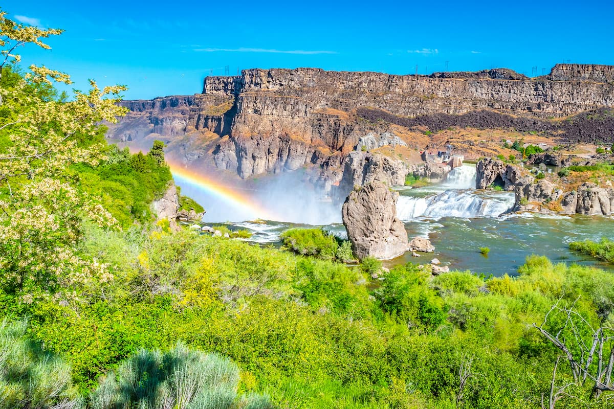
Located to the east of the Owyhee Mountains, the city of Twin Falls is the largest city in Twin Falls County. It has a population of over 44,000 people and it is one of the largest cities in the Magic Valley, making it a commercial center for much of northeastern Nevada and south-central Idaho.
Interestingly, Twin Falls is one of the largest cities in Idaho that’s not located along a major interstate. However, it’s still fairly easy to get to by road off of US Route 30, US Route 93, I-80, and I-84


The highest peak in the Owyhee Mountains is Hayden Peak, at 2,566 m.
The Owyhee Mountains have 204 named peaks.


.jpg)
.jpg)
.jpg)
.jpg)
.jpg)
.jpg)