
Scan the QR code and open PeakVisor on your phone
Steens Mountain Wilderness has 6 named peaks. The highest is Devine Rock at 2,372 m. Other notable peaks include Alvord Peak, The Peaks and Eusabio Ridge.
The Steens Mountain Wilderness is a protected wilderness area located in southeastern Oregon in the United States. The wilderness lies within Steens Mountain Cooperative Management and Protection Area. In total the wilderness spans 170,166 acres and was established back in 2000. Within the wilderness, 80,000 acres are open to grazing for cattle. There are 5 named mountains in Steens Mountain Wilderness. Devine Rock is the highest point at 7,772 feet. The most prominent mountain is Alvord Peak with 1,299 feet of prominence. Steens Mountain, located next to the wilderness, stands at 9,733 feet. The Alvord Desert lies within part of the wilderness and is characterized by juniper, sagebrush, and aspen.
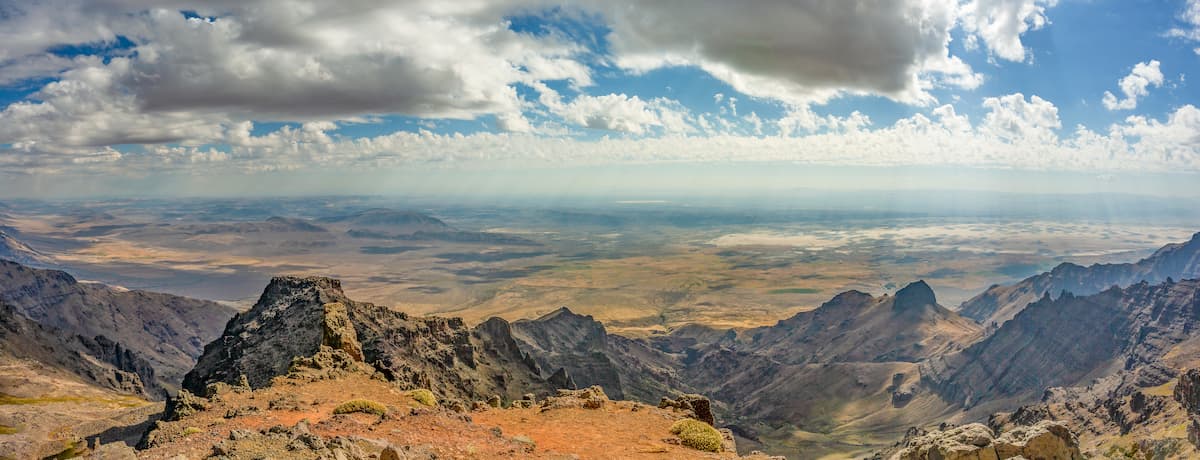
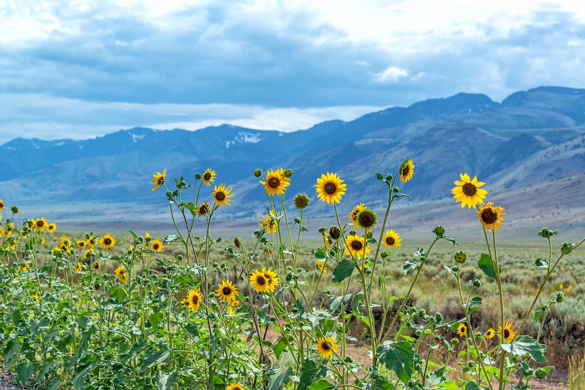
Steens Mountain is known for being the largest fault-block within the state of Oregon, and within the United States. The mountain was formed 20 million years ago and is characterized by a steep eastern face and a sloping western face. Vegetation in the wilderness ranges greatly based on elevation. Throughout the wilderness are bunchgrass, aspen, juniper and mahogany, though higher elevations have little tree coverage. Similar to eastern Oregon and western Idaho, the Steens Mountain Wilderness is home to bighorn sheep, elk, deer, trout, and coyotes. While cattle are allowed to graze in certain regions of the wilderness, 98,000 acres are off limits.
Though motorized vehicles are not allowed in the wilderness regions of the United States, the Steens Mountain Wilderness is visited throughout the year. Hiking trails run through nearly all sections of the region. In the winter months snowshoeing and cross-country skiing are accessible.
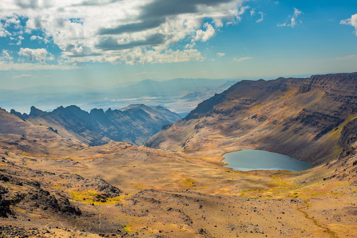
Wildhorse Lake Trail: Wildhorse Lake is one of the most popular hikes in the wilderness. The 2.5 mile out and back trail has just over 1,000 feet of elevation gain. The trail climbs a ridgeline before dropping down to the lake. Once at the lake, hikers are able to take in the full magnitude of their surroundings. Note that the hike is exposed and at high elevation so hikers should pack accordingly.
Big Indian Gorge Trail: This 17-mile out and back hike has 2,083 feet of elevation gain. The trail winds through the gorge with the steep peaks marking either side. The gorge itself is full of a variety of trees that change colors with the seasons. Pine trees intermixed with sage brush make for spectacular views throughout. Complete in one day or set up camp at one of the campgrounds along the way.

Pike Creek Canyon Trail: The Pike Creek Canyon Trail is 5.6 miles in length with 1,840 feet of elevation gain. The canyon’s rugged red rocks are visible throughout the trail, with steep slopes and wildflowers during the summer months. Hikers must pay $10 at the Alvord Hot Springs office in order to complete this hike.
Steens Mountain Summit: The trail to Steens Mountain Summit is just 0.2 miles with 206 feet of elevation gain. Steens Mountain Road takes hikers almost right to the summit of the mountain. Though the trail is short, the views are impeccable from the top. Hikers can look out over the Steens Mountain Wilderness with Wildhorse Lake below. Weather is often quite windy at the summit, so hikers are sure to hold onto anything that might blow away.
Located just an hour north of Steens Mountain Wilderness, lies the small town of Burns, Oregon. The city has an estimated population of 2,800 residents. Archeologists believe that the region has been inhabited by humans for over 10,000 years. The small town is also located near the Malheur National Wildlife Refuge. Much of the region is used for ranching and other forms of land use. The Burns-Hines region is characterized as a high-desert climate, similar to many parts of eastern Oregon.
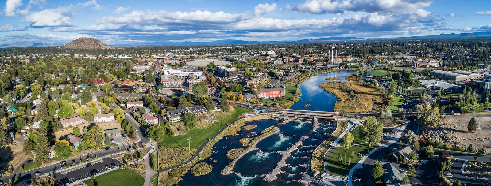
Just three and a half hours northwest, lies the city of Bend, Oregon. Bend is the largest city located in eastern Oregon with a population of nearly 100,000. The city is located on the Deschutes River and is known for being an outdoor paradise. To the west lies the lake and peaks of the Cascade Mountains, along with Mount Bachelor Ski Resort, while a trail in the city leads to the top of Pilot Butte. To the south lies the High Desert Museum and Newberry National Volcanic Monument. Just north of town is one of the state’s most iconic rock-climbing locations, Smith Rock State Park. As a whole, the city is a mecca for trail running, skiing, mountain biking, hiking, rock climbing, and even surfing in the river. Besides the abundance of outdoor activities, Bend is known for its numerous breweries and restaurants.


The highest peak in Steens Mountain Wilderness is Devine Rock, at 2,372 m.
Notable peaks in Steens Mountain Wilderness include Devine Rock, Alvord Peak, The Peaks, Eusabio Ridge and Home Creek Butte.


