Scan the QR code and open PeakVisor on your phone
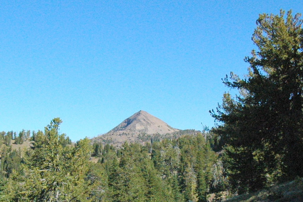
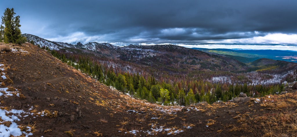
The Strawberry Mountain Wilderness covers nearly 69,000 acres (27,900 hectares) of Malheur National Forest in Oregon, USA. With alpine lakes and jagged peaks, the wilderness is best used from July to November when there is less snow at higher elevations. Of the 18 named mountains in the wilderness, Strawberry Mountain is the highest at 9,049 ft (2,758 m) and has a prominence of 4,094 ft (1,248 m).
Located in Malheur National Forest, the Strawberry Mountain Wilderness encompasses the Strawberry Mountains, part of the Blue Mountains, in Oregon. It includes 68,700 acres (27,800 hectares) and more than 100 mi (160 km) of trails. It was officially designated a wilderness area in 1964.
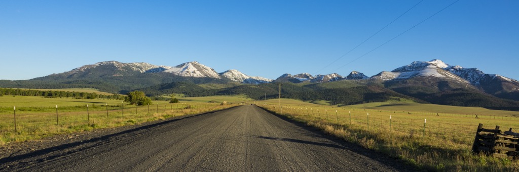
The Aldrich Mountains and Ochoco National Forest lie to the west and Umatilla National Forest sits to the north. The wilderness is home to the headwaters of Pine, Indian, Strawberry, Canyon, Bear, Lake, Wall, Roberts, and Big Creeks. Elevations in the wilderness range from 4,000 ft (1,219 m) to 9,048 ft (2,758 m) at the summit of Strawberry Mountain.
The tallest peaks in the wilderness are Strawberry Mountain (9,049 ft/2,758 m), Graham Mountain (8,570 ft/2,612 m), Indian Spring Butte (8,547 ft/2,605 m), and Slide Mountain (8,543 ft/2,604 m).
The Strawberry Mountains are part of the Blue Mountain Range, a mountain chain running east-west through northeast Oregon. The formation of this range began millions of years ago as an ancient sea floor buckled and folded as a result of the now inactive John Day fault.
Another major fault lies along Indian Creek, causing older rocks to be uplifted in the range’s western section. This western end of the range, part of the Canyon Mountain Complex, is made up of uplifted ancient seafloor that is over 275 million years old. Primary rocks in this section are iron-rich gabbro and magnesium-rich peridotite.
The eastern portion of the range formed by different means. It is made up of 14 million year old volcanic rocks dating from the Miocene Age. The primary rock is andesite. The volcanic activity responsible for this formation was part of the tail end of the Columbia River basalt-related volcanism that shaped this part of the state.
During the Pleistocene about two million to 12,000 years ago, the range was sculpted by glaciers. Glacial activity left behind U-shaped valleys and hollowed out spots where the wilderness’ seven alpine lakes are found today.
The first big gold discovery in eastern Oregon occurred in the Western Strawberry Mountains in 1862. This drew many miners to the region. During World War I and World War II, there was mining for chrome on sections of Canyon Mountain and Baldy Mountain.
Between the high elevation peaks, numerous streams, and thick forest, five of the seven main life zones of North America are found in the Strawberry Mountain Wilderness. The Canyon Creek Research Natural Area has helped to maintain and support wildlife populations.
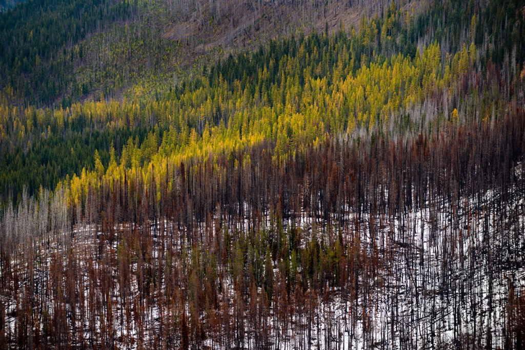
The forests here consist of larch, the only conifer that loses its needles, as well as spruce, pine, and fir. Wild strawberries ripen in July and wildflowers bloom in the meadows during the summer. Sage and juniper grow between the tree line and grasses.
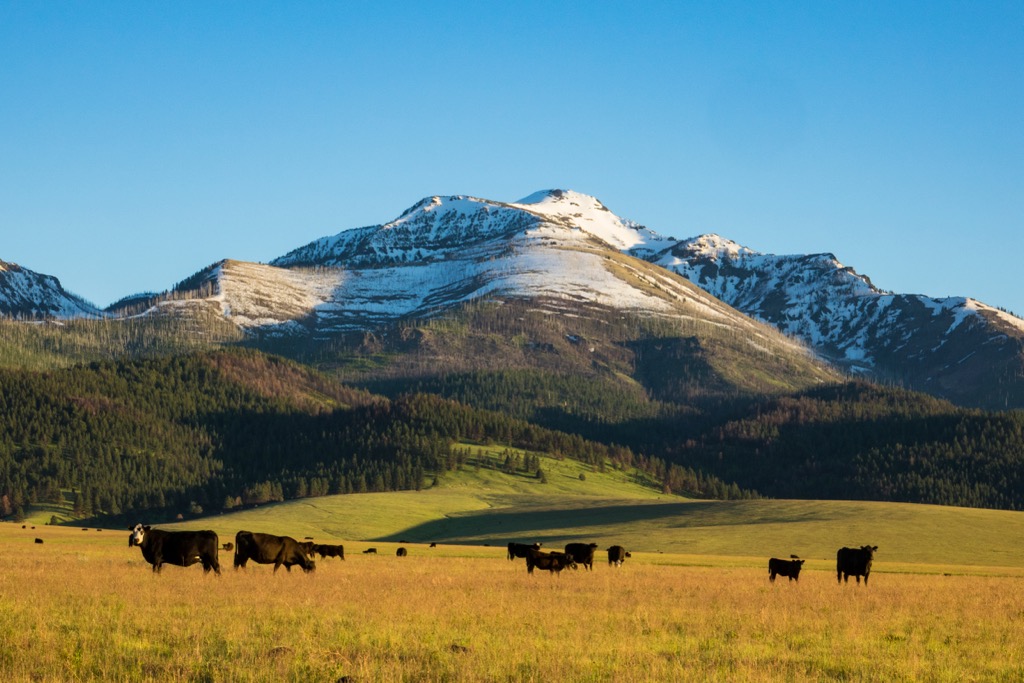
The area is home to a native population of Rocky Mountain elk, mule deer, antelopes, black bears, cougars, California bighorn sheep, pine martens, minks, and beavers. There are also ruffed and blue grouse, pileated woodpeckers, sharp-shinned hawks, bald eagles, juncos, chickadees, robins, warblers, and nutcrackers. In total, 378 species of animals and 22 fish species have been recorded in the area.
Summer thunderstorms pass through, typically in several day cycles. Daytime temperatures range from 30 to 80 Fahrenheit (-1 to 27 Celsius). Between 1995 and 2008, numerous wildfires broke out, typically caused by lightning.
Some of earliest archeological evidence of early peoples is an obsidian tool workshop dating back 7,500 years or more. Malheur Forest was historically, and continues today, to be used by the Burns Paiute Tribe, the Confederated Tribes of the Umatilla Indian Reservation, and the Confederated Tribes of the Warm Springs Indian Reservation.
First contact with Europeans in the Blue Mountains occurred in the early 1800s. But the presence of Europeans was felt nearly a century earlier. Horses are one example, having been introduced by other tribes during the 1700s. European diseases also spread to tribes of the Pacific Northwest prior to the physical arrival of Europeans in the region.
The first Europeans pursued trapping and fur trade, staking out claims against competing traders. With the discovery of gold in the mid to late 1800s, settlers and settlements boomed in the region. Towns popped up nearly overnight and ranching and timber industries arose primarily to support the increasing mining population. This very quickly led to tensions with Native Americans over land and natural resources, and resulted in the establishment of reservations and restricted land use for Native Americans.
Today, timber, livestock, tourism, and mining are the major industries in the Blue Mountains. New laws have worked to give more say to Native Americans in the region on the management of the National Forest and its resources.
The Strawberry Mountain Wilderness offers over 100 mi (160 km) of trails. Horses are allowed on many trails and hunting is allowed with a license from the Oregon Department of Fish and Wildlife. For a full list of hiking and backpacking trails, visit the Forest Service website.
Onion Creek Trail begins below Strawberry Campground. It climbs from 5,520 ft (1,680 m) to 8,640 ft (2,635 m) along a steep incline. The trail passes through a section burned by wildfire on Strawberry Mountain’s northern face. The trail can be hard to follow through alpine meadows so keep a close eye out for cairns and blazes. Carry sufficient water as there is not much water available near the top.
The trail is 6.3 mi (10.1 km) until it meets and ends with the Roads End Trail. As part of a day hike, Onion Creek Trail can connect to Summit Trail to reach the top of Strawberry Mountain and amazing views from the top. As part of a multi-day backpacking trail, this route can be used to access other trails such as Strawberry Basin Trail #375 and Roads End.
Skyline Trail runs along the backbone of the eastern portion of the mountains. It offers access to Big Creek drainage and both Slide and High Lakes. The trail is 17.8 mi (28.6 km) one way. It is about 11 mi (17.7 km) to Slide Lake and 12 mi (19.3 km) to High Lake. The trail ranges in elevation from 6,100 ft (1,860 m) to 8,000 ft (2,438 m).
Climbing from 5,400 ft (1,645 m) to 7,600 ft (2,315 m), you’ll get great views of the John Day Valley from the top. The trail is 15.5 mi (24.9 km) one way and there are several stream crossings along the way.
For a day hike, follow the trail to where it intersects with Joaquin Miller Trail #219. For multi day hikes, follow the Canyon Mountain Trail to Pine Creek Trail #201, which then connects to multiple other trails. 4WD vehicles are recommended to access the trailhead parking area.
Strawberry Campground lies at the edge of the wilderness and the trail for Strawberry Mountain leaves from here. Besides that, the small town of Prairie City is less than an hour away, Bend is a 3.5 hour drive, and Portland is just under 6 hours drive away.
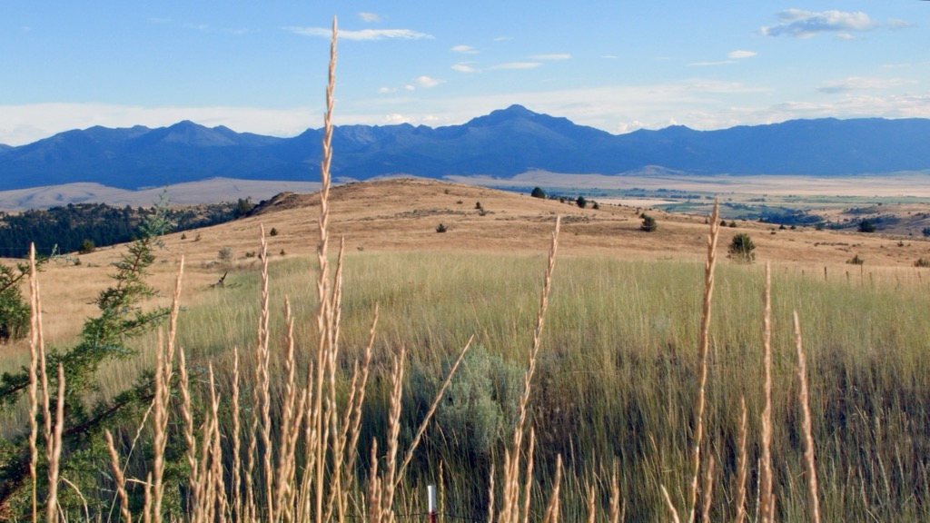
Only 45 minutes away by car, Prairie Town is home to 750 people and lies on the edge of beautiful grasslands, only a stone’s throw from National Forest, state lands, and BLM lands with hundreds of miles of trails for outdoor recreation. Lakes and rivers offer great steelhead and mountain trout fishing. In winter, the nearby trails are excellent for snowshoeing, cross country skiing, and snowmobiling.
As a small town, there are just a few spots to grab a bite or stay over. You’ll find a few shops downtown and a historic restaurant, The Oxbow. Stay over in the historic Hotel Prairie, an RV park, or a small selection of rentals and AirB&Bs.
Located 3.5 hours away by car, Bend borders the Cascade Range and high desert plateaus. The options for getting out and enjoying nature are abundant, and you can easily spend days hiking, biking, and paddling the rivers around town. In winter, skiing, snowboarding, snowshoeing, and ice skating are popular.
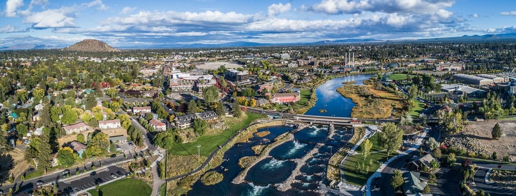
The city is home to 97,000 people and home to numerous parks and shopping districts. You can learn more about the area at the High Desert Museum. Breweries abound around town and restaurants come in all flavors – vegetarian, burger joints, Greek, Indian, Thai, Mexican, and more. Lodging in the city includes hotels, B&Bs, resorts, vacation rentals, and campgrounds.
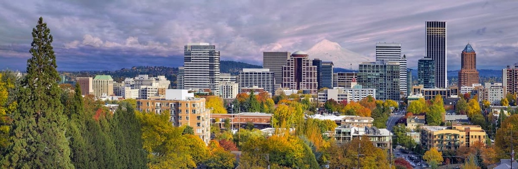
Slightly under six hours drive away, Portland has a major airport and a population of 650,000 people. It is one of the top cities for food trucks and home to the Portland Saturday Market – the largest arts and crafts fair in the county, open every Saturday March through October.
Forest Park is only 7 mi (11 km) from the city and has 70 mi (112 km) of trails to explore. You can also get outside by visiting the Japanese or Chinese Gardens. For a rainy day in, visit the Portland Art Museum.
In addition to food carts, the city is packed with farmers markets. These products make their way into restaurants and the dining scene has a big emphasis on locally sourced foods, including fresh seafood. Accommodation in the city includes hotels, motels, rental properties, B&Bs, camping, and glamping.