Scan the QR code and open PeakVisor on your phone
The Selway-Bitterroot Wilderness is a protected wilderness area within Idaho and Montana in the United States. The wilderness spans 1.3 million acres across the two states and is one of the largest designated wildernesses in the entire country. This wilderness encompasses all of the Bitterroot Mountain Range, which gives it its name. Because this wilderness is so expensive, it has land within Bitterroot National Forest, Clearwater National Forest, Nez Perce National Forest, and the Lolo National Forest. To the south of the Selway-Bitterroot Wilderness lies the Frank Church-River of No Return Wilderness Area. The forest is also home to the Lochsa and Selway rivers that flow into the Clearwater River.
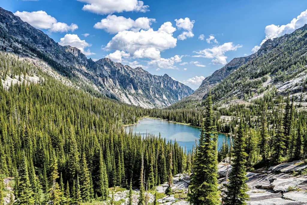
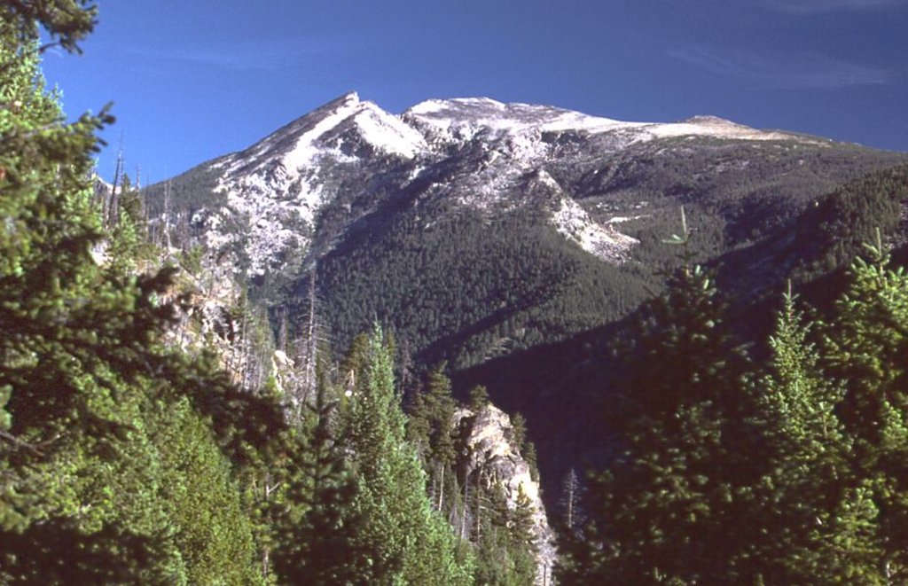
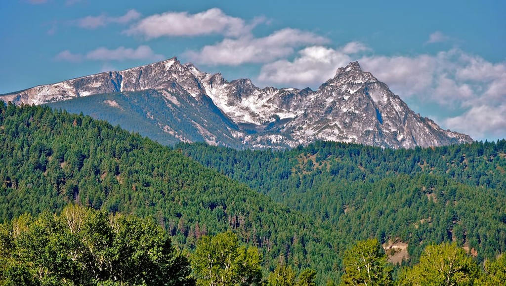
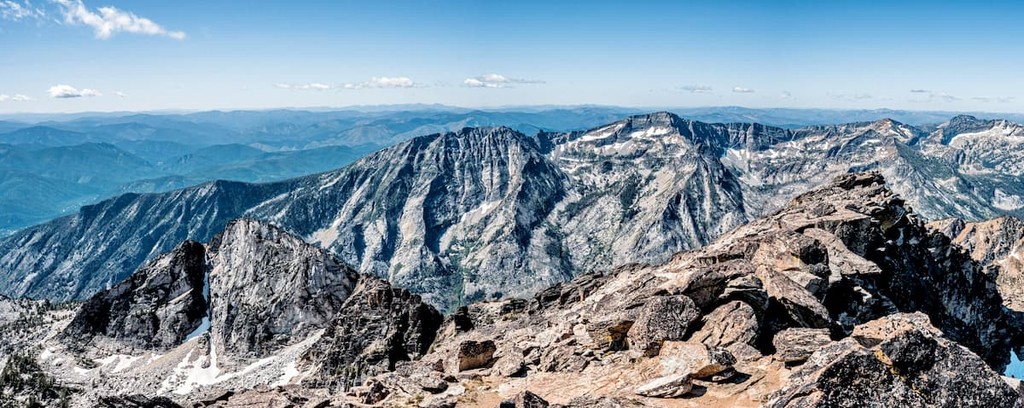
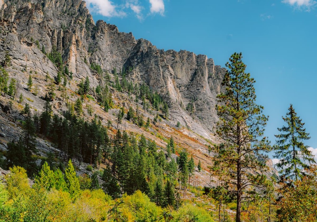
There are 159 named mountains in Selway-Bitterroot Wilderness. The highest and the most prominent mountain is Trapper Peak at 10,148 feet. The wilderness is also home to numerous peaks reaching above 9,000 feet. Elevations within the region span from 1,700 feet up to the summit of Trapper Peak. The higher elevations in the wilderness are characterized by their rugged peaks and alpine lakes. Lower elevations are mostly covered by dense coniferous forest, interspersed with plateaus and fields of wildflowers during the summer months. The vast landscape makes this wilderness a popular destination for those wanting to experience solitude within the mountains.
Like much of the surrounding region, the wilderness is home to black bear, grizzly bear, cougar, mountain goat, big horned sheep, deer and one of the largest elk herds in all of the United States. Because of the remoteness of much of the wilderness, it has been chosen as one of the regions to reintroduce packs of grey wolf in hopes of growing their population. The Selway-Bitterroot National Forest has 1,490 miles of trails throughout it, making it a popular destination for hikers, backpackers, and trail runners. There are hundreds more miles of trails that are not maintained, so hikers should be prepared for such conditions.
Trapper Peak: While the hike to the summit of Trapper Peak may be difficult, the views are worth the climb. The trail totals 8.1 miles with 3,740 feet of elevation gain. The trail winds through the forest before opening up the final few miles. From there the route climbs steeply to the summit. Once at the summit hikers have panoramic views of the Selway-Bitterroot Wilderness along with the rugged Bitterroot Mountains. Take in the landscape from the highest point in the entire wilderness.
Saint Mary Peak Trail: Another popular hike in the Saint Mary Peak Trail. This route is 7 miles roundtrip and has 2,490 feet of elevation gain. The final half mile climbs steeply before reaching the summit at 9,344 feet. Weather can change quickly at the summit so hikers should pack accordingly.
Blodgett Canyon: The Blodgett Canyon trail totals 8.5 miles out and back with just under 1,000 feet of elevation gain. The route is located within the Bitterroot National Forest region of the wilderness. Hikers walk through the canyon along the river before reaching the waterfall and turning around. The trail is accessible throughout much of the year with snowshoes being used during the winter months.
Bass Creek Trail: The Bass Creek Trail is 6.6 miles out and back with 1,138 feet of elevation gain. This trail follows along Bass Creek, through the steep valley. While the trail is mostly within the forest, viewpoints of the rugged peaks towering on either side are available throughout. Similar to other hikes in the area, the trail is accessible much of the year with snowshoes or spikes on hiking boots.
Stanley Hot Springs: Located in the Idaho section of the wilderness lies Stanley Hot Springs. The trail is 9.6 miles out and back and has just under 2,000 feet of elevation gain. The climb is worth the pay off with natural hot springs located at the turn around point.
Located just a short drive northeast of the wilderness lies the city of Missoula. Located in western Montana, this city sits at the convergence of five mountain ranges and is known as the “hub of five valleys”. The population is approximately 75,000 and is the second largest city within the state. Due to the proximity to mountains, rivers, and public lands, the city is known for its outdoor spaces. Within the city lie 22 miles of trails and 5,000 acres of conserved open space. Sitting at the confluence of the Clark Fork, Bitterroot, and Blackfoot rivers makes the city a popular white-water rafting destination. During the winter months, snow sports take center stage in the surrounding mountains, cross country skiing trails, and snowmobile routes.

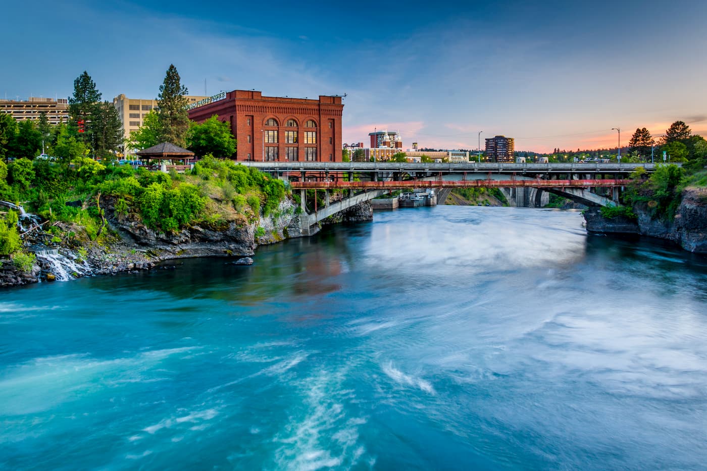
The city of Spokane lies just three and a half hours to the northwest of the wilderness. Spokane is the most populous city in eastern Washington. The Spokane river runs through the city while it sits 92 miles south of the Canada-U.S. border. With a population of 222,000, Spokane is the second largest city within the state of Washington. While most of the state’s population lives on the western side of the Cascade Mountain Range, Spokane is a hidden gem for any outdoor enthusiast. There are four ski resorts within two hours of downtown, while rock climbing, hiking, running, rafting, canoeing, and fishing are all accessible within minutes.