Scan the QR code and open PeakVisor on your phone
Whether you’re looking to visit sprawling grasslands, dense woodlands, towering peaks, or stunning alpine lakes, the scenic Payette National Forest in the west-central part of the US state of Idaho has it all. The forest contains 135 named mountains, the highest of which is North Loon Mountain (9,324ft/2,842m), and the most prominent of which is Sturgill Peak (7,559ft/2,304m).
Payette National Forest is a federally-managed area of land located in the west-central part of Idaho, near the state’s border with Oregon. The forest is located in Washington, Idaho, Adams, and Valley counties within the state of Idaho.
Spanning some 2,327,621 acres (941,954 ha) of land, the Payette National Forest is the 18th largest in the country. It is the 5th largest of Idaho’s national forest, trailing behind Salmon-Challis, Idaho Panhandle, Boise, and Caribou-Targhee, but leading Nez Perce-Clearwater, Bitterroot, and Sawtooth in terms of total land cover.
Due to the fairly large size of the forest’s boundaries, Payette National Forest includes a number of different mountain ranges. Some of the largest ranges in the forest include the Seven Devils Mountains, the Cuddy Mountains, and the Hitt Mountains of the Columbia Plateau in the west, as well as the Bitterroot Range of the Idaho-Bitterroot Rocky Mountains in the east.

Payette National Forest also includes a sizable section of the Frank Church-River of No Return Wilderness along its eastern boundary. The Frank Church-River of No Return Wilderness is the largest contiguous wilderness in the continental United States and it is jointly administered by all of Idaho’s national forests except Caribou-Targhee, Idaho Panhandle, and Sawtooth.
The forest also contains a section of the Hells Canyon Wilderness, which it shares with the Nez Perce and Wallowa-Whitman National Forests.
Moreover, the Payette National Forest is located within a highly mountainous region of the state of Idaho. As a result, the forest is surrounded by other major areas of public land.
To the west of Payette National Forest lies the Hells Canyon National Recreation Area and the Eagle Cap Wilderness, which are managed as part of the Wallowa-Whitman National Forest. Meanwhile, to the south and east, Payette National Forest is bordered by the Boise National Forest and the Salmon-Challis National Forest.
Payette National Forest shares its northern border with both the Bitterroot National Forest and the Nez Perce National Forest, the latter of which also contains the Gospel Hump Wilderness. The Nez Perce Reservation of the Nez Perce Tribe (Nimiipuu) is also located to the north of the forest.
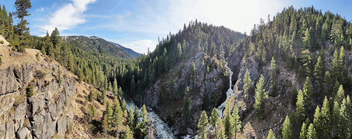
The geology of Payette National Forest is diverse and complex. Conveniently, the forest is split nearly perfectly down the middle by the North Fork Payette River, breaking it up into the Idaho-Bitterroot Rocky Mountain region to the east and the Columbia Plateau region to the west.
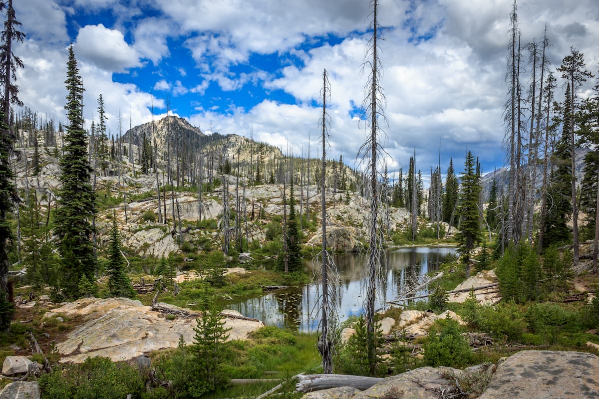
Much of the eastern region of the Payette National Forest is part of the Idaho-Bitterroot Rocky Mountains and, in particular, the Bitterroot Range. A substantial portion of this area is underlain by the Idaho Batholith, which itself is a massive granitic pluton.
These mountains started to form about 80 to 55 million years ago at the height of the Laramide orogeny. Over the millenia, the region experienced widespread uplift, creating the peaks that we see today. These ranges were also heavily glaciated during the Pleistocene, an event that helped to carve out the many post-glacial landforms that characterize the Bitterroot Range.
Major peaks in this part of the forest include: North Loon Mountain, Greeley Mountain, Mount Eldridge, Murphy Peak, Log Mountain, and Dixie Mountain.
In stark contrast to the Idaho-Bitterroot Rocky Mountains to the east, the Columbia Plateau section of the Payette National Forest to the west is a unique geological entity in its own right. This portion of the forest contains the Seven Devils Mountains, the Hitt Mountains, and the Cuddy Mountains.
Like the Bitterroot Range, the Columbia Plateau mountains are also primarily composed of igneous rock. However, the bedrock in this region is not part of the Idaho Batholith.
Instead, this rock started to form some 17 to 6 million years ago during a period of widespread volcanism. This volcanism led to large areas of basalt bedrock, which is evidenced in the region’s many basalt columnar cliffs.
Moreover, the erosive forces of the mighty Snake River helped to carve out and erode away at the landscape, leaving behind the many deep valleys and canyons that we see in the region today. Although it’s technically slightly outside the boundaries of Payette National Forest, the erosive power behind the Snake River is best evidenced in the nearby Hells Canyon National Recreation Area.
Major peaks in the Columbia Plateau region of the Payette National Forest include: Sturgill Peak, Cuddy Mountain, and Jackley Mountain.
Payette National Forest contains a number of rich and vibrant ecosystems, including woodlands, grasslands, and alpine meadows.
The lowest elevation regions in the forest are grass and shrublands. Much of this region is covered by species like Idaho fescue, stiff sagebrush, bitterbrush, mountain big sagebrush, and bluebunch wheatgrass.
Meanwhile, the forest’s many woodlands contain 8 primary species of conifers, including ponderosa pines and Douglas-firs at the lowest elevations; western larch and grand fir at the mid-elevations; and a mix of lodgepole pine, subalpine fir, and Engelmann spruce at the high elevations. Finally, there are some stands of whitebark pine on the very tallest ridges in the forest.
Additionally, Payette National Forest is home to many vascular plants and stunning wildflowers, both in its alpine meadows and in its deep river canyons. Some of the over 1,500 species of plants that call the forest home include saxifrage, monkeyflower, milkvetch, phlox, Macfarlane’s four-o’clock, and camas.
When it comes to wildlife, the Payette National Forest doesn’t disappoint. It is the perfect habitat for many large and mid-sized mammals, including black bears, moose, mountain goats, deer, elk, mountain lions, and coyotes.
The forest’s waterways also contain a number of important fish species, including bull trout, steelhead, and chinook salmon.
The area that is now part of the Payette National Forest has been inhabited by humans since time immemorial. Indeed, the forest is located on the ancestral homelands of a number of tribes, including the Nez Perce Tribe (Nimiipuu), the Confederated Tribes of the Umatilla Indian Reservation, and the Shoshone-Bannock Tribes.
Perhaps the first people of European descent to visit the region were members of the Lewis and Clark Expedition, which traveled down the Salmon River. The expedition actually reached the nearby Hells Canyon in 1806, but they chose not to follow its course. Meanwhile, the Wilson Price Hunt Expedition of 1811 is known to have floated the Snake River through the canyon.
One of the earliest settlers of European descent to have arrived in the region and settled permanently was a fur trapper by the name of François Payette, for whom the forest is named. Payette was a fur trapper from Canada who traveled into the region from nearby Oregon and started a homestead in the area around 1818 before returning to Quebec in the 1840s. During his time in the area, Payette worked for the Hudson’s Bay Company and, at one point, he was the manager of Fort Boise on the Snake River.
Gold was later discovered in the nearby region in the 1860s, which brought a surge of settlers and prospectors to the region. These settlers came in vain, however, as the mining in the region turned out not to be as profitable as they had thought.
Despite this, throughout the 19th century, the region in and around what is now the Payette National Forest became a popular destination for fur trappers and homesteaders. A number of families, including the McCalls, set up homesteads around the shores of Payette Lake by the late 1800s, leading to the establishment of many of the region’s towns.
Interestingly, Payette was among the earliest of the national forests to be established in the US, having been first established as the Weiser National Forest in 1905 - the same year as the creation of the US Forest Service. A few years later, in 1908, the Idaho National Forest was also established out of parts of the original Payette National Forest (which was broken up and added to other public land parcels) and the Bitterroot National Forest.
In 1944, these two forests were officially merged to create the Payette National Forest, which is named after local fur trapper François Payette.
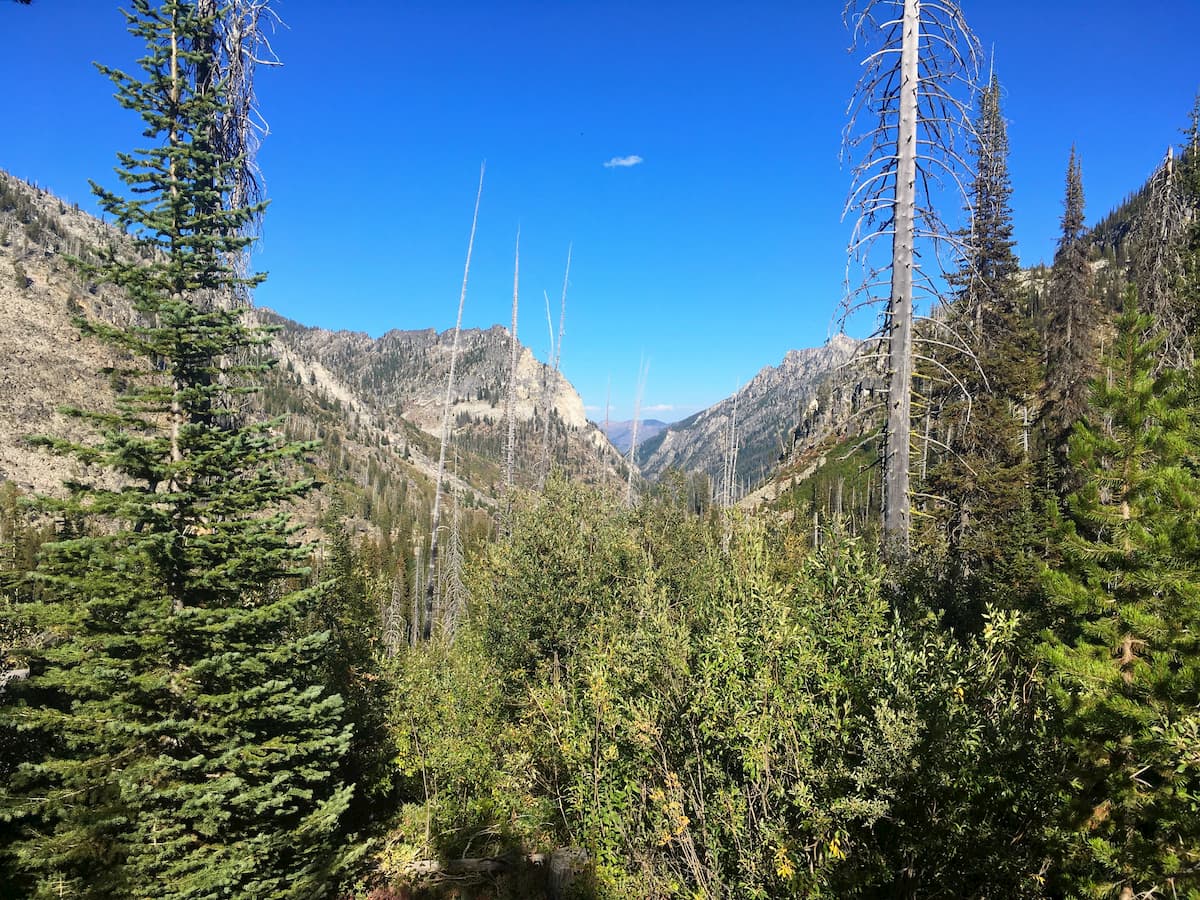
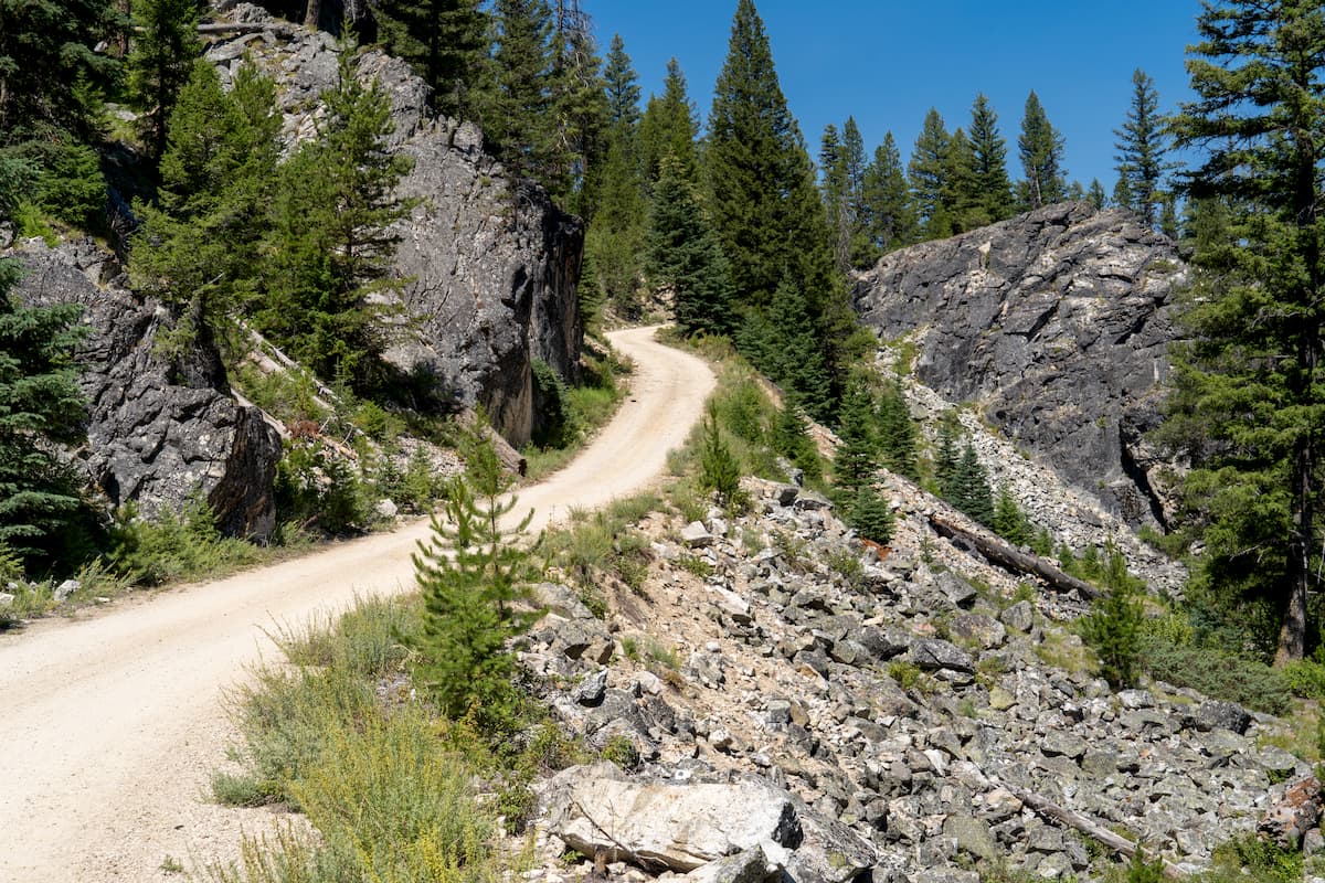
There are hundreds of miles of hiking trails within the Payette National Forest, so a lifetime of adventure awaits inside its borders. Here are some of the most popular places to visit in the region:
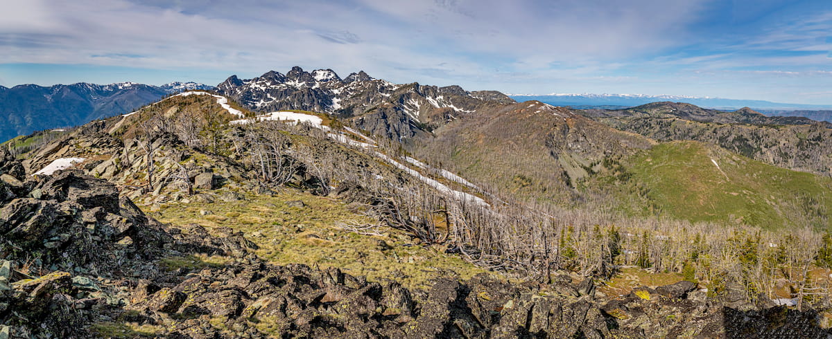
The largest contiguous federal wilderness area in the continental United States, the Frank Church-River of No Return Wilderness is truly a massive collection of public land. With over 4 million acres (1.6 million ha) of land and 176 named mountains - the highest and most prominent of which is Mount McGuire - adventures are nearly limitless in the wilderness.
Comprising much of the eastern half of the Payette National Forest, there are a number of great trails to check out in the Frank Church-River of No Return Wilderness. Nice hikes to check out in this area include the paths to Chamberlain Basin, Cold Meadows, and Soldier Bar.
The Hells Canyon Wilderness is a small federally protected region in the eastern part of the Payette National Forest. Within the wilderness there are 39 named mountains, the highest and most prominent of which is She Devil.
Jointly managed between the Wallowa-Whitman National Forest, the Nez Perce National Forest, the Payette National Forest, and the Bureau of Land Management, the Hells Canyon Wilderness is a stunning region featuring rugged terrain and three National Wild and Scenic Rivers: the Snake River, the Rapid River, and the Imnaha river.
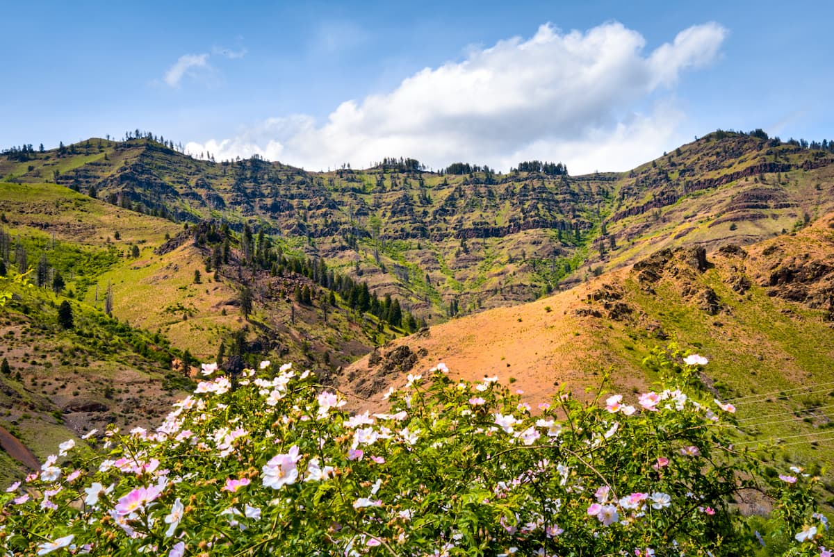
Hiking opportunities in the region are top-notch and there are plenty of trails to choose from. Potential hikes include those up to the summit of Cuddy Mountain and to Mirror Lake. Summiting She Devil is also a great day of adventure, though that trail is technically outside the boundaries of the Payette National Forest.
Looking for a place to stay before or after your trip to the Payette National Forest? Here are some great cities to check out:
Boise is the capital and largest city in Idaho with about 228,000 residents. It is located to the southwest of the Payette National Forest, though it’s just a short drive from the region’s major trailheads. The city is a great place to start your adventures because it’s well-connected by road to Portland, Oregon and Salt Lake City, Utah, and it’s home to the largest airport in the state of Idaho.

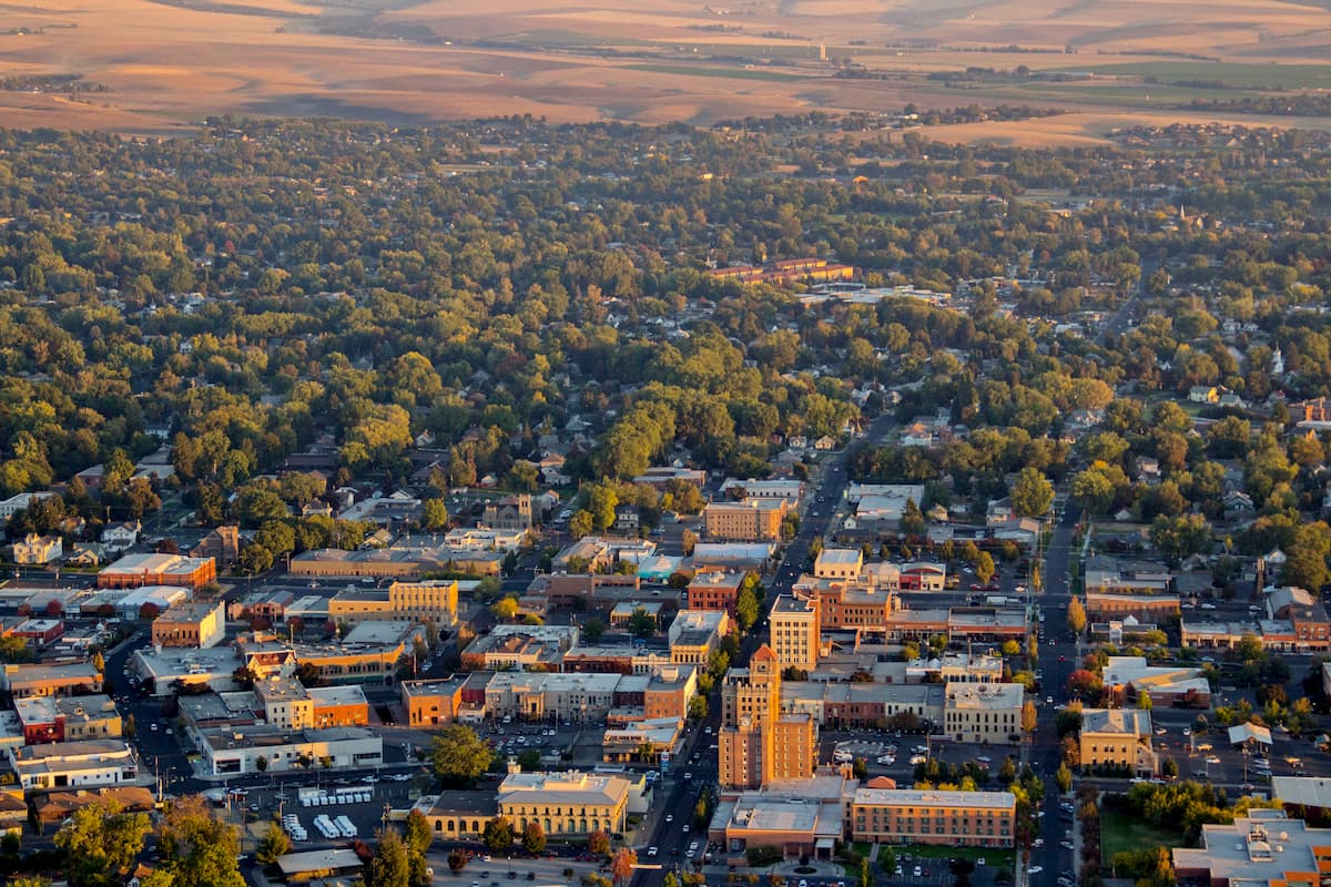
Located to the northwest of the Payette National Forest, the city of Walla Walla, Washington is home to approximately 33,000 residents. The city is about 6 hours by road from the heart of the forest, but it’s one of the largest population centers in the region. Walla Walla is particularly well-known for its wine industry, and it’s the home to Whitman College. It also has a small regional airport with services to Seattle.
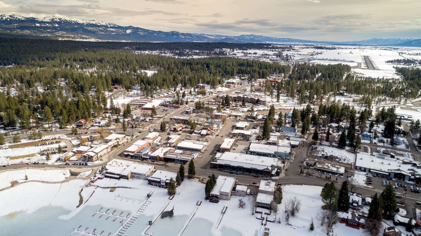
Situated on the southern shore of Payette Lake, the town of McCall, Idaho is a popular outdoor recreation destination in the region. McCall is home to around 3,000 residents, and it has a busy alpine ski area, so it tends to attract a good number of visitors in the winter months. Payette Lake is also a great place to visit in the summertime, especially since it’s just a few hours by road from the city of Boise to the south.