
Scan the QR code and open PeakVisor on your phone
The Lake Tahoe Basin Management Unit (LTBMU) is a mountainous area of federally managed land located in the US states of California and Nevada. The unit surrounds Lake Tahoe and encompasses a swath of the Lake Tahoe Basin region. There are 52 named mountains in the management unit, the highest and most prominent of which is Freel Peak (10,856 ft/3,309 m).
The Lake Tahoe Basin Management Unit (LTBMU) lies in east-central California, and it straddles the state border with Nevada. It encompasses land in El Dorado and Placer counties in California and Douglas County in Nevada.
The management unit is surrounded by national forest land and it contains 154,851 acres (627 sq. km) of public land. Also known as the “Jewel of the Sierra,” the management unit is an administrative office of the US Forest Service that is tasked with operating the national forest lands surrounding Lake Tahoe (Dáʔaw).
The mountainous landscape of the management unit ranges in elevation from 6,225 ft (1,897 m) along the shores of Lake Tahoe, up to the summit of Freel Peak at 10,856 ft (3,309 m) in elevation. Though the unit is smaller than all of the surrounding national forests, it encompasses 78 percent of the land in the Lake Tahoe basin.
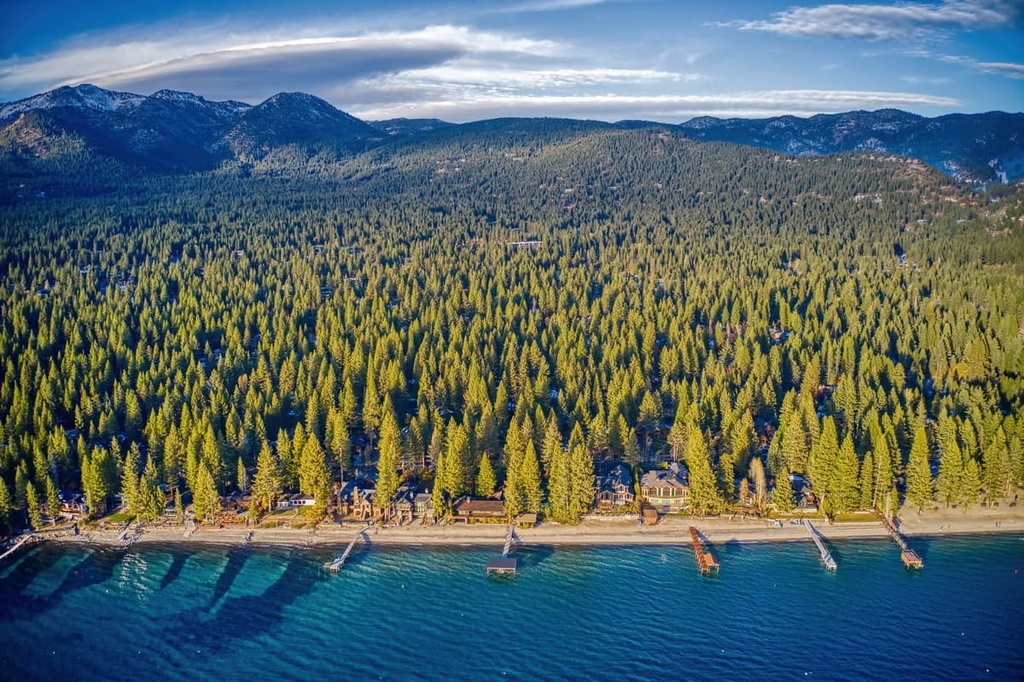
Here, forested slopes rise gradually from the shores of Lake Tahoe, as the peaks transition into the eastern foothills of the Sierra Nevada. The eastern shores of the lake are more arid, and, as such, they often contain fewer trees and more sagebrush.
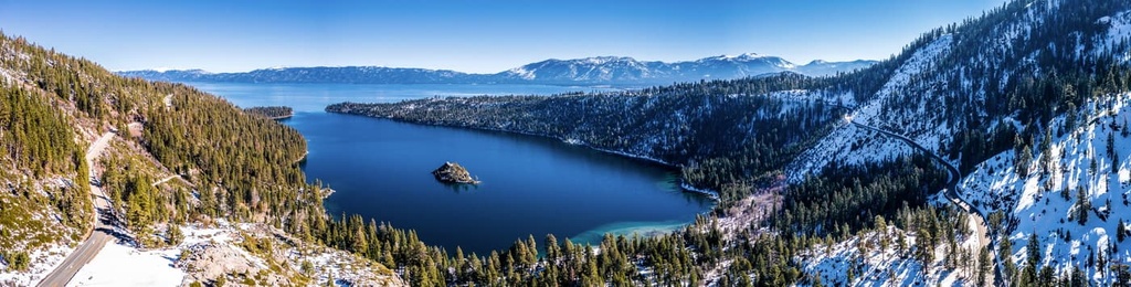
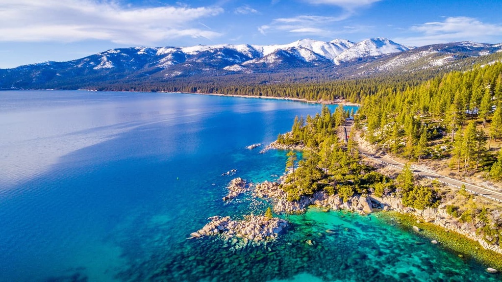
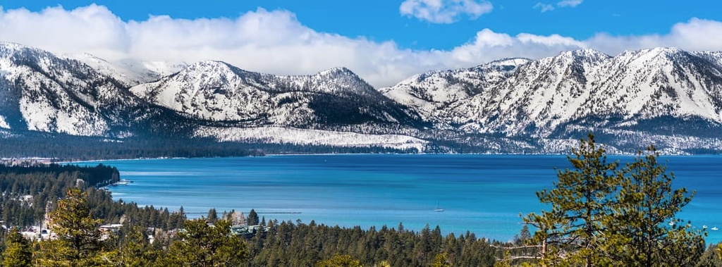
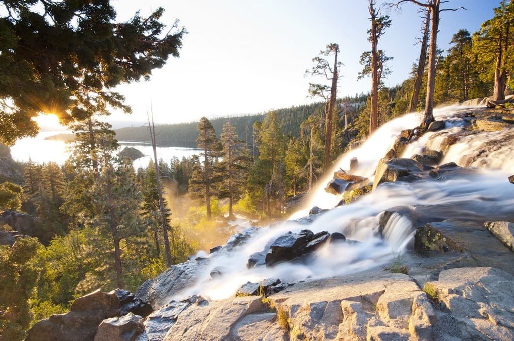
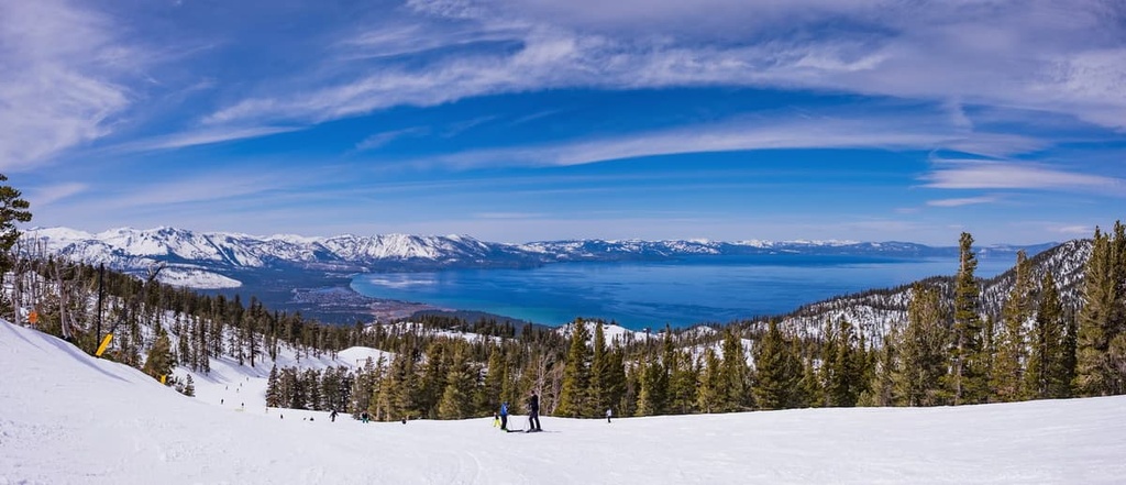
At the center of these rolling hills and mountains lies Lake Tahoe, the second deepest lake in the US after Crater Lake in Oregon. The lake is roughly 22 miles (35 km) long and 12 miles (19 km) wide. Around two-thirds of the lakes’ shoreline lies in California while the rest is located in Nevada.
The LTBMU encompasses a diversity of landscapes that feature stunning natural beauty and small residential mountain communities. Besides the lake, the other major waterways in the unit include the Truckee River and Fallen Leaf Lake.
Additionally, the LTBMU is surrounded by other popular outdoor recreation areas. Nearby areas of public land include Eldorado National Forest and the Desolation Wilderness to the south, Tahoe National Forest to the west and north, and Toiyabe National Forest to the north, east, and south.
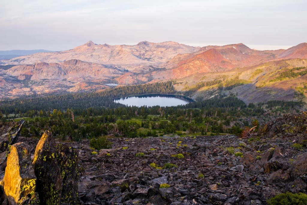
The Lake Tahoe Basin lies within the Sierra Nevada, which is the main mountain range that runs throughout eastern California. The basin was formed by faulting that thrust up the Carson Range in the east and the rest of the Sierra Nevada in the west.
As these ranges were slowly thrust upwards, block tilting and down-dropping faulting created a basin landscape between the ranges. Major faults in the region include the Sierra Nevada Fault, Stateline/North Tahoe Fault, Incline Village Fault, and West Tahoe Fault.
A volcanic dam was formed on the north side of the basin from the now extinct Mount Pluto volcano. Lava flows from this volcano were widespread millions of years ago, and they often filled in the various valleys found throughout the region.
Around 2.5 million years ago, during the last glacial period, much of the region’s mountainous landscape was covered in glaciers. As the glaciers began to melt, they further carved out the landscape, leaving behind wide basins.
The runoff from the glaciers and other snowmelt slowly filled in the Tahoe Basin and eventually formed Lake Tahoe. Common rocks found in the basin include granodiorite and andesite, while metamorphic rocks are less common.
Major peaks within the basin include Freel Peak, Mount Pluto, Red Lake Peak, Waterhouse Peak, Twin Peaks, and Monument Peak.
A wide variety of both flora and fauna are able to thrive in the Lake Tahoe Basin due to the vast network of surrounding national forests and areas of protected land. The forested hillsides that surround the lake are home to stands of various species of pine along with alder, aspen, red fir, white fir, cedar, and willow trees.
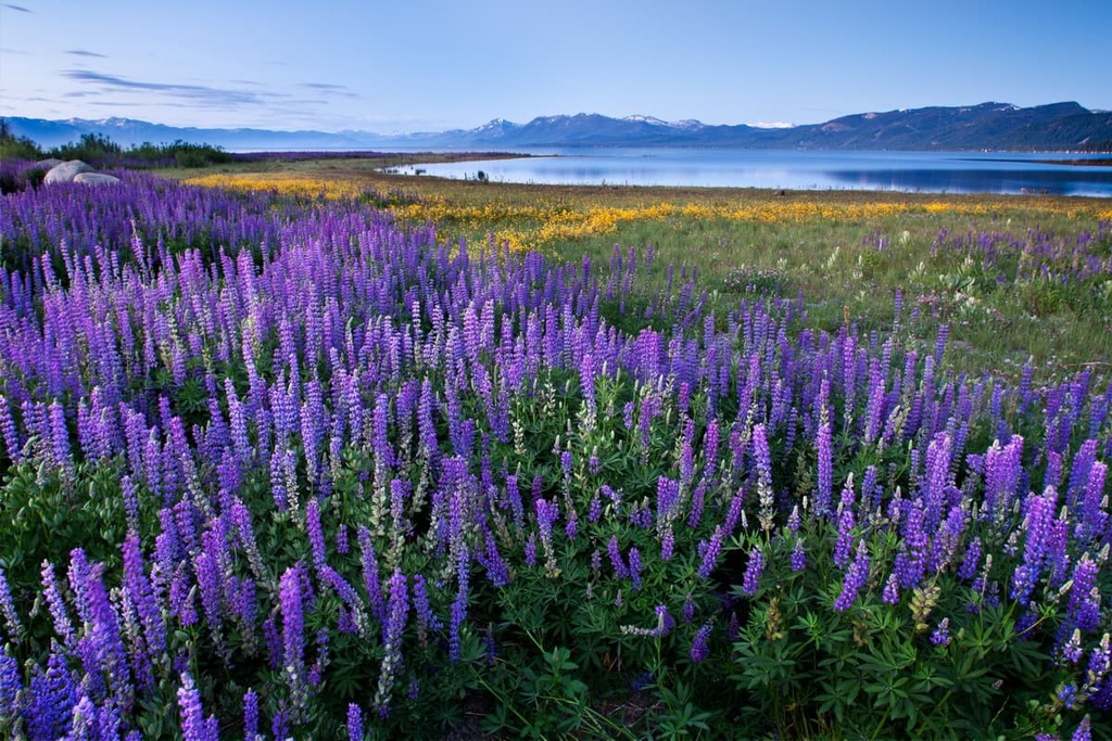
Sagebrush and low-growing shrubs are more commonly found along the eastern side of the lake. During the summer months, north Lake Tahoe features a plethora of wildflowers. Common species include Indian paintbrush, columbine, meadow penstemon, lupine, dwarf alpine aster, mariposa lily, and common yarrow among various others.
Despite the region’s large tourism industry and popularity among hikers, numerous species of animals inhabit the Lake Tahoe Basin. Larger mammals that live in the basin include black bears, mountain lions, coyotes, and mule deer. Bears are extremely common throughout the region and feeding the animals is prohibited.
Smaller animals found in the region include Douglas squirrels, golden-mantled ground squirrels, pine martens, yellow-bellied marmots, raccoons, and beavers. Common bird species that live in the area include California gulls, bald eagles, American rods, red-tailed hawks, mallards, mountain chickadees, dark-eyed juncos, and western tanagers.
Both the Truckee River and Lake Tahoe are home to lake trout, rainbow trout, brown trout, and kokanee salmon.
The land in and surrounding the Lake Tahoe Basin Management Unit has been inhabited by humans for thousands of years. Artifacts from ancient villages and various cultural trails are still present throughout the region to this today.
The region in and around the Lake Tahoe basin is part of the ancestral homelands of the Washoe Tribe (Wašišiw) and Nisenan Tribe, among other Indigenous communities.
The Washoe traditionally lived throughout the Lake Tahoe Basin (the lake is called Dáʔaw in Washo), while the Nisenan traditionally lived to the west of the region near present-day Sacramento. Both of these Indigenous Tribes were historically hunters and gatherers who harvested edible plants, such as acorns, and hunted elk, rabbits, deer, and other game.
The first European-American to arrive in the basin was likely John C. Frémont in 1844. Gold was discovered in the region a few years later, leading to a large influx of miners and settlers.
Both the Washoe and Nisenan people were forced off their homelands as a result of this influx of settlers. These settlers built dozens of small communities in the region. Many of these small communities are still present in the area to this day as many old mining towns have since been transformed into mountain towns that are known for their proximity to outdoor recreation opportunities.
Today, the Washoe Tribe of Nevada and California has a parcel of land that encompasses parts of both states and covers around 64,300 acres (26,000 ha) of terrain.
The Nisenan Tribe of California had a federally-recognized reservation called the Nevada City Rancheria, which was created in 1913. In 1964, the reservation, along with many others in the US, was terminated by the US Congress. Today the Nisenan no longer have a reservation on their ancestral homelands, though there are Tribal advocates and allies working to restore the Nevada City Rancheria to the status it held before it was terminated.
During the 1860s, the transcontinental railroad brought even more people to California, further displacing and decimating Indigenous communities. Much of the region was protected as a forest reserve in 1893 and would later become the various national forests that were established at the beginning of the twentieth century. The Lake Tahoe Basin Management Unit was established in 1973 in order to preserve and restore the Lake Tahoe watershed ecosystem.
The Lake Tahoe Basin Management Unit is home to numerous trails and other opportunities for outdoor recreation. Here are some of the best hikes in the Lake Tahoe Basin Management Unit to check out during your next trip to the region.
The Cascade Falls Trail is a shorter route situated along the southern shores of Lake Tahoe next to Cascade Lake. The trail takes hikers along the west side of Cascade Lake and also offers views of Emerald Bay and Lake Tahoe.
Hikers on this trail are rewarded with views of the cascading falls that rush into the nearby lake. This route is 1.4 miles (2.3 km) long and it has 255 ft (78 m) of elevation gain.
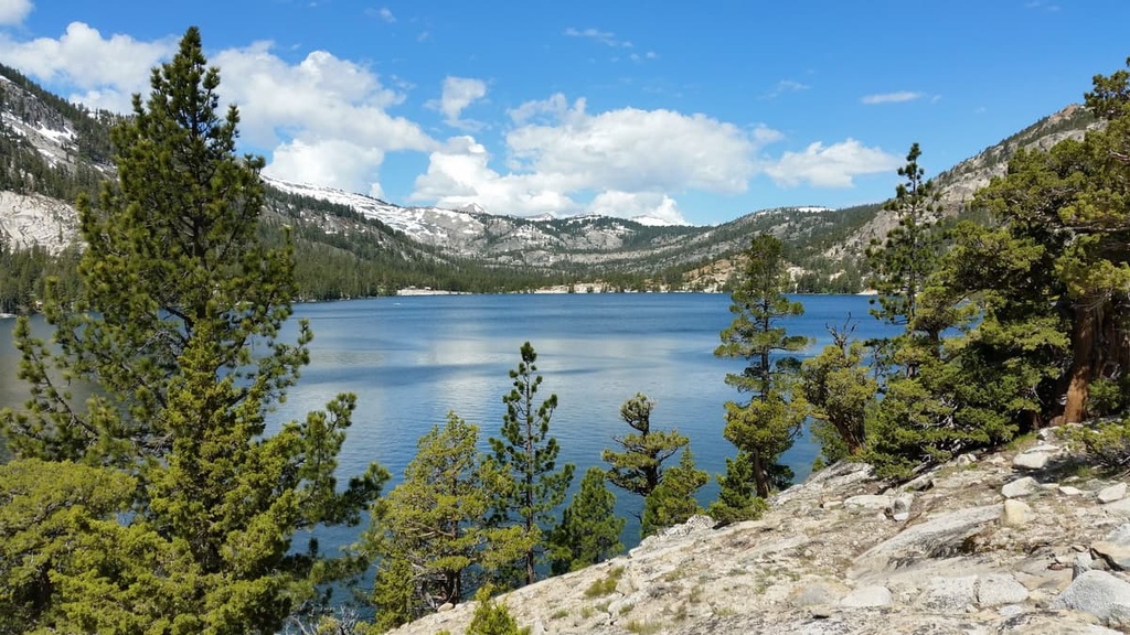
This hiking route begins along the shores of Fallen Leaf Lake and climbs steadily throughout. The trail starts in the forested hillsides around Fallen Leaf Lake before climbing up to a series of other small lakes.
Tallac Creek flows along the trail as it makes its way toward Lake Tahoe. This trail can also be extended to reach the summit of Mount Tallac, which offers stunning views of the surrounding lakes and mountains. This route is 5.5 miles (8.9 km) long round-trip and it has 1,197 feet (365 m) of elevation gain.
The Fallen Leaf Lake Trail is a fun, family-friendly route within the Lake Tahoe Basin Management Unit. This trail gently meanders along the eastern shores of Fallen Leaf Lake and it offers great views of the surrounding terrain.
As the trail is an out-and-back route, hikers have the option to complete the full distance or turn around early. The full route is 3.6 miles (5.8 km) long round-trip and it has 137 feet (42 m) of elevation gain.
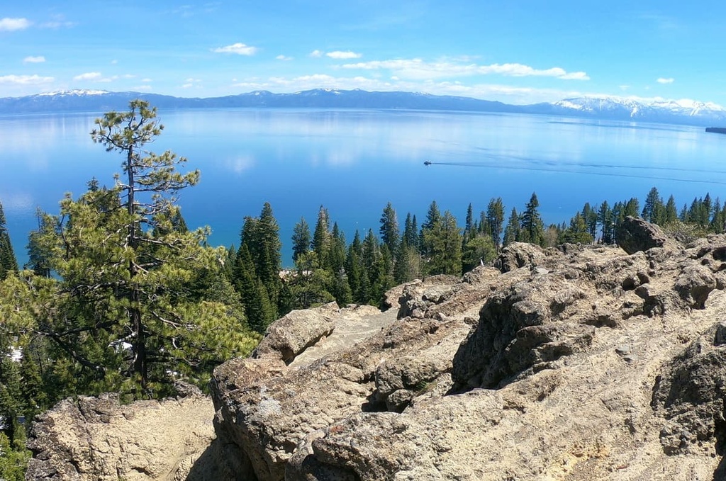
Though it is located just off Highway 89, the Eagle Rock Trail offers incredible views of Lake Tahoe. This out-and-back trail is 0.7 miles (1.1 km) long round-trip and it has just 239 feet (73 m) of elevation gain.
The Eagle Rock Trail begins in a beautiful forest and it meanders its way uphill to the top of Eagle Rock. Once at the summit, hikers can enjoy expansive views of Lake Tahoe and the mountainous landscape that surrounds the entire lake.
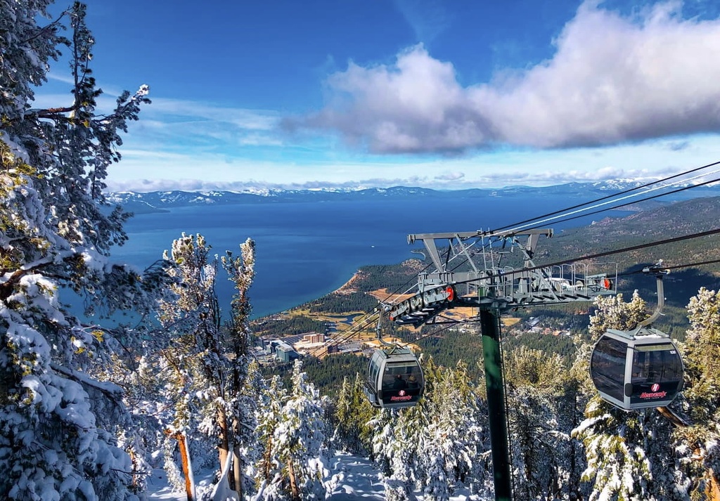
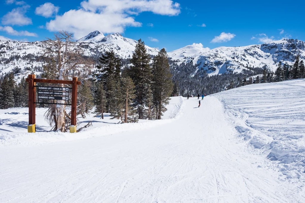
The Lake Tahoe region is home to world-renowned ski resorts that attract visitors from across the globe. The land surrounding Lake Tahoe is home to a staggering 15 ski resorts. Here’s a look at a few of the most popular mountains for winter recreation in the region.
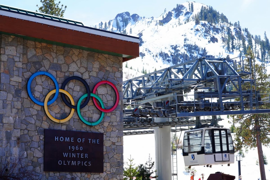
Palisades Tahoe is a world-famous mountain resort that was home to the 1960s Winter Olympics. A tram at the resort takes skiers during the winter (and hikers during the summer) from the base of the mountain up to the summit.
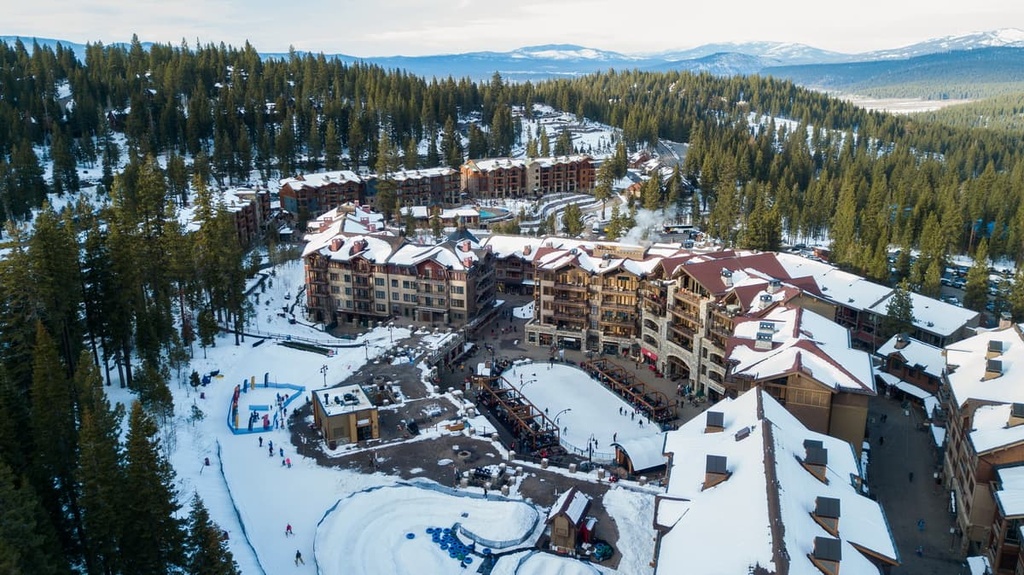
Home to over 4,000 acres (1,619 ha) of terrain, Palisades Tahoe encompasses six peaks and its steep chutes and bowls offer adrenaline-packed runs for skiers and snowboarders alike. The base of the mountain also features a village full of dozens of restaurants and shops.
During the summer, Palisades Tahoe also serves as the starting point for the famous Western States 100 Mile Endurance Race.
Heavenly Ski Resort is another iconic mountain in the Lake Tahoe region that straddles the state line between California and Nevada.
Home to some of the best views of Lake Tahoe, Heavenly features the highest peak of all the mountains in the region and the biggest vertical drop from its summit down to the base. Within its 4,800 acres (1,943 ha) of terrain, the resort also features a snow tubing hill and multiple terrain parks
Northstar Ski Resort lies to the north of Lake Tahoe, just a few miles outside of the town of Truckee. The 3,000 acres (1,214 ha) of skiable terrain at Northstar includes nearly 100 trails and 13 ski lifts.
Visitors to Northstar can also enjoy some fine dining at a restaurant that’s located at an elevation of 8,610 feet (2,624 m) on the mountain itself. Northstar also boasts 25 miles (40 km) of groomed cross-country ski trails for visitors to enjoy.
Though smaller than some of the other nearby resorts, Kirkwood Ski Resort boasts the highest average annual snowfall levels of all the surrounding mountains in the region.
In addition to its 2,300 acres (931 ha) of skiable terrain, the mountain also features the highest base elevation of all the ski resorts in the Lake Tahoe region as its base station is located at an elevation of 7,800 feet (2,377 m). Kirkwood features trails for both cross country skiing and snowshoeing as well as year-round ziplining opportunities.
Founded in 1939, Sugar Bowl is one of the oldest ski resorts in the Lake Tahoe region. The resort is located on land that tourists had been skiing on since the early twentieth century, though it didn't get its first chair lift or lodge until 1939.
Nowadays, the resort features 1,500 acres (607 ha) of skiable terrain along with multiple terrain parks. It remains one of the most popular ski resorts in the region due to its extensive history and its sizable quantity of excellent advanced-level terrain.
Looking for a place to stay near Lake Tahoe Basin Management Unit? Here are some of the best cities and villages to check out in the region.
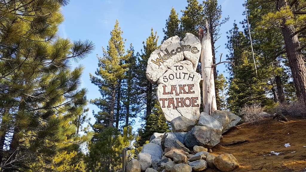
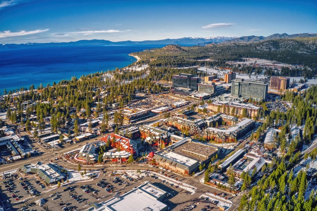
True to its name, South Lake Tahoe is situated along the southern shores of the lake. The resort city is home to around 21,000 residents though thousands of tourists visit the region each year, too. While it is still relatively small when compared to other cities in California, South Lake Tahoe is the largest city located along the shores of the lake.
Additionally, Heavenly Mountain Resort lies next to the city along the border between California and Nevada. The ski resort features the highest elevation terrain out of all the region’s resorts.
During the summer months, visitors flock to the region to enjoy the lake and to adventure in the Desolation Wilderness that lies just to the west of the city. South Lake Tahoe is also home to a variety of restaurants and galleries if you’re looking for something to do in town.
The closest major city to Lake Tahoe is Reno, Nevada. Situated just a half an hour’s drive to the east of the northern shores of the lake, Reno has a metro population of 425,000 residents. Often called “The Biggest Little City in the World,” Reno is predominantly known for its plethora of casinos.
Reno is the second-most populous city in the state after Las Vegas. Along with its bustling casino scene and nightlife, Reno is a great place to travel to if you enjoy the great outdoors. The city is surrounded by ample opportunities for outdoor recreation including hiking, trail running, mountain biking, rock climbing, and skiing. The downtown region of the city is also home to the Nevada Museum of Art and the National Automobile Museum.


western-state-climbers
western-state-climbers-star
sierra-club-sierra-peaks-section
sierra-sampler
tahoe-ogul
western-state-climbers
western-state-climbers-star
sierra-club-sierra-peaks-section
sierra-sampler
tahoe-ogul


