
Scan the QR code and open PeakVisor on your phone
Tahoe National Forest is a mountainous area of federally managed land located in the US state of California. The forest encompasses the bulk of the mountains that are located to the northwest of the famous Lake Tahoe. There are 198 named mountains in the forest, the tallest of which is Castle Peak at 9,098 ft (2,773 m) and the most prominent of which is Babbitt Peak with 2,375 ft (724 m) of prominence.
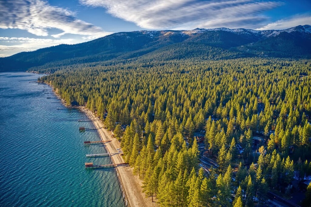
Tahoe National Forest is situated in east-central California, along the state’s border with Nevada. It includes parts of Nevada, Yuba, El Dorado, Plumas, Placer, and Sierra counties. The forest covers over 870,000 acres (352,000 ha) of land across the northern crest of the Sierra Nevada.
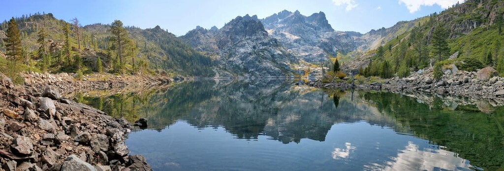
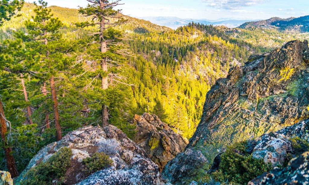
The western side of the forest lies to the northeast of Sacramento and is characterized by its dense pine forest. Moving eastward, the forest is met with steep and rugged canyons as well as numerous rivers and streams. The peaks on the western side of the forest often offer panoramic views of the protected region.
The eastern side of the forest is home to gentler slopes as the peaks transition into the open expanse that characterizes western Nevada. The eastern foothills of Sierra Nevada are more arid than those to the west and they feature fewer pine trees and more sagebrush.
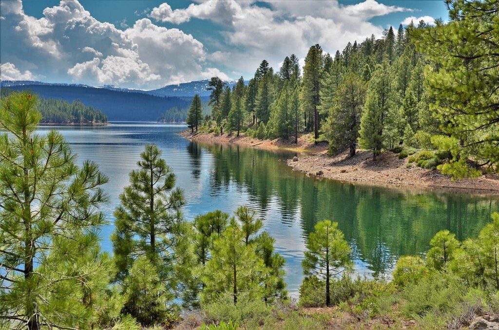
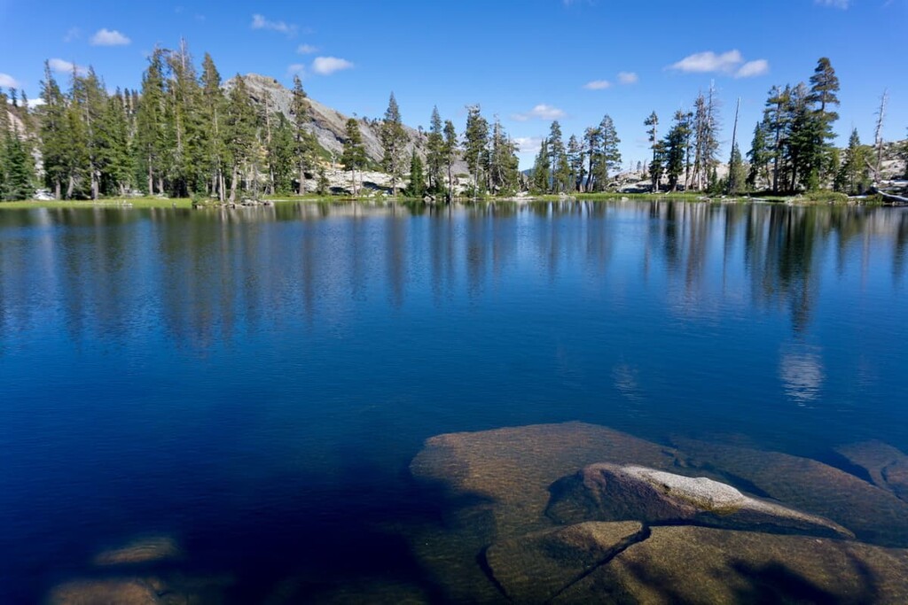
There are hundreds of lakes and reservoirs scattered throughout the forest with the most
prominent being the Boca Reservoir. Though river canyons are more prolific on the western side, they can be found in the eastern region as well.
The Granite Chief Wilderness lies within the forest, spanning 19,048 acres (7,700 ha) of land. The peaks in this portion of wilderness are heavily glaciated and characterized by cirques, deep valleys, along with U-shaped valleys. However, lakes are less common within the wilderness.
Additionally, Tahoe National Forest is surrounded by other popular outdoor recreation areas. Immediately south of the forest lies Desolation Wilderness of the Eldorado National Forest, while Lassen National Forest and Plumas National Forest are located to the north and the Mount Rose Wilderness of the Humboldt-Toiyabe National Forest is located to the east.
The part of the Sierra Nevada that runs throughout the forest contains a number of roof pendants that date back to the Paleozoic era. These peaks began forming around 20 million years ago.
During this time, crustal extension led to an immense amount of volcanism with the Sierra Nevada. The continued pressure resulted in a section of the Earth’s crust being uplifted by the pressure of the Coastal Range to the west and the Basin and Range Province to the east.
Over time, the Sierra Nevada began to rise and tilt westward.
Lava flows began forming in the numerous valleys that are present throughout the range today. During the last glacial period, which began around 2.5 million years ago, the landscape was covered with massive glaciers. As these glaciers receded, they carved out wide basins amidst rugged pekas.
Further erosion by these once mighty glaciers, coupled with the emergence of numerous rivers, helped create the landscape that we see today. To this day the Sierra Nevada is still being uplifted, evidence of which is more present on its eastern slopes.
Major peaks within the forest include Castle Peak, Babbitt Peak, Granite Chief, Basin Peak, Needle Peak, and Sierra Buttes.
Tahoe National Forest is home to numerous species of flora and fauna. The forest consists of dense patches of pine intermixed with mountain chaparral, mixed conifer, and red fir, along with regions of sage-pine.
The diversity of landscape on the western and eastern sides of the forest help provide healthy habitats for a variety of animals. Large populations of black bear, mountain lion, and mule deer can be found throughout the forest.
Smaller animals such as raccoons, squirrels, skunks, coyotes, and beavers are also found in Tahoe National Forest. Porcupines can be spotted in the more wooded areas of the forest.
The bodies of water within the forest boundaries are also known for having some of the best fishing opportunities in the country. Popular trout fishing spots can be found along the Truckee and Yuba Rivers.

Human history of the land within Tahoe National Forest dates back thousands of years. Villages and travel routes of the Nisenan and Washoe (Wašišiw) peoples are evident throughout the region. The region that is now part of Tahoe National Forest is the ancestral homelands of Nisenan, the Washoe, and many other Indigenous communities.
The Nisenan people traditionally lived near the watersheds throughout what is now northern California. Prior to the arrival of European colonists and settlers, there were a number of Nisenan communities in the region. Acorns were an integral part of the traditional diet as were hunting deer, elk, rabbits, and even bears.
After the arrival of settlers of European descent, the Nisenan and the Washoe were forced off their homelands. The Washoe Tribe of Nevada and California currently maintains a number of parcels of land in California and Nevada that equal approximately 64,300 acres (26,000 ha) of land.
Meanwhile, the Nisenan Tribe of California had a federally-recognized reservation called the Nevada City Rancheria that was created by the executive order of President Wilson in 1913. However, it was terminated, alongside other reservations, by US Congress in 1964 through the California Rancheria Termination Acts, so the tribal nation no longer has access to their land.
The first large group of settlers of European descent arrived on the indigenous land during the 1840s. While populations began to grow, the Gold Rush of 1849 resulted in a massive influx of people. This gold rush led to many of the mountain communities scattered along the foothills of Sierra Nevada.
The transcontinental railroad was built during the 1860s, an event that led to an even larger influx of people moving to the area and traveling west into California. A forest reserve was established not long afterward in 1893 due to the over exploitation of the land’s resources.
Lake Tahoe Forest Reserve was established in 1899 and renamed Tahoe National Forest in 1905. Further divisions of the forest management were made in 1908.
Tahoe National Forest is home to numerous trails and other opportunities for outdoor recreation. Here are some of the top hiking areas to visit in the forest:
The Five Lakes Trail in the forest is 5 miles (8 km) long with 1,118 ft (340 m) of elevation gain. Situated in the foothills of the Granite Chief Wilderness, the trail features five small and pristine lakes. Much of the elevation gain occurs during the first mile of the hike with minimal gain between the various small lakes.
The Castle Peak Trail allows visitors to summit the tallest peak in the entire national forest—Castle Peak. The route is 6 miles (9.7 km) long with 1,811 ft (552 m) elevation gain. It climbs steadily through the forest, interspersed with periods of relatively flat trail that traverse open plateaus.
After passing Andesite Peak, the trail follows a ridgeline up to the summit of Castle Peak. This route can also be extended to include summiting Andesite Peak or Basin Peak.
The Stevens Trail is located in the western stretches of Tahoe National Forest. This route is 7.7 miles (12.4 km) long with 1,584 ft (483 m) of elevation gain.
Once used as a toll road for miners, much of the trail follows along the North Fork American River. Throughout the route, there are options to head down to the river to cool off and gaze up at the forested hillsides of the river valley.
Looking for a place to stay near Tahoe National Forest? Here are some of the best cities and villages to check out in the region:
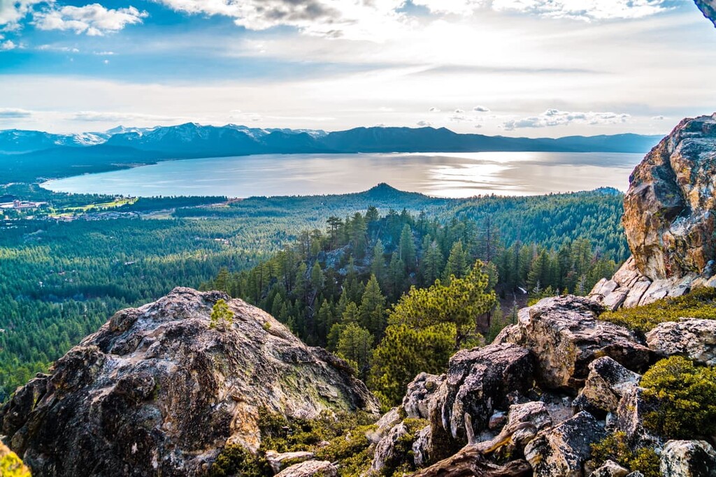
Located in the eastern region of the forest lies the city of Truckee, California. The city has a population of around 17,000 people and it is surrounded by a number of outdoor recreation areas. Nestled between Tahoe National Forest, Donner Memorial State Park, and Lake Tahoe, Truckee is full of outdoor activities for visitors to enjoy.
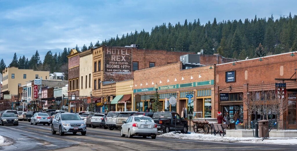
Besides hiking, the town is known for its close proximity to rock climbing, biking, skiing, and watersports destinations. Downtown Truckee is also home to numerous street festivals, farmers markets, as well as live music during the summer months.
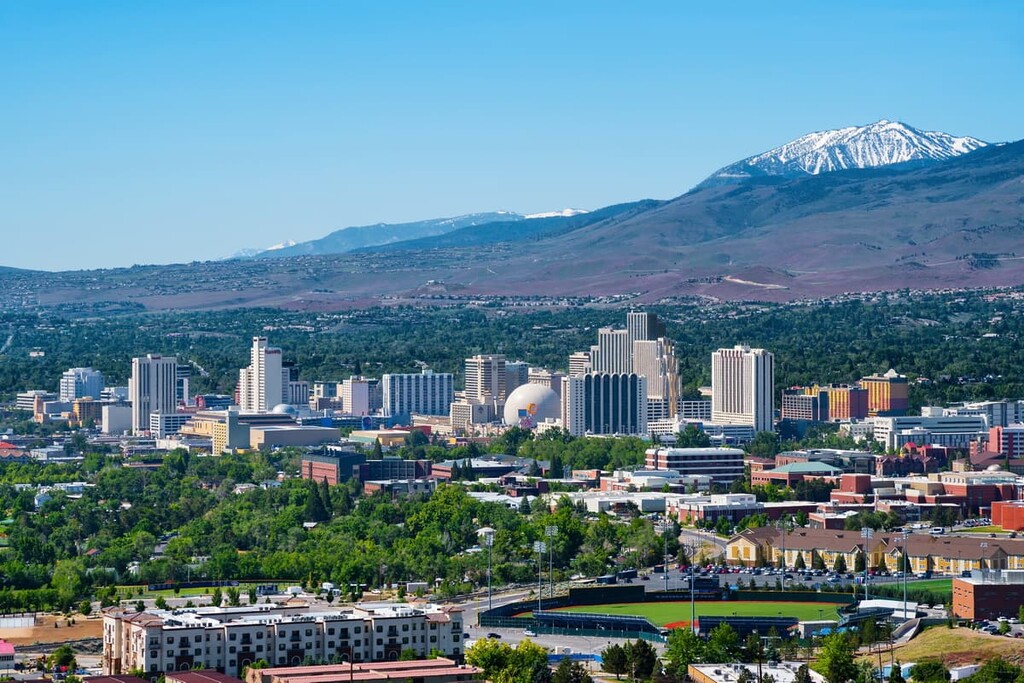
The city of Reno, Nevada is located just a half an hour to the east of Truckee. Referred to as “The Biggest Little City in the World,” Reno is known for its abundance of casinos. With a metro population of 425,000, Reno is the second most populated city in the state.
Besides being home to numerous museums, including the Nevada Museum of Art, Reno is also surrounded by prime destinations for both summer and winter activities. The eastern foothills of Sierra Nevada provide hundreds of miles of hiking, running, and mountain biking trails, along with opportunities for rock climbing. Countless ski resorts in the area also allow for outdoor activities all year round.


western-state-climbers
western-state-climbers-emblem
sierra-club-sierra-peaks-section
sierra-sampler
tahoe-ogul
western-state-climbers
western-state-climbers-star
sierra-club-sierra-peaks-section
sierra-sampler
tahoe-ogul
western-state-climbers
western-state-climbers-star
sierra-club-sierra-peaks-section
sierra-sampler
tahoe-ogul
western-state-climbers
western-state-climbers-emblem
sierra-club-sierra-peaks-section
sierra-sampler
tahoe-ogul
western-state-climbers
western-state-climbers-emblem
sierra-club-sierra-peaks-section
sierra-sampler
tahoe-ogul
western-state-climbers
western-state-climbers-emblem
sierra-club-sierra-peaks-section
sierra-sampler
tahoe-ogul
western-state-climbers
western-state-climbers-star
sierra-club-sierra-peaks-section
sierra-sampler
tahoe-ogul
western-state-climbers
western-state-climbers-emblem
sierra-club-sierra-peaks-section
tahoe-ogul
western-state-climbers
western-state-climbers-star
sierra-club-sierra-peaks-section
sierra-sampler
tahoe-ogul


