
Scan the QR code and open PeakVisor on your phone
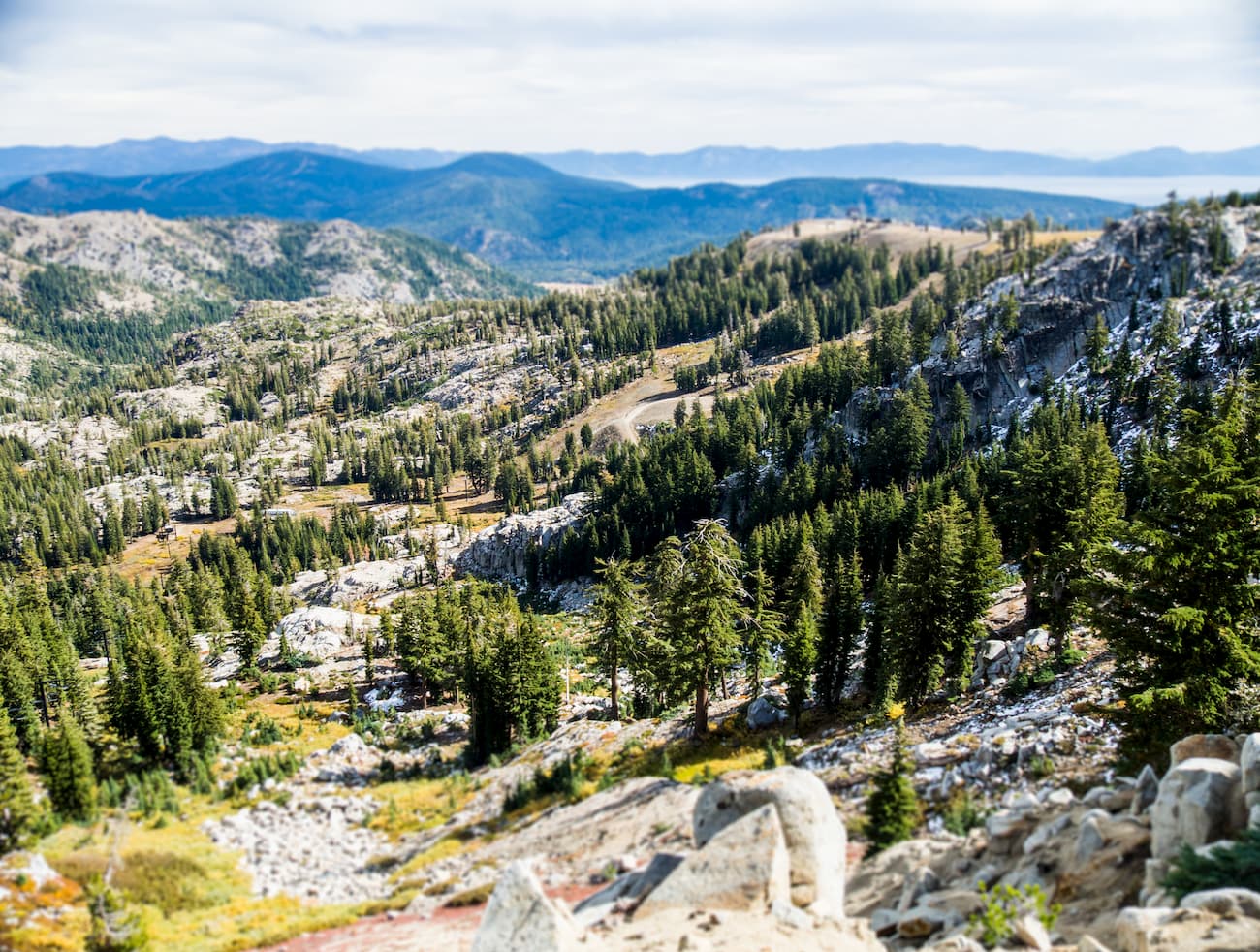
The Granite Chief Wilderness is a small area of federally-protected land in the eastern part of the US state of California. The wilderness is known for its beautiful glacially carved landscapes, which make it a popular outdoor recreation area for people in the greater Lake Tahoe Region. It is home to 5 named mountains, the highest and most prominent of which is Granite Chief (9,026ft/2,751m).
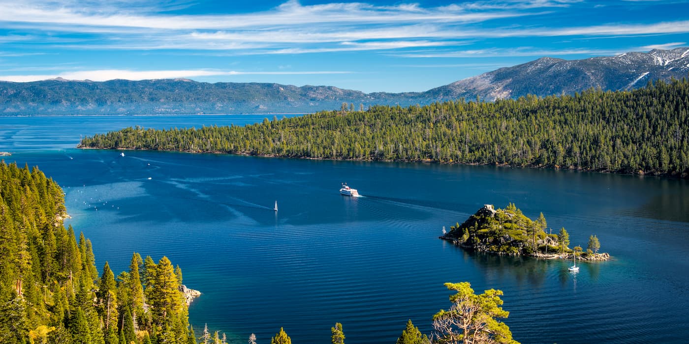
The Granite Chief Wilderness is located to the west of Lake Tahoe, which is near California’s border with Nevada. It is located wholly within Placer County and is very close to the city of South Lake Tahoe.
These days, the Granite Chief Wilderness is managed as a part of the Tahoe National Forest, which covers a large section of the northern Sierra Nevada Range. It is bordered to the south by Eldorado National Forest and the Desolation Wilderness, both of which are also highly popular among outdoor enthusiasts.
Land within the Granite Chief Wilderness is mostly within the watershed of the American River, which connects the drainages of the Sierra Nevada to the Sacramento River. The water from these rivers then drains into the San Francisco Bay Area and is also a major source of drinking water for the city of Sacramento.
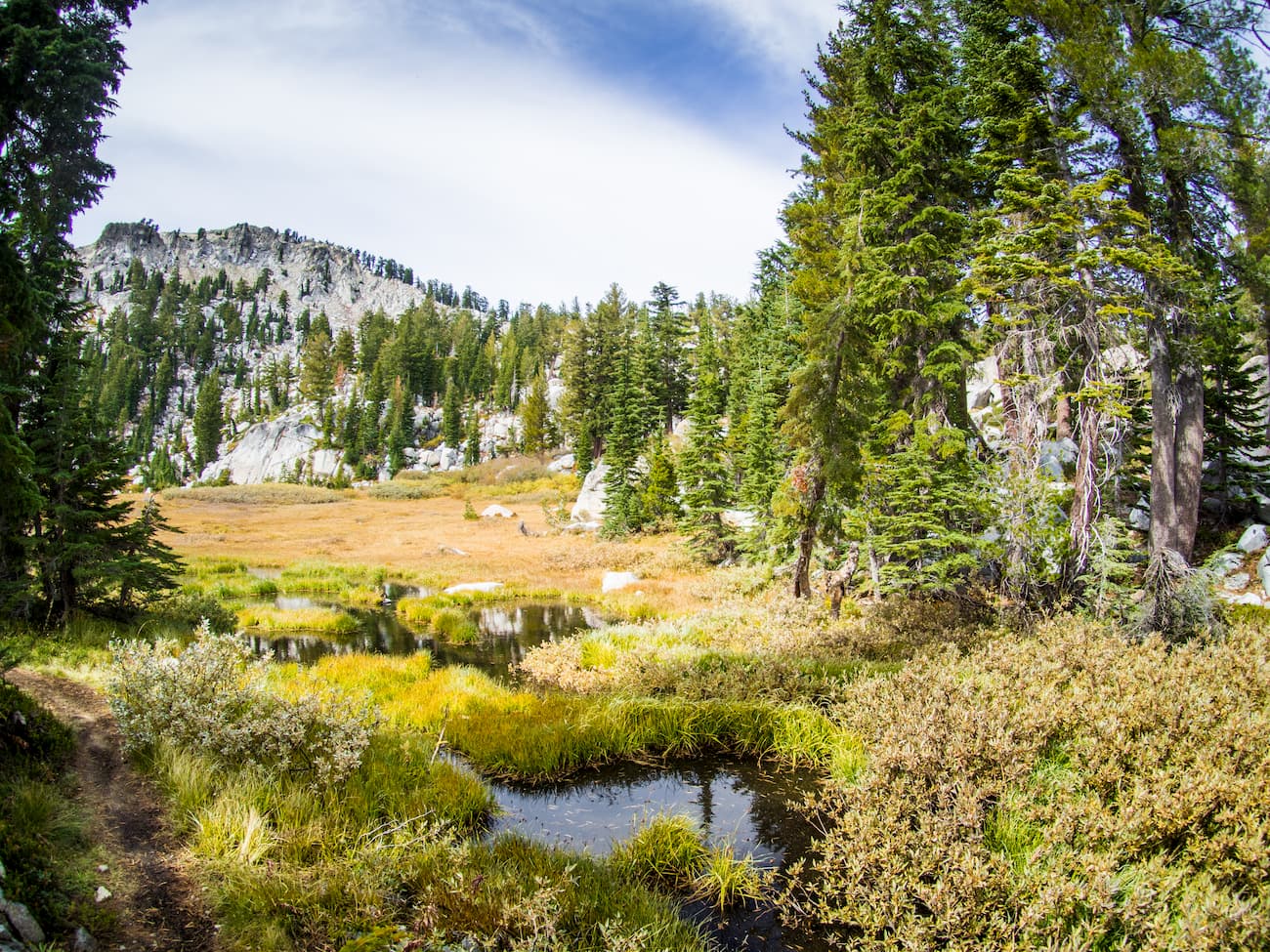
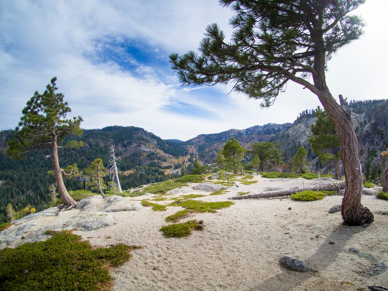
The Granite Chief Wilderness is fairly small, containing just 40 square miles (103.6 sq. km) of land. This means that it is just under half the size of the city of Sacramento. But, the Granite Chief Wilderness manages to pack a fantastic array of beautiful scenery, alpine meadows, and towering granite peak into its small borders.
As a part of the Sierra Nevada range, the mountains within the Granite Chief Wilderness are home to rocks that are part of the Sierra Batholith. The batholith is a massive collection of plutons, which are the result of magma that cooled underground as the Farallon Plate subducted below the North American Plate.
The peaks in the region, alongside the nearby Klamath Mountains, were created during the Nevadan orogeny, a mountain-building event that took place during the Middle Jurassic and Early Cretaceous. However, the region’s distinctive landforms were mostly created as a result of the extensive Pleistocene glaciation, which covered much of the landscape in ice.
As a result of this extensive glaciation, the Granite Chief Wilderness is home to a number of hanging valleys and glacial cirques, which are typical of ice-carved areas.
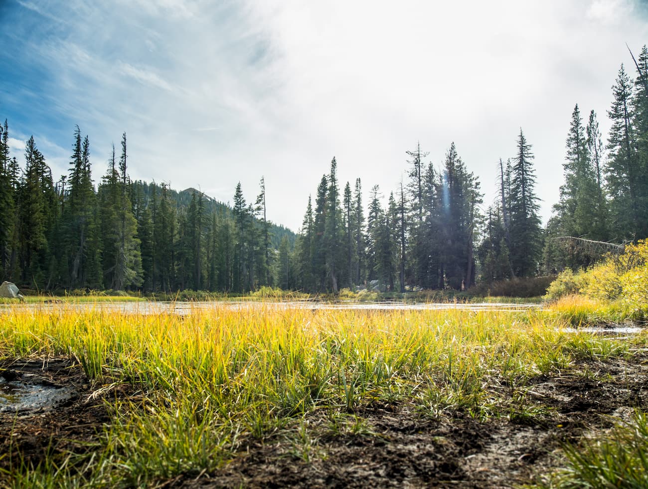
The Granite Chief Wilderness has rich, volcanic soils throughout most of its range. These soils support an abundance of plant life, including large forests of whitebark pine. Closer to rivers and streams, the wilderness also contains plenty of black cottonwoods, aspen, and alder.
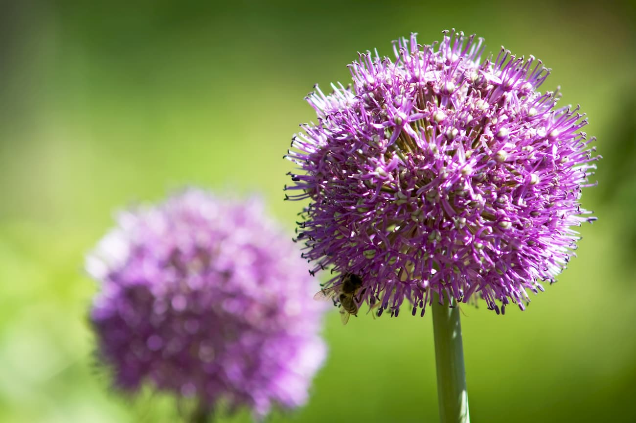
Additionally, the Granite Chief Wilderness is home to an assortment of rare plants that are endemic to California. This includes the three bracted onion (Allium tribracteatum), which is listed as rare and endangered by the California Native Plant Society.
As far as wildlife goes, the wilderness is a good habitat for an assortment of large mammals that are typical of the high Sierra, including black bear and mountain lion. Interestingly, the Granite Chief Wilderness is also considered an important fawning area for mule deer, so no dogs are allowed in certain parts of the area for a significant part of the summer months (usually May 15 to July 15).
The Granite Chief Wilderness and the rest of the Lake Tahoe region are the traditional homelands of the Washoe people, who inhabited the area for at least the last 6,000 years. The Washoe people traditionally lived throughout the Great Basin and the eastern Sierra Nevada until the arrival of white settlers, many of whom came in search of gold.
The area became a federally designated wilderness area under the California Wilderness Act of 1984 and is now managed as part of the Tahoe National Forest. These days, the area is a very popular destination for outdoor recreation, thanks to its large trail network and proximity to Lake Tahoe.
In fact, the summit of Granite Chief is also the northwestern boundary of the Squaw Valley Ski Resort. Additionally, both the Western States Endurance Run and the Western States Trail Ride (aka the Tevis Cup) are hosted on trails that cross through the Wilderness. Within the wilderness area, the Five Lakes Basin is perhaps the most heavily visited section, although the entire region is a popular destination for hiking, fishing, skiing, climbing, and horsepacking.
There are about 37 miles (60km) of trails within the Granite Chief Wilderness. Here are some of the most popular hiking options:
The Pacific Crest (PCT) Trail passes through portions of the Granite Chief Wilderness. In total, about 11 miles of the PCT crosses through the wilderness. Keen hikers can access the trail from:
The Five Lakes Trail begins at the Alpine Meadows Trailhead and covers about 2 miles (3.3km) of trail in the wilderness. It takes visitors to see the largest of the “Five Lakes,” which are actually a collection of lakes that can vary in number based on the time of year and the local snowpack conditions.
Here are some of the best places to stay near the Granite Chief Wilderness:
Situated on the southern shore of Lake Tahoe, the city of South Lake Tahoe is home to over 20,000 residents. The city is a population center for the Tahoe Basin and is a popular destination among outdoor recreationalists. Although South Lake Tahoe doesn’t have a major airport, it is within driving distance of Reno, which offers great air links to cities around the US.
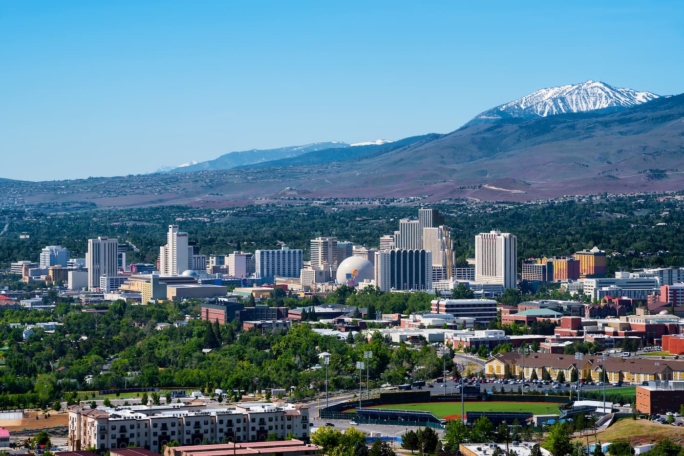
Reno is the second-largest city in the state of Nevada and is a growing tech hub within the Great Basin region. The city is home to over 225,000 inhabitants and is home to a major international airport that provides fantastic access to other cities throughout the United States.
Sacramento is the capital city of California and is the state’s sixth-largest municipality. The city is home to two large universities and is a cultural center of the California Central Valley. Although it is not as large as nearby San Francisco, Sacramento is well connected by air, road, and rail to cities around California and the rest of the country.


western-state-climbers
western-state-climbers-star
sierra-club-sierra-peaks-section
sierra-sampler
tahoe-ogul
western-state-climbers
western-state-climbers-star
sierra-club-sierra-peaks-section
sierra-sampler
tahoe-ogul


