
Scan the QR code and open PeakVisor on your phone
One of the state’s longest mountain ranges, the Shoshone Mountains are a chain of peaks that stretch across the central part of the US state of Nevada. The range contains 31 named mountains, the highest of which is North Shoshone Peak (10,305ft/3,141m), and the most prominent of which is Mount Lewis (9,688ft/2,953m).
Located in central Nevada, the Shoshone Mountains stretch for some 66 miles (106km) across the heart of the state. Forming more or less a straight line from northeast to southwest, the range cuts through parts of Lander and Nye counties starting at I-80 in the north and continuing to just north of Route 95 in the south.
Due to the Shoshone Mountains’ location in the heart of Nevada, the mountain chain is surrounded by other ranges. In particular, the range is located to the east of the Toiyabe Range, the Cortez Mountains, the Paradise Range, the Roberts Mountains, and the Simpson Park Range as well as to the west of the Desatoya Mountains, the New Pass Range, the Clan Alpine Mountains, the Fish Creek Mountains, and the Tobin Range.
Furthermore, the Shoshone Mountains are located to the north of the Cedar Mountains and the Gabbs Valley Range and to the south of the Sheep Creek Range.
The range is also located on a patchwork of different land. It is located partly on BLM land, in the Toiyabe National Forest, and in the Berlin-Ichthyosaur State Park. Additionally, the Shoshone Mountains are partly included within the Yomba Reservation of the Yomba Shoshone Tribe and on other privately-owned land.
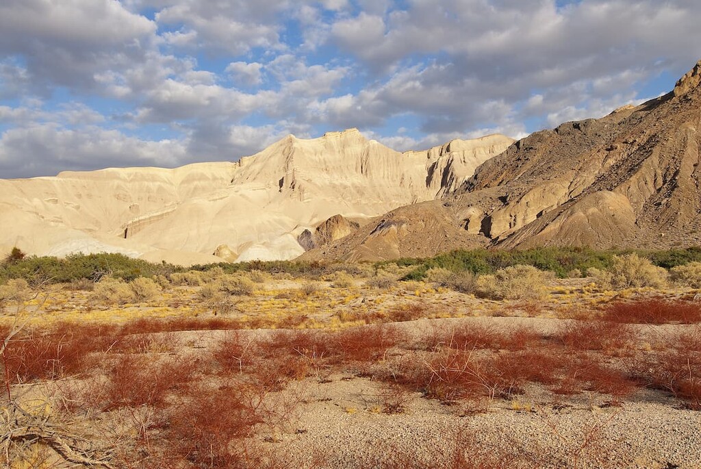
Geologically, the Shoshone Mountains are part of the Great Basin Ranges, which is a major physiographic province that covers nearly all of Nevada, as well as parts of California, Oregon, Idaho, Utah, and Arizona.
The geology of the region is fairly complex, though from a topographical perspective, the Great Basin Ranges are dominated by an alternating set of valleys and narrow mountain ranges. It’s believed that the province started to take shape after a period of widespread tectonic expansion that took place during the early Miocene.
Furthermore, the Shoshone Mountains themselves have a unique and varied geologic structure. The range is, for the most part, actually comprised of Cenozoic-age volcanic rocks and volcaniclastic sedimentary rocks. Within the southern part of the range there are also a number of dikes and igneous intrusions.
Major peaks in the range include North Shoshone Peak, South Shoshone Peak, Mount Lewis, Mount Ardivey, Buffalo Mountain, Elephant Head, and Horse Mountain.
The Shoshone Mountains are located squarely within the Central Basin and Range ecoregion, which stretches across much of the central part of Nevada to the south of the Humboldt River.
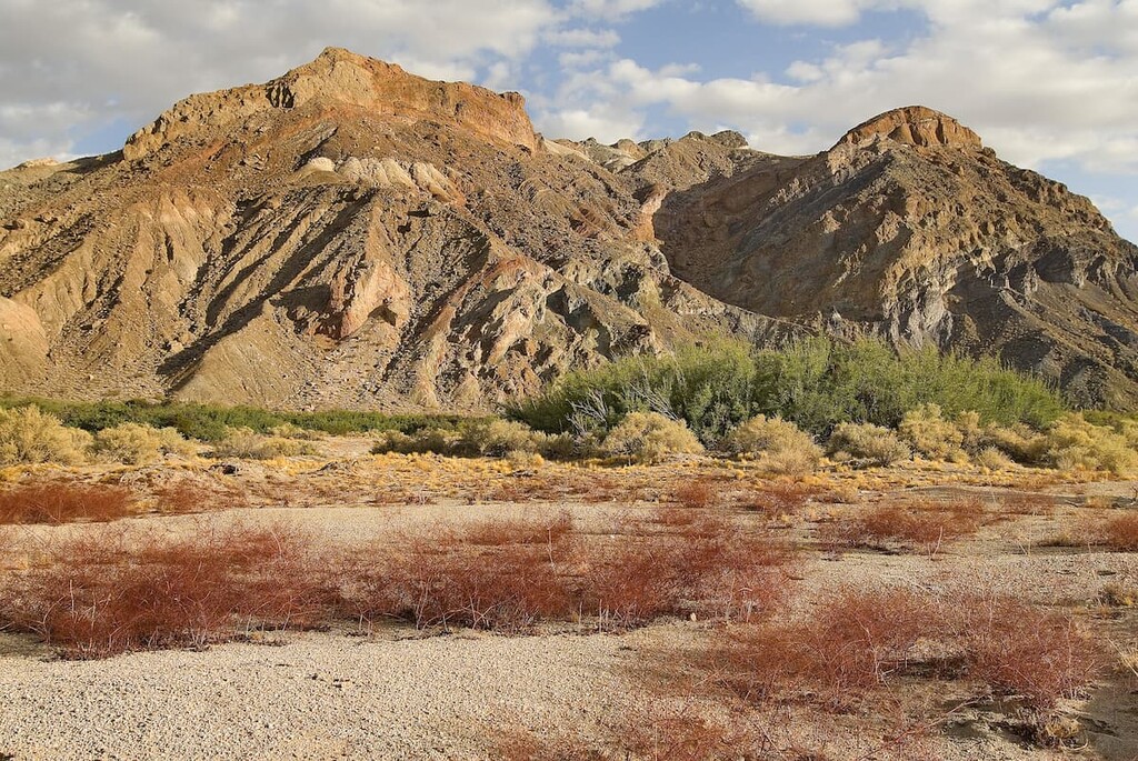
Within the range, the ecosystems are typical of the region. Due to the extreme aridity of the region, the range is dominated by sagebrush scrub, particularly at lower elevations. Furthermore, the range contains some pinyon-juniper woodlands, especially on higher slopes.
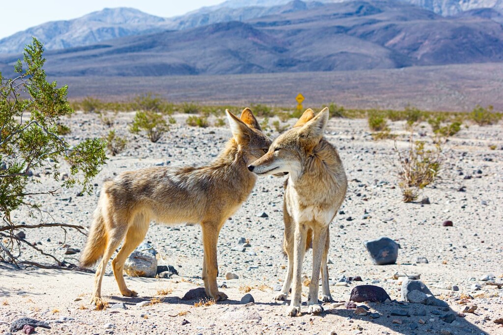
Wildlife in the region is fairly abundant, despite the hot, arid climate. There are dozens of bird species that call the Shoshone Mountains home, as well as a variety of mammals, such as mule deer, coyotes, and elk.
The land in and around the Shoshone Mountains has been home to humans for thousands of years. Numerous peoples have called the region home since time immemorial and the range is on the traditional territory of the Western Shoshone, including the Yomba Shoshone Tribe.
Although it’s likely that people of European descent traveled through the region before the mid to late 19th century, it wasn’t until the 1860s that US cartographers had started to map the region in earnest. In many ways, the United States’ interest in the region came down to the country’s need to find new stores of gold and other precious metals to support the Union during the Civil War.
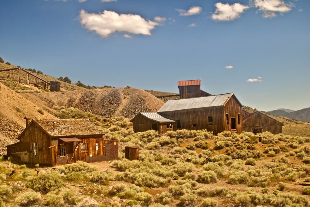
In 1863, silver was discovered in the Shoshone Mountains by local prospectors, leading to the establishment of a number of different boom towns around the range. One of the boomtowns in the southern part of the range, Ione, became a major center for trade and commerce as a result of the silver and gold rushes in the region.
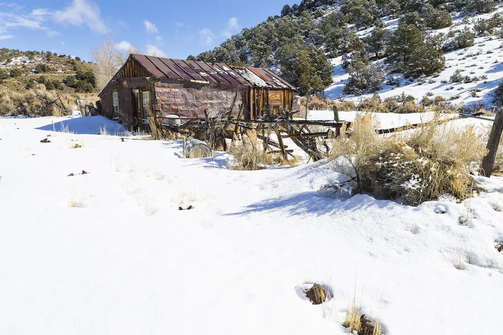
Although the mining booms eventually died out, Ione saw a short secondary boom in the 1850s when a 10-stamp mill was built in the town. Although this new economic opportunity also quickly dwindled, the town saw a final resurgence in the early twentieth century after prospectors found large cinnabar deposits, which allowed for a fairly strong mercury mining industry.
Nevertheless, the mercury mining in the region also died out and by the late 1950s, the town had been nearly entirely abandoned. However, Ione bills itself as the “Town That Won’t Die.” Although there isn’t much of a full-time population in Ione anymore, however, the land in the town is owned by a number of people and there are quite a few cool historic buildings in the town to check out.
These days, the land in the range is a patchwork of public and privately-owned land. A decent portion of the range is part of the Humboldt-Toiyabe National Forest, which was established over a few decades, with some of the earliest areas being officially designated in 1906.
Although the Shoshone Mountains aren’t as well visited as some of the neighboring ranges, like the Toiyabe Range, they’re an awesome place to check out if you’re looking for some solitude in the mountains.
When compared to some of the neighboring ranges, the Shoshone Mountains are infrequently visited. As a result, there are relatively few maintained footpaths in the range, though there are plenty of old forest roads for hikers to check out.
Nevertheless, if you plan to head into the Shoshone Mountains, a high level of self-sufficiency is a must. You’ll also want to take care while hiking in the range to ensure that you stay on public land at all times.
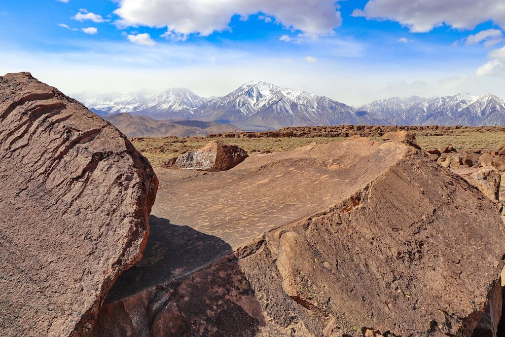
Located in the central part of the range, Berlin-Ichthyosaur State Park preserves the remnants of Berlin, a ghost town that saw its heyday in the 1890s. The town is exceptionally well-preserved and there are plenty of trails that take you through the town to tell you the story of the region.
Furthermore, Berlin also happens to be the largest known concentration of Ichthyosaur remains. The Ichthyosaur is believed to be a marine reptile that lived about 225 million years ago and you can check out some of the fossils that were discovered in the town at the park’s Fossil House.
Although there aren’t many trails in the Shoshone Mountains, the American Discovery Trail (ADT) does pass through the central part of the range. The ADT bills itself as the first coast to coast trail for non-motorized travel in the country as it connects Henlopen State Park in Delaware to Point Reyes National Seashore in California.
In Nevada, the ADT more or less travels straight across the state. Near the Shoshone Mountains, it exits the nearby Toiyabe Range and Arc Dome Wilderness, heading south for a stretch before picking up South Newe Road 22 and heading south. Eventually, the trail heads west and cuts straight across the Shoshone Mountains, picking up a path that travels right by Richmond Hill.
Whether you’re looking to thru-hike a section of the ADT or just go on a day hike, the trail offers great access into the range. From the ADT, you can also head into more remote parts of the range if you’re willing to travel off-trail.
Looking for a place to stay near the Shoshone Mountains? Here are some of the best cities to check out:
Nevada’s second largest city, Reno is located to the west of the Shoshone Mountains. The city is home to about 225,000 people and is a major commercial and cultural hub for the region.
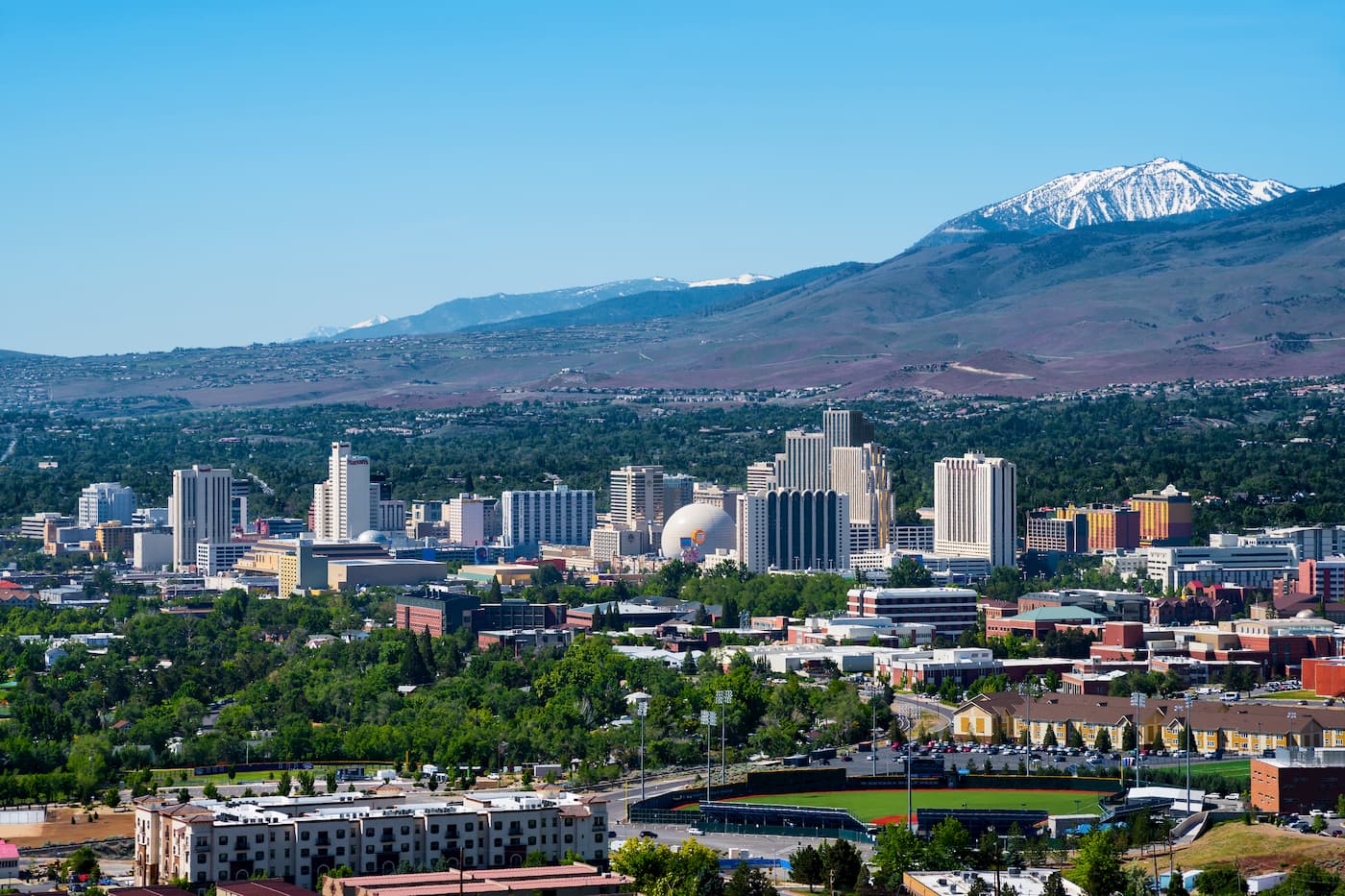
Although Reno is a bit of a drive from the heart of the Shoshone Mountains, it is home to the largest airport in the area. Plus, it has great road access to many of the region’s best mountain ranges and parks, so it’s a nice place to start your trip if you’re looking to travel around northern and central Nevada.
Situated to the northeast of the Shoshone Mountains, the city of Elko is the largest city in Elko County with some 20,000 residents. It is the hub of the Ruby Valley, which offers great access to the famous Ruby Mountains. Elko is easy to access by road as it is located along I-80, and it even has a small regional airport with great connections to nearby major cities, like Salt Lake City.

Battle Mountain is a town of some 3,600 people located at the northern edge of the Shoshone Mountains. It is the county seat of Lander County and is a solid place to start your adventures into the range.
In addition to being located close to the range, Battle Mountain is also the starting point for Nevada State Route 305, which is the only north-to-south connection highway in the state. As a result, it runs the length of the Shoshone Mountains (even crossing it about halfway through), offering unparalleled access to the range.


