
Scan the QR code and open PeakVisor on your phone
Point Reyes National Seashore has 7 named peaks. The highest is Mount Wittenberg at 429 m. Other notable peaks include Point Reyes Hill, Firtop and Mount Vision.
On September 13, 1962, President John F. Kennedy signed legislation to “save and preserve, for purposes of public recreation, benefit, and inspiration, a portion of the diminishing seashore of the United States…” This stretch of undeveloped seashore, named the Point Reyes National Seashore, would become the third of fourteen subsequent national seashores and lakeshores added to the park system.
In 1976, a portion of the Point Reyes National Seashore would also receive wilderness designation, further protecting the untamed beauty of the seashore and preventing future development of its backcountry. Today, the 33,000-acre Phillip Burton Wilderness covers thousands of acres of undeveloped forested ridges, coastal grasslands, and many miles of weathered shoreline.
Overall, the Point Reyes National Seashore encompasses more than 71,000 acres of the Point Reyes Peninsula in Marin County, California. The park’s headquarters in Bear Valley is located just an hour or two from the San Francisco-Oakland metropolitan area and the seashore receives an average of two million visitors each year.
But long before Point Reyes became a bustling destination for sightseeing and tourism, the peninsula and adjacent land was inhabited by the Coast Miwok people. Using dip nets, woven surf nets, various traps, and fire-hardened digging sticks, the Coast Miwok people developed a rich and prosperous economy established on hunting, gathering, and fishing.
Today, the seashore still contains archaeological evidence of the Coast Miwok presence at Point Reyes and a recreated village, “Kule Loklo,” allows visitors to imagine the lives of the people who first cherished and thrived off of the land.
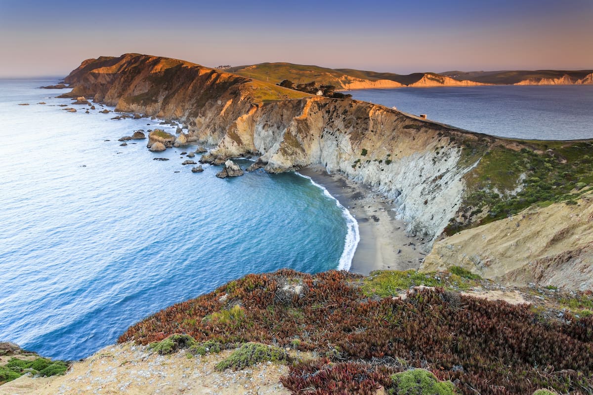
Though wildland has been lost elsewhere along California’s coastline, Point Reyes remains an important habitat to biological diversity. Roughly 45% of North America’s bird species and 18% of the state’s plant species can be found here. Not to mention, thirty federally listed threatened and endangered species of animals, including the sei whale, northern fur seal, blue whale, and Point Reyes Mountain Beaver exist within the Seashore.

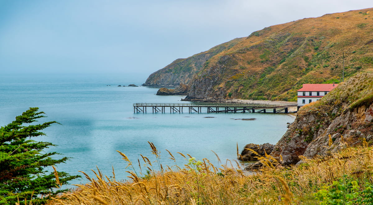
The Point Reyes National Seashore also encompasses several historic landmarks and landscapes, including the 22,000-acre Point Reyes Ranches Historic District, the Point Reyes Light Station, and the Point Reyes Lifesaving Station. Overall, the Seashore is responsible for preserving 300 historic structures, 60 of which are listed on the National Register of Historic Places.
Geologically, the Point Reyes Peninsula has perplexed geologists because rocks located along this craggy stretch of shoreline match those found in the Tehachapi Mountains more than 310 miles away. However, one of the park’s key features, the San Andreas Fault, has a major influence on the Shoreline’s unique topography. According to experts, Point Reyes is a park on the move and is destined to continue to move.
The 1.6-mile Chimney Rock trail is a scenic coastal hike that begins at the Elephant Seal Overlook and travels above craggy cliffs toward the edge of the peninsula. Visitors generally hike Chimney Rock for the opportunity to see grey whales or elephant seals. The short mileage and minimal elevation gain also makes this trail popular among families and novice hikers.
Reach the highest point in the park, Mount Wittenberg, by hiking the Mount Wittenberg loop trail. This 5-mile trek gains just under 1,300 feet in elevation and offers incredible views of the Pacific coastline. The trail starts in a grassy meadow, but quickly ascending through a dense forest canopy to the summit of Mount Wittenberg. At the summit, hikers are greeted with miles of untouched coastline.
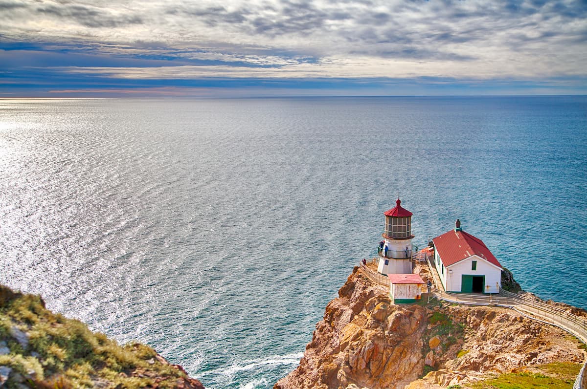
The historic Point Reyes Lighthouse was built in 1870 to warn sailors of the imposing Point Reyes Headlands, which protrude 10 miles out to sea and pose a risk to ships traveling north from San Francisco Bay. The lighthouse was retired from service in 1975 and has since become an important example of our maritime heritage. The 1.3-mile walk to the lighthouse is rated as easy to moderate and is an excellent option for visitors looking to learn about the amazing maritime history of the Seashore.
Point Reyes Station is a tiny town, or village, located at the entrance of the Point Reyes National Seashore. Located along State Route 1, Point Reyes Station is home to a variety of downtown eateries and quaint accommodations, including the Point Reyes Country Inn, Black Heron Inn, and Marsh Cottage. These small inns and cottages scattered along the edges of Point Reyes National Seashore are some of the park’s only lodging options.
Located in western Marin County, along the southwest shore of Tomales Bay, Inverness is a primarily residential community that offers a handful of lodging options, including highly ranked bed-and-breakfasts. Though not particularly large, Inverness provides a variety of services to visitors traveling to the Point Reyes National Seashore and Tomales Bay State Park.
Located on a peninsula between the Pacific Ocean and San Francisco Bay, San Francisco is one of the most popular tourist destinations in California. Just two hours from Point Reyes, San Francisco is best known to be a city where contemporary art and culture merge to form a hilly, uniquely featured city surrounded by mountains and coast. Noteworthy San Francisco attractions include Alcatraz, a rocky island in San Francisco Bay that once served as a federal prison, Pier 39, Golden Gate Park, Lombard Street, and a variety of contemporary museums.


The highest peak in Point Reyes National Seashore is Mount Wittenberg, at 429 m.
Notable peaks in Point Reyes National Seashore include Mount Wittenberg, Point Reyes Hill, Firtop, Mount Vision and Pablo Point.


