
Scan the QR code and open PeakVisor on your phone
The Fremont-Winema National Forest sits in southern Oregon, just north of the California border. The region spans 2,252,587 acres, making it the second largest national forest in the state, second only to the Deschutes National Forest. The Fremont-Winema National Forest was formed in 2002 when the Fremont National Forest was merged with the Winema National Forest. There are 175 named mountains in Fremont-Winema National Forest. Mount McLoughlin is the highest point at 9,493 feet. The most prominent mountain is Gearhart Mountain.
The Fremont National Forest was named after John C. Fremont who explored the area in the 1840s. This section of the forest totals 1,207,039 acres and it is estimated that 549,000 of those acres are old growth forest. There are many trails in the forest with the most popular being the Fremont National Recreation Trail. This trail runs northwest-southeast between totaling 150-miles.
The Winema National Forest is on the eastern slopes of the Cascade Range and covers 1,045,548 acres. Part of the forest borders Crater Lake National Park. The northeast section of the forest is characterized by ponderosa and lodgepole pines on deep pumice and ash. The nutrient ground dates back to the eruption of Mount Mazama that occurred nearly 7,000 years ago to form Crater Lake. There is an estimated 711,000 acres of old growth forest within the Winema National Forest. Over 50 percent of this section of the forest previously belonged to the Klamath Indian Reservation. Two purchases of this land by the United States government shrunk the Klamath Indian Reservation from 762,000 acres down to 145,000 acres.
Within the Fremont-Winema National Forest there are four designated wilderness areas; Gearhart Mountain Wilderness, Mount Thielsen Wilderness, Mount Lakes Wilderness, and Sky Lakes Wilderness.
The entire length of the Fremont National Recreation Trail totals 150-miles. The trail begins in the north on Yamsay Mountain and travels south over Hager Mountain, then along Winter Rim, Warner Mountains, and finally to Vee Lake. The trail can be completed as a serious backpacking trip or crossed at any point to complete an out and back section. Note that much of the trail is in remote areas so plan accordingly with food, water, and GPS.
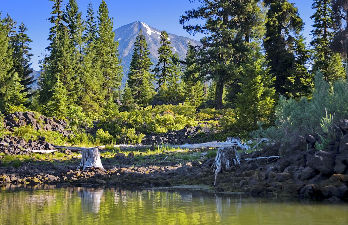
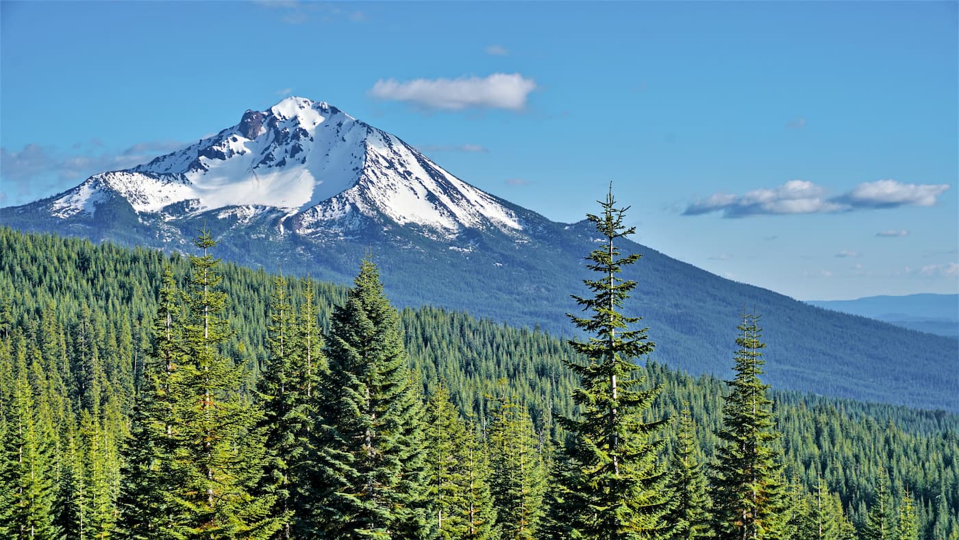
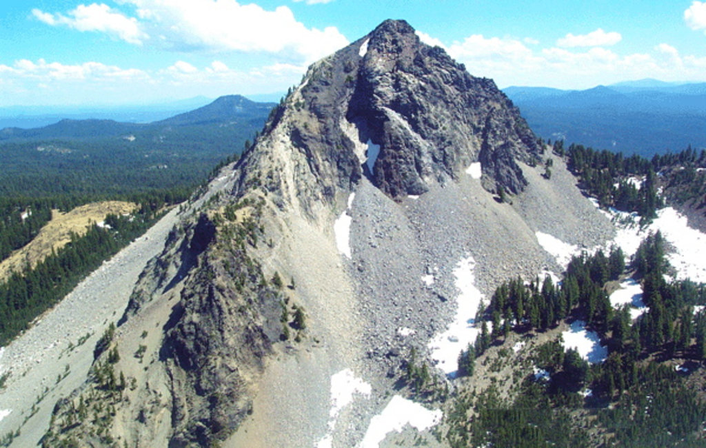
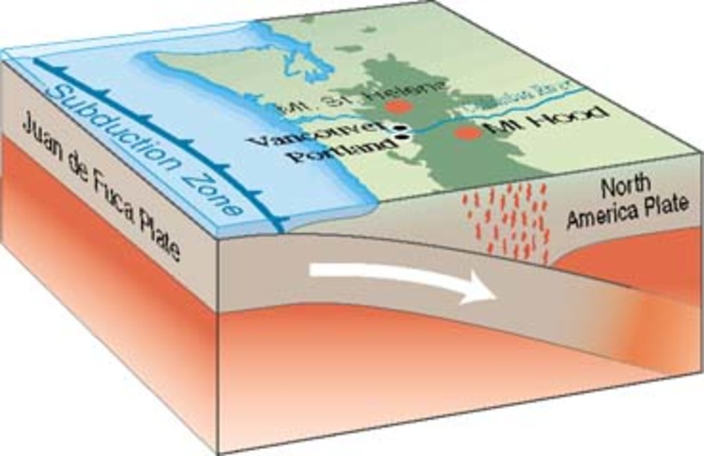
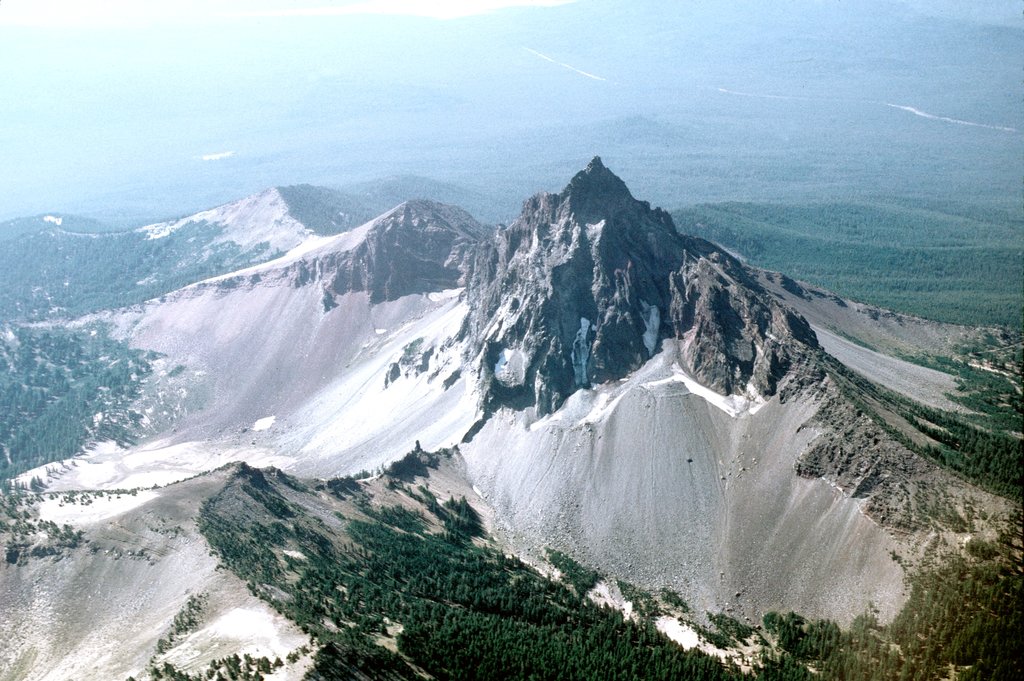
As the highest peak in southern Oregon. Hiking Mount McLoughlin is no easy feat. The route is 9-miles out and back with 3,900 feet of total elevation gain. Unlike nearby Mount Thielsen, this summit doesn’t require any rock climbing or scrambling to reach the top. From the top hikers can look out at the expansive views of the Cascade Range. Mount Thielsen, Mount Shasta, the rim of Crater Lake, and basins full of lakes are all within view. The mountain itself is a lava cone that sits on top of a composite volcano. The volcano has been inactive for tens of thousands of years. From the top of this exquisite peak, on a clear day, nearly a quarter of the state of Oregon is visible.
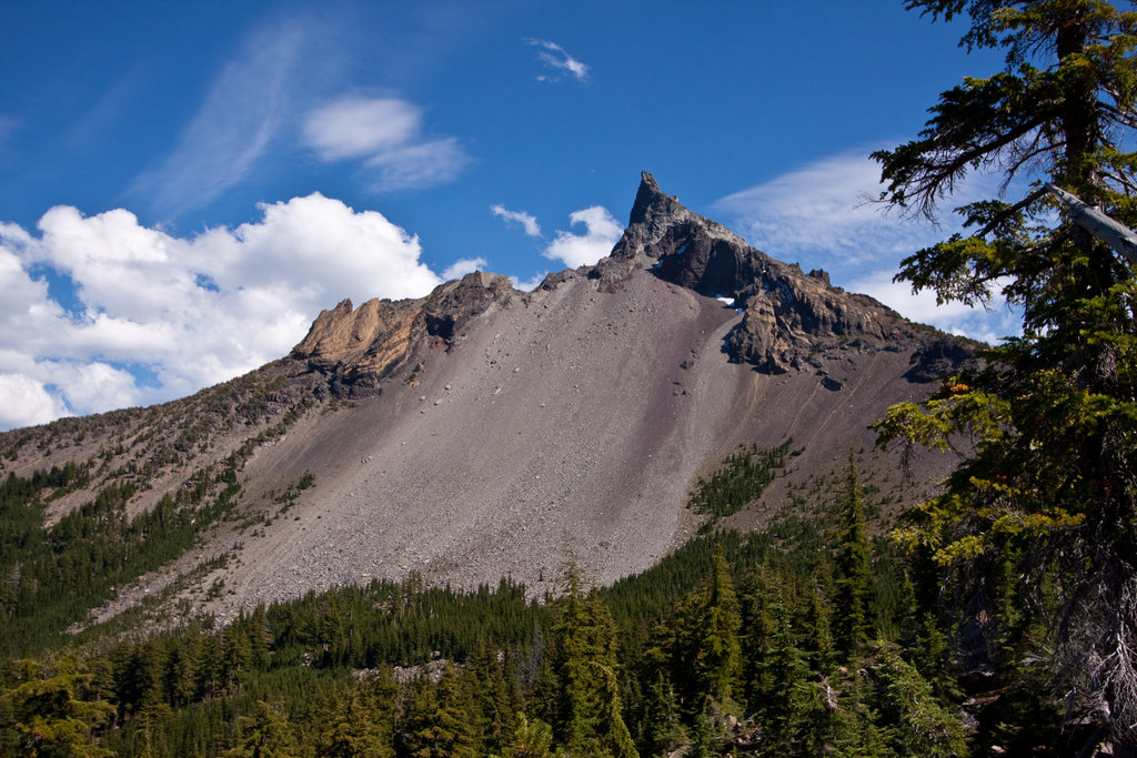
Located in the Gearhart Mountain Wilderness, this trail is 11-miles long with 2,795 feet of elevation gain. The out and back trail climbs steadily through the forest, across streams and springs, past rock formations before climbing to the summit. The last section of the trail is exposed above the tree line and offers expansive views of the surrounding forest and mountains.
The only nearby city to the national forest is Klamath Falls. With a population of just over 20,000 the city sits 25 miles north or the California border. The area has been inhabited by indigienous populations for over 4,000 years before European settlers first arrived. The city is known for being located in a geothermal resource area and has been used for hearing since the early 1900s. The town is classified as high desert and is known as “Oregon’s City of Sunshine” since it gets 300 days of sun per year. The town is home to many outdoor activities including hiking, biking, canoeing, white water rafting and camping. The quaint downtown offers a variety of local business and galleries
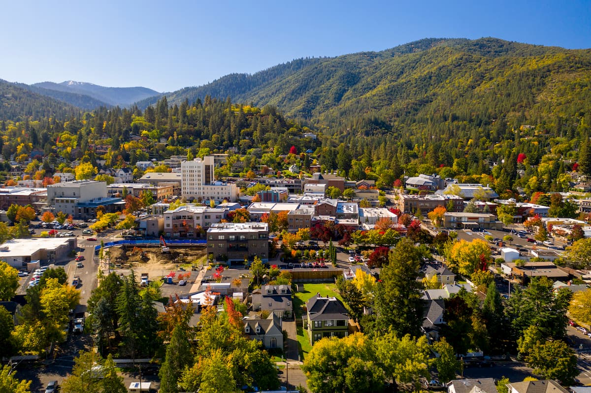
The city of Ashland sits under two hours west of the Fremont-Winema National Forest. Ashland is a city located in Southern Oregon with a population of around 21,000. The small city is known for being home to the Oregon Shakespeare Festival. The town is known for being very liberal, a sharp contrast to much of southern Oregon. Many of the city’s historical buildings have been preserved which give the downtown a quaint setting. Ashland is the perfect place to stay after a long hike in the mountains and is ideal for grabbing a bite to eat or check out a local gallery. The nearby city of Medford also has ample housing with close proximity to the surrounding mountain trails.
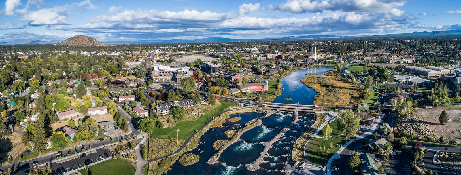
Two hours to the north of the Fremont-Winema National Forest sits the city of Bend. Bend is the largest city located in eastern Oregon with a population of nearly 100,000. The city is located on the Deschutes River and is known for being an outdoor paradise. To the west lies the lake and peaks of the Cascade Mountains, along with Mount Bachelor Ski Resort, while a trail in the city leads to the top of Pilot Butte. To the south lies the High Desert Museum and Newberry National Volcanic Monument. Just north of town is one of the state’s most iconic rock-climbing locations, Smith Rock State Park. As a whole, the city is a mecca for trail running, skiing, mountain biking, hiking, rock climbing, and even surfing in the river. Besides the abundance of outdoor activities, Bend is known for its numerous breweries and restaurants.


volcano
oregon-9000ers
cascade-range-9000ers
western-state-climbers
western-state-climbers-star
chemeketan-18-nw
cascade-volcanoes-pin
volcano
oregon-9000ers
cascade-range-9000ers
western-state-climbers
western-state-climbers-star
chemeketan-18-nw
cascade-volcanoes-pin


