
Scan the QR code and open PeakVisor on your phone
The Pine Nut Mountains are a north to south running mountain range situated in the western region of the US state of Nevada. The rugged range marks some of the westernmost peaks in the state. There are 32 named peaks in the range with the tallest and most prominent being Mount Siegel at 9,432 feet (2,875 m) tall with 3,455 feet (1,053 m) or prominence.
The Pine Nut Mountains lie in western Nevada, marking one of the most western subranges of the Great Basin Ranges. Though it is surrounded by sections of Toiyabe National Forest, it is not designated as part of the forest.
The range spans roughly 40 miles (64 km) in length and between 10-12 miles (16-19 km) in width. On the west side of the range lies Carson Valley which spans for 14 miles (22.5 km) to the eastern foothills of the Sierra Nevada. Mason Valley lies just east of the range.
Surrounded by other mountain ranges, the Pine Nut Mountains are situated between the Virginia Range to the north and the Sierra Nevada to the south.
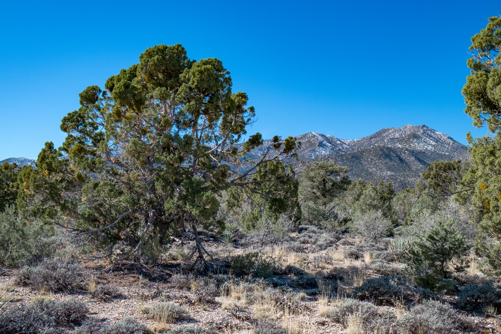
The tallest peaks in the range are free of much flora, characteristic of desert peaks found throughout the state of Nevada. The entire range lies within Douglas and Lyon counties. Elevations rise steadily from the valley floor up to the main ridgelines.
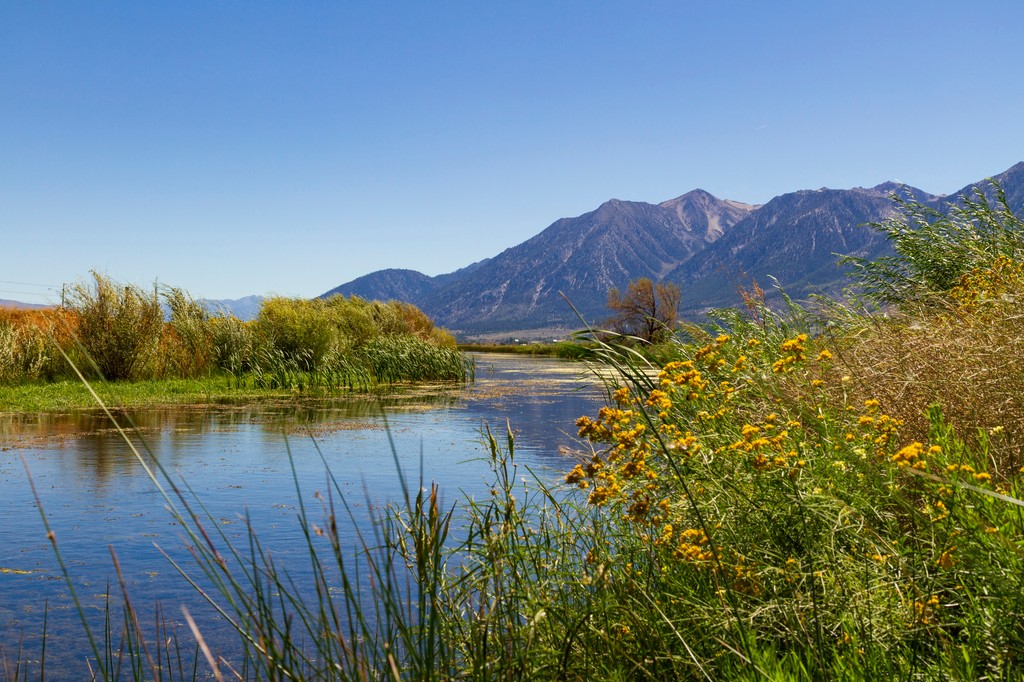
The Pine Nut Mountains lie within the rain shadow of the Sierra Nevada, creating a dry and arid climate. This terrain makes it difficult for most plant life to thrive. The rolling hillsides and barren ridgelines allow hikers to experience stunning views throughout much of the range.

Low growing grasses and thick brush dominate this mountain range. The highest peaks in the range are often covered in snow from December through April. Artesia Lake lies just east of the range while Topaz Lake lies directly south. There are no major rivers or streams within the range.
The Pine Nut Mountains are surrounded by portions of the Humboldt - Toiyabe National Forest. The Burbank Canyons Wilderness Study Area lies within the range while the Lake Tahoe Basin management Unit and Tahoe National Forest are situated further west. The Mount Rose Wilderness Area is to the northwest.
The peaks within the Pine Nut Mountains are part of the larger Great Basin Ranges, which extend throughout much of the states of Nevada, Utah, Idaho, Oregon, and California. This range marks one of the western most subranges.
The entire Great Basin Region was formed through tectonic extension. The Earth’s crust in the region was continually stretched and folded during the Early Miocene. This extension led to a series of alternating valleys and mountain ranges, giving the region its name.
Fault lines on either side of the ranges have resulted in continual extension in the area. As the surrounding valleys are slowly dropping in elevation, the peaks continue to rise slightly with each passing year.
During the Pleistocene, glaciers formed throughout the nearby Sierra Nevada, carving away the landscape as they slowly retreated. Despite the Pine Nut Mountains' close proximity to the Sierra Nevada, it does not feature any major glacial geological features.
These peaks feature a metamorphic and igneous rock core complex while the outer layers are primarily sedimentary in origin.

Major peaks within the Pine Nut Mountains include Mount Siegel, Lyon Peak, Mount Como, Mineral Peak, and Galena Peak.
The desert peaks are relatively free of flora, often covered in thick brush and stands of both pinyon pine and juniper trees. The single-leaf pinyon trees dominate the landscape between 5,000-7,000 feet (1,524 - 2,134 m) These trees produce pine nuts, for which the range is named after.
The Sierra Nevada, which lies just 20 miles (32 km) west of the Pine Nut Mountains, features more densely forested hillsides and a plethora of plant and animal life.
Common animals in the region include pronghorn antelope and mule deer. Various species of rodents, lizards, and raptors are also common. Hikers are likely to spot either prairie falcons or golden eagles.
The land surrounding the Pine Nut Mountains has been inhabited by humans for thousands of years. Archaeological evidence found in what is now called Nevada and California shows that humans have lived in the region for roughly 10,000 years.
Many Indigneous communities and tribes have inhabited land in eastern Nevada and western California since time immemorial. The most prominent tribal nation who has ancestral ties to this region is the Washoe Tribe (Wašišiw).
The Pine Nut Mountains mark the western stretches of the Washone people who traditionally lived in the Lake Tahoe Basin (the lake is called Dáʔaw in Washo). The Indigenous Tribes were primarily hunters and gatherers who harvested acorns and hunted for deer, rabbits, and elk.
Settlers of European descent first arrived in the region during 1844, led by John C. Frémont. Gold was discovered in the region shortly after leading to a large influx of both settlers and miners.
The rising population led to the Washone people being forcibly removed from their traditional homelands. Small mining communities were established throughout the region, many of which have transformed into mountain resort towns.
Despite their continual efforts, the Indigneous Tribes of the area were repeatedly harassed, attacked, displaced, and killed by settlers who were backed by the US government. Today, the Washoe Tribe of Nevada and California has a parcel of land that encompasses parts of both states and covers around 64,300 acres (26,000 ha) of terrain.
The transcontinental railroad traveled through this region during the 1860s. While most people would eventually settle in present-day California, some stayed in what would later become Carson City and Reno.

The Pine Nut Mountains are surrounded by sections of the Toiyabe National Forest, which was originally established as a forest reserve in 1908. Today there are no designated hiking trails found within the range.
While there are no designated trails in the range, some primitive trails have been created over the past few decades. Most of these routes lie along the foothills of the range. Those wishing to explore the region should be equipped to navigate the terrain, especially due to the lack of signage.
Common hikes in the range include:

Looking for a place to stay near the Pine Nut Mountains? Here are some of the best cities and villages to check out in the region.
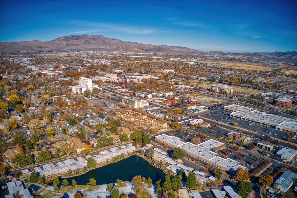
Situated in a valley between the Pine Nut Mountains to the east and the Sierra Nevada to the west, lies Carson City. Home to around 59,000 residents, Carson City marks the sixth most populous city in the state of Nevada. Known for being the capital of the state, the city offers a more quiet and relaxing atmosphere compared to nearby Reno.
The downtown streets are lined with local restaurants, shops and museums including the Nevada State Museum and the Nevada State Railroad Museum. Carson City is surrounded by trails for hiking, trail running, and mountain biking. In less than thirty minutes, visitors can drive from downtown Carson City to the eastern shores of Lake Tahoe.
The winter months provide locals and visitors alike with a plethora of opportunities for snow sports. Fifteen ski resorts surround the Lake Tahoe region along with opportunities for nordic skiing and backcountry skiing.
Reno lies just north of the Pine Nut Mountains, a thirty minute drive from Carson City. Often referred to as “The Biggest Little City in the World,” Reno is home to world-class access to outdoor recreation and a plethora of casinos.
The city is home to around 425,000 residents, making it the second most populous city in Nevada after Las Vegas. The Nevada Museum of Art is also located in Reno, amidst the plethora of casinos. Besides gambling opportunities, Reno is surrounded by areas for hiking, mountain biking, rock climbing, water sports, and snow sports during the winter months.


nevada-peaks-club
western-state-climbers
tahoe-ogul
great-basin
nevada-peaks-club
western-state-climbers
tahoe-ogul
great-basin


