Scan the QR code and open PeakVisor on your phone
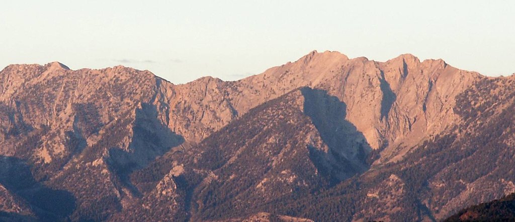
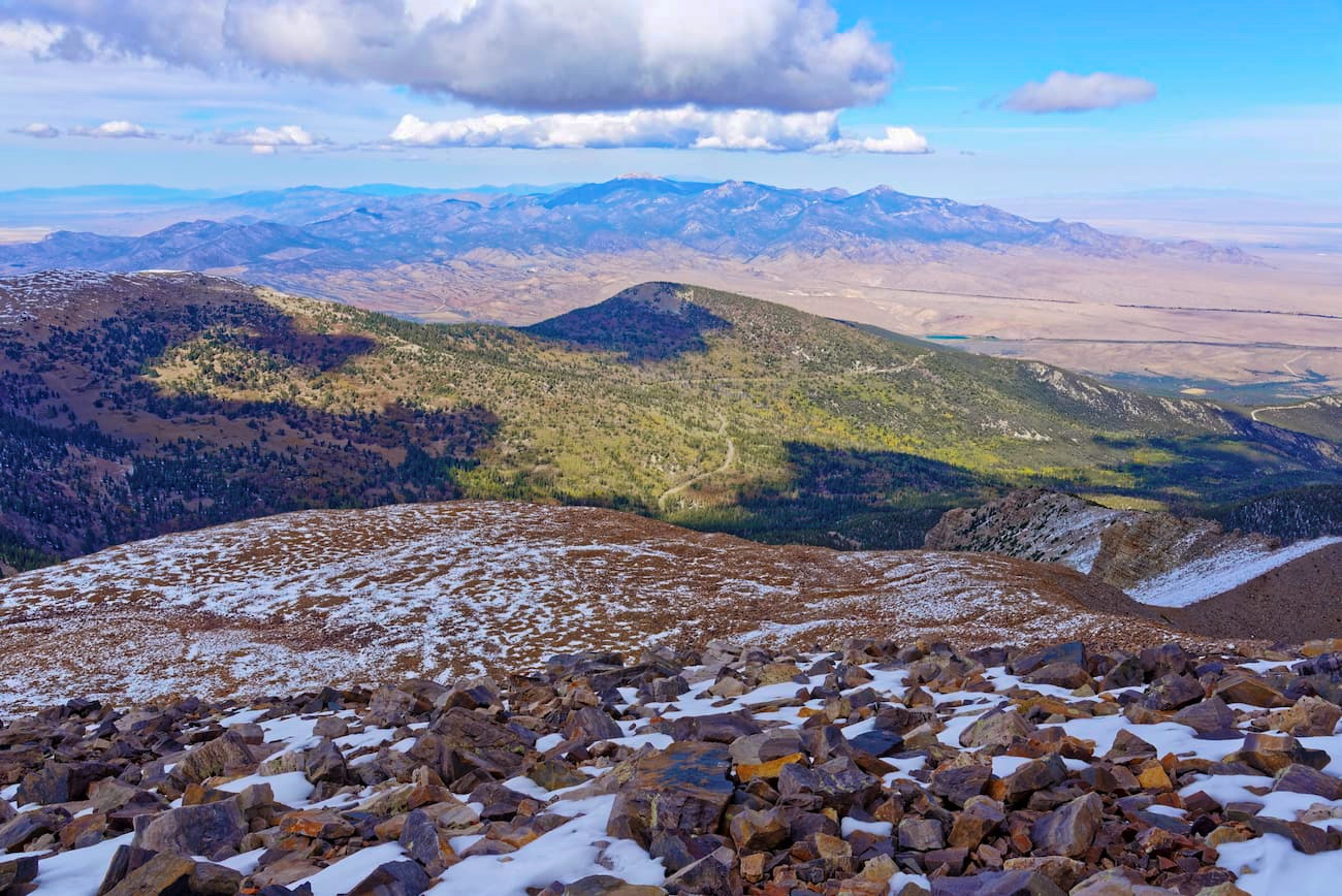
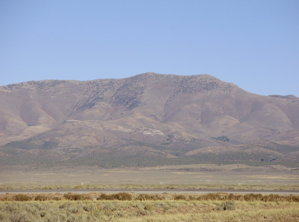
The Diamond Mountains are part of the Great Basin Ranges in central Nevada in the United States. The range is approximately 60 miles (97 km) long and six to nine miles (9.5 to 14.5 km) wide, located primarily in Eureka and White Pine counties on public BLM land. There are 31 named mountains. At 10,604 ft (3,232 m), Diamond Peak is the tallest and the most prominent (3,586 ft/1,093 m).
The Diamond Mountains lie mainly within Eureka and White Pine counties in Nevada. Newark Valley lies to the east and Diamond Valley, at an elevation of around 5,700 ft (1,737 m), lies to the west. The northern portion of the Diamond Valley is an alkali (or salt) flat, common to the valleys of Nevada.
The Great Basin Ranges generally have steep north-south running mountains separated by valleys. The Diamond Mountains follow this trend, stretching north-south for approximately 60 miles (97 km) and spanning between six and nine miles (9.5 to 14.5 km) wide. The mountains are steep with many narrow canyons carved through them.
The range is monitored by three BLM planning areas and three Herd Management Areas. Wild horses live near Diamond Peak during the warm months and shift to the valleys during winter.
The mountains are surrounded by patches of the Humboldt-Toiyabe National Forest and several wilderness areas are located nearby – the Ruby Mountain Wilderness, Red Mountain Wilderness, and Currant Mountain Wilderness, to name a few.
The Diamond Mountains are part of Nevada’s Great Basin Ranges. During the Miocene era, crustal extensions warped and shaped the landscape into the pattern of ranges bound by valleys that is seen today. Mountains in this region are usually rich in mineral resources.
The Eureka Mine near the southern end of the Diamond Mountains contains several rock types. Some deposits are located in Cambrian limestone. Igneous rocks show up as quartz monzonite stock and quartz porphyry dikes from the early Cretaceous, andesite from the middle Eocene, and rhyolite from the middle Oligocene.
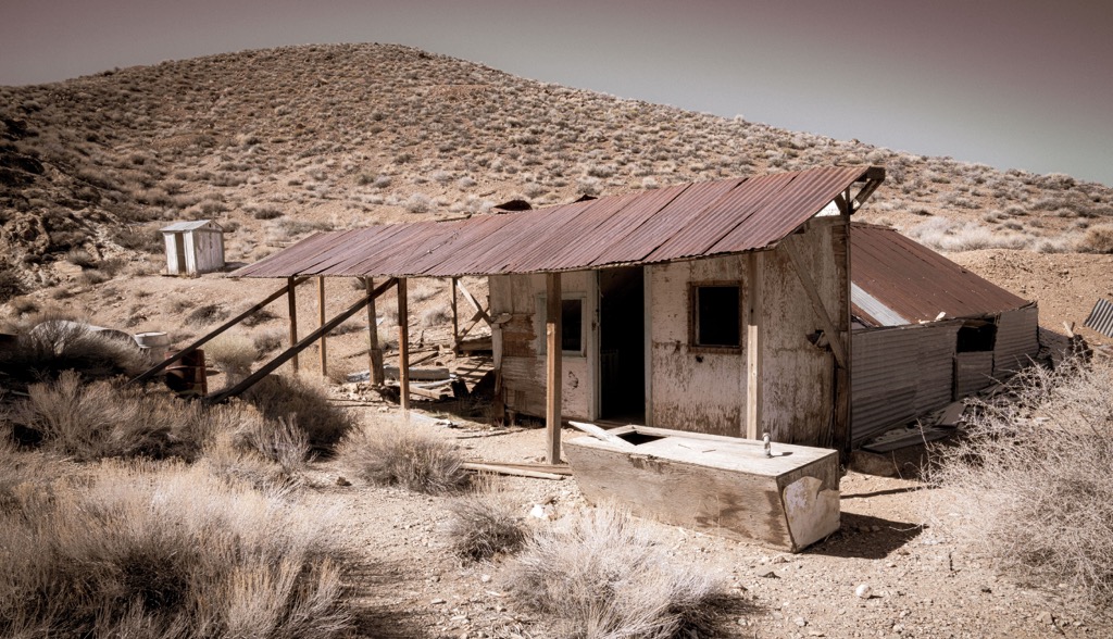
Silver was discovered in the area in 1864. It took several years to develop smelters in the area to extract silver from the complex lead ores. Once these smelters were in place, large-scale mining took off and thrived from the late 1800s into the early 1900s. The region was a major producer of lead, silver, gold, and zinc.
The area around the Diamond Mountains can experience temperatures over 100 Fahrenheit (38 C) in summer and -20 Fahrenheit (-29 C) in winter. Rainfall is scarce with annual precipitation between five and 16 inches (12.7 and 40.6 cm).
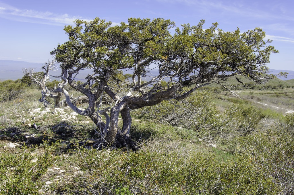
Pinyon pine, juniper, mountain mahogany, and sagebrush grow at the highest elevations with the most precipitation. Bitterbrush, serviceberry, and snowberry provide good browsing feed for deer.
In the lower and drier areas, saltbrush, greasewood, and sagebrush dominate. There are also a number of grasses and wildflowers such as needle-and-thread, bluegrass, Indian ricegrass, bottlebrush, squirrel tail, scarlet globemallow, phlox, lupine, and asters. Cheatgrass is invasive and common on the lower rangeland.
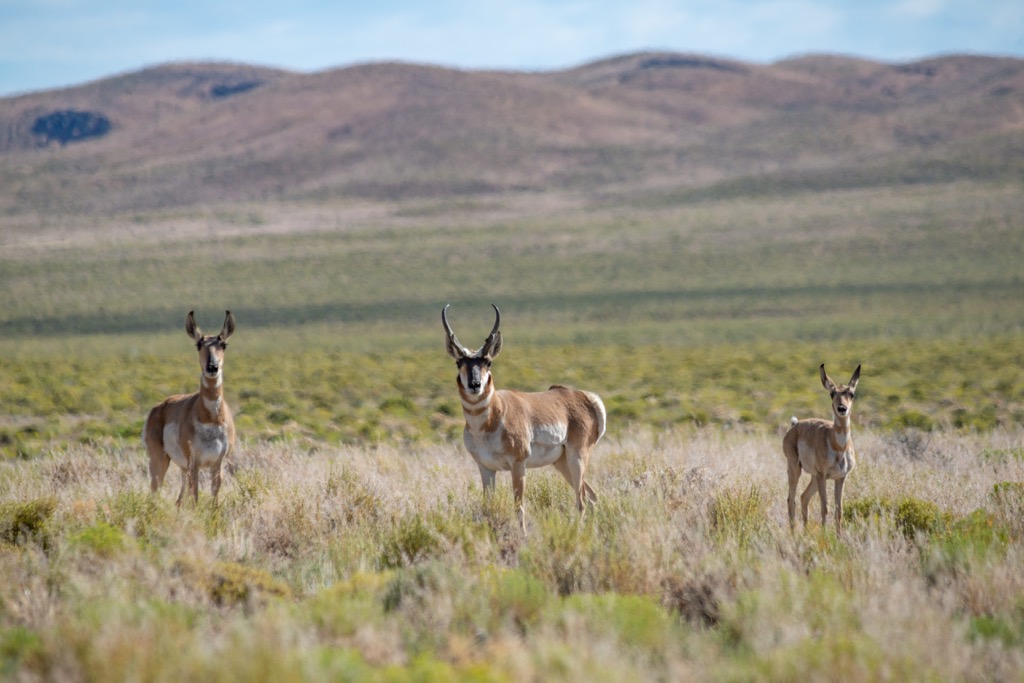
Wild horses may live near Diamond Peak in the warmer months and move to lower elevations when there is snow on the mountains. Other wildlife that calls these mountains home includes mule deer, sage grouse, chukar, coyotes, mountain lions, bobcats, pronghorns, and a number of birds, reptiles, and small mammals.
The Diamond Mountains and surrounding area fall within the traditional territory of the Western Shoshone. The Shoshone come from a people known as the Newe. It was white settlers in the 1820s who began to refer to the tribe as the Shoshone.
Their early contact with Europeans was largely with fur trappers beginning in the 1800s. After the discovery of mineral deposits in Nevada and California around the mid-1800s, many foreigners began immigrating into the region and claiming the most fertile lands for themselves.
Eureka, just south of the mountains, was the first big silver-lead district in the US and Nevada’s second largest mineral producer in the 1800s. It took several years after the discovery of silver in 1864 to create the smelters that allowed the silver to be extracted from complex lead ores. The construction of smelters allowed large scale mining to take off.
In 1870 a stage route was built between Eureka and Palisade along the Transcontinental Railroad. In 1875 the Eureka & Palisade railroad was finished, helping establish Eureka as a main shipping center for the region’s mining districts.
One further implication of the industry in the region was the demand for charcoal that accompanied the smelters. This demand for charcoal led to about 5,000 acres (2,025 ha) of forest being cut per year in the late 1800s, leading to rapid deforestation in a wide radius around the city.
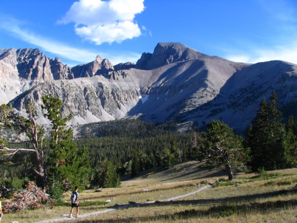
The Diamond Mountains don’t get many visitors but those wanting to explore can do so on their own. It is possible to drive to the top of Newark Mountain (8,816 ft/2,687 m). Richmond Mountain (8,383 ft/2,555 m) is another mountain in the range near Eureka that is sometimes visited. Besides that, Diamond Peak (10,604 ft/3,232 m) is sometimes bagged for being the tallest in the range.
It is a Class 2 scramble to summit Diamond Peak. It is likely you’ll have the trail to yourself, or perhaps sharing with the odd hiker, climber, or BLM official. On the way up, you’ll pass limber pine groves that are found only at high elevations in the region. As with most hikes in the Great Basin Ranges, there are great views of the surrounding valleys from the top.
There are a few ways to tackle the mountain. One route suggests parking near Poison Spring. From here, keep to the ridgeline for the best footing although it will be steeper than traversing the side of the slope. From Poison Spring, the route will be about 9.5 mi (15.3 km) out and back with about 3,200 ft (975 m) elevation gain. If your vehicle can handle it, drive further to cut down the mileage and elevation gain on the hike.
Elko is the nearest city and Reno is just under five hours away. Las Vegas and Salt Lake City, Utah are both around five and a half hours away. Small towns like Eureka and Ely lie closer and there are options for campgrounds in the neighboring Humboldt-Toiyabe National Forest.
Located two hours drive to the north, Elko has a population of 20,500 people. Check out the rodeo scene, explore ghost towns or head to the Ruby Mountains for some hiking while you’re in town. If you like poetry and cowboy culture, plan your visit during the city’s National Cowboy Poetry Gathering.
The city offers a selection of burger joints, steakhouses, Mexican, old west saloons, and a few varied restaurant options like vegetarian and sushi. If you’re looking to stay over, you’ll find a range of hotels, motels, and campsites and RV parks near the city.

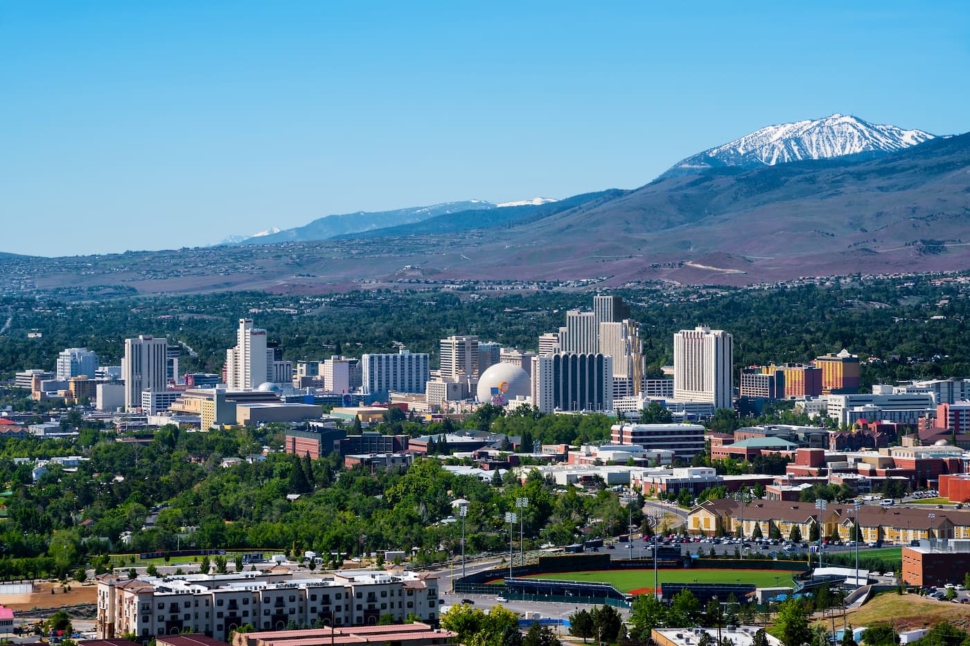
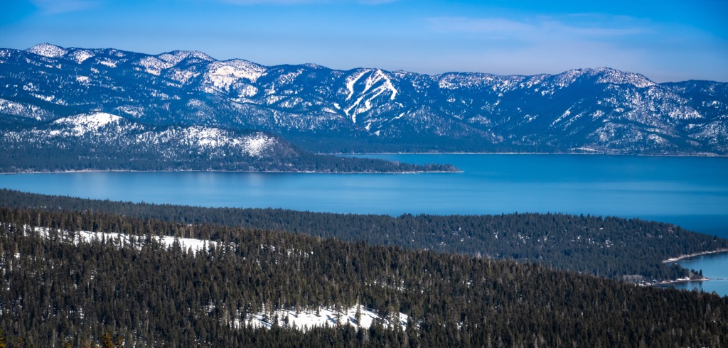
Reno has a population of 269,000 people and is less than five hours away to the west. Located near Lake Tahoe, there are ample opportunities for hiking, skiing, fishing, rock climbing, and paddling depending on the season and your preference. Visit the Nevada Museum of Art while in town, or wander on your own to catch glimpses of the murals and sculptures located throughout the city. One of Reno’s summer specialities is the Lake Tahoe Shakespeare Festival.
If you’re looking to grab a drink or bite to eat, you can choose from a number of craft brewers and distillers and find options ranging from casual, American fare to international cuisines and fine dining. Lodging options in the area include hotels, resorts, vacation rentals, cozy B&Bs, RV parks, and campsites in the great outdoors.