
Scan the QR code and open PeakVisor on your phone
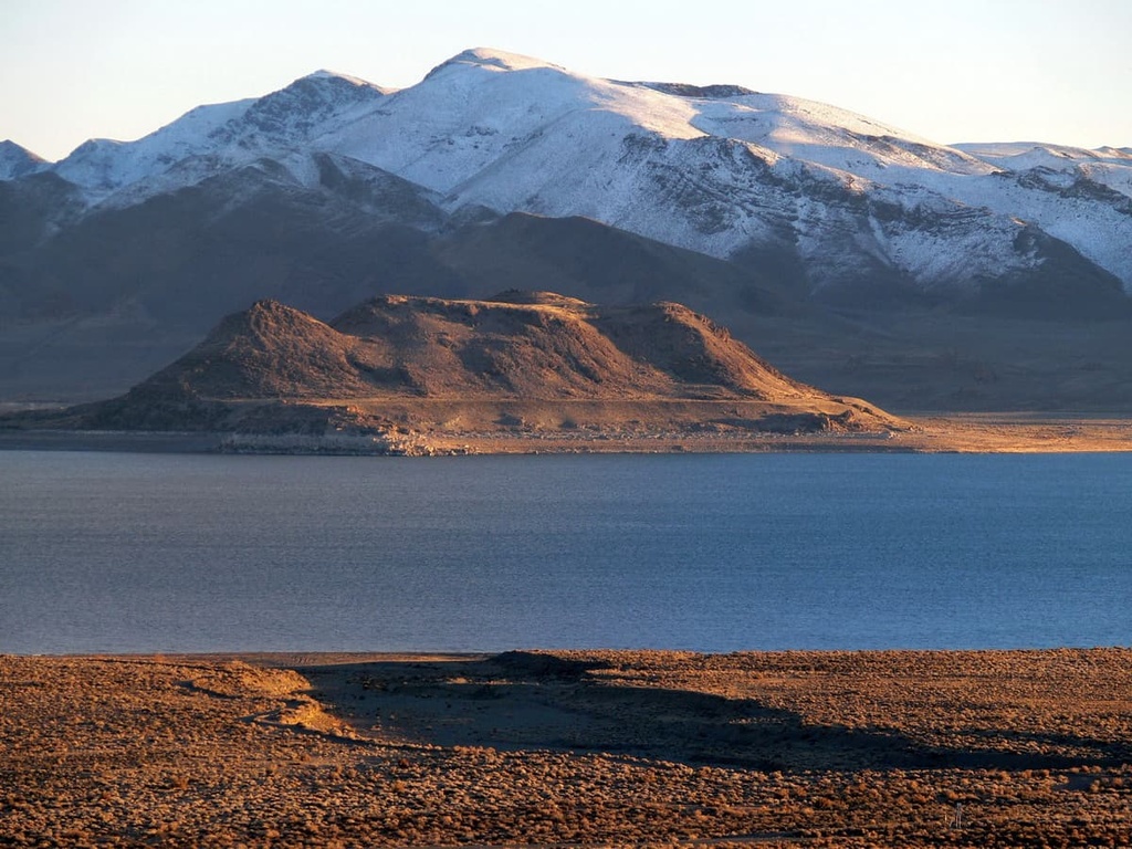
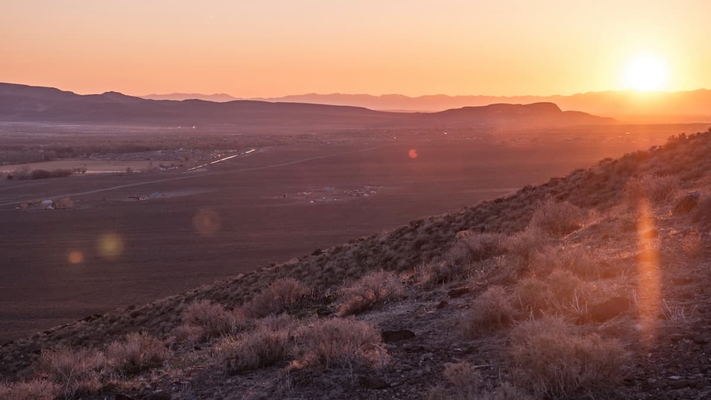
The Lake Range is a collection of peaks that extends for approximately 36 miles (58 km) through Washoe County in the northwestern part of the US state of Nevada. The range contains 7 named mountains, the highest and most prominent of which is Tohakum Peak (8,182 ft/2,494 m).
The Lake Range is located about 70 miles (113 km) to the north of Reno, Nevada and 70 miles (113 km) to the south of the Black Rock Desert. It’s situated between Pyramid Lake (Cui-ui Pah) to the west and the waterless Winnemucca Lake to the east. The southern two-thirds of the range lie within the boundaries of the Pyramid Lake Paiute Tribe Reservation.
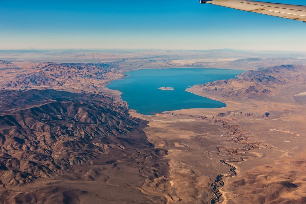
Pyramid Lake is roughly 15 miles (24 km) long and 11 miles (18 km) wide. It covers 112,000 acres (45,325 ha) of the Pyramid Lake Paiute Tribe Reservation. The Truckee River flows out of Lake Tahoe in the Sierra Nevada of California and ends at Pyramid Lake.
Long before European-American settlers arrived in the area, a channel split off the Truckee River to fill Winnemucca Lake. This now-dry distributary channel is known as Mud Lake Slough and lies to the southeast of the Lake Range. Beyond Pyramid Lake are the Virginia Mountains and Pah Pah Range.
Anaho Island, a rocky island located at the southeastern end of Pyramid Lake, is protected by the Anaho Island National Wildlife Refuge.
To the east, the now-dry Winnemucca Lake sits at an elevation of 3,770 ft (1,150 m) and covers about 28 miles (45 km) of land along the border of Washoe and Pershing Counties.
Home to the oldest known petroglyphs in North America, Winnemucca Lake separates the Lake Range from the Nightingale Mountains and Selenite Range. The Winnemucca lakebed should not be confused with Winnemucca Lake in California near Carson Pass.
Located just east of the California state line, the Lake Range lies between two markedly different physiographic provinces—the Sierra Nevada to the west and the Basin and Range to the east. As such, the landscape surrounding the range has a unique and complex geologic history.
Pyramid Lake and the now-dry Lake Winnemucca are two of seven smaller lakes that collectively formed Lake Lahontan, a colossal ancient lake that covered much of western Nevada during the late Pleistocene Epoch.
At its historic maximum, Lake Lahontan was about 715 ft (281 m) deep and covered 8,500 sq. mi (22,800 sq. km) of terrain. During the most recent glacial period, Lake Lahontan was one of the largest lakes in North America.
Lake Lahontan formed during the last glacial maximum, when the regional climate was significantly cooler and wetter. A warming climate near the end of the Pleistocene epoch led to a gradual desiccation of ancient Lake Lahontan.
As the lake’s surface elevation dropped, it broke up into a series of small lakes and playas. These plays include what are now called the Black Rock Desert, the Carson Sink, and the Humboldt Sink.
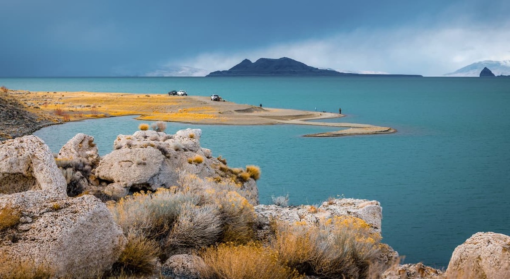
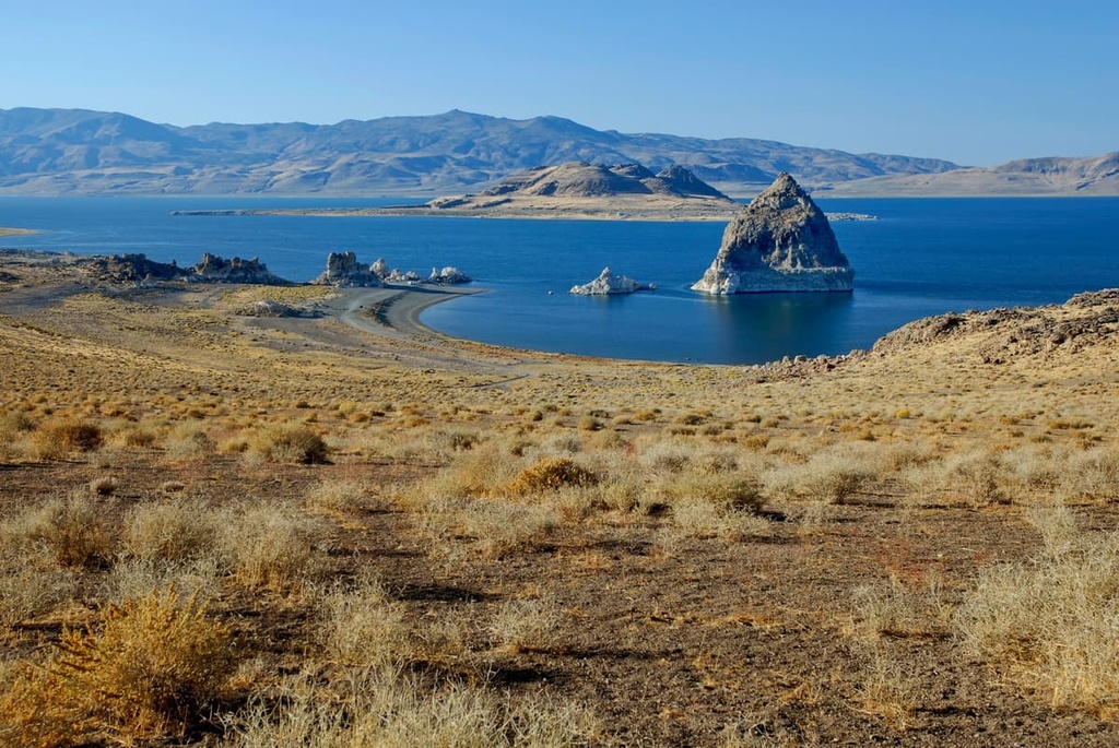
The greatest remnant of Lake Lahontan is Pyramid Lake, which takes its name from pyramid-shaped deposits of tufa, rock formed by the precipitation of calcium carbonate from spring water, lake water, or a combination of the two.
Today, Pyramid Lake is the site of some of the world’s most spectacular calcium carbonate tufa deposits. These impressive landforms formed in the Pyramid Lake subbasin roughly 26,000 and 13,000 years ago.
Nearby, Winnemucca Lake remained a shallow lake until the 1930s when a dam and road were constructed that restricted water flow to the area.
The Lake Range lies in the Central Basin and Range ecoregion of Nevada, as defined by the US Environmental Protection Agency and US Geological Survey. Pleistocene lakes, like Lake Lahontan, have greatly influenced the environment in this region.
Higher elevations in this region are covered by sagebrush, grasses, and scattered Utah juniper. Low sagebrush and black sagebrush grow above the woodland zone. Cool season grasses, including bluebunch wheatgrass, dominate the understory in the northern part of the range, while warm season grasses, like Indian ricegrass, dominate the understory in the south.
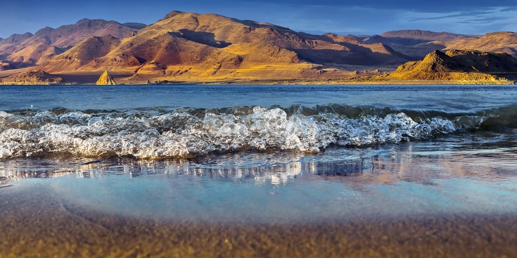
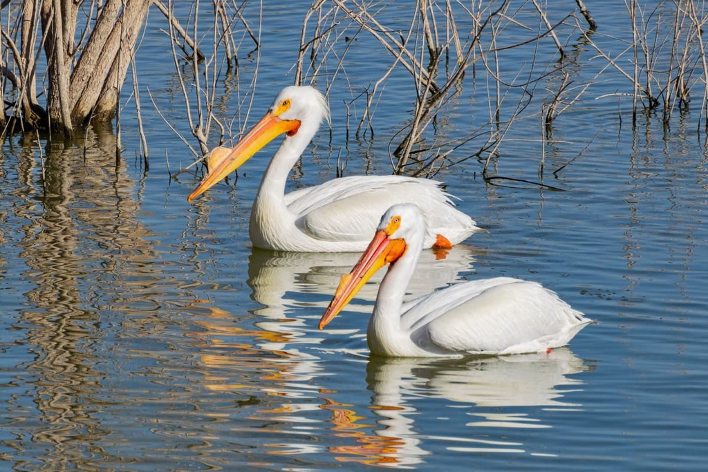
Pyramid Lake is one of the last remaining strongholds for Lahontan cutthroat trout and is home to the endangered cui-ui, which was once the main food source of the Paiute people. Plant communities surrounding the lake include desert shrubs, but also include limited riparian and wetland habitats.
Located on Pyramid Lake, Anaho Island sustains extensive nesting colonies of American white pelican, double-crested cormorants, great blue herons, and California gulls. Peregrine falcons have also historically nested on the island.
Archeological evidence unearthed near Pyramid Lake and cultural knowledge suggests that the lake has been continuously inhabited by humans for at least 10,000 years.
Before Europeans arrived in western Nevada, the Northern Paiute and Shoshone thrived in the area despite the region’s scarce natural resources.
The Northern Paiute traditionally subsisted on cui-ui and Lahontan cutthroat trout from Pyramid Lake. They also traditionally hunted deer and rabbit, gathered pinyon nuts in the mountains as a critical food source, and gathered grass seeds and roots.
The first White settler to travel to the Pyramid Lake region was likely John C. Fremont, who in 1844 gave Pyramid Lake (Cui-ui Pah) its English language name after the pyramid-shaped rock formation that rises from its eastern shore. The rock formation, which is known as the Stone Mother, is sacred to the Pyramid Lake Paiute Tribe.
In the mid-1800s, the discovery of silver in the Washoe Hills enticed more White settlers into the region. Colonizers and miners devastated the region’s important natural resources and forcibly took possession of the area’s critical water sources and grazing lands.
Several violent encounters between the Paiute and Euro-Americans occurred in the area throughout the 1850s and 1860s. During the early part of the summer of 1860, these hostilities came to a head in the Pyramid Lake War, which was centered around Pyramid Lake.
Today, the Pyramid Lake Paiute Tribe Reservation covers 475,000 acres (192,226 ha) of northwest Nevada.
The reservation is centered around Pyramid Lake, which covers about 112,000 acres (45,325 ha), but it also encompasses portions of Winnemucca Lake, most of the Lake Range, portions of the Virginia Mountains and Pah Pah Range, as well as the southern end of the Smoke Creek Desert.
Most of the Lake Range lies in the Pyramid Paiute Tribe Reservation. Though visitors are encouraged to visit and recreate in the Pyramid Lake area, they are asked to respect and follow all tribal laws and restrictions.
Several natural attractions in the area are sacred to the Paiute people and are off-limits to visitors. This includes Anaho Island, the Needles area, Marble Bluff, and the Pyramid/Stone Mother, all of which are closed to the public.
Remember that access to the beauty of Pyramid Lake is an incredible privilege—not a right—for visitors. Strict adherence to all tribal regulations is of the utmost importance for any visit to this sacred landscape.
The most popular destination near the Lake Range is Pyramid Lake. One of the only places in the world where the ancient cui-ui can be found, Pyramid Lake is a world-class fishery. Visitors to Pyramid Lake can also learn more about the history of the Paiute at the Pyramid Lake Paiute Museum and Visitor Center.
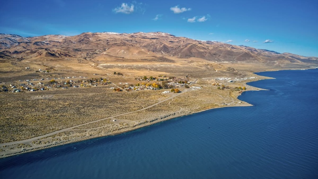
Keep in mind that much of the lake’s eastern and northern shoreline is closed to visitors. However, visitors are encouraged to visit one of the many beaches and marinas open to the public on the lake’s western shoreline.
Note that anyone who wants to swim, fish, or camp around Pyramid Lake is required to purchase a tribal permit. You can get a tribal permit online or at the ranger station in Sutcliffe, Nevada.
This region of Nevada is sparsely populated. However, there are a couple of metropolitan areas nearby. If you’re visiting the Lake Range, here are some great places to stay during your trip..
Known as “The Biggest Little City in the World,” Reno is Nevada’s second largest city and the closest major city to the Lake Range.
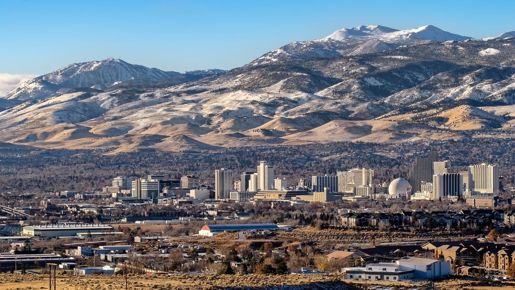
Reno is well-known for its lively entertainment scene, luxury hotels, and renowned sporting events. But it’s also centrally located to exceptional outdoor recreation destinations, including Lake Tahoe, Tahoe National Forest, and Lassen National Forest.
Home to the Reno-Fernley Raceway, Fernley is a rural town that was established in 1904 as an agricultural and ranching community.
Fernley has a population of under 20,000 permanent residents. But its location along Interstate 80 makes it the perfect stop for anyone traveling through remote western Nevada.


nevada-peaks-club
western-state-climbers
western-state-climbers-emblem
great-basin
nevada-peaks-club
western-state-climbers
western-state-climbers-emblem
great-basin


