
Scan the QR code and open PeakVisor on your phone
The Stillwater Range is a chain of peaks that stretches for 70 miles (113 km) through Churchill County and Pershing County in the US state of Nevada. The range contains 24 named mountains, the highest and most prominent of which is Job Peak (8,780 ft/2,676 m).
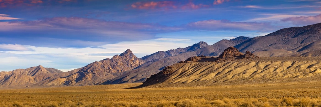
The Stillwater Range forms a natural barrier that separates the Carson Sink, a playa in the Carson Desert, and Lahontan Valley from the Dixie Valley in north-central Nevada. Three peaks in the Stillwater Range reach over 8,000 feet (2,438 m): Job Peak, Table Mountain, and Mount Lincoln.
To the north, a low pass separates the range from the East Range. To the south, Sand Springs Pass separates the range from the Sand Springs Range. A 600-foot (183 m) sand dune, Sand Mountain, also lies along the southern boundary of the Stillwater Range between Four Mile Flat and Sand Springs Pass.
The Stillwater Range Wilderness Study Area includes the central third of the Stillwater Range and the Job Peak Wilderness Study Area contains the southern third of the range.
Within the last few years, however, the US military has proposed lifting development restrictions in the Stillwater Range Wilderness Study Area, as well as nearby Job Peak, Clan Alpine Mountains, Desatoya Mountains, and Gabbs Valley, in order to expand the Fallon Range Training Complex, a navy-managed training complex.
To the southwest of the Stillwater Range, the Stillwater Wildlife Management Area, Stillwater National Wildlife Refuge, Fallon National Wildlife Refuge, and Anaho Island National Wildlife Refuge collectively form the Stillwater National Wildlife Refuge Complex.
The complex encompasses about 163,000 acres (65,964 ha) of important wetland and upland habitats and contributes substantially to the conservation of wildlife in the western Great Basin.
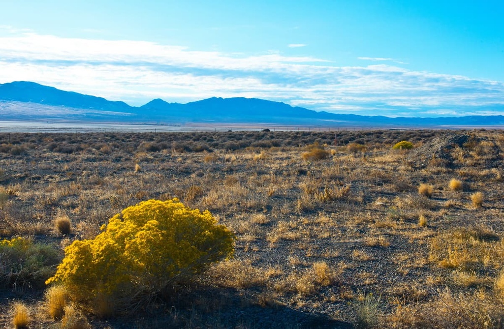
The Stillwater Range lies in the Basin and Range province, a region that is characterized by alternating flat valleys and narrow mountain chains. The Basin and Range province covers a large portion of the western US and northern Mexico.
Though the geology in this region is complex, the topography of the Basin and Range province is largely attributed to tectonic extension that began in the Early Miocene.
The Stillwater Range has been uplifted several miles relative to bordering basins since Basin and Range faulting began. The Dixie Valley fault bounds the east side of the range, and the southern part of the range was tilted 40 to 90 degrees to the east during a period of extensional faulting that took place throughout the early Miocene.
A series of earthquakes occurred beneath the Stillwater Range in the 1950s. Extensive surface rupturing occurred along the eastern slope of the range from earthquakes measuring 6.6-7.1 on the Richter Scale.
In 1954, the Dixie Valley Earthquake produced surface ruptures up to 2.8 m (9.2 ft) high along the southern part of the Dixie Valley fault zone. As a result, the eastern flank of the Stillwater Range, which is located adjacent to the Dixie Valley geothermal area, hosts one of the best exposures of Mesozoic thrust faults in the Basin and Range province.
The bedrock of the Stillwater Range is made up of allochthonous thrust plates of Triassic and Jurassic oceanic sedimentary and Jurassic igneous rocks. To the west of the Stillwater Range, the Stillwater Marshes contain remnants of an ancient lake that once covered 8,900 square miles (23,051 sq. km.) of land during the Pleistocene Period.
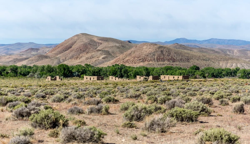
In the 1860s, silver was discovered in the area and several mining districts were established. Remnants of these mining camps are still scattered throughout the Stillwater Range. One such district, La Plata, lies at the southern end of the Stillwater Range. La Plata was once owned by the Silver Wave Mining Company and was the county seat of Churchill County from 1864 to 1868.
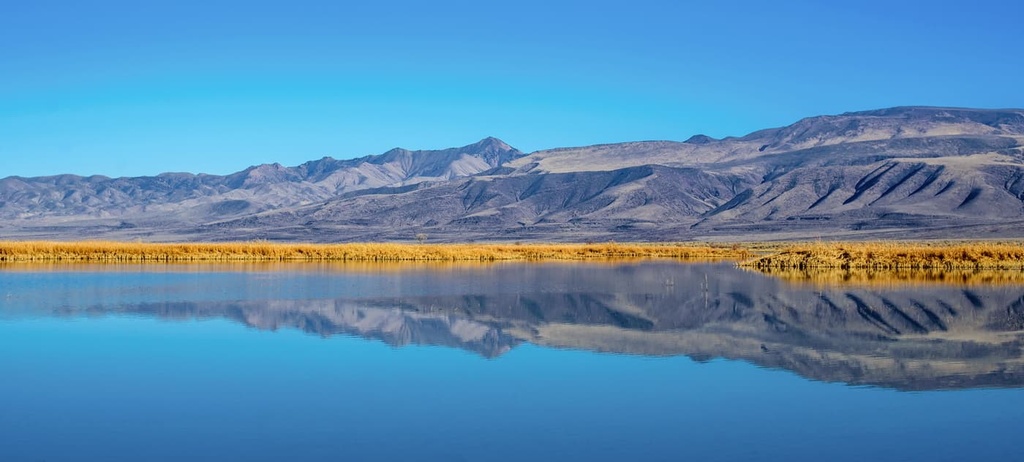
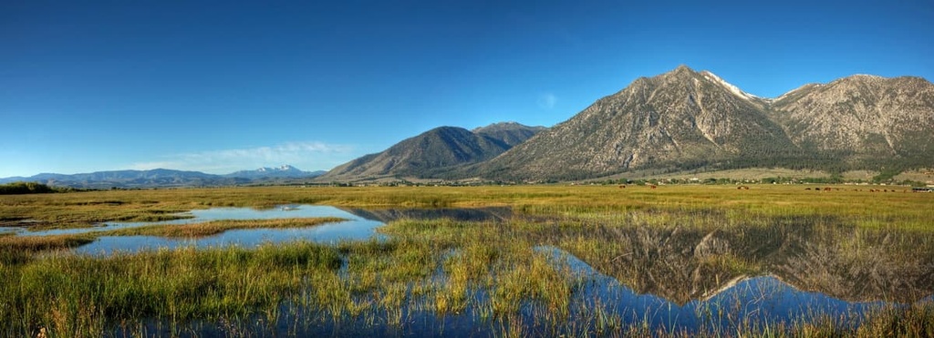
Located adjacent to the Stillwater Range, the Stillwater National Wildlife Refuge Complex encompasses about 163,000 acres (65,964 ha) of biodiverse landscapes. It is home to wetland and upland habitats, freshwater and brackish water marshes, cottonwood and willow riparian areas, alkali playas, salt desert shrublands, sand dunes, and a 500-acre (202 ha) island.
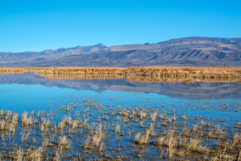
The Stillwater wetlands are cherished by birders and are globally renowned due to the hundreds of thousands of shorebirds that pass through the area during migration. More than a quarter million waterfowl and over 20,000 other water birds, including American white pelicans, double-crested cormorants, white-faced ibis, gulls, and herons, have been spotted in the wetlands.
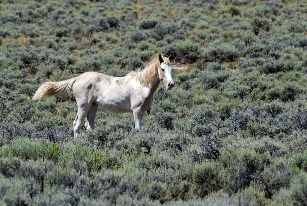
Nearly 400 wildlife species, including 260 bird species, rely on habitats within the Stillwater National Wildlife Refuge Complex. Other known residents of the Stillwater Range region include coyotes, white-tailed antelope squirrels, jack rabbits, kangaroo rats, several species of lizards, and a few species of snakes.
Desert bighorn sheep, once native to the Stillwater Range, were eliminated through poaching and diseases transmitted by domestic sheep until the 1940s but have since been successfully reintroduced.
The earliest inhabitants of the Great Basin are estimated to have arrived as early as 10,000 BCE, when an ancient lake, Lake Lahontan, covered the valleys of western Nevada.
When the first Euro-American pioneers arrived in the area surrounding the Stillwater Range, in the mid 1800s, they more than likely met the Cattail-Eater Paiute, a Northern Paiute tribe that is now part of the Paiute-Shoshone Tribe of the Fallon Reservation and Colony.
The Cattail-Eater Paiute thrived in the region's harsh desert environment. They often lived near wetlands and lakes that supplied ample fish, waterfowl, and plants. They were also highly innovative as a community, constructing mat-covered houses, tule duck decoys for hunting, and tule balsa boats equipped to navigate nearby marshes.
In the late 1800s, many emigrants made their way through the Great Basin in search of gold in the west. Many established farms and pastures along the way, devastating marshes, meadows, and river bottoms and forcing indigenous people from their homeland.
In the 1860s, growing hostilities between US emigrants and the Northern Paiute prompted the establishment of Fort Churchill, a military outpost near the Carson River.
The outpost was to provide protection for early settlers and the mail route along the Pony Express. Though it was abandoned in 1869, the Fort Churchill State Historic Park, located about 97 miles (156 km) to the southwest of the Stillwater Range, preserves the remains of the US Army fort and a waystation on the Pony Express.
By the mid 1900s, action was taken to prevent a total loss of the Stillwater marshes and other critical wildlife habitats. The Stillwater National Wildlife Refuge was established in 1949 to protect almost 80,000 acres (32,375 ha) of Lahontan Valley. Nearby, the Fallon National Wildlife Refuge was established in 1931 to preserve 17,848 acres (7,223 ha) of the Carson Sink and provide a sanctuary for birds and other wildlife.
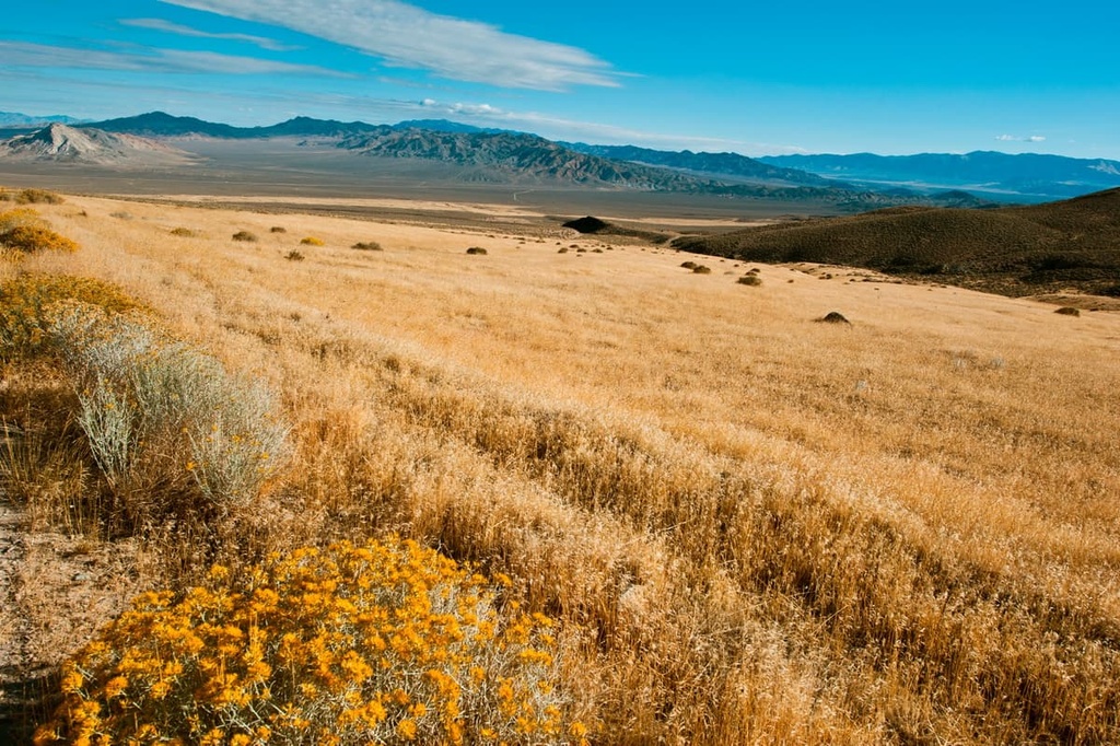
The Stillwater Range is a very remote and rugged mountain range that sees very few visitors. Though designated hiking trails in the range are limited, there are many hiking areas and natural attractions nearby.
Located in the heart of the Lahontan Valley, the Stillwater National Wildlife Refuge is the perfect day trip from Reno, Nevada.
The refuge boasts 79,570 acres (32,201 ha) of freshwater and brackish marshes, river corridors, alkali playas, and desert shrublands. It also encompasses sand dunes and an island at a desert lake. The Stillwater National Wildlife Refuge is a particularly popular destination for wildlife enthusiasts and birders.
Located just 20 miles (32 km) northeast of the community of Fallon, the Fallon National Wildlife Refuge is a primitive park that features 17,848 acres (7,223 ha) of alkali-shrub habitat and gently rolling hills.
Access to the refuge is limited to a 4WD dirt road and no maintained trails exist in the park. However, those willing to make the trip can spend time bird watching and view wildlife in relative solitude.
Located roughly 25 miles (40 km) to the south of Fallon, in the high desert of west central Nevada, the 4,795-acre (1,940 ha) Sand Mountain Recreation Area features windblown sand deposits halted by the rising Stillwater Range.
The most dominant feature in the area is Sand Mountain, the largest single sand dune in the Great Basin, which stretches for roughly 3.5 miles (5.6 km) long, a mile wide, and rises 600 feet (183 m) above the surrounding desert landscape.
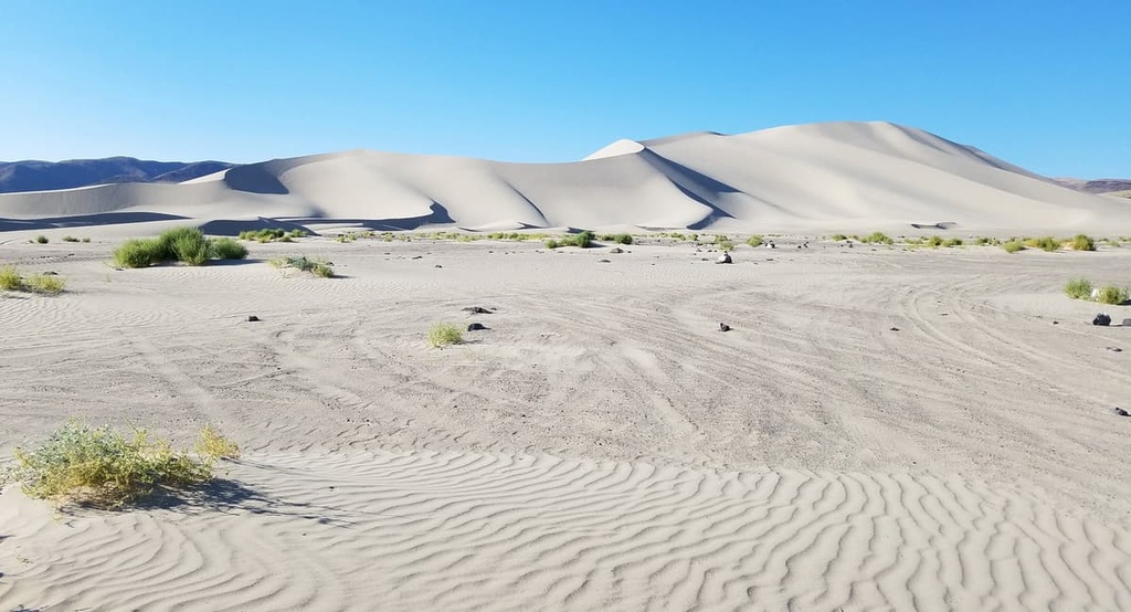
Nearly 23 miles (37 km) of designated OHV trails are available in the area, making this a popular destination for riding ATVs, motorcycles, sand rails, and dune buggies.
The tallest peak in the Stillwater Range, Job Peak boasts spectacular vistas of the surrounding desert landscape.
On a clear day, hikers will be rewarded with views of several distant Nevada summits, including King Lear Peak, Mount Grant, Mount Rose, and Arc Dome. Though Job Peak contains a trail to the summit and is relatively accessible, it receives very few visitors each year.
Looking for a place to stay near the Stillwater Range? Here are some of the best cities and towns to check out.
Located south of the Stillwater Range, Fallon is the closest community to the Stillwater National Wildlife Refuge Complex.
The community is centrally located to several state parks, wildlife refuges, off-road trails, wetlands, and wide-open spaces, making it the perfect basecamp for birders, hunters, off-road enthusiasts, fishermen, and boaters.
Known as “The Biggest Little City in the World,” Reno, is the second largest city in the state of Nevada and the closest major city to the Stillwater Range.
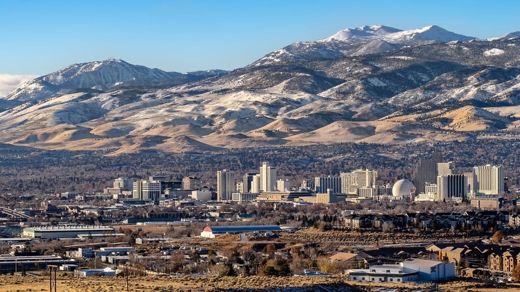
Reno is best-known for its casino and tourism industries. But it’s also centrally located to exceptional outdoor recreation destinations, including Lake Tahoe, Tahoe National Forest, and Lassen National Forest.


