
Scan the QR code and open PeakVisor on your phone
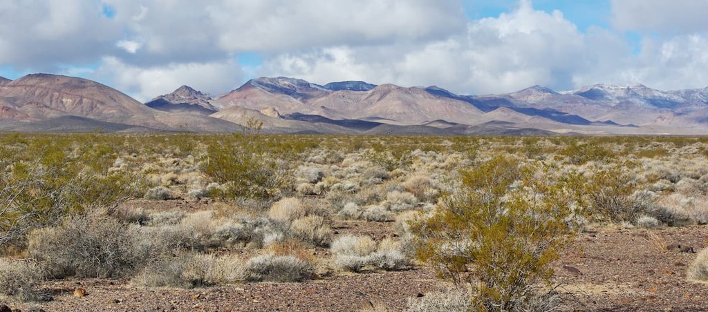
Named after wild grapes in the area, the Grapevine Mountains stretch for roughly 22 miles along the California-Nevada border. The Grapevine Mountains lie in the Amargosa Mountains, a 110-mile mountain range that stretches along the eastern side of California’s Death Valley, separating it from the Amargosa Desert in Nevada.
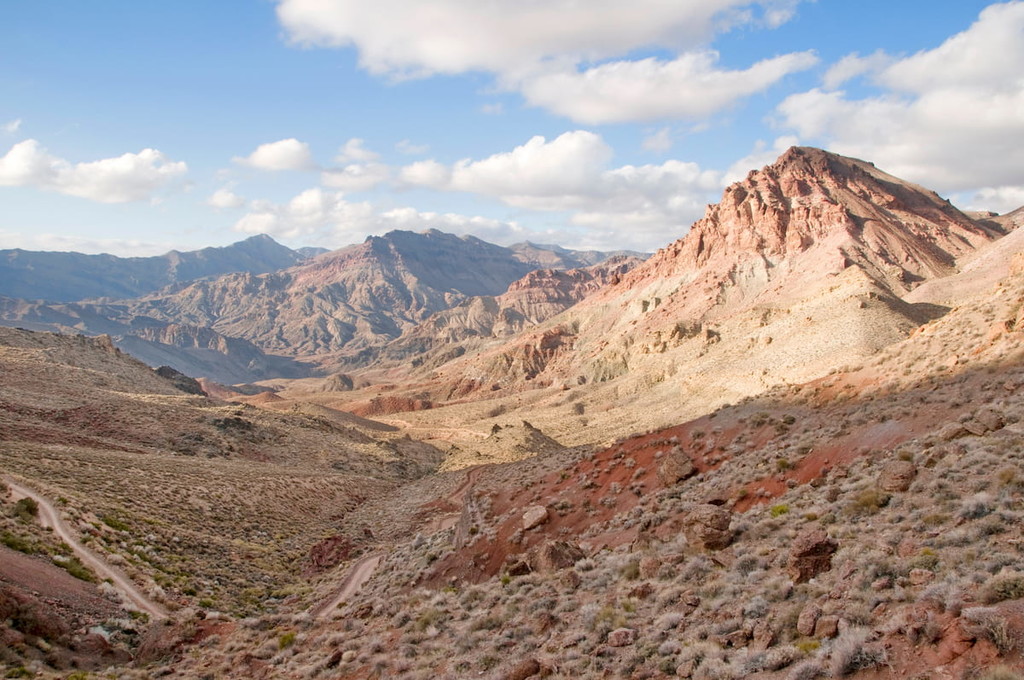
Located near the western edge of the Great Basin physiographic province, the Grapevine Mountains cover portions of both Inyo County, California, and Nye County, Nevada. The range rises from roughly 980 feet on the floor of Death Valley to over 8,700 feet at the summit of Grapevine Peak.
Grapevine Peak, the highest peak in the range, lies along a remote corner of Death Valley National Park known as the ‘Nevada Triangle.’ This remote summit is covered in juniper trees and receives very few visitors. Nearby, Wahgunyah Peak, the second tallest of the Grapevine Mountain, rises to 8,619 feet.
Most of the Grapevine Mountain chain lies in Death Valley National Park. The set of summits is notoriously rugged and isolated. The central part of the range extends from Titus Canyon to Scotty’s Castle and Grapevine Canyon.
Though several unofficial names have been assigned to natural features in the Grapevine Mountains, very few officially named landmarks exist in the range.
For example, the name ‘Moonlight Canyon’ has been assigned to a seldom-visited, isolated canyon that dissects the central portion of the range. Moonlight Bridge, the tallest natural bridge in Death Valley, is located near this secluded canyon. However, remarkably, the natural bridge wasn’t discovered until 2013. Several other extraordinary natural bridges, including Turret Bridge, Sunlight Bridge, and Crescent Bridge have been discovered in this region of the park.
Another isolated canyon, Fall Canyon, lies at the north end of Death Valley in the Grapevine Mountains. Shaped by flash floods, Fall Canyon is believed to be one of the most colorful ravines in the Grapevines. Like other canyons in the area, Fall Canyon is incredibly isolated and rarely traversed.
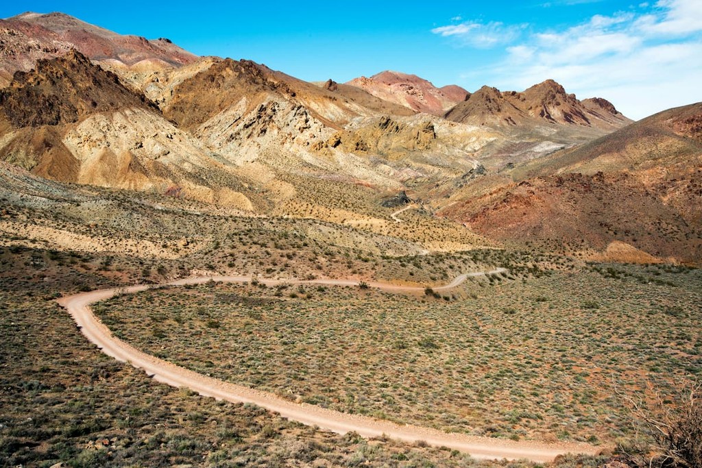
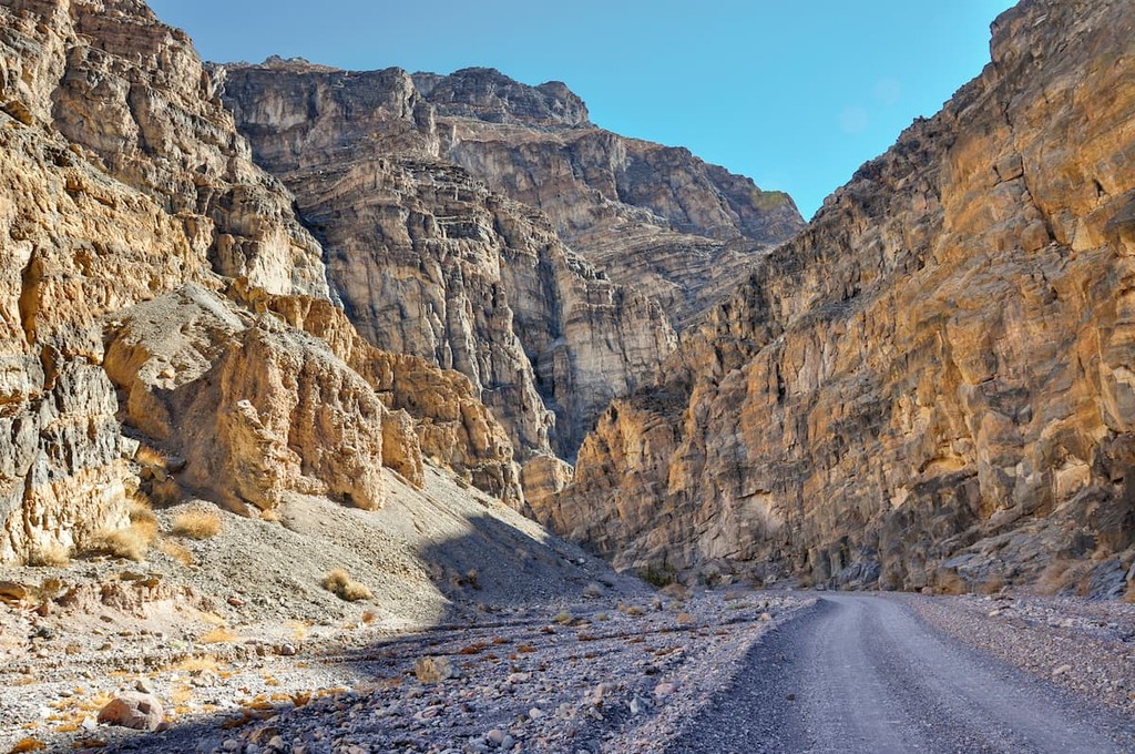
Arguably the best-known natural treasure in the area is Titus Canyon, a narrow and picturesque gorge that has been carved into the steep face of the Grapevine Mountains. A popular backcountry road travels for 27 miles through Titus Canyon allowing visitors to experience the region’s colorful rock formations, petroglyphs, native plants, and wildlife. Limestone tucked within Titus Canyon is roughly 570-505 million years old and is believed to have been formed when Death Valley was submerged beneath tropical seas.
One of the deepest and most impressive canyons in Death Valley National Park, Titus Canyon features incredible limestone rock formations, ancient petroglyphs, and a variety of native plants and wildlife. Most visitors to Titus Canyon will opt to take the 27-mile Titus Canyon Road, a narrow, one-way road that leads directly to the foothills of the Grapevine Mountains. Visitors to Titus Canyon can explore the vibrant Red Pass hills, hike nearby Thimble Peak, or check out Leadfield, a ghost town that has an eerie reputation for its former, unsavory residents.
The tallest peak in the Grapevine Mountains, Grapevine peak reaches over 8,700 feet and has an impressive 4,551-foot prominence. The summit can be reached by driving a rugged dirt road to Phinney Canyon and traversing a high-elevation pine forest in the Nevada Triangle. There is no maintained trail to the summit, so route-finding skills are a must on this trip.
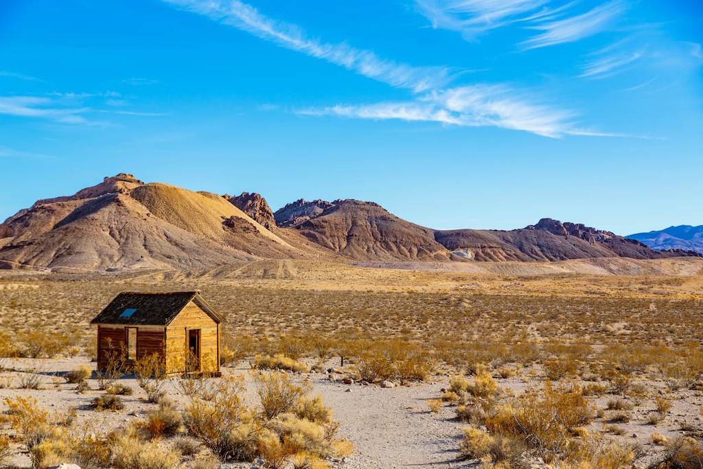
Located in Nye County, Nevada, Beatty is a small, incorporated town located along U.S. Route 95. The town was established in 1905 and named after Montillus ‘Old Man’ Beatty, the community’s first postmaster. In 1905, Beatty was a bustling railway center. Today, the town serves as a gateway community to Death Valley National Park. Aside from exploring the country’s hottest and driest national park, visitors to Beatty can also visit Rhyolite, an old ghost town, Yucca Mountain, and the Nevada Test Site, where nuclear devices were previously tested.


nevada-peaks-club
desert-summits-book
bartells-death-valley
sierra-club-desert
great-basin
western-state-climbers
western-state-climbers-emblem
desert-summits-book
bartells-death-valley
sierra-club-desert
nevada-peaks-club
desert-summits-book
bartells-death-valley
sierra-club-desert
great-basin
western-state-climbers
western-state-climbers-emblem
desert-summits-book
bartells-death-valley
sierra-club-desert


